File:Fig8 mappingTags.png
Jump to navigation
Jump to search
Size of this preview: 402 × 599 pixels. Other resolutions: 161 × 240 pixels | 612 × 912 pixels.
Original file (612 × 912 pixels, file size: 119 KB, MIME type: image/png)
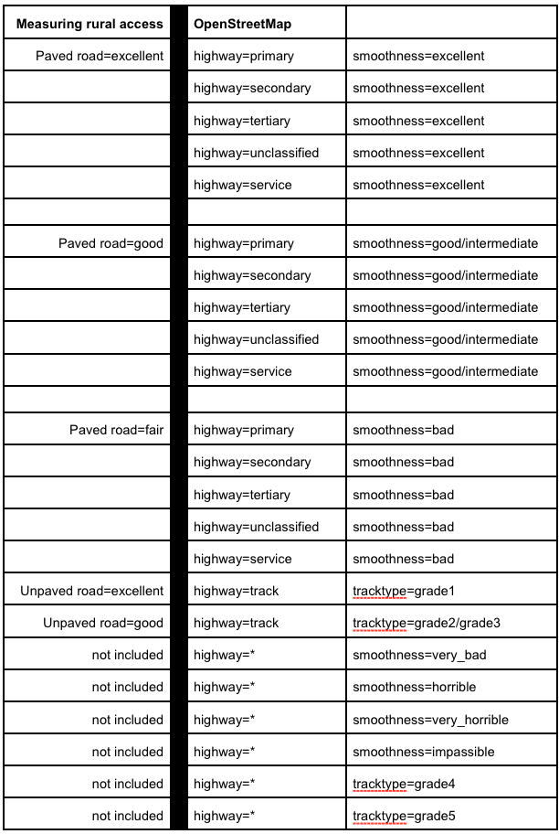
The correspondence between OSM tags and international standards for road condition.
File history
Click on a date/time to view the file as it appeared at that time.
| Date/Time | Thumbnail | Dimensions | User | Comment | |
|---|---|---|---|---|---|
| current | 02:47, 21 January 2019 | | 612 × 912 (119 KB) | Codrina (talk | contribs) | The correspondence between OSM tags and international standards for road condition. |
You cannot overwrite this file.
File usage
The following page uses this file: