Search results
Jump to navigation
Jump to search
Page title matches
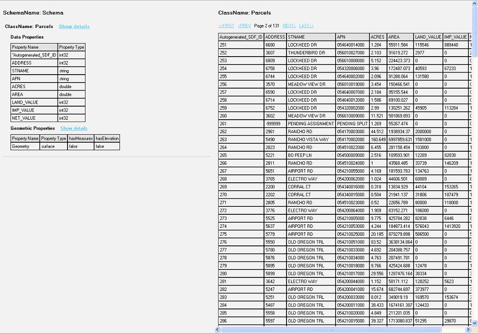
File:Data Display.JPG Screenshot view of the data from the feature class(956 × 667 (140 KB)) - 12:24, 12 December 2006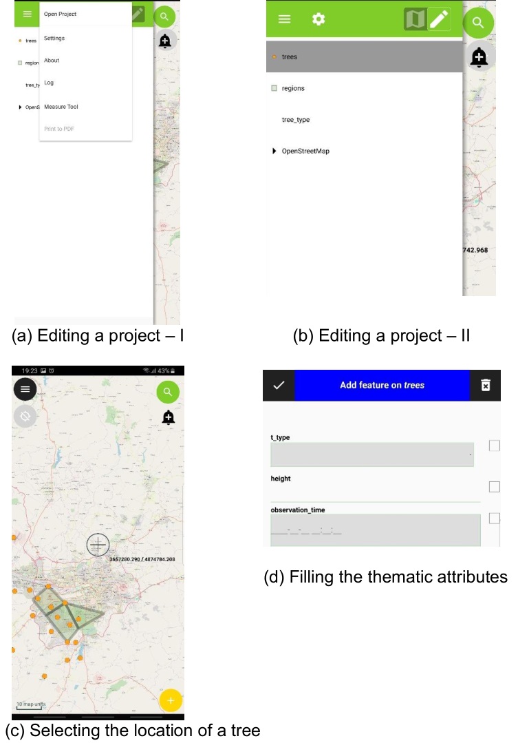
File:Qfield data collection.jpg (753 × 1,079 (122 KB)) - 14:53, 10 February 2020
File:Data All 170712.pdf (79 KB) - 07:17, 12 July 2017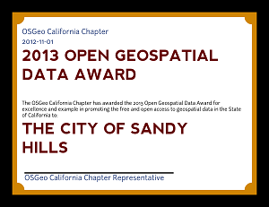
File:Example Open Geospatial Data Award.png (300 × 231 (22 KB)) - 16:06, 7 December 2012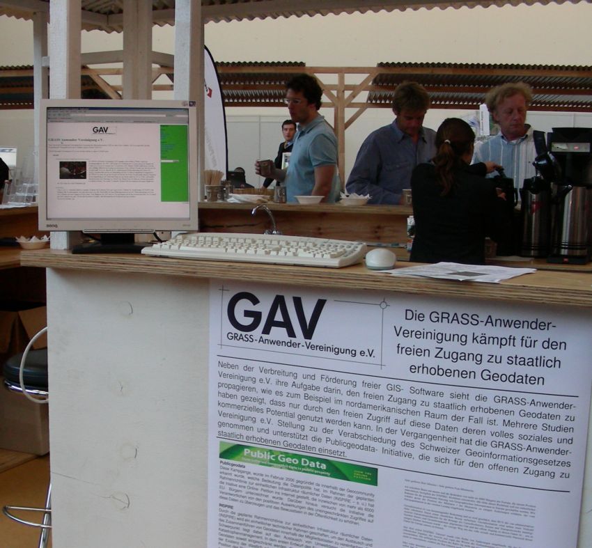
File:Gav grass public geo data manifesto.jpg (850 × 787 (116 KB)) - 08:01, 3 February 2007
File:1 5 Defining the Data Model.odt (29 KB) - 23:30, 24 March 2011File:Virtual Data Help Desk at EGU20 202004301617 150dpi.pdf (1.84 MB) - 02:18, 23 February 2022File:1 2 (part2) Manipulating the Data Bank.odt (31 KB) - 23:24, 24 March 2011File:1 2 Manipulating Data Bank in SPRING.odt (13 KB) - 23:24, 24 March 2011File:2 6 Vectorial data manipulation in the SPRING.odt (69 KB) - 23:31, 24 March 2011File:Conversion of an ARC-INFO Coverage Containing Multipe Attribute Data to a MOSS.pdf (1.94 MB) - 02:17, 11 June 2019


Page text matches
File:04 knudsen.pdf ...r scanned DEMs. The approach used is independent of navigational (GPS/INS) data and ground control points. ...d gridding program for scattered geodata. It uses a simple, but efficient, data management technique to speed up the gridding procedure.(1.64 MB) - 18:45, 21 October 2009
File:Asdar.jpg Applied Spatial Data Analysis with R(95 × 144 (40 KB)) - 02:23, 16 April 2009File:Dems.pdf Get DEM, DOQ, and SRTM data for any area of interest in(943 KB) - 01:07, 25 August 2009File:Data Display.JPG Screenshot view of the data from the feature class(956 × 667 (140 KB)) - 12:24, 12 December 2006File:R3GIS-DVD.pdf Merano (Italy) data license statement(133 KB) - 02:33, 30 April 2008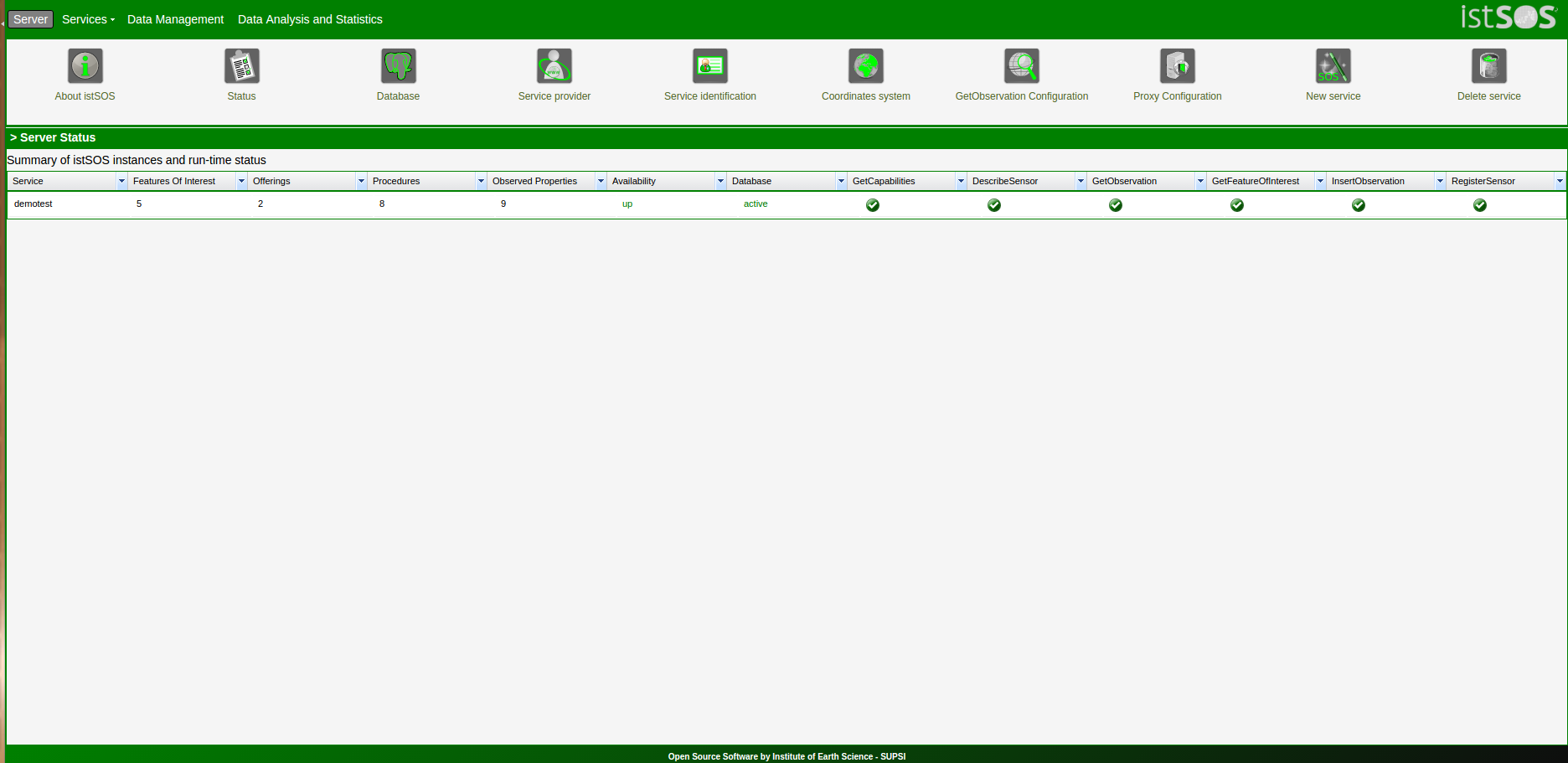
File:Main.png istSOS-Data analysis statistics tool suite(1,872 × 911 (84 KB)) - 21:54, 25 June 2017File:Ottawa Chapter Tutorial 4 Building National Framework.pdf How I Continued My Love Affair With Free Geospatial Data in Canada(179 KB) - 10:41, 21 September 2006File:Ottawa Chapter Tutorial 3 Building Ottawa.pdf How I learned to Stop Worrying and Love Mining for Free Geospatial Data in Canada(179 KB) - 10:38, 21 September 2006
File:DatabaseStorage.png This image shows the option I added for storing output data(708 × 399 (25 KB)) - 10:36, 13 August 2018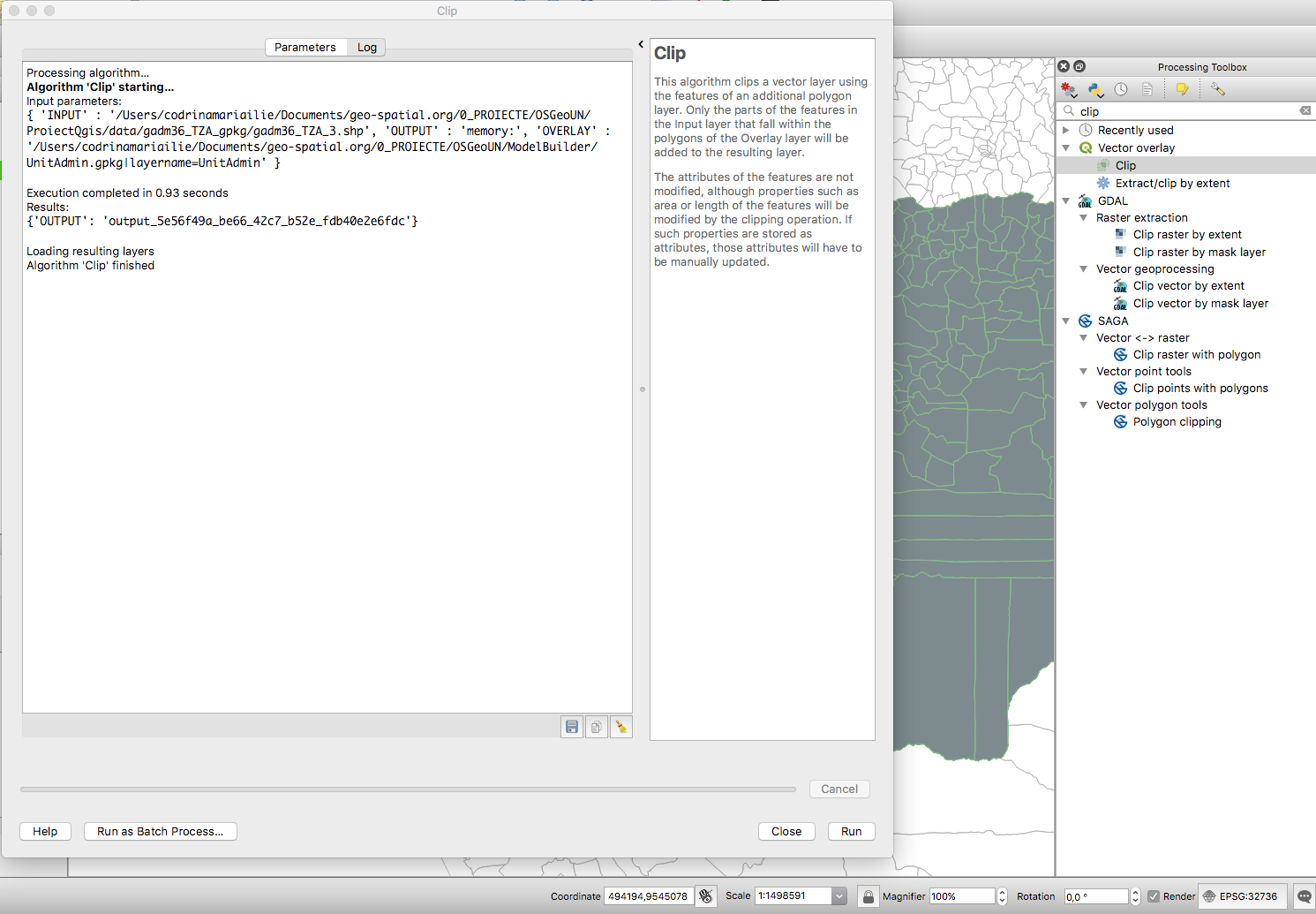
File:Fig2 clip.png Clip tool for vector data identified in the Processing Toolbox through search functionality.(1,491 × 1,035 (303 KB)) - 02:19, 21 January 2019File:SSURGO to PostgreSQL.odt A method to import USDA-NRCS SSURGO soils data into PostgreSQL on a GNU/Linux OS.(37 KB) - 20:43, 13 October 2011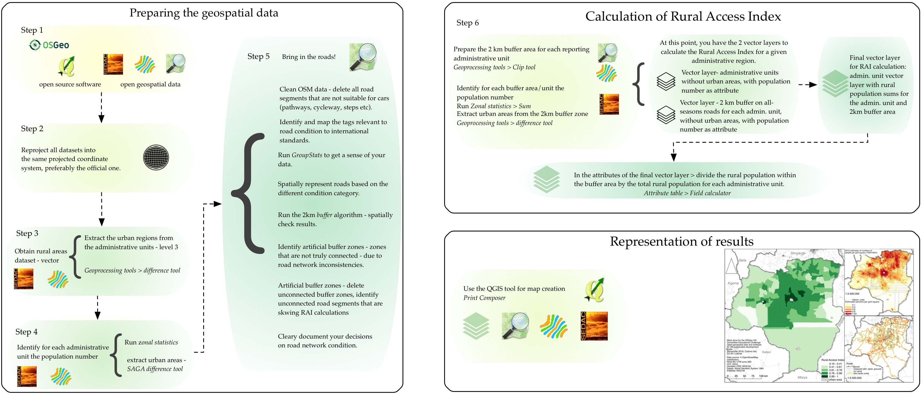
File:Fig25 workflow.jpg ...ual schema for the workflow to calculate the Rural Access Index using open data and open source software.(3,119 × 1,336 (805 KB)) - 03:33, 21 January 2019File:Osgeo-austnz vic inquiry psi v1.1.pdf and Data(344 KB) - 17:53, 11 February 2009
File:UN contest IdaVanOs1.jpg ...go communicates the assembly, building and packaging of an open source geo data base. The OpenGIS initiative is an ongoing process, therefor the open layou(1,200 × 1,200 (109 KB)) - 03:26, 16 August 2016File:LynchBrowneFoleyPoster.pdf ...development of OpenMap™ to support PostgreSQL/PostGIS queries and spatial data types.(266 KB) - 11:12, 7 September 2006
File:UN contest IdaVanOs2.jpg ...go communicates the assembly, building and packaging of an open source geo data base. The OpenGIS initiative is an ongoing process, therefor the open conti(1,200 × 1,200 (123 KB)) - 06:37, 16 August 2016
File:UN contest IdaVanOs2 icon.png ...go communicates the assembly, building and packaging of an open source geo data base. The OpenGIS initiative is an ongoing process, therefor the open conti(1,200 × 1,200 (66 KB)) - 06:38, 16 August 2016File:Australia FME User Meeting Inviation.pdf ...ME investment. Plus, discover new ways that FME can help you solve spatial data access challenges.(108 KB) - 18:02, 16 September 2009


