Unused files
Jump to navigation
Jump to search
The following files exist but are not embedded in any page. Please note that other web sites may link to a file with a direct URL, and so may still be listed here despite being in active use.
Showing below up to 250 results in range #1 to #250.
View (previous 250 | next 250) (20 | 50 | 100 | 250 | 500)
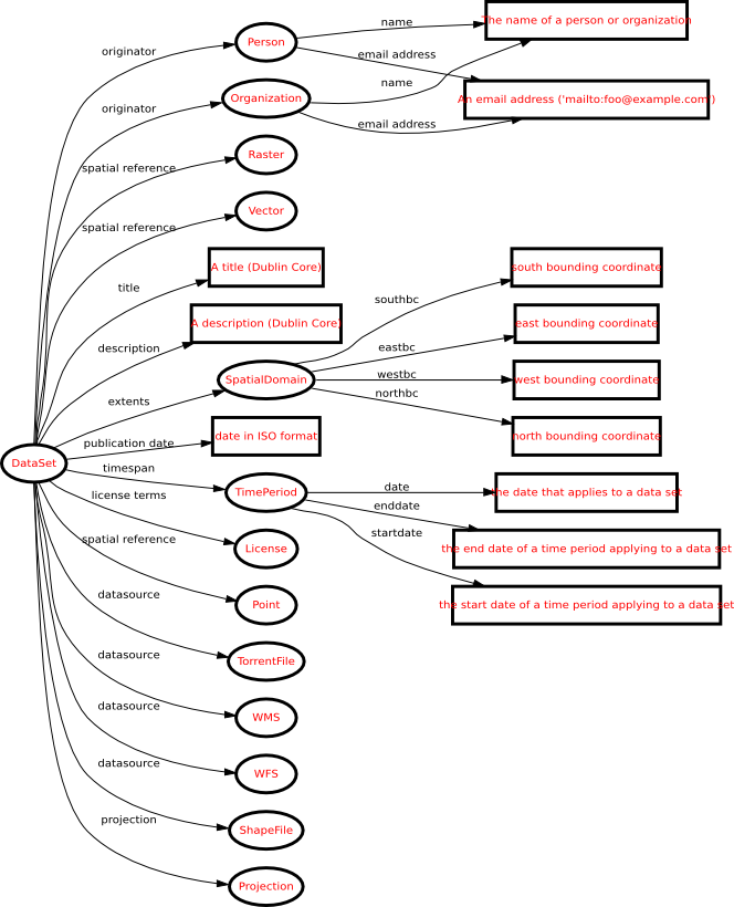 Graph0.png 664 × 820; 139 KB
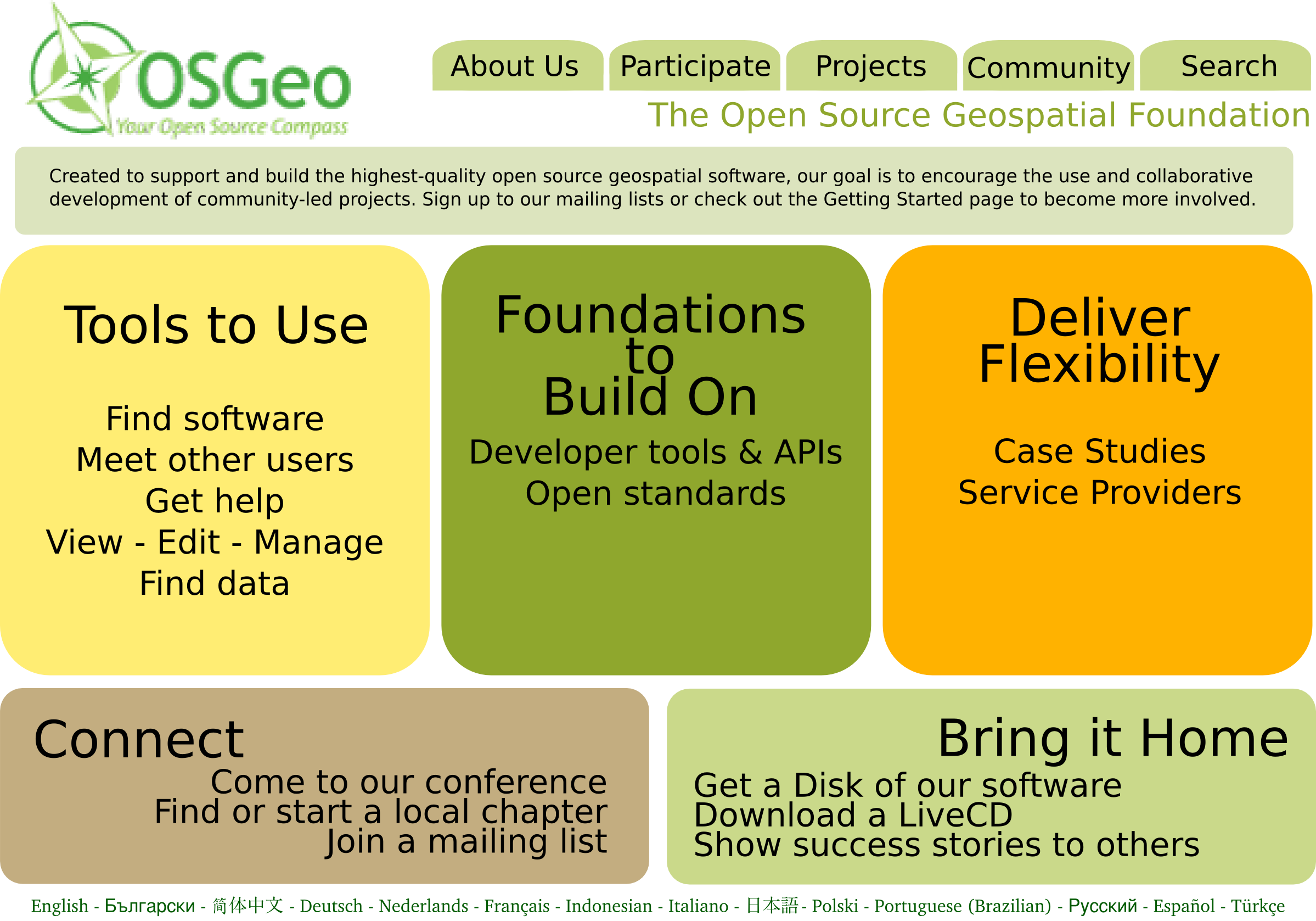
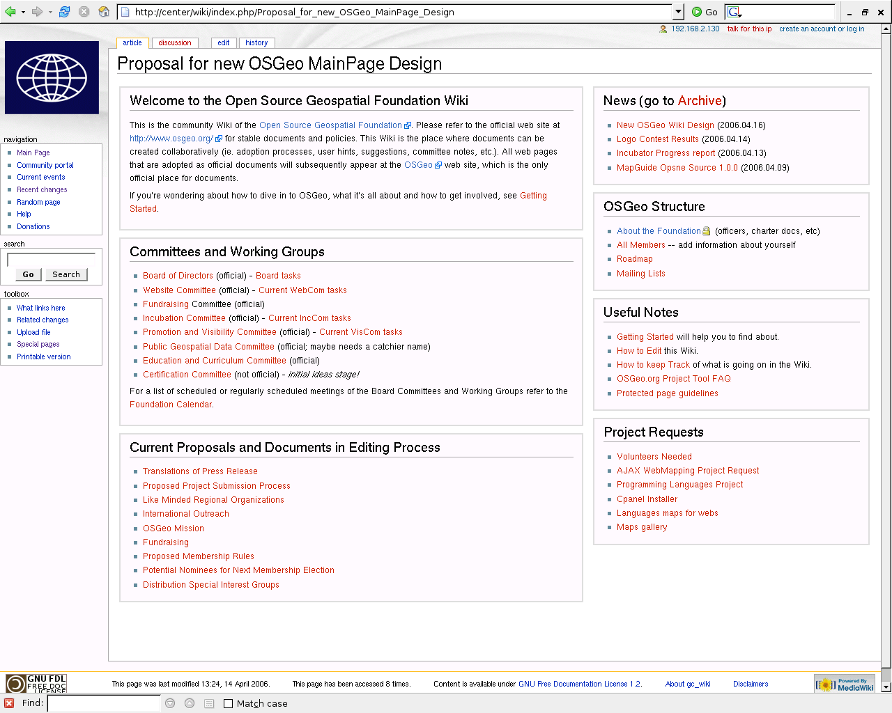 OSGeo design proposal for Main Page.png 1,280 × 1,024; 110 KB
 30g iPod.jpg 140 × 232; 13 KB
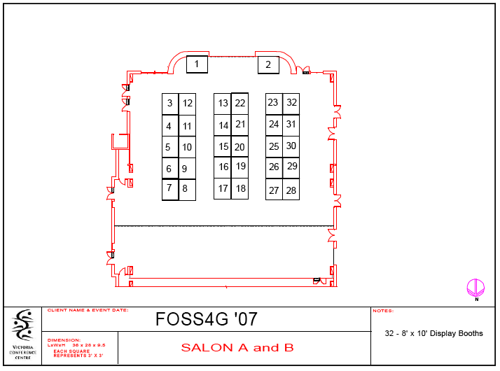
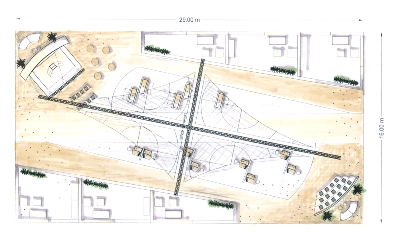 Booth floor plan 2 small.jpg 800 × 494; 162 KB
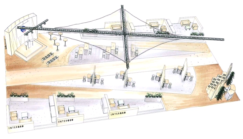 Intergeo perspective var1 small.jpg 800 × 459; 161 KB
 Shirt logo 1.pdf ; 301 KB
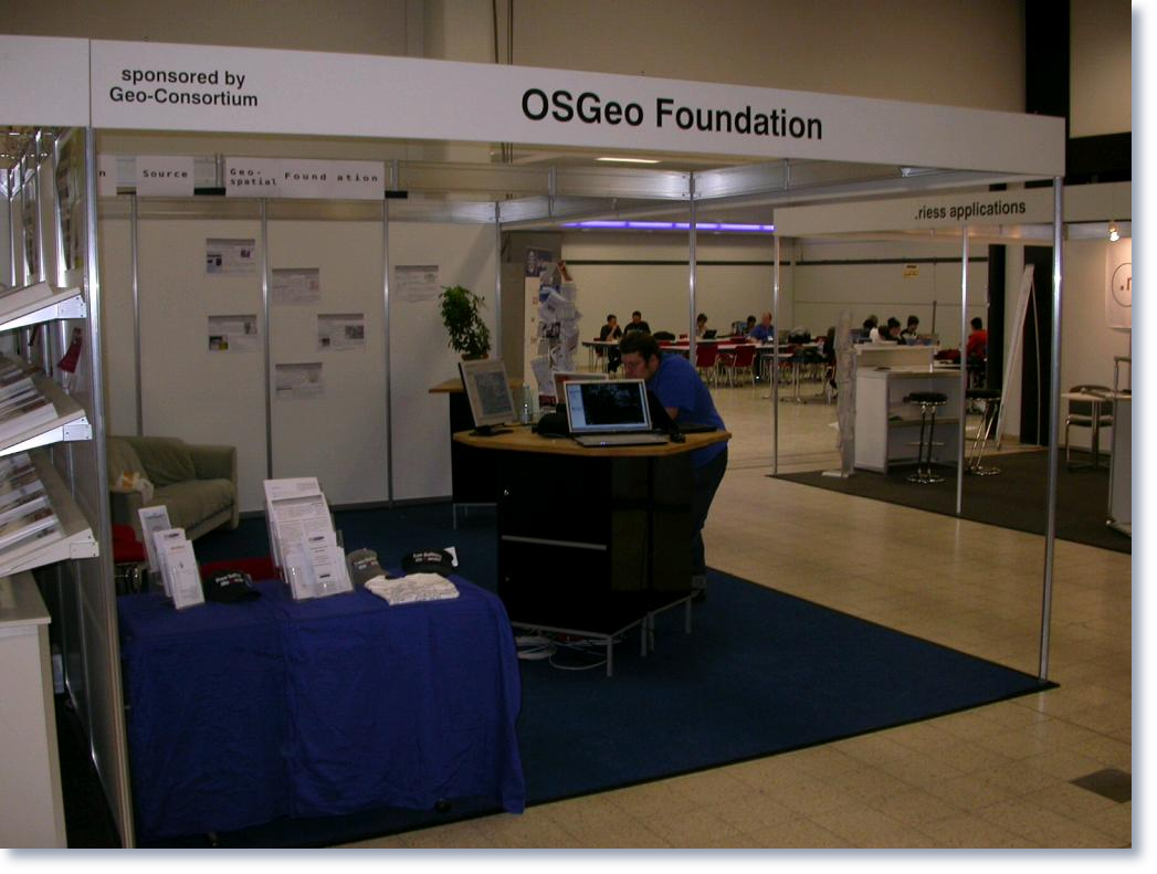 Booting the booth.png 1,047 × 791; 763 KB
 Shirt logo test.jpg 537 × 453; 24 KB
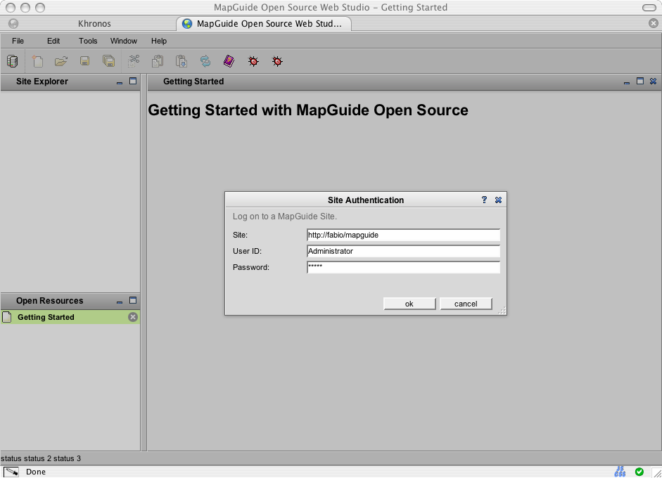 Ws1.png 941 × 680; 41 KB
 Ws2.png 941 × 680; 78 KB
 Ws3.png 941 × 680; 102 KB
 Ws4.png 941 × 680; 155 KB
 Ws5.png 941 × 680; 73 KB
- FOSS4G2006 abstractsToPDF.pdf ; 49 KB
- FOSS4G2006 abstractsList.pdf ; 76 KB
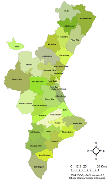 Pvcastello.png 345 × 580; 90 KB
 Snuggles.jpg 750 × 605; 232 KB
- LynchBrowneFoleyPoster.pdf ; 266 KB
- PatrickBrowneFOSS.pdf ; 484 KB
- Foss4geo06 igeoportal-workshop.pdf ; 1.1 MB
- PatBrowne2.pdf ; 515 KB
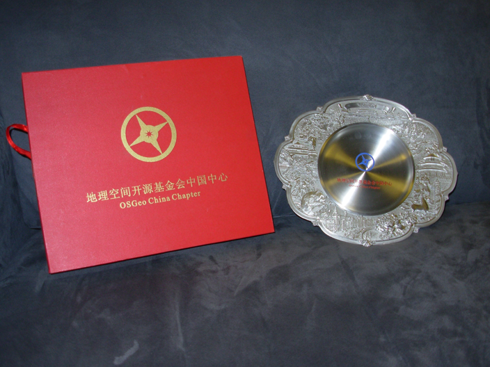 Mpg china 01.png 704 × 528; 550 KB
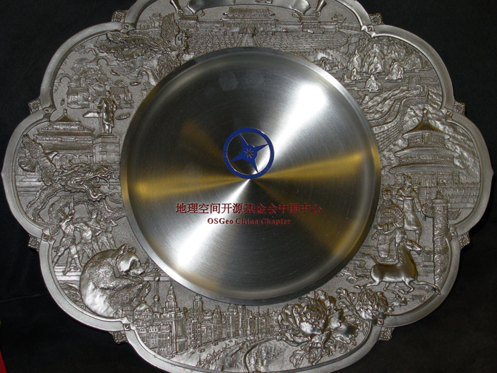 Mpg china 02.png 704 × 528; 724 KB
- Proposal OSGeo.pdf ; 79 KB
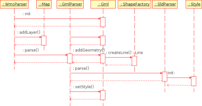 Initialise.png 667 × 350; 11 KB
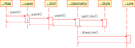 Paint.png 548 × 196; 6 KB
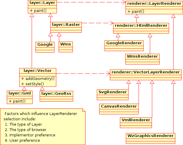 Renderer.png 618 × 488; 30 KB
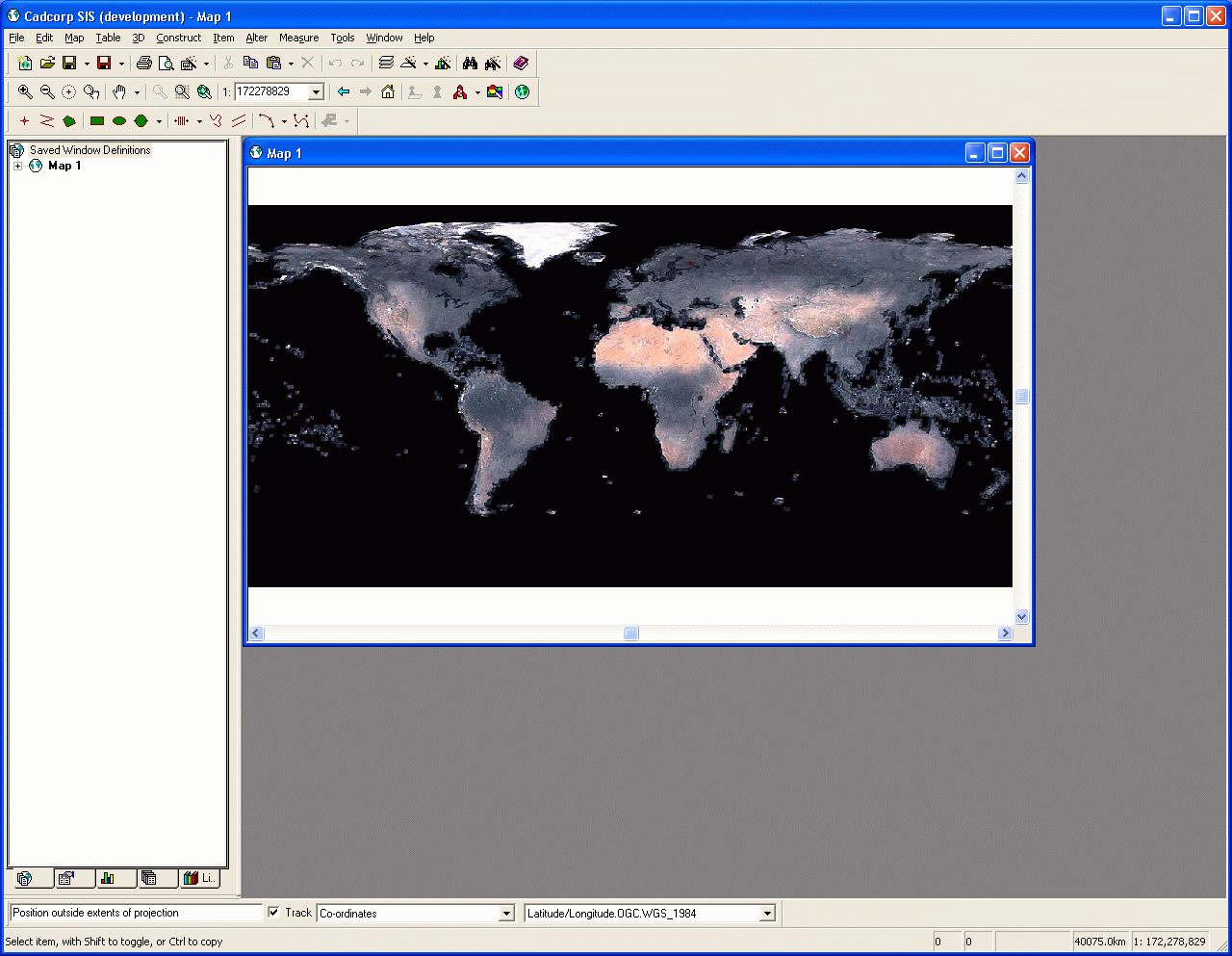 CadcorpTmsClient.png 1,280 × 993; 195 KB
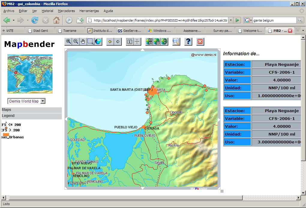 MICROBIOLOGIC WATER QUALITY COLOMBIA.PNG 1,020 × 692; 173 KB
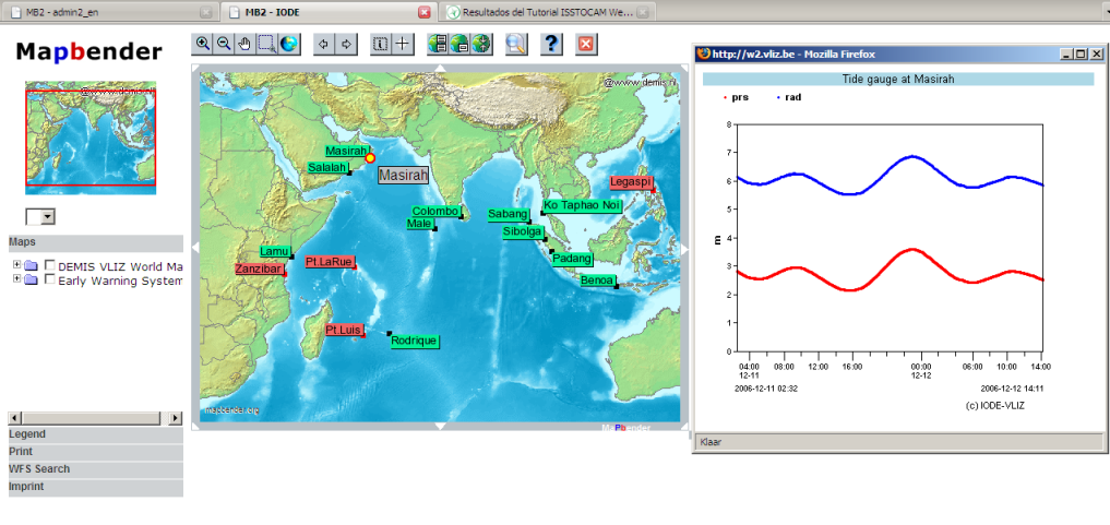 Printscreen.png 1,017 × 481; 325 KB
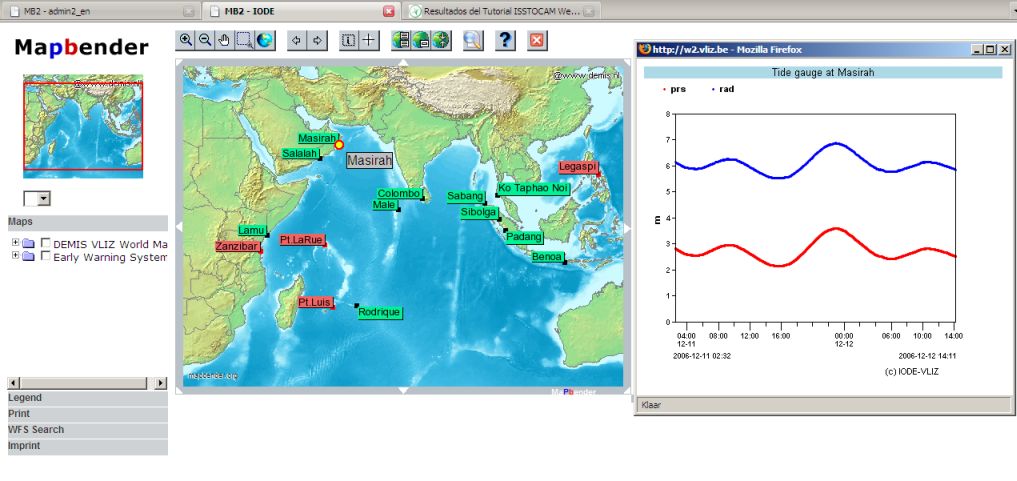 Indianocean.jpg 1,017 × 481; 78 KB
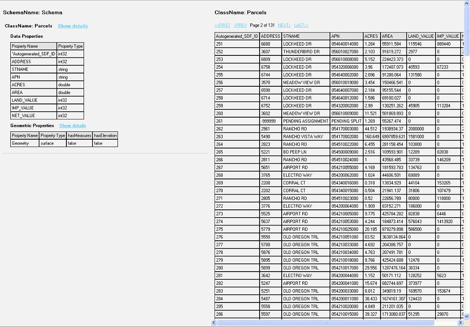 Data Display.JPG 956 × 667; 140 KB
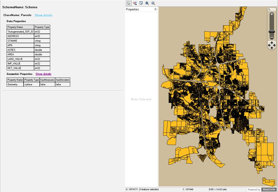 Geom Display.JPG 895 × 619; 87 KB
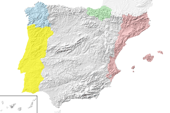 Fisic-idiomes.png 580 × 385; 60 KB
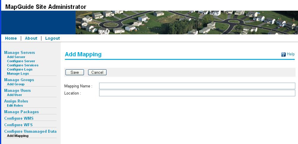 AddUnmanagedData.JPG 1,001 × 486; 57 KB
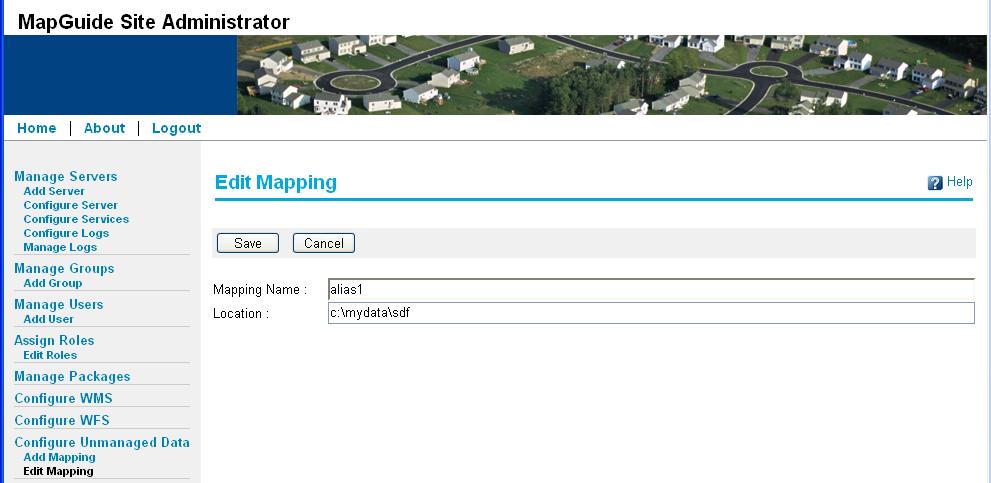 EditUnmanagedData.JPG 991 × 483; 60 KB
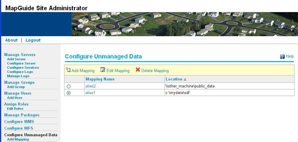 ConfigureUnmanagedData.JPG 987 × 471; 61 KB
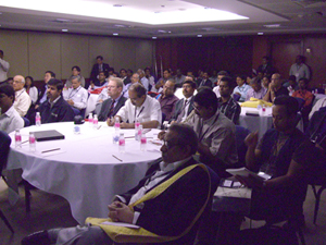 Osgeo participants mwf2007.jpg 300 × 225; 130 KB
 Grass-italia logo.png 82 × 91; 6 KB
- MapServer-flyer-pt BR.pdf ; 379 KB
- MapServer-flyer-en.pdf ; 378 KB
- MapServer-flyer-fr.pdf ; 229 KB
- 3Liz Mozilla.pdf ; 2.64 MB
- ATOLCD SIGMétier.pdf ; 586 KB
- Camptocamp GeoportailOpensource.pdf ; 1.74 MB
- Camptocamp-OSGeo DGL2.pdf ; 377 KB
- Camptocamp presentation cartoweb.pdf ; 1.49 MB
- Camptocamp-Waynasoft Eco libre.pdf ; 202 KB
- Booth layout.pdf ; 6 KB
 OSGeo 200 79 pixel.png 200 × 79; 10 KB
 OSGeo 300 118 pixel.png 300 × 118; 17 KB
- OS Park Ansicht gesamt.pdf ; 627 KB
 OSGeo lo gis business.png 262 × 117; 15 KB
 Osgeo grafik bearbeitet.png 1,417 × 1,292; 126 KB
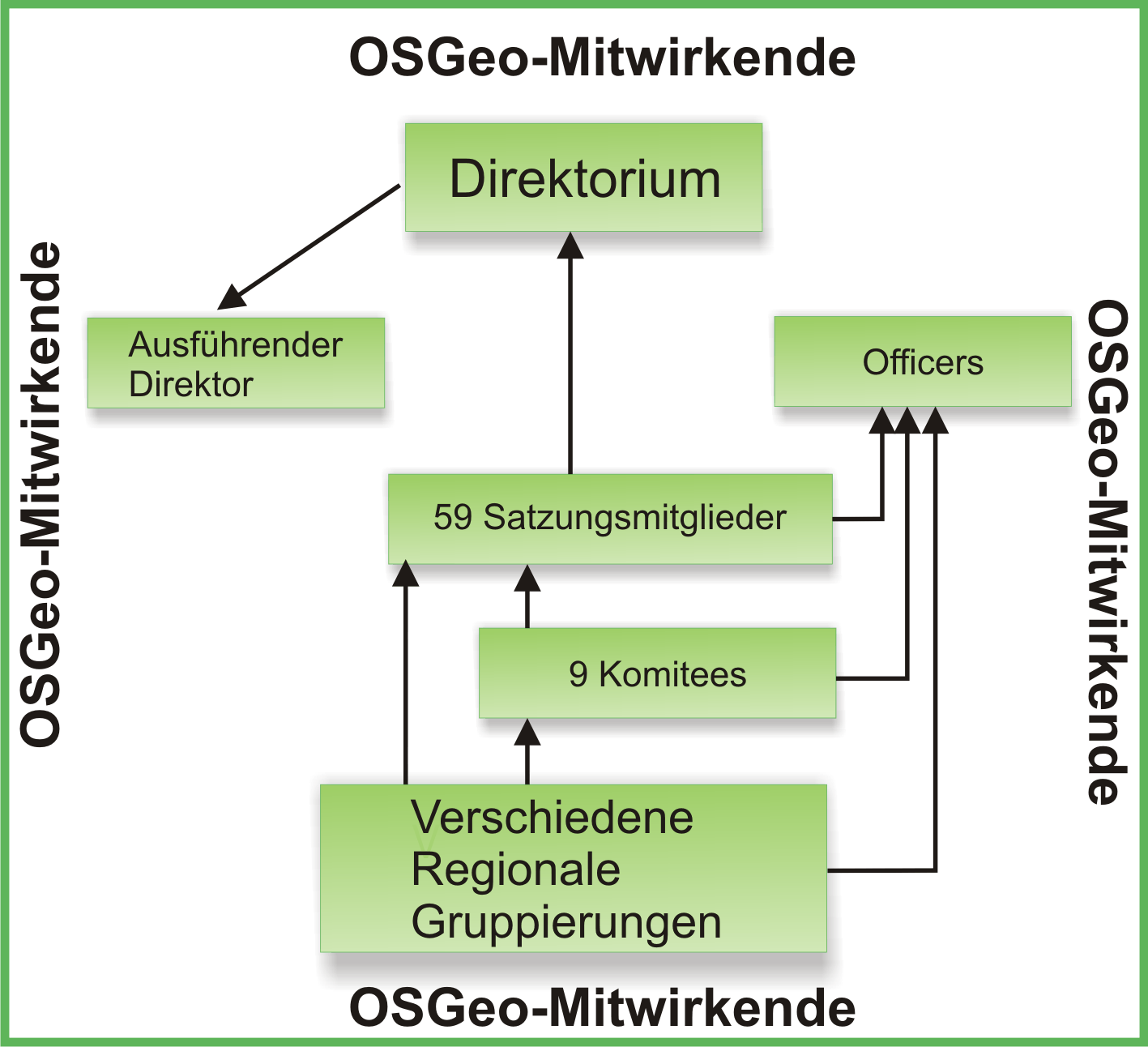
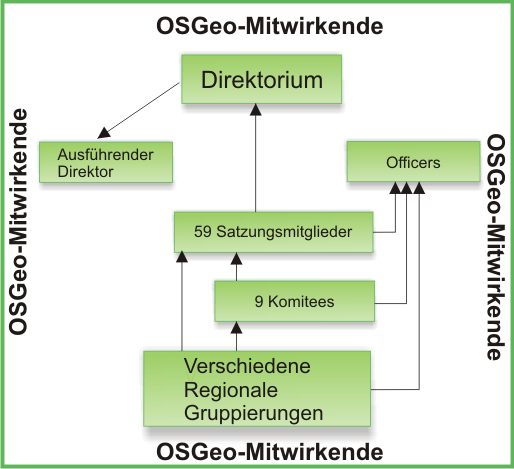 Organigramm osgeo.png 514 × 469; 36 KB
 Markuslupp small.jpg 130 × 156; 4 KB
 Foss4g booth.png 714 × 530; 27 KB
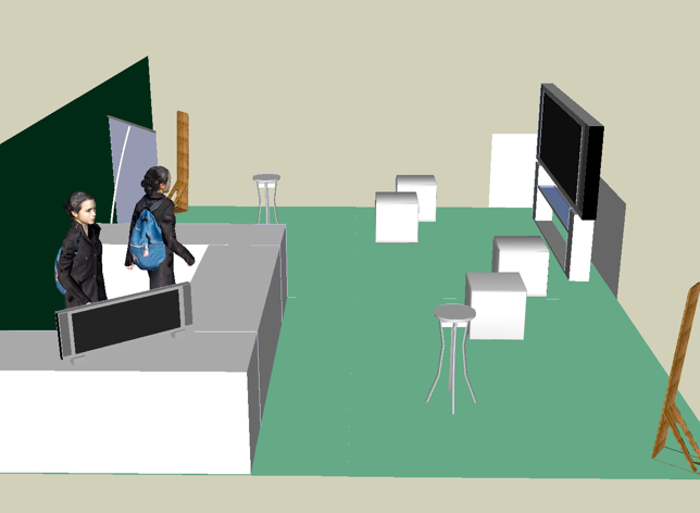 Osgeo booth foss4g v1.jpg 644 × 472; 99 KB
 Somerights20.png 88 × 31; 958 bytes
 Poweredby mediawiki 88x31.png 88 × 31; 2 KB
 Magnify-clip.png 15 × 11; 267 bytes
 Checkmark.png 20 × 28; 218 bytes
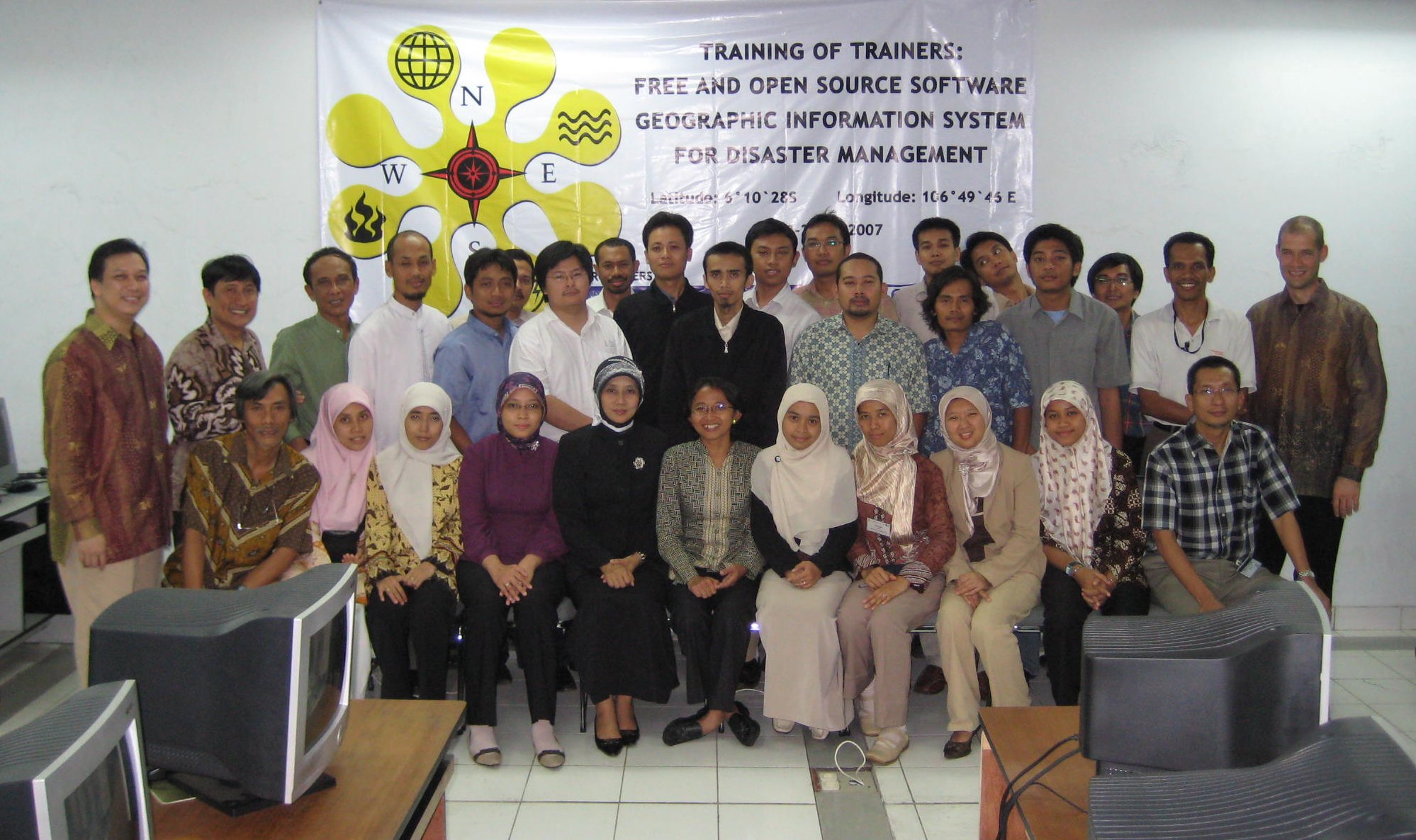 ToT FOSSGIS Participants.jpg 1,998 × 1,186; 377 KB
- Osgeo.pdf ; 659 KB
- OSGeo marketing III.pdf ; 557 KB
- GIS OSGeo.pdf ; 1.11 MB
 Mlupp small.jpg 129 × 156; 4 KB
 Simon.jpg 150 × 224; 36 KB
 B.Sc. Simon Appelt.jpg 150 × 224; 36 KB
 Chart.jpg 1,058 × 794; 86 KB
 Less30.jpg 759 × 291; 47 KB
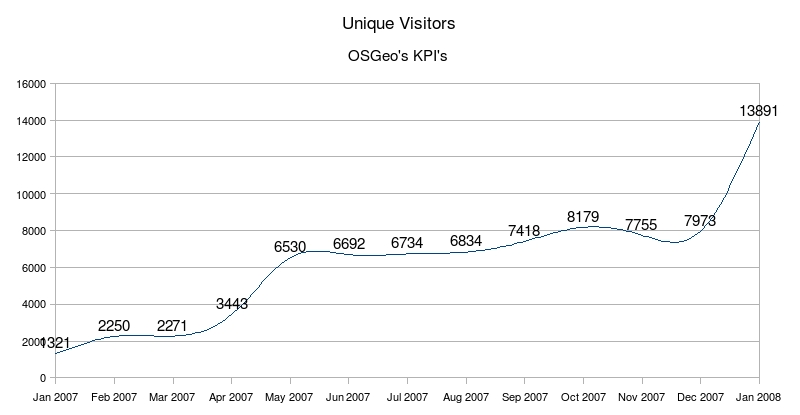 UniqueVwJan.jpg 800 × 415; 49 KB
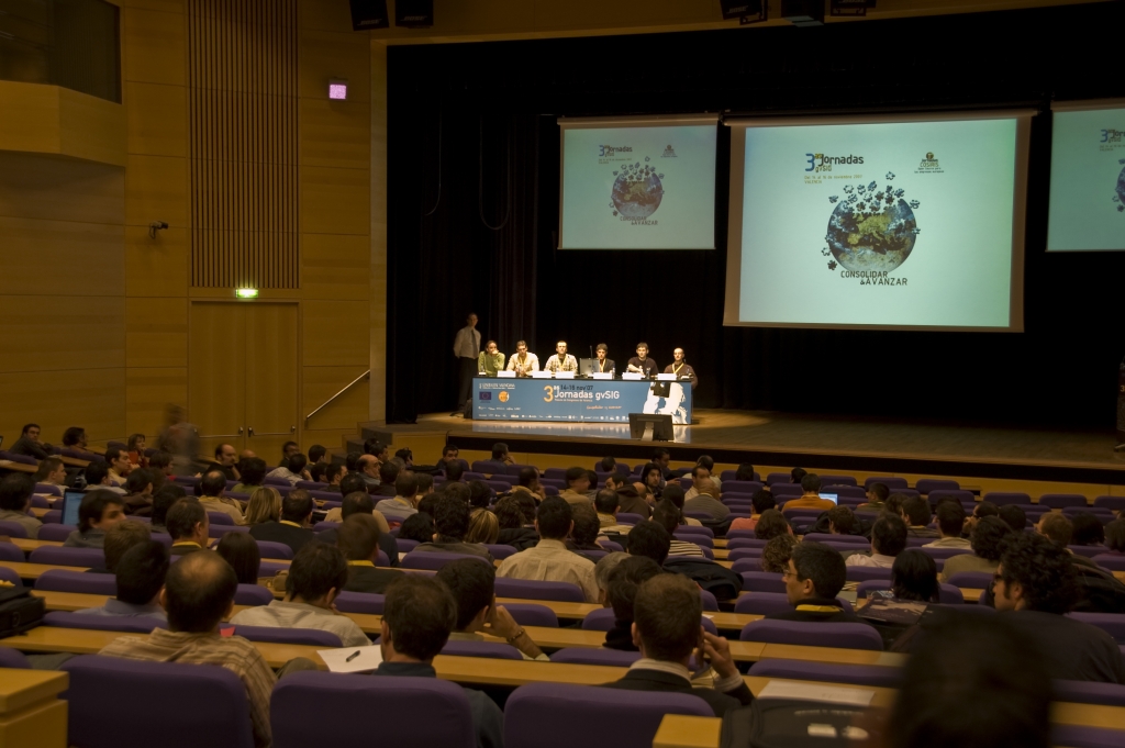 3rd gvSIG Meeting2.jpg 1,024 × 681; 375 KB
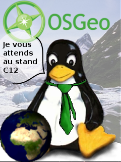 Tux geoevenement2008.png 240 × 321; 132 KB
 LOGO RGB web-edits1.jpg 179 × 124; 6 KB
 LOGO RGB web-edits-0408-3.jpg 992 × 314; 95 KB
 Zoeandme.png 243 × 211; 64 KB
 Af.png 19 × 13; 1 KB
 Osgeo v3.png 255 × 223; 139 KB
 Stefan krüger hacking.jpg 540 × 450; 89 KB
- Statuts osgeo-fr 200806.pdf ; 202 KB
 Fileicon-pdf.png 120 × 120; 5 KB
- FOSS4G2008 AuthorGuidelines.pdf ; 270 KB
 Irc exemple.png 398 × 117; 12 KB
- Free softw.pdf ; 779 KB
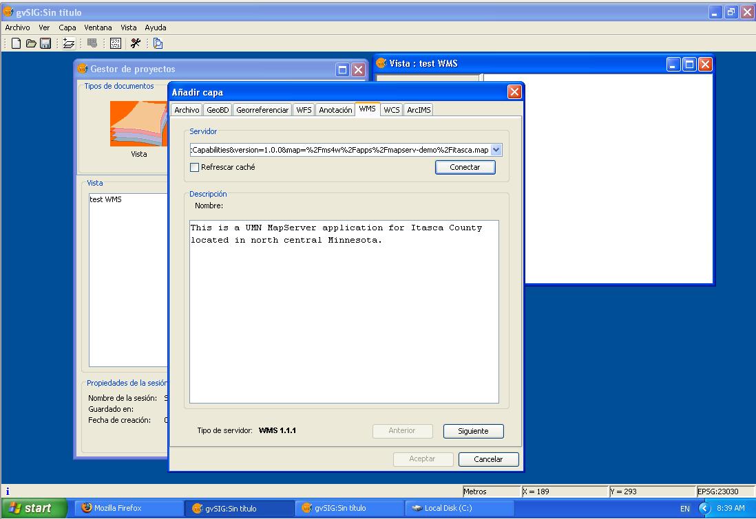 Gvsig wms getCapabilities.jpg 1,098 × 755; 81 KB
 Manie id2.jpg 1,258 × 1,395; 158 KB
 Logo FOSSGIS 1.png 464 × 154; 10 KB
 Logo FOSSGIS 2.png 468 × 146; 9 KB
 Logo FOSSGIS 3.png 574 × 154; 10 KB
- Foss4g 2008 intro to osgeo.pdf ; 511 KB
- Osgeo wrap.pdf ; 424 KB
- WPSdownload.pdf ; 591 KB
- GvSIG allg Ueberblick.pdf ; 1.86 MB
- Intergeo Metadata Publikation.pdf ; 1.25 MB
 J03lar50n yahoo.png 145 × 20; 833 bytes
 OSGeo Logo 150by64 pixel.png 150 × 64; 10 KB
 Osgeo-africa-logo-small.png 400 × 300; 28 KB
 FOSSGIS-Sholler-logo1.png 1,000 × 1,368; 239 KB
 OSGeo Aust NZ Logo Med.png 342 × 153; 28 KB
 Usermap placemark icon.png 16 × 16; 1 KB
 Mikee63.jpg 392 × 505; 45 KB
 Faunalia pt logo.png 170 × 142; 15 KB
 OSGeo Site mockup.png 2,398 × 1,677; 498 KB
 Airport.png 256 × 256; 70 KB
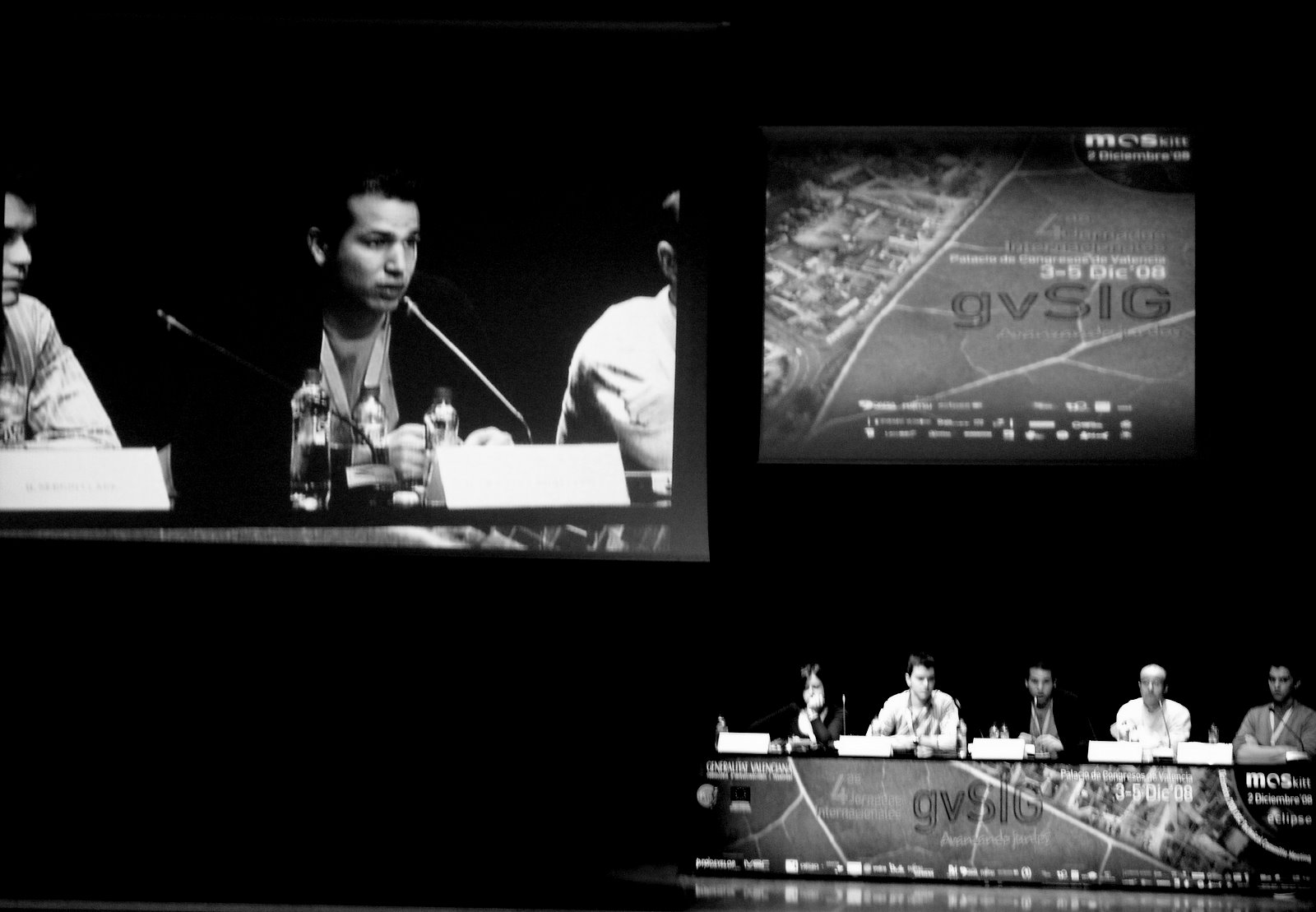 4th gvSIG conf session.jpg 1,600 × 1,109; 150 KB
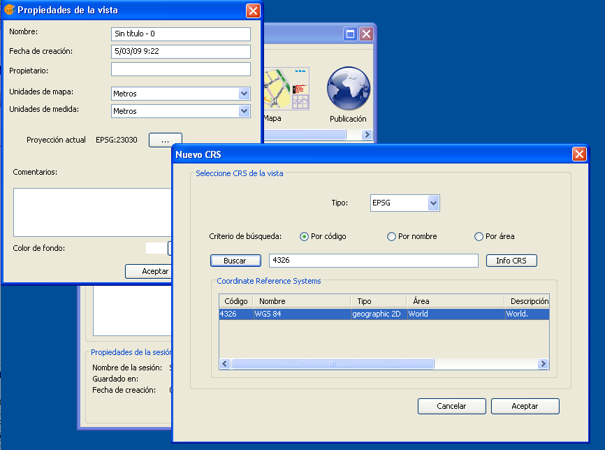 GvSig propriedades vista.png 866 × 644; 55 KB
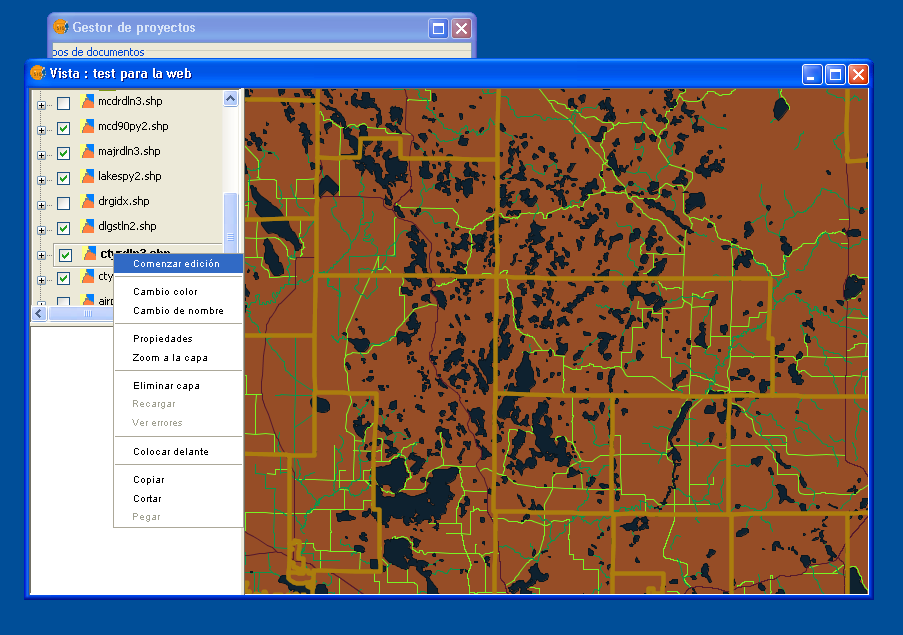 Gvsig menu layer.png 903 × 635; 186 KB
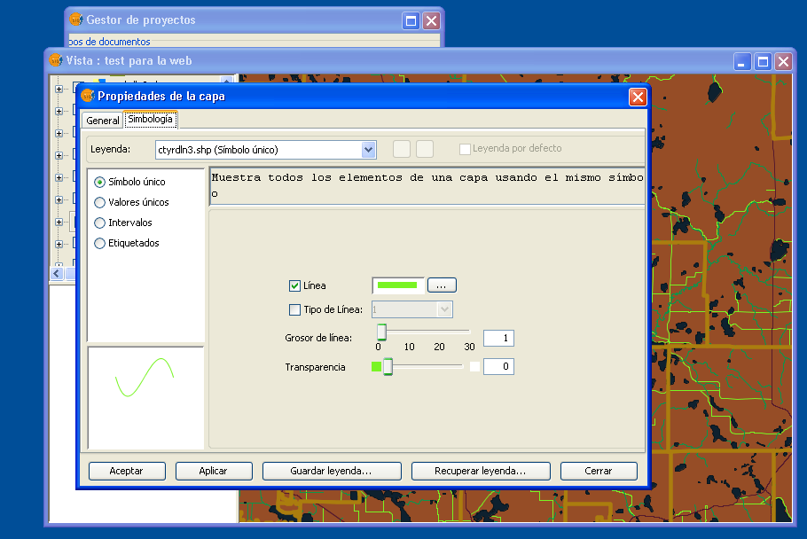 Gvsig layer simbology.png 910 × 608; 89 KB
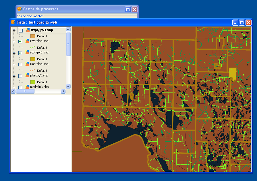 Gvsig view for web.png 895 × 630; 177 KB
- CaDraftSupportletter.pdf ; 439 KB
- TorontoCodeSprintReceipts1.pdf ; 160 KB
- TorontoCodeSprintReceipts2.pdf ; 195 KB
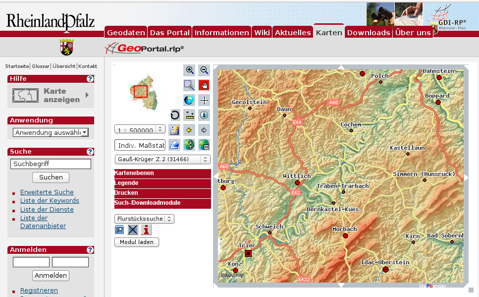 Geoportal.png 967 × 599; 579 KB
- Aag2010floorplan.pdf ; 868 KB
 Openlayers-itasca-wms.jpg 1,024 × 600; 93 KB
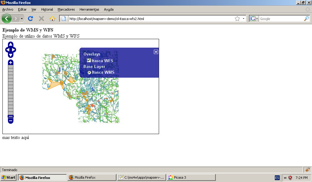 Openlayers-itasca-wms+wfs.jpg 1,024 × 600; 96 KB
 Opengeo avatar.png 150 × 150; 10 KB
 Logo fr.png 628 × 1,510; 184 KB
 Logo ogrs2009.jpg 457 × 198; 66 KB
 Wo Ti.JPG 225 × 303; 10 KB
 Wolfgang Tinkl.JPG 129 × 95; 3 KB
- Intropython.pdf ; 176 KB
- Geometries.pdf ; 268 KB
- Geocode.pdf ; 1.27 MB
- Wfs.pdf ; 137 KB
- Dems.pdf ; 943 KB
- Aggregation.pdf ; 182 KB
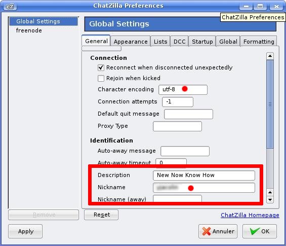 Chatzilla.jpg 565 × 485; 49 KB
- Bannerman OpenSourceSpatial v1.0.pdf ; 157 KB
- 01 arevalo ican poster.pdf ; 608 KB
- 04 knudsen.pdf ; 1.64 MB
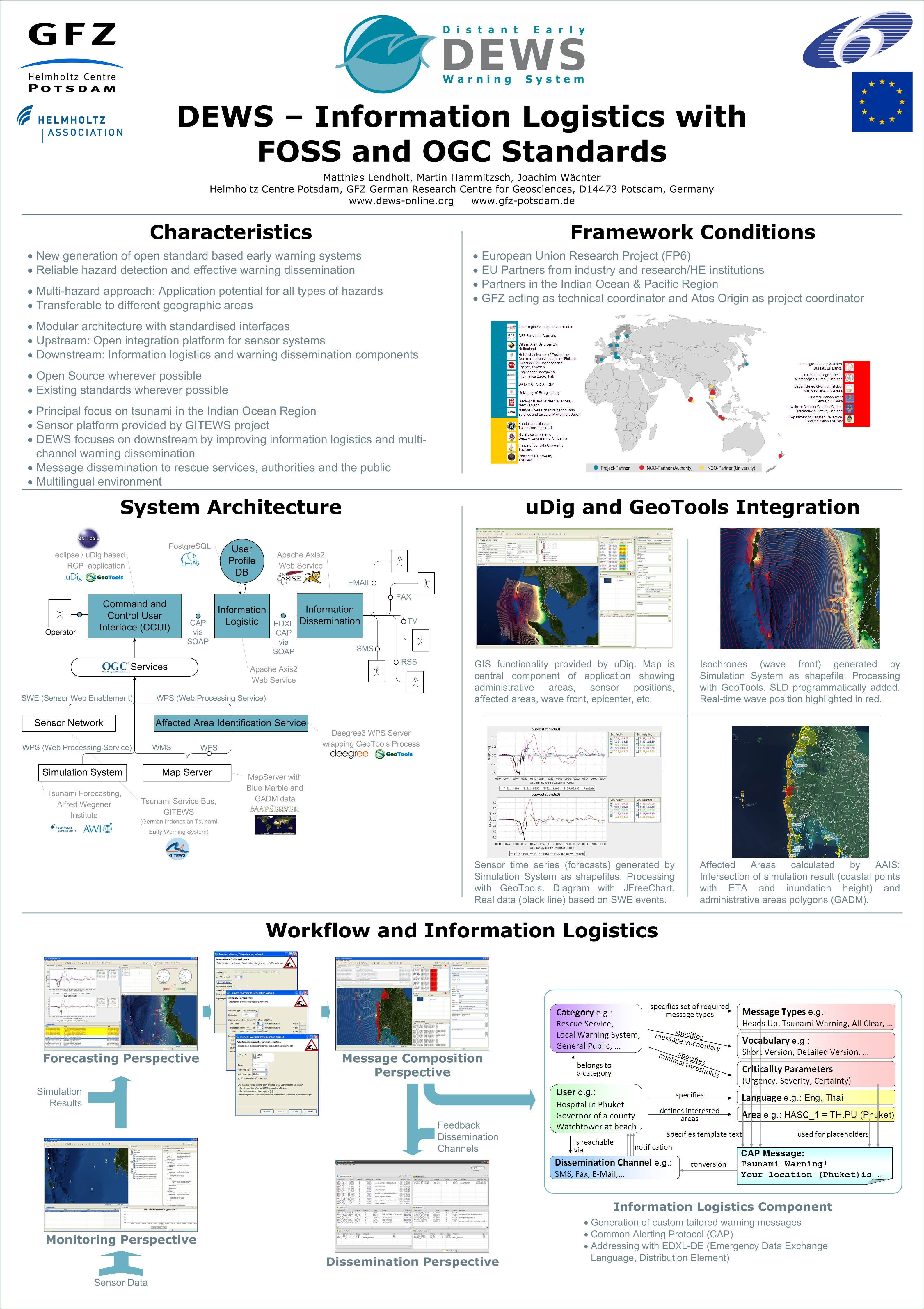 Foss4g2009-dews-poster.jpg 3,176 × 4,499; 1.41 MB
 800px-First Page2.PNG 800 × 197; 121 KB
 Visancal.jpg 362 × 508; 121 KB
 Clc122.png 30 × 30; 3 KB
 Clc213.png 30 × 30; 3 KB
 Clc222.png 30 × 30; 3 KB
 Clc231.png 30 × 30; 3 KB
 Clc241.png 30 × 30; 3 KB
 Clc322.png 30 × 30; 3 KB
 Clc335.png 30 × 30; 3 KB
 Clc411.png 30 × 30; 3 KB
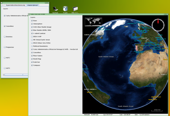 Igp1 small.png 719 × 491; 236 KB
 Logo 125x125.jpg 125 × 125; 17 KB
 Fos4g2010 logo sponsor silver.jpg 125 × 125; 17 KB
 Wms2.png 306 × 86; 36 KB
 Osgeo vietnam chapter meeting.JPG 3,264 × 2,448; 1.86 MB
- Nyc-2010-receipts.pdf ; 1.2 MB
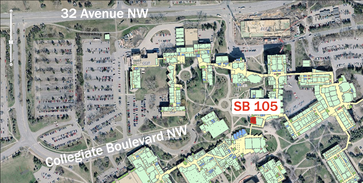 CampusUofC.png 1,262 × 636; 1.42 MB
 DotNetListHeaderLogo.png 504 × 98; 27 KB
 MathieuBaudier-0901-KranjaGora.png 976 × 976; 923 KB
 Clc2004-123.png 100 × 100; 3 KB
- FOSS4G2011 Concept1.pdf ; 1.96 MB
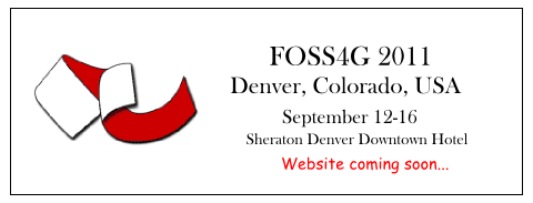 Foss4g2011 prelogo.png 480 × 183; 22 KB
 Logo 2006.png 300 × 129; 30 KB
 Karstenvennemann.jpg 112 × 140; 9 KB
 Tim Astle.jpg 1,600 × 1,200; 996 KB
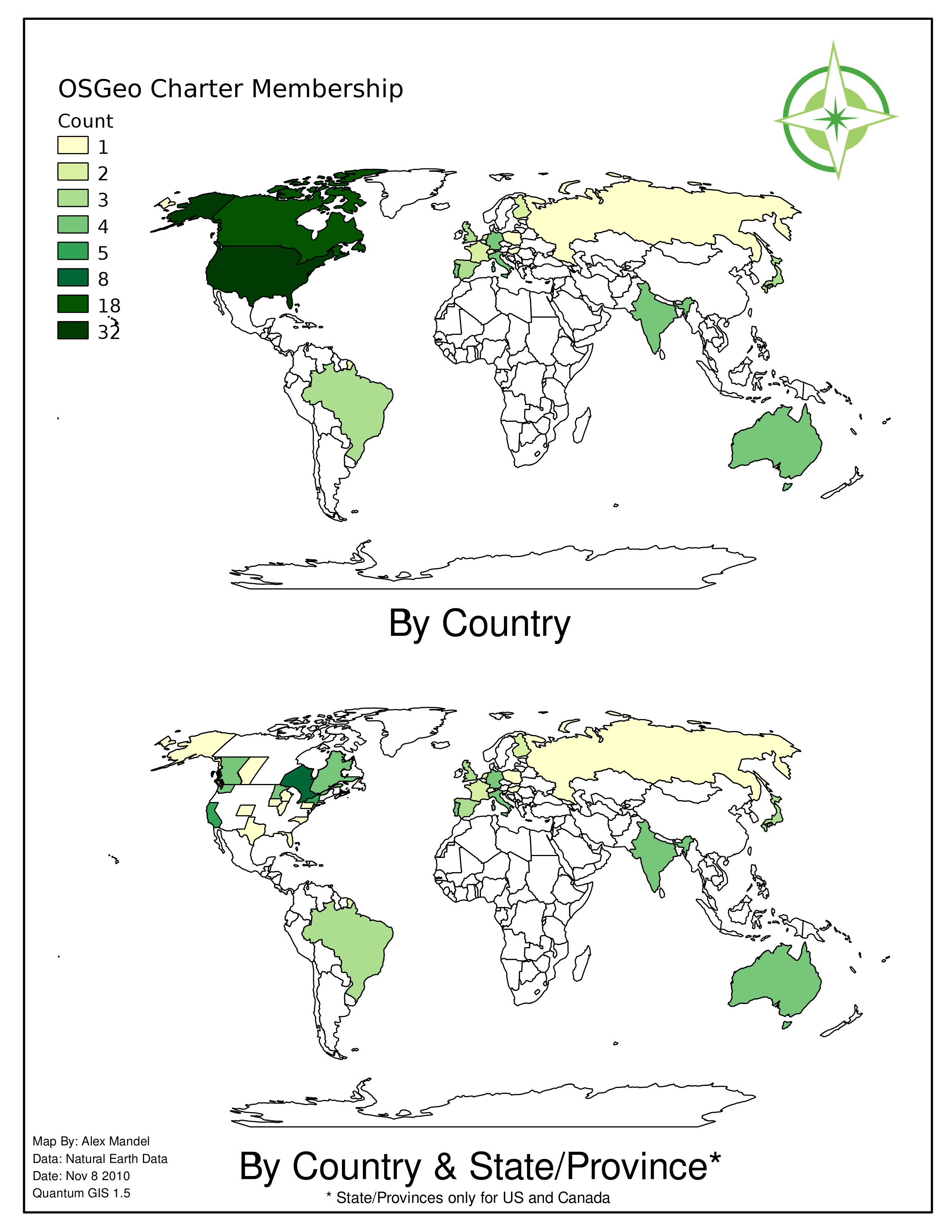 Chartermap11-2010.png 2,550 × 3,300; 1.03 MB
- Chartermap11-2010.pdf ; 482 KB
 Milo cartoon.png 117 × 156; 26 KB
 JoaoMatos.jpg 256 × 341; 15 KB
 JMatos.jpg 179 × 239; 9 KB
 Faunalia pt logo new.png 170 × 140; 19 KB
 Ilwis .jpg 114 × 112; 2 KB
- MOU OSGeo 20081201.pdf ; 123 KB
 Alrocar.jpg 80 × 60; 2 KB
 Logo-osgeo-es 100x100.png 100 × 100; 6 KB
 Remeras-denver.jpg 8,796 × 2,686; 1.18 MB
 Remeras-girona.jpg 8,796 × 2,686; 1.15 MB
 Remeras-buenosaires.jpg 8,796 × 2,686; 1.18 MB
 Remeras-marca-negro.jpg 2,278 × 2,140; 345 KB
 Remeras-marca-blanco.jpg 2,278 × 2,140; 341 KB
 Code-sprint-foss4g2010.jpg 1,018 × 765; 231 KB
 Appelt.jpg 134 × 201; 19 KB
- 2011 FOSS4G PDX Lightning.pdf ; 1.18 MB
 Paraninfo.jpg 704 × 528; 94 KB
 Richard.jpg 160 × 240; 43 KB
- Korean Local Chapter Activities 2011.pdf ; 1.05 MB
 Osgeonl logo2.png 300 × 140; 21 KB
 Osgeonl logo3.png 300 × 140; 23 KB
 Osgeonl logo4.png 300 × 130; 20 KB
 Osgeonl logo1.jpg 300 × 114; 31 KB
 UniCantabria.jpg 1,085 × 584; 119 KB
- OSGeo-ICA MoU.pdf ; 145 KB
 Foss4g-beijing-logo larger-font.png 443 × 418; 47 KB
 Logo效果.jpg 500 × 572; 119 KB
 QPublic 400.png 400 × 99; 61 KB
 Borealis 200.png 200 × 168; 14 KB
 FOSS4G-2012-beijing.png 388 × 219; 43 KB
- OC-amicus-AnswerOnMerits.pdf ; 1.57 MB
- OrangeCountry amicus letter.pdf ; 361 KB
- IslandWood accounting.pdf ; 191 KB
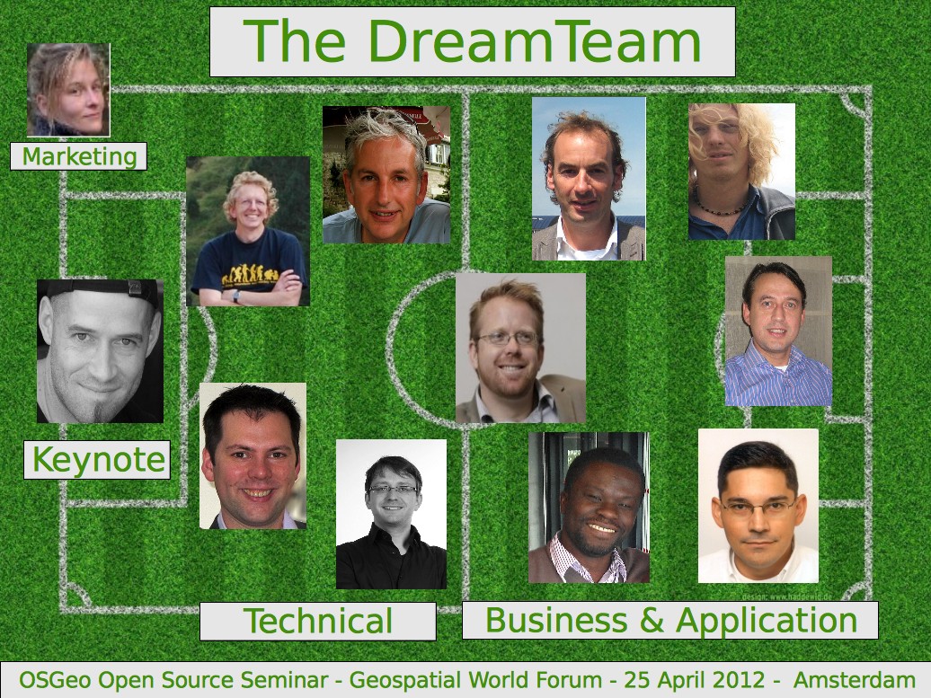 OSGeo OpenSource GWF12 DreamTeam.jpg 1,036 × 777; 304 KB
- Poster-osgeonl-dag-2012.pdf ; 498 KB
 Camerons75x100.jpg 75 × 100; 9 KB
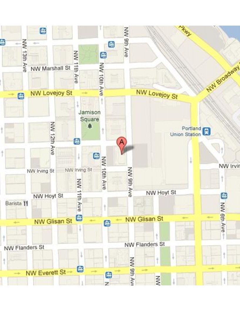 PDXOSGEO-Meeting EcoTrust.jpg 816 × 1,056; 88 KB
 GZeiss.jpg 414 × 515; 53 KB
 Jeroen ticheler100.jpg 82 × 100; 6 KB
 Boston codesprint 2012.png 600 × 189; 274 KB
 GeoinquietosBA-r1-2012-05-30 20-10-21 7.jpg 2,592 × 1,936; 1.96 MB
 Ragi Burhum.jpg 402 × 512; 62 KB
 Edwin amado team wikisquare image.jpg 211 × 288; 39 KB
 Andrew Ross small.png 400 × 560; 324 KB
 Schéma CO v1.png 790 × 596; 162 KB
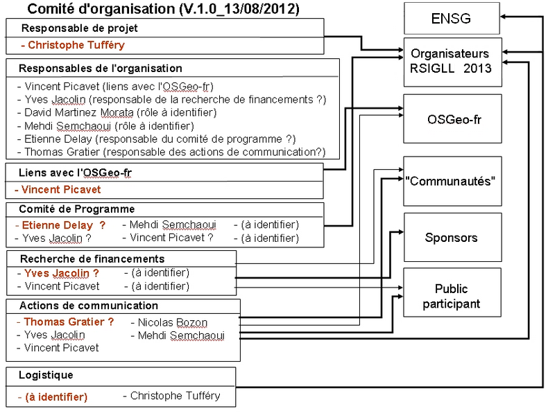 Schéma CO v2.png 790 × 596; 162 KB
 Edwin amado image.png 98 × 136; 11 KB
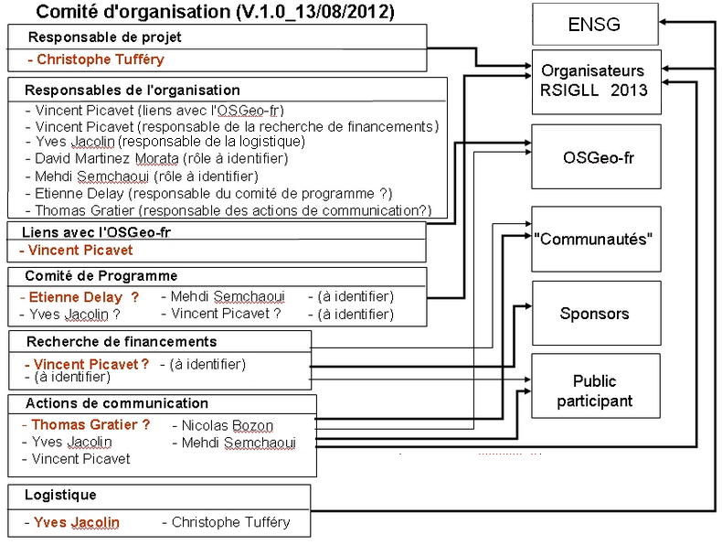 Schéma CO v3.png 790 × 596; 161 KB
 Axl2mapNGU.odt ; 21 KB
 Smallfrankface.png 115 × 150; 25 KB
 2012-11-22 08.48.11.jpg 1,600 × 1,200; 424 KB
- Padon - Web Mapping with Drupal.pdf ; 1.63 MB
- OSGeo Como DraftMoU.odt ; 11 KB
- GeoprocessingPython WilRada.pdf ; 789 KB
 La foto.JPG 640 × 480; 91 KB
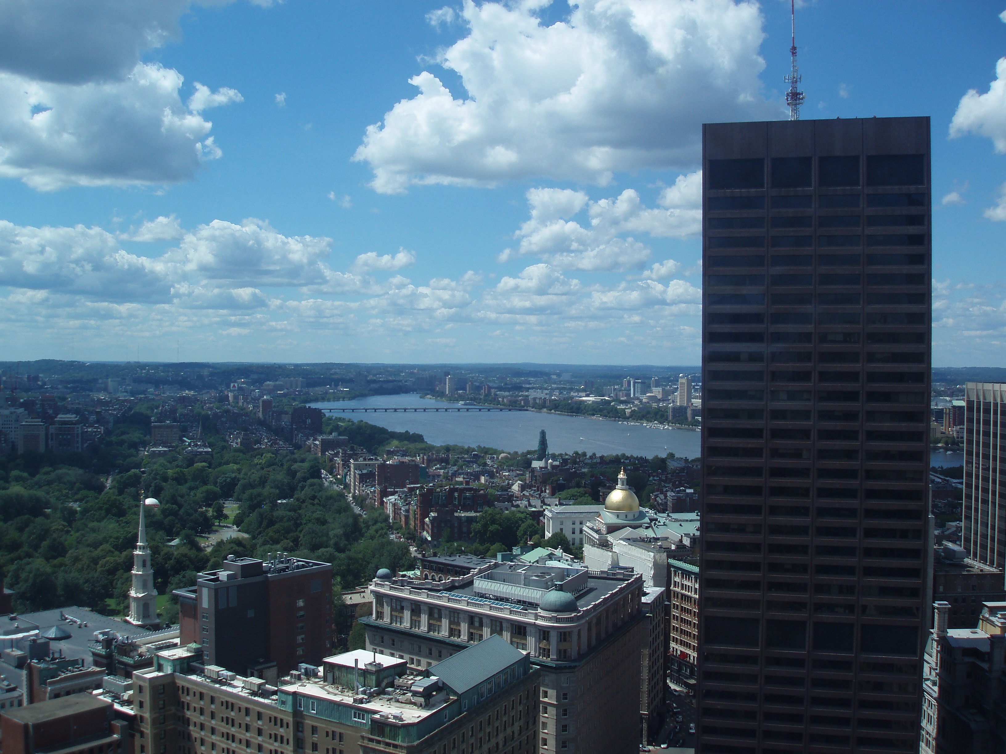 Boston2.jpg 3,264 × 2,448; 1.5 MB
 GeoSynergy 650.jpg 157 × 38; 2 KB
 Cartografia web.png 1,500 × 1,132; 179 KB
 Cartografia web1.png 1,500 × 1,132; 179 KB
 Logo-geoserver.png 200 × 47; 4 KB
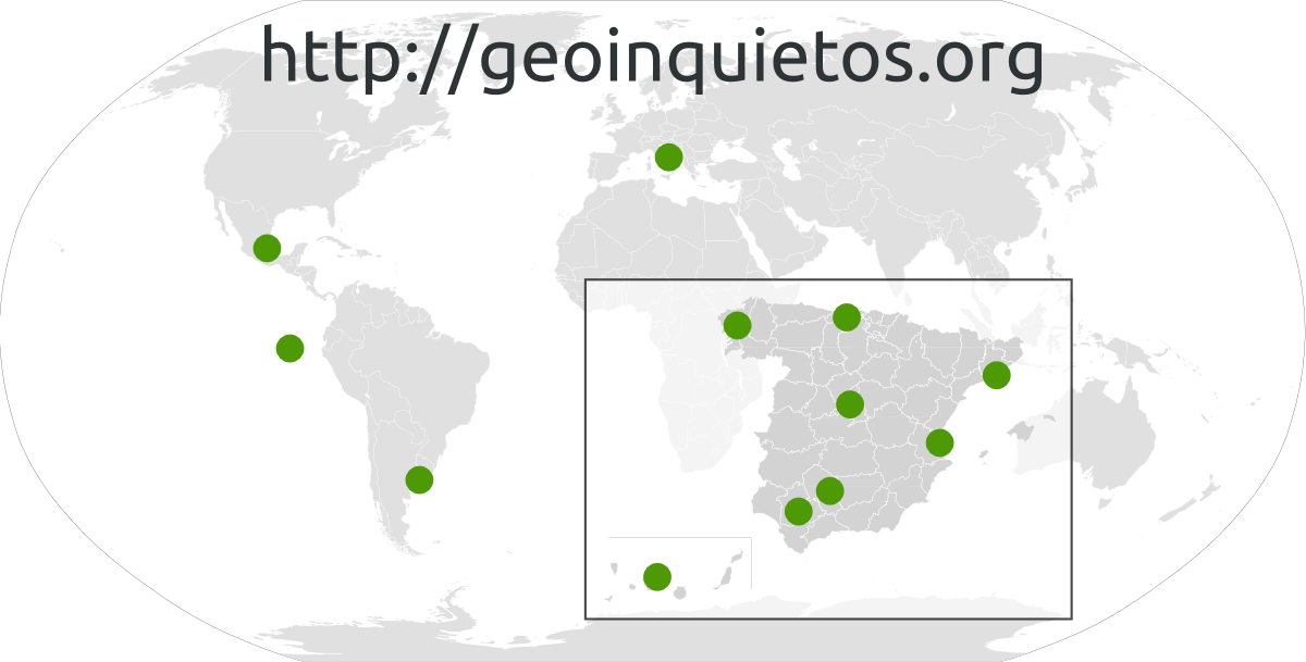 Geoinquietos-world.png 1,200 × 609; 159 KB
- Geoinquietosmad.pdf ; 264 KB
- Osm cheatsheet.pdf ; 60 KB
 Michogar.jpeg 1,448 × 1,892; 1.4 MB


