Exercise: A spatial model of a catchment
Note 1: this exercise is designed to be used with libral and Gtk2::Ex::Geo tools. Note 2: the tools have to be currently the CVS versions.
Required data: a land cover raster and a DEM. Results: the hydrological structure (lakes, subcatchments, stream sections, and their topological structure) of a catchment as a vector layer.
Students should follow the outline below and do the same procedure for a catchment of their own selection. Each step may involve explanations by the teacher.
More information about the tools
Steps of the exercise:
- open land cover raster
- zoom to probable catchment area (rather too large than too small!)
- clip a piece of the land cover, name it "lc" (*)
- make a 'lakes' raster by saying $lakes = $lc == 43 (or whatever the land cover code for water is) [TODO: add instructions for removing streams from the lakes raster]
- give unique id's for all lakes: $lakes->number_areas
- open a DEM raster
- clip a similar piece(***) of the dem, name it 'dem'
- compute pitless flow direction grid: say(**) $fdg = $dem->filldepressions (*4)
- fix the FDG so that each lake has one and only one outlet, say: $fdg->kill_extra_outlets($lakes)
- compute upslope area grid, say: $uag = $fdg->uag
- search for the catchment (lake) outlet cell and compute a catchment raster: $c = $fdg->catchment(<coordinates>)
- compute a streams raster from the $uag: $s = $uag > x
- remove very short streams: $s->prune($fdg, $lakes, <coordinates>, $l)
- give unique id's for each stream segment: $s->number_streams($fdg, <coordinates>);
- compute a subcatchments raster and topology information: ($sc, $topo) = $s->subcatchments($fdg, $lakes, <coordinates>)
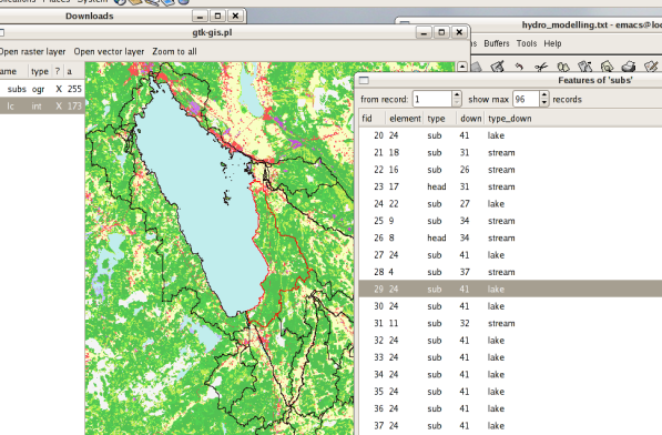
- save the subcatchment structure as an OGR vector layer: $sc->save_catchment_structure($topo, $s, $lakes, $ogr_datasource, $layer)
The result should look something like this:
footnotes:
(*) the clipped piece is automatically a plain libral raster, it may (and should) be saved by saying(**) $lc-save('lc'); later the saved raster may be opened in the usual way, but it needs to be "librated" by clipping to <self>
(**) "say", means write to the combo box, i.e. the command line interface
(***) in the clip dialog, select a raster to make a raster that is overlayable to it
(*4) this can be checked by saying: p($self,$fdg->contents), which computes the contents (number of cells having different values) and prints it
