File:Fig24 RAI.jpg
Jump to navigation
Jump to search
Size of this preview: 800 × 572 pixels. Other resolutions: 320 × 229 pixels | 3,509 × 2,511 pixels.
Original file (3,509 × 2,511 pixels, file size: 1.9 MB, MIME type: image/jpeg)
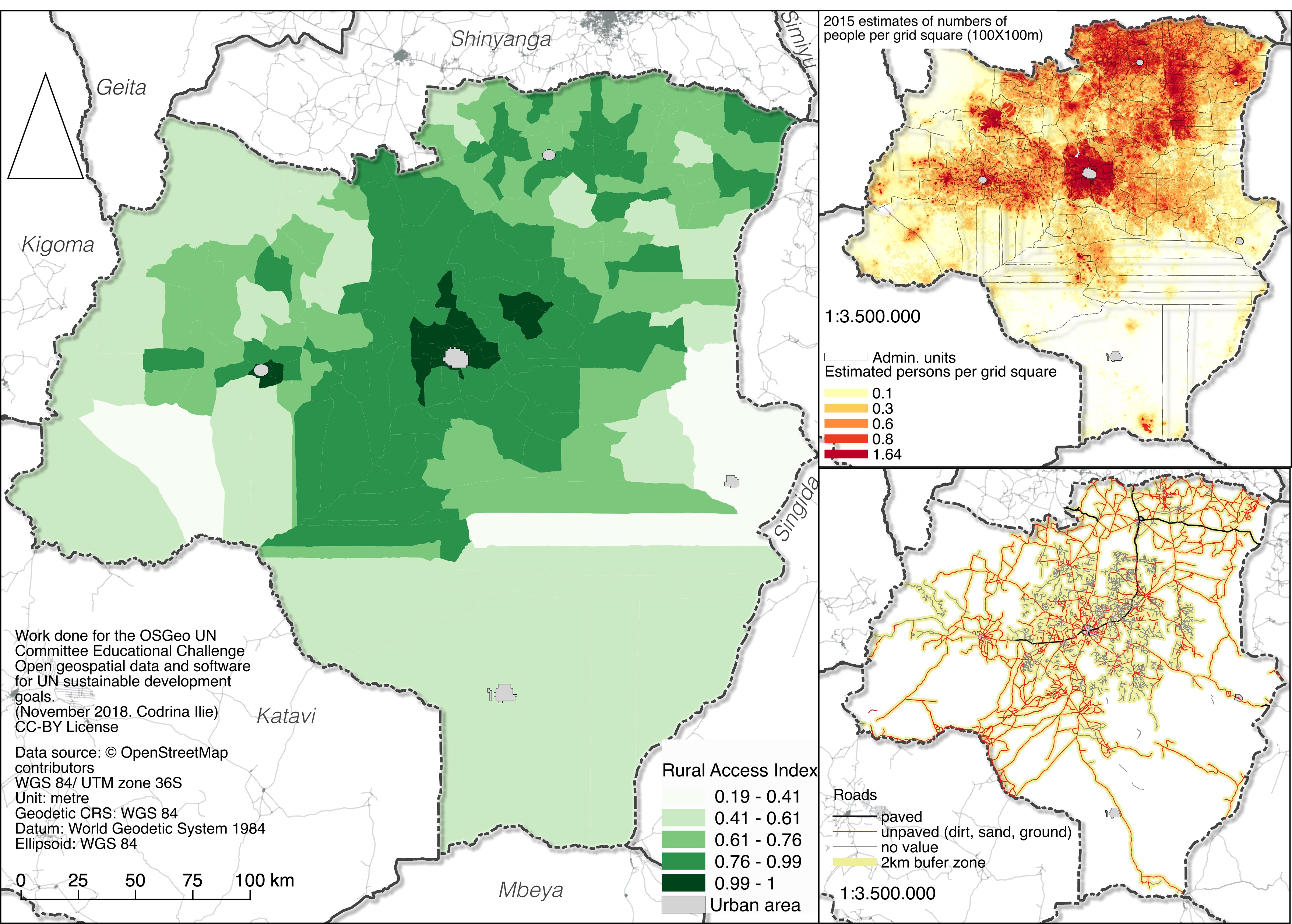
Rural Access Index calculated for Tabora county, Tanzania.
File history
Click on a date/time to view the file as it appeared at that time.
| Date/Time | Thumbnail | Dimensions | User | Comment | |
|---|---|---|---|---|---|
| current | 03:31, 21 January 2019 | | 3,509 × 2,511 (1.9 MB) | Codrina (talk | contribs) | Rural Access Index calculated for Tabora county, Tanzania. |
You cannot overwrite this file.
File usage
The following page uses this file: