File:Fig24 RAI.jpg
Jump to navigation
Jump to search
The printable version is no longer supported and may have rendering errors. Please update your browser bookmarks and please use the default browser print function instead.
Size of this preview: 800 × 572 pixels. Other resolutions: 320 × 229 pixels | 3,509 × 2,511 pixels.
Original file (3,509 × 2,511 pixels, file size: 1.9 MB, MIME type: image/jpeg)
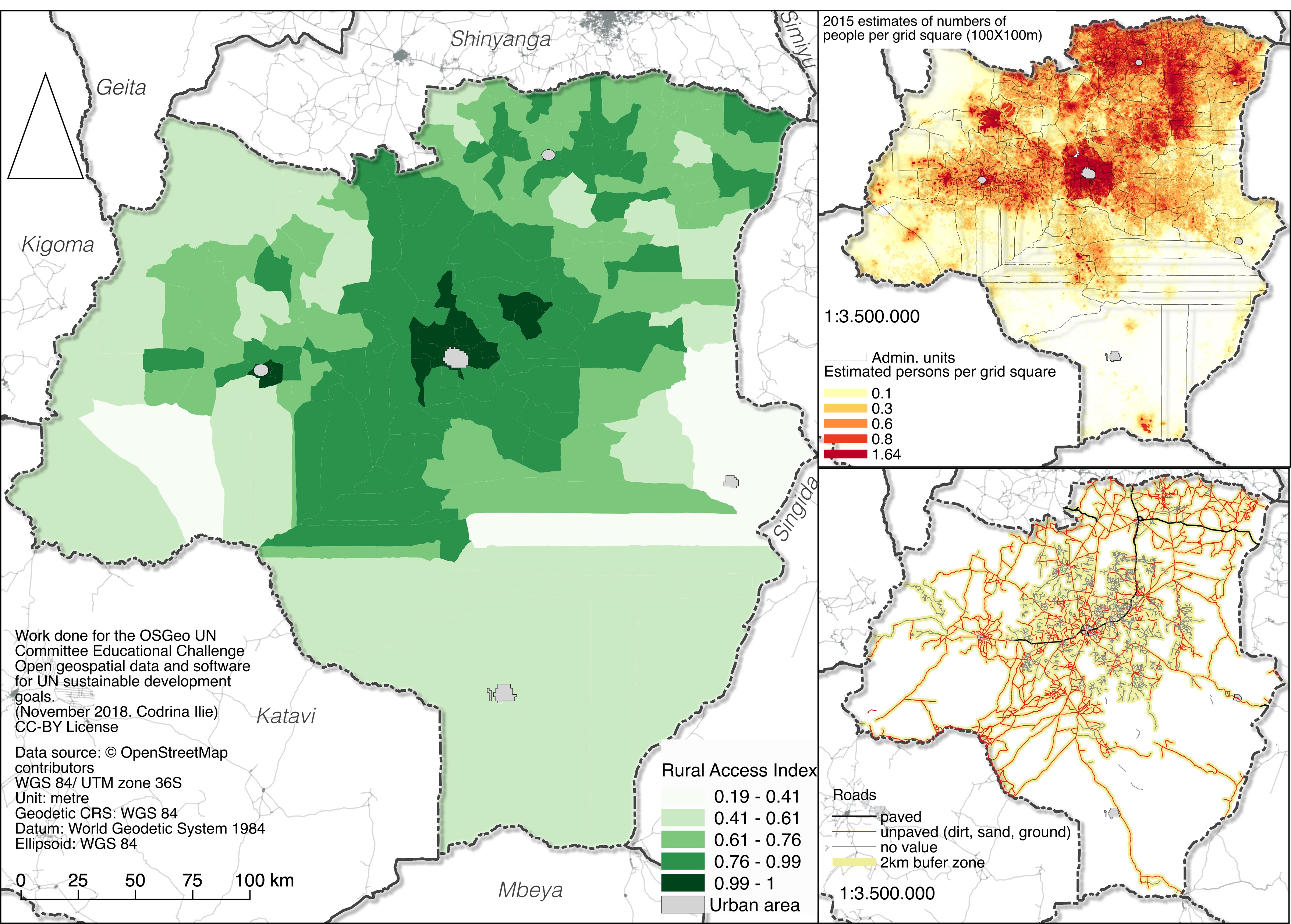
Rural Access Index calculated for Tabora county, Tanzania.
File history
Click on a date/time to view the file as it appeared at that time.
| Date/Time | Thumbnail | Dimensions | User | Comment | |
|---|---|---|---|---|---|
| current | 03:31, 21 January 2019 | | 3,509 × 2,511 (1.9 MB) | Codrina (talk | contribs) | Rural Access Index calculated for Tabora county, Tanzania. |
You cannot overwrite this file.
File usage
The following page uses this file: