Live GIS Disc
About
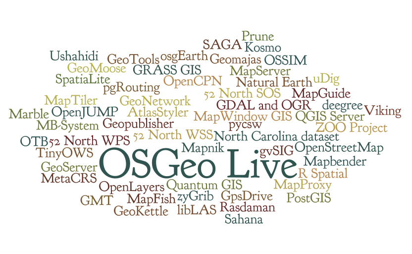
OSGeo Live provides bootable ISO-Images and Virtual Machines which allow users to try out fully-operational versions of popular Free Geospatial Software without the need to install a thing. Everything is set up for you ready to go: just reboot into it, glance at the help pages on the desktop, and go. The existing hard drive and operating system will not be modified in any way, everything happens in temporary system memory. As such it will run a bit slower than the "real thing" and you may want to grab a USB flash drive to save or transfer files with. You can load and boot a live-image completely from a USB stick too if you prefer.
We do this in large part by maintaining automated build scripts which collect many OSGeo programs and sample data-sets together, and then combine them to form the Live disc or VM itself. By tweaking these scripts, users are free to make their own custom distributions, for example localized in their own language and with local map data.
- For the 2009 FOSS4G conference a snapshot of Free Geospatial software has been collected onto the Arramagong Live DVD and VM.
- The Arramagong Live DVD & VM contains a collection of the best Geospatial Open Source, pre-configured with sample data. The DVD and Virtual Machine are available for download at http://live.osgeo.org/en/download.html . Refer to Live GIS Disc Quick Start to get started.
Key Links
Quick Start
How to add a project to OSGeoLive
Build Process
- Live GIS Build instructions
Package List
- Package List and status spreadsheet (sometimes lags reality)
- Future/wishlist
Documentation
Live_GIS_Add_Project#Documentation
Stable release: http://live.osgeo.org
Nightly build: http://adhoc.osgeo.osuosl.org/livedvd/docs/en/index.html
Translate
Artwork
You can find the artwork sleeves, background images, booklet at:
- Version 4.5
- http://trac.osgeo.org/osgeo/browser/livedvd/artwork/backgrounds/4.5
- http://trac.osgeo.org/osgeo/browser/livedvd/artwork/sleeve/4.5
Review
Presentation
Workshops with OSGeoLive
Schedule
Contact Us
- Mailing List: http://lists.osgeo.org/mailman/listinfo/live-demo
- The mailing list is archived at Gmane and Nabble
- IRC: irc://irc.freenode.net#osgeolive - Logs
- You can log into IRC from: http://webchat.freenode.net/ Enter a nickname, and set channel=osgeolive
- Meeting Minutes
Downloads
Latest Stable Release: http://live.osgeo.org/en/download.html
Latest Development Release: http://live.osgeo.org/dev/build
Older Releases: http://download.osgeo.org/livedvd
Issue Tracker
Our issue tracker is hosted at OSGeo's Trac system, and you will need to create an OSGeo UserId before you can login and edit issues. To distinguish the LiveDVD project from other OSGeo projects, use the following conventions:
- Component field
- Set to `LiveDVD`
- Keywords
- Version: Set to base release version: eg: 5.0, 5.5 (not 5.5rc1)
- Application: Set to application with issue (use lower case): eg: "geoserver"
OSGeo User Id
- Create an OSGeo id: http://www.osgeo.org/osgeo_userid , which is required to edit the wiki, commit to svn and create an issue in the issue tracker.
Subversion
- Repository
- https://svn.osgeo.org/osgeo/livedvd/gisvm/trunk and web view
- On Linux systems: access Subversion using:
svn checkout https://svn.osgeo.org/osgeo/livedvd/gisvm/trunk
- On windows systems, install Tortoise Subversion, which extends Windows Explorer to include subversion commands.
- Commit access
- To get commit access, you need to create yourself an osgeo user id, then join our email list and ask to be given access to subversion. In this email, you will also need to confirm that you will comply with our license guidelines. Write something like:
- Hi all, I'd like to contribute XXX to OSGeo-Live. Could I please get access to subversion. My osgeo-user id is: YYYY.
- I confirm that my contributions to OSGeo-Live will be compatible with the OSGeo-Live license guidelines at the time of contribution.
- The current OSGeo-Live license guidelines are:
- Creative Commons Attribution-ShareAlike 3.0 Unported License for Quickstarts
- Creative Commons Attribution 3.0 Unported License for Project Overviews
- A version of LGPL for install scripts
- One of the OSI approved Open Source licenses for installed applications
- A project admin will then add you to the osgeo user group.
- Add your name to contributors list
- The first thing you should do to test your svn install is to add your name the contributors list:
cd trunk/doc
# to edit a file
svn update contributors.csv
# edit contributors.csv
# please add your Name, Email, Country and Osgeo_id to the list, separated by comma
#  - Order alphabetical by first name,
#  - remove punctuation from email addresses to stop harvesting for junk mail

# optionally check to see what has changed.
svn diff contributors.csv

# check the file back into subversion
svn commit contributors.csv
# to add a file
cd <dir>
# create a file
svn add <file>
svn propset svn:mime-type <mime.type> <file>
svn commit <file>
# to move or rename a file
svn move <file>
svn commit <file>
- A script to automatically set the svn props can be found here. More SVN hints here.
- On Windows this can be made easy using Tortoise SVN which plugs directly into Windows Explorer.
FAQ
Press Releases
- FOSS4G 2009 Press Releases
- 27 August 2009, FOSS4G 2009 Press Release 28 - Simple steps to get your project on the FOSS4G Live DVD
- 6 September 2009, FOSS4G 2009 Press Release 29 - What Windows installers should be on the FOSS4G Live DVD + Live DVD Status.
- 3 October 2009, [1] Arramagong GIS Live DVD - off to printers
- 16 October 2009, FOSS4G 2009 Press Release 35 - LiveDVD/VM on click2try Cover Email
- 16 December 2009, Live GIS Disc Press Release 1 - Defining the next LiveDVD/VM
- 14 January 2009, Live GIS Disc Press Release 2 - 3 weeks to Live DVD 3.0 feature freeze
- 24 March 2010, Live GIS Disc Press Release 4 - LiveDVD project joins Google Summer of Code
- 31 March 2010, Live GIS Disc Press Release 3 - Arramagong Live DVD 3.0 released
- 10 June 2010, Live GIS Disc Press Release 5 - Building OSGeo Live DVD for FOSS4G 2010
- 27 June 2010, Live GIS Disc Press Release 6 - 1 week till OSGeoLive Feature Freeze
- 21 July 2010, Live GIS Disc Press Release 7 - OGC and OSGeo collaborate on documentation
- 3 August 2010, Live GIS Disc Press Release 8 - 1 week to test the OSGeo-Live DVD
- 13 August 2010, Live GIS Disc Press Release 9 - Testing OSGeo-Live on the USB
- 3 September 2010, Live GIS Disc Press Release 10 - Video & DVD for OSGeoLive 4.0, the best GeoSpatial OpenSource
- 23 November 2010, Live GIS Disc Press Release 11 - Goals and schedule for OSGeo-Live 4.5
- 11 December 2010, Live GIS Disc Press Release 12 - Contact application contacts
- 14 January 2011, Live GIS Disc Press Release 13 - Last call for projects to be included on OSGeo-Live 4.5
- 13 February 2011, Live GIS Disc Press Release 14 - Two weeks to translate Project Overviews
- 13 February 2011, Live GIS Disc Press Release 15 - Two weeks to write Quick Starts
- 25 February 2011, Live GIS Disc Press Release 16 - OSGeo-Live 4.5 ready for testing
- 28 March 2011, Live GIS Disc Press Release 17 - OSGeo-Live 4.5 released
- 8 May 2011, Live GIS Disc Press Release 18 - Call for interest in OSGeo-Live 5.0
- 4 June 2011, Live GIS Disc Press Release 19 - Last call for new projects wishing to be included on OSGeo-Live
- 17 June 2011, Memoirs of a Cat Herder - Coordinating OSGeo-Live volunteers
- 9 July 2011, Live GIS Disc Press Release 20 - One week to update of OSGeo-Live English Overviews and Quickstarts
- 18 July 2011, Project Overviews & Quickstarts for New Zealand's SDI Cookbook
- 2 August 2011, Live GIS Disc Press Release 21 - Calling for OSGeo-Live Testers
- 30 August 2011, Live GIS Disc Press Release 22 - OSGeo-Live 5.0 released
- 1 November 2011, Live GIS Disc Press Release 23 - Call for interest in OSGeo-Live 5.5
- 17 December 2011, Live GIS Disc Press Release 24 - What version of applications should we be installing on OSGeo-Live 5.5?
- 16 January 2012, Live GIS Disc Press Release 25 - Update OSGeo-Live 5.5 docs & installer
- 1 March 2012, Live GIS Disc Press Release 26 - OSGeo-Live 5.5 released
- 30 April 2012, Live GIS Disc Press Release 27 - Starting build cycle for OSGeo-Live 6.0
History
Project Metrics
Metrics from Ohloh: https://www.ohloh.net/p/OSGeo-Live
Use Cases
There are multiple use cases for this product:
- Demo DVD that can be handed out at conferences.
This will contain a wide variety of applications, preconfigured with some sample data and containing introductory tutorials. It should be able to function completely offline, at least within the scope of the tutorials, and should provide an introduction to many products. This is very much a Live DVD, and as such should be conservative with regards to size (it will be run from RAM). - Education DVD
This seems to be a more involved version than the Demo DVD, including more involved material, including train-the-trainer style material. This is targeted at those who will be teaching others, be it in workshops or university classes/labs. My expectation (mleslie: feel free to correct me) is that this is more likely to be installed on machines and used as a teaching resource, as opposed to a toy to play with, as with the Demo DVD. This will require material developed through the. - Workstation Install DVD
This need was seen in Cape Town, where the bandwidth seems to be a very limiting factor. Using the DVD to install either a complete OS, a set of packages to an existing Linux, or Windows installers completely offline is of great value in the developing world. Would it be of greater value to lose the Edu or demo material and put in complete application documentation?
- DebianGIS. We encourage projects to package applications into Debian, which in turn is incorporated into Ubuntu.
- UbuntuGIS
- Enterprise Linux GIS packages as RPMs for redhat based systems.
- GISVM home page (GIS Virtual Machine by Ricardo Pinho)
- DebianGIS Live Image
- Omniverdi LiveCD project
- List of live CDs from the GRASS download site
- Gfoss.it live DVD
- Portable GIS - Zero-install GIS for MS Windows on a USB stick
- Poseidon Linux
- GISLive - LiveDVD project from FOSSGIS e.V. (German language)
Links to Build tool options
- The live-helper package - DebianLive home page
- Debian\Ubuntu Tricks
- Ubuntu Help Way