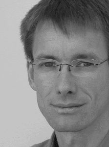
Markus Neteler
| OSGeo Member | ||
|---|---|---|
| Name: | Markus Neteler |  |
| Job Title: | Owner and Senior Consultant | |
| Company: | mundialis GmbH & Co KG | |
| Address: | Koelnstrasse 99 | |
| City: | Bonn | |
| State: | ||
| Country: | Germany | |
| Local Chapter: | FOSSGIS | |
| Email: | neteler@osgeo.org | |
| Phone: | ||
| Instant Messaging: | ||
| Website: | https://www.mundialis.de/neteler/ | |
| Language(s): | German; English; Italian | |
| Personal Description : | ||
|
|
||
OSGeo Experience and Roles:
- Since 2015: founder of the mundialis company in Bonn (Germany) with focus on remote sensing and massive satellite data processing.
- Chair of the GRASS PSC
- My freelance activities
- My blog
- Contact me at [1] or 'neteler*osgeo.org'
- Bio
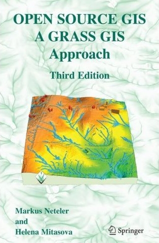
Markus Neteler, PhD, is a Geographer and Open Source GIS enthusiast. After 15 years working as a researcher in Italy (remote sensing for environmental risk assessment, epidemiological GIS modelling, vector-borne diseases, biodiversity, and Free Software GIS development) he joined in 2015 the startup mundialis (www.mundialis.de) as a partner and general manager focusing on remote sensing and big geodata processing. Markus is project coordinator of GRASS GIS and founding member of FOSSGIS.de, GFOSS.it, and OSGeo.org. He is author/co-author of two books on GRASS GIS and over 80 papers on GIS applications. He is founding-member of the OSGeo Foundation and served on its board of directors between 2006-2011. In 2006, he was honored with the international Sol Katz Award for Geospatial Free and Open Source Software.
- OSGeo Experience
- Misc
... roughly in temporal order:
- co-founder of mundialis, Germany - 2015
- Neteler, M., Bowman, M.H., Landa, M. and Metz, M. (2012): GRASS GIS: a multi-purpose Open Source GIS. Environmental Modelling & Software, 31: 124-130 (DOI)
- Sol Katz Award in 2006
- Board of Directors member of OSGeo.org (2006-2011) and of several committees (GRASS GIS PSC, SAC, geodata, ... since 2006)
- co-founder of GDF Hannover, Germany - 2003
- co-founder and member of:
- GFOSS.it, Italy - 2007
- OSGeo.org - 2006
- FOSSGIS.de (formerly GRASS-Anwender-Vereingung e.V. - GAV), D-A-CH - 2000
- First book on Open Source GIS:
 http://www.grassbook.org - 2002
- Microdonations - don't ignore the small money! (really, we need a better framework for that)
- OSGeo Python Library (Software stack)
- OSGeo Cartographic Library (Software stack)
- OSGeo map symbol set (Software stack)
- OSGeo Multilanguage Dictionary (Education) -
prototype - Software Translation Portal (Software stack)
- OSGeo book shop (see Template:Books) <-- in Drupal, please, complete at http://www.osgeo.org/books
Done goals 2006-2011
- [✓] Started Open Source GIS History article
- [✓] Get Postgrey installed for lists.osgeo.org (combat spam on lists.osgeo.org)
- [✓] Italiano - OSGeo local chapter
- [✓] First OSGeo Educational data set
- [✓] GRASS Incubation
My goals 2010-2011 (as a director)
Ex post note: I could not realize all my goals in my years of being a director (since 2006), so please pick 'em up!
- Board:
- [✓] Extend the OSGeo mission statement: add "collaborative"
- [✓] consider
twoone F2F board of directors meetings per year - consider a MoU with OpenStreetMap Foundation to clarify relationship for people outside of communities
- discuss a low charter member fee (as most organizations worldwide have incl. OSGeo local chapters), perhaps BIP adjusted
- Conference
- run two conferences per year in different parts of the world rather than targeting at 2000 participants. One could be the current conference, the other more workshop oriented (Geoff Zeiss: make that topic oriented)
- Marketing
- Edu Marketing reachout initiative - better advertise the multi-language Edu portal
- Data
- Geodata committee: fill the raster niche (as OSM does for vector data) - e.g. by supporting http://openaerialmap.org
- Business
- Service providers directory: better support individual freelancers
- consider to establish a FOSS4G "engineer" certificate (which can even generate revenue for OSGeo)
- Community
- better link OSGeo int'l and local chapters (basically poor performance of many OSGeo liason officers. Maybe tag important messages and send to new local-chapters list?)
- [✓] promote a spatially more representative charter membership structure: elections went into this direction, see: Board of Directors Report 2011
{{#umUserMap: Neteler|300px|300px|9|2}}
