Difference between revisions of "OSGeoLive"
m (→Build Process) |
|||
| (32 intermediate revisions by 8 users not shown) | |||
| Line 1: | Line 1: | ||
| − | = About | + | [[image:OSGeo_project.png|right|180px|caption]] |
| + | This page is '''deprecated''', please find the latest version here :https://trac.osgeo.org/osgeolive/wiki | ||
| + | = OSGeo-Live wiki docs migrating = | ||
| + | June 2018: OSGeo-Live howto wiki documentation is is in the process of migrating to: https://trac.osgeo.org/osgeolive/wiki | ||
| + | It is best to try the new docs first, then come back to this wiki afterwards if you can't find what you are looking for. | ||
| + | |||
| + | = About OSGeo-Live = | ||
[[File:Osgeolive wordle.png|center|link=http://live.osgeo.org|750px]] | [[File:Osgeolive wordle.png|center|link=http://live.osgeo.org|750px]] | ||
| Line 7: | Line 13: | ||
We do this in large part by maintaining automated build scripts which collect many [[OSGeo]] programs and sample data-sets together, and then combine them to form the Live disc or VM itself. By tweaking these scripts, users are free to make their own custom distributions, for example localized in their own language and with local map data. | We do this in large part by maintaining automated build scripts which collect many [[OSGeo]] programs and sample data-sets together, and then combine them to form the Live disc or VM itself. By tweaking these scripts, users are free to make their own custom distributions, for example localized in their own language and with local map data. | ||
| − | = | + | = For users = |
== Quick Start == | == Quick Start == | ||
| − | * [ | + | * [https://live.osgeo.org/en/quickstart/osgeolive_quickstart.html OSGeoLive Quick Start] |
| − | == | + | == Documentation == |
| − | + | June 2018: The OSGeo-Live documentation process is changing to use transfix and the process for using it is moving wikis to: https://trac.osgeo.org/osgeolive/wiki/How%20to%20document%20a%20project | |
| − | |||
| − | + | It is best to try the new docs first, then come back to wiki pages below if you don't find what you are looking for: | |
| − | |||
| − | + | [[OSGeoLive_AddProject#Documentation]] | |
| − | + | Stable release: http://live.osgeo.org | |
| − | : | ||
| − | + | Nightly build: http://adhoc.osgeo.osuosl.org/livedvd/docs/en/index.html | |
| − | : | ||
| − | + | Source is stored in git: https://github.com/OSGeo/OSGeoLive-doc | |
| − | |||
| − | |||
| − | |||
| − | |||
| − | |||
| − | |||
| − | |||
| − | |||
| − | |||
| − | : | ||
| − | |||
| − | |||
| − | |||
| − | |||
| − | |||
| − | |||
| − | |||
| − | |||
| − | |||
| − | |||
| − | |||
| − | |||
| − | |||
| − | |||
| − | |||
== Package List == | == Package List == | ||
| Line 57: | Line 34: | ||
* [[Live_GIS_Disc_Packages#Package_wishlist|Future/wishlist]] | * [[Live_GIS_Disc_Packages#Package_wishlist|Future/wishlist]] | ||
| − | == | + | === Project Metrics === |
| − | + | * Metrics from Open Hub (former Ohloh): https://www.openhub.net/p/OSGeo-Live | |
| − | + | * https://live.osgeo.org/en/metrics.html | |
| − | + | * Transifex OSGeoLive Translation Stats: https://www.transifex.com/osgeo/osgeolive/languages/ | |
| − | |||
| − | |||
| − | |||
| − | |||
| − | |||
| − | |||
| − | |||
| − | == | ||
| − | |||
| − | |||
| − | |||
| − | |||
| − | |||
| − | |||
| − | |||
| − | * | ||
| − | |||
| − | |||
| − | |||
| − | |||
| − | |||
| − | |||
| − | |||
| − | |||
| − | |||
| − | |||
| − | |||
| − | |||
| − | |||
| − | |||
| − | |||
| − | |||
| − | |||
| − | * | ||
| − | |||
| − | |||
| − | |||
| − | |||
| − | |||
| − | |||
| − | |||
| − | |||
| − | |||
| − | |||
| − | |||
| − | |||
| − | |||
| − | |||
| − | |||
| − | * | ||
| − | |||
| − | |||
| − | |||
== Contact Us == | == Contact Us == | ||
| − | + | Refer to: https://trac.osgeo.org/osgeolive#Communication | |
| − | |||
| − | |||
| − | |||
| − | |||
| − | |||
== Downloads == | == Downloads == | ||
| Line 131: | Line 50: | ||
Older Releases: http://download.osgeo.org/livedvd | Older Releases: http://download.osgeo.org/livedvd | ||
| − | == | + | == Including OSGeoLive at your event == |
| − | + | [http://live.osgeo.org OSGeoLive] provides a DVD, USB and a Virtual Machine which allow users to try out fully-operational versions of popular Free Geospatial Software without the need to install a thing. It also includes documentation and a comprehensive presentation. | |
| − | |||
| − | |||
| − | |||
| − | |||
| − | |||
| − | + | This is the process to follow if you wish to make use of OSGeoLive at your conference, workshop or similar event. | |
| − | + | ; Tell Us | |
| − | + | : Add your event to our [[OSGeoLive_History|OSGeoLive History]] page and tell us how you would like to use OSGeoLive on our [http://lists.osgeo.org/mailman/listinfo/live-demo email list] (or email [http://wiki.osgeo.org/wiki/OSGeo_Advocate#Cameron_Shorter Cameron Shorter] directly). Hearing how OSGeoLive is used motivates us to keep going, and we plan releases around upcoming events. | |
| − | + | ; Presentation | |
| − | + | : Conference attendees appreciate the [http://live.osgeo.org/en/presentation/index.html OSGeoLive Lightning Overview], which explains the breadth of OSGeo software, abstract [http://live.osgeo.org/en/presentation/abstract.txt here]. It is often presented by one of the conference organisors, or keynote speakers. You may wish to find a suitable speaker from the [[OSGeo Advocate]] list. The presentation may be given as is, or modified to align with time constraints, presenter's interest, or conference focus. (For prior variants, see [[Live GIS Presentation]].) | |
| − | + | ; Handing out USBs or DVDs | |
| + | : OSGeoLive DVDs and/or USBs are often handed out to all conference delegates, or a smaller number handed out from an OSGeo booth. DVDs are cheaper (around $2 per copy), but USBs provide a better experience as they are faster to boot up and run. You will need to: | ||
| + | :# Work out how to pay for the USBs/DVDs. Usually the price is factored into event budgets. This means you will require commitment from the event Organisors. However you may find an external sponsor, or for smaller print runs, you might find volunteers to print from their computers. | ||
| + | :# Source a local printer, preferably local. Printers typically require 2 weeks to do the print run, although they often will turn around faster if you pay more money. | ||
| + | :# Printing DVDs: The printer will require an [http://live.osgeo.org/en/download.html ISO image], and artwork for the DVD face and DVD sleeve. You may make use of existing [https://svn.osgeo.org/osgeo/livedvd/artwork/sleeve/ artwork] or create your own. | ||
| + | :# Printing USBs: A 4 Gig USB is required for [http://live.osgeo.org/en/download.html osgeo-live-mini] (8 Gig if you wish the full image with windows and mac installers). The process for installing USBs is described [http://live.osgeo.org/en/quickstart/usb_quickstart.html here]. Note that it is important to ask the printer if they can create '''bootable''' USBs. (We have found that many printers are not familiar with the process). It is prudent to [http://live.osgeo.org/en/quickstart/osgeolive_quickstart.html check] the first USB that is printed before printing the rest. You can also print a logo on the USB. | ||
| − | ; | + | ; Workshops |
| − | + | : For workshops, we recommend using OSGeoLive from a [http://live.osgeo.org/en/quickstart/virtualization_quickstart.html Virtual Machine] or from a USB. Note that some computers can't boot from a USB. OSGeoLive on a DVD is slow and as such is not recommended for workshops. However it is wise to have a few spare DVDs in case one of your computers can't boot from the USB. Note that OSGeoLive we have heard some issues when running on Apple Macs, so if using Macs, please test first. | |
| + | ; Poster | ||
| + | : We have a [http://wiki.osgeo.org/wiki/OSGeoLive#Poster Poster] which is useful for hanging on a wall of a conference booth. | ||
| − | + | == Workshops with OSGeoLive == | |
| − | + | [[ Workshops with OSGeoLive ]] | |
| − | + | == Presentation == | |
| − | |||
| − | + | [[ OSGeoLive Presentation ]] | |
| − | + | == Poster == | |
| − | |||
| − | + | [[OSGeoLive Poster]] | |
| − | + | == History == | |
| − | + | [[Live GIS History]] | |
| − | |||
| − | + | == Testimonials == | |
| − | + | [[OSGeoLive_Testimonials]] | |
| − | + | == Press Releases == | |
| + | This content has being moved to: [https://trac.osgeo.org/osgeolive/wiki/Press%20Releases Press Releases] | ||
| − | + | == FAQ == | |
| − | + | * [[Live GIS Disc FAQ]] | |
| − | |||
| − | |||
| − | |||
| − | |||
| − | + | == Want to help? == | |
| − | + | We love volunteers, and would love to hear from you if you would like to help out. Best place to start is to introduce yourself on our [https://wiki.osgeo.org/wiki/Live_GIS_Disc#Contact_Us email list], maybe mention how you'd like to get involved. Here are some ideas about things that you might want to help with: | |
| + | ; Translations: Know another language? Why not join our team of translators: | ||
| + | : http://wiki.osgeo.org/wiki/Live_GIS_Disc#Translate | ||
| − | + | ; Testing: | |
| + | ; Quickstarts: | ||
| + | ; Debian Packaging: | ||
| − | + | = Use Cases = | |
| − | |||
| − | + | There are multiple use cases for this product: | |
| − | |||
| − | |||
| − | |||
| − | |||
| − | |||
| − | |||
| − | |||
| − | |||
| − | |||
| − | + | * '''Demo DVD/USB''' that can be handed out at conferences.<br />This will contain a wide variety of applications, preconfigured with some sample data and containing introductory tutorials. It should be able to function completely offline, at least within the scope of the tutorials, and should provide an introduction to many products. This is very much a Live DVD, and as such should be conservative with regards to size (it will be run from RAM). | |
| − | + | * '''Education DVD'''<br />This seems to be a more involved version than the Demo DVD, including more involved material, including train-the-trainer style material. This is targeted at those who will be teaching others, be it in workshops or university classes/labs. My expectation (mleslie: feel free to correct me) is that this is more likely to be installed on machines and used as a teaching resource, as opposed to a toy to play with, as with the Demo DVD. This will require material developed through the [[Category:Education|Education initiative]]. | |
| + | * '''Workstation Install DVD'''<br /> This need was seen in Cape Town, where the bandwidth seems to be a very limiting factor. Using the DVD to install either a complete OS, a set of packages to an existing Linux, or Windows installers completely offline is of great value in the developing world. Would it be of greater value to lose the Edu or demo material and put in complete application documentation? | ||
| − | + | =For developers or people would like to contribute= | |
| − | |||
| − | + | == How to add a project to OSGeoLive == | |
| + | * [[OSGeoLive_Apply| Requesting to add an application to OSGeoLive]] | ||
| + | * [[OSGeoLive_AddProject| OSGeoLive Add Project]] | ||
| − | + | == Source code == | |
| − | |||
| − | |||
| − | |||
| − | |||
| − | + | https://github.com/OSGeo/OSGeoLive | |
| − | + | You can find instructions how to contribute to OSGeoLive source code in the [https://trac.osgeo.org/osgeolive/wiki/Source_code Trac page] | |
| − | |||
| − | + | == License == | |
| − | + | [https://github.com/OSGeo/OSGeoLive/blob/master/LICENSE.txt OSGeoLive license] | |
| − | |||
| − | |||
| − | + | == Issue Tracker == | |
| − | + | Our issue tracker is [http://trac.osgeo.org/osgeolive/query?group=status&component=OSGeoLive&order=priority hosted at OSGeo's Trac system], and you will need to create an [http://www.osgeo.org/osgeo_userid OSGeo UserId] before you can login and edit issues. Please use the following conventions: | |
| − | + | ; Component field | |
| − | + | : Set to `<tt>OSGeoLive</tt>` | |
| − | + | ; Keywords: | |
| − | + | : Milestone: Set to base release version: eg: OSGeoLive11.0 | |
| + | : Keywords: Add the relevant application to the issue (use lower case): eg: "geoserver" | ||
| + | * [https://trac.osgeo.org/osgeolive/report/10 List of open tickets] | ||
| + | * [https://trac.osgeo.org/osgeolive/report/11 Just those concerning the upcoming release] | ||
| + | * [https://trac.osgeo.org/osgeolive/query?status=closed&group=type&order=priority&component=LiveDVD List of tickets already fixed] | ||
| + | * [https://trac.osgeo.org/osgeolive/query?component=Documentation&group=status&order=priority Documentation tickets] | ||
| − | + | == Schedule == | |
| + | * [http://spreadsheets.google.com/ccc?key=tMRaCwabv7SiIG3moHEfMrQ&hl=en_GB Live GIS Disc Schedule] | ||
| − | + | == Build Process == | |
| + | * [[OSGeoLive Build]] instructions | ||
| − | + | == Project Steering Committee (PSC) == | |
| + | [https://trac.osgeo.org/osgeolive/wiki/OSGeoLive%20PSC OSGeoLive PSC Trac Page] | ||
| − | + | == Translate == | |
| + | * OSGeoLive Translation Process has been moved here: https://trac.osgeo.org/osgeolive/wiki/translation_on_transifex | ||
| + | * [https://www.transifex.com/osgeo/osgeolive/languages/ Translation Status on Transifex] | ||
| + | * You find the latest Translation Build at: http://adhoc.osgeo.osuosl.org/livedvd/docs/en/index.html (not using Transifex) | ||
| + | * [https://wiki.osgeo.org/wiki/Talk:Live_GIS_Translate Discussion about moving to Transifex] | ||
| − | + | == Artwork == | |
| + | You can find the artwork sleeves, background images, booklet at: | ||
| + | * http://trac.osgeo.org/osgeo/browser/livedvd/artwork/ | ||
| − | + | == Review == | |
| − | == | ||
| − | + | * [[OSGeoLive Review]] | |
| − | * | + | * [[OSGeoLive_AddProject#Quickstart_Review_Checklist|Quickstart Review]] |
| − | |||
| − | + | == USB Creation == | |
| − | + | * Quickstart on creating a USB is here: https://live.osgeo.org/en/quickstart/usb_quickstart.html | |
| − | + | * Wiki with extra information and tips is here: [[OSGeoLive Quickstart USB]] | |
| − | |||
| − | |||
| − | |||
| − | |||
| − | |||
| − | |||
| − | |||
| − | |||
| − | |||
| − | |||
| − | |||
| − | |||
| − | |||
| − | |||
| − | : | ||
| − | |||
| − | |||
| − | |||
| − | |||
| − | |||
| − | |||
| − | |||
| − | |||
| − | |||
| − | |||
| − | |||
| − | |||
| − | |||
| − | |||
| − | |||
| − | |||
| − | |||
| − | |||
| − | |||
| − | |||
| − | |||
| − | |||
| − | |||
| − | |||
| − | |||
| − | |||
| − | |||
| − | |||
| − | |||
| − | |||
| − | |||
| − | |||
| − | |||
| − | |||
| − | |||
| − | |||
| − | |||
| − | |||
| − | |||
| − | |||
| − | |||
| − | |||
| − | |||
| − | |||
| − | |||
| − | |||
| − | |||
| − | |||
==Code of Conduct== | ==Code of Conduct== | ||
Within the OSGeoLive community we act respectfully toward others in line with the [http://www.osgeo.org/code_of_conduct OSGeo Code of Conduct]. | Within the OSGeoLive community we act respectfully toward others in line with the [http://www.osgeo.org/code_of_conduct OSGeo Code of Conduct]. | ||
| − | == | + | == OSGeo Incubation == |
| − | |||
| − | |||
| − | |||
| − | |||
| − | |||
| − | |||
| − | |||
| − | |||
| − | |||
| − | |||
| − | |||
| − | |||
| − | |||
| − | |||
| − | |||
| − | |||
| − | |||
| − | |||
| − | |||
| − | |||
| − | |||
| − | |||
| − | |||
| − | |||
| − | |||
| − | |||
| − | |||
| − | |||
| − | |||
| − | |||
| − | |||
| − | |||
| − | |||
| − | |||
| − | |||
| − | |||
| − | |||
| − | |||
| − | |||
| − | |||
| − | |||
| − | |||
| − | |||
| − | |||
| − | |||
| − | |||
| − | |||
| − | |||
| − | |||
| − | |||
| − | |||
| − | |||
| − | |||
| − | |||
| − | |||
| − | |||
| − | |||
| − | |||
| − | |||
| − | |||
| − | |||
| − | |||
| − | |||
| − | |||
| − | |||
| − | |||
| − | |||
| − | |||
| − | |||
| − | |||
| − | |||
| − | |||
| − | |||
| − | |||
| − | |||
| − | |||
| − | |||
| − | |||
| − | |||
| − | |||
| − | |||
| − | |||
| − | |||
| − | |||
| − | |||
| − | |||
| − | |||
| − | |||
| − | |||
| − | + | * [[OSGeoLive_Incubation]] | |
| − | |||
| − | |||
| − | |||
| − | * | ||
| − | |||
| − | |||
| − | |||
| − | |||
| − | |||
| − | |||
| − | |||
| − | |||
| − | |||
| − | |||
| − | |||
| − | |||
| − | [[ | ||
| − | |||
| − | |||
| − | |||
| − | |||
| − | |||
== Google Summer of Code == | == Google Summer of Code == | ||
| Line 441: | Line 183: | ||
* [https://github.com/hotosm/HOT-Project-Ideas/issues/15 Cross project OSGeo-Live and HOT in GSoC 2015] | * [https://github.com/hotosm/HOT-Project-Ideas/issues/15 Cross project OSGeo-Live and HOT in GSoC 2015] | ||
| − | |||
| − | |||
| − | |||
| − | |||
| − | |||
| − | |||
| − | |||
| − | |||
| − | |||
| − | |||
| − | |||
= Links to related projects = | = Links to related projects = | ||
| Line 467: | Line 198: | ||
* [http://www.fossgis.de/projekte_gislive.html GISLive] - LiveDVD project from [http://www.fossgis.de FOSSGIS e.V.] (German language) | * [http://www.fossgis.de/projekte_gislive.html GISLive] - LiveDVD project from [http://www.fossgis.de FOSSGIS e.V.] (German language) | ||
* [http://imincik.github.io/gis-lab/ GIS.lab] - Automatic deployment of GIS infrastructure | * [http://imincik.github.io/gis-lab/ GIS.lab] - Automatic deployment of GIS infrastructure | ||
| − | |||
| − | |||
| − | |||
| − | |||
| − | |||
[[Category: Software Stack]] | [[Category: Software Stack]] | ||
[[Category: OSGeoLive]] | [[Category: OSGeoLive]] | ||
Latest revision as of 05:57, 28 August 2022

This page is deprecated, please find the latest version here :https://trac.osgeo.org/osgeolive/wiki
OSGeo-Live wiki docs migrating
June 2018: OSGeo-Live howto wiki documentation is is in the process of migrating to: https://trac.osgeo.org/osgeolive/wiki It is best to try the new docs first, then come back to this wiki afterwards if you can't find what you are looking for.
About OSGeo-Live
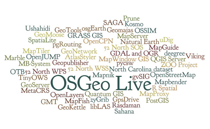
OSGeoLive provides bootable ISO-Images and Virtual Machines which allow users to try out fully-operational versions of popular Free Geospatial Software without the need to install a thing.
We do this in large part by maintaining automated build scripts which collect many OSGeo programs and sample data-sets together, and then combine them to form the Live disc or VM itself. By tweaking these scripts, users are free to make their own custom distributions, for example localized in their own language and with local map data.
For users
Quick Start
Documentation
June 2018: The OSGeo-Live documentation process is changing to use transfix and the process for using it is moving wikis to: https://trac.osgeo.org/osgeolive/wiki/How%20to%20document%20a%20project
It is best to try the new docs first, then come back to wiki pages below if you don't find what you are looking for:
OSGeoLive_AddProject#Documentation
Stable release: http://live.osgeo.org
Nightly build: http://adhoc.osgeo.osuosl.org/livedvd/docs/en/index.html
Source is stored in git: https://github.com/OSGeo/OSGeoLive-doc
Package List
Project Metrics
- Metrics from Open Hub (former Ohloh): https://www.openhub.net/p/OSGeo-Live
- https://live.osgeo.org/en/metrics.html
- Transifex OSGeoLive Translation Stats: https://www.transifex.com/osgeo/osgeolive/languages/
Contact Us
Refer to: https://trac.osgeo.org/osgeolive#Communication
Downloads
Latest Stable Release: http://live.osgeo.org/en/download.html
Latest Development Release: http://aiolos.survey.ntua.gr/gisvm/dev/
Older Releases: http://download.osgeo.org/livedvd
Including OSGeoLive at your event
OSGeoLive provides a DVD, USB and a Virtual Machine which allow users to try out fully-operational versions of popular Free Geospatial Software without the need to install a thing. It also includes documentation and a comprehensive presentation.
This is the process to follow if you wish to make use of OSGeoLive at your conference, workshop or similar event.
- Tell Us
- Add your event to our OSGeoLive History page and tell us how you would like to use OSGeoLive on our email list (or email Cameron Shorter directly). Hearing how OSGeoLive is used motivates us to keep going, and we plan releases around upcoming events.
- Presentation
- Conference attendees appreciate the OSGeoLive Lightning Overview, which explains the breadth of OSGeo software, abstract here. It is often presented by one of the conference organisors, or keynote speakers. You may wish to find a suitable speaker from the OSGeo Advocate list. The presentation may be given as is, or modified to align with time constraints, presenter's interest, or conference focus. (For prior variants, see Live GIS Presentation.)
- Handing out USBs or DVDs
- OSGeoLive DVDs and/or USBs are often handed out to all conference delegates, or a smaller number handed out from an OSGeo booth. DVDs are cheaper (around $2 per copy), but USBs provide a better experience as they are faster to boot up and run. You will need to:
- Work out how to pay for the USBs/DVDs. Usually the price is factored into event budgets. This means you will require commitment from the event Organisors. However you may find an external sponsor, or for smaller print runs, you might find volunteers to print from their computers.
- Source a local printer, preferably local. Printers typically require 2 weeks to do the print run, although they often will turn around faster if you pay more money.
- Printing DVDs: The printer will require an ISO image, and artwork for the DVD face and DVD sleeve. You may make use of existing artwork or create your own.
- Printing USBs: A 4 Gig USB is required for osgeo-live-mini (8 Gig if you wish the full image with windows and mac installers). The process for installing USBs is described here. Note that it is important to ask the printer if they can create bootable USBs. (We have found that many printers are not familiar with the process). It is prudent to check the first USB that is printed before printing the rest. You can also print a logo on the USB.
- Workshops
- For workshops, we recommend using OSGeoLive from a Virtual Machine or from a USB. Note that some computers can't boot from a USB. OSGeoLive on a DVD is slow and as such is not recommended for workshops. However it is wise to have a few spare DVDs in case one of your computers can't boot from the USB. Note that OSGeoLive we have heard some issues when running on Apple Macs, so if using Macs, please test first.
- Poster
- We have a Poster which is useful for hanging on a wall of a conference booth.
Workshops with OSGeoLive
Presentation
Poster
History
Testimonials
Press Releases
This content has being moved to: Press Releases
FAQ
Want to help?
We love volunteers, and would love to hear from you if you would like to help out. Best place to start is to introduce yourself on our email list, maybe mention how you'd like to get involved. Here are some ideas about things that you might want to help with:
- Translations
- Know another language? Why not join our team of translators:
- http://wiki.osgeo.org/wiki/Live_GIS_Disc#Translate
- Testing
- Quickstarts
- Debian Packaging
Use Cases
There are multiple use cases for this product:
- Demo DVD/USB that can be handed out at conferences.
This will contain a wide variety of applications, preconfigured with some sample data and containing introductory tutorials. It should be able to function completely offline, at least within the scope of the tutorials, and should provide an introduction to many products. This is very much a Live DVD, and as such should be conservative with regards to size (it will be run from RAM). - Education DVD
This seems to be a more involved version than the Demo DVD, including more involved material, including train-the-trainer style material. This is targeted at those who will be teaching others, be it in workshops or university classes/labs. My expectation (mleslie: feel free to correct me) is that this is more likely to be installed on machines and used as a teaching resource, as opposed to a toy to play with, as with the Demo DVD. This will require material developed through the. - Workstation Install DVD
This need was seen in Cape Town, where the bandwidth seems to be a very limiting factor. Using the DVD to install either a complete OS, a set of packages to an existing Linux, or Windows installers completely offline is of great value in the developing world. Would it be of greater value to lose the Edu or demo material and put in complete application documentation?
For developers or people would like to contribute
How to add a project to OSGeoLive
Source code
https://github.com/OSGeo/OSGeoLive
You can find instructions how to contribute to OSGeoLive source code in the Trac page
License
Issue Tracker
Our issue tracker is hosted at OSGeo's Trac system, and you will need to create an OSGeo UserId before you can login and edit issues. Please use the following conventions:
- Component field
- Set to `OSGeoLive`
- Keywords
- Milestone: Set to base release version: eg: OSGeoLive11.0
- Keywords: Add the relevant application to the issue (use lower case): eg: "geoserver"
- List of open tickets
- Just those concerning the upcoming release
- List of tickets already fixed
- Documentation tickets
Schedule
Build Process
- OSGeoLive Build instructions
Project Steering Committee (PSC)
Translate
- OSGeoLive Translation Process has been moved here: https://trac.osgeo.org/osgeolive/wiki/translation_on_transifex
- Translation Status on Transifex
- You find the latest Translation Build at: http://adhoc.osgeo.osuosl.org/livedvd/docs/en/index.html (not using Transifex)
- Discussion about moving to Transifex
Artwork
You can find the artwork sleeves, background images, booklet at:
Review
USB Creation
- Quickstart on creating a USB is here: https://live.osgeo.org/en/quickstart/usb_quickstart.html
- Wiki with extra information and tips is here: OSGeoLive Quickstart USB
Code of Conduct
Within the OSGeoLive community we act respectfully toward others in line with the OSGeo Code of Conduct.
OSGeo Incubation
Google Summer of Code
- DebianGIS. We encourage projects to package applications into Debian, which in turn is incorporated into Ubuntu.
- UbuntuGIS
- Enterprise Linux GIS packages as RPMs for redhat based systems.
- GISVM home page (GIS Virtual Machine by Ricardo Pinho)
- DebianGIS Live Image
- Omniverdi LiveCD project
- List of live CDs from the GRASS download site
- Gfoss.it live DVD
- Portable GIS - Zero-install GIS for MS Windows on a USB stick
- Poseidon Linux
- GISLive - LiveDVD project from FOSSGIS e.V. (German language)
- GIS.lab - Automatic deployment of GIS infrastructure