Difference between revisions of "OSGeo Advocate"
Wiki-Vehrka (talk | contribs) (→Europe) |
|||
| Line 22: | Line 22: | ||
== Canada == | == Canada == | ||
{{User:Gzeiss}} | {{User:Gzeiss}} | ||
| + | |||
| + | == United States == | ||
| + | {{User:Alex Mandel}} | ||
= Lapsed OSGeo Advocates = | = Lapsed OSGeo Advocates = | ||
Revision as of 15:39, 15 June 2012
Introduction
OSGeo Advocates are authoritative OSGeo personalities who have volunteered to talk on behalf of the OSGeo foundation. Advocates should be able to speak well, even better if they are entertaining.
There are hundreds, if not thousands of conferences around the world which have an interest in seeing presentations from authoritative speakers, with deep insights into topics related to Open Source Geospatial Software. Luckily, OSGeo is fortunate to draw extensive membership from around the world, and has access to such authoritative figures within most countries.
OSGeo Advocates
This section lists current OSGeo Advocates:
Australia
| OSGeo Member | ||
|---|---|---|
| Name: | Cameron Shorter |  |
| Job Title: | Open Technologies and Geospatial Consultant | |
| Company: | Government (NSW, Australia) | |
| Address: | ||
| City: | Sydney | |
| State: | NSW | |
| Country: | Australia | |
| Local Chapter: | Aust-NZ | |
| Email: | cameron shorter AT gmail DOT com | |
| Phone: | ||
| Instant Messaging: | ||
| Website: | http://cameronshorter.blogspot.com/ | |
| Language(s): | English | |
| Personal Description : | Cameron has a breadth of practical experience with the numerous facets of Geospatial Open Source and OGC Standards. He has chaired a FOSS4G conference; served on the OSGeo Board, co-founded and co-coordinates the OSGeoLive project; co-authored OSGeo Software Incubation criteria; and consults to governments and industry on Open Source, Open Standards and Spatial Data Systems. | |
|
|
||
URIs of the form "cameron shorter AT gmail DOT com" are not allowed.
OSGeo Experience and Roles:
![]()
![]()
![]()
![]()
![]()
![]()
![]() More at http://cameron.shorter.net/resume.html
More at http://cameron.shorter.net/resume.html
Europe
| OSGeo Member | ||
|---|---|---|
| Name: | Arnulf Christl | |
| Job Title: | ||
| Company: | ||
| Address: | Tharpaling, Germany | |
| City: | ||
| State: | ||
| Country: | [[|{{{Country}}}]] | |
| Local Chapter: | [[|{{{LocalChapter}}}]] | |
| Email: | ||
| Phone: | ||
| Instant Messaging: | ||
| Website: | ||
| Language(s): | ||
| Personal Description : | ||
|
|
||
| OSGeo Member | ||
|---|---|---|
| Name: | Jeroen Ticheler | |
| Job Title: | Director | |
| Company: | GeoCat | |
| Address: | Veenderweg 13 | |
| City: | 6721WD Bennekom | |
| State: | Gelderland | |
| Country: | The Netherlands | |
| Local Chapter: | Nederlands | |
| Email: | jeroen.ticheler@geocat.net | |
| Phone: | ||
| Instant Messaging: | ||
| Website: | GeoCat | |
| Language(s): | Dutch, English | |
| Personal Description : | Jeroen has been promoting the use of international standards and Free and Open Source Software for geographic data and information for over twenty years now. Jeroen is Project Officer for the GeoNetwork opensource project. He served on the OSGeo Board in 2007 & 2008 and is a Charter member since the early days of OSGeo. | |
|
|
||
[[Website::GeoCat| ]]
OSGeo Experience and Roles:
Jeroen Ticheler
Jeroen studied Tropical Forestry at the Wageningen University with specialization in GIS and Remote Sensing. Upon graduation in 1997 he worked on Participatory Soil Fertility Management in Africa at the Royal Institute for the Tropics of The Netherlands (also: Tropenmuseum) until he joined the Food and Agriculture Organization of the UN FAO in 1999.
At the FAO Jeroen worked on satellite data processing for early warning systems for food security and for desert locust control. He founded the GeoNetwork opensource project in 2001 allowing the agency to catalog its geographic data assets. He participated in writing the United Nations SDI (UNSDI) Reference Architecture as Task group manager Interoperability in the United Nations Geographic Information Working Group UNGIWG. He frequently participated in ISO TC211 and OGC meetings in the past.
In 2007 he founded GeoCat. A commercial company providing Enterprise products, SAAS and services around OSGeo software. Working with a team of core developers that contribute and give back is at the heart of what GeoCat does. GeoCat is a strong supporter and sponsor of the OSGeo Foundation and the related FOSS4G conferences and events ever since.
Jorge Sanz
| OSGeo Member | ||
|---|---|---|
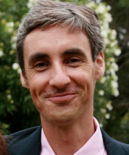
| Name: | Jorge Sanz |  |
| Job Title: | Data Engineer | |
| Company: | Elastic | |
| Address: | ||
| City: | València | |
| State: | Valencia | |
| Country: | Spain | |
| Local Chapter: | OSGeo-es | |
| Email: | jorge@jorgesanz.net | |
| Phone: | ||
| Instant Messaging: | ||
| Website: | http://jorgesanz.net | |
| Language(s): | Catalan; Spanish; English | |
| Personal Description : | Jorge is Charter Member of OSGeo since 2008 and member of the Spanish Language Local Chapter (OSGeo-ES) since its foundation., has been member of the OSGeo Board of Directors in the 2013-2015 term and been part of the gvSIG Technical Steering Committee. He helps on some OSGeo.org systems, participates actively on OSGeo-ES initiatives and Geoinquietos Valencia (a little local group part of a broader network of microchapters). Further details at his OSGeo wiki complete profile page or at linkedin. | |
|
|
||
[[Info::Jorge is Charter Member of OSGeo since 2008 and member of the Spanish Language Local Chapter (OSGeo-ES) since its foundation., has been member of the OSGeo Board of Directors in the 2013-2015 term and been part of the gvSIG Technical Steering Committee. He helps on some OSGeo.org systems, participates actively on OSGeo-ES initiatives and Geoinquietos Valencia (a little local group part of a broader network of microchapters). Further details at his OSGeo wiki complete profile page or at linkedin.| ]]
OSGeo Experience and Roles:
- OSGeo Charter Member since 2008
- Current co-admin of the OSGeo planet
- Current co-admin of the Nabble archives and mailing lists
- Past experience
-
- Coordinator of Spanish translation of the OSGeo Live documentation (2010-2015)
- Member of the Board of Directors (2013-2015)
- OSGeo-es Board of Directors Member (2008-2012)
- Packager of gvSIG Desktop at the OSGeo Live project (2010-2014)
- gvSIG TSC member (2009-2015)
- Incubation Committee member (as gvSIG contact) (2008-2012)
- Translator of OSGeo.org website into Spanish (2007-2008)
- Profile last updated
- May 2020
Pedro-Juan Ferrer
| OSGeo Member | ||
|---|---|---|
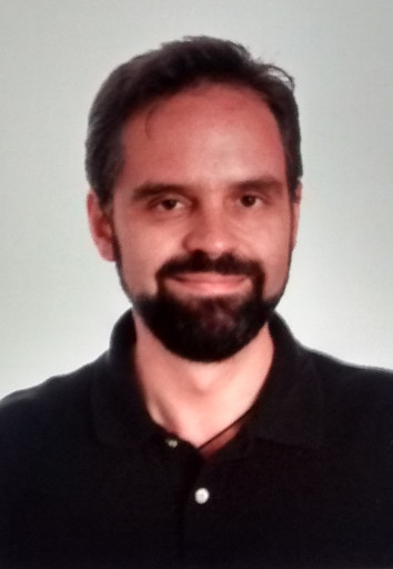
| Name: | Pedro-Juan Ferrer Matoses |  |
| Job Title: | Project Manager | |
| Company: | Geographica SL | |
| Address: | Valencia, Spain | |
| City: | Valencia | |
| State: | ||
| Country: | Spain | |
| Local Chapter: | OSGeo-es | |
| Email: | pferrer@osgeo.org | |
| Phone: | ||
| Instant Messaging: | ||
| Website: | ||
| Language(s): | ||
| Personal Description : | Pedro-Juan is a Cartographer and Project Manager that works in a Location Intelligence company. He has been collaborating with different NGOs in spreading the word of the Open Knowledge, Open data and FOSS (and FOSS4G) | |
|
|
||
OSGeo Experience and Roles:
Project Manager, Geographica.gs
Location: Valencia, Spain
Pedro-Juan is a Cartographer and Project Manager that works in a Location Intelligence company. He has been collaborating with different NGOs in spreading the word of the Open Knowledge, Open data and FOSS (and FOSS4G)
- OSGeo Experience
-
- OSGeo Charter Member since 2012
- OSGeo Spanish-speaking Local Chapter Charter Member and Liaison Officer since 2008
- PostGIS power user
- OSGeo-Live translator into Spanish
- Contact
- Email: pferrer@osgeo.org
- Snail-mail: Carrer Chera 3, esc 1, pta 7, 46017 Valencia
- Skype: geovehrka
- Spoken Language(s)
- English, Spanish
- Profile last updated
- 2018-10-17
Canada
| OSGeo Member | ||
|---|---|---|
| Name: | Geoff Zeiss |  |
| Job Title: | Director Utility Industry Program, | |
| Company: | Autodesk | |
| Address: | ||
| City: | Ottawa | |
| State: | Ontario | |
| Country: | Canada | |
| Local Chapter: | Ottawa Chapter | |
| Email: | geoff.zeiss@autodesk.com | |
| Phone: | ||
| Instant Messaging: | ||
| Website: | ||
| Language(s): | ||
| Personal Description : | Geoff has more than 20 years experience in the geospatial software industry and 15 years experience developing enterprise geospatial solutions for the utilities, communications, and public works industries. His particular interests include streamlining the infrastructure management workflow, open source geospatial, and converged BIM/CAD/GIS/3D solutions. | |
|
|
||
OSGeo Experience and Roles:
Geoff Zeiss
Director Utility Industry Program, Autodesk
Location: Ottawa, Ontario, Canada
Geoff has more than 20 years experience in the geospatial software industry and 15 years experience developing enterprise geospatial solutions for the utilities, communications, and public works industries. His particular interests include streamlining the infrastructure management workflow, open source geospatial, and converged BIM/CAD/GIS/3D solutions.
- Spoken at a number of events about open source geospatial and OSGEO including URISA, Location Intelligence, FOSS4Gs, GITA and military open source software conferences.
- In 2005, worked with others including DMSolutions to help initiate the formation of OSGEO.
- A Charter Member and served on the OSGEO Board of Directors for two years.
- Contact
- Email: geoff.zeiss@autodesk.com
- Phone (work): 613 755 5070
- Skype: geoffzeiss
- Profile last updated
- 12 June 2012
United States
| OSGeo Member | ||
|---|---|---|
| Name: | Alex Mandel, Phd |  |
| Job Title: | Geospatial Scientist | |
| Company: | Geography, University of California, Davis | |
| Address: | ||
| City: | Davis | |
| State: | CA | |
| Country: | USA | |
| Local Chapter: | California Chapter | |
| Email: | tech AT wildintellect DOT com | |
| Phone: | ||
| Instant Messaging: | ||
| Website: | http://careers.stackoverflow.com/wildintellect | |
| Language(s): | ||
| Personal Description : | Alex is a geographer with a background in natural resource sciences. He studies geospatial software development and applications working with many government agencies and other small organizations to implement geospatial solutions. He is an active advocate of OSGeo in the Western US at related academic conferences and local un-conferences. | |
|
|
||
URIs of the form "tech AT wildintellect DOT com" are not allowed.
OSGeo Experience and Roles:
Alex Mandel
Phd. Candidate, Geography, University of California, Davis
Location: Davis, CA USA
Alex is a geographer with a background in natural resource sciences. He studies geospatial software development and applications working with many government agencies and other small organizations to implement geospatial solutions. He is an active advocate of OSGeo in the Western US at related academic conferences and local un-conferences. Additional Information
- OSGeo Experience


-
- Chair, System Administration Committee
- Member, Marketing Committee
- Member, California OSGeo Chapter
- Contributor, Ubuntugis
- Build co-coordinator for OSGeo-Live
- Teaches: Introduction to GIS, GIS Programming in Python, Open Source Cartography, GeoWeb, Spatial Databases
- Uses: Python, QGIS, Inkscape, Postgis, Spatialite, Ubuntu, GDAL, GeoDjango, Openlayers, Geoserver, Geonode, R
- Presentation Archive on Scribd
- Contact
- Email: tech AT wildintellect DOT com
- IRC: wildint(ellect)
- Profile last updated
- 21 June 2012
Lapsed OSGeo Advocates
This section lists prior listed Advocates who have not recently updated their profiles. These prior Advocates might have refocused their interests in other areas.
Understanding OSGeo roles
Below is an explanation of roles which Advocates might have been involved in as part of OSGeo:
 OSGeo Board Members
- We only have 8 active board members in the world, which have been peer selected based upon their outstanding leadership in the greater OSGeo community.
 OSGeo Charter Members
- Charter membership is obtained through a strongly contested selection process. Members tend to be developers and leaders in one or more OSGeo projects, and/or OSGeo business leaders, and have a deep understanding in many of the OSGeo projects and principles of Open Source.

 Voted position in an OSGeo community
- These people hold a position of responsibility within one of the OSGeo sub-communities. This may be a chair of an OSGeo Regional Chapter, or as a member of a project's Project Steering Committee.
Developers and Committee Members
- This is where the real work gets done developing and coordinating development of OSGeo Software.
OSGeo Community Members
- These people are actively involved in one or more OSGeo communities, acting as users, promoters or supporters of OSGeo software. These people tend to have a practical understanding about how OSGeo software works.
Process for becoming an OSGeo Advocate
Anyone fitting one of the OSGeo Advocate categories, may put themselves forward as an OSGeo Advocate. To do so, you will need to:
- Create an OSGeo wiki account, to edit this wiki (See "login" link in top right of this page).
- Create a new wiki page http://wiki.osgeo.org/wiki/User:<YourOSGeoWikiUserName>, and populate as per User:Template.
- You can then add your profile on this wiki page, under your Country, using the following:
{{User:<YourOSGeoWikiUserName>}}
Annual Refresh of Advocate list
- The list of OSGeo Advocates will be refreshed annually, after the annual voting of OSGeo Charter Members. This will be achieved by removing Lapsed Advocates, then moving all Current Advocates into the Lapsed Advocate section. All Advocates will be invited to update their profile, and move their profile back into the current Advocates section.
Other Resources
Links to other organizations running a similar process.