Introduction
OSGeo Advocates are authoritative OSGeo personalities who have volunteered to talk on behalf of the OSGeo foundation. Advocates should be able to speak well, even better if they are entertaining.
There are hundreds, if not thousands of conferences around the world which have an interest in seeing presentations from authoritative speakers, with deep insights into topics related to Open Source Geospatial Software. Luckily, OSGeo is fortunate to draw extensive membership from around the world, and has access to such authoritative figures within most countries.
Process for becoming an OSGeo Advocate
Anyone fitting one of the OSGeo Advocate categories, may put themselves forward as an OSGeo Advocate. To do so, you will need to:
- Create an OSGeo wiki account, to edit this wiki (See "login" link in top right of this page).
- Add a portrait photo of yourself using the Upload file link in left margin in each page.
- Create a new wiki page http://wiki.osgeo.org/wiki/User:YourOSGeoWikiUserName, and populate as per User:Template, (copy and paste from the source so that you see comments in the template).
- You can then add your profile on this wiki page, under your Region:Country, names ordered alphabetically by First name, using the following:
{{User:<YourOSGeoWikiUserName>}}
Annual Refresh of Advocate list
- The list of OSGeo Advocates will be refreshed annually, after the annual voting of OSGeo Charter Members. This will be achieved by removing lapsed Advocates, then moving all Current Advocates into the Past Advocate section. All Advocates will be invited to update their profile, and move their profile back into the current Advocates section.
Advocates
Advocate Map
{{#umAllUserMap:}}
Africa:Ghana
OSGeo Experience and Roles:

Software Developer, Ushahidi
Location: Accra, Ghana
Henry Addo is an open source software developer. He is an active contributor to the open source community and develops core features for the Ushahidi platform, a free and open source software for crowdsourcing information through multiple channels including SMS, the web, email and twitter and visualizing the information on a map. ...more.
- OSGeo Experience

- Contact
- Email: henry@ushahidi.com
- Phone: +233 26 2109717
- Twitter: @eyedol
- Languages spoken
- English.
- Profile last updated
- 05 July 2012
Africa:South Africa
Gavin Fleming
URIs of the form "tim (A T) gis.org" are not allowed. [[Info::Tim is a GIS practitioner, QGIS Developer and Free Software advocate. You can find out more about Tim at kartoza.com. Tim has been involved in the QGIS project since 2002 and currently serves as Chair of the QGIS Project Steering Committee. Tim is also the developer team lead for InaSAFE - an open source contingency planning tool for disaster managers implemented as a plugin for QGIS. Tim has created numerous other free software projects - you can find more at Tim's Github Page. Tim is also actively creating FOSSGIS related docker images to the docker public repository - see the Kartoza docker repository for more details.| ]]
OSGeo Experience and Roles:


Tim Sutton
Kartoza (Pty) Ltd.
Location: Somerset West, South Africa
Tim is a GIS practitioner, QGIS Developer and Free Software advocate. You can find out more about Tim at kartoza.com. Tim has been involved in the QGIS project since 2002 and currently serves as Chair of the QGIS Project Steering Committee. Tim is also the developer team lead for InaSAFE - an open source contingency planning tool for disaster managers implemented as a plugin for QGIS. Tim has created numerous other free software projects - you can find more at Tim's Github Page. Tim is also actively creating FOSSGIS related docker images to the docker public repository - see the Kartoza docker repository for more details.


- QGIS Board Chair
- OSGEO Charter Member
- Contact
Email: tim (A T) gis.org
Profile last updated: 05 July 2012
Asia:India
OSGeo Experience and Roles:
- OSGeo Experience
-
- An OSGeo enthusiast. Using FOSS4G tools for GIS based development. PgRouting user and QGIS python script developer.
- Contact
- Email: mohammed.zia33@gmail.com
- Spoken Language(s)
- English, Hindi
- Profile last updated
- 05 October 2022
URIs of the form "ravivundavalliATyahooDOTcom" are not allowed.
OSGeo Experience and Roles:

Location: Rajahmundry, India
Evangelist of Free and Open Source Software (FOSS). FOSS GIS teacher. Trained more than a hundred Geologists of Geological Survey of India, as head of it's training division at Hyderabad, India. Currently developing FOSS GIS for transparent administration in India. 'mana-rajahmundry.org', is a website developed for society with various themes like roads, toilets, schools, drainage etc. A similar website is being prepared for the City of Mysuru, http://www.mana-rajahmundry.org/namma-mysuru/. Being a Geologist mapping the districts of Godavari, Andhra Pradesh for Free Geological Geospatial data.
Present Interest: 'Crowd-sourcing', with Android smart phones, for various societal needs is present endeavour. Geopaparazzi and OSMAND are used for 'Mobile-GIS', with training workshops. Building specific forms for crowd-sourcing Geospatial data is also in progress.
- OSGeo Experience

-
- Charter member since 2006, the first charter of OSGeo.
- Served OSGeo Board from 2009 to 2011.
- Contact
- Email: ravivundavalliATyahooDOTcom
- Skype:ravivundavalli
- Spoken Language(s)
- English,Telugu, Hindi,Oriya, Bengali
- Profile last updated
- 27 Oct 2015
Asia:Japan
URIs of the form "yoichi.kayama AT gmail DOT com" are not allowed.
OSGeo Experience and Roles:

Yoichi Kayama
Researcher and Programmer, Aero Asahi Corporation.
Location: Tokyo, Japan
Yoichi Kayama is a software engineer and researcher who has conducted research and program development related to geographic information for more than 20 years. Since OSGeo.JP was formed, he has been supporting the Japanese FOSS4G event held annually in Tokyo and Osaka. He co-authored a FOSS4G handbook, he was engaged in the Japanese localization of QGIS, and he has taught how to use QGIS in a number of workshops.
LinkedIn profile
Facebook
twitter
blog
- OSGeo Experience

-
- Contact
- Email: yoichi.kayama AT gmail DOT com
- Phone (work): +81-49-244-4032
- Spoken Language(s)
- Japanese, English
- Profile last updated
- 06 July 2012
URIs of the form "tosseto AT gmail DOT com" are not allowed.
OSGeo Experience and Roles:
Toshikazu Seto
Project Lecturer, Center for Spatial Information Science at The University of Tokyo
Location: Tokyo, Japan
Toshikazu Seto is a researcher who has conducted research and analysis related to "GIS and Society". Since OSGeo.JP was formed, he has been supporting the Japanese FOSS4G event held annually in Tokyo and Osaka. He is also interested in community-building for FOSS4G and attends a wide range of activities related to Volunteered Geographic Information and OpenGeoData.
Facebook
twitter
blog
- OSGeo Experience
:
- Contact
- Email: tosseto AT gmail DOT com
- Spoken Language(s)
- Japanese, English
- Profile last updated
- 04 September 2017
Senior Researcher, National Institute for Agro-Environmental Sciences
Location: Tsukuba, Japan
Nobusuke Iwasaki is researcher of land use change and rural planning and extensively using FOSS4G. Also, he is one of the main organizers of FOSS4G-Japan event and proactively commits promotion and dissemination of FOSS4G, especially academic sector. He strongly contributes some academic project which aims utilization of satellite image and FOSS4G for beginners and non-specialist user.
The major his product is Historical Agro-Environmental Browsing System (HABS), which is commended the first Cyber Japan Award.
- OSGeo Experience
-
- Contact
- Email: wata909 AT gmail DOT com
- Skype: wata909
- Profile last updated
- 2013-07-11
Asia:Korea
[[Info::Sanghee Shin is a business man who is managing & running Gaia3D, Inc., a geospatial software company in Korea. He established OSGeo Korean Chapter in 2008 and was elected as a Charter Member of OSGeo Foundation in 2011. He also co-founded KAOS-G(Korea Alliance of Open Source GeoSpatial), an alliance of commercial open source GIS companies in Korea and has served as chair person of KAOS-G since 2013. He organised International FOSS4G 2015 Seoul as a chairperson. He was elected as Board of Directors, OSGeo. He has actively promoted open source, open standard and open data in Korea and around Asia. He enjoys giving talks about open source GIS and open source business. You can find more at his blog and Facebook| ]]
OSGeo Experience and Roles:
Board Member of OSGeo, C.E.O. and President, Gaia3D, Inc.
Location: Seoul, South Korea and Cambridge, U.K.
Sanghee Shin is a business man who is managing & running Gaia3D, Inc., a geospatial software company in Korea. He established OSGeo Korean Chapter in 2008 and was elected as a Charter Member of OSGeo Foundation in 2011. He also co-founded KAOS-G(Korea Alliance of Open Source GeoSpatial), an alliance of commercial open source GIS companies in Korea and has served as chair person of KAOS-G since 2013. He organised International FOSS4G 2015 Seoul as a chairperson. He was elected as Board of Directors, OSGeo. He has actively promoted open source, open standard and open data in Korea and around Asia. He enjoys giving talks about open source GIS and open source business. You can find more at his blog and Facebook
- OSGeo Experience

-
- Contact
- Email: endofcap AT gmail DOT com or shshin AT gaia3d DOT com
- Phone (work): +82-2-3397-3475
- Skype: endofcap
- Spoken Language(s)
- Korean, English
- Profile last updated
- 22nd, November, 2015
OSGeo Experience and Roles:
Marketing Director and Business Development at Gaia3D Inc.
Location: Suwon, South Korea
Heegu Park is a member of OSGeo Korean Chapter and loves the spirit of Opensource. He is one of the LOC members of FOSS4G 2015 event.
- OSGeo Experience
- GIS Business Development and Marketing Director at Gaia3D
- Lecturers Opensource GIS
- Loves video games, music, and movies
- Contact
- email: hgpark@gaia3d.com(official), slhead@gmail.com(personal)
- Twitter: https://twitter.com/slhead
- Facebook: https://www.facebook.com/heegu.park
- Spoken Language
- Korean, English, and a little Spanish
- Profile last updated
- 09 September 2014
[[Info::Byeong-Hyeok Yu is a GIS/RS analyst (GISP) working at Korea National Park Service (KNPS). KNPS is a public organization that manages almost all domestic national parks. He is using an Open Source GIS (QGIS, R, and others) for scientific national park management in Korea. He first launched a QGIS education program for employee training and making a variety of natural resource maps. He is an also Ph.D. student of the University of Seoul, and studying an open source-based Drone application. You can find more his blog GGRS and Facebook| ]]
OSGeo Experience and Roles:
GIS/RS analyst (GISP), Korea National Park Service
Location: Seoul, South Korea
Byeong-Hyeok Yu is a GIS/RS analyst (GISP) working at Korea National Park Service (KNPS). KNPS is a public organization that manages almost all domestic national parks. He is using an Open Source GIS (QGIS, R, and others) for scientific national park management in Korea. He first launched a QGIS education program for employee training and making a variety of natural resource maps. He is an also Ph.D. student of the University of Seoul, and studying an open source-based Drone application. You can find more his blog GGRS and Facebook
- OSGeo Experience
- Contact
- Email: bhyu@knps.or.kr
- Phone (work): +82-2-721-9655
- Spoken Language(s)
- Korean, English
- Profile last updated
- 30th, August 2015
Asia:Philippines
URIs of the form "emmanuel.sambaleATgmail.com" are not allowed.
OSGeo Experience and Roles:
Emmanuel "Maning" Sambale
Location: Philippines
As an OSGeo member, Maning would like to Strengthen the OSGeo-PH Local Chapter and
promote OSGeo in the Philippines through training and material development. His area of focus is Mindanao Island.
- OSGeo Experience
-
- Contact
- Email: emmanuel.sambaleATgmail.com
- Spoken Language(s)
- English, Filipino
- Profile last updated
- 07 25 2012
Asia:Malaysia
Asia:Sri Lanka
URIs of the form "nimalikaf AT gmail DOT com" are not allowed.
OSGeo Experience and Roles:
Nimalika Fernando
Location: Colombo, Sri Lanka
Nimalika has moved to Open source GIS in 2006 as a novice user and application developer in her research studies related to web-mapping. Since then she has been involved in adopting OSGeo tools in teaching, research and spreading the use of them (particularly QGIS, MapServer, PostgreSQL, OSM ) in Sri Lanka. She is interested in integrating open source GIS solutions in solving locally important problems and linking different organizations organizations with OSGeo products.At present she is a Phd candidate at Curtin University, Perth, Australia
OSGeo Experience
Trainer of Open source GIS products
Initiated OSGeo Lab of SLIIT , Sri Lanka
Involved in organizing first FOSS4G Sri Lanka event in 2014
Presenter of OSGeo related topic in different forums
Organizing committee member FOSS4G 2015, FOSS4G Asia 2016
Contact
Email: nimalikaf AT gmail DOT com
Spoken Language(s)
Sinhala (mother tongue), English
Online
Academia.edu: [1]
LinkedIn: [2]
Profile last updated
01-03-2017
Australia
URIs of the form "cameron shorter AT gmail DOT com" are not allowed.
OSGeo Experience and Roles:


 More at http://cameron.shorter.net/resume.html
URIs of the form "woodrow.nathan AT gmail DOT com" are not allowed.
OSGeo Experience and Roles:
Nathan Woodrow
Technical Consultant/QGIS Specialist at Digital Mapping Solutions
Location: Warwick, Australia
Nathan is a active core developer and promoter of QGIS. He is an advocate of using open source solutions in local government, promoting its use to save money, add flexibility in workflows, and allow greater freedom from vendor lock in.
Nathan can be found at:
- Twitter
- Google+
- LinkedIn
- @NathanW on FreeNode IRC
- OSGeo Experience
-
- Contact
- Email: woodrow.nathan AT gmail DOT com
- Skype: madmanwoo
- Profile last updated
- 11/07/2013
New Zealand
URIs of the form "pcreso at pcreso dot com, b.wood at niwa dot co dot nz" are not allowed.
OSGeo Experience and Roles:
Programme Leader for Environmental Information Delivery, NIWA.
Location: Wellington, New Zealand
Brent Wood has worked in fisheries/marine/environmental research for 40 years, and for almost half of this time he used Open Source tools for spatial data management, analysis and visualisation. He has been a NZ Open Source Society Council member for several years, as well as an active Wellington Linux User Group member and Installfest organiser. He has been a regular presenter at FOSS4G since 2009, and was a finalist in the 2010 NZOSA awards for a web mapping portal using Silverstripe, Postgis. mapserver and Geonetwork which provided public access to research data and reports.
Brent manages the NIWA QGIS Users Group, which is currently acting as the NZ QGIS User Group, and is an active participant in the Wellington Postgres Users Group (with a focus on Postgis). He is also interested in the use of R as a GIS/spatial analysis & mapping tool. His platform of choice is Linix, and has several years experience is setting up and using Linux based GIS workstations.
In 2016 Brent won the "People's Choice" Award in the NZ Open Source Awards for "services to Open Source Geospatial in New Zealand". This was accepted on behalf of the wider OSGEO community, rather than Brent as an individual.
- OSGeo Experience
- Experienced QGIS user
- Experienced Postgis user
- UMN Mapserver user
- Geonetwork user
Outside of the OSGEO umbrella, Brent is also an experienced user of Generic Mapping Tools, a powerful open source spatial data analysis and mapping toolset.
- Contact
- Email: pcreso at pcreso dot com, b.wood at niwa dot co dot nz
- Skype: pcreso
- Spoken Language(s)
- English
- Profile last updated
- 30 Nov 2015
{{#umSetParam: 174.969|-41.282|Wainuiomata, New Zealand|Brent Wood|pcreso}}
Europe:Austria
OSGeo Experience and Roles:
Anita Graser
Spatial data scientist at the AIT Austrian Institute of Technology
Location: Vienna, Austria
QGIS PSC member and author of "Learning QGIS" and "QGIS Map Design".
Other projects: MovingPandas
- Profile last updated
- 7 Dec 2023
Europe:Belgium
URIs of the form "johan DOT vandewauw AT gmail DOT com" are not allowed. [[Info::Johan is working as a freelance Senior GIS Consultant and Data scientist. Recent projects include implementing web and mobile gis systems and their backends, mostly based on open source components.
He is a contributor to SAGA GIS, Debian and Ubuntu GIS and the OSGEO live dvd and blogs infrequently at http://blog.gisky.be
Johan is a fan of open source GIS software and has given different presentations about it:
At Fosdem 2014 I was also present at the OSGEO booth. In 2015 I organised the geospatial development room.| ]]
OSGeo Experience and Roles:
Johan Van de Wauw
GIS Consultant, Gisky
Ghent, Belgium
Johan is working as a freelance Senior GIS Consultant and Data Scientist. Recent projects include implementing web and mobile gis systems and their backends, mostly based on open source components.
He is a contributor to SAGA GIS, Debian and Ubuntu GIS and the OSGEO live dvd and blogs infrequently at http://blog.gisky.be
Johan is a fan of open source GIS software and has given different presentations about it:
At Fosdem 2014 I was also present at the OSGEO booth. In 2015 I organised the geospatial development room.
Languages
Dutch, English, French, Spanish, German
Contact
johan DOT vandewauw AT gmail DOT com
+32486025381
http://be.linkedin.com/in/johanvdw/
Profile last updated: june 2015
{{#umSetParam: 3.732141|51.049762|Gent, Belgium|johanvdw|Johan Van de Wauw}}
URIs of the form "pieter DØT degraef ÅT geosparc DØT com" are not allowed. [[Info::Pieter De Graef is a software engineer at Geosparc. He is the PSC chair and core engineer of Geomajas. Pieter is a frequent user and contributor of various OSGeo projects.| ]]
OSGeo Experience and Roles:
Pieter De Graef
Software Engineer, Geosparc
Location: Gent, Belgium
Pieter De Graef is a software engineer at Geosparc. He is the PSC chair and core engineer of Geomajas. Pieter is a frequent user and contributor of various OSGeo projects.
- OSGeo Experience

- User, advocate and contributor of/to (geospatial) open source software
- Speaker at FOSS4G (Cape Town, Sydney, Barcelona, Denver, Nottingham), OSGeo Gent and FOSSDEM conferences
- Maintainer of Geomajas on the OSGeo LiveDVD
- Contact
- Email: pieter DØT degraef ÅT geosparc DØT com
- Spoken Language(s)
- Dutch, English, Java (lots of it)
- Profile last updated
- 24 July 2014
URIs of the form "mlennert at club point worldonline point be" are not allowed.
OSGeo Experience and Roles:
- Profile last updated
- 09 10 2023
[[Info::Developer at the Geomajas project, and member of its Project Steering Committee. Founding member of OSGeo Belgium and OSGeo Europe.| ]]
OSGeo Experience and Roles:
Oliver May
Ghent, Belgium
Open Source Software enthousiast.
Developer at the Geomajas project, and member of it's Project Steering Committee. Founding member of OSGeo Belgium.
Works at DFC Software Engineering and for Geosparc.
- OSGeo Experience
- User, advocate and contributor of/to (geospatial) open source software
- Speaker at FOSS4G (Barcelona 2010, Nottingham 2013, Bonn 2016), FOSS4GE Como 2015 and FOSS4G Belgium 2015.
- Maintainer of Geomajas Server and Deskmanager module
- Contact
- Oliver.may@geomajas.org
- Spoken Language(s)
- Dutch, English, French
- Last update
- May 2021
{{#umSetParam: 3.723421|51.053751|Gent, Belgium|OliverMay|Oliver May}}
URIs of the form "tommy DOT oozeer AT geobusinet DOT com" are not allowed. [[Info::Secretary - Administrator - Co-founding member of the OSGeo Belgium Chapter (OSGeo.be)
Co-organisor at the FOSS4G-be, 2016
Co-organisor at the FOSS4G-be, 2015
Founder and director of Geobusinet
Geobusinet is a company specialized in geomatics, e-business, software development and open source technologies.
Activities include:
- Custom software development
- Project management
- Open source technologies integration
- IT infrastructure audit
- Training
| ]]
OSGeo Experience and Roles:
Tommy Oozeer
Secretary - Administrator - Founding member of the OSGeo Belgium Chapter (OSGeo.be)
Co-organisor at the FOSS4G-be, 2016
Co-organisor at the FOSS4G-be, 2015
Founder and director of Geobusinet
Geobusinet is a company specialized in geomatics, e-business, software development and open source technologies.
Activities include:
- Custom software development
- Project management
- Open source technologies integration
- IT infrastructure audit
- Training
Location: Braine-l'Alleud, Belgium
- OSGeo Experience
- Contact
- Email: tommy DOT oozeer AT geobusinet DOT com
- Spoken Language(s)
- English, French, Dutch
- Profile last updated
- 14 07 2016
Europe:Czech Republic
URIs of the form "charvat AT ccss DOT cz" are not allowed. [[Info::Karel is former president of EFITA, currently a member of Board of Seniors of EFITA, Chair of Czech
Centre of Science and Society (CCSS), actively participating on various EU projects and geospatial
communities. His current field of activities is OpenData (combination of OpenStreetMap with public administration data), finding business strategies for Open Source software and promotion of Open GIS solutions, such as Geoportal4everybody.
Karel was chair of first FOSSG4-CEE event in Prague 2012.| ]]
OSGeo Experience and Roles:
Chair of Czech Center for Science and Sociaty
Location: Prague, Czech Republic
Karel is former president of EFITA, currently a member of Board of Seniors of EFITA, Chair of Czech
Centre of Science and Society (CCSS), actively participating on various EU projects and geospatial
communities. His current field of activities is OpenData (combination of OpenStreetMap with public administration data), finding business strategies for Open Source software and promotion of Open GIS solutions, such as Geoportal4everybody.
Karel was chair of first FOSSG4-CEE event in Prague 2012.
- OSGeo Experience
- Contact
- Email: charvat AT ccss DOT cz
- LinkedIn: http://www.linkedin.com/profile/view?id=73516853
- Spoken Language(s)
- Czech, Russian, English
- Profile last updated
- 02 July 2012
URIs of the form "landa.martin AT gmail DOT com" are not allowed.
OSGeo Experience and Roles:
Martin Landa
Employed at Department of Geomatics, Faculty of Civil Engineering, Czech Technical University in Prague
Location: Czech Republic
Martin contributes to various Open Source GIS projects as a user and mainly as a developer. He is member of GRASS PSC and GRASS development team. Beside the GRASS project he also contributes to GDAL and QGIS.
- OSGeo Experience
- Member of GRASS Development Team since 2006
- Member of GRASS PSC since 2012
-
- Contributed to:
- Contact
- landa.martin AT gmail DOT com
- web: http://geo.fsv.cvut.cz/gwiki/Landa
- Spoken Language(s)
- Czech, English
- Profile last updated
- 31 July 2014
Europe:Denmark
URIs of the form "asgerpetersen AT gmail DOT com" are not allowed.
OSGeo Experience and Roles:
Asger Sigurd Skovbo Petersen
Partner, Septima
Location: Copenhagen, Denmark
Asger is an open source and open data advocate. Open source geospatial software has played a central role in his professional life since 2000, where he does development, consulting and training on open source geospatial software. Asger co-founded the company Septima in 2013 with the aim to help Danish clients to utilize newly released open governmental geodata using open source software.
- OSGeo Experience
- Open source geospatial software nerd since 2000
- Develops QGIS plugins
- Offers training in OSGEO software
- Some minor patches for GDAL
- Bug reports for numerous OSGEO software
- Developer on rasterio (pythonic python wrapper around GDAL)
- Regularly facilitates clients´ funding of OSGEO software
- Developed and taught semester long basic GIS course at Techical University of Denmark using PostGIS as primary GIS
- Attended all international FOSS4Gs since Denver
- Failed miserably at founding Danish OSGEO chapter in 2014
- In the founding committee for the Danish QGIS user group, 2015
- Contact
- Email: asgerpetersen AT gmail DOT com
- Phone (work): +45 91 32 69 44
- Spoken Language(s)
- English, German, Scandinavian
- Profile last updated
- 21 8 2015
URIs of the form "gregers AT septima DOT dk" are not allowed.
OSGeo Experience and Roles:
(Hans) Gregers Petersen
Partner, Senior Consultant, Septima
Location: Copenhagen, Denmark
Greg is an open source and open data advocate. Though he started as a statistical consultant and developer (using FOSS like Debian, R, etc), he ended up in the geo business. Now he consults clients on several areas regarding geodata - mostly within the use of geodata and GIS at public admin clients. He has a strong belief in Open Data, and co-founded the company Septima in January 2013 to utilize the newly released national data. Greg is an avid speaker on the subject of Open Data.
- OSGeo Experience
- Open source and geospatial software nerd since 2003
- Developed software using OSGEO libraries since 2008
- Offers training in OSGEO software
- Consultant and architect on minor and major FOSS4G setups, and on the transition to using it
- Active Open Data Advocate, and often speaks on the topic
- Minor patches for GDAL
- Bug reports for other OSGEO software
- Regularly facilitates clients´ funding of OSGEO software
- Consultant on the geo-part of the National Danish Data Distributor - using an OSGEO stack
- Attended FOSS4G 2013 in Nottingham, spoke about open data at FOSS4GE in Como in 2015, has attended the Danish "Kortdage"-conference since 2008 (with several talks on FOSS4G software), key note speaker on Open Data at the Modern Mapping tracks at Tekna Kursdage in January 2014. Talk on Open Data at FOSS4G 2016 in Bonn.
- Contact
- Email: gregers AT septima DOT dk
- Phone (work): +45 9132 6945
- Skype: gregerspetersen
- Twitter: GregersP
- Github: GregersP
- Spoken Language(s)
- English, Danish, German, (Swedish, Norwegian), and a bit of Hindi
- Profile last updated
- 17 October 2017
Europe:Finland
URIs of the form "ari.jolma at gmail.com" are not allowed.
OSGeo Experience and Roles:
I work on GDAL and the GDAL Perl bindings and on several Perl modules that build on it.
Europe:France
Founder and CEO of GeoLabs SARL.
Location: Lattes, France.
- OSGeo Experience
- OSGeo Board member from 2013-2015
- ZOO-Project Developper and PSC Chair,
- Creator of the original french web site for PostGIS,
- Provide training, use and develop (WEB-)GIS applications based on OSGeo Libraries / Applications,
- Active in the OSGeo Senegal Local chapter,
- Provide Gentoo packaging and patches for proj, geos, postgis, pgRouting, mapserver and gpsbabel,
- Active at all FOSS4G international events since 2006.
- Contacts
- Phone: +33670082539
- Skype: gfenoy
- Mail: gerald DOT fenoy AT geolabs DOT fr
- IRC: djay
URIs of the form "jrmorreale (a) osgeo.asso.fr" are not allowed.
OSGeo Experience and Roles:
Informations System Administrator
Departmental Center of Archeology, Conseil Général du Pas de Calais
Location : Arras, France
Jean-Roc is an archaeologist specialized in the long-term conservation and exploitation of field data, this task is made much easier when using open data formats and free software. For this reason, he started to localize Quantum GIS and participate as board member of the french OSGeo chapter to the promotion and the diffusion of free and open GIS tools into the labs but also into the public administration.
OSGeo Experience :
- member of the french chapter OSGeo-fr
- OSGeo-fr's board member 2010-2012
- promotion of the use of free gis software in state departments and communities
- translation of QGIS' UI and documentation
- helped organise the QGIS User Meeting in Paris in 2011 and the QGIS Hackfest in Lyon in 2012
Contact :
jrmorreale (a) osgeo.asso.fr
Spoken Languages :
French, English (with ze french touch)
URIs of the form "julien.michel AT orfeo-toolbox DOT org" are not allowed.
OSGeo Experience and Roles:
Julien Michel
R&D engineer, CNES
Location: Toulouse, France
Julien Michel is a many year (9+) contributor to the Orfeo ToolBox (www.orfeo-toolbox.org), an open-source C++ library for remote
sensing images processing, which is an incubating OSGeo project. Julien Michel is also a
member of the OTB Project Steering Committee.
He occasionnaly contributes to the OSSIM and ITK projects.
- OSGeo Experience
-
- Developer of Orfeo ToolBox
- Member of Orfeo ToolBox PSC
- User of Qgis, Gdal, OSSIM
- Contact
- Email: julien.michel AT orfeo-toolbox DOT org
- Spoken Language(s)
- French, English
- Profile last updated
- 31 august 2015
URIs of the form "manuel.grizonnet AT gmail DOT com" are not allowed.
OSGeo Experience and Roles:
Manuel Grizonnet
Location : Toulouse, France
Manuel works at CNES (French Space Agency) and is a many years (9 years) contributor to the Open Source library for remote sensing image processing Orfeo ToolBox.
- OSGeo Experience
-
- Part of the developers team of the ORFEO ToolBox library
- Contributor to the OSGeo Live project
- Occasional contributor to OSSIM and QGIS
- Contact
- Email: manuel.grizonnet AT gmail DOT com
- Spoken Language(s)
- French, English.
URIs of the form "volayaf AT gmail DOT com" are not allowed.
OSGeo Experience and Roles:
Developer, Universidad de Extremadura, UNEX
Location: Auch, France
Victor is the creator and main developer of the SEXTANTE library, a spatial data analysis library currently used by several open source GIS such as gvSIG or QGIS. He is also the main author of the Spanish Free GIS Book, a free (CC BY) book on the fundamentals of Geographic Information Systems. ... more.
- OSGeo Experience
-
- Editor and main author of the Spanish Free GIS Book
- Creator and main developer of the SEXTANTE library
- Contact
- Email: volayaf AT gmail DOT com
- Skype: volaya1978
- Spoken Language(s)
- Spanish, English, French, Russian.
URIs of the form "thomas.gratier AT webgeodatavore DOT com" are not allowed. [[Info::Thomas works in Geospatial since 2006. After studies in Geography and Urban planning, focused on GIS analysis and data extraction, he switched to GIS development and in particular web mapping.
He enjoys JavaScript, PHP and Python and server side OSGeo tools like MapServer, TinyOWS, ZOO Project or GeoServer but he also use a lot QGIS for analysis.
At the moment, I'm working as a freelancer in Geospatial under the WebGeoDataVore banner| ]]
OSGeo Experience and Roles:
Thomas Gratier
Location: Nantes, France
Thomas works in Geospatial since 2006. After studies in Geography and Urban planning, focused on GIS analysis and data extraction, he switched to GIS development and in particular web mapping.
He enjoys JavaScript, PHP and Python and server side OSGeo tools like MapServer, TinyOWS, ZOO Project or GeoServer but he also use a lot QGIS for analysis.
At the moment, I'm working as a freelancer in Geospatial under the WebGeoDataVore banner
Feel free to contact me if you need my services.
OSGeo Experience
Thomas is a member of the OSGeo-FR association and has been involved into the organization comittees of the FROG 2013 event and the successfull 3-day FOSS4G-FR 2014 that took place in May 2014.
He contributes to several of our projects, mainly focused on translation :
- parts of the OSGeo-Live DVD, which he presented as well as OSGeo4W during a session at FOSS4G-FR
- French translation of TinyOWS documentation
- French translation of ZOO Project
- French translation of MapServer Project
- French translation of Addok
Contributions around QGIS:
Presentations:
Other contributions to Open Source software:
Thomas is involved into other user forums such as GeoRezo, and has redacted tutorials and press reviews for GeoTribu.net.
He is also the co-writer for the book OpenLayers 3 Beginner’s Guide edited by Packt Publishing.
- Contact
- Email: thomas.gratier AT webgeodatavore DOT com
- Skype : gratierthomas
- Twitter : ThomasG77
- Github profile
- Spoken Language(s)
- French, English
- Profile last updated
- 1 November 2014
Europe:Germany
OSGeo Experience and Roles:
Anne is a natural scientist who got interested in GIS and open source programming during university. She started with GRASS GIS and QGIS, first met the OSGeo community by helping on documentation. Then she started programming in 2008 thanks to Google Summer of Code, and became mentor and administrator for OSGeo in following years. She doesn't code much anymore, as she is now focused in connecting people and communities of different software projects. She helped Jorge Rocha with CRO duties for OSGeo elections in 2019 and 2020.
- OSGeo Experience
- OSGeo Google Summer of Code administrator in 2011, 2012, 2013, 2014 and 2015
- Member of Italian chapter GFOSS.it from September 2007 to November 2014
- OSGeo Board member from 2012 to 2015
- Currently dormant GRASS GIS core developer
- Co-founder of OSGeo Women Chapter
- CRO helper in 2019 and 2020
- Contact
- Email: a DOT ghisla AT gmail DOT com
- IRC: aghisla on freenode (#osgeo)
- Spoken Language(s)
- Italian and French (mother tongues), English (fluent), German (improving :) )
- Profile last updated
- 03-04-2020
URIs of the form "astrid_emde AT osgeo DOT org" are not allowed. [[Info::Astrid Emde is an active member of OSGeo and a Charter Member since 2010. She is involved in the OSGeoLive & marketing project project.
She is also active in the german language OSGeo local chapter FOSSGIS e.V which organized the annual FOSSGIS conference.
Astrid Emde is part of the Mapbender Team.
She lead several workshops and presentations on Mapbender, MapServer, GeoServer, PostgreSQL/PostGIS and OWS, for example at FOSS4G, FOSSGIS or AGIT. She likes community meeting and organizes Hacking Events and loves to spread the spirit of OSGeo & FOSSGIS.
She co-authored the german edition of Tyler Mitchell's book Web Mapping Illustrated.
Astrid was the winner of the 2018 Sol Katz Award for her leadership and longtime efforts in the OSGeo and FOSSGIS communities.| ]]
OSGeo Experience and Roles:

- Profile last updated
- January 2022
URIs of the form "chris #AT# meggsimum #DOT# de" are not allowed.
OSGeo Experience and Roles:
Christian Mayer
CEO and Software Engineer, meggsimum
Geomatic Engineer, Software Developer, Software Engineer, Surveyor
Location: Palatinate, Germany
Chris is involved in the development of several OpenSource Projects. He is one of the co-founders of the GeoExt Mobile (GXM) and SHOGun projects and a committer for GeoExt, GeoExt 2 and GeoExt 3. Furthermore he blogs about tech and is a frequent speaker at international and German conferences (where he shares his love for OpenSource).
- OSGeo Experience

-
- Core Developer of the GeoExt Project
- PSC member of the GeoExt project
- Speaker at FOSS4G & FOSSGIS conferences
- Blog (mainly German)
- Contact
- Email: chris #AT# meggsimum #DOT# de
- Twitter: @geofootballer
- Spoken Language(s)
- German (native), English (fluent)
- Profile last updated
- 24-09-2015
URIs of the form "franz-josef.behr AT hft-stuttgart DOT de" are not allowed. URIs of the form "+49 721 45 39 80-1, +49 173 895 7311" are not allowed. [[Info::Until 2002 Dr. Behr worked as a senior consultant, supporting the introduction of Geographical Information Systems, the design and implementation of spatial databases and GIS applications for municipalities and power supply companies. Hence he has a strong background in computer science, especially geospatial IT and consultancy work regarding GI system introduction.
He joined Stuttgart University of Applied Sciences as a full time professor of spatial information processing in 2002. He is teaching software development, Internet Technology and Internet GIS as well as Database design, XML technologies and scientific writing.
Interoperability and open standards are important for him, currently also topics like disaster mapping and crowd sourcing. Free and Open Software/standards/data are applied in teaching and research.
He published two GIS text books, more than 60 scientific papers and gave numerous presentations at international conferences. He is very interested in continuing education and in internationalization of education. He conducted workshops in India (IIITM-K, University of Kerala, Trivandrum, Anna University, Tirunelveli) and Egypt (National Authority for Remote Sensing and Space Sciences, Cairo) and organised scientific conferences in Arequipa, Peru (AGSE 2010), Nairobi, Kenya (AGSE 2011), Johor Bahru, Malaysia (AGSE 2012), Ahmedaba, India (2013), Stuttgart, Germany (2014) and Kish, Iran (2017).
He is head of the Laboratory for interoperable, and open-source Geospatial Software, Data and Standards (HFT ICA-OSGeo-Lab). He is co-founder and head of the Applied Geoonformatics for Society and Environment conferences which will take place in Windhoek this year.
He is member of the German Organisation for Standardization (DIN-Board NA 005-03-03 AA „Kartographie und Geoinformation“, comparable to CEN/TC 287 and ISO/TC 211). In the field of cartography he serves as co-chair of the ‘Commission on SDIs and Standards' of the International Cartographic Association (ICA).
In 2013 and 2016 he was co-chairing the Academic Track of the international FOSS4G conferences. Since 2016 he is Member of the SDI Advisory Board, State of Baden-Württemberg, Germany. In spring 2018 he was Erudite-Scholar-in-Residence at the University of Kerala, Trivandrum, India.| ]]
OSGeo Experience and Roles:
Franz-Josef Behr
Full time Professor of spatial information processing at Stuttgart University of Applied Sciences.
Until 2002 Dr. Behr worked as a senior consultant, supporting the introduction of Geographical Information Systems, the design and implementation of spatial databases and GIS applications for municipalities and power supply companies. Hence he has a strong background in computer science, especially geospatial IT and consultancy work regarding GI system introduction.
At Stuttgart University of Applied Sciences his teaching comprises programming, DBMS and data modeling, GIS, XML technologies, Internet technology, web services etc.). Interoperability and open standards are important for him, currently also topics like disaster mapping and crowd sourcing. Free and Open Software/standards/data are applied in teaching and research. He published two GIS text books, more than 50 scientific papers and gave numerous presentations at international conferences. He is very interested in continuing education and in internationalization of education.
- OSGeo Experience
-
- Founder of the open SUAS MapServer project, and some more open web services, i. e. geoweb.hft-stuttgart.de, opencts.org and opengeocoding.org.
- Co-founder FOSS4G_Southeast_Asia
- 2013: Co-chair of the Academic Track FOSS4G in Nottingham
- 2014: Co-chair of the Academic Track FOSS4G in Portland.
- Member of the LOC for FOSS4G 216, Bonn, Germany, chair of the Academic Track FOSS4G.
- Contact
- Email: franz-josef.behr AT hft-stuttgart DOT de
- Phone (work): +49 721 45 39 80-1
- Skype: fjbehr
He is member of the German Organisation for Standardization and active supporter of Open Source and Open Data and co-founder of the AGSE conferences, an interdisciplinary, international forum for sharing knowledge about the application of Geoinformatics with focus on application and on developing countries, and inititated FOSS4G_Southeast_Asia. AGSE took place in Stuttgart (2009), Arequipa, Peru (AGSE 2010), Nairobi, Kenya (AGSE 2011), Johor Bahru, Malaysia (AGSE 2012), Ahmedaad, India (AGSE 2013), Stuttgart, Germany (AGSE 2014).
- Further information
- gis-management.de
- gis-news.de
- Applied Geoinformatics for Society and Environment
- Spoken Language(s)
- English, German
- Profile last updated
- 19 Oct 2016
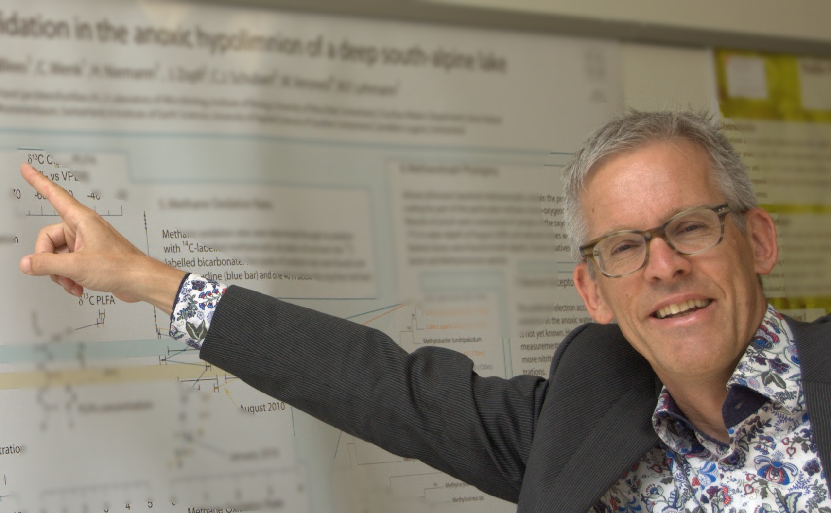
URIs of the form "misev AT rasdaman DOT com" are not allowed. [[Info::Dimitar Misev is a Postdoc fellow in Computer Science at Jacobs University Bremen in Germany, with focus on array databases and Big Data. He is actively contributing to the development of rasdaman, a world-leading database engine for multi-dimensional raster data of unlimited extent.| ]]
OSGeo Experience and Roles:
Dimitar Misev
Postdoc researcher, Constructor University
Location: Bremen, Germany
Dimitar Misev is a Postdoc fellow in Computer Science at Jacobs University Bremen in Germany, with focus on array databases and Big Data. He is actively contributing to the development of rasdaman, a world-leading database engine for multi-dimensional raster data of unlimited extent.
LinkedIn profile
- OSGeo Experience
-
- Core developer of the rasdaman project
- User support on the rasdaman mailing lists and maintenance of the wiki pages
- Contact
- Email: misev AT rasdaman DOT com
- Spoken Language(s)
- English, Macedonian
- Profile last updated
- 15 Oct 2019
URIs of the form "olt ÅT bogosoft DØT com" are not allowed. [[Info::Oliver Tonnhofer is a software engineer at Omniscale. He is the core-developer of MapProxy and Imposm, user and contributor of various OSGeo projects.| ]]
OSGeo Experience and Roles:
Oliver Tonnhofer
Software Engineer, Omniscale
Location: Oldenburg, Germany
Oliver Tonnhofer is a software engineer at Omniscale. He is the core-developer of MapProxy and Imposm, user and contributor of various OSGeo projects.
- OSGeo Experience
- Speaker at FOSS4G, FOSSGIS and FOSS4GE conferences
- Maintainer of MapProxy on the OSGeo LiveDVD
- User, advocate and contributor of/to (geospatial) open source software
- Contact
- Email: olt ÅT bogosoft DØT com
- Spoken Language(s)
- English, German
- Profile last updated
- 22 July 2014
URIs of the form "aumann followed by @ followed by rasdaman . com" are not allowed. [[Info::Peter Baumann is Professor of Computer Science at Jacobs University where he is leading the Large-Scale Scientific Information Systems research group. His main areas of interest are large-scale multi-dimensional array databases, generally on "Big Data in Science".
His group develops and maintains the rasdaman Big Data Analytics engine which is in OSGeo incubation.
The spinoff, rasdaman GmbH, he has founded specifically to add industry support for the rasdaman technology next to the academic research part.| ]]
OSGeo Experience and Roles:
Peter Baumann
Professor of Computer Science, Jacobs University
Founder and CEO, rasdaman GmbH
Location: Bremen, Germany
Peter Baumann is Professor of Computer Science at Jacobs University where he is leading the Large-Scale Scientific Information Systems research group. His main areas of interest are large-scale multi-dimensional array databases, generally on "Big Data in Science".
His group develops and maintains the rasdaman Big Data Analytics engine which is in OSGeo incubation.
The spinoff, rasdaman GmbH, he has founded specifically to add industry support for the rasdaman technology next to the academic research part.
LinkedIn profile
- OSGeo Experience
- Principal Architect of rasdaman
- co-editor: ISO 9075 SQL Part 15: MDA (Multi-Dimensional Arrays) candidate standard
- chair: OGC Web Coverage Service Standards Working Group (WCS.SWG), Coverages Domain Working Group (Coverages.DWG), Big Data Working Group (BigData.DWG)
- editor: of most of the OGC coverage standards, candidate standards, and Best Practices, among them: GMLCOV, the OGC Unified Coverage Data Model, Web Coverage (WCS) suite, Web Coverage Processing Service (WCPS) coverage query language
- external expert for Data Specification and Download Services on coverages, EU INSPIRE
- co-chair: Research Data Alliance Big Data Analytics Interest Group, Geospatial Interest Group
- delegate, DIN NIA (German representative in ISO/IEC JTC1 SC32 / WG3: SQL)
- council member, Commission for the Management and Application of Geoscience Information (CGI) of the International Union of Geological Sciences (IUGS)
- founding member and secretary, CODATA Germany
- member, advisory board, GDI-HB (state geo data infrastructure for Bremen)
- expert,ODBMS (Object Database Management Systems) expert panel
- Contact
- Email: user name baumann followed by @ followed by rasdaman . com
- Skype: pefrabau
- Spoken Language(s)
- German, English, Spanish
- Profile last updated
- 20 July 2013
[[Info::Steve is a Java developer. Since 2007 he has run wikisquare, a company specialized on free Java software, GIS, and statistics. Since 2008 he has been the main developer of the AtlasStyler SLD editor. In 2011 he participated in the foundation of empirica systeme GmbH, a company specialized in observing and mapping the German real estate market.| ]]
OSGeo Experience and Roles:
Stefan Tzeggai
- OSGeo Experience
- Core developer of AtlasStyler, an OGC Styled Layer Descriptor (SLD) / SE 1.1 editor based on Swing and Geotools.
- Core developer of Geopublisher is an atlas authoring system which simplifies the creation of multimedia atlases for online and offline use.
- Minimal development but power-user of Geotools and Geoserver.
- Contact
- Business contact mailto:tzeggai(æ)wikisquare.de
- XING: https://www.xing.com/profile/StefanAlfons_Tzeggai
- LinkedIn: http://www.linkedin.com/in/stefanalfonskrueger
- Twitter for AtlasStyler and Geopublisher: http://twitter.com/geopublishing
- Spoken Language(s)
- German, English, Spanish
- Profile last updated
- 11 November 2015
URIs of the form "info AT thomas-baschetti.de" are not allowed.
OSGeo Experience and Roles:
Thomas Baschetti
Location: Osnabrück, Germany
Thomas is a freelancer doing all kind of GIS and database stuff, especially helping people to migrate from proprietary to free software, connecting different systems and getting things to work.
- OSGeo Experience
- Contact
- Email: info AT thomas-baschetti.de
- Phone: +49 541 259190
- Spoken Language(s)
- German, English, very basic Italian
- Profile last updated
- 09 July 2012
Europe:Greece
OSGeo Experience and Roles:

- OSGeo Experience
-
- Profile last updated
- 17 April 2020
URIs of the form "arargyridis at gmail dot com" are not allowed.
OSGeo Experience and Roles:
PhD Student, Remote Sensing Laboratory, NTUA
Location: Athens, Greece
Argyros finished his master thesis on Rural and Surveying Engineering at NTUA. His research is regarding the development and investigation of computer vision techniques and artificial inteligence methods for remote sensing applications. ...more.
- OSGeo Experience
-
- Using applications such as Grass, QGis, Pogresql/postgis etc.
- Contact
- Email: arargyridis at gmail dot com
- Spoken Language(s)
- Greek, English, French
- Profile last updated
- 27 June 2012
URIs of the form "kotzino at gmail dot com" are not allowed.
OSGeo Experience and Roles:
Faculty member at the Department of Computer Science of University of Cergy Pontoise.
Location: Cergy Pontoise, France
Dimitris's interests are in the areas of Web Information Systems, Semantic Web, Open Linked Data, Social Networks, etc.
Dimitris is a frequent speaker at GI Conferences both national and international and also an organizer of events or special sessions dedicated to Open Geospatial Software/Data/Protocols.
More information on Dimitris here.
- OSGeo Experience
- Uses and teaches applications such as Geoserver, Mapserver, Mapbender, GeoTools, gvSIG, QGis, Pogresql/postgis etc.
- Founder of the OSGeo Greek Local Chapter
- Section Editor of the OSGeo Journal (at times) and here's A_proposal_for_the_OSGeo_Journal!
- Contact
- Email: kotzino at gmail dot com
- Spoken Language(s)
- Greek, English
- Profile last updated
- 10 March 2015
URIs of the form "chiossif AT gmail DOT com" are not allowed. [[Info::Christos Iosifidis is a Dipl.Rural & Surveying Eng. teaching at Remote Sensing Lab.[5] at NTUA[6]. He is known in the digital world as chiossif, an ardent promoter of free software and scholar of ancient codes in Fortran 77 and K&R's C. Moreover specializes in geoinformatics and generally in geo-art, in photo-topografy and photographic techniques, in geo-motion and generally dance on earth. Inappropriate for solving simple problems, because he always composes more complex ones and famed for his profuse rhetoric which in case of digital recording produces huge files due to the increased duration and complexity in composition. The contact with him gives new dimensions to understanding concepts like co-mmunication and co-operation, while "teaching" (as he describes his patter) for freedom, love and peace on earth is beyond any physical or logical limit. ( himself 2010 )| ]]
OSGeo Experience and Roles:
Christos 'Chiossif' Iosifidis
Remote Sensing Tutor, NTUA, GR
Location: ATH, GR
Christos Iosifidis is a Dipl.Rural & Surveying Eng. teaching at Remote Sensing Lab.[7] at NTUA[8]. He is known in the digital world as chiossif, an ardent promoter of free software and scholar of ancient codes in Fortran 77 and K&R's C. Moreover specializes in geoinformatics and generally in geo-art, in photo-topografy and photographic techniques, in geo-motion and generally dance on earth. Inappropriate for solving simple problems, because he always composes more complex ones and famed for his profuse rhetoric which in case of digital recording produces huge files due to the increased duration and complexity in composition. The contact with him gives new dimensions to understanding concepts like co-mmunication and co-operation, while "teaching" (as he describes his patter) for freedom, love and peace on earth is beyond any physical or logical limit. ( himself 2010 )
(more)[9]
- OSGeo Experience (optionally add icons here)
-
- Instructor, user and coder of geo-Free as in Freedom-ware
- Translator in Greek for OSGeoDVD
- Contact
- Email: chiossif AT gmail DOT com
- Phone (work): +30 210 772 2606
- Skype: chiossif
- Spoken Language(s)
- Greek, English
- Profile last updated
- 27 July 2014
Europe:Hungary
Teacher at the Budapest University of Technology.
Location: Budapest, Hungary
Zoltan Siki graduated in Surveying and Geoinformatics MSc. He gained his dr univ in Traffic simulation and modelling in GIS.
- OSGeo Experience
- QGIS Hungarian translator
- QGIS plugin developer
- Leader of the Geo for All lab at the Budapest University of Technology and Economics http://www.geod.bme.hu/osgeolab/?lang=en https://github.com/OSGeolabBp
- Hungarian tutorials (QGIS, GRASS, OpenLayers, PostGIS, MapServer, GDAL/OGR) http://osgeo.hu
- Organizer of Hungarian OSGeo meetings http://foss4g.hu
- teaching QGIS, GRASS, PostGIS, MapServer
- maintener of open source based GIS sytems at local municipalities (MapServer, p.mapper, OpenLayers)
- main developer of Ulyxes open source project https://github.com/zsiki
- Spoken languages
English; Hungarian.
- Contacts
Europe:Ireland
Senior Researcher
Location: Maynooth Unversity, Ireland
Peter has been a user, an advocate, a user and teacher in FOSS4G and OSGeo software for over 15 years. He uses open source software as often as he can - in his teaching, his research and in his personal life. Peter is a very strong advocate of open source software, open data and open access to scientific data and information. With Prof. Maria Brovelli he is the European Co-Chair for the ICA-OSGeo Labs World-Wide initiative Geo For All The motto of ICA-OSGeo Lab initiative is "Geo For All".
Peter lead a bid from Dublin Ireland in February 2015 to host the Global FOSS4G 2016 conference in Dublin Ireland.
Europe:Italy
URIs of the form "lucadeluge AT gmail DOT com" are not allowed. [[Info::Luca is an OSGeo and OSM contributor and advocate. He graduated in Geography applied to the environment, landscape and tourism from University of Genoa (Italy) in 2008. Since the same year he work at Fondazione Edmund Mach, a research center near Trento. He is interested in all features about GIS: desktop, web, geodatabase, developing and geodata. He is core developer and translator of GRASS GIS project, main developer of pyModis library and OSGeoLive and ZOO-Project contributor.
He is really active in the Italian community, GFOSS.it. From February 2012 to October 2015 he has been a board member and from November 2017 to December 2020 he was President of the Italian OSGeo local chapter. He still continue to be part of the board.
He was the chair of the successful FOSS4G 2022 held in Florence, it was the first internation FOSS4G meeting in person after the COVID-19| ]]
OSGeo Experience and Roles:
He is involved in the following projects:
- GRASS GIS: developer and Italian translator
- QGIS: I developed and contributed to some plugin (OGR2Layers, QuickMultiAttributeEdit)
- ZOO-project: beta tester and documentation
- pyModis: main developer library to download and works with MODIS data
- From February 2012 to October 2015 he has been a board member of GFOSS.it (Associazione Italiana per il Software Geografico Libero), the Italian OSGeo local chapter. From November 2017 to December 2020 he was President of the Italian OSGeo local chapter. He still continue to be part of the board.
- Actively participating in OpenStreetMap and promoting OpenStreetMap in Italy organizing a lot of events
- Since 2011, he has been an OSGeo Charter Member
- OSGeo-Live, helping in documentation and Italian Translation
He know and use the following Free and Open Source Project:
- Desktop
- Database
- Web Server
- MapServer
- GeoDjango
- ZOO-Project
- IstSOS
- Web client
- Other tools
- Spoken Language(s)
Italian (mother tongue), English, a little bit of French
- Profile last updated
2021 April 7
- redirect:Massimiliano Cannata
[[Info::Massimo Di Stefano, research data programmer at the Norwegian Metereological Institute. Massimo graduated from "Università degli Studi di Napoli "Parthenope"" (Naples, IT) with a Master's Degree in Environmental Science, specializing in Marine Ecosystem and completed and completed his Ph.D. in Oceanography at the University of New Hampshire, Center for Coastal and Ocean Mapping - CCOM-JHC. A founding member of [https:// gfoss.it], the Italian community of users and developers of Geographic Free/Open-Source Software (GFOSS) and charter member of OSGeo, Massimo has spent more than 20 years developing Geographical Free and Open Source Software, with current development activities in GRASS, OSSIM, QGIS and OSGeo Live projects. For the past years, Massimo worked as Research Assistant III at the Woods Hole Oceanographic Institute (WHOI) for the HABCAM project, and as Software Engineer on staff at the Tetherless World Constellation (RPI) on the ECO-OP project.| ]]
OSGeo Experience and Roles:
Massimo Di Stefano, graduated from "Università degli Studi di Napoli "Parthenope"" (Naples, IT) with a Master's Degree in Environmental Science, specializing in Marine Ecosystem. Massimo is now pursuing his Ph.D. at CCOM-JHC in Oceanography. A founding member of GFOSS.it, the Italian community of users and developers of Geographic Free/Open-Source Software (GFOSS) and charter member of OSGeo, Massimo has spent more than 10 years developing Geographical Free and Open Source Software, with current development activities in GRASS, OSSIM, QGIS and OSGeo Live projects. For the past four years, Massimo worked as Research Assistant III at the Woods Hole Oceanographic Institute (WHOI) for the HABCAM project, and as Software Engineer on staff at the Tetherless World Constellation (RPI) on the ECO-OP project.
- OSGeo Experience
Contact
- epiesasha@me.com
- IRC : epifanio
- Skype : epifaniox
- Location 1
- 41°31′27.12″N 70°40′11.28″W
- Woods Hole, Massachussetts, USA
- Location 2
- 40°37′1″N 15°3′23″E
- Eboli, Salerno, Italy
- UTC (GMT) offset 1
- Standard time zone: UTC/GMT -5 hours (details)
- Daylight saving time: +1 hour (northern hemisphere summer time)
- UTC (GMT) offset 2
- Standard time zone: UTC/GMT +1 hour (details)
- Daylight saving time: +1 hour (northern hemisphere summer time)
time-zone-spec
- Web logs and more
- http://web.me.com/epiesasha/PlanetSasha/Project.html
-->
[[Info::I'm an environmental engineer addicted to GIS development playing in the field of hydrologic and geomorphologic modelling with gvSIG and the Hortonmachine.
Since 2005 I'm cofounder of HydroloGIS, were we mainly develop around and make advanced use of gvSIG, Hortonmachine and Geopaparazzi.| ]]
OSGeo Experience and Roles:
Tech lead, HydroloGIS
Location: Bolzano, Alto Adige, Italia
I'm an environmental engineer addicted to GIS development playing in the field of hydrologic and geomorphologic modelling with gvSIG and the Hortonmachine.
Since 2005 I'm cofounder of HydroloGIS, were we mainly develop around and make advanced use of gvSIG, uDig, Hortonmachine and Geopaparazzi.
- OSGeo Experience
- core developer of the Hortonmachine project.
- core developer of the Geopaparazzi project.
- plugin developer of the gvSIG desktop GIS.
- loves (and goes regularly to) FOSS4G conferences and code sprints
- does training courses on a regular basis
- Contact
- Personal page: http://www.andreaantonello.com
- Email: andrea DOT antonello AT gmail DOT com
- Twitter: themoovida
- Spoken Language(s)
- Italian, German, English, Spanish
- Profile last updated
- 19 September 2018
Europe:The Netherlands
[[Info::Just van den Broecke is a software consultant/architect with ample experience in various projects and products involving and integrating OSGeo and other Open Source software.
Since 2011 Just is heavily involved in the OSGeo Dutch Language Local Chapter, first as initiator/trailblazer, currently as chairman on the board of the
OSGeo.nl Foundation. He is a regular speaker at various OSGeo-related conferences on OSGeo-subjects ranging from highly technical like the OSGeo Live DVD and specific
software/standards to Open Source and Open Data in general. He became OSGeo Charter Member in 2013.| ]]
OSGeo Experience and Roles:
Open Source Geospatial Professional at Just Objects B.V. and the Dutch OpenGeoGroep
Location: Amstelveen, the Netherlands
Just van den Broecke is a software consultant/architect with ample experience in various projects and products involving and integrating OSGeo and other Open Source software.
Since 2011 Just is heavily involved in the OSGeo Dutch Language Local Chapter, first as initiator/trailblazer, currently as secretary of the board of the
OSGeo.nl Foundation. He is a regular speaker at various OSGeo-related conferences on OSGeo-subjects ranging from highly technical like the OSGeo Live DVD and specific
software/standards to Open Source and Open Data in general. He became OSGeo Charter Member in 2013.
Read more details on his homepage/blog and LinkedIn profile.
- OSGeo Experience
- Contact
- Email: just@justobjects.nl
- Skype: justb4
- Twitter: justb4
- Spoken Language(s)
- Dutch (1st), English (2nd), German, French (modeste)
- Profile last updated
- August 15, 2019
URIs of the form "bartvde AT osgis DOT nl" are not allowed. [[Info::Bart is passionate about open source and open standards. He is a contributor to several front-end libraries such as OpenLayers and GeoExt. He is also a power user of server packages such as MapServer and GeoServer.
In 2005 Bart started his own consultancy focussing on open source geospatial in The Netherlands, working mainly as a contractor to the Dutch Ministry of Transport, Public Works and Water Management. In 2011 Bart joined OpenGeo. See also [11].| ]]
OSGeo Experience and Roles:
Bart van den Eijnden
Front-end software engineer, OSGIS/OpenGeo
Location: Utrecht, The Netherlands
Bart is passionate about open source and open standards. He is a contributor to several front-end libraries such as OpenLayers and GeoExt. He is also a power user of server packages such as MapServer and GeoServer.
In 2005 Bart started his own consultancy focussing on open source geospatial in The Netherlands, working mainly as a contractor to the Dutch Ministry of Transport, Public Works and Water Management. In 2011 Bart joined OpenGeo. See also [12].
OSGeo Experience
- OSGeo Board member (as of September 7th 2013)
- Member of the GeoExt PSC
- Contributor to OpenLayers
- Charter member since 2006
- Technical reviewer of Web Mapping Illustrated by Tyler Mitchell
Contact:
- Email: bartvde AT osgis DOT nl
- Phone +31 6 42233115
- Skype: bartvde
Spoken Language(s): Dutch, English, German
Profile last updated: 7 September 2013
URIs of the form "+31-(0)53 4874 253" are not allowed. [[Info::Barend Köbben holds a MSc in Geography, specialising in Cartography. He is at present Senior Lecturer in GIS and cartographic visualisation. His teaching subjects include Cartographic Theory, WebCartography and WebGIS, Geo-webservices, web application building and 3D visualisation.
He participates in the research activities of the Research Theme STAMP (Spatio–Temporal Analytics, Maps and Processing). His main research interests are automated mapping in a services environment, animated vector map services, and VaaS (Visualisation as a Service). He was involved in various consultancy projects in The Netherlands, India, Iran, Italy, Malaysia, South Africa, Thailand and Zambia. He is Map Editor and member of the Editorial Board of Geografie (Journal of the Koninklijk Nederlands Aardrijkskundig Genootschap, ISSN 0926-3837).| ]]
OSGeo Experience and Roles:
Barend Köbben
University of Twente – Faculty of Geo–Information Science and Earth Observation (ITC)
Department of Geo–information Processing
Hengelosestraat 99, PO Box 217, 7500AE Enschede, The Netherlands
http://barendkobben.com/
52° 13′ 24.675″ N, 6° 53″ 7.641′ E (52.223521,6.885456) – OpenStreetMap | Google Maps
Barend Köbben holds a MSc in Geography, specialising in Cartography. He is at present Senior Lecturer in GIS and cartographic visualisation. His teaching subjects include Cartographic Theory, WebCartography and WebGIS, Geo-webservices, web application building and 3D visualisation.
He participates in the research activities of the Research Theme STAMP (Spatio–Temporal Analytics, Maps and Processing). His main research interests are automated mapping in a services environment, animated vector map services, and VaaS (Visualisation as a Service). He was involved in various consultancy projects in The Netherlands, India, Iran, Italy, Malaysia, South Africa, Thailand and Zambia. He is Map Editor and member of the Editorial Board of Geografie (Journal of the Koninklijk Nederlands Aardrijkskundig Genootschap, ISSN 0926-3837).
- OSGeo Experience
-
- Contact
- Email: b.j.kobben@utwente.nl
- Phone (work): +31-(0)53 4874 253
- Skype: barendkobben
- Twitter: @barendkobben
- Spoken Language(s)
- English, Dutch, German, limited French.
- Profile last updated
- 10 August 2013
URIs of the form "p.meems AT topx-group DOT nl" are not allowed. [[Info::Paul Meems is a software consultant/developer with a lot of experience in various projects and products involving Open Source and proprietary software. Since 2004 Paul is involved in MapWindow Open Source GIS project. First as a user, later as a translator and forum manager. Currently Paul is the team manager of the development of MapWindow v5. In his team are developers from countries on different continents.| ]]
OSGeo Experience and Roles:
Product manager Open-Source GIS and Sr. GIS Consultant at TopX Geo-ICT and active member of the MapWindow Open Source GIS community
Location: Hoogezand, The Netherlands
Intro: Paul Meems is a software consultant/developer with a lot of experience in various projects and products involving Open Source and proprietary software. Since 2004 Paul is involved in MapWindow Open Source GIS project. First as a user, later as a translator and forum manager. Currently Paul is the team manager of the development of MapWindow v5. In his team are developers from countries on different continents.
Read more details on his LinkedIn profile.
- OSGeo Experience
- Presenter at the MapWindow Open Source GIS Users & Developers conference 2010, Orlando (USA)
- Keynote speaker at the MapWindow Open Source GIS Users & Developers conference 2011, San Diego (USA)
- Release and configuration manager of the MapWindow GIS project
- Organized and chaired the MapWindow Open Source GIS Users & Developers conference 2012, Velp (The Netherlands)
- Presenter at the Hungarian GIS Conference 2013, Debrecen (Hungary)
- Organized and chaired the MapWindow Open Source GIS Users & Developers conference 2014, Debrecen (Hungary)
- Committer for MapWindow Open Source GIS v4
- Committer for MapWinGIS ActiveX Control
- Initiator and core developer for MapWindow Open Source GIS v5
- Used and is using several OSGeo products, like OpenLayers, PostGIS, Geoserver in custom applications
- Contact
- Email: p.meems AT topx-group DOT nl
- Twitter: mapwindow_nl
- Spoken languages
- Dutch (1st), English (2nd)
- Profile last updated
- July 28, 2014
[[Website::GeoCat| ]]
OSGeo Experience and Roles:
Jeroen Ticheler
Jeroen studied Tropical Forestry at the Wageningen University with specialization in GIS and Remote Sensing. Upon graduation in 1997 he worked on Participatory Soil Fertility Management in Africa at the Royal Institute for the Tropics of The Netherlands (also: Tropenmuseum) until he joined the Food and Agriculture Organization of the UN FAO in 1999.
At the FAO Jeroen worked on satellite data processing for early warning systems for food security and for desert locust control. He founded the GeoNetwork opensource project in 2001 allowing the agency to catalog its geographic data assets. He participated in writing the United Nations SDI (UNSDI) Reference Architecture as Task group manager Interoperability in the United Nations Geographic Information Working Group UNGIWG. He frequently participated in ISO TC211 and OGC meetings in the past.
In 2007 he founded GeoCat. A commercial company providing Enterprise products, SAAS and services around OSGeo software. Working with a team of core developers that contribute and give back is at the heart of what GeoCat does. GeoCat is a strong supporter and sponsor of the OSGeo Foundation and the related FOSS4G conferences and events ever since.
[[Info::After 10 years of working in software development & consultancy, I've been working as public servant at the Ministry of Housing, Spatial Planning & the Environment (8 years) and at the municipality of The Hague (3 years), 1 year as asset engineer data at the drinking water supply company PWN and 3 years as a Geo-ICT consultant at Ordina.
Since June 2019 I'm working as GIS specialist at the Amsterdam-Amstelland Fire Department.| ]]
OSGeo Experience and Roles:
Location: Amsterdam, The Netherlands
After 10 years of working in software development & consultancy, I've been working as public servant at the Ministry of Housing, Spatial Planning & the Environment (8 years) and at the municipality of The Hague (3 years) and 1 year as asset engineer data at the drinking water supply company PWN.
Since August 2015 I'm working as a Geo-ICT consultant at Ordina
- OSGeo Experience
Developing open source software is fun, to make sure it's being used is even more fun!
My last pieces of code (some small Mapserver contributions) date from somewhere around 2002. Since 2012 involved in the Dutch local chapter, since summer 2013 as chairman of the local board.
Co-organizer of the 2013 "OSGeoNL dag" (the yearly dutch local meeting), with 125 participants.
Members of the FOSS4G-2016 LOC.
Always looking for opportunities to coöperate with other geo-spatial organisations, including governmental and commercial organisations.
Small detail: Ten years ago I've been in the board of the Dutch ArcGIS user group for 5 years.
My personal blog (in Dutch): gisnederland
- Spoken languages
- Dutch
- English
- German
- Un peu Francais
- Contact
- twitter: @gisnederland
- email: gert-jan AT gisnederland DOT nl
- Profile last updated
- August 10, 2015
Europe:Norway
URIs of the form "alexander.nossum(at)norkart(dot)no" are not allowed. [[Info::Alexander is currently working as a software developer at Norkart - a Norwegian GIS company. His interests are focused around open source software and open data. He holds a PhD in Geomatics from NTNU where he explored indoor visualisation techniques. Alexander is actively advocating open source software and entrepeneurship on open data in Norway through conferences, introduction courses, professional courses, workshops and actively involving and recruiting students to FOSS4G communities through lectures and tutorials.| ]]
OSGeo Experience and Roles:
Alexander Salveson Nossum
Alexander is currently working as a software developer at Norkart - a Norwegian GIS company. His interests are focused around open source software and open data. He holds a PhD in Geomatics from NTNU where he explored indoor visualisation techniques. Alexander is actively advocating open source software and entrepeneurship on open data in Norway through conferences, introduction courses, professional courses, workshops and actively involving and recruiting students to FOSS4G communities through lectures and tutorials.
- Software developer at Norkart
- Board member GeoForum (Norwegian geomatics society)
- Initiator of "project innovation" - more use and commercialisation of open data
- Initiator for FOSS4G conference in Norway
- Infrequently lecturer at NTNU
- Programme committee Norwegian Geomatics Conference
Contact:
- Email: alexander.nossum(at)norkart(dot)no
- Twitter: http://twitter.com/alexanno
- Web: http://alexanno.net
- Github: http://github.com/alexanno
Europe:Poland
OSGeo Experience and Roles:
Elżbieta Wołoszyńska-Wiśniewska
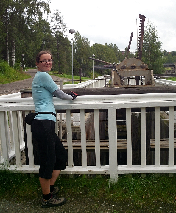
On the bicycle journey through Finland
- OsGeo experience
- Contact
- Email: ela(at)gridw(dot)pl
- Skype username: sterniczka
- Twitter: http://www.twitter.com/ElaWolo
More details at LinkedIn profile.
- Spoken languages
- Polish, English, Russian and German (basic level)
- Profile last updated
26/08/2015
Europe:Portugal
URIs of the form "giovanni DOT manghi AT naturalgis DOT pt" are not allowed.
OSGeo Experience and Roles:
Giovanni Manghi
GIS/WebGIS Teacher, tester and developer.
I funded and was associate at Faunalia Portugal, but the company changed name in February 2015 and now is NATURALGIS http://www.naturalgis.pt/
Location: Évora, Portugal
Giovanni is conservation biologist with 10+ years of GIS experience, Italian but lives and work in Portugal. Is a GFOSS enthusiast and a active member of both the international and Portuguese OSGeo communities, in particular the QGIS (Quantum GIS) one.
- OSGeo Experience
-
- 2015 - present:
- 2009 - 2014: Funder and associate at Faunalia LDA (Portugal)
- Co-funder of the QGIS Portuguese community (http://www.qgis.pt/)
- OSGeo Charter Member 2011
- OSGeo Portugal (OSGeo local chapter) board member
- 2009 - present: Quantum GIS user, translator and tester
- 2nd SASIG organizer, Évora 2009 (Portuguese Congress about free and open source GIS Software)
- 1st Portuguese Quantum GIS Day organizer, Lisbon 2011
- Contact
- Email: giovanni DOT manghi AT naturalgis DOT pt
- Web: http://www.naturalgis.pt/
- Phone (work): +351967058216
- IRC: gioman on freenode (#qgis, #grass, ...)
- Skype: toirao
- Facebook: https://www.facebook.com/naturalgis
- Twitter: https://twitter.com/naturalgis
- Linkedin: https://www.linkedin.com/company/naturalgis
- Spoken Language(s)
- English, Italian, Portuguese, Spanish
- Profile last updated
- 18 February 2015
Europe:Romania
URIs of the form "vasile AT geo-spatial DOT org" are not allowed. [[Info::Vasile is a researcher at Romanian National Meteorological Administration, working in the RS & GIS Laboratory. Currently is in charge of the activities related to rapid mapping, air quality data integration, SDI and webmapping. Vasile is a FOSS4G promoter and use his free time to further develop geo-spatial.org, a collaborative effort by and for the Romanian community to facilitate the sharing of geospatial knowledge and free geographic datasets.| ]]
OSGeo Experience and Roles:
Researcher, Romanian National Meteorological Administration
Location: Bucharest, Romania
Vasile is a researcher at Romanian National Meteorological Administration, working in the RS & GIS Laboratory. Currently is in charge of the activities related to rapid mapping, air quality data integration, SDI and webmapping. Vasile is a FOSS4G promoter and use his free time to further develop geo-spatial.org, a collaborative effort by and for the Romanian community to facilitate the sharing of geospatial knowledge and free geographic datasets. ... more.
- OSGeo Experience
- Responsible on the organization of a local series of workshops called FOSS4G for geodata analysis
- Leader of Romanian Local Chapter OSGeo Romania since 2011
- OSGeo CRO 2015-2018
- OSGeo Conference Committee Chair 2019 - 2022
- Chair of the FOSS4G-CEE 2013
- Chair of the FOSS4G 2019
- Contact
- Email: vasile AT geo-spatial DOT org
- Skype: vasile.craciunescu
- Twiter: vcraciunescu
- Spoken Language(s)
- Romanian, English
- Profile last updated
- 21 September 2022
Europe:Spain
OSGeo Experience and Roles:
Project Manager, Geographica.gs
Location: Valencia, Spain
Pedro-Juan is a Cartographer and Project Manager that works in a Location Intelligence company. He has been collaborating with different NGOs in spreading the word of the Open Knowledge, Open data and FOSS (and FOSS4G)
Member of geomatic blog
LinkedIn profile
- OSGeo Experience
-
- OSGeo Charter Member since 2012
- OSGeo Spanish-speaking Local Chapter Charter Member and Liaison Officer since 2008
- PostGIS power user
- OSGeo-Live translator into Spanish
- Contact
- Email: pferrer@osgeo.org
- Snail-mail: Carrer Chera 3, esc 1, pta 7, 46017 Valencia
- Skype: geovehrka
- Spoken Language(s)
- English, Spanish
- Profile last updated
- 2018-10-17
[[Info::María (aka Délawen) is currently focusing on her work around Open Source and Middleware at Red Hat. She participates actively in OSGeo-ES initiatives and Geoinquietos Sevilla (a little local group part of a broader network of microchapters). Also, she never misses the Girona's Sig Libre Conference. Read more!
- Presidenta Emerita OSGeo (not a formal title)
- Current member of Spanish Chapter Board (since 2012)
- OpenStreetMap evangelizer. Open Data believer.
- FLOSS Evangelizer, in general.
- Debian fan.| ]]
OSGeo Experience and Roles:
URIs of the form "adiez AT uv DOT edu" are not allowed.
OSGeo Experience and Roles:
Location: València, Spain
Agustín is a GIS specialits at the University of Valencia, Spain. Agustín teaches Geographic Information Systems in the Master program of the Departament de Prehistòria i Aruqeologia.
- OSGeo Experience
- Contact
- Email: adiez AT uv DOT edu
- Twiter: agustindiez
- Spoken Language(s)
- Spanish (native speaker), English, French and Catalan
[[Info::Jorge is Charter Member of OSGeo since 2008 and member of the Spanish Language Local Chapter (OSGeo-ES) since its foundation., has been member of the OSGeo Board of Directors in the 2013-2015 term and been part of the gvSIG Technical Steering Committee. He helps on some OSGeo.org systems, participates actively on OSGeo-ES initiatives and Geoinquietos Valencia (a little local group part of a broader network of microchapters). Further details at his OSGeo wiki complete profile page or at linkedin.| ]]
OSGeo Experience and Roles:
- Past experience
-
- Coordinator of Spanish translation of the OSGeo Live documentation (2010-2015)
- Member of the Board of Directors (2013-2015)
- OSGeo-es Board of Directors Member (2008-2012)
- Packager of gvSIG Desktop at the OSGeo Live project (2010-2014)
- gvSIG TSC member (2009-2015)
- Incubation Committee member (as gvSIG contact) (2008-2012)
- Translator of OSGeo.org website into Spanish (2007-2008)
- Profile last updated
- May 2020
Europe:Switzerland
- redirect:Massimiliano Cannata
URIs of the form "marco (A T) opengis.ch" are not allowed. [[Info::I am an open-source advocate, consultant, teacher, and developer. My background is in geography with a specialization in geographic information science. I live in Switzerland in a small Romansh-speaking mountain village where I love scrambling around the mountains to enjoy the feeling of freedom it gives me. I’m a very communicative person, I fluently speak Italian, German, French English, and Spanish and love travelling.
I work as director of OPENGIS.ch which I founded in 2011. Since 2015 I share the company ownership with Matthias Kuhn. At OPENGIS.ch we are core developers, senior architects, full-stack ninjas and GIS wizards. We love open-source and are committed to the sustainable growth of the tools we work on.
My first QGIS (to be correct for that time QuantumGIS) ever was “Simon (0.6)” during my BSc when the University of Zurich was teaching us proprietary products and I started looking around for Open Source alternatives. In 2008, when starting my MSc, I made the definitive switch to Ubuntu and I started working more and more with QGIS Metis (0.11) and ended up developing some plugins and part of Globe as my master's thesis. Since three years the University of Zurich invites me to hold two seminars on Entrepreneurship and Open Source. In November 2011 I attended my first Hackfest in Zürich where I started porting all QGIS dependencies and developing QGIS for Android under a Google Summer of Code. A couple of years and a lot of work later QField was born. Since then I’ve always tried to attend at least one Hackfest per year to be able to feel first-hand the strong bonds within our very welcoming community.
In 2013 I was lucky enough to have a release named after a suggestion I saved you all from having QGIS 2.0 - Hönggerberg and giving you instead QGIS 2.0 - Dufour
Besides my long story with QGIS as a user and passionate advocate, I have a long story as a QGIS service provider where we are fully committed to its stability, feature-richness and sustainable development. Furthermore, as a consultant, I am lucky enough to be sent now and then to spread the QGIS goodness in less fortunate countries.
You can find out more about Marco at berna.io| ]]
OSGeo Experience and Roles:
Marco Bernasocchi
founder, OPENGIS.ch
Location: Laax, Switzerland
- OSGeo Experience
-
- QGIS Chair
- QGIS Plugins developer
- QGIS developer
- QGIS Android father
- QField Developer
- PostGIS Consultant
- Contact
- Email: marco (A T) opengis.ch
- Spoken Language(s)
- Italian, English, German, French, Spanish
Profile last updated: 10 October 2018
URIs of the form "pka AT sourcepole DOT ch" are not allowed.
OSGeo Experience and Roles:
Pirmin Kalberer
Co-founder and Managing director, Sourcepole
Location: Zurich, Switzerland
Pirmin is an active Geospatial Open Source community member since 2002. He works for Sourcepole, a Swiss based commercial Open Source company.
- OSGeo Experience
-
- t-rex vector tile server
- QWC2 / QWC Services
- GDAL/OGR committer: Maintainer Interlis driver
- QGIS committer
- Creator of the first OSS GIS Live CD (GIS-Knoppix) and several FOSSGIS projects
- OSGeo-Live contributions and UbuntuGIS packaging
- Presenter and co-organzier at numerous conferences (FOSS4G, FOSSGIS, QGIS User conferences)
- OSGeo Charter member
- Contact
- Email: pka AT sourcepole DOT ch
- Phone (work): +41 44 440 77 11
- Spoken Languages
- German, English
- Profile last updated
- 25 May 2023
Europe:Ukraine
URIs of the form "alexander DOT bruy AT gmail DOT com" are not allowed.
OSGeo Experience and Roles:
Alexander Bruy
GIS developer, tester and teacher
Location: Zaporizhzhya, Ukraine
Alexander is a microelectronics engineer who got interested in GIS and open source programming during university. He started with OSGeo4W and QGIS, first met the OSGeo community by helping on translation. Then he became QGIS contributor, later — core developer and translation team lead. Is a GFOSS enthusiast and a active member of both the international and Ukrainian OSGeo communities, in particular the QGIS one.
- OSGeo Experience
-
- OSGeo Charter Member (2014)
- QGIS core developer
- QGIS plugins developer
- QGIS GUI/Website/Documentation translation team lead (Ukrainian)
- OSGeo4W installer translator and package maintainer
- GDAL tester and contributor
- Co-founder of Ukrainian QGIS User Group
- Co-founder of ICA-OSGeo Lab in Ukraine (Taras Shevchenko National University of Kyiv)
- OSGeo Google Summer of Code mentor in 2012 - 2015 (QGIS project)
- Contact
- Email: alexander DOT bruy AT gmail DOT com
- IRC: alexbruy on freenode (#qgis, #gdal, ...)
- Spoken Language(s)
- English, Ukrainian, Russian
- Profile last updated
- 21 September 2015
URIs of the form "d DOT svidzinska AT gmail DOT com" are not allowed. [[Info::Landscape Ecologist and Open Source GIS Specialist
Coordinator of the TSNUK OSGeo Research and Education Lab| ]]
OSGeo Experience and Roles:
- Location
Kyiv, Ukraine
- Affiliation
Associate Professor
Department of Physical Geography and Geoecology, Faculty of Geography
Taras Shevchenko National University of Kyiv (TSNUK), Ukraine
Landscape Ecologist and Open Source GIS Specialist
Coordinator of the TSNUK OSGeo Research and Education Lab
- OSGeo Experience
- Russian translator for OSGeo-Live documentation
- Open Source GIS Software User (QGIS, SAGA, PostGIS, GRASS)
- QGIS Ukraine User Group Co-founder and Member
- Ukrainian translator for QGIS documentation
- Ukrainian and Russian SAGA GIS documentation developer
- Contact
- Email: d DOT svidzinska AT gmail DOT com
- Skype: darsvid
- Spoken Language(s)
- Ukrainian, English, Russian
- Profile last updated
- 27 August 2015
Europe:United Kingdom
URIs of the form "ian.edwards (#) myacorn.com" are not allowed.
OSGeo Experience and Roles:
Ian Edwards
Technical Director, MyAcorn Limited (UK)
Location: Exeter, United Kingdom
Ian's GIS career has spanned academia, business and government, including research positions at the universities of Cambridge and Exeter, director of a GIS company and also working for the UK government as a lead software engineer at the Met Office. Ian is an honorary fellow of the University of Exeter, and continues to be a regular speaker at the University of Cambridge. He is also a Fellow of the Royal Geographical Society.
- OSGeo Experience
- Chair OSGeo UK, 2012-15
- Member FOSS4G Local organising committee, 2013
- Contributor OSGeo Live
- Former chair OSGeo Website committee
- Contact
- Email: ian.edwards (#) myacorn.com
- Profile last updated
- 15 March 2016
[[Company::Astun Technology Limited| ]] URIs of the form "jocook AT astuntechnology.com" are not allowed. [[Website::https://www.archaeogeek.com| ]] [[Info::Consultant for Astun Technology - who provide internet mapping products based the OSGeo technology stack. Charter Member, founder and past Chair of the UK local chapter, and a Board Member for OSGeo (2011-2012). Available for seminars, workshops, and presentations about OSGeo or about open source GIS, with a focus on spreading the word to new users, both personal and enterprise. Quelling myths about proprietary vs open source are a speciality. Creator of Portable GIS- Open Source GIS on a USB stick for windows. Find out more at Archaeogeek or about.me.| ]]
OSGeo Experience and Roles:
- OSGeo Experience
- Board Member (2011-2012)
- Charter Member (2010-present)
- UK Local Chapter Founder and Chair (2007-2021)
- Deputy-chair of FOSS4G 2013
- Chair of FOSS4GUK 2016
- Incubation Committee (2018-present)
- Google Season of Docs administrator and mentor (2019)
- Contact
- Email: jocook AT astuntechnology.com
- Twitter
- Profile last updated
- 21st June 2019
[[Info::Employed by Astun Technology who provide support and train all types of OSGeo software. Ian will also undertake contract Java development using GeoTools and GeoServer (primarily).
Ian was a software developer for Envitia Ltd. He spent the previous 20 years doing geospatial research at the University of Leeds and Pennsylvania State University, during this period he founded the GeoTools project with James Macgill.
Find out more about Ian at GIS.stackexchange and LinkedIn.| ]]
OSGeo Experience and Roles:
- Co-founder and developer of Geotools project
- Developed and taught a webmapping course based upon open source software at Penn State University
- Contact
- email: ian@ianturton.com
- twitter: @ijturton
- www: ianturton.com
[[LocalChapter::OSGeo:UK| ]] [[Info::Steven Feldman was Managing Director of GDC, a UK local government specialist and subsequently of MapInfo UK. He now mentors startups and advises businesses in the location space while focussing his spare time on Open Data and Open Source projects including the OSM-GB project at the Nottingham Geospatial Institute.
Steven is currently a strategic advisor to Astun Technology, chairman of geo.me Solutions, past chairman of Exprodat Consulting and a board advisor at OpenCage Data.
Steven was the Chair of the LOC for FOSS4G 2013. He is a recent past chair the Conference Committee and is active in OSGeo:UK, the UK local chapter
Steven is a regular presenter on geo and open topics, some slide decks are here. He tends to tweet too much as @stevenfeldman| ]]
OSGeo Experience and Roles:
- Contact
- Email: via KnowWhere
- via twitter
- Spoken Language
- English
- Profile last updated
- 7th April 2021
OSGeo Experience and Roles:
Consultant
Location: Nottingham, United Kingdom
Suchith Anand is a Charter Member of OSGeo and actively involved in OSGeo Education initiatives. He is the chair of the ICA Commission on Open Source Geospatial Technologies and is leading open source research at the University of Nottingham. He is also working for establishing Open Source Geospatial Labs/Research Centres in key universities worldwide as part of the Open Source Geospatial Foundation- ICA MoU ...more.
- OSGeo Experience
- Established Open Source Geospatial Labs/Research Centres in key universities worldwide as part of the Open Source Geospatial Foundation- ICA MoU
- Charter member of OSGeo Foundation
- Volunteer of OSGeo Education/GeoForAll
- Develop and promote OSGeo Educational initiatives
- Founder and Chair of OSGIS conference series
- Invited speaker and presenter at United Nations and other International organisations
- Editorial Board member of journals
- Building synergies between OSGeo and other open education initiatives globally
- One of the founding members of the Open Source GIS Summer School initiative and the Geospatial Open Source, Open Standards, Open Data e-learning initiative.
- Contact
- Email: suchith_anand@yahoo.com
- Profile last updated
- 25th May , 2018
Latin America:Argentina
Latin America:Brazil
URIs of the form "fsc7mail AT gmail DOT com" are not allowed. [[Info::Felipe Costa works with FOSSGIS software since 2005. He has worked with webmapping using both Mapserver and Geoserver and has experience with I3Geo and Openlayers. He is also interested in geospatial metadata and has worked mainly with Geonetwork.
Nowadays works at Fiocruz Amazônia after a time in Rio de Janeiro studying Geomatics at UERJ where he wrote his thesis was about Spatial Data Infrastructures and OGC Webservices.| ]]
OSGeo Experience and Roles:
Felipe Costa
Programming Analyst, Fiocruz
Location: Manaus, Brazil
Felipe Costa works with FOSSGIS software since 2005. He has worked with webmapping using both Mapserver and Geoserver and has experience with I3Geo and Openlayers. He is also interested in geospatial metadata and has worked mainly with Geonetwork.
Nowadays works at Fiocruz Amazônia after a time in Rio de Janeiro studying Geomatics at UERJ where he wrote his thesis was about Spatial Data Infrastructures and OGC Webservices.
...more.
- OSGeo Experience (optionally add icons here)
- He has experience as user with the following softwares: Mapserver, Geoserver, Geonetwork, Postgis, Qgis and GvSig.
- He has some experience teaching and participating at conferences talking about Postgis, Qgis and Geoserver. He also contributes to the Brazilian FOSSGIS magazine.
- Contact
- Email: fsc7mail AT gmail DOT com
- Skype: fsc0307
- Spoken Language(s)
- Portuguese, English.
- Profile last updated
- 2 December 2015
Latin America:Chile
URIs of the form "sstein AT geo DOT uzh DOT ch - and temporary: - ssteiniger AT uc DOT cl" are not allowed. [[Info::Stefan has been project (co-)leader of the OpenJUMP GIS project from 2005 to 2010 and is still a contributor. He has been writing 2-3 journal articles about FOSS4G to a scientific audience, to spread the word there (on desktop GIS, Landscape Ecology tools, SDI software, and FOSS4G for teaching). Since 2012 he is living in Chile and trying to promote FOSS4G there.| ]]
OSGeo Experience and Roles:
GIS/c Researcher with the Pontificia Universidad Catolica de Chile, freelance GIS Programmer
Locations: Santiago de Chile, Chile
Stefan has been project (co-)leader of the OpenJUMP GIS project from 2005 to 2010 and is still a contributor. He has been writing 2-3 journal articles about FOSS4G to a scientific audience, to spread the word there (on desktop GIS, Landscape Ecology tools, SDI software, and FOSS4G for teaching). Since 2012 he is living in Chile and trying to promote FOSS4G there.
- OSGeo Experience
- Used applications such as JTS Topology Suite, OpenJUMP, Sextante, QGIS, GeoNode, bits of GeoServer and PostGIS, etc. (and still learning...)
- Thinks he has generally a good overview of the FOSS4G software map (well.. just click the link)
- Contact
- Email: sstein AT geo DOT uzh DOT ch - and temporary: - ssteiniger AT uc DOT cl
- Spoken Language(s)
- German, English, Spanish
- Profile last updated
- 7 July 2012
Latin America:Colombia
URIs of the form "ingenieroariel AT gmail DOT com" are not allowed.
OSGeo Experience and Roles:
Consultant, , Global Facility for Disaster Reduction and Recovery, World Bank
Location: Barranquilla, Colombia
Ariel is an electronic engineer with experience in sensor networks and software development. He has contributed to many open source software projects centered around web development and GIS. His work in disaster risk reduction centers around the use of open source geospatial tools to improve resilience to natural hazards. He is doing a masters degree on Electronic Engineering and his research involves finding abnormal patterns using computer vision and machine learning.
- Contact
- Email: ingenieroariel AT gmail DOT com
- Skype : ingenieroariel
- Twitter : ingenieroariel
- Spoken Language(s)
- Spanish, English
- Profile last updated
- 22 July 2014
{{#umSetParam: -74|11|Barranquilla, Colombia|ingenieroariel|Ariel Nunez}}
Latin America:Ecuador
Latin America:Mexico
URIs of the form "vicky.vergara at osgeo.org" are not allowed. URIs of the form "52 55 5364-3403" are not allowed.
OSGeo Experience and Roles:
Celia Virginia Vergara Castillo
Location(s): Mexico city, México
Vicky is an Economist and Computer Scientist, pgRouting fan and developer, Free Software advocate.
- OSGeo Experience
- pgRouting project leader and developer: pgRouting, pgRoutingLayers, osm2pgRouting
- Mentor for Google Summer of Code 2017, 2016, 2015
- FOSS4G speaker
- OSGeoLive PSC
- Contact
- Email: vicky at georepublic.de
- Phone: 52-55-5364-3403
- Spoken Language(s)
- Spanish, English, Japanese
- Profile last updated
- Nov 2017
United States
URIs of the form "tech AT wildintellect DOT com" are not allowed.
OSGeo Experience and Roles:
Alex Mandel
Phd. Candidate, Geography, University of California, Davis
Location: Davis, CA USA
Alex is a geographer with a background in natural resource sciences. He studies geospatial software development and applications working with many government agencies and other small organizations to implement geospatial solutions. He is an active advocate of OSGeo in the Western US at related academic conferences and local un-conferences. Additional Information
- OSGeo Experience
-
- Chair, System Administration Committee
- Member, Marketing Committee
- Member, California OSGeo Chapter
- Contributor, Ubuntugis
- Build co-coordinator for OSGeo-Live
- Teaches: Introduction to GIS, GIS Programming in Python, Open Source Cartography, GeoWeb, Spatial Databases
- Uses: Python, QGIS, Inkscape, Postgis, Spatialite, Ubuntu, GDAL, GeoDjango, Openlayers, Geoserver, Geonode, R
- Presentation Archive on Scribd
- Contact
- Email: tech AT wildintellect DOT com
- IRC: wildint(ellect)
- Profile last updated
- 21 June 2012
URIs of the form "kratochanna AT gmail DOT com" are not allowed.
OSGeo Experience and Roles:
Anna Petrasova
- Profile last updated
- September 2023
URIs of the form "maplabs AT- light42 DOT com" are not allowed. [[Info::By fate or by fluke, Brian served as steering committee member for the 5th International Symposium on Digital Earth in 2007. link As liason to speakers and distinguished guests, network administrator and conference strategist, Brian built on experience with un-conferences and an unusual collection of resources to make the five day, one hundred and twenty presentation international event a critical success. Subsequently Brian dove headlong into the vast arcana of geo-software, beginning with GDAL and moving on to C-Tribe projects and web software. The OSGeo Live DVD is a fundamental piece of the puzzle, in a rapidly changing and perhaps urgent context of the relationship of civilization and Gaia current: PostGIS maintainer on the Live; brought Marble, NaturalEarth, IRIS, netCDF data to the Live; SciPy stack maintainer| ]]
OSGeo Experience and Roles:
Brian Hamlin
Location: Berkeley, CA USA
"The time is now to accelerate geo data and geo software. I will use my best abilities as an investigator, coder and communicator to further the development and deployment of Open Source Geospatial Software."
By fate or by fluke, Brian served as steering committee member for the 5th International Symposium on Digital Earth in 2007. link As liason to speakers and distinguished guests, network administrator and conference strategist, Brian built on experience with un-conferences and an unusual collection of resources to make the five day, one hundred and twenty presentation international event a critical success. Subsequently Brian dove headlong into the vast arcana of geo-software, beginning with GDAL and moving on to C-Tribe projects and web software. The OSGeo Live DVD is a fundamental piece of the puzzle, in a rapidly changing and perhaps urgent context of the relationship of civilization and Gaia current: PostGIS maintainer on the Live; brought Marble, NaturalEarth, IRIS, netCDF data to the Live; SciPy stack maintainer
- OSGeo Experience
-
- Member, California OSGeo Chapter
- Developer Diplomat for OSGeo-Live
- Teaches: Introduction to PostGIS, GeoWeb, Spatial Databases
- Uses: C, Python, Postgis, Debian, Ubuntu, GDAL, Openlayers, Geoserver
- Geo Web Log
- Contact
- Email: maplabs AT light42 DOT com
- IRC: darkblue_b dbb
- Profile last updated
- 04 July 2012
URIs of the form "gistinkerATgmail.com" are not allowed.
OSGeo Experience and Roles:
Cartographer
Location: Raleigh, North Carolina
Doug Newcomb has a BS and MA in Geography and is an advocate of Free and Open Source Software (FOSS) in general and geospatial software specifically. Doug has used Linux (Red Hat, CentOS,Debian,Ubuntu) since 1996. Employed at various government environmental agencies since 1990. Specializes in use of GRASS with incomplete LiDAR data to derive landscape scale (statewide) forest canopy structure data.
- OSGeo Experience
-
- Charter member since 2012.
Contact:
- Email: gistinkerATgmail.com
- Phone: 336-639-9545
- Spoken Language(s)
- English
- Profile last updated
- 9 September 2012
URIs of the form "amy AT spatialfront DOT com" are not allowed.
OSGeo Experience and Roles:
Feng Amy Gao
President, Spatial Front Inc.
Location: Potomac, Maryland, US
Amy is the President of Spatial Front Inc, a fast-growing IT consulting company. She has extensive experience with the design and development of enterprise geospatial information systems. She has worked for all levels of US governments (federal, state, and local), companies from IBM to start-ups, and as Adjunct Professor in college. One of her latest projects - National Broadband Map, a high-profile project funded by Recovery Act - was built on an open source stack. She is enthusiastic about open source geospatial technologies and interested in using more and helping people learn more about them.
- OSGeo Experience
-
- Used technologies such as GeoServer, PostGIS, and Layers in multiple projects.
- Translated OSGeo-Live document from English to Chinese.
- Contact
- Email: amy AT spatialfront DOT com
- Spoken Language(s)
- English, Chinese (Mandarin)
- Profile last updated
- 08 July 2012
URIs of the form "+1 (650) 701-7823" are not allowed. [[Info::Frank Warmerdam is a C++, Java and Python geospatial software developer, primarily known for founding the GDAL/OGR multi format geospatial data access and translation project. He is also active on the PROJ.4, libtiff, and libgeotiff projects, was a founding director of OSGeo, and is a Primary Administrator on the OSGeo System Administration Committee.| ]]
OSGeo Experience and Roles:
Frank Warmerdam
Employment: Google
Location: Mountain View, California, USA
Frank Warmerdam is a C++, Java and Python geospatial software developer, primarily known for founding the GDAL/OGR multi format geospatial data access and translation project. He is also active on the PROJ.4, libtiff, and libgeotiff projects, was a founding director of OSGeo, and is a Primary Administrator on the OSGeo System Administration Committee.
- OSGeo Experience

- Contact
- Email: warmerdam@pobox.com
- Web: http://pobox.com/~warmerdam/
- Phone: +1 (650) 701-7823
- Spoken Language(s)
- English
- Profile last updated
- 17 August 2012
OSGeo Experience and Roles:
Helena Mitasova
Professor at the Department of Marine, Earth and Atmospheric Sciences and the Center for Geospatial Analytics, North Carolina State University
Location: Raleigh, North Carolina
Helena has participated in the GRASS GIS development since 1991 and co-authored the first book on GRASS. She is an associate director for earth and environmental sciences applications at the Center for Geospatial Analytics at North Carolina State University (NCSU) in Raleigh, NC and she leads NCSU GeoForAll lab, one of the founding labs of the OSGeo research and education initiative. She published numerous publications on tools and applications of GRASS GIS. She co-developed methods for spatial interpolation, terrain analysis, hydrologic and erosion modeling and visualization. She received her PhD from the Slovak Technical University, Bratislava, Slovakia.
OSGeo Experience
- past member of the Board of Directors
- member of GRASS PSC
- past member of the OSGeo conference and education committees
- OSGeo charter member
- lead faculty for NCSU GeoForAll Lab
- development of graduate courses on Geospatial Analysis and Modeling using GRASS GIS and other FOSS4G software, offered at NCSU by the Center for Geospatial Analytics
- research on terrain analysis, geospatial modeling and visualization at University of Illinois, US Army Construction Engineering Research Laboratories and NCSU.
- Contact
- hmitaso@ncsu.edu
- Spoken Languages
- English, Slovak
- Profile last updated
- 12 October 2023
URIs of the form "rjhale AT northrivergeographic DOT com" are not allowed.
OSGeo Experience and Roles:
Randal Hale
GIS Person, North River Geographic Systems, Inc
Location: Chattanooga, TN, United States
Randal Hale is the owner of North River Geographic Systems, Inc. He's been active in the QGIS Community by participating in beta testing and answering questions on the QGIS mailing list. He's also developed QGIS classes that target people active in the GIS Community.
- http://www.twitter.com/rjhale
- http://www.linkedin.com/in/randalhale/
- OSGeo Experience
: QGIS, PostGIS, GDAL, UbuntuGIS, MapServer
- Local Chapter
Southeast OSGEO Chapter
- Description of OSGeo Experience
- QGIS Workshop - FOSS4GNA2013
- Participates in QGIS Community
- Advocate of the OSGEO Live Suite
- QGIS Workshop - FOSS4GNA2015
- Contact
- Email: rjhale AT northrivergeographic DOT com
- Phone (work): 1-423-653-3611
- Skype: rjhale1971
- Spoken Language(s)
- English
- Profile last updated
- 11 22 2015
URIs of the form "kate.chapman AT hotosm DOT org" are not allowed.
OSGeo Experience and Roles:
Kate Chapman
Executive Director, Humanitarian OpenStreetMap Team
Location: Portland, Oregon, United States of America
Kate is Executive Director of the Humanitarian OpenStreetMap Team. Her most recent projects have included working in Indonesia leading a team to train disaster managers in using open-source software to better plan for disasters and relaunching of the OpenAerialMap project. Kate has spoken about the benefits of open-source and open data for disaster response and risk reduction all over the world, including giving keynotes at Linux Conf Australia and FOSS4G in 2013.
- OSGeo Experience
-
- Keynote FOSS4G 2013
- Workshop FOSS4G 2013 "Impact Modelling with OpenStreetMap and InaSAFE"
- Participation in development of Curriculum on InaSAFE.org on using InaSAFE/QGIS/OpenStreetMap for Disaster Planning
- Planning Volunteer FOSS4G North American 2013
- Workshop FOSS4G 2011 "Using OpenStreetMap for Disaster Response and Planning"
- OSGEO Booth Volunteer American Association of Geographers Annual Conference
- Contact
- Email: kate.chapman AT hotosm DOT org
- Phone (mobile): +1 703 673 8834
- Skype: kateachapman
Spoken Language(s): English, Indonesian (intermediate speaker)
- Profile last updated
- 23 07 2014
URIs of the form "1-505-265-0243" are not allowed. "Twitter" has not been listed as valid URI scheme.
OSGeo Experience and Roles:
Kurt Menke
GIS Specialist, Owner, Bird's Eye View GIS
- Location
Albuquerque, New Mexico
- Bio
Kurt Menke is a Certified GIS Professional (GISP) who has been working in the field for 19 years. He works largely on spatial analysis in the public health and conservation fields. He received a Masters degree (MA) in Geography from the University of New Mexico in 2000. He is a long time advocate of FOSS4G. Recently he has authored Discover QGIS through Locate Press and co-authored Mastering QGIS through Packt Publishing. In 2015 he was part of the GeoAcademy team awarded the GeoForAll Educator of the Year award.
https://www.birdseyeviewgis.com/staff/
https://www.linkedin.com/profile/view?id=23073414&trk=nav_responsive_tab_profile
- OSGeo Experience
- Author Discover QGIS
- Co-author Mastering QGIS
- FOSS4G Practitioner for 15 years
- FOSS4G Educator for 9 years
- Have developed 4 college level semester long FOSS4G courses
- GST 101: Intro to GIT Using QGIS
- GST 102: Spatial Analysis with FOSS4G
- GST 103: Data Acquisition and Analysis Using QGIS
- GIS 2020: Introduction to Open Source GIS and Web Mapping
- Contact
- Email: Kurt@birdseyeviewgis.com
- Phone (work): 1-505-265-0243
- Skype: birdseyeviewgis
- Spoken Language(s)
- English
- Profile last updated
- 09 27 2017
URIs of the form "sunburned dot surveyor at gmail dot com" are not allowed. URIs of the form "(209) 571-1765" are not allowed.
OSGeo Experience and Roles:
Landon Blake (AKA - The Sunburned Surveyor)
Owner, Redefined Horizons
Location: Stockton, California, United States of America
Landon Blake is a land surveyor and GIS programmer with a focus on OpenJUMP and CAD customization. He serves as the Vice President of the California Land Surveyors Association Central Valley Chapter, is a member of the California Land Surveyors Association GIS Committee, and also serves as a member of the California Geodetic Control Working Group.
- OSGeo Experience
- Past Volunteer Editor of the OSGeo Journal
- Board Representative for the OSGeo California Chapter
- Contact
- Email: sunburned dot surveyor at gmail dot com
- Phone (cell): (209) 298-7521
- Phone (home): (209) 464-2612
- Skype:
- Profile last updated
- 08 13 2014
GIS Data Models
URIs of the form "mlucas17 AT mac DOT com" are not allowed. URIs of the form "321 266 1475" are not allowed. [[Info::Mark Lucas has pioneered efforts in Open Source Software Development in remote sensing, image processing and geographical information systems. Mark established ossim.org and has led several government funded studies and development efforts since 1996. ... more.| ]]
OSGeo Experience and Roles:
Principal Scientist, RadiantBlue Technologies Inc.
Location:Melbourne Beach, Florida, USA
Mark Lucas has pioneered efforts in Open Source Software Development in remote sensing, image processing and geographical information systems. Mark established ossim.org and has led several government funded studies and development efforts since 1996. ... more.
- OSGeo Experience
- OSGeo experience
-
- Original founder of the OSSIM remote sensing project
- On the original organizing committee for the OSGeo, a founding member and board member.
- Recently returned to serve on the current Board of Directors
- Contact
- Email: mlucas17 AT mac DOT com
- Phone (work): 321 266 1475 (USA)
- Spoken Language(s)
- English, Spanish
- Profile last updated
- 07 JULY 2012
[[Email::michael.smith.erdc[at]gmail.com| ]]
OSGeo Experience and Roles:
Mike Smith & Jeff McKenna collaborating on WMS Benchmarking
Michael Smith
Physical Scientist, US Army Corps of Engineers
Location: Hanover, New Hampshire, USA
Michael Smith is a Physical Scientist with the Remote Sensing GIS Center of Expertise at the Cold Regions Research Engineering Laboratory of the US Army Corps of Engineers. He has been working as a GIS Specialist for 25 years with the last 13 years very involved with Open Source Geospatial.
- OSGeo Experience
- Charter member since 2012
- Member of the MapServer Project Steering Committee
- Member of WMS Benchmarking Group
- Member of PDAL Project Steering Committee
- irc
- msmitherdc
- email
- michael.smith.erdc[at]gmail.com
- Spoken Language(s)
- English
- Profile last updated
- 06 Nov 2017
Peter Batty
Co-founder and CTO of Geospatial Division, Ubisense
Location: Denver, CO, United States (originally from the United Kingdom)
Peter has worked in the geospatial industry for 25 years and has served as CTO for two of the world's top 200 software companies, Intergraph and Smallworld (now part of GE Energy). In recent years he has worked extensively with open source systems and new generation web mapping applications such as Google Maps.
More details at LinkedIn.
- OSGeo Experience
-
- Chaired the FOSS4G conference in Denver in 2011. It was the largest FOSS4G to date with over 900 attendees from 42 countries
- Has spoken at many conferences around the world on trends in the geospatial industry, including open source geospatial
- Served on the OSGeo board from 2011 to 2013
- Has developed applications using a variety of OSGeo software, including PostGIS, MapFish and OpenLayers
- Is a member of the OSGeo Conference Committee
- Was the OSGeo Board Liaison for the FOSS4G 2013 conference in Nottingham, UK
- Writes a Blog
- Other interests
- Contact
- Email: peter AT ebatty DOT com
- Skype: pmbatty
- twitter @pmbatty
- Spoken Language(s)
- English
- Profile last updated
- 1 February 2015
{{#umSetParam: -104.99854|39.753358|Denver, CO, US|Pmbatty|Peter Batty}}
URIs of the form "steve.lime AT state DOT mn DOT us or sdlime AT comcast DOT net" are not allowed. URIs of the form "1-651-259-5473" are not allowed.
OSGeo Experience and Roles:
Steve Lime
Data & Applications Manager, Minnesota DNR
Location: St. Paul, MN USA
Steve is one of the principle developers for MapServer and does a fair amount of web application development using MapServer/MapScript, PostGIS, GDAL, GEOS and OpenLayers.
- OSGeo Experience
- Founder MapServer project, PSC chair
- Participated OSGeo Foundation initiation meeting
- Conference chair MapServer User Group (MUM) meetings in 2001 and 2003
- Recipient of OSGeo's 2007 Sol Katz Award
- Member of OSGeo incubation committee, past member of OSGeo conference committee
- Instructor at University of Minnesota (Geography Dept) in Web-based GIS
- Frequent presenter (papers/workshops) at local and international conferences (although not as much any more)
- Contact
- Email: steve.lime AT state DOT mn DOT us or sdlime AT comcast DOT net
- Phone (work): 1-651-259-5473
- Skype:
- Profile last updated
- 04 Oct 2012
URIs of the form "woodbri AT swoodbridge DOT com" are not allowed. URIs of the form "1-978-251-4502" are not allowed. "Skype" has not been listed as valid URI scheme. [[Info::Stephen works on PointClouds, Vehicle Routing Problems, Mapserver, pgRouting, Geocoding, Reverse Geocoding, GDAL/OGR, OpenLayers as well as other open source products. Stephen can be found at iMapTools.com where he provides geospatial products, consulting and advocates OSGeo and OpenSource products to his clients.| ]]
OSGeo Experience and Roles:
Stephen Woodbridge
Owner, iMaptools.com
Location: North Chelmsford, MA, USA
Stephen works on PointClouds, Vehicle Routing Problems, Mapserver, pgRouting, Geocoding, Reverse Geocoding, GDAL/OGR, OpenLayers as well as other open source products. Stephen can be found at iMapTools.com where he provides geospatial products, consulting and advocates OSGeo and OpenSource products to his clients.
Resume.
LinkedIn Profile.
- OSGeo Experience
-
- Mapserver PSC member and user. Stephen constructs mapfiles and manages client production environments that collectively serve billions map of draws per year.
- pgRouting PSC member, user and developer. Stephen prepares client data for use with pgRouting, has developed driving directions module, and has mentored Google of Summer Code students developing pgRouting.
- PAGC (Postal Address Geocoder) PSC member and user, tester and developer.
- A knowledgeable user of GDAL/OGR and OpenLayers as well as other Open Source projects.
- Contact
- Email: woodbri AT swoodbridge DOT com
- Phone (work): 1-978-251-4502
- Skype: stephen.woodbridge
- Spoken Language(s)
- English
- Profile last updated
- 28 JUNE 2012
URIs of the form "wenzeslaus gmail com" are not allowed.
OSGeo Experience and Roles:
Vaclav Petras
- Profile last updated
- August 2018
URIs of the form "vivien.deparday AT gmail DOT com" are not allowed. [[Info::Vivien started to use and contribute to open source GIS in 2006 while working for GIS consulting company in France and then focused his master research on using open source tools for geovisualization. He is currently working at the World Bank promoting and spreading the use of open source software internally at the World Bank and in many countries around the world through the work of the Open Data for Resilience Initiative| ]]
OSGeo Experience and Roles:
Open Data and Geospatial Technology Specialist, Global Facility for Disaster Reduction and Recovery (GFDRR) at the World Bank
Location: Washinton, DC, United States
Vivien started to use and contribute to open source GIS in 2006 while working for GIS consulting company in France and then focused his master research on using open source tools for geovisualization. He is currently working at the World Bank promoting and spreading the use of open source software internally at the World Bank and in many countries around the world through the work of the Open Data for Resilience Initiative
OSGeo Experience
- FOSS4G user and contributor since 2006 participating and presenting in code sprints, conferences, and user meetings
- GeoNode. Core developer.
- QGIS Plugin: InaSAFE. Developer, technical working group member
- Contact
- Email: vivien.deparday AT gmail DOT com
- Skype : vivien.deparday
- Twitter : vdeparday
- Github profile
- Personal page
- Spoken Language(s)
- French, English
- Profile last updated
- 12 August 2014
URIs of the form "cschweik AT pubpol DOT umass DOT edu" are not allowed.
OSGeo Experience and Roles:
Charles Schweik
Associate Professor, University of Massachusetts, Amherst
Location: Amherst, Massachusetts
Charlie Schweik is a social scientist who studies commons-based peer production efforts generally, and teaches GIS in his university's Environmental Conservation and Public Policy and Administration programs. He is interested in building OSGeo and the GeoForAll effort toward true global collaboration in open source geospatial related research and education.
For more information, see his website
- OSGeo Experience
- Chair, OSGeo Education and Curriculum committee 2007-present
- Co-founder, GeoForAll.org initiative
- Contact
- Email: cschweik AT pubpol DOT umass DOT edu
- Skype: cschweik
- Profile last updated
- 11 March 2015
OSGeo Experience and Roles:
Owner/Consultant, dbSpatial LLC
Location: Minneapolis, MN, USA
David Bitner is the founder of dbSpatial and a consultant specializing in open source geospatial application and database development. David is an OSGeo Charter Member and a member of the Sahana Software Foundation Board of Directors. David has served on several conference committees and was the chair of the 2013 FOSS4GNA event in Minneapolis.
OSGeo Charter Member
Chair, Public Geospatial Data Committee
Member, Conference Committee, Incubation Committee
MapServer, PostGIS, QGIS, OpenLayers, OGR/GDAL and many other tools user
- Contact
- Email: bitner@dbspatial.com
- Profile last updated
- 23 September 2014
Landon Blake (AKA - The Sunburned Surveyor)
Owner, Redefined Horizons
Location: Stockton, California, United States of America
Landon Blake is a land surveyor and GIS programmer with a focus on OpenJUMP and CAD customization.
- OSGeo Experience
- Volunteer Editor of the OSGeo Journal
- Board Representative for the OSGeo California Chapter
- Contact
- Email: sunburned dot surveyor at gmail dot com
- Phone (Home): 209-464-2612
- Phone (Cell): 209-298-7521
- Skype:
- Profile last updated
- 07 14 2013
Canada
URIs of the form "andrea DOT ross AT eclipse DOT org" are not allowed.
OSGeo Experience and Roles:
Andrea Ross
Location: Ottawa, Ontario, Canada
Andrea Ross is Director of Ecosystem Development at the Eclipse Foundation, an independent not-for-profit foundation supporting a large community of open source projects. She is also one of the founders of LocationTech, an ecosystem of R&D collaborators focusing on open source location aware technologies. Andrea is an award winning software architect and technology leader with more than 20 years experience.
- OSGeo Experience
- Charter member since 2008
- Conference Chair for FOSS4G NA 2015
- Conference Producer for FOSS4G NA 2015 and FOSS4G NA 2016
- FOSS4G bid team member for Washington D.C. 2014, Ottawa 2017, Philadelphia 2017
- Conference Chair for Geocamp 2008, 2009, 2010
- Sponsor for FOSS4G 2009, 2013, 2014, Code sprint 2015, GDAL/OGR, OSGeo itself for a few years and many other things.
- Recorded and hosted videos from FOSS4G 2009, FOSS4G 2011, Rendez-Vous OSGeo Quebec, FOSS4G 2011, FOSS4G 2013, FOSS4G NA 2015, and FOSS4G NA 2016.
- Led team to develop Ingres' OGC compliant geospatial support in the core DBMS which included contributions to multiple OSGeo projects
- Also led team to add support for Ingres geospatial in Mapserver, Geoserver, GDAL/OGR, ESRI's ArcGIS, and other software
- Long time member in the Ottawa Chapter Local Chapter
Other relevant experience
- Producer & helpful elf for FedGeoDay, a 1 day conference focused on open source geospatial use in the U.S. Federal Government.
- Co-founder & helpful elf for the LocationTech Tour, a global series of federated events open & welcoming to all open source geospatial technologies & initiatives
- Co-founder & helpful elf for various intern programs such as UCOSP, Open Academy, etc. Approximately 200+ interns worked on open source geospatial projects.
- Frequent speaker at various events around the world encouraging people to get involved in the ecosystem
- Contact
- Email: andrea DOT ross AT eclipse DOT org
- Twitter: @42aross
- LinkedIn: aross
- Blog: 42aross
- Spoken Languages
- English
- Profile last updated
- 10 October 2015
OSGeo Experience and Roles:
Geoff Zeiss
Director Utility Industry Program, Autodesk
Location: Ottawa, Ontario, Canada
Geoff has more than 20 years experience in the geospatial software industry and 15 years experience developing enterprise geospatial solutions for the utilities, communications, and public works industries. His particular interests include streamlining the infrastructure management workflow, open source geospatial, and converged BIM/CAD/GIS/3D solutions.
- OSGeo Experience
- Spoken at a number of events about open source geospatial and OSGEO including URISA, Location Intelligence, FOSS4Gs, GITA and military open source software conferences.
- In 2005, worked with others including DMSolutions to help initiate the formation of OSGEO.
- A Charter Member and served on the OSGEO Board of Directors for two years.
- Contact
- Email: geoff.zeiss@autodesk.com
- Phone (work): 613 755 5070
- Skype: geoffzeiss
- Profile last updated
- 12 June 2012
Reunion of the 3 original founders of the global FOSS4G event (from left to right: Markus Neteler, Jeff McKenna, Venka Raghavan); photo taken at FOSS4G Europe, July 2017, in Paris
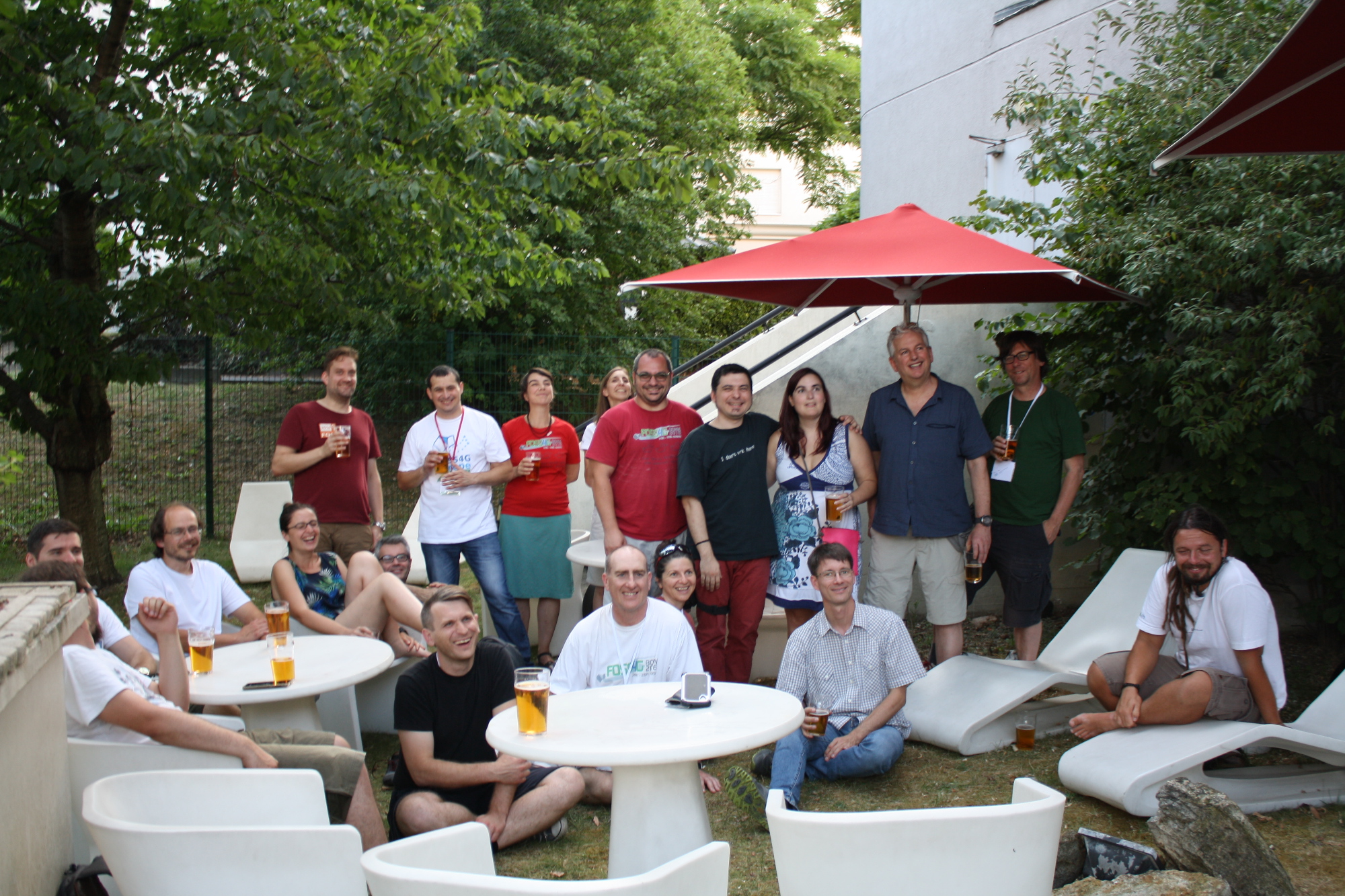
With the OSGeo family at FOSS4G Europe, July 2017, in Paris
Receiving the 2016 Sol Katz Award, at FOSS4G Bonn, on 2016-08-26.
With Venka at FOSS4G Seoul, Sept 2015. Two of the founders of FOSS4G.
With the ZOO family at FOSS4G Europe, July 2014
Having a sushi lunch at FOSS4G Tokyo 2008
Memories of meeting the "boy genius" at FOSS4G 2006 (pic is from OpenLayers sprint 2007)
Jeff McKenna is one of the 3 original founders of the global FOSS4G event, which has spread all across the globe, and he has traveled to over 500+ FOSS4G events of all sizes (which means he has almost 1,000 FOSS4G t-shirts). He is the President Emeritus of OSGeo, and has his own consulting company based around FOSS4G, GatewayGeo. He has been actively contributing to OSGeo since its formation.
- one of the 3 original founders of the global FOSS4G event
- Winner of the 2016 Sol Katz Award, for longtime leadership in the OSGeo and FOSS4G communities
- named as the President of OSGeo, Dec '12, retired in Dec '15
- named to the OSGeo Board of Directors, Sept '09 (served until Feb '12), re-elected Aug '12, re-elected Aug '14, re-elected Oct '17
- Founder of the Sol Katz Award, and managed that from 2005-2015, 2017+
- Founding and Charter member of OSGeo
- Founding chair of the UN committee for OSGeo
- Founder of the UN GGIM working group for OSGeo
- Member of the Geo for All Advisory Board
- Member of OSGeo's Google Summer of Code 2017 & 2018 Administrative teams
- Founding member of OSGeo's Google Code-in 2017 Administrative team, and also part of 2018 admin team
- involved in the creation of the Code of Conduct committee for OSGeo
- Founding member of the Open GeoScience committee for OSGeo
- FOSS4G conference committee chair (2006-2012)
- FOSS4G Workshop committee member (2004-2011)
- Developer of MS4W
- One of the founding developers of OSGeo4W
- MapServer Project Steering Committee (PSC) member
- MapServer documentation lead
- founding co-chair of the Ottawa Chapter of OSGeo
- ZOO-Project Project Steering Committee (PSC) member
- ZOO-Project documentation contributor
- mentor for the pycsw Project for the OSGeo Incubation process
- mentor for the istSOS Project for the OSGeo Incubation process
- founding member of the Atlantic Canada Chapter of OSGeo
- 2011-2012 vice president of the Nova Scotia Geomatics Association
- member of the Open Geospatial Consortium from 2010-present
- member of the QGIS Community
contact:
- email: jmckenna(at)osgeo(dot)org
- Twitter: @mapserving
- IRC username - jmckenna on freenode.net
- Linkedin: http://www.linkedin.com/in/jeffmckenna
Map of OSGeo Members
Loading map...
{"format":"leaflet","minzoom":false,"maxzoom":false,"limit":10000,"offset":0,"link":"all","sort":[""],"order":[],"headers":"show","mainlabel":"","intro":"","outro":"","searchlabel":"... further results","default":"","import-annotation":false,"width":"auto","height":"480px","centre":false,"title":"","label":"","icon":"","lines":[],"polygons":[],"circles":[],"rectangles":[],"copycoords":false,"static":false,"zoom":false,"defzoom":14,"layers":["OpenStreetMap"],"image layers":[],"overlays":[],"resizable":false,"fullscreen":false,"scrollwheelzoom":true,"cluster":false,"clustermaxzoom":20,"clusterzoomonclick":true,"clustermaxradius":80,"clusterspiderfy":true,"geojson":"","clicktarget":"","showtitle":true,"hidenamespace":true,"template":"","userparam":"","activeicon":"","pagelabel":false,"ajaxcoordproperty":"","ajaxquery":"","locations":[{"text":"\u003Cb\u003E\u003Ca href=\"/wiki/0x48piraj\" title=\"0x48piraj\"\u003E0x48piraj\u003C/a\u003E\u003C/b\u003E\u003Chr /\u003E\u003Ca href=\"/wiki/Property:Name\" title=\"Property:Name\"\u003EName\u003C/a\u003E: Piyush Raj\u003Cbr /\u003E\u003Ca href=\"/wiki/Property:Address\" title=\"Property:Address\"\u003EAddress\u003C/a\u003E: 127.0.0.1\u003Cbr /\u003E\u003Ca href=\"/wiki/Property:City\" title=\"Property:City\"\u003ECity\u003C/a\u003E: Jaipur\u003Cbr /\u003E\u003Ca href=\"/wiki/Property:State\" title=\"Property:State\"\u003EState\u003C/a\u003E: Rajasthan\u003Cbr /\u003E\u003Ca href=\"/wiki/Property:Country\" title=\"Property:Country\"\u003ECountry\u003C/a\u003E: \u003Ca href=\"/wiki/India\" title=\"India\"\u003EIndia\u003C/a\u003E\u003Cbr /\u003E\u003Ca href=\"/wiki/Property:LocalChapter\" title=\"Property:LocalChapter\"\u003ELocalChapter\u003C/a\u003E: \u003Ca href=\"/wiki/India\" title=\"India\"\u003EIndia\u003C/a\u003E\u003Cbr /\u003E\u003Ca href=\"/wiki/Property:Website\" title=\"Property:Website\"\u003EWebsite\u003C/a\u003E: \u003Ca class=\"external\" rel=\"nofollow\" href=\"https://pwninthehole.com/\"\u003Ehttps://pwninthehole.com/\u003C/a\u003E\u003Cbr /\u003E\u003Cspan class=\"smw-highlighter\" data-type=\"1\" data-state=\"inline\" data-title=\"Property\" title=\"This property is a special property in this wiki.\"\u003E\u003Cspan class=\"smwbuiltin\"\u003E\u003Ca href=\"/wiki/Property:Email\" title=\"Property:Email\"\u003EEmail\u003C/a\u003E\u003C/span\u003E\u003Cspan class=\"smwttcontent\"\u003EThis property is a special property in this wiki.\u003C/span\u003E\u003C/span\u003E: \u003Ca class=\"external\" rel=\"nofollow\" href=\"mailto:piyush@linuxmail.org\"\u003Epiyush@linuxmail.org\u003C/a\u003E","title":"0x48piraj","link":"","lat":20.5937,"lon":78.9629,"icon":""},{"text":"\u003Cb\u003E\u003Ca href=\"/wiki/User:13scoter\" title=\"User:13scoter\"\u003E13scoter\u003C/a\u003E\u003C/b\u003E\u003Chr /\u003E\u003Ca href=\"/wiki/Property:Name\" title=\"Property:Name\"\u003EName\u003C/a\u003E: Scott Hatcher\u003Cbr /\u003E\u003Ca href=\"/wiki/Property:City\" title=\"Property:City\"\u003ECity\u003C/a\u003E: Raglan\u003Cbr /\u003E\u003Ca href=\"/wiki/Property:State\" title=\"Property:State\"\u003EState\u003C/a\u003E: Waikato\u003Cbr /\u003E\u003Ca href=\"/wiki/Property:Country\" title=\"Property:Country\"\u003ECountry\u003C/a\u003E: \u003Ca href=\"/w/index.php?title=New_Zealand\u0026amp;action=edit\u0026amp;redlink=1\" class=\"new\" title=\"New Zealand (page does not exist)\"\u003ENew Zealand\u003C/a\u003E\u003Cbr /\u003E\u003Ca href=\"/wiki/Property:LocalChapter\" title=\"Property:LocalChapter\"\u003ELocalChapter\u003C/a\u003E: \u003Ca href=\"/wiki/Aust-NZ\" title=\"Aust-NZ\"\u003EAust-NZ\u003C/a\u003E\u003Cbr /\u003E\u003Cspan class=\"smw-highlighter\" data-type=\"1\" data-state=\"inline\" data-title=\"Property\" title=\"This property is a special property in this wiki.\"\u003E\u003Cspan class=\"smwbuiltin\"\u003E\u003Ca href=\"/wiki/Property:Email\" title=\"Property:Email\"\u003EEmail\u003C/a\u003E\u003C/span\u003E\u003Cspan class=\"smwttcontent\"\u003EThis property is a special property in this wiki.\u003C/span\u003E\u003C/span\u003E: \u003Ca class=\"external\" rel=\"nofollow\" href=\"mailto:scott.v.hatcher@gmail.com\"\u003Escott.v.hatcher@gmail.com\u003C/a\u003E","title":"13scoter","link":"","lat":-37.8014,"lon":174.8718,"icon":""},{"text":"\u003Cb\u003E\u003Ca href=\"/wiki/18ttruongk\" title=\"18ttruongk\"\u003E18ttruongk\u003C/a\u003E\u003C/b\u003E\u003Chr /\u003E\u003Ca href=\"/wiki/Property:Name\" title=\"Property:Name\"\u003EName\u003C/a\u003E: Tri Truong\u003Cbr /\u003E\u003Ca href=\"/wiki/Property:Address\" title=\"Property:Address\"\u003EAddress\u003C/a\u003E: 13090 Magnolia St\u003Cbr /\u003E\u003Ca href=\"/wiki/Property:City\" title=\"Property:City\"\u003ECity\u003C/a\u003E: Westminster\u003Cbr /\u003E\u003Ca href=\"/wiki/Property:State\" title=\"Property:State\"\u003EState\u003C/a\u003E: CA\u003Cbr /\u003E\u003Ca href=\"/wiki/Property:Country\" title=\"Property:Country\"\u003ECountry\u003C/a\u003E: \u003Ca href=\"/w/index.php?title=United_States\u0026amp;action=edit\u0026amp;redlink=1\" class=\"new\" title=\"United States (page does not exist)\"\u003EUnited States\u003C/a\u003E\u003Cbr /\u003E\u003Ca href=\"/wiki/Property:LocalChapter\" title=\"Property:LocalChapter\"\u003ELocalChapter\u003C/a\u003E: \u003Ca href=\"/w/index.php?title=California_Chapter\u0026amp;action=edit\u0026amp;redlink=1\" class=\"new\" title=\"California Chapter (page does not exist)\"\u003ECalifornia Chapter\u003C/a\u003E\u003Cbr /\u003E\u003Cspan class=\"smw-highlighter\" data-type=\"1\" data-state=\"inline\" data-title=\"Property\" title=\"This property is a special property in this wiki.\"\u003E\u003Cspan class=\"smwbuiltin\"\u003E\u003Ca href=\"/wiki/Property:Email\" title=\"Property:Email\"\u003EEmail\u003C/a\u003E\u003C/span\u003E\u003Cspan class=\"smwttcontent\"\u003EThis property is a special property in this wiki.\u003C/span\u003E\u003C/span\u003E: \u003Ca class=\"external\" rel=\"nofollow\" href=\"mailto:18ttruongk@gmail.com\"\u003E18ttruongk@gmail.com\u003C/a\u003E","title":"18ttruongk","link":"","lat":33.77,"lon":-117.97,"icon":""},{"text":"\u003Cb\u003E\u003Ca href=\"/wiki/User:42islife\" title=\"User:42islife\"\u003E42islife\u003C/a\u003E\u003C/b\u003E\u003Chr /\u003E\u003Ca href=\"/wiki/Property:Name\" title=\"Property:Name\"\u003EName\u003C/a\u003E: Vrishank Paladugu\u003Cbr /\u003E\u003Ca href=\"/wiki/Property:Address\" title=\"Property:Address\"\u003EAddress\u003C/a\u003E: 11 N 4th St, St. Louis\u003Cbr /\u003E\u003Ca href=\"/wiki/Property:City\" title=\"Property:City\"\u003ECity\u003C/a\u003E: St.louis\u003Cbr /\u003E\u003Ca href=\"/wiki/Property:State\" title=\"Property:State\"\u003EState\u003C/a\u003E: Missouri\u003Cbr /\u003E\u003Ca href=\"/wiki/Property:Country\" title=\"Property:Country\"\u003ECountry\u003C/a\u003E: \u003Ca href=\"/w/index.php?title=United_States\u0026amp;action=edit\u0026amp;redlink=1\" class=\"new\" title=\"United States (page does not exist)\"\u003EUnited States\u003C/a\u003E\u003Cbr /\u003E\u003Ca href=\"/wiki/Property:Website\" title=\"Property:Website\"\u003EWebsite\u003C/a\u003E: \u003Ca class=\"external\" rel=\"nofollow\" href=\"http://www.osgeo.org\"\u003Ehttp://www.osgeo.org\u003C/a\u003E","title":"42islife","link":"","lat":38.625674,"lon":-90.189274,"icon":""},{"text":"\u003Cb\u003E\u003Ca href=\"/wiki/User:A_Pushpendra\" title=\"User:A Pushpendra\"\u003EA Pushpendra\u003C/a\u003E\u003C/b\u003E\u003Chr /\u003E\u003Ca href=\"/wiki/Property:Name\" title=\"Property:Name\"\u003EName\u003C/a\u003E: A Pushpendra\u003Cbr /\u003E\u003Ca href=\"/wiki/Property:City\" title=\"Property:City\"\u003ECity\u003C/a\u003E: Bhubaneswar\u003Cbr /\u003E\u003Ca href=\"/wiki/Property:State\" title=\"Property:State\"\u003EState\u003C/a\u003E: Odisha\u003Cbr /\u003E\u003Ca href=\"/wiki/Property:Country\" title=\"Property:Country\"\u003ECountry\u003C/a\u003E: \u003Ca href=\"/wiki/India\" title=\"India\"\u003EIndia\u003C/a\u003E\u003Cbr /\u003E\u003Ca href=\"/wiki/Property:LocalChapter\" title=\"Property:LocalChapter\"\u003ELocalChapter\u003C/a\u003E: \u003Ca href=\"/wiki/India\" title=\"India\"\u003EIndia\u003C/a\u003E","title":"A Pushpendra","link":"","lat":20.2960587,"lon":85.8245398,"icon":""},{"text":"\u003Cb\u003E\u003Ca href=\"/wiki/User:ADennison\" title=\"User:ADennison\"\u003EADennison\u003C/a\u003E\u003C/b\u003E\u003Chr /\u003E\u003Ca href=\"/wiki/Property:Name\" title=\"Property:Name\"\u003EName\u003C/a\u003E: Andrew_Dennison\u003Cbr /\u003E\u003Ca href=\"/wiki/Property:Address\" title=\"Property:Address\"\u003EAddress\u003C/a\u003E: Australia","title":"ADennison","link":"","lat":-31.938359,"lon":115.842614,"icon":""},{"text":"\u003Cb\u003E\u003Ca href=\"/wiki/User:Aaime\" title=\"User:Aaime\"\u003EAaime\u003C/a\u003E\u003C/b\u003E\u003Chr /\u003E\u003Ca href=\"/wiki/Property:Name\" title=\"Property:Name\"\u003EName\u003C/a\u003E: Andrea Aime\u003Cbr /\u003E\u003Ca href=\"/wiki/Property:Address\" title=\"Property:Address\"\u003EAddress\u003C/a\u003E: Reggiolo","title":"Aaime","link":"","lat":44.92,"lon":10.81,"icon":""},{"text":"\u003Cb\u003E\u003Ca href=\"/wiki/User:Aanthieni\" title=\"User:Aanthieni\"\u003EAanthieni\u003C/a\u003E\u003C/b\u003E\u003Chr /\u003E\u003Ca href=\"/wiki/Property:Name\" title=\"Property:Name\"\u003EName\u003C/a\u003E: Ariel Anthieni\u003Cbr /\u003E\u003Ca href=\"/wiki/Property:City\" title=\"Property:City\"\u003ECity\u003C/a\u003E: CABA\u003Cbr /\u003E\u003Ca href=\"/wiki/Property:State\" title=\"Property:State\"\u003EState\u003C/a\u003E: CABA\u003Cbr /\u003E\u003Ca href=\"/wiki/Property:Country\" title=\"Property:Country\"\u003ECountry\u003C/a\u003E: \u003Ca href=\"/wiki/Argentina\" title=\"Argentina\"\u003EArgentina\u003C/a\u003E\u003Cbr /\u003E\u003Ca href=\"/wiki/Property:LocalChapter\" title=\"Property:LocalChapter\"\u003ELocalChapter\u003C/a\u003E: \u003Ca href=\"/w/index.php?title=Argentinia\u0026amp;action=edit\u0026amp;redlink=1\" class=\"new\" title=\"Argentinia (page does not exist)\"\u003EArgentinia\u003C/a\u003E\u003Cbr /\u003E\u003Ca href=\"/wiki/Property:Website\" title=\"Property:Website\"\u003EWebsite\u003C/a\u003E: \u003Ca class=\"external\" rel=\"nofollow\" href=\"https://wiki.osgeo.org/wiki/User:Aanthieni\"\u003Ehttps://wiki.osgeo.org/wiki/User:Aanthieni\u003C/a\u003E\u003Cbr /\u003E\u003Cspan class=\"smw-highlighter\" data-type=\"1\" data-state=\"inline\" data-title=\"Property\" title=\"This property is a special property in this wiki.\"\u003E\u003Cspan class=\"smwbuiltin\"\u003E\u003Ca href=\"/wiki/Property:Email\" title=\"Property:Email\"\u003EEmail\u003C/a\u003E\u003C/span\u003E\u003Cspan class=\"smwttcontent\"\u003EThis property is a special property in this wiki.\u003C/span\u003E\u003C/span\u003E: \u003Ca class=\"external\" rel=\"nofollow\" href=\"mailto:aanthieni@kan.com.ar\"\u003Eaanthieni@kan.com.ar\u003C/a\u003E","title":"Aanthieni","link":"","lat":-34.622071,"lon":-58.377138,"icon":""},{"text":"\u003Cb\u003E\u003Ca href=\"/wiki/User:Abdiel\" title=\"User:Abdiel\"\u003EAbdiel\u003C/a\u003E\u003C/b\u003E\u003Chr /\u003E\u003Ca href=\"/wiki/Property:Name\" title=\"Property:Name\"\u003EName\u003C/a\u003E: Abdiel Cruz Robaina\u003Cbr /\u003E\u003Ca href=\"/wiki/Property:Address\" title=\"Property:Address\"\u003EAddress\u003C/a\u003E: La Habana","title":"Abdiel","link":"","lat":23.13218,"lon":-82.35881,"icon":""},{"text":"\u003Cb\u003E\u003Ca href=\"/wiki/Abhinav_Raj\" title=\"Abhinav Raj\"\u003EAbhinav Raj\u003C/a\u003E\u003C/b\u003E\u003Chr /\u003E\u003Ca href=\"/wiki/Property:Name\" title=\"Property:Name\"\u003EName\u003C/a\u003E: Abhinav Raj\u003Cbr /\u003E\u003Ca href=\"/wiki/Property:Address\" title=\"Property:Address\"\u003EAddress\u003C/a\u003E: Gobaria Bawari\u003Cbr /\u003E\u003Ca href=\"/wiki/Property:City\" title=\"Property:City\"\u003ECity\u003C/a\u003E: Kota\u003Cbr /\u003E\u003Ca href=\"/wiki/Property:State\" title=\"Property:State\"\u003EState\u003C/a\u003E: Rajasthan\u003Cbr /\u003E\u003Ca href=\"/wiki/Property:Country\" title=\"Property:Country\"\u003ECountry\u003C/a\u003E: \u003Ca href=\"/wiki/India\" title=\"India\"\u003EIndia\u003C/a\u003E","title":"Abhinav Raj","link":"","lat":28.022074,"lon":73.319271,"icon":""},{"text":"\u003Cb\u003E\u003Ca href=\"/wiki/User:Abhinj\" title=\"User:Abhinj\"\u003EAbhinj\u003C/a\u003E\u003C/b\u003E\u003Chr /\u003E\u003Ca href=\"/wiki/Property:Name\" title=\"Property:Name\"\u003EName\u003C/a\u003E: Abhinav Jain\u003Cbr /\u003E\u003Ca href=\"/wiki/Property:City\" title=\"Property:City\"\u003ECity\u003C/a\u003E: Phillaur\u003Cbr /\u003E\u003Ca href=\"/wiki/Property:State\" title=\"Property:State\"\u003EState\u003C/a\u003E: Punjab\u003Cbr /\u003E\u003Ca href=\"/wiki/Property:Country\" title=\"Property:Country\"\u003ECountry\u003C/a\u003E: \u003Ca href=\"/wiki/India\" title=\"India\"\u003EIndia\u003C/a\u003E\u003Cbr /\u003E\u003Ca href=\"/wiki/Property:LocalChapter\" title=\"Property:LocalChapter\"\u003ELocalChapter\u003C/a\u003E: \u003Ca href=\"/wiki/India\" title=\"India\"\u003EIndia\u003C/a\u003E","title":"Abhinj","link":"","lat":31.019,"lon":75.7879,"icon":""},{"text":"\u003Cb\u003E\u003Ca href=\"/wiki/User:Aborrell\" title=\"User:Aborrell\"\u003EAborrell\u003C/a\u003E\u003C/b\u003E\u003Chr /\u003E\u003Ca href=\"/wiki/Property:Name\" title=\"Property:Name\"\u003EName\u003C/a\u003E: alex borrell\u003Cbr /\u003E\u003Ca href=\"/wiki/Property:Address\" title=\"Property:Address\"\u003EAddress\u003C/a\u003E: Zapopan, Mexico","title":"Aborrell","link":"","lat":20.67,"lon":-103.41,"icon":""},{"text":"\u003Cb\u003E\u003Ca href=\"/wiki/Aculver1405\" title=\"Aculver1405\"\u003EAculver1405\u003C/a\u003E\u003C/b\u003E\u003Chr /\u003E\u003Ca href=\"/wiki/Property:Name\" title=\"Property:Name\"\u003EName\u003C/a\u003E: Tyler Culver\u003Cbr /\u003E\u003Ca href=\"/wiki/Property:City\" title=\"Property:City\"\u003ECity\u003C/a\u003E: Vancouver\u003Cbr /\u003E\u003Ca href=\"/wiki/Property:State\" title=\"Property:State\"\u003EState\u003C/a\u003E: Wa\u003Cbr /\u003E\u003Ca href=\"/wiki/Property:Country\" title=\"Property:Country\"\u003ECountry\u003C/a\u003E: \u003Ca href=\"/w/index.php?title=US\u0026amp;action=edit\u0026amp;redlink=1\" class=\"new\" title=\"US (page does not exist)\"\u003EUS\u003C/a\u003E","title":"Aculver1405","link":"","lat":45.6318,"lon":-122.6716,"icon":""},{"text":"\u003Cb\u003E\u003Ca href=\"/wiki/User:Adamhusain12\" title=\"User:Adamhusain12\"\u003EAdamhusain12\u003C/a\u003E\u003C/b\u003E\u003Chr /\u003E\u003Ca href=\"/wiki/Property:Name\" title=\"Property:Name\"\u003EName\u003C/a\u003E: Adam Husain\u003Cbr /\u003E\u003Ca href=\"/wiki/Property:City\" title=\"Property:City\"\u003ECity\u003C/a\u003E: Muscat\u003Cbr /\u003E\u003Ca href=\"/wiki/Property:Country\" title=\"Property:Country\"\u003ECountry\u003C/a\u003E: \u003Ca href=\"/w/index.php?title=Oman\u0026amp;action=edit\u0026amp;redlink=1\" class=\"new\" title=\"Oman (page does not exist)\"\u003EOman\u003C/a\u003E","title":"Adamhusain12","link":"","lat":23.5,"lon":58.4,"icon":""},{"text":"\u003Cb\u003E\u003Ca href=\"/wiki/User:Adamsteer\" title=\"User:Adamsteer\"\u003EAdamsteer\u003C/a\u003E\u003C/b\u003E\u003Chr /\u003E\u003Ca href=\"/wiki/Property:Name\" title=\"Property:Name\"\u003EName\u003C/a\u003E: Adam Steer\u003Cbr /\u003E\u003Ca href=\"/wiki/Property:City\" title=\"Property:City\"\u003ECity\u003C/a\u003E: Troms\u00f8\u003Cbr /\u003E\u003Ca href=\"/wiki/Property:State\" title=\"Property:State\"\u003EState\u003C/a\u003E: Troms\u003Cbr /\u003E\u003Ca href=\"/wiki/Property:Country\" title=\"Property:Country\"\u003ECountry\u003C/a\u003E: \u003Ca href=\"/w/index.php?title=Norway\u0026amp;action=edit\u0026amp;redlink=1\" class=\"new\" title=\"Norway (page does not exist)\"\u003ENorway\u003C/a\u003E\u003Cbr /\u003E\u003Ca href=\"/wiki/Property:LocalChapter\" title=\"Property:LocalChapter\"\u003ELocalChapter\u003C/a\u003E: \u003Ca href=\"/w/index.php?title=Norway\u0026amp;action=edit\u0026amp;redlink=1\" class=\"new\" title=\"Norway (page does not exist)\"\u003ENorway\u003C/a\u003E\u003Cbr /\u003E\u003Ca href=\"/wiki/Property:Website\" title=\"Property:Website\"\u003EWebsite\u003C/a\u003E: \u003Ca class=\"external\" rel=\"nofollow\" href=\"http://spatialised.net\"\u003Ehttp://spatialised.net\u003C/a\u003E\u003Cbr /\u003E\u003Cspan class=\"smw-highlighter\" data-type=\"1\" data-state=\"inline\" data-title=\"Property\" title=\"This property is a special property in this wiki.\"\u003E\u003Cspan class=\"smwbuiltin\"\u003E\u003Ca href=\"/wiki/Property:Email\" title=\"Property:Email\"\u003EEmail\u003C/a\u003E\u003C/span\u003E\u003Cspan class=\"smwttcontent\"\u003EThis property is a special property in this wiki.\u003C/span\u003E\u003C/span\u003E: \u003Ca class=\"external\" rel=\"nofollow\" href=\"mailto:adam.d.steer@gmail.com\"\u003Eadam.d.steer@gmail.com\u003C/a\u003E","title":"Adamsteer","link":"","lat":69.694,"lon":18.955,"icon":""},{"text":"\u003Cb\u003E\u003Ca href=\"/wiki/User:Adesinausman\" title=\"User:Adesinausman\"\u003EAdesinausman\u003C/a\u003E\u003C/b\u003E\u003Chr /\u003E\u003Ca href=\"/wiki/Property:Name\" title=\"Property:Name\"\u003EName\u003C/a\u003E: Adesina usman\u003Cbr /\u003E\u003Ca href=\"/wiki/Property:City\" title=\"Property:City\"\u003ECity\u003C/a\u003E: Osogbo\u003Cbr /\u003E\u003Ca href=\"/wiki/Property:State\" title=\"Property:State\"\u003EState\u003C/a\u003E: Osun\u003Cbr /\u003E\u003Ca href=\"/wiki/Property:Country\" title=\"Property:Country\"\u003ECountry\u003C/a\u003E: \u003Ca href=\"/wiki/Nigeria\" title=\"Nigeria\"\u003ENigeria\u003C/a\u003E\u003Cbr /\u003E\u003Cspan class=\"smw-highlighter\" data-type=\"1\" data-state=\"inline\" data-title=\"Property\" title=\"This property is a special property in this wiki.\"\u003E\u003Cspan class=\"smwbuiltin\"\u003E\u003Ca href=\"/wiki/Property:Email\" title=\"Property:Email\"\u003EEmail\u003C/a\u003E\u003C/span\u003E\u003Cspan class=\"smwttcontent\"\u003EThis property is a special property in this wiki.\u003C/span\u003E\u003C/span\u003E: \u003Ca class=\"external\" rel=\"nofollow\" href=\"mailto:Maxphelon@gmail.com\"\u003EMaxphelon@gmail.com\u003C/a\u003E","title":"Adesinausman","link":"","lat":7.7511763,"lon":4.5679913,"icon":""},{"text":"\u003Cb\u003E\u003Ca href=\"/wiki/User:Adiez\" title=\"User:Adiez\"\u003EAdiez\u003C/a\u003E\u003C/b\u003E\u003Chr /\u003E\u003Ca href=\"/wiki/Property:Name\" title=\"Property:Name\"\u003EName\u003C/a\u003E: Agust\u00edn Diez Castillo\u003Cbr /\u003E\u003Ca href=\"/wiki/Property:City\" title=\"Property:City\"\u003ECity\u003C/a\u003E: Val\u00e8ncia\u003Cbr /\u003E\u003Ca href=\"/wiki/Property:Country\" title=\"Property:Country\"\u003ECountry\u003C/a\u003E: \u003Ca href=\"/w/index.php?title=Spain\u0026amp;action=edit\u0026amp;redlink=1\" class=\"new\" title=\"Spain (page does not exist)\"\u003ESpain\u003C/a\u003E\u003Cbr /\u003E\u003Ca href=\"/wiki/Property:LocalChapter\" title=\"Property:LocalChapter\"\u003ELocalChapter\u003C/a\u003E: \u003Ca href=\"/wiki/Cap%C3%ADtulo_Local_de_la_comunidad_hispano-hablante\" class=\"mw-redirect\" title=\"Cap\u00edtulo Local de la comunidad hispano-hablante\"\u003ECap\u00edtulo Local de la comunidad hispano-hablante\u003C/a\u003E","title":"Adiez","link":"","lat":39.6819591,"lon":-0.7654406,"icon":""},{"text":"\u003Cb\u003E\u003Ca href=\"/wiki/User:Adik\" title=\"User:Adik\"\u003EAdik\u003C/a\u003E\u003C/b\u003E\u003Chr /\u003E\u003Ca href=\"/wiki/Property:Name\" title=\"Property:Name\"\u003EName\u003C/a\u003E: Adrian Hassa\u003Cbr /\u003E\u003Ca href=\"/wiki/Property:City\" title=\"Property:City\"\u003ECity\u003C/a\u003E: Tarnowskie G\u00f3ry\u003Cbr /\u003E\u003Ca href=\"/wiki/Property:State\" title=\"Property:State\"\u003EState\u003C/a\u003E: \u015al\u0105skie\u003Cbr /\u003E\u003Ca href=\"/wiki/Property:Country\" title=\"Property:Country\"\u003ECountry\u003C/a\u003E: \u003Ca href=\"/w/index.php?title=Polska\u0026amp;action=edit\u0026amp;redlink=1\" class=\"new\" title=\"Polska (page does not exist)\"\u003EPolska\u003C/a\u003E\u003Cbr /\u003E\u003Ca href=\"/wiki/Property:LocalChapter\" title=\"Property:LocalChapter\"\u003ELocalChapter\u003C/a\u003E: \u003Ca href=\"/wiki/Poland\" title=\"Poland\"\u003EPoland\u003C/a\u003E","title":"Adik","link":"","lat":50.449099,"lon":18.878708,"icon":""},{"text":"\u003Cb\u003E\u003Ca href=\"/wiki/User:Aditi_Sawant\" title=\"User:Aditi Sawant\"\u003EAditi Sawant\u003C/a\u003E\u003C/b\u003E\u003Chr /\u003E\u003Ca href=\"/wiki/Property:Name\" title=\"Property:Name\"\u003EName\u003C/a\u003E: Aditi Mohan Sawant\u003Cbr /\u003E\u003Ca href=\"/wiki/Property:Address\" title=\"Property:Address\"\u003EAddress\u003C/a\u003E: IIT Bombay, Powai, Mumbai\u003Cbr /\u003E\u003Ca href=\"/wiki/Property:City\" title=\"Property:City\"\u003ECity\u003C/a\u003E: Mumbai\u003Cbr /\u003E\u003Ca href=\"/wiki/Property:State\" title=\"Property:State\"\u003EState\u003C/a\u003E: Maharashtra\u003Cbr /\u003E\u003Ca href=\"/wiki/Property:Country\" title=\"Property:Country\"\u003ECountry\u003C/a\u003E: \u003Ca href=\"/wiki/India\" title=\"India\"\u003EIndia\u003C/a\u003E\u003Cbr /\u003E\u003Ca href=\"/wiki/Property:LocalChapter\" title=\"Property:LocalChapter\"\u003ELocalChapter\u003C/a\u003E: \u003Ca href=\"/wiki/India\" title=\"India\"\u003EIndia\u003C/a\u003E\u003Cbr /\u003E\u003Ca href=\"/wiki/Property:Website\" title=\"Property:Website\"\u003EWebsite\u003C/a\u003E: \u003Ca class=\"external\" rel=\"nofollow\" href=\"https://wiki.osgeo.org/wiki/User:Aditi_Sawant\"\u003Ehttps://wiki.osgeo.org/wiki/User:Aditi Sawant\u003C/a\u003E\u003Cbr /\u003E\u003Cspan class=\"smw-highlighter\" data-type=\"1\" data-state=\"inline\" data-title=\"Property\" title=\"This property is a special property in this wiki.\"\u003E\u003Cspan class=\"smwbuiltin\"\u003E\u003Ca href=\"/wiki/Property:Email\" title=\"Property:Email\"\u003EEmail\u003C/a\u003E\u003C/span\u003E\u003Cspan class=\"smwttcontent\"\u003EThis property is a special property in this wiki.\u003C/span\u003E\u003C/span\u003E: \u003Ca class=\"external\" rel=\"nofollow\" href=\"mailto:aditisawant007@gmail.com\"\u003Eaditisawant007@gmail.com\u003C/a\u003E","title":"Aditi Sawant","link":"","lat":19.137796,"lon":72.914282,"icon":""},{"text":"\u003Cb\u003E\u003Ca href=\"/wiki/User:Aditya_Chondke\" title=\"User:Aditya Chondke\"\u003EAditya Chondke\u003C/a\u003E\u003C/b\u003E\u003Chr /\u003E\u003Ca href=\"/wiki/Property:Name\" title=\"Property:Name\"\u003EName\u003C/a\u003E: Aditya Chondke\u003Cbr /\u003E\u003Ca href=\"/wiki/Property:Address\" title=\"Property:Address\"\u003EAddress\u003C/a\u003E: Indian Institute of Technology Bombay\u003Cbr /\u003E\u003Ca href=\"/wiki/Property:City\" title=\"Property:City\"\u003ECity\u003C/a\u003E: Mumbai\u003Cbr /\u003E\u003Ca href=\"/wiki/Property:State\" title=\"Property:State\"\u003EState\u003C/a\u003E: Maharashtra\u003Cbr /\u003E\u003Ca href=\"/wiki/Property:Country\" title=\"Property:Country\"\u003ECountry\u003C/a\u003E: \u003Ca href=\"/wiki/India\" title=\"India\"\u003EIndia\u003C/a\u003E\u003Cbr /\u003E\u003Ca href=\"/wiki/Property:LocalChapter\" title=\"Property:LocalChapter\"\u003ELocalChapter\u003C/a\u003E: \u003Ca href=\"/wiki/India\" title=\"India\"\u003EIndia\u003C/a\u003E\u003Cbr /\u003E\u003Ca href=\"/wiki/Property:Website\" title=\"Property:Website\"\u003EWebsite\u003C/a\u003E: \u003Ca class=\"external\" rel=\"nofollow\" href=\"https://wiki.osgeo.org/wiki/User:Aditya_Chondke\"\u003Ehttps://wiki.osgeo.org/wiki/User:Aditya Chondke\u003C/a\u003E\u003Cbr /\u003E\u003Cspan class=\"smw-highlighter\" data-type=\"1\" data-state=\"inline\" data-title=\"Property\" title=\"This property is a special property in this wiki.\"\u003E\u003Cspan class=\"smwbuiltin\"\u003E\u003Ca href=\"/wiki/Property:Email\" title=\"Property:Email\"\u003EEmail\u003C/a\u003E\u003C/span\u003E\u003Cspan class=\"smwttcontent\"\u003EThis property is a special property in this wiki.\u003C/span\u003E\u003C/span\u003E: \u003Ca class=\"external\" rel=\"nofollow\" href=\"mailto:adityachondke96@gmail.com\"\u003Eadityachondke96@gmail.com\u003C/a\u003E","title":"Aditya Chondke","link":"","lat":19.134385,"lon":72.905793,"icon":""},{"text":"\u003Cb\u003E\u003Ca href=\"/wiki/User:Adityabhinge\" title=\"User:Adityabhinge\"\u003EAdityabhinge\u003C/a\u003E\u003C/b\u003E\u003Chr /\u003E\u003Ca href=\"/wiki/Property:Name\" title=\"Property:Name\"\u003EName\u003C/a\u003E: Aditya Bhinge\u003Cbr /\u003E\u003Ca href=\"/wiki/Property:Address\" title=\"Property:Address\"\u003EAddress\u003C/a\u003E: hadapsar\u003Cbr /\u003E\u003Ca href=\"/wiki/Property:City\" title=\"Property:City\"\u003ECity\u003C/a\u003E: pune\u003Cbr /\u003E\u003Ca href=\"/wiki/Property:State\" title=\"Property:State\"\u003EState\u003C/a\u003E: maharashtra\u003Cbr /\u003E\u003Ca href=\"/wiki/Property:Country\" title=\"Property:Country\"\u003ECountry\u003C/a\u003E: \u003Ca href=\"/wiki/India\" title=\"India\"\u003EIndia\u003C/a\u003E\u003Cbr /\u003E\u003Ca href=\"/wiki/Property:LocalChapter\" title=\"Property:LocalChapter\"\u003ELocalChapter\u003C/a\u003E: \u003Ca href=\"/wiki/India\" title=\"India\"\u003EIndia\u003C/a\u003E\u003Cbr /\u003E\u003Cspan class=\"smw-highlighter\" data-type=\"1\" data-state=\"inline\" data-title=\"Property\" title=\"This property is a special property in this wiki.\"\u003E\u003Cspan class=\"smwbuiltin\"\u003E\u003Ca href=\"/wiki/Property:Email\" title=\"Property:Email\"\u003EEmail\u003C/a\u003E\u003C/span\u003E\u003Cspan class=\"smwttcontent\"\u003EThis property is a special property in this wiki.\u003C/span\u003E\u003C/span\u003E: \u003Ca class=\"external\" rel=\"nofollow\" href=\"mailto:adityabhinge94@gmail.com\"\u003Eadityabhinge94@gmail.com\u003C/a\u003E","title":"Adityabhinge","link":"","lat":18.5009914,"lon":73.9407009,"icon":""},{"text":"\u003Cb\u003E\u003Ca href=\"/wiki/User:Afabiani\" title=\"User:Afabiani\"\u003EAfabiani\u003C/a\u003E\u003C/b\u003E\u003Chr /\u003E\u003Ca href=\"/wiki/Property:Name\" title=\"Property:Name\"\u003EName\u003C/a\u003E: Alessio Fabiani\u003Cbr /\u003E\u003Ca href=\"/wiki/Property:Address\" title=\"Property:Address\"\u003EAddress\u003C/a\u003E: Massarosa, Lucca, Italia\u003Cbr /\u003E\u003Ca href=\"/wiki/Property:City\" title=\"Property:City\"\u003ECity\u003C/a\u003E: Massarosa\u003Cbr /\u003E\u003Ca href=\"/wiki/Property:Country\" title=\"Property:Country\"\u003ECountry\u003C/a\u003E: \u003Ca href=\"/w/index.php?title=Italia\u0026amp;action=edit\u0026amp;redlink=1\" class=\"new\" title=\"Italia (page does not exist)\"\u003EItalia\u003C/a\u003E\u003Cbr /\u003E\u003Ca href=\"/wiki/Property:LocalChapter\" title=\"Property:LocalChapter\"\u003ELocalChapter\u003C/a\u003E: \u003Ca href=\"/wiki/Italiano\" title=\"Italiano\"\u003EItaliano\u003C/a\u003E\u003Cbr /\u003E\u003Ca href=\"/wiki/Property:Website\" title=\"Property:Website\"\u003EWebsite\u003C/a\u003E: \u003Ca class=\"external\" rel=\"nofollow\" href=\"http://geo-solutions.it/\"\u003Ehttp://geo-solutions.it/\u003C/a\u003E","title":"Afabiani","link":"","lat":43.8721,"lon":10.3374,"icon":""},{"text":"\u003Cb\u003E\u003Ca href=\"/wiki/Afabiani\" title=\"Afabiani\"\u003EAfabiani\u003C/a\u003E\u003C/b\u003E\u003Chr /\u003E\u003Ca href=\"/wiki/Property:Name\" title=\"Property:Name\"\u003EName\u003C/a\u003E: Alessio Fabiani\u003Cbr /\u003E\u003Ca href=\"/wiki/Property:Address\" title=\"Property:Address\"\u003EAddress\u003C/a\u003E: Massarosa, Lucca, Italia\u003Cbr /\u003E\u003Ca href=\"/wiki/Property:City\" title=\"Property:City\"\u003ECity\u003C/a\u003E: Massarosa\u003Cbr /\u003E\u003Ca href=\"/wiki/Property:State\" title=\"Property:State\"\u003EState\u003C/a\u003E: Italia (ITA)\u003Cbr /\u003E\u003Ca href=\"/wiki/Property:Country\" title=\"Property:Country\"\u003ECountry\u003C/a\u003E: \u003Ca href=\"/w/index.php?title=Italia\u0026amp;action=edit\u0026amp;redlink=1\" class=\"new\" title=\"Italia (page does not exist)\"\u003EItalia\u003C/a\u003E\u003Cbr /\u003E\u003Ca href=\"/wiki/Property:LocalChapter\" title=\"Property:LocalChapter\"\u003ELocalChapter\u003C/a\u003E: \u003Ca href=\"/wiki/Italiano\" title=\"Italiano\"\u003EItaliano\u003C/a\u003E\u003Cbr /\u003E\u003Ca href=\"/wiki/Property:Website\" title=\"Property:Website\"\u003EWebsite\u003C/a\u003E: \u003Ca class=\"external\" rel=\"nofollow\" href=\"http://www.geo-solutions.it\"\u003Ehttp://www.geo-solutions.it\u003C/a\u003E\u003Cbr /\u003E\u003Cspan class=\"smw-highlighter\" data-type=\"1\" data-state=\"inline\" data-title=\"Property\" title=\"This property is a special property in this wiki.\"\u003E\u003Cspan class=\"smwbuiltin\"\u003E\u003Ca href=\"/wiki/Property:Email\" title=\"Property:Email\"\u003EEmail\u003C/a\u003E\u003C/span\u003E\u003Cspan class=\"smwttcontent\"\u003EThis property is a special property in this wiki.\u003C/span\u003E\u003C/span\u003E: \u003Ca class=\"external\" rel=\"nofollow\" href=\"mailto:alessio.fabiani@geo-solutions.it\"\u003Ealessio.fabiani@geo-solutions.it\u003C/a\u003E","title":"Afabiani","link":"","lat":43.8721,"lon":10.3374,"icon":""},{"text":"\u003Cb\u003E\u003Ca href=\"/wiki/User:Aggarwalmehak\" title=\"User:Aggarwalmehak\"\u003EAggarwalmehak\u003C/a\u003E\u003C/b\u003E\u003Chr /\u003E\u003Ca href=\"/wiki/Property:Name\" title=\"Property:Name\"\u003EName\u003C/a\u003E: Mehak Aggarwal\u003Cbr /\u003E\u003Ca href=\"/wiki/Property:City\" title=\"Property:City\"\u003ECity\u003C/a\u003E: Yamunanagar\u003Cbr /\u003E\u003Ca href=\"/wiki/Property:State\" title=\"Property:State\"\u003EState\u003C/a\u003E: Haryana\u003Cbr /\u003E\u003Ca href=\"/wiki/Property:Country\" title=\"Property:Country\"\u003ECountry\u003C/a\u003E: \u003Ca href=\"/wiki/India\" title=\"India\"\u003EIndia\u003C/a\u003E\u003Cbr /\u003E\u003Ca href=\"/wiki/Property:LocalChapter\" title=\"Property:LocalChapter\"\u003ELocalChapter\u003C/a\u003E: \u003Ca href=\"/wiki/India\" title=\"India\"\u003EIndia\u003C/a\u003E","title":"Aggarwalmehak","link":"","lat":23.5,"lon":5.23,"icon":""},{"text":"\u003Cb\u003E\u003Ca href=\"/wiki/User:Aghisla\" title=\"User:Aghisla\"\u003EAghisla\u003C/a\u003E\u003C/b\u003E\u003Chr /\u003E\u003Ca href=\"/wiki/Property:Name\" title=\"Property:Name\"\u003EName\u003C/a\u003E: Anne Ghisla\u003Cbr /\u003E\u003Ca href=\"/wiki/Property:City\" title=\"Property:City\"\u003ECity\u003C/a\u003E: Berlin\u003Cbr /\u003E\u003Ca href=\"/wiki/Property:State\" title=\"Property:State\"\u003EState\u003C/a\u003E: Berlin\u003Cbr /\u003E\u003Ca href=\"/wiki/Property:Country\" title=\"Property:Country\"\u003ECountry\u003C/a\u003E: \u003Ca href=\"/w/index.php?title=Germany\u0026amp;action=edit\u0026amp;redlink=1\" class=\"new\" title=\"Germany (page does not exist)\"\u003EGermany\u003C/a\u003E\u003Cbr /\u003E\u003Ca href=\"/wiki/Property:LocalChapter\" title=\"Property:LocalChapter\"\u003ELocalChapter\u003C/a\u003E: \u003Ca href=\"/wiki/FOSSGIS_e.V.\" title=\"FOSSGIS e.V.\"\u003EFOSSGIS e.V.\u003C/a\u003E","title":"Aghisla","link":"","lat":52.5170365,"lon":13.3888599,"icon":""},{"text":"\u003Cb\u003E\u003Ca href=\"/wiki/User:Ahendry\" title=\"User:Ahendry\"\u003EAhendry\u003C/a\u003E\u003C/b\u003E\u003Chr /\u003E\u003Ca href=\"/wiki/Property:Name\" title=\"Property:Name\"\u003EName\u003C/a\u003E: Ahendry\u003Cbr /\u003E\u003Ca href=\"/wiki/Property:Address\" title=\"Property:Address\"\u003EAddress\u003C/a\u003E: Edinburgh Office","title":"Ahendry","link":"","lat":55.955,"lon":-3.223,"icon":""},{"text":"\u003Cb\u003E\u003Ca href=\"/wiki/User:Ahugenerd\" title=\"User:Ahugenerd\"\u003EAhugenerd\u003C/a\u003E\u003C/b\u003E\u003Chr /\u003E\u003Ca href=\"/wiki/Property:Name\" title=\"Property:Name\"\u003EName\u003C/a\u003E: St. Johns\u003Cbr /\u003E\u003Ca href=\"/wiki/Property:Address\" title=\"Property:Address\"\u003EAddress\u003C/a\u003E: St. Johns","title":"Ahugenerd","link":"","lat":47.5782,"lon":-52.7044,"icon":""},{"text":"\u003Cb\u003E\u003Ca href=\"/wiki/User:Ahunter\" title=\"User:Ahunter\"\u003EAhunter\u003C/a\u003E\u003C/b\u003E\u003Chr /\u003E\u003Ca href=\"/wiki/Property:Name\" title=\"Property:Name\"\u003EName\u003C/a\u003E: Andrew Hunter\u003Cbr /\u003E\u003Ca href=\"/wiki/Property:Address\" title=\"Property:Address\"\u003EAddress\u003C/a\u003E: Calgary, Canada","title":"Ahunter","link":"","lat":50.914666,"lon":-114.133333,"icon":""},{"text":"\u003Cb\u003E\u003Ca href=\"/wiki/User:Ajolma\" title=\"User:Ajolma\"\u003EAjolma\u003C/a\u003E\u003C/b\u003E\u003Chr /\u003E\u003Ca href=\"/wiki/Property:Name\" title=\"Property:Name\"\u003EName\u003C/a\u003E: Ari Jolma\u003Cbr /\u003E\u003Ca href=\"/wiki/Property:Address\" title=\"Property:Address\"\u003EAddress\u003C/a\u003E: Skinnarintie 12 H 20\u003Cbr /\u003E\u003Ca href=\"/wiki/Property:City\" title=\"Property:City\"\u003ECity\u003C/a\u003E: Vantaa\u003Cbr /\u003E\u003Ca href=\"/wiki/Property:Country\" title=\"Property:Country\"\u003ECountry\u003C/a\u003E: \u003Ca href=\"/wiki/Finland\" title=\"Finland\"\u003EFinland\u003C/a\u003E\u003Cbr /\u003E\u003Ca href=\"/wiki/Property:LocalChapter\" title=\"Property:LocalChapter\"\u003ELocalChapter\u003C/a\u003E: \u003Ca href=\"/w/index.php?title=Finland_(Board_Member)\u0026amp;action=edit\u0026amp;redlink=1\" class=\"new\" title=\"Finland (Board Member) (page does not exist)\"\u003EFinland (Board Member)\u003C/a\u003E\u003Cbr /\u003E\u003Ca href=\"/wiki/Property:Website\" title=\"Property:Website\"\u003EWebsite\u003C/a\u003E: \u003Ca class=\"external\" rel=\"nofollow\" href=\"http://arijolma.org\"\u003Ehttp://arijolma.org\u003C/a\u003E","title":"Ajolma","link":"","lat":60.267,"lon":24.785,"icon":""},{"text":"\u003Cb\u003E\u003Ca href=\"/wiki/User:Akotsev\" title=\"User:Akotsev\"\u003EAkotsev\u003C/a\u003E\u003C/b\u003E\u003Chr /\u003E\u003Ca href=\"/wiki/Property:Name\" title=\"Property:Name\"\u003EName\u003C/a\u003E: Alexander Kotsev\u003Cbr /\u003E\u003Ca href=\"/wiki/Property:Address\" title=\"Property:Address\"\u003EAddress\u003C/a\u003E: Via E. Fermi, 2749 \u2013 TP 263 - 21027 Ispra (VA),\u003Cbr /\u003E\u003Ca href=\"/wiki/Property:City\" title=\"Property:City\"\u003ECity\u003C/a\u003E: Ispra\u003Cbr /\u003E\u003Ca href=\"/wiki/Property:State\" title=\"Property:State\"\u003EState\u003C/a\u003E: VA\u003Cbr /\u003E\u003Ca href=\"/wiki/Property:Country\" title=\"Property:Country\"\u003ECountry\u003C/a\u003E: \u003Ca href=\"/wiki/Italiano\" title=\"Italiano\"\u003EItaliano\u003C/a\u003E\u003Cbr /\u003E\u003Cspan class=\"smw-highlighter\" data-type=\"1\" data-state=\"inline\" data-title=\"Property\" title=\"This property is a special property in this wiki.\"\u003E\u003Cspan class=\"smwbuiltin\"\u003E\u003Ca href=\"/wiki/Property:Email\" title=\"Property:Email\"\u003EEmail\u003C/a\u003E\u003C/span\u003E\u003Cspan class=\"smwttcontent\"\u003EThis property is a special property in this wiki.\u003C/span\u003E\u003C/span\u003E: \u003Ca class=\"external\" rel=\"nofollow\" href=\"mailto:akotsev@gmail.com\"\u003Eakotsev@gmail.com\u003C/a\u003E","title":"Akotsev","link":"","lat":45.81,"lon":8.626,"icon":""},{"text":"\u003Cb\u003E\u003Ca href=\"/wiki/Akotsev\" title=\"Akotsev\"\u003EAkotsev\u003C/a\u003E\u003C/b\u003E\u003Chr /\u003E\u003Ca href=\"/wiki/Property:Name\" title=\"Property:Name\"\u003EName\u003C/a\u003E: Alexander Kotsev\u003Cbr /\u003E\u003Ca href=\"/wiki/Property:Address\" title=\"Property:Address\"\u003EAddress\u003C/a\u003E: Via E. Fermi, 2749 \u2013 TP 263 - 21027 Ispra (VA),\u003Cbr /\u003E\u003Ca href=\"/wiki/Property:City\" title=\"Property:City\"\u003ECity\u003C/a\u003E: Ispra\u003Cbr /\u003E\u003Ca href=\"/wiki/Property:State\" title=\"Property:State\"\u003EState\u003C/a\u003E: VA\u003Cbr /\u003E\u003Ca href=\"/wiki/Property:Country\" title=\"Property:Country\"\u003ECountry\u003C/a\u003E: \u003Ca href=\"/wiki/Italiano\" title=\"Italiano\"\u003EItaliano\u003C/a\u003E\u003Cbr /\u003E\u003Cspan class=\"smw-highlighter\" data-type=\"1\" data-state=\"inline\" data-title=\"Property\" title=\"This property is a special property in this wiki.\"\u003E\u003Cspan class=\"smwbuiltin\"\u003E\u003Ca href=\"/wiki/Property:Email\" title=\"Property:Email\"\u003EEmail\u003C/a\u003E\u003C/span\u003E\u003Cspan class=\"smwttcontent\"\u003EThis property is a special property in this wiki.\u003C/span\u003E\u003C/span\u003E: \u003Ca class=\"external\" rel=\"nofollow\" href=\"mailto:akotsev@gmail.com\"\u003Eakotsev@gmail.com\u003C/a\u003E","title":"Akotsev","link":"","lat":45.81,"lon":8.626,"icon":""},{"text":"\u003Cb\u003E\u003Ca href=\"/wiki/User:Akshara\" title=\"User:Akshara\"\u003EAkshara\u003C/a\u003E\u003C/b\u003E\u003Chr /\u003E\u003Ca href=\"/wiki/Property:Name\" title=\"Property:Name\"\u003EName\u003C/a\u003E: Akshara\u003Cbr /\u003E\u003Ca href=\"/wiki/Property:City\" title=\"Property:City\"\u003ECity\u003C/a\u003E: Harrison\u003Cbr /\u003E\u003Ca href=\"/wiki/Property:State\" title=\"Property:State\"\u003EState\u003C/a\u003E: New Jersey\u003Cbr /\u003E\u003Ca href=\"/wiki/Property:Country\" title=\"Property:Country\"\u003ECountry\u003C/a\u003E: \u003Ca href=\"/w/index.php?title=United_States_of_America\u0026amp;action=edit\u0026amp;redlink=1\" class=\"new\" title=\"United States of America (page does not exist)\"\u003EUnited States of America\u003C/a\u003E\u003Cbr /\u003E\u003Ca href=\"/wiki/Property:LocalChapter\" title=\"Property:LocalChapter\"\u003ELocalChapter\u003C/a\u003E: \u003Ca href=\"/w/index.php?title=North_America\u0026amp;action=edit\u0026amp;redlink=1\" class=\"new\" title=\"North America (page does not exist)\"\u003ENorth America\u003C/a\u003E","title":"Akshara","link":"","lat":40.7465,"lon":-74.1563,"icon":""},{"text":"\u003Cb\u003E\u003Ca href=\"/wiki/Aleda_Freeman\" title=\"Aleda Freeman\"\u003EAleda Freeman\u003C/a\u003E\u003C/b\u003E\u003Chr /\u003E\u003Ca href=\"/wiki/Property:Name\" title=\"Property:Name\"\u003EName\u003C/a\u003E: Aleda Freeman\u003Cbr /\u003E\u003Ca href=\"/wiki/Property:Address\" title=\"Property:Address\"\u003EAddress\u003C/a\u003E: 1 Ashburton Pl.\u003Cbr /\u003E\u003Ca href=\"/wiki/Property:City\" title=\"Property:City\"\u003ECity\u003C/a\u003E: Boston\u003Cbr /\u003E\u003Ca href=\"/wiki/Property:State\" title=\"Property:State\"\u003EState\u003C/a\u003E: Massachusetts\u003Cbr /\u003E\u003Ca href=\"/wiki/Property:Country\" title=\"Property:Country\"\u003ECountry\u003C/a\u003E: \u003Ca href=\"/w/index.php?title=USA\u0026amp;action=edit\u0026amp;redlink=1\" class=\"new\" title=\"USA (page does not exist)\"\u003EUSA\u003C/a\u003E\u003Cbr /\u003E\u003Ca href=\"/wiki/Property:Website\" title=\"Property:Website\"\u003EWebsite\u003C/a\u003E: \u003Ca class=\"external\" rel=\"nofollow\" href=\"http://www.mass.gov/mgis\"\u003Ehttp://www.mass.gov/mgis\u003C/a\u003E\u003Cbr /\u003E\u003Cspan class=\"smw-highlighter\" data-type=\"1\" data-state=\"inline\" data-title=\"Property\" title=\"This property is a special property in this wiki.\"\u003E\u003Cspan class=\"smwbuiltin\"\u003E\u003Ca href=\"/wiki/Property:Email\" title=\"Property:Email\"\u003EEmail\u003C/a\u003E\u003C/span\u003E\u003Cspan class=\"smwttcontent\"\u003EThis property is a special property in this wiki.\u003C/span\u003E\u003C/span\u003E: \u003Ca class=\"external\" rel=\"nofollow\" href=\"mailto:aleda.freeman@mass.gov\"\u003Ealeda.freeman@mass.gov\u003C/a\u003E","title":"Aleda Freeman","link":"","lat":42.359416666667,"lon":-71.062305555556,"icon":""},{"text":"\u003Cb\u003E\u003Ca href=\"/wiki/User:Aleroux\" title=\"User:Aleroux\"\u003EAleroux\u003C/a\u003E\u003C/b\u003E\u003Chr /\u003E\u003Ca href=\"/wiki/Property:Name\" title=\"Property:Name\"\u003EName\u003C/a\u003E: Alexandre Leroux\u003Cbr /\u003E\u003Ca href=\"/wiki/Property:Address\" title=\"Property:Address\"\u003EAddress\u003C/a\u003E: Montr\u00e9al, Canada","title":"Aleroux","link":"","lat":45.48,"lon":-73.79,"icon":""},{"text":"\u003Cb\u003E\u003Ca href=\"/wiki/User:Alex_Gabriel\" title=\"User:Alex Gabriel\"\u003EAlex Gabriel\u003C/a\u003E\u003C/b\u003E\u003Chr /\u003E\u003Ca href=\"/wiki/Property:Name\" title=\"Property:Name\"\u003EName\u003C/a\u003E: Alex Gabriel Santiago Gonzalez\u003Cbr /\u003E\u003Ca href=\"/wiki/Property:City\" title=\"Property:City\"\u003ECity\u003C/a\u003E: Santo Domingo\u003Cbr /\u003E\u003Ca href=\"/wiki/Property:Country\" title=\"Property:Country\"\u003ECountry\u003C/a\u003E: \u003Ca href=\"/w/index.php?title=Dominican_Republic\u0026amp;action=edit\u0026amp;redlink=1\" class=\"new\" title=\"Dominican Republic (page does not exist)\"\u003EDominican Republic\u003C/a\u003E","title":"Alex Gabriel","link":"","lat":18.4860575,"lon":-69.9312117,"icon":""},{"text":"\u003Cb\u003E\u003Ca href=\"/wiki/User:Alex_Mandel\" title=\"User:Alex Mandel\"\u003EAlex Mandel\u003C/a\u003E\u003C/b\u003E\u003Chr /\u003E\u003Ca href=\"/wiki/Property:Name\" title=\"Property:Name\"\u003EName\u003C/a\u003E: Alex Mandel, Phd\u003Cbr /\u003E\u003Ca href=\"/wiki/Property:City\" title=\"Property:City\"\u003ECity\u003C/a\u003E: Davis\u003Cbr /\u003E\u003Ca href=\"/wiki/Property:State\" title=\"Property:State\"\u003EState\u003C/a\u003E: CA\u003Cbr /\u003E\u003Ca href=\"/wiki/Property:Country\" title=\"Property:Country\"\u003ECountry\u003C/a\u003E: \u003Ca href=\"/w/index.php?title=USA\u0026amp;action=edit\u0026amp;redlink=1\" class=\"new\" title=\"USA (page does not exist)\"\u003EUSA\u003C/a\u003E\u003Cbr /\u003E\u003Ca href=\"/wiki/Property:LocalChapter\" title=\"Property:LocalChapter\"\u003ELocalChapter\u003C/a\u003E: \u003Ca href=\"/w/index.php?title=California_Chapter\u0026amp;action=edit\u0026amp;redlink=1\" class=\"new\" title=\"California Chapter (page does not exist)\"\u003ECalifornia Chapter\u003C/a\u003E\u003Cbr /\u003E\u003Ca href=\"/wiki/Property:Website\" title=\"Property:Website\"\u003EWebsite\u003C/a\u003E: \u003Ca class=\"external\" rel=\"nofollow\" href=\"http://careers.stackoverflow.com/wildintellect\"\u003Ehttp://careers.stackoverflow.com/wildintellect\u003C/a\u003E","title":"Alex Mandel","link":"","lat":38.5507,"lon":-121.7339,"icon":""},{"text":"\u003Cb\u003E\u003Ca href=\"/wiki/User:Alex-mathew\" title=\"User:Alex-mathew\"\u003EAlex-mathew\u003C/a\u003E\u003C/b\u003E\u003Chr /\u003E\u003Ca href=\"/wiki/Property:Name\" title=\"Property:Name\"\u003EName\u003C/a\u003E: Alex Mathew\u003Cbr /\u003E\u003Ca href=\"/wiki/Property:Address\" title=\"Property:Address\"\u003EAddress\u003C/a\u003E: Indian Institute of Technology, Bombay\u003Cbr /\u003E\u003Ca href=\"/wiki/Property:City\" title=\"Property:City\"\u003ECity\u003C/a\u003E: Mumbai\u003Cbr /\u003E\u003Ca href=\"/wiki/Property:State\" title=\"Property:State\"\u003EState\u003C/a\u003E: Maharashtra\u003Cbr /\u003E\u003Ca href=\"/wiki/Property:Country\" title=\"Property:Country\"\u003ECountry\u003C/a\u003E: \u003Ca href=\"/wiki/India\" title=\"India\"\u003EIndia\u003C/a\u003E\u003Cbr /\u003E\u003Ca href=\"/wiki/Property:LocalChapter\" title=\"Property:LocalChapter\"\u003ELocalChapter\u003C/a\u003E: \u003Ca href=\"/wiki/India\" title=\"India\"\u003EIndia\u003C/a\u003E\u003Cbr /\u003E\u003Ca href=\"/wiki/Property:Website\" title=\"Property:Website\"\u003EWebsite\u003C/a\u003E: \u003Ca class=\"external\" rel=\"nofollow\" href=\"https://alex-mathew.github.io/\"\u003Ehttps://alex-mathew.github.io/\u003C/a\u003E\u003Cbr /\u003E\u003Cspan class=\"smw-highlighter\" data-type=\"1\" data-state=\"inline\" data-title=\"Property\" title=\"This property is a special property in this wiki.\"\u003E\u003Cspan class=\"smwbuiltin\"\u003E\u003Ca href=\"/wiki/Property:Email\" title=\"Property:Email\"\u003EEmail\u003C/a\u003E\u003C/span\u003E\u003Cspan class=\"smwttcontent\"\u003EThis property is a special property in this wiki.\u003C/span\u003E\u003C/span\u003E: \u003Ca class=\"external\" rel=\"nofollow\" href=\"mailto:pingalex94@gmail.com\"\u003Epingalex94@gmail.com\u003C/a\u003E","title":"Alex-mathew","link":"","lat":19.134385,"lon":72.905793,"icon":""},{"text":"\u003Cb\u003E\u003Ca href=\"/wiki/User:Alexandre_Leroux\" title=\"User:Alexandre Leroux\"\u003EAlexandre Leroux\u003C/a\u003E\u003C/b\u003E\u003Chr /\u003E\u003Ca href=\"/wiki/Property:Name\" title=\"Property:Name\"\u003EName\u003C/a\u003E: Aleroux\u003Cbr /\u003E\u003Ca href=\"/wiki/Property:Address\" title=\"Property:Address\"\u003EAddress\u003C/a\u003E: Montr\u00e9al, Canada","title":"Alexandre Leroux","link":"","lat":45.5,"lon":-74.6,"icon":""},{"text":"\u003Cb\u003E\u003Ca href=\"/wiki/User:Alexanno\" title=\"User:Alexanno\"\u003EAlexanno\u003C/a\u003E\u003C/b\u003E\u003Chr /\u003E\u003Ca href=\"/wiki/Property:Name\" title=\"Property:Name\"\u003EName\u003C/a\u003E: Alexander Salveson Nossum\u003Cbr /\u003E\u003Ca href=\"/wiki/Property:City\" title=\"Property:City\"\u003ECity\u003C/a\u003E: Trondheim\u003Cbr /\u003E\u003Ca href=\"/wiki/Property:Country\" title=\"Property:Country\"\u003ECountry\u003C/a\u003E: \u003Ca href=\"/w/index.php?title=Norway\u0026amp;action=edit\u0026amp;redlink=1\" class=\"new\" title=\"Norway (page does not exist)\"\u003ENorway\u003C/a\u003E\u003Cbr /\u003E\u003Ca href=\"/wiki/Property:LocalChapter\" title=\"Property:LocalChapter\"\u003ELocalChapter\u003C/a\u003E: \u003Ca href=\"/w/index.php?title=Norway\u0026amp;action=edit\u0026amp;redlink=1\" class=\"new\" title=\"Norway (page does not exist)\"\u003ENorway\u003C/a\u003E\u003Cbr /\u003E\u003Ca href=\"/wiki/Property:Website\" title=\"Property:Website\"\u003EWebsite\u003C/a\u003E: \u003Ca class=\"external\" rel=\"nofollow\" href=\"http://alexanno.net/\"\u003Ehttp://alexanno.net/\u003C/a\u003E","title":"Alexanno","link":"","lat":63.4305,"lon":10.3951,"icon":""},{"text":"\u003Cb\u003E\u003Ca href=\"/wiki/User:Alexbruy\" title=\"User:Alexbruy\"\u003EAlexbruy\u003C/a\u003E\u003C/b\u003E\u003Chr /\u003E\u003Ca href=\"/wiki/Property:Name\" title=\"Property:Name\"\u003EName\u003C/a\u003E: Alexander Bruy\u003Cbr /\u003E\u003Ca href=\"/wiki/Property:City\" title=\"Property:City\"\u003ECity\u003C/a\u003E: Zaporizhzhya\u003Cbr /\u003E\u003Ca href=\"/wiki/Property:Country\" title=\"Property:Country\"\u003ECountry\u003C/a\u003E: \u003Ca href=\"/w/index.php?title=Ukraine\u0026amp;action=edit\u0026amp;redlink=1\" class=\"new\" title=\"Ukraine (page does not exist)\"\u003EUkraine\u003C/a\u003E\u003Cbr /\u003E\u003Ca href=\"/wiki/Property:LocalChapter\" title=\"Property:LocalChapter\"\u003ELocalChapter\u003C/a\u003E: \u003Ca href=\"/w/index.php?title=Ukraine\u0026amp;action=edit\u0026amp;redlink=1\" class=\"new\" title=\"Ukraine (page does not exist)\"\u003EUkraine\u003C/a\u003E","title":"Alexbruy","link":"","lat":47.4165079,"lon":35.922969,"icon":""},{"text":"\u003Cb\u003E\u003Ca href=\"/wiki/User:Alexneto\" title=\"User:Alexneto\"\u003EAlexneto\u003C/a\u003E\u003C/b\u003E\u003Chr /\u003E\u003Ca href=\"/wiki/Property:Name\" title=\"Property:Name\"\u003EName\u003C/a\u003E: Alexandre Neto\u003Cbr /\u003E\u003Ca href=\"/wiki/Property:Address\" title=\"Property:Address\"\u003EAddress\u003C/a\u003E: Cascais, Portugal","title":"Alexneto","link":"","lat":38.69727,"lon":-9.421756,"icon":""},{"text":"\u003Cb\u003E\u003Ca href=\"/wiki/Algci2017\" title=\"Algci2017\"\u003EAlgci2017\u003C/a\u003E\u003C/b\u003E\u003Chr /\u003E\u003Ca href=\"/wiki/Property:Name\" title=\"Property:Name\"\u003EName\u003C/a\u003E: A. L.","title":"Algci2017","link":"","lat":35.201,"lon":-91.8318,"icon":""},{"text":"\u003Cb\u003E\u003Ca href=\"/wiki/User:Alina_Gerl%C3%A9e\" title=\"User:Alina Gerl\u00e9e\"\u003EAlina Gerl\u00e9e\u003C/a\u003E\u003C/b\u003E\u003Chr /\u003E\u003Ca href=\"/wiki/Property:Name\" title=\"Property:Name\"\u003EName\u003C/a\u003E: Alina Gerl\u00e9e\u003Cbr /\u003E\u003Ca href=\"/wiki/Property:City\" title=\"Property:City\"\u003ECity\u003C/a\u003E: Warsaw\u003Cbr /\u003E\u003Ca href=\"/wiki/Property:Country\" title=\"Property:Country\"\u003ECountry\u003C/a\u003E: \u003Ca href=\"/wiki/Poland\" title=\"Poland\"\u003EPoland\u003C/a\u003E\u003Cbr /\u003E\u003Ca href=\"/wiki/Property:LocalChapter\" title=\"Property:LocalChapter\"\u003ELocalChapter\u003C/a\u003E: \u003Ca href=\"/wiki/Poland\" title=\"Poland\"\u003EPoland\u003C/a\u003E\u003Cbr /\u003E\u003Ca href=\"/wiki/Property:Website\" title=\"Property:Website\"\u003EWebsite\u003C/a\u003E: \u003Ca class=\"external\" rel=\"nofollow\" href=\"http://www.alinagerlee.pl\"\u003Ehttp://www.alinagerlee.pl\u003C/a\u003E","title":"Alina Gerl\u00e9e","link":"","lat":52.24001,"lon":21.01728,"icon":""},{"text":"\u003Cb\u003E\u003Ca href=\"/wiki/User:Alrocar\" title=\"User:Alrocar\"\u003EAlrocar\u003C/a\u003E\u003C/b\u003E\u003Chr /\u003E\u003Ca href=\"/wiki/Property:Name\" title=\"Property:Name\"\u003EName\u003C/a\u003E: Alberto Romeu\u003Cbr /\u003E\u003Ca href=\"/wiki/Property:Address\" title=\"Property:Address\"\u003EAddress\u003C/a\u003E: Valencia, Spain","title":"Alrocar","link":"","lat":39.4737,"lon":-0.3806,"icon":""},{"text":"\u003Cb\u003E\u003Ca href=\"/wiki/User:Altjira\" title=\"User:Altjira\"\u003EAltjira\u003C/a\u003E\u003C/b\u003E\u003Chr /\u003E\u003Ca href=\"/wiki/Property:Name\" title=\"Property:Name\"\u003EName\u003C/a\u003E: Greg R Perry\u003Cbr /\u003E\u003Ca href=\"/wiki/Property:Address\" title=\"Property:Address\"\u003EAddress\u003C/a\u003E: Towanda, United States","title":"Altjira","link":"","lat":41.84,"lon":-76.4,"icon":""},{"text":"\u003Cb\u003E\u003Ca href=\"/wiki/Aman\" title=\"Aman\"\u003EAman\u003C/a\u003E\u003C/b\u003E\u003Chr /\u003E\u003Ca href=\"/wiki/Property:Name\" title=\"Property:Name\"\u003EName\u003C/a\u003E: aman\u003Cbr /\u003E\u003Ca href=\"/wiki/Property:City\" title=\"Property:City\"\u003ECity\u003C/a\u003E: jammu\u003Cbr /\u003E\u003Ca href=\"/wiki/Property:State\" title=\"Property:State\"\u003EState\u003C/a\u003E: jammu and kashmir\u003Cbr /\u003E\u003Ca href=\"/wiki/Property:Country\" title=\"Property:Country\"\u003ECountry\u003C/a\u003E: \u003Ca href=\"/wiki/India\" title=\"India\"\u003EIndia\u003C/a\u003E\u003Cbr /\u003E\u003Ca href=\"/wiki/Property:LocalChapter\" title=\"Property:LocalChapter\"\u003ELocalChapter\u003C/a\u003E: \u003Ca href=\"/wiki/India\" title=\"India\"\u003EIndia\u003C/a\u003E","title":"Aman","link":"","lat":33.92,"lon":74.24,"icon":""},{"text":"\u003Cb\u003E\u003Ca href=\"/wiki/User:Amercader\" title=\"User:Amercader\"\u003EAmercader\u003C/a\u003E\u003C/b\u003E\u003Chr /\u003E\u003Ca href=\"/wiki/Property:Name\" title=\"Property:Name\"\u003EName\u003C/a\u003E: Adri\u00e0 Mercader\u003Cbr /\u003E\u003Ca href=\"/wiki/Property:Address\" title=\"Property:Address\"\u003EAddress\u003C/a\u003E: Newcastle upon Tyne","title":"Amercader","link":"","lat":55,"lon":-1.62,"icon":""},{"text":"\u003Cb\u003E\u003Ca href=\"/wiki/User:Ameyad22\" title=\"User:Ameyad22\"\u003EAmeyad22\u003C/a\u003E\u003C/b\u003E\u003Chr /\u003E\u003Ca href=\"/wiki/Property:Name\" title=\"Property:Name\"\u003EName\u003C/a\u003E: Ameya Deshmukh\u003Cbr /\u003E\u003Ca href=\"/wiki/Property:Address\" title=\"Property:Address\"\u003EAddress\u003C/a\u003E: Opp. Chanakyapuri, Shahnoormiya Dargah\u003Cbr /\u003E\u003Ca href=\"/wiki/Property:City\" title=\"Property:City\"\u003ECity\u003C/a\u003E: Aurangabad\u003Cbr /\u003E\u003Ca href=\"/wiki/Property:State\" title=\"Property:State\"\u003EState\u003C/a\u003E: Maharashtra\u003Cbr /\u003E\u003Ca href=\"/wiki/Property:Country\" title=\"Property:Country\"\u003ECountry\u003C/a\u003E: \u003Ca href=\"/wiki/India\" title=\"India\"\u003EIndia\u003C/a\u003E\u003Cbr /\u003E\u003Ca href=\"/wiki/Property:LocalChapter\" title=\"Property:LocalChapter\"\u003ELocalChapter\u003C/a\u003E: \u003Ca href=\"/wiki/India\" title=\"India\"\u003EIndia\u003C/a\u003E","title":"Ameyad22","link":"","lat":19.8560956,"lon":75.3426753,"icon":""},{"text":"\u003Cb\u003E\u003Ca href=\"/wiki/Amidacoder\" title=\"Amidacoder\"\u003EAmidacoder\u003C/a\u003E\u003C/b\u003E\u003Chr /\u003E\u003Ca href=\"/wiki/Property:Name\" title=\"Property:Name\"\u003EName\u003C/a\u003E: Mimche Njikam Amida\u003Cbr /\u003E\u003Ca href=\"/wiki/Property:Address\" title=\"Property:Address\"\u003EAddress\u003C/a\u003E: Foumban, Cameroon\u003Cbr /\u003E\u003Ca href=\"/wiki/Property:City\" title=\"Property:City\"\u003ECity\u003C/a\u003E: Foumban\u003Cbr /\u003E\u003Ca href=\"/wiki/Property:State\" title=\"Property:State\"\u003EState\u003C/a\u003E: West\u003Cbr /\u003E\u003Ca href=\"/wiki/Property:Country\" title=\"Property:Country\"\u003ECountry\u003C/a\u003E: \u003Ca href=\"/w/index.php?title=Cameroon\u0026amp;action=edit\u0026amp;redlink=1\" class=\"new\" title=\"Cameroon (page does not exist)\"\u003ECameroon\u003C/a\u003E\u003Cbr /\u003E\u003Ca href=\"/wiki/Property:LocalChapter\" title=\"Property:LocalChapter\"\u003ELocalChapter\u003C/a\u003E: \u003Ca href=\"/wiki/Africa_Local_Chapter\" title=\"Africa Local Chapter\"\u003EAfrica Local Chapter\u003C/a\u003E\u003Cbr /\u003E\u003Cspan class=\"smw-highlighter\" data-type=\"1\" data-state=\"inline\" data-title=\"Property\" title=\"This property is a special property in this wiki.\"\u003E\u003Cspan class=\"smwbuiltin\"\u003E\u003Ca href=\"/wiki/Property:Email\" title=\"Property:Email\"\u003EEmail\u003C/a\u003E\u003C/span\u003E\u003Cspan class=\"smwttcontent\"\u003EThis property is a special property in this wiki.\u003C/span\u003E\u003C/span\u003E: \u003Ca class=\"external\" rel=\"nofollow\" href=\"mailto:amida.njikam@gmail.com\"\u003Eamida.njikam@gmail.com\u003C/a\u003E","title":"Amidacoder","link":"","lat":5.720293,"lon":10.900937,"icon":""},{"text":"\u003Cb\u003E\u003Ca href=\"/wiki/User:Amyonthemap\" title=\"User:Amyonthemap\"\u003EAmyonthemap\u003C/a\u003E\u003C/b\u003E\u003Chr /\u003E\u003Ca href=\"/wiki/Property:Name\" title=\"Property:Name\"\u003EName\u003C/a\u003E: Feng Amy Gao\u003Cbr /\u003E\u003Ca href=\"/wiki/Property:City\" title=\"Property:City\"\u003ECity\u003C/a\u003E: Potomac\u003Cbr /\u003E\u003Ca href=\"/wiki/Property:State\" title=\"Property:State\"\u003EState\u003C/a\u003E: Maryland\u003Cbr /\u003E\u003Ca href=\"/wiki/Property:Country\" title=\"Property:Country\"\u003ECountry\u003C/a\u003E: \u003Ca href=\"/w/index.php?title=USA\u0026amp;action=edit\u0026amp;redlink=1\" class=\"new\" title=\"USA (page does not exist)\"\u003EUSA\u003C/a\u003E\u003Cbr /\u003E\u003Ca href=\"/wiki/Property:LocalChapter\" title=\"Property:LocalChapter\"\u003ELocalChapter\u003C/a\u003E: \u003Ca href=\"/w/index.php?title=North_America\u0026amp;action=edit\u0026amp;redlink=1\" class=\"new\" title=\"North America (page does not exist)\"\u003ENorth America\u003C/a\u003E","title":"Amyonthemap","link":"","lat":39.017936,"lon":-77.2094542,"icon":""},{"text":"\u003Cb\u003E\u003Ca href=\"/wiki/User:AnaLeticiaGIS\" title=\"User:AnaLeticiaGIS\"\u003EAnaLeticiaGIS\u003C/a\u003E\u003C/b\u003E\u003Chr /\u003E\u003Ca href=\"/wiki/Property:Name\" title=\"Property:Name\"\u003EName\u003C/a\u003E: Ana Leticia Ma\u003Cbr /\u003E\u003Ca href=\"/wiki/Property:City\" title=\"Property:City\"\u003ECity\u003C/a\u003E: Los Angeles\u003Cbr /\u003E\u003Ca href=\"/wiki/Property:State\" title=\"Property:State\"\u003EState\u003C/a\u003E: California\u003Cbr /\u003E\u003Ca href=\"/wiki/Property:Country\" title=\"Property:Country\"\u003ECountry\u003C/a\u003E: \u003Ca href=\"/w/index.php?title=United_States\u0026amp;action=edit\u0026amp;redlink=1\" class=\"new\" title=\"United States (page does not exist)\"\u003EUnited States\u003C/a\u003E\u003Cbr /\u003E\u003Ca href=\"/wiki/Property:LocalChapter\" title=\"Property:LocalChapter\"\u003ELocalChapter\u003C/a\u003E: \u003Ca href=\"/w/index.php?title=North_America\u0026amp;action=edit\u0026amp;redlink=1\" class=\"new\" title=\"North America (page does not exist)\"\u003ENorth America\u003C/a\u003E","title":"AnaLeticiaGIS","link":"","lat":34.0522,"lon":-118.2437,"icon":""},{"text":"\u003Cb\u003E\u003Ca href=\"/wiki/User:AndersHjalmarson\" title=\"User:AndersHjalmarson\"\u003EAndersHjalmarson\u003C/a\u003E\u003C/b\u003E\u003Chr /\u003E\u003Ca href=\"/wiki/Property:Name\" title=\"Property:Name\"\u003EName\u003C/a\u003E: Anders Hjalmarson\u003Cbr /\u003E\u003Ca href=\"/wiki/Property:City\" title=\"Property:City\"\u003ECity\u003C/a\u003E: LINK\u00d6PING\u003Cbr /\u003E\u003Ca href=\"/wiki/Property:Country\" title=\"Property:Country\"\u003ECountry\u003C/a\u003E: \u003Ca href=\"/w/index.php?title=Sweden\u0026amp;action=edit\u0026amp;redlink=1\" class=\"new\" title=\"Sweden (page does not exist)\"\u003ESweden\u003C/a\u003E\u003Cbr /\u003E\u003Ca href=\"/wiki/Property:LocalChapter\" title=\"Property:LocalChapter\"\u003ELocalChapter\u003C/a\u003E: \u003Ca href=\"/w/index.php?title=None\u0026amp;action=edit\u0026amp;redlink=1\" class=\"new\" title=\"None (page does not exist)\"\u003ENone\u003C/a\u003E","title":"AndersHjalmarson","link":"","lat":58.43739,"lon":15.35394,"icon":""},{"text":"\u003Cb\u003E\u003Ca href=\"/wiki/User:Andres_Herrera\" title=\"User:Andres Herrera\"\u003EAndres Herrera\u003C/a\u003E\u003C/b\u003E\u003Chr /\u003E\u003Ca href=\"/wiki/Property:Name\" title=\"Property:Name\"\u003EName\u003C/a\u003E: AndresHerrera\u003Cbr /\u003E\u003Ca href=\"/wiki/Property:Address\" title=\"Property:Address\"\u003EAddress\u003C/a\u003E: Cali, Colombia","title":"Andres Herrera","link":"","lat":3.421579,"lon":-76.507416,"icon":""},{"text":"\u003Cb\u003E\u003Ca href=\"/wiki/User:AndresHerrera\" title=\"User:AndresHerrera\"\u003EAndresHerrera\u003C/a\u003E\u003C/b\u003E\u003Chr /\u003E\u003Ca href=\"/wiki/Property:Name\" title=\"Property:Name\"\u003EName\u003C/a\u003E: Andres Herrera\u003Cbr /\u003E\u003Ca href=\"/wiki/Property:Address\" title=\"Property:Address\"\u003EAddress\u003C/a\u003E: Cali, Colombia","title":"AndresHerrera","link":"","lat":-76.507416,"lon":3.421579,"icon":""},{"text":"\u003Cb\u003E\u003Ca href=\"/wiki/User:Andrewbell\" title=\"User:Andrewbell\"\u003EAndrewbell\u003C/a\u003E\u003C/b\u003E\u003Chr /\u003E\u003Ca href=\"/wiki/Property:Name\" title=\"Property:Name\"\u003EName\u003C/a\u003E: Andrew Bell\u003Cbr /\u003E\u003Ca href=\"/wiki/Property:Address\" title=\"Property:Address\"\u003EAddress\u003C/a\u003E: Southampton","title":"Andrewbell","link":"","lat":50.85,"lon":-1.25,"icon":""},{"text":"\u003Cb\u003E\u003Ca href=\"/wiki/Andy_Anderson\" title=\"Andy Anderson\"\u003EAndy Anderson\u003C/a\u003E\u003C/b\u003E\u003Chr /\u003E\u003Ca href=\"/wiki/Property:Name\" title=\"Property:Name\"\u003EName\u003C/a\u003E: Andy Anderson\u003Cbr /\u003E\u003Ca href=\"/wiki/Property:Address\" title=\"Property:Address\"\u003EAddress\u003C/a\u003E: Amherst College, Academic Technology Services\u003Cbr /\u003E\u003Ca href=\"/wiki/Property:City\" title=\"Property:City\"\u003ECity\u003C/a\u003E: Amherst\u003Cbr /\u003E\u003Ca href=\"/wiki/Property:State\" title=\"Property:State\"\u003EState\u003C/a\u003E: Massachusetts\u003Cbr /\u003E\u003Ca href=\"/wiki/Property:Country\" title=\"Property:Country\"\u003ECountry\u003C/a\u003E: \u003Ca href=\"/w/index.php?title=USA\u0026amp;action=edit\u0026amp;redlink=1\" class=\"new\" title=\"USA (page does not exist)\"\u003EUSA\u003C/a\u003E\u003Cbr /\u003E\u003Ca href=\"/wiki/Property:LocalChapter\" title=\"Property:LocalChapter\"\u003ELocalChapter\u003C/a\u003E: \u003Ca href=\"/w/index.php?title=North_America\u0026amp;action=edit\u0026amp;redlink=1\" class=\"new\" title=\"North America (page does not exist)\"\u003ENorth America\u003C/a\u003E\u003Cbr /\u003E\u003Ca href=\"/wiki/Property:Website\" title=\"Property:Website\"\u003EWebsite\u003C/a\u003E: \u003Ca class=\"external\" rel=\"nofollow\" href=\"https://www.amherst.edu/people/facstaff/aanderson\"\u003Ehttps://www.amherst.edu/people/facstaff/aanderson\u003C/a\u003E\u003Cbr /\u003E\u003Cspan class=\"smw-highlighter\" data-type=\"1\" data-state=\"inline\" data-title=\"Property\" title=\"This property is a special property in this wiki.\"\u003E\u003Cspan class=\"smwbuiltin\"\u003E\u003Ca href=\"/wiki/Property:Email\" title=\"Property:Email\"\u003EEmail\u003C/a\u003E\u003C/span\u003E\u003Cspan class=\"smwttcontent\"\u003EThis property is a special property in this wiki.\u003C/span\u003E\u003C/span\u003E: \u003Ca class=\"external\" rel=\"nofollow\" href=\"mailto:aanderson@amherst.edu\"\u003Eaanderson@amherst.edu\u003C/a\u003E","title":"Andy Anderson","link":"","lat":42.371,"lon":-72.517,"icon":""},{"text":"\u003Cb\u003E\u003Ca href=\"/wiki/User:AneeshM\" title=\"User:AneeshM\"\u003EAneeshM\u003C/a\u003E\u003C/b\u003E\u003Chr /\u003E\u003Ca href=\"/wiki/Property:Name\" title=\"Property:Name\"\u003EName\u003C/a\u003E: Aneesh Malepatal\u003Cbr /\u003E\u003Ca href=\"/wiki/Property:City\" title=\"Property:City\"\u003ECity\u003C/a\u003E: plano\u003Cbr /\u003E\u003Ca href=\"/wiki/Property:State\" title=\"Property:State\"\u003EState\u003C/a\u003E: TX\u003Cbr /\u003E\u003Ca href=\"/wiki/Property:Country\" title=\"Property:Country\"\u003ECountry\u003C/a\u003E: \u003Ca href=\"/w/index.php?title=USA\u0026amp;action=edit\u0026amp;redlink=1\" class=\"new\" title=\"USA (page does not exist)\"\u003EUSA\u003C/a\u003E\u003Cbr /\u003E\u003Cspan class=\"smw-highlighter\" data-type=\"1\" data-state=\"inline\" data-title=\"Property\" title=\"This property is a special property in this wiki.\"\u003E\u003Cspan class=\"smwbuiltin\"\u003E\u003Ca href=\"/wiki/Property:Email\" title=\"Property:Email\"\u003EEmail\u003C/a\u003E\u003C/span\u003E\u003Cspan class=\"smwttcontent\"\u003EThis property is a special property in this wiki.\u003C/span\u003E\u003C/span\u003E: \u003Ca class=\"external\" rel=\"nofollow\" href=\"mailto:aneeshmalepatal@gmail.com\"\u003Eaneeshmalepatal@gmail.com\u003C/a\u003E","title":"AneeshM","link":"","lat":33.0198,"lon":-96.6989,"icon":""},{"text":"\u003Cb\u003E\u003Ca href=\"/wiki/Angelos_Tzotsos\" title=\"Angelos Tzotsos\"\u003EAngelos Tzotsos\u003C/a\u003E\u003C/b\u003E\u003Chr /\u003E\u003Ca href=\"/wiki/Property:Name\" title=\"Property:Name\"\u003EName\u003C/a\u003E: Angelos Tzotsos\u003Cbr /\u003E\u003Ca href=\"/wiki/Property:City\" title=\"Property:City\"\u003ECity\u003C/a\u003E: Athens\u003Cbr /\u003E\u003Ca href=\"/wiki/Property:State\" title=\"Property:State\"\u003EState\u003C/a\u003E: Attica\u003Cbr /\u003E\u003Ca href=\"/wiki/Property:Country\" title=\"Property:Country\"\u003ECountry\u003C/a\u003E: \u003Ca href=\"/w/index.php?title=Greece\u0026amp;action=edit\u0026amp;redlink=1\" class=\"new\" title=\"Greece (page does not exist)\"\u003EGreece\u003C/a\u003E\u003Cbr /\u003E\u003Ca href=\"/wiki/Property:LocalChapter\" title=\"Property:LocalChapter\"\u003ELocalChapter\u003C/a\u003E: \u003Ca href=\"/wiki/Greek\" title=\"Greek\"\u003EGreek\u003C/a\u003E\u003Cbr /\u003E\u003Ca href=\"/wiki/Property:Website\" title=\"Property:Website\"\u003EWebsite\u003C/a\u003E: \u003Ca class=\"external\" rel=\"nofollow\" href=\"http://users.ntua.gr/tzotsos\"\u003Ehttp://users.ntua.gr/tzotsos\u003C/a\u003E\u003Cbr /\u003E\u003Cspan class=\"smw-highlighter\" data-type=\"1\" data-state=\"inline\" data-title=\"Property\" title=\"This property is a special property in this wiki.\"\u003E\u003Cspan class=\"smwbuiltin\"\u003E\u003Ca href=\"/wiki/Property:Email\" title=\"Property:Email\"\u003EEmail\u003C/a\u003E\u003C/span\u003E\u003Cspan class=\"smwttcontent\"\u003EThis property is a special property in this wiki.\u003C/span\u003E\u003C/span\u003E: \u003Ca class=\"external\" rel=\"nofollow\" href=\"mailto:tzotsos@osgeo.org\"\u003Etzotsos@osgeo.org\u003C/a\u003E","title":"Angelos Tzotsos","link":"","lat":37.979,"lon":23.7676,"icon":""},{"text":"\u003Cb\u003E\u003Ca href=\"/wiki/User:Anguscarr\" title=\"User:Anguscarr\"\u003EAnguscarr\u003C/a\u003E\u003C/b\u003E\u003Chr /\u003E\u003Ca href=\"/wiki/Property:Name\" title=\"Property:Name\"\u003EName\u003C/a\u003E: Angus Carr\u003Cbr /\u003E\u003Ca href=\"/wiki/Property:Address\" title=\"Property:Address\"\u003EAddress\u003C/a\u003E: Thunder Bay, Canada","title":"Anguscarr","link":"","lat":48.4,"lon":-89.26,"icon":""},{"text":"\u003Cb\u003E\u003Ca href=\"/wiki/User:Aniket167\" title=\"User:Aniket167\"\u003EAniket167\u003C/a\u003E\u003C/b\u003E\u003Chr /\u003E\u003Ca href=\"/wiki/Property:Name\" title=\"Property:Name\"\u003EName\u003C/a\u003E: Aniket Agarwal\u003Cbr /\u003E\u003Ca href=\"/wiki/Property:City\" title=\"Property:City\"\u003ECity\u003C/a\u003E: Agra\u003Cbr /\u003E\u003Ca href=\"/wiki/Property:State\" title=\"Property:State\"\u003EState\u003C/a\u003E: Uttar Pradesh\u003Cbr /\u003E\u003Ca href=\"/wiki/Property:Country\" title=\"Property:Country\"\u003ECountry\u003C/a\u003E: \u003Ca href=\"/wiki/India\" title=\"India\"\u003EIndia\u003C/a\u003E\u003Cbr /\u003E\u003Ca href=\"/wiki/Property:LocalChapter\" title=\"Property:LocalChapter\"\u003ELocalChapter\u003C/a\u003E: \u003Ca href=\"/wiki/India\" title=\"India\"\u003EIndia\u003C/a\u003E\u003Cbr /\u003E\u003Cspan class=\"smw-highlighter\" data-type=\"1\" data-state=\"inline\" data-title=\"Property\" title=\"This property is a special property in this wiki.\"\u003E\u003Cspan class=\"smwbuiltin\"\u003E\u003Ca href=\"/wiki/Property:Email\" title=\"Property:Email\"\u003EEmail\u003C/a\u003E\u003C/span\u003E\u003Cspan class=\"smwttcontent\"\u003EThis property is a special property in this wiki.\u003C/span\u003E\u003C/span\u003E: \u003Ca class=\"external\" rel=\"nofollow\" href=\"mailto:aniketgarg187@gmail.com\"\u003Eaniketgarg187@gmail.com\u003C/a\u003E","title":"Aniket167","link":"","lat":27.22013,"lon":78.01767,"icon":""},{"text":"\u003Cb\u003E\u003Ca href=\"/wiki/User:AniketGiri\" title=\"User:AniketGiri\"\u003EAniketGiri\u003C/a\u003E\u003C/b\u003E\u003Chr /\u003E\u003Ca href=\"/wiki/Property:Name\" title=\"Property:Name\"\u003EName\u003C/a\u003E: Aniket Giri\u003Cbr /\u003E\u003Ca href=\"/wiki/Property:Address\" title=\"Property:Address\"\u003EAddress\u003C/a\u003E: IIT Bombay, Powai, Mumbai\u003Cbr /\u003E\u003Ca href=\"/wiki/Property:City\" title=\"Property:City\"\u003ECity\u003C/a\u003E: Mumbai\u003Cbr /\u003E\u003Ca href=\"/wiki/Property:State\" title=\"Property:State\"\u003EState\u003C/a\u003E: Maharashtra\u003Cbr /\u003E\u003Ca href=\"/wiki/Property:Country\" title=\"Property:Country\"\u003ECountry\u003C/a\u003E: \u003Ca href=\"/wiki/India\" title=\"India\"\u003EIndia\u003C/a\u003E\u003Cbr /\u003E\u003Ca href=\"/wiki/Property:LocalChapter\" title=\"Property:LocalChapter\"\u003ELocalChapter\u003C/a\u003E: \u003Ca href=\"/wiki/India\" title=\"India\"\u003EIndia\u003C/a\u003E\u003Cbr /\u003E\u003Ca href=\"/wiki/Property:Website\" title=\"Property:Website\"\u003EWebsite\u003C/a\u003E: \u003Ca class=\"external\" rel=\"nofollow\" href=\"https://wiki.osgeo.org/wiki/User:AniketGiri\"\u003Ehttps://wiki.osgeo.org/wiki/User:AniketGiri\u003C/a\u003E\u003Cbr /\u003E\u003Cspan class=\"smw-highlighter\" data-type=\"1\" data-state=\"inline\" data-title=\"Property\" title=\"This property is a special property in this wiki.\"\u003E\u003Cspan class=\"smwbuiltin\"\u003E\u003Ca href=\"/wiki/Property:Email\" title=\"Property:Email\"\u003EEmail\u003C/a\u003E\u003C/span\u003E\u003Cspan class=\"smwttcontent\"\u003EThis property is a special property in this wiki.\u003C/span\u003E\u003C/span\u003E: \u003Ca class=\"external\" rel=\"nofollow\" href=\"mailto:aniketgiri770@gmail.com\"\u003Eaniketgiri770@gmail.com\u003C/a\u003E","title":"AniketGiri","link":"","lat":19.137796,"lon":72.914282,"icon":""},{"text":"\u003Cb\u003E\u003Ca href=\"/wiki/User:Anirudh\" title=\"User:Anirudh\"\u003EAnirudh\u003C/a\u003E\u003C/b\u003E\u003Chr /\u003E\u003Ca href=\"/wiki/Property:Name\" title=\"Property:Name\"\u003EName\u003C/a\u003E: Anirudh\u003Cbr /\u003E\u003Ca href=\"/wiki/Property:Website\" title=\"Property:Website\"\u003EWebsite\u003C/a\u003E: \u003Ca class=\"external\" rel=\"nofollow\" href=\"https://wiki.osgeo.org/wiki/User:Anirudh\u0026#10;\\\"\u003Ehttps://wiki.osgeo.org/wiki/User:Anirudh\n\\\u003C/a\u003E\u003Cbr /\u003E\u003Cspan class=\"smw-highlighter\" data-type=\"1\" data-state=\"inline\" data-title=\"Property\" title=\"This property is a special property in this wiki.\"\u003E\u003Cspan class=\"smwbuiltin\"\u003E\u003Ca href=\"/wiki/Property:Email\" title=\"Property:Email\"\u003EEmail\u003C/a\u003E\u003C/span\u003E\u003Cspan class=\"smwttcontent\"\u003EThis property is a special property in this wiki.\u003C/span\u003E\u003C/span\u003E: \u003Ca class=\"external\" rel=\"nofollow\" href=\"mailto:pathaneni.anirudh9@gmail.com\"\u003Epathaneni.anirudh9@gmail.com\u003C/a\u003E","title":"Anirudh","link":"","lat":17.8280875,"lon":83.3570507,"icon":""},{"text":"\u003Cb\u003E\u003Ca href=\"/wiki/User:Anis\" title=\"User:Anis\"\u003EAnis\u003C/a\u003E\u003C/b\u003E\u003Chr /\u003E\u003Ca href=\"/wiki/Property:Name\" title=\"Property:Name\"\u003EName\u003C/a\u003E: Anis Harmel\u003Cbr /\u003E\u003Ca href=\"/wiki/Property:Address\" title=\"Property:Address\"\u003EAddress\u003C/a\u003E: Tunis, Tunisia","title":"Anis","link":"","lat":36.781,"lon":10.1758,"icon":""},{"text":"\u003Cb\u003E\u003Ca href=\"/wiki/User:Anish\" title=\"User:Anish\"\u003EAnish\u003C/a\u003E\u003C/b\u003E\u003Chr /\u003E\u003Ca href=\"/wiki/Property:Name\" title=\"Property:Name\"\u003EName\u003C/a\u003E: Anish Joshi\u003Cbr /\u003E\u003Ca href=\"/wiki/Property:Address\" title=\"Property:Address\"\u003EAddress\u003C/a\u003E: Kathmandu, Nepal","title":"Anish","link":"","lat":27.66,"lon":85.31,"icon":""},{"text":"\u003Cb\u003E\u003Ca href=\"/wiki/User:Anitagraser\" title=\"User:Anitagraser\"\u003EAnitagraser\u003C/a\u003E\u003C/b\u003E\u003Chr /\u003E\u003Ca href=\"/wiki/Property:Name\" title=\"Property:Name\"\u003EName\u003C/a\u003E: Anita Graser\u003Cbr /\u003E\u003Ca href=\"/wiki/Property:City\" title=\"Property:City\"\u003ECity\u003C/a\u003E: Vienna\u003Cbr /\u003E\u003Ca href=\"/wiki/Property:Country\" title=\"Property:Country\"\u003ECountry\u003C/a\u003E: \u003Ca href=\"/w/index.php?title=Austria\u0026amp;action=edit\u0026amp;redlink=1\" class=\"new\" title=\"Austria (page does not exist)\"\u003EAustria\u003C/a\u003E\u003Cbr /\u003E\u003Ca href=\"/wiki/Property:LocalChapter\" title=\"Property:LocalChapter\"\u003ELocalChapter\u003C/a\u003E: \u003Ca href=\"/wiki/FOSSGIS_e.V.\" title=\"FOSSGIS e.V.\"\u003EFOSSGIS e.V.\u003C/a\u003E\u003Cbr /\u003E\u003Ca href=\"/wiki/Property:Website\" title=\"Property:Website\"\u003EWebsite\u003C/a\u003E: \u003Ca class=\"external\" rel=\"nofollow\" href=\"https://anitagraser.com/\"\u003Ehttps://anitagraser.com/\u003C/a\u003E\u003Cbr /\u003E\u003Cspan class=\"smw-highlighter\" data-type=\"1\" data-state=\"inline\" data-title=\"Property\" title=\"This property is a special property in this wiki.\"\u003E\u003Cspan class=\"smwbuiltin\"\u003E\u003Ca href=\"/wiki/Property:Email\" title=\"Property:Email\"\u003EEmail\u003C/a\u003E\u003C/span\u003E\u003Cspan class=\"smwttcontent\"\u003EThis property is a special property in this wiki.\u003C/span\u003E\u003C/span\u003E: \u003Ca class=\"external\" rel=\"nofollow\" href=\"mailto:anitagraser@gmx.at\"\u003Eanitagraser@gmx.at\u003C/a\u003E","title":"Anitagraser","link":"","lat":48.267435,"lon":16.425131,"icon":""},{"text":"\u003Cb\u003E\u003Ca href=\"/wiki/User:Anjo_Weichbrodt\" title=\"User:Anjo Weichbrodt\"\u003EAnjo Weichbrodt\u003C/a\u003E\u003C/b\u003E\u003Chr /\u003E\u003Ca href=\"/wiki/Property:Address\" title=\"Property:Address\"\u003EAddress\u003C/a\u003E: Avenches","title":"Anjo Weichbrodt","link":"","lat":46.88,"lon":7.04,"icon":""},{"text":"\u003Cb\u003E\u003Ca href=\"/wiki/User:Anjo.weichbrodt\" title=\"User:Anjo.weichbrodt\"\u003EAnjo.weichbrodt\u003C/a\u003E\u003C/b\u003E\u003Chr /\u003E\u003Ca href=\"/wiki/Property:Name\" title=\"Property:Name\"\u003EName\u003C/a\u003E: Anjo Weichbrodt\u003Cbr /\u003E\u003Ca href=\"/wiki/Property:Address\" title=\"Property:Address\"\u003EAddress\u003C/a\u003E: Avenches, Switzerland","title":"Anjo.weichbrodt","link":"","lat":7.05,"lon":46.88,"icon":""},{"text":"\u003Cb\u003E\u003Ca href=\"/wiki/Anna_Petrasova\" title=\"Anna Petrasova\"\u003EAnna Petrasova\u003C/a\u003E\u003C/b\u003E\u003Chr /\u003E\u003Ca href=\"/wiki/Property:Name\" title=\"Property:Name\"\u003EName\u003C/a\u003E: Anna Petrasova\u003Cbr /\u003E\u003Ca href=\"/wiki/Property:City\" title=\"Property:City\"\u003ECity\u003C/a\u003E: Raleigh\u003Cbr /\u003E\u003Ca href=\"/wiki/Property:State\" title=\"Property:State\"\u003EState\u003C/a\u003E: NC\u003Cbr /\u003E\u003Ca href=\"/wiki/Property:Country\" title=\"Property:Country\"\u003ECountry\u003C/a\u003E: \u003Ca href=\"/w/index.php?title=USA\u0026amp;action=edit\u0026amp;redlink=1\" class=\"new\" title=\"USA (page does not exist)\"\u003EUSA\u003C/a\u003E\u003Cbr /\u003E\u003Ca href=\"/wiki/Property:LocalChapter\" title=\"Property:LocalChapter\"\u003ELocalChapter\u003C/a\u003E: \u003Ca href=\"/w/index.php?title=North_America\u0026amp;action=edit\u0026amp;redlink=1\" class=\"new\" title=\"North America (page does not exist)\"\u003ENorth America\u003C/a\u003E","title":"Anna Petrasova","link":"","lat":35.7804015,"lon":-78.6390779,"icon":""},{"text":"\u003Cb\u003E\u003Ca href=\"/wiki/Ant_Scott\" title=\"Ant Scott\"\u003EAnt Scott\u003C/a\u003E\u003C/b\u003E\u003Chr /\u003E\u003Ca href=\"/wiki/Property:Name\" title=\"Property:Name\"\u003EName\u003C/a\u003E: Ant Scott\u003Cbr /\u003E\u003Ca href=\"/wiki/Property:Address\" title=\"Property:Address\"\u003EAddress\u003C/a\u003E: 17 West St, Epsom KT18 7RL\u003Cbr /\u003E\u003Ca href=\"/wiki/Property:City\" title=\"Property:City\"\u003ECity\u003C/a\u003E: Epsom\u003Cbr /\u003E\u003Ca href=\"/wiki/Property:Country\" title=\"Property:Country\"\u003ECountry\u003C/a\u003E: \u003Ca href=\"/wiki/United_Kingdom\" title=\"United Kingdom\"\u003EUnited Kingdom\u003C/a\u003E\u003Cbr /\u003E\u003Ca href=\"/wiki/Property:LocalChapter\" title=\"Property:LocalChapter\"\u003ELocalChapter\u003C/a\u003E: \u003Ca href=\"/w/index.php?title=OSGeo_UK\u0026amp;action=edit\u0026amp;redlink=1\" class=\"new\" title=\"OSGeo UK (page does not exist)\"\u003EOSGeo UK\u003C/a\u003E\u003Cbr /\u003E\u003Cspan class=\"smw-highlighter\" data-type=\"1\" data-state=\"inline\" data-title=\"Property\" title=\"This property is a special property in this wiki.\"\u003E\u003Cspan class=\"smwbuiltin\"\u003E\u003Ca href=\"/wiki/Property:Email\" title=\"Property:Email\"\u003EEmail\u003C/a\u003E\u003C/span\u003E\u003Cspan class=\"smwttcontent\"\u003EThis property is a special property in this wiki.\u003C/span\u003E\u003C/span\u003E: \u003Ca class=\"external\" rel=\"nofollow\" href=\"mailto:antony.scott@gmail.com\"\u003Eantony.scott@gmail.com\u003C/a\u003E","title":"Ant Scott","link":"","lat":51.33321,"lon":-0.27288,"icon":""},{"text":"\u003Cb\u003E\u003Ca href=\"/wiki/Anurag\" title=\"Anurag\"\u003EAnurag\u003C/a\u003E\u003C/b\u003E\u003Chr /\u003E\u003Ca href=\"/wiki/Property:Name\" title=\"Property:Name\"\u003EName\u003C/a\u003E: Anurag De\u003Cbr /\u003E\u003Ca href=\"/wiki/Property:Address\" title=\"Property:Address\"\u003EAddress\u003C/a\u003E: Sibrampur Road, Holding No. \u2013 E3-398/New Ward No. \u2013 14 (New), Kolkata, West Bengal, Block 18/ 1E\u003Cbr /\u003E\u003Ca href=\"/wiki/Property:City\" title=\"Property:City\"\u003ECity\u003C/a\u003E: KOLKATA\u003Cbr /\u003E\u003Ca href=\"/wiki/Property:State\" title=\"Property:State\"\u003EState\u003C/a\u003E: West Bengal\u003Cbr /\u003E\u003Ca href=\"/wiki/Property:Country\" title=\"Property:Country\"\u003ECountry\u003C/a\u003E: \u003Ca href=\"/wiki/India\" title=\"India\"\u003EIndia\u003C/a\u003E\u003Cbr /\u003E\u003Ca href=\"/wiki/Property:LocalChapter\" title=\"Property:LocalChapter\"\u003ELocalChapter\u003C/a\u003E: \u003Ca href=\"/wiki/India\" title=\"India\"\u003EIndia\u003C/a\u003E\u003Cbr /\u003E\u003Cspan class=\"smw-highlighter\" data-type=\"1\" data-state=\"inline\" data-title=\"Property\" title=\"This property is a special property in this wiki.\"\u003E\u003Cspan class=\"smwbuiltin\"\u003E\u003Ca href=\"/wiki/Property:Email\" title=\"Property:Email\"\u003EEmail\u003C/a\u003E\u003C/span\u003E\u003Cspan class=\"smwttcontent\"\u003EThis property is a special property in this wiki.\u003C/span\u003E\u003C/span\u003E: \u003Ca class=\"external\" rel=\"nofollow\" href=\"mailto:anuragde2004@gmail.com\"\u003Eanuragde2004@gmail.com\u003C/a\u003E","title":"Anurag","link":"","lat":22.4955,"lon":88.2746,"icon":""},{"text":"\u003Cb\u003E\u003Ca href=\"/wiki/User:Anushkachaudhari\" title=\"User:Anushkachaudhari\"\u003EAnushkachaudhari\u003C/a\u003E\u003C/b\u003E\u003Chr /\u003E\u003Ca href=\"/wiki/Property:Name\" title=\"Property:Name\"\u003EName\u003C/a\u003E: Anushka Chaudhari\u003Cbr /\u003E\u003Ca href=\"/wiki/Property:Address\" title=\"Property:Address\"\u003EAddress\u003C/a\u003E: 2395 Peachtree Pkwy\u003Cbr /\u003E\u003Ca href=\"/wiki/Property:City\" title=\"Property:City\"\u003ECity\u003C/a\u003E: Cumming\u003Cbr /\u003E\u003Ca href=\"/wiki/Property:State\" title=\"Property:State\"\u003EState\u003C/a\u003E: Georgia\u003Cbr /\u003E\u003Ca href=\"/wiki/Property:Country\" title=\"Property:Country\"\u003ECountry\u003C/a\u003E: \u003Ca href=\"/w/index.php?title=United_States\u0026amp;action=edit\u0026amp;redlink=1\" class=\"new\" title=\"United States (page does not exist)\"\u003EUnited States\u003C/a\u003E\u003Cbr /\u003E\u003Ca href=\"/wiki/Property:LocalChapter\" title=\"Property:LocalChapter\"\u003ELocalChapter\u003C/a\u003E: \u003Ca href=\"/wiki/Southeast_US\" title=\"Southeast US\"\u003ESoutheast US\u003C/a\u003E","title":"Anushkachaudhari","link":"","lat":34.100139,"lon":-84.173746,"icon":""},{"text":"\u003Cb\u003E\u003Ca href=\"/wiki/User:Apadberg\" title=\"User:Apadberg\"\u003EApadberg\u003C/a\u003E\u003C/b\u003E\u003Chr /\u003E\u003Ca href=\"/wiki/Property:Name\" title=\"Property:Name\"\u003EName\u003C/a\u003E: Alexander Padberg\u003Cbr /\u003E\u003Ca href=\"/wiki/Property:Address\" title=\"Property:Address\"\u003EAddress\u003C/a\u003E: Bonn, Germany","title":"Apadberg","link":"","lat":50.725047,"lon":7.092094,"icon":""},{"text":"\u003Cb\u003E\u003Ca href=\"/wiki/User:ArArgyridis\" title=\"User:ArArgyridis\"\u003EArArgyridis\u003C/a\u003E\u003C/b\u003E\u003Chr /\u003E\u003Ca href=\"/wiki/Property:Name\" title=\"Property:Name\"\u003EName\u003C/a\u003E: Argyros Argyridis\u003Cbr /\u003E\u003Ca href=\"/wiki/Property:City\" title=\"Property:City\"\u003ECity\u003C/a\u003E: Athens\u003Cbr /\u003E\u003Ca href=\"/wiki/Property:Country\" title=\"Property:Country\"\u003ECountry\u003C/a\u003E: \u003Ca href=\"/w/index.php?title=Greece\u0026amp;action=edit\u0026amp;redlink=1\" class=\"new\" title=\"Greece (page does not exist)\"\u003EGreece\u003C/a\u003E\u003Cbr /\u003E\u003Ca href=\"/wiki/Property:LocalChapter\" title=\"Property:LocalChapter\"\u003ELocalChapter\u003C/a\u003E: \u003Ca href=\"/wiki/Greek\" title=\"Greek\"\u003EGreek\u003C/a\u003E\u003Cbr /\u003E\u003Ca href=\"/wiki/Property:Website\" title=\"Property:Website\"\u003EWebsite\u003C/a\u003E: \u003Ca class=\"external\" rel=\"nofollow\" href=\"http://users.ntua.gr/arargyr\"\u003Ehttp://users.ntua.gr/arargyr\u003C/a\u003E","title":"ArArgyridis","link":"","lat":37.978436,"lon":23.780582,"icon":""},{"text":"\u003Cb\u003E\u003Ca href=\"/wiki/AreenGupta\" title=\"AreenGupta\"\u003EAreenGupta\u003C/a\u003E\u003C/b\u003E\u003Chr /\u003E\u003Ca href=\"/wiki/Property:Name\" title=\"Property:Name\"\u003EName\u003C/a\u003E: Areen Gupta\u003Cbr /\u003E\u003Ca href=\"/wiki/Property:City\" title=\"Property:City\"\u003ECity\u003C/a\u003E: Ghaziabad\u003Cbr /\u003E\u003Ca href=\"/wiki/Property:State\" title=\"Property:State\"\u003EState\u003C/a\u003E: Uttar Pradesh\u003Cbr /\u003E\u003Ca href=\"/wiki/Property:Country\" title=\"Property:Country\"\u003ECountry\u003C/a\u003E: \u003Ca href=\"/wiki/India\" title=\"India\"\u003EIndia\u003C/a\u003E\u003Cbr /\u003E\u003Ca href=\"/wiki/Property:LocalChapter\" title=\"Property:LocalChapter\"\u003ELocalChapter\u003C/a\u003E: \u003Ca href=\"/wiki/India\" title=\"India\"\u003EIndia\u003C/a\u003E","title":"AreenGupta","link":"","lat":28.6692,"lon":77.4538,"icon":""},{"text":"\u003Cb\u003E\u003Ca href=\"/wiki/User:Arnulf_Christl\" title=\"User:Arnulf Christl\"\u003EArnulf Christl\u003C/a\u003E\u003C/b\u003E\u003Chr /\u003E\u003Ca href=\"/wiki/Property:Name\" title=\"Property:Name\"\u003EName\u003C/a\u003E: Arnulf Christl\u003Cbr /\u003E\u003Ca href=\"/wiki/Property:Address\" title=\"Property:Address\"\u003EAddress\u003C/a\u003E: Tharpaling, Germany","title":"Arnulf Christl","link":"","lat":48.8058,"lon":13.29864,"icon":""},{"text":"\u003Cb\u003E\u003Ca href=\"/wiki/User:Aross\" title=\"User:Aross\"\u003EAross\u003C/a\u003E\u003C/b\u003E\u003Chr /\u003E\u003Ca href=\"/wiki/Property:Name\" title=\"Property:Name\"\u003EName\u003C/a\u003E: Andrea Ross\u003Cbr /\u003E\u003Ca href=\"/wiki/Property:City\" title=\"Property:City\"\u003ECity\u003C/a\u003E: Ottawa\u003Cbr /\u003E\u003Ca href=\"/wiki/Property:State\" title=\"Property:State\"\u003EState\u003C/a\u003E: Ontario\u003Cbr /\u003E\u003Ca href=\"/wiki/Property:Country\" title=\"Property:Country\"\u003ECountry\u003C/a\u003E: \u003Ca href=\"/wiki/Canada\" title=\"Canada\"\u003ECanada\u003C/a\u003E\u003Cbr /\u003E\u003Ca href=\"/wiki/Property:LocalChapter\" title=\"Property:LocalChapter\"\u003ELocalChapter\u003C/a\u003E: \u003Ca href=\"/wiki/Ottawa_Chapter\" title=\"Ottawa Chapter\"\u003EOttawa Chapter\u003C/a\u003E\u003Cbr /\u003E\u003Ca href=\"/wiki/Property:Website\" title=\"Property:Website\"\u003EWebsite\u003C/a\u003E: \u003Ca class=\"external\" rel=\"nofollow\" href=\"http://42aross.wordpress.com/\"\u003Ehttp://42aross.wordpress.com/\u003C/a\u003E","title":"Aross","link":"","lat":45.4210328,"lon":-75.6900219,"icon":""},{"text":"\u003Cb\u003E\u003Ca href=\"/wiki/User:Arshiya_Kamboj\" title=\"User:Arshiya Kamboj\"\u003EArshiya Kamboj\u003C/a\u003E\u003C/b\u003E\u003Chr /\u003E\u003Ca href=\"/wiki/Property:Name\" title=\"Property:Name\"\u003EName\u003C/a\u003E: Arshiya Kamboj\u003Cbr /\u003E\u003Ca href=\"/wiki/Property:Address\" title=\"Property:Address\"\u003EAddress\u003C/a\u003E: Raghunath Puri, Lal dwara,ynr\u003Cbr /\u003E\u003Ca href=\"/wiki/Property:City\" title=\"Property:City\"\u003ECity\u003C/a\u003E: Yamunanagar\u003Cbr /\u003E\u003Ca href=\"/wiki/Property:State\" title=\"Property:State\"\u003EState\u003C/a\u003E: Haryana\u003Cbr /\u003E\u003Ca href=\"/wiki/Property:Country\" title=\"Property:Country\"\u003ECountry\u003C/a\u003E: \u003Ca href=\"/wiki/India\" title=\"India\"\u003EIndia\u003C/a\u003E\u003Cbr /\u003E\u003Ca href=\"/wiki/Property:LocalChapter\" title=\"Property:LocalChapter\"\u003ELocalChapter\u003C/a\u003E: \u003Ca href=\"/wiki/India\" title=\"India\"\u003EIndia\u003C/a\u003E","title":"Arshiya Kamboj","link":"","lat":30.129,"lon":77.2674,"icon":""},{"text":"\u003Cb\u003E\u003Ca href=\"/wiki/User:Arturo_Blas\" title=\"User:Arturo Blas\"\u003EArturo Blas\u003C/a\u003E\u003C/b\u003E\u003Chr /\u003E\u003Ca href=\"/wiki/Property:Name\" title=\"Property:Name\"\u003EName\u003C/a\u003E: Arturo Blas\u003Cbr /\u003E\u003Ca href=\"/wiki/Property:Address\" title=\"Property:Address\"\u003EAddress\u003C/a\u003E: Guadalajara, Spain","title":"Arturo Blas","link":"","lat":40.63,"lon":-3.17,"icon":""},{"text":"\u003Cb\u003E\u003Ca href=\"/wiki/Arunvinodknm\" title=\"Arunvinodknm\"\u003EArunvinodknm\u003C/a\u003E\u003C/b\u003E\u003Chr /\u003E\u003Ca href=\"/wiki/Property:Name\" title=\"Property:Name\"\u003EName\u003C/a\u003E: Arun Vinod\u003Cbr /\u003E\u003Ca href=\"/wiki/Property:Address\" title=\"Property:Address\"\u003EAddress\u003C/a\u003E: gvr.kunnamkulam\u003Cbr /\u003E\u003Ca href=\"/wiki/Property:City\" title=\"Property:City\"\u003ECity\u003C/a\u003E: Thrissur\u003Cbr /\u003E\u003Ca href=\"/wiki/Property:State\" title=\"Property:State\"\u003EState\u003C/a\u003E: Kerala\u003Cbr /\u003E\u003Ca href=\"/wiki/Property:Country\" title=\"Property:Country\"\u003ECountry\u003C/a\u003E: \u003Ca href=\"/wiki/India\" title=\"India\"\u003EIndia\u003C/a\u003E\u003Cbr /\u003E\u003Ca href=\"/wiki/Property:LocalChapter\" title=\"Property:LocalChapter\"\u003ELocalChapter\u003C/a\u003E: \u003Ca href=\"/wiki/India\" title=\"India\"\u003EIndia\u003C/a\u003E","title":"Arunvinodknm","link":"","lat":10.6516,"lon":76.0711,"icon":""},{"text":"\u003Cb\u003E\u003Ca href=\"/wiki/User:Aryanbhasin\" title=\"User:Aryanbhasin\"\u003EAryanbhasin\u003C/a\u003E\u003C/b\u003E\u003Chr /\u003E\u003Ca href=\"/wiki/Property:Name\" title=\"Property:Name\"\u003EName\u003C/a\u003E: Aryan Bhasin\u003Cbr /\u003E\u003Ca href=\"/wiki/Property:City\" title=\"Property:City\"\u003ECity\u003C/a\u003E: Jaipur\u003Cbr /\u003E\u003Ca href=\"/wiki/Property:State\" title=\"Property:State\"\u003EState\u003C/a\u003E: Rajasthan\u003Cbr /\u003E\u003Ca href=\"/wiki/Property:Country\" title=\"Property:Country\"\u003ECountry\u003C/a\u003E: \u003Ca href=\"/wiki/India\" title=\"India\"\u003EIndia\u003C/a\u003E","title":"Aryanbhasin","link":"","lat":26.89663,"lon":75.741886,"icon":""},{"text":"\u003Cb\u003E\u003Ca href=\"/wiki/Aryanbhasin\" title=\"Aryanbhasin\"\u003EAryanbhasin\u003C/a\u003E\u003C/b\u003E\u003Chr /\u003E\u003Ca href=\"/wiki/Property:Name\" title=\"Property:Name\"\u003EName\u003C/a\u003E: Aryan Bhasin\u003Cbr /\u003E\u003Ca href=\"/wiki/Property:City\" title=\"Property:City\"\u003ECity\u003C/a\u003E: Jaipur\u003Cbr /\u003E\u003Ca href=\"/wiki/Property:State\" title=\"Property:State\"\u003EState\u003C/a\u003E: Rajasthan\u003Cbr /\u003E\u003Ca href=\"/wiki/Property:Country\" title=\"Property:Country\"\u003ECountry\u003C/a\u003E: \u003Ca href=\"/wiki/India\" title=\"India\"\u003EIndia\u003C/a\u003E","title":"Aryanbhasin","link":"","lat":26.896614,"lon":75.741877,"icon":""},{"text":"\u003Cb\u003E\u003Ca href=\"/wiki/User:Aryang257\" title=\"User:Aryang257\"\u003EAryang257\u003C/a\u003E\u003C/b\u003E\u003Chr /\u003E\u003Ca href=\"/wiki/Property:Name\" title=\"Property:Name\"\u003EName\u003C/a\u003E: Aryan Gupta\u003Cbr /\u003E\u003Ca href=\"/wiki/Property:City\" title=\"Property:City\"\u003ECity\u003C/a\u003E: Sonipat\u003Cbr /\u003E\u003Ca href=\"/wiki/Property:State\" title=\"Property:State\"\u003EState\u003C/a\u003E: Haryana\u003Cbr /\u003E\u003Ca href=\"/wiki/Property:Country\" title=\"Property:Country\"\u003ECountry\u003C/a\u003E: \u003Ca href=\"/wiki/India\" title=\"India\"\u003EIndia\u003C/a\u003E\u003Cbr /\u003E\u003Ca href=\"/wiki/Property:LocalChapter\" title=\"Property:LocalChapter\"\u003ELocalChapter\u003C/a\u003E: \u003Ca href=\"/wiki/India\" title=\"India\"\u003EIndia\u003C/a\u003E\u003Cbr /\u003E\u003Cspan class=\"smw-highlighter\" data-type=\"1\" data-state=\"inline\" data-title=\"Property\" title=\"This property is a special property in this wiki.\"\u003E\u003Cspan class=\"smwbuiltin\"\u003E\u003Ca href=\"/wiki/Property:Email\" title=\"Property:Email\"\u003EEmail\u003C/a\u003E\u003C/span\u003E\u003Cspan class=\"smwttcontent\"\u003EThis property is a special property in this wiki.\u003C/span\u003E\u003C/span\u003E: \u003Ca class=\"external\" rel=\"nofollow\" href=\"mailto:guptaaryan1010@gmail.com\"\u003Eguptaaryan1010@gmail.com\u003C/a\u003E","title":"Aryang257","link":"","lat":28.988908,"lon":77.151431,"icon":""},{"text":"\u003Cb\u003E\u003Ca href=\"/wiki/User:Aryankenchappagol\" title=\"User:Aryankenchappagol\"\u003EAryankenchappagol\u003C/a\u003E\u003C/b\u003E\u003Chr /\u003E\u003Ca href=\"/wiki/Property:Name\" title=\"Property:Name\"\u003EName\u003C/a\u003E: Aryan Kenchappagol\u003Cbr /\u003E\u003Ca href=\"/wiki/Property:Address\" title=\"Property:Address\"\u003EAddress\u003C/a\u003E: Rajiv Gandhi IT Park Hinjewadi Phase 1, Pune.\u003Cbr /\u003E\u003Ca href=\"/wiki/Property:City\" title=\"Property:City\"\u003ECity\u003C/a\u003E: Pune\u003Cbr /\u003E\u003Ca href=\"/wiki/Property:State\" title=\"Property:State\"\u003EState\u003C/a\u003E: Maharashtra\u003Cbr /\u003E\u003Ca href=\"/wiki/Property:Country\" title=\"Property:Country\"\u003ECountry\u003C/a\u003E: \u003Ca href=\"/wiki/India\" title=\"India\"\u003EIndia\u003C/a\u003E\u003Cbr /\u003E\u003Ca href=\"/wiki/Property:LocalChapter\" title=\"Property:LocalChapter\"\u003ELocalChapter\u003C/a\u003E: \u003Ca href=\"/wiki/India\" title=\"India\"\u003EIndia\u003C/a\u003E\u003Cbr /\u003E\u003Ca href=\"/wiki/Property:Website\" title=\"Property:Website\"\u003EWebsite\u003C/a\u003E: \u003Ca class=\"external\" rel=\"nofollow\" href=\"https://wiki.osgeo.org/wiki/User:Aryankenchappagol\"\u003Ehttps://wiki.osgeo.org/wiki/User:Aryankenchappagol\u003C/a\u003E\u003Cbr /\u003E\u003Cspan class=\"smw-highlighter\" data-type=\"1\" data-state=\"inline\" data-title=\"Property\" title=\"This property is a special property in this wiki.\"\u003E\u003Cspan class=\"smwbuiltin\"\u003E\u003Ca href=\"/wiki/Property:Email\" title=\"Property:Email\"\u003EEmail\u003C/a\u003E\u003C/span\u003E\u003Cspan class=\"smwttcontent\"\u003EThis property is a special property in this wiki.\u003C/span\u003E\u003C/span\u003E: \u003Ca class=\"external\" rel=\"nofollow\" href=\"mailto:aryan.kenchappagol@gmail.com\"\u003Earyan.kenchappagol@gmail.com\u003C/a\u003E","title":"Aryankenchappagol","link":"","lat":18.585214,"lon":73.7377476,"icon":""},{"text":"\u003Cb\u003E\u003Ca href=\"/wiki/User:Arygup\" title=\"User:Arygup\"\u003EArygup\u003C/a\u003E\u003C/b\u003E\u003Chr /\u003E\u003Ca href=\"/wiki/Property:Name\" title=\"Property:Name\"\u003EName\u003C/a\u003E: Arygup\u003Cbr /\u003E\u003Ca href=\"/wiki/Property:Address\" title=\"Property:Address\"\u003EAddress\u003C/a\u003E: ats\u003Cbr /\u003E\u003Ca href=\"/wiki/Property:City\" title=\"Property:City\"\u003ECity\u003C/a\u003E: gzb\u003Cbr /\u003E\u003Ca href=\"/wiki/Property:State\" title=\"Property:State\"\u003EState\u003C/a\u003E: up\u003Cbr /\u003E\u003Ca href=\"/wiki/Property:Country\" title=\"Property:Country\"\u003ECountry\u003C/a\u003E: \u003Ca href=\"/wiki/India\" title=\"India\"\u003EIndia\u003C/a\u003E\u003Cbr /\u003E\u003Ca href=\"/wiki/Property:LocalChapter\" title=\"Property:LocalChapter\"\u003ELocalChapter\u003C/a\u003E: \u003Ca href=\"/wiki/India\" title=\"India\"\u003EIndia\u003C/a\u003E\u003Cbr /\u003E\u003Cspan class=\"smw-highlighter\" data-type=\"1\" data-state=\"inline\" data-title=\"Property\" title=\"This property is a special property in this wiki.\"\u003E\u003Cspan class=\"smwbuiltin\"\u003E\u003Ca href=\"/wiki/Property:Email\" title=\"Property:Email\"\u003EEmail\u003C/a\u003E\u003C/span\u003E\u003Cspan class=\"smwttcontent\"\u003EThis property is a special property in this wiki.\u003C/span\u003E\u003C/span\u003E: \u003Ca class=\"external\" rel=\"nofollow\" href=\"mailto:2015aryan@gmail.com\"\u003E2015aryan@gmail.com\u003C/a\u003E","title":"Arygup","link":"","lat":28.639325,"lon":77.365159,"icon":""},{"text":"\u003Cb\u003E\u003Ca href=\"/wiki/User:Asgerpetersen\" title=\"User:Asgerpetersen\"\u003EAsgerpetersen\u003C/a\u003E\u003C/b\u003E\u003Chr /\u003E\u003Ca href=\"/wiki/Property:Name\" title=\"Property:Name\"\u003EName\u003C/a\u003E: Asger Sigurd Skovbo Petersen\u003Cbr /\u003E\u003Ca href=\"/wiki/Property:City\" title=\"Property:City\"\u003ECity\u003C/a\u003E: Copenhagen\u003Cbr /\u003E\u003Ca href=\"/wiki/Property:Country\" title=\"Property:Country\"\u003ECountry\u003C/a\u003E: \u003Ca href=\"/wiki/Danmark\" title=\"Danmark\"\u003EDanmark\u003C/a\u003E\u003Cbr /\u003E\u003Ca href=\"/wiki/Property:LocalChapter\" title=\"Property:LocalChapter\"\u003ELocalChapter\u003C/a\u003E: \u003Ca href=\"/wiki/Danmark\" title=\"Danmark\"\u003EDanmark\u003C/a\u003E\u003Cbr /\u003E\u003Ca href=\"/wiki/Property:Website\" title=\"Property:Website\"\u003EWebsite\u003C/a\u003E: \u003Ca class=\"external\" rel=\"nofollow\" href=\"http://www.septima.dk/\"\u003Ehttp://www.septima.dk/\u003C/a\u003E","title":"Asgerpetersen","link":"","lat":55.692743,"lon":12.599355,"icon":""},{"text":"\u003Cb\u003E\u003Ca href=\"/wiki/User:Ashley.lry\" title=\"User:Ashley.lry\"\u003EAshley.lry\u003C/a\u003E\u003C/b\u003E\u003Chr /\u003E\u003Ca href=\"/wiki/Property:Name\" title=\"Property:Name\"\u003EName\u003C/a\u003E: Ashley\u003Cbr /\u003E\u003Ca href=\"/wiki/Property:City\" title=\"Property:City\"\u003ECity\u003C/a\u003E: Singapore","title":"Ashley.lry","link":"","lat":1.299,"lon":103.8829,"icon":""},{"text":"\u003Cb\u003E\u003Ca href=\"/wiki/User:Assefa\" title=\"User:Assefa\"\u003EAssefa\u003C/a\u003E\u003C/b\u003E\u003Chr /\u003E\u003Ca href=\"/wiki/Property:Name\" title=\"Property:Name\"\u003EName\u003C/a\u003E: Yewondwossen Assefa\u003Cbr /\u003E\u003Ca href=\"/wiki/Property:Country\" title=\"Property:Country\"\u003ECountry\u003C/a\u003E: \u003Ca href=\"/w/index.php?title=Ethiopia\u0026amp;action=edit\u0026amp;redlink=1\" class=\"new\" title=\"Ethiopia (page does not exist)\"\u003EEthiopia\u003C/a\u003E\u003Cbr /\u003E\u003Ca href=\"/wiki/Property:LocalChapter\" title=\"Property:LocalChapter\"\u003ELocalChapter\u003C/a\u003E: \u003Ca href=\"/wiki/Canada\" title=\"Canada\"\u003ECanada\u003C/a\u003E\u003Cbr /\u003E\u003Cspan class=\"smw-highlighter\" data-type=\"1\" data-state=\"inline\" data-title=\"Property\" title=\"This property is a special property in this wiki.\"\u003E\u003Cspan class=\"smwbuiltin\"\u003E\u003Ca href=\"/wiki/Property:Email\" title=\"Property:Email\"\u003EEmail\u003C/a\u003E\u003C/span\u003E\u003Cspan class=\"smwttcontent\"\u003EThis property is a special property in this wiki.\u003C/span\u003E\u003C/span\u003E: \u003Ca class=\"external\" rel=\"nofollow\" href=\"mailto:assefay@gmail.com\"\u003Eassefay@gmail.com\u003C/a\u003E","title":"Assefa","link":"","lat":8.9806,"lon":38.7578,"icon":""},{"text":"\u003Cb\u003E\u003Ca href=\"/wiki/User:Assinkhh\" title=\"User:Assinkhh\"\u003EAssinkhh\u003C/a\u003E\u003C/b\u003E\u003Chr /\u003E\u003Ca href=\"/wiki/Property:Name\" title=\"Property:Name\"\u003EName\u003C/a\u003E: Herman Assink\u003Cbr /\u003E\u003Ca href=\"/wiki/Property:Address\" title=\"Property:Address\"\u003EAddress\u003C/a\u003E: Holten, The Netherlands","title":"Assinkhh","link":"","lat":52.28238,"lon":6.41995,"icon":""},{"text":"\u003Cb\u003E\u003Ca href=\"/wiki/Astrid_Emde\" title=\"Astrid Emde\"\u003EAstrid Emde\u003C/a\u003E\u003C/b\u003E\u003Chr /\u003E\u003Ca href=\"/wiki/Property:Name\" title=\"Property:Name\"\u003EName\u003C/a\u003E: Astrid Emde\u003Cbr /\u003E\u003Ca href=\"/wiki/Property:City\" title=\"Property:City\"\u003ECity\u003C/a\u003E: Cologne\u003Cbr /\u003E\u003Ca href=\"/wiki/Property:State\" title=\"Property:State\"\u003EState\u003C/a\u003E: Nordrhein-Westfalen\u003Cbr /\u003E\u003Ca href=\"/wiki/Property:Country\" title=\"Property:Country\"\u003ECountry\u003C/a\u003E: \u003Ca href=\"/w/index.php?title=Germany\u0026amp;action=edit\u0026amp;redlink=1\" class=\"new\" title=\"Germany (page does not exist)\"\u003EGermany\u003C/a\u003E\u003Cbr /\u003E\u003Ca href=\"/wiki/Property:LocalChapter\" title=\"Property:LocalChapter\"\u003ELocalChapter\u003C/a\u003E: \u003Ca href=\"/wiki/FOSSGIS_e.V.\" title=\"FOSSGIS e.V.\"\u003EFOSSGIS e.V.\u003C/a\u003E","title":"Astrid Emde","link":"","lat":50.940432,"lon":6.968602,"icon":""},{"text":"\u003Cb\u003E\u003Ca href=\"/wiki/User:Atd\" title=\"User:Atd\"\u003EAtd\u003C/a\u003E\u003C/b\u003E\u003Chr /\u003E\u003Ca href=\"/wiki/Property:Name\" title=\"Property:Name\"\u003EName\u003C/a\u003E: Arne Schubert\u003Cbr /\u003E\u003Ca href=\"/wiki/Property:City\" title=\"Property:City\"\u003ECity\u003C/a\u003E: Bonn\u003Cbr /\u003E\u003Ca href=\"/wiki/Property:State\" title=\"Property:State\"\u003EState\u003C/a\u003E: NRW\u003Cbr /\u003E\u003Ca href=\"/wiki/Property:Country\" title=\"Property:Country\"\u003ECountry\u003C/a\u003E: \u003Ca href=\"/w/index.php?title=Germany\u0026amp;action=edit\u0026amp;redlink=1\" class=\"new\" title=\"Germany (page does not exist)\"\u003EGermany\u003C/a\u003E\u003Cbr /\u003E\u003Ca href=\"/wiki/Property:LocalChapter\" title=\"Property:LocalChapter\"\u003ELocalChapter\u003C/a\u003E: \u003Ca href=\"/wiki/FOSSGIS_e.V.\" title=\"FOSSGIS e.V.\"\u003EFOSSGIS e.V.\u003C/a\u003E\u003Cbr /\u003E\u003Ca href=\"/wiki/Property:Website\" title=\"Property:Website\"\u003EWebsite\u003C/a\u003E: \u003Ca class=\"external\" rel=\"nofollow\" href=\"https://atd.yagajs.org\"\u003Ehttps://atd.yagajs.org\u003C/a\u003E","title":"Atd","link":"","lat":50.739498,"lon":7.119983,"icon":""},{"text":"\u003Cb\u003E\u003Ca href=\"/wiki/User:Aureliopires\" title=\"User:Aureliopires\"\u003EAureliopires\u003C/a\u003E\u003C/b\u003E\u003Chr /\u003E\u003Ca href=\"/wiki/Property:Name\" title=\"Property:Name\"\u003EName\u003C/a\u003E: Aur\u00e9lio Pires\u003Cbr /\u003E\u003Ca href=\"/wiki/Property:City\" title=\"Property:City\"\u003ECity\u003C/a\u003E: Braga\u003Cbr /\u003E\u003Ca href=\"/wiki/Property:Country\" title=\"Property:Country\"\u003ECountry\u003C/a\u003E: \u003Ca href=\"/wiki/Portugal\" title=\"Portugal\"\u003EPortugal\u003C/a\u003E\u003Cbr /\u003E\u003Ca href=\"/wiki/Property:LocalChapter\" title=\"Property:LocalChapter\"\u003ELocalChapter\u003C/a\u003E: \u003Ca href=\"/wiki/Portugal\" title=\"Portugal\"\u003EPortugal\u003C/a\u003E","title":"Aureliopires","link":"","lat":41.551738,"lon":-8.417295,"icon":""},{"text":"\u003Cb\u003E\u003Ca href=\"/wiki/User:Ayoubft\" title=\"User:Ayoubft\"\u003EAyoubft\u003C/a\u003E\u003C/b\u003E\u003Chr /\u003E\u003Ca href=\"/wiki/Property:Name\" title=\"Property:Name\"\u003EName\u003C/a\u003E: Ayoub FATIHI\u003Cbr /\u003E\u003Ca href=\"/wiki/Property:Address\" title=\"Property:Address\"\u003EAddress\u003C/a\u003E: Madinat Al Irfane, B.P. 6202\u003Cbr /\u003E\u003Ca href=\"/wiki/Property:City\" title=\"Property:City\"\u003ECity\u003C/a\u003E: Rabat\u003Cbr /\u003E\u003Ca href=\"/wiki/Property:State\" title=\"Property:State\"\u003EState\u003C/a\u003E: Rabat\u003Cbr /\u003E\u003Ca href=\"/wiki/Property:Country\" title=\"Property:Country\"\u003ECountry\u003C/a\u003E: \u003Ca href=\"/w/index.php?title=Morocco\u0026amp;action=edit\u0026amp;redlink=1\" class=\"new\" title=\"Morocco (page does not exist)\"\u003EMorocco\u003C/a\u003E\u003Cbr /\u003E\u003Ca href=\"/wiki/Property:LocalChapter\" title=\"Property:LocalChapter\"\u003ELocalChapter\u003C/a\u003E: \u003Ca href=\"/wiki/-\" title=\"-\"\u003E-\u003C/a\u003E\u003Cbr /\u003E\u003Ca href=\"/wiki/Property:Website\" title=\"Property:Website\"\u003EWebsite\u003C/a\u003E: \u003Ca class=\"external\" rel=\"nofollow\" href=\"https://ayoubft.github.io/\"\u003Ehttps://ayoubft.github.io/\u003C/a\u003E\u003Cbr /\u003E\u003Cspan class=\"smw-highlighter\" data-type=\"1\" data-state=\"inline\" data-title=\"Property\" title=\"This property is a special property in this wiki.\"\u003E\u003Cspan class=\"smwbuiltin\"\u003E\u003Ca href=\"/wiki/Property:Email\" title=\"Property:Email\"\u003EEmail\u003C/a\u003E\u003C/span\u003E\u003Cspan class=\"smwttcontent\"\u003EThis property is a special property in this wiki.\u003C/span\u003E\u003C/span\u003E: \u003Ca class=\"external\" rel=\"nofollow\" href=\"mailto:ayoubfatihi1999@gmail.com\"\u003Eayoubfatihi1999@gmail.com\u003C/a\u003E","title":"Ayoubft","link":"","lat":33.976489557266,"lon":-6.8665005929583,"icon":""},{"text":"\u003Cb\u003E\u003Ca href=\"/wiki/Ayush.prd\" title=\"Ayush.prd\"\u003EAyush.prd\u003C/a\u003E\u003C/b\u003E\u003Chr /\u003E\u003Ca href=\"/wiki/Property:Name\" title=\"Property:Name\"\u003EName\u003C/a\u003E: Ayush Prasad\u003Cbr /\u003E\u003Ca href=\"/wiki/Property:Country\" title=\"Property:Country\"\u003ECountry\u003C/a\u003E: \u003Ca href=\"/wiki/India\" title=\"India\"\u003EIndia\u003C/a\u003E\u003Cbr /\u003E\u003Ca href=\"/wiki/Property:LocalChapter\" title=\"Property:LocalChapter\"\u003ELocalChapter\u003C/a\u003E: \u003Ca href=\"/wiki/India\" title=\"India\"\u003EIndia\u003C/a\u003E","title":"Ayush.prd","link":"","lat":22.810554,"lon":86.171984,"icon":""},{"text":"\u003Cb\u003E\u003Ca href=\"/wiki/AyushMunot\" title=\"AyushMunot\"\u003EAyushMunot\u003C/a\u003E\u003C/b\u003E\u003Chr /\u003E\u003Ca href=\"/wiki/Property:Name\" title=\"Property:Name\"\u003EName\u003C/a\u003E: Ayush Munot\u003Cbr /\u003E\u003Ca href=\"/wiki/Property:City\" title=\"Property:City\"\u003ECity\u003C/a\u003E: Jaipur\u003Cbr /\u003E\u003Ca href=\"/wiki/Property:State\" title=\"Property:State\"\u003EState\u003C/a\u003E: Rajasthan\u003Cbr /\u003E\u003Ca href=\"/wiki/Property:Country\" title=\"Property:Country\"\u003ECountry\u003C/a\u003E: \u003Ca href=\"/wiki/India\" title=\"India\"\u003EIndia\u003C/a\u003E\u003Cbr /\u003E\u003Ca href=\"/wiki/Property:LocalChapter\" title=\"Property:LocalChapter\"\u003ELocalChapter\u003C/a\u003E: \u003Ca href=\"/wiki/India\" title=\"India\"\u003EIndia\u003C/a\u003E","title":"AyushMunot","link":"","lat":26.89485,"lon":75.816051,"icon":""},{"text":"\u003Cb\u003E\u003Ca href=\"/wiki/User:Bagha\" title=\"User:Bagha\"\u003EBagha\u003C/a\u003E\u003C/b\u003E\u003Chr /\u003E\u003Ca href=\"/wiki/Property:Name\" title=\"Property:Name\"\u003EName\u003C/a\u003E: Bagha\u003Cbr /\u003E\u003Ca href=\"/wiki/Property:Address\" title=\"Property:Address\"\u003EAddress\u003C/a\u003E: Curepipe\u003Cbr /\u003E\u003Ca href=\"/wiki/Property:Country\" title=\"Property:Country\"\u003ECountry\u003C/a\u003E: \u003Ca href=\"/w/index.php?title=Mauritius\u0026amp;action=edit\u0026amp;redlink=1\" class=\"new\" title=\"Mauritius (page does not exist)\"\u003EMauritius\u003C/a\u003E","title":"Bagha","link":"","lat":-20.3171,"lon":57.5265,"icon":""},{"text":"\u003Cb\u003E\u003Ca href=\"/wiki/User:Bakaniko\" title=\"User:Bakaniko\"\u003EBakaniko\u003C/a\u003E\u003C/b\u003E\u003Chr /\u003E\u003Ca href=\"/wiki/Property:Name\" title=\"Property:Name\"\u003EName\u003C/a\u003E: Nicolas Roelandt\u003Cbr /\u003E\u003Ca href=\"/wiki/Property:City\" title=\"Property:City\"\u003ECity\u003C/a\u003E: Bron\u003Cbr /\u003E\u003Ca href=\"/wiki/Property:Country\" title=\"Property:Country\"\u003ECountry\u003C/a\u003E: \u003Ca href=\"/wiki/France\" class=\"mw-redirect\" title=\"France\"\u003EFrance\u003C/a\u003E\u003Cbr /\u003E\u003Ca href=\"/wiki/Property:LocalChapter\" title=\"Property:LocalChapter\"\u003ELocalChapter\u003C/a\u003E: \u003Ca href=\"/wiki/Francophone_OSGeo_Chapter\" title=\"Francophone OSGeo Chapter\"\u003EFrancophone OSGeo Chapter\u003C/a\u003E","title":"Bakaniko","link":"","lat":45.736,"lon":4.926,"icon":""},{"text":"\u003Cb\u003E\u003Ca href=\"/wiki/Baovola\" title=\"Baovola\"\u003EBaovola\u003C/a\u003E\u003C/b\u003E\u003Chr /\u003E\u003Ca href=\"/wiki/Property:Name\" title=\"Property:Name\"\u003EName\u003C/a\u003E: Baovola\u003Cbr /\u003E\u003Ca href=\"/wiki/Property:Address\" title=\"Property:Address\"\u003EAddress\u003C/a\u003E: VC 11 TER Ambanidia\u003Cbr /\u003E\u003Ca href=\"/wiki/Property:City\" title=\"Property:City\"\u003ECity\u003C/a\u003E: Antananarivo\u003Cbr /\u003E\u003Ca href=\"/wiki/Property:State\" title=\"Property:State\"\u003EState\u003C/a\u003E: Madagascar\u003Cbr /\u003E\u003Ca href=\"/wiki/Property:Country\" title=\"Property:Country\"\u003ECountry\u003C/a\u003E: \u003Ca href=\"/wiki/Madagascar\" title=\"Madagascar\"\u003EMadagascar\u003C/a\u003E\u003Cbr /\u003E\u003Ca href=\"/wiki/Property:LocalChapter\" title=\"Property:LocalChapter\"\u003ELocalChapter\u003C/a\u003E: \u003Ca href=\"/wiki/Madagascar\" title=\"Madagascar\"\u003EMadagascar\u003C/a\u003E\u003Cbr /\u003E\u003Cspan class=\"smw-highlighter\" data-type=\"1\" data-state=\"inline\" data-title=\"Property\" title=\"This property is a special property in this wiki.\"\u003E\u003Cspan class=\"smwbuiltin\"\u003E\u003Ca href=\"/wiki/Property:Email\" title=\"Property:Email\"\u003EEmail\u003C/a\u003E\u003C/span\u003E\u003Cspan class=\"smwttcontent\"\u003EThis property is a special property in this wiki.\u003C/span\u003E\u003C/span\u003E: \u003Ca class=\"external\" rel=\"nofollow\" href=\"mailto:marieannabvl@gmail.com\"\u003Emarieannabvl@gmail.com\u003C/a\u003E","title":"Baovola","link":"","lat":-18.8792,"lon":47.5079,"icon":""},{"text":"\u003Cb\u003E\u003Ca href=\"/wiki/User:BarendKobben\" title=\"User:BarendKobben\"\u003EBarendKobben\u003C/a\u003E\u003C/b\u003E\u003Chr /\u003E\u003Ca href=\"/wiki/Property:Name\" title=\"Property:Name\"\u003EName\u003C/a\u003E: Barend K\u00f6bben\u003Cbr /\u003E\u003Ca href=\"/wiki/Property:City\" title=\"Property:City\"\u003ECity\u003C/a\u003E: Enschede\u003Cbr /\u003E\u003Ca href=\"/wiki/Property:Country\" title=\"Property:Country\"\u003ECountry\u003C/a\u003E: \u003Ca href=\"/wiki/The_Netherlands\" title=\"The Netherlands\"\u003EThe Netherlands\u003C/a\u003E\u003Cbr /\u003E\u003Ca href=\"/wiki/Property:LocalChapter\" title=\"Property:LocalChapter\"\u003ELocalChapter\u003C/a\u003E: \u003Ca href=\"/w/index.php?title=OSGeo.NL\u0026amp;action=edit\u0026amp;redlink=1\" class=\"new\" title=\"OSGeo.NL (page does not exist)\"\u003EOSGeo.NL\u003C/a\u003E\u003Cbr /\u003E\u003Ca href=\"/wiki/Property:Website\" title=\"Property:Website\"\u003EWebsite\u003C/a\u003E: \u003Ca class=\"external\" rel=\"nofollow\" href=\"http://barendkobben.com/\"\u003Ehttp://barendkobben.com/\u003C/a\u003E\u003Cbr /\u003E\u003Cspan class=\"smw-highlighter\" data-type=\"1\" data-state=\"inline\" data-title=\"Property\" title=\"This property is a special property in this wiki.\"\u003E\u003Cspan class=\"smwbuiltin\"\u003E\u003Ca href=\"/wiki/Property:Email\" title=\"Property:Email\"\u003EEmail\u003C/a\u003E\u003C/span\u003E\u003Cspan class=\"smwttcontent\"\u003EThis property is a special property in this wiki.\u003C/span\u003E\u003C/span\u003E: \u003Ca class=\"external\" rel=\"nofollow\" href=\"mailto:b.j.kobben@utwente.nl\"\u003Eb.j.kobben@utwente.nl\u003C/a\u003E","title":"BarendKobben","link":"","lat":52.223521,"lon":6.885456,"icon":""},{"text":"\u003Cb\u003E\u003Ca href=\"/wiki/User:Barryrowlingson\" title=\"User:Barryrowlingson\"\u003EBarryrowlingson\u003C/a\u003E\u003C/b\u003E\u003Chr /\u003E\u003Ca href=\"/wiki/Property:Name\" title=\"Property:Name\"\u003EName\u003C/a\u003E: Barry Rowlingson\u003Cbr /\u003E\u003Ca href=\"/wiki/Property:City\" title=\"Property:City\"\u003ECity\u003C/a\u003E: Lancaster\u003Cbr /\u003E\u003Ca href=\"/wiki/Property:Country\" title=\"Property:Country\"\u003ECountry\u003C/a\u003E: \u003Ca href=\"/wiki/United_Kingdom\" title=\"United Kingdom\"\u003EUnited Kingdom\u003C/a\u003E\u003Cbr /\u003E\u003Ca href=\"/wiki/Property:LocalChapter\" title=\"Property:LocalChapter\"\u003ELocalChapter\u003C/a\u003E: \u003Ca href=\"/w/index.php?title=OSGeo_UK\u0026amp;action=edit\u0026amp;redlink=1\" class=\"new\" title=\"OSGeo UK (page does not exist)\"\u003EOSGeo UK\u003C/a\u003E\u003Cbr /\u003E\u003Ca href=\"/wiki/Property:Website\" title=\"Property:Website\"\u003EWebsite\u003C/a\u003E: \u003Ca class=\"external\" rel=\"nofollow\" href=\"http://barry.rowlingson.com/\"\u003Ehttp://barry.rowlingson.com/\u003C/a\u003E\u003Cbr /\u003E\u003Cspan class=\"smw-highlighter\" data-type=\"1\" data-state=\"inline\" data-title=\"Property\" title=\"This property is a special property in this wiki.\"\u003E\u003Cspan class=\"smwbuiltin\"\u003E\u003Ca href=\"/wiki/Property:Email\" title=\"Property:Email\"\u003EEmail\u003C/a\u003E\u003C/span\u003E\u003Cspan class=\"smwttcontent\"\u003EThis property is a special property in this wiki.\u003C/span\u003E\u003C/span\u003E: \u003Ca class=\"external\" rel=\"nofollow\" href=\"mailto:b.rowlingson@gmail.com\"\u003Eb.rowlingson@gmail.com\u003C/a\u003E","title":"Barryrowlingson","link":"","lat":54.04981,"lon":-2.80562,"icon":""},{"text":"\u003Cb\u003E\u003Ca href=\"/wiki/Bart_van_den_Eijnden\" title=\"Bart van den Eijnden\"\u003EBart van den Eijnden\u003C/a\u003E\u003C/b\u003E\u003Chr /\u003E\u003Ca href=\"/wiki/Property:Name\" title=\"Property:Name\"\u003EName\u003C/a\u003E: Bart van den Eijnden\u003Cbr /\u003E\u003Ca href=\"/wiki/Property:City\" title=\"Property:City\"\u003ECity\u003C/a\u003E: Utrecht\u003Cbr /\u003E\u003Ca href=\"/wiki/Property:Country\" title=\"Property:Country\"\u003ECountry\u003C/a\u003E: \u003Ca href=\"/wiki/The_Netherlands\" title=\"The Netherlands\"\u003EThe Netherlands\u003C/a\u003E\u003Cbr /\u003E\u003Ca href=\"/wiki/Property:LocalChapter\" title=\"Property:LocalChapter\"\u003ELocalChapter\u003C/a\u003E: \u003Ca href=\"/w/index.php?title=OSGeo.NL\u0026amp;action=edit\u0026amp;redlink=1\" class=\"new\" title=\"OSGeo.NL (page does not exist)\"\u003EOSGeo.NL\u003C/a\u003E","title":"Bart van den Eijnden","link":"","lat":52.0809,"lon":5.1276,"icon":""},{"text":"\u003Cb\u003E\u003Ca href=\"/wiki/User:Bastian\" title=\"User:Bastian\"\u003EBastian\u003C/a\u003E\u003C/b\u003E\u003Chr /\u003E\u003Ca href=\"/wiki/Property:Name\" title=\"Property:Name\"\u003EName\u003C/a\u003E: Bastian Drees\u003Cbr /\u003E\u003Ca href=\"/wiki/Property:Address\" title=\"Property:Address\"\u003EAddress\u003C/a\u003E: Welfengarten 1B\u003Cbr /\u003E\u003Ca href=\"/wiki/Property:City\" title=\"Property:City\"\u003ECity\u003C/a\u003E: Hannover\u003Cbr /\u003E\u003Ca href=\"/wiki/Property:State\" title=\"Property:State\"\u003EState\u003C/a\u003E: Lower Saxony\u003Cbr /\u003E\u003Ca href=\"/wiki/Property:Country\" title=\"Property:Country\"\u003ECountry\u003C/a\u003E: \u003Ca href=\"/w/index.php?title=Germany\u0026amp;action=edit\u0026amp;redlink=1\" class=\"new\" title=\"Germany (page does not exist)\"\u003EGermany\u003C/a\u003E\u003Cbr /\u003E\u003Ca href=\"/wiki/Property:LocalChapter\" title=\"Property:LocalChapter\"\u003ELocalChapter\u003C/a\u003E: \u003Ca href=\"/wiki/FOSSGIS_e.V.\" title=\"FOSSGIS e.V.\"\u003EFOSSGIS e.V.\u003C/a\u003E\u003Cbr /\u003E\u003Cspan class=\"smw-highlighter\" data-type=\"1\" data-state=\"inline\" data-title=\"Property\" title=\"This property is a special property in this wiki.\"\u003E\u003Cspan class=\"smwbuiltin\"\u003E\u003Ca href=\"/wiki/Property:Email\" title=\"Property:Email\"\u003EEmail\u003C/a\u003E\u003C/span\u003E\u003Cspan class=\"smwttcontent\"\u003EThis property is a special property in this wiki.\u003C/span\u003E\u003C/span\u003E: \u003Ca class=\"external\" rel=\"nofollow\" href=\"mailto:bastian.drees@tib.eu\"\u003Ebastian.drees@tib.eu\u003C/a\u003E","title":"Bastian","link":"","lat":52.3814,"lon":9.7199,"icon":""},{"text":"\u003Cb\u003E\u003Ca href=\"/wiki/User:Bdollins\" title=\"User:Bdollins\"\u003EBdollins\u003C/a\u003E\u003C/b\u003E\u003Chr /\u003E\u003Ca href=\"/wiki/Property:Name\" title=\"Property:Name\"\u003EName\u003C/a\u003E: Bill Dollins\u003Cbr /\u003E\u003Ca href=\"/wiki/Property:Country\" title=\"Property:Country\"\u003ECountry\u003C/a\u003E: \u003Ca href=\"/w/index.php?title=USA\u0026amp;action=edit\u0026amp;redlink=1\" class=\"new\" title=\"USA (page does not exist)\"\u003EUSA\u003C/a\u003E\u003Cbr /\u003E\u003Cspan class=\"smw-highlighter\" data-type=\"1\" data-state=\"inline\" data-title=\"Property\" title=\"This property is a special property in this wiki.\"\u003E\u003Cspan class=\"smwbuiltin\"\u003E\u003Ca href=\"/wiki/Property:Email\" title=\"Property:Email\"\u003EEmail\u003C/a\u003E\u003C/span\u003E\u003Cspan class=\"smwttcontent\"\u003EThis property is a special property in this wiki.\u003C/span\u003E\u003C/span\u003E: \u003Ca class=\"external\" rel=\"nofollow\" href=\"mailto:bill@geomusings.com\"\u003Ebill@geomusings.com\u003C/a\u003E","title":"Bdollins","link":"","lat":38.369611,"lon":-76.707181,"icon":""},{"text":"\u003Cb\u003E\u003Ca href=\"/wiki/User:Benizar\" title=\"User:Benizar\"\u003EBenizar\u003C/a\u003E\u003C/b\u003E\u003Chr /\u003E\u003Ca href=\"/wiki/Property:Name\" title=\"Property:Name\"\u003EName\u003C/a\u003E: Benito M. Zaragozi\u003Cbr /\u003E\u003Ca href=\"/wiki/Property:Address\" title=\"Property:Address\"\u003EAddress\u003C/a\u003E: Altea, Alicante, Spain","title":"Benizar","link":"","lat":38.60533,"lon":-0.045524,"icon":""},{"text":"\u003Cb\u003E\u003Ca href=\"/wiki/BerlinAB\" title=\"BerlinAB\"\u003EBerlinAB\u003C/a\u003E\u003C/b\u003E\u003Chr /\u003E\u003Ca href=\"/wiki/Property:Name\" title=\"Property:Name\"\u003EName\u003C/a\u003E: Burlyn Andall-Blake","title":"BerlinAB","link":"","lat":40.741895,"lon":-73.989308,"icon":""},{"text":"\u003Cb\u003E\u003Ca href=\"/wiki/User:Berniejconnors\" title=\"User:Berniejconnors\"\u003EBerniejconnors\u003C/a\u003E\u003C/b\u003E\u003Chr /\u003E\u003Ca href=\"/wiki/Property:Name\" title=\"Property:Name\"\u003EName\u003C/a\u003E: Bernie Connors\u003Cbr /\u003E\u003Ca href=\"/wiki/Property:Address\" title=\"Property:Address\"\u003EAddress\u003C/a\u003E: Fredericton, NB, Canada","title":"Berniejconnors","link":"","lat":45.94034,"lon":-66.64824,"icon":""},{"text":"\u003Cb\u003E\u003Ca href=\"/wiki/User:Bfraser\" title=\"User:Bfraser\"\u003EBfraser\u003C/a\u003E\u003C/b\u003E\u003Chr /\u003E\u003Ca href=\"/wiki/Property:Name\" title=\"Property:Name\"\u003EName\u003C/a\u003E: Brent Fraser\u003Cbr /\u003E\u003Ca href=\"/wiki/Property:Address\" title=\"Property:Address\"\u003EAddress\u003C/a\u003E: Calgary, Canada","title":"Bfraser","link":"","lat":51.05,"lon":-114.0788,"icon":""},{"text":"\u003Cb\u003E\u003Ca href=\"/wiki/User:Bha\" title=\"User:Bha\"\u003EBha\u003C/a\u003E\u003C/b\u003E\u003Chr /\u003E\u003Ca href=\"/wiki/Property:Name\" title=\"Property:Name\"\u003EName\u003C/a\u003E: Bhawin\u003Cbr /\u003E\u003Ca href=\"/wiki/Property:Address\" title=\"Property:Address\"\u003EAddress\u003C/a\u003E: Rangoli Gardens\u003Cbr /\u003E\u003Ca href=\"/wiki/Property:City\" title=\"Property:City\"\u003ECity\u003C/a\u003E: Jaipur\u003Cbr /\u003E\u003Ca href=\"/wiki/Property:State\" title=\"Property:State\"\u003EState\u003C/a\u003E: Rajasthan\u003Cbr /\u003E\u003Ca href=\"/wiki/Property:Country\" title=\"Property:Country\"\u003ECountry\u003C/a\u003E: \u003Ca href=\"/wiki/India\" title=\"India\"\u003EIndia\u003C/a\u003E\u003Cbr /\u003E\u003Ca href=\"/wiki/Property:LocalChapter\" title=\"Property:LocalChapter\"\u003ELocalChapter\u003C/a\u003E: \u003Ca href=\"/wiki/India\" title=\"India\"\u003EIndia\u003C/a\u003E\u003Cbr /\u003E\u003Cspan class=\"smw-highlighter\" data-type=\"1\" data-state=\"inline\" data-title=\"Property\" title=\"This property is a special property in this wiki.\"\u003E\u003Cspan class=\"smwbuiltin\"\u003E\u003Ca href=\"/wiki/Property:Email\" title=\"Property:Email\"\u003EEmail\u003C/a\u003E\u003C/span\u003E\u003Cspan class=\"smwttcontent\"\u003EThis property is a special property in this wiki.\u003C/span\u003E\u003C/span\u003E: \u003Ca class=\"external\" rel=\"nofollow\" href=\"mailto:bmittal2000@gmail.com\"\u003Ebmittal2000@gmail.com\u003C/a\u003E","title":"Bha","link":"","lat":26.9092,"lon":75.7128,"icon":""},{"text":"\u003Cb\u003E\u003Ca href=\"/wiki/User:Bhavana\" title=\"User:Bhavana\"\u003EBhavana\u003C/a\u003E\u003C/b\u003E\u003Chr /\u003E\u003Ca href=\"/wiki/Property:Name\" title=\"Property:Name\"\u003EName\u003C/a\u003E: Bhavana Umrikar\u003Cbr /\u003E\u003Ca href=\"/wiki/Property:City\" title=\"Property:City\"\u003ECity\u003C/a\u003E: Pune\u003Cbr /\u003E\u003Ca href=\"/wiki/Property:State\" title=\"Property:State\"\u003EState\u003C/a\u003E: Maharashtra,\u003Cbr /\u003E\u003Ca href=\"/wiki/Property:Country\" title=\"Property:Country\"\u003ECountry\u003C/a\u003E: \u003Ca href=\"/wiki/India\" title=\"India\"\u003EIndia\u003C/a\u003E\u003Cbr /\u003E\u003Ca href=\"/wiki/Property:LocalChapter\" title=\"Property:LocalChapter\"\u003ELocalChapter\u003C/a\u003E: \u003Ca href=\"/wiki/India\" title=\"India\"\u003EIndia\u003C/a\u003E","title":"Bhavana","link":"","lat":18.5204,"lon":73.8567,"icon":""},{"text":"\u003Cb\u003E\u003Ca href=\"/wiki/User:Biancafederici\" title=\"User:Biancafederici\"\u003EBiancafederici\u003C/a\u003E\u003C/b\u003E\u003Chr /\u003E\u003Ca href=\"/wiki/Property:Name\" title=\"Property:Name\"\u003EName\u003C/a\u003E: Bianca Federici\u003Cbr /\u003E\u003Ca href=\"/wiki/Property:City\" title=\"Property:City\"\u003ECity\u003C/a\u003E: Genoa\u003Cbr /\u003E\u003Ca href=\"/wiki/Property:Country\" title=\"Property:Country\"\u003ECountry\u003C/a\u003E: \u003Ca href=\"/wiki/Italiano\" title=\"Italiano\"\u003EItaliano\u003C/a\u003E\u003Cbr /\u003E\u003Ca href=\"/wiki/Property:LocalChapter\" title=\"Property:LocalChapter\"\u003ELocalChapter\u003C/a\u003E: \u003Ca href=\"/wiki/Italiano\" title=\"Italiano\"\u003EItaliano\u003C/a\u003E","title":"Biancafederici","link":"","lat":44.4149,"lon":8.9267,"icon":""},{"text":"\u003Cb\u003E\u003Ca href=\"/wiki/User:Bitner\" title=\"User:Bitner\"\u003EBitner\u003C/a\u003E\u003C/b\u003E\u003Chr /\u003E\u003Ca href=\"/wiki/Property:Name\" title=\"Property:Name\"\u003EName\u003C/a\u003E: David Bitner\u003Cbr /\u003E\u003Ca href=\"/wiki/Property:City\" title=\"Property:City\"\u003ECity\u003C/a\u003E: Minneapolis\u003Cbr /\u003E\u003Ca href=\"/wiki/Property:State\" title=\"Property:State\"\u003EState\u003C/a\u003E: MN\u003Cbr /\u003E\u003Ca href=\"/wiki/Property:Country\" title=\"Property:Country\"\u003ECountry\u003C/a\u003E: \u003Ca href=\"/w/index.php?title=USA\u0026amp;action=edit\u0026amp;redlink=1\" class=\"new\" title=\"USA (page does not exist)\"\u003EUSA\u003C/a\u003E\u003Cbr /\u003E\u003Ca href=\"/wiki/Property:LocalChapter\" title=\"Property:LocalChapter\"\u003ELocalChapter\u003C/a\u003E: \u003Ca href=\"/wiki/Twin_Cities\" title=\"Twin Cities\"\u003ETwin Cities\u003C/a\u003E\u003Cbr /\u003E\u003Ca href=\"/wiki/Property:Website\" title=\"Property:Website\"\u003EWebsite\u003C/a\u003E: \u003Ca class=\"external\" rel=\"nofollow\" href=\"http://dbspatial.com/\"\u003Ehttp://dbspatial.com/\u003C/a\u003E\u003Cbr /\u003E\u003Cspan class=\"smw-highlighter\" data-type=\"1\" data-state=\"inline\" data-title=\"Property\" title=\"This property is a special property in this wiki.\"\u003E\u003Cspan class=\"smwbuiltin\"\u003E\u003Ca href=\"/wiki/Property:Email\" title=\"Property:Email\"\u003EEmail\u003C/a\u003E\u003C/span\u003E\u003Cspan class=\"smwttcontent\"\u003EThis property is a special property in this wiki.\u003C/span\u003E\u003C/span\u003E: \u003Ca class=\"external\" rel=\"nofollow\" href=\"mailto:bitner@dbspatial.com\"\u003Ebitner@dbspatial.com\u003C/a\u003E","title":"Bitner","link":"","lat":44.9772995,"lon":-93.2654692,"icon":""},{"text":"\u003Cb\u003E\u003Ca href=\"/wiki/Bjornharrtell\" title=\"Bjornharrtell\"\u003EBjornharrtell\u003C/a\u003E\u003C/b\u003E\u003Chr /\u003E\u003Ca href=\"/wiki/Property:Name\" title=\"Property:Name\"\u003EName\u003C/a\u003E: Bj\u00f6rn Harrtell\u003Cbr /\u003E\u003Ca href=\"/wiki/Property:City\" title=\"Property:City\"\u003ECity\u003C/a\u003E: Malm\u00f6\u003Cbr /\u003E\u003Ca href=\"/wiki/Property:Country\" title=\"Property:Country\"\u003ECountry\u003C/a\u003E: \u003Ca href=\"/w/index.php?title=Sweden\u0026amp;action=edit\u0026amp;redlink=1\" class=\"new\" title=\"Sweden (page does not exist)\"\u003ESweden\u003C/a\u003E\u003Cbr /\u003E\u003Cspan class=\"smw-highlighter\" data-type=\"1\" data-state=\"inline\" data-title=\"Property\" title=\"This property is a special property in this wiki.\"\u003E\u003Cspan class=\"smwbuiltin\"\u003E\u003Ca href=\"/wiki/Property:Email\" title=\"Property:Email\"\u003EEmail\u003C/a\u003E\u003C/span\u003E\u003Cspan class=\"smwttcontent\"\u003EThis property is a special property in this wiki.\u003C/span\u003E\u003C/span\u003E: \u003Ca class=\"external\" rel=\"nofollow\" href=\"mailto:bjorn@wololo.org\"\u003Ebjorn@wololo.org\u003C/a\u003E","title":"Bjornharrtell","link":"","lat":55.55,"lon":13.09,"icon":""},{"text":"\u003Cb\u003E\u003Ca href=\"/wiki/User:BlueOrange\" title=\"User:BlueOrange\"\u003EBlueOrange\u003C/a\u003E\u003C/b\u003E\u003Chr /\u003E\u003Ca href=\"/wiki/Property:Name\" title=\"Property:Name\"\u003EName\u003C/a\u003E: Cheng Lan\u003Cbr /\u003E\u003Ca href=\"/wiki/Property:Address\" title=\"Property:Address\"\u003EAddress\u003C/a\u003E: Edmonton, Canada","title":"BlueOrange","link":"","lat":53.5,"lon":-113.4,"icon":""},{"text":"\u003Cb\u003E\u003Ca href=\"/wiki/User:Bluecoder1\" title=\"User:Bluecoder1\"\u003EBluecoder1\u003C/a\u003E\u003C/b\u003E\u003Chr /\u003E\u003Ca href=\"/wiki/Property:Name\" title=\"Property:Name\"\u003EName\u003C/a\u003E: Siddarth Peddi\u003Cbr /\u003E\u003Ca href=\"/wiki/Property:City\" title=\"Property:City\"\u003ECity\u003C/a\u003E: South Brunswick\u003Cbr /\u003E\u003Ca href=\"/wiki/Property:State\" title=\"Property:State\"\u003EState\u003C/a\u003E: New Jersey\u003Cbr /\u003E\u003Ca href=\"/wiki/Property:Country\" title=\"Property:Country\"\u003ECountry\u003C/a\u003E: \u003Ca href=\"/w/index.php?title=United_States\u0026amp;action=edit\u0026amp;redlink=1\" class=\"new\" title=\"United States (page does not exist)\"\u003EUnited States\u003C/a\u003E","title":"Bluecoder1","link":"","lat":40.3807,"lon":-74.5317,"icon":""},{"text":"\u003Cb\u003E\u003Ca href=\"/wiki/User:Bob_Bruce\" title=\"User:Bob Bruce\"\u003EBob Bruce\u003C/a\u003E\u003C/b\u003E\u003Chr /\u003E\u003Ca href=\"/wiki/Property:Name\" title=\"Property:Name\"\u003EName\u003C/a\u003E: Bob Bruce\u003Cbr /\u003E\u003Ca href=\"/wiki/Property:Address\" title=\"Property:Address\"\u003EAddress\u003C/a\u003E: Winnipeg, Manitoba","title":"Bob Bruce","link":"","lat":49.86056,"lon":-97.10489,"icon":""},{"text":"\u003Cb\u003E\u003Ca href=\"/wiki/User:Bogdan_Grama\" title=\"User:Bogdan Grama\"\u003EBogdan Grama\u003C/a\u003E\u003C/b\u003E\u003Chr /\u003E\u003Ca href=\"/wiki/Property:Name\" title=\"Property:Name\"\u003EName\u003C/a\u003E: Bogdan Grama\u003Cbr /\u003E\u003Ca href=\"/wiki/Property:Address\" title=\"Property:Address\"\u003EAddress\u003C/a\u003E: Bucharest, Romania\u003Cbr /\u003E\u003Ca href=\"/wiki/Property:City\" title=\"Property:City\"\u003ECity\u003C/a\u003E: Bucharest\u003Cbr /\u003E\u003Ca href=\"/wiki/Property:Country\" title=\"Property:Country\"\u003ECountry\u003C/a\u003E: \u003Ca href=\"/w/index.php?title=Romania\u0026amp;action=edit\u0026amp;redlink=1\" class=\"new\" title=\"Romania (page does not exist)\"\u003ERomania\u003C/a\u003E\u003Cbr /\u003E\u003Ca href=\"/wiki/Property:LocalChapter\" title=\"Property:LocalChapter\"\u003ELocalChapter\u003C/a\u003E: \u003Ca href=\"/wiki/Romanian\" title=\"Romanian\"\u003ERomanian\u003C/a\u003E\u003Cbr /\u003E\u003Ca href=\"/wiki/Property:Website\" title=\"Property:Website\"\u003EWebsite\u003C/a\u003E: \u003Ca class=\"external\" rel=\"nofollow\" href=\"https://ro.linkedin.com/in/bogdan-grama-56a2a99\"\u003Ehttps://ro.linkedin.com/in/bogdan-grama-56a2a99\u003C/a\u003E","title":"Bogdan Grama","link":"","lat":44.418016,"lon":26.142227,"icon":""},{"text":"\u003Cb\u003E\u003Ca href=\"/wiki/User:Bolosig\" title=\"User:Bolosig\"\u003EBolosig\u003C/a\u003E\u003C/b\u003E\u003Chr /\u003E\u003Ca href=\"/wiki/Property:Name\" title=\"Property:Name\"\u003EName\u003C/a\u003E: Wladimir Szczerban\u003Cbr /\u003E\u003Ca href=\"/wiki/Property:Address\" title=\"Property:Address\"\u003EAddress\u003C/a\u003E: Barcelona, Spain","title":"Bolosig","link":"","lat":41.38,"lon":2.18,"icon":""},{"text":"\u003Cb\u003E\u003Ca href=\"/wiki/Boonen\" title=\"Boonen\"\u003EBoonen\u003C/a\u003E\u003C/b\u003E\u003Chr /\u003E\u003Ca href=\"/wiki/Property:Name\" title=\"Property:Name\"\u003EName\u003C/a\u003E: Jan Boonen\u003Cbr /\u003E\u003Ca href=\"/wiki/Property:City\" title=\"Property:City\"\u003ECity\u003C/a\u003E: Tilburg\u003Cbr /\u003E\u003Ca href=\"/wiki/Property:Country\" title=\"Property:Country\"\u003ECountry\u003C/a\u003E: \u003Ca href=\"/wiki/The_Netherlands\" title=\"The Netherlands\"\u003EThe Netherlands\u003C/a\u003E\u003Cbr /\u003E\u003Ca href=\"/wiki/Property:LocalChapter\" title=\"Property:LocalChapter\"\u003ELocalChapter\u003C/a\u003E: \u003Ca href=\"/wiki/Dutch\" class=\"mw-redirect\" title=\"Dutch\"\u003EDutch\u003C/a\u003E\u003Cbr /\u003E\u003Ca href=\"/wiki/Property:Website\" title=\"Property:Website\"\u003EWebsite\u003C/a\u003E: \u003Ca class=\"external\" rel=\"nofollow\" href=\"https://www.linkedin.com/in/janboonen/\"\u003Ehttps://www.linkedin.com/in/janboonen/\u003C/a\u003E\u003Cbr /\u003E\u003Cspan class=\"smw-highlighter\" data-type=\"1\" data-state=\"inline\" data-title=\"Property\" title=\"This property is a special property in this wiki.\"\u003E\u003Cspan class=\"smwbuiltin\"\u003E\u003Ca href=\"/wiki/Property:Email\" title=\"Property:Email\"\u003EEmail\u003C/a\u003E\u003C/span\u003E\u003Cspan class=\"smwttcontent\"\u003EThis property is a special property in this wiki.\u003C/span\u003E\u003C/span\u003E: \u003Ca class=\"external\" rel=\"nofollow\" href=\"mailto:janboonen5@gmail.com\"\u003Ejanboonen5@gmail.com\u003C/a\u003E","title":"Boonen","link":"","lat":51.561098,"lon":5.056764,"icon":""},{"text":"\u003Cb\u003E\u003Ca href=\"/wiki/User:Borysiasty\" title=\"User:Borysiasty\"\u003EBorysiasty\u003C/a\u003E\u003C/b\u003E\u003Chr /\u003E\u003Ca href=\"/wiki/Property:Name\" title=\"Property:Name\"\u003EName\u003C/a\u003E: Borys Jurgiel\u003Cbr /\u003E\u003Ca href=\"/wiki/Property:City\" title=\"Property:City\"\u003ECity\u003C/a\u003E: Warsaw\u003Cbr /\u003E\u003Ca href=\"/wiki/Property:Country\" title=\"Property:Country\"\u003ECountry\u003C/a\u003E: \u003Ca href=\"/wiki/Poland\" title=\"Poland\"\u003EPoland\u003C/a\u003E\u003Cbr /\u003E\u003Ca href=\"/wiki/Property:LocalChapter\" title=\"Property:LocalChapter\"\u003ELocalChapter\u003C/a\u003E: \u003Ca href=\"/wiki/Poland\" title=\"Poland\"\u003EPoland\u003C/a\u003E\u003Cbr /\u003E\u003Ca href=\"/wiki/Property:Website\" title=\"Property:Website\"\u003EWebsite\u003C/a\u003E: \u003Ca class=\"external\" rel=\"nofollow\" href=\"http://www.borysjurgiel.pl\"\u003Ehttp://www.borysjurgiel.pl\u003C/a\u003E","title":"Borysiasty","link":"","lat":52.2812,"lon":20.9507,"icon":""},{"text":"\u003Cb\u003E\u003Ca href=\"/wiki/User:Bpuls52\" title=\"User:Bpuls52\"\u003EBpuls52\u003C/a\u003E\u003C/b\u003E\u003Chr /\u003E\u003Ca href=\"/wiki/Property:Name\" title=\"Property:Name\"\u003EName\u003C/a\u003E: Brandon Puls\u003Cbr /\u003E\u003Ca href=\"/wiki/Property:City\" title=\"Property:City\"\u003ECity\u003C/a\u003E: Cedar Rapids\u003Cbr /\u003E\u003Ca href=\"/wiki/Property:State\" title=\"Property:State\"\u003EState\u003C/a\u003E: Iowa\u003Cbr /\u003E\u003Ca href=\"/wiki/Property:Country\" title=\"Property:Country\"\u003ECountry\u003C/a\u003E: \u003Ca href=\"/w/index.php?title=United_States\u0026amp;action=edit\u0026amp;redlink=1\" class=\"new\" title=\"United States (page does not exist)\"\u003EUnited States\u003C/a\u003E","title":"Bpuls52","link":"","lat":42.0246802,"lon":-91.68050000003,"icon":""},{"text":"\u003Cb\u003E\u003Ca href=\"/wiki/Brandon_Whitehead\" title=\"Brandon Whitehead\"\u003EBrandon Whitehead\u003C/a\u003E\u003C/b\u003E\u003Chr /\u003E\u003Ca href=\"/wiki/Property:Name\" title=\"Property:Name\"\u003EName\u003C/a\u003E: Brandon\u003Cbr /\u003E\u003Ca href=\"/wiki/Property:City\" title=\"Property:City\"\u003ECity\u003C/a\u003E: Palmerston North\u003Cbr /\u003E\u003Ca href=\"/wiki/Property:Country\" title=\"Property:Country\"\u003ECountry\u003C/a\u003E: \u003Ca href=\"/w/index.php?title=New_Zealand\u0026amp;action=edit\u0026amp;redlink=1\" class=\"new\" title=\"New Zealand (page does not exist)\"\u003ENew Zealand\u003C/a\u003E\u003Cbr /\u003E\u003Ca href=\"/wiki/Property:LocalChapter\" title=\"Property:LocalChapter\"\u003ELocalChapter\u003C/a\u003E: \u003Ca href=\"/wiki/Aust-NZ\" title=\"Aust-NZ\"\u003EAust-NZ\u003C/a\u003E\u003Cbr /\u003E\u003Cspan class=\"smw-highlighter\" data-type=\"1\" data-state=\"inline\" data-title=\"Property\" title=\"This property is a special property in this wiki.\"\u003E\u003Cspan class=\"smwbuiltin\"\u003E\u003Ca href=\"/wiki/Property:Email\" title=\"Property:Email\"\u003EEmail\u003C/a\u003E\u003C/span\u003E\u003Cspan class=\"smwttcontent\"\u003EThis property is a special property in this wiki.\u003C/span\u003E\u003C/span\u003E: \u003Ca class=\"external\" rel=\"nofollow\" href=\"mailto:brandonnodnarb@gmail.com\"\u003Ebrandonnodnarb@gmail.com\u003C/a\u003E","title":"Brandon Whitehead","link":"","lat":-40.355,"lon":175.611667,"icon":""},{"text":"\u003Cb\u003E\u003Ca href=\"/wiki/Brendan_Harmon\" title=\"Brendan Harmon\"\u003EBrendan Harmon\u003C/a\u003E\u003C/b\u003E\u003Chr /\u003E\u003Ca href=\"/wiki/Property:Name\" title=\"Property:Name\"\u003EName\u003C/a\u003E: Brendan\u003Cbr /\u003E\u003Ca href=\"/wiki/Property:Address\" title=\"Property:Address\"\u003EAddress\u003C/a\u003E: College of Design, 50 Pullen Rd\u003Cbr /\u003E\u003Ca href=\"/wiki/Property:City\" title=\"Property:City\"\u003ECity\u003C/a\u003E: Raleigh\u003Cbr /\u003E\u003Ca href=\"/wiki/Property:State\" title=\"Property:State\"\u003EState\u003C/a\u003E: NC\u003Cbr /\u003E\u003Ca href=\"/wiki/Property:Country\" title=\"Property:Country\"\u003ECountry\u003C/a\u003E: \u003Ca href=\"/w/index.php?title=USA\u0026amp;action=edit\u0026amp;redlink=1\" class=\"new\" title=\"USA (page does not exist)\"\u003EUSA\u003C/a\u003E\u003Cbr /\u003E\u003Ca href=\"/wiki/Property:LocalChapter\" title=\"Property:LocalChapter\"\u003ELocalChapter\u003C/a\u003E: \u003Ca href=\"/w/index.php?title=North_America\u0026amp;action=edit\u0026amp;redlink=1\" class=\"new\" title=\"North America (page does not exist)\"\u003ENorth America\u003C/a\u003E\u003Cbr /\u003E\u003Ca href=\"/wiki/Property:Website\" title=\"Property:Website\"\u003EWebsite\u003C/a\u003E: \u003Ca class=\"external\" rel=\"nofollow\" href=\"http://baharmon@github.io\"\u003Ehttp://baharmon@github.io\u003C/a\u003E\u003Cbr /\u003E\u003Cspan class=\"smw-highlighter\" data-type=\"1\" data-state=\"inline\" data-title=\"Property\" title=\"This property is a special property in this wiki.\"\u003E\u003Cspan class=\"smwbuiltin\"\u003E\u003Ca href=\"/wiki/Property:Email\" title=\"Property:Email\"\u003EEmail\u003C/a\u003E\u003C/span\u003E\u003Cspan class=\"smwttcontent\"\u003EThis property is a special property in this wiki.\u003C/span\u003E\u003C/span\u003E: \u003Ca class=\"external\" rel=\"nofollow\" href=\"mailto:brendan.harmon@gmail.com\"\u003Ebrendan.harmon@gmail.com\u003C/a\u003E","title":"Brendan Harmon","link":"","lat":35.784456,"lon":-78.664874,"icon":""},{"text":"\u003Cb\u003E\u003Ca href=\"/wiki/User:Brent_Wood\" title=\"User:Brent Wood\"\u003EBrent Wood\u003C/a\u003E\u003C/b\u003E\u003Chr /\u003E\u003Ca href=\"/wiki/Property:Name\" title=\"Property:Name\"\u003EName\u003C/a\u003E: pcreso\u003Cbr /\u003E\u003Ca href=\"/wiki/Property:Address\" title=\"Property:Address\"\u003EAddress\u003C/a\u003E: Wainuiomata, New Zealand","title":"Brent Wood","link":"","lat":-41.282,"lon":174.969,"icon":""},{"text":"\u003Cb\u003E\u003Ca href=\"/wiki/User:Brfr\" title=\"User:Brfr\"\u003EBrfr\u003C/a\u003E\u003C/b\u003E\u003Chr /\u003E\u003Ca href=\"/wiki/Property:Name\" title=\"Property:Name\"\u003EName\u003C/a\u003E: Frank Broniewski (Metrico)\u003Cbr /\u003E\u003Ca href=\"/wiki/Property:Address\" title=\"Property:Address\"\u003EAddress\u003C/a\u003E: Niederdonven","title":"Brfr","link":"","lat":49.6355,"lon":6.4039,"icon":""},{"text":"\u003Cb\u003E\u003Ca href=\"/wiki/User:Brian_H_Wilson\" title=\"User:Brian H Wilson\"\u003EBrian H Wilson\u003C/a\u003E\u003C/b\u003E\u003Chr /\u003E\u003Ca href=\"/wiki/Property:Name\" title=\"Property:Name\"\u003EName\u003C/a\u003E: Brian Wilson\u003Cbr /\u003E\u003Ca href=\"/wiki/Property:City\" title=\"Property:City\"\u003ECity\u003C/a\u003E: Cotati\u003Cbr /\u003E\u003Ca href=\"/wiki/Property:State\" title=\"Property:State\"\u003EState\u003C/a\u003E: California\u003Cbr /\u003E\u003Ca href=\"/wiki/Property:LocalChapter\" title=\"Property:LocalChapter\"\u003ELocalChapter\u003C/a\u003E: \u003Ca href=\"/w/index.php?title=California_Chapter\u0026amp;action=edit\u0026amp;redlink=1\" class=\"new\" title=\"California Chapter (page does not exist)\"\u003ECalifornia Chapter\u003C/a\u003E\u003Cbr /\u003E\u003Ca href=\"/wiki/Property:Website\" title=\"Property:Website\"\u003EWebsite\u003C/a\u003E: \u003Ca class=\"external\" rel=\"nofollow\" href=\"http://wildsong.biz\"\u003Ehttp://wildsong.biz\u003C/a\u003E\u003Cbr /\u003E\u003Cspan class=\"smw-highlighter\" data-type=\"1\" data-state=\"inline\" data-title=\"Property\" title=\"This property is a special property in this wiki.\"\u003E\u003Cspan class=\"smwbuiltin\"\u003E\u003Ca href=\"/wiki/Property:Email\" title=\"Property:Email\"\u003EEmail\u003C/a\u003E\u003C/span\u003E\u003Cspan class=\"smwttcontent\"\u003EThis property is a special property in this wiki.\u003C/span\u003E\u003C/span\u003E: \u003Ca class=\"external\" rel=\"nofollow\" href=\"mailto:brian@wildsong.biz\"\u003Ebrian@wildsong.biz\u003C/a\u003E","title":"Brian H Wilson","link":"","lat":38.332276,"lon":-122.693209,"icon":""},{"text":"\u003Cb\u003E\u003Ca href=\"/wiki/User:Brian_Hamlin\" title=\"User:Brian Hamlin\"\u003EBrian Hamlin\u003C/a\u003E\u003C/b\u003E\u003Chr /\u003E\u003Ca href=\"/wiki/Property:Name\" title=\"Property:Name\"\u003EName\u003C/a\u003E: Brian M Hamlin\u003Cbr /\u003E\u003Ca href=\"/wiki/Property:City\" title=\"Property:City\"\u003ECity\u003C/a\u003E: Berkeley\u003Cbr /\u003E\u003Ca href=\"/wiki/Property:State\" title=\"Property:State\"\u003EState\u003C/a\u003E: CA\u003Cbr /\u003E\u003Ca href=\"/wiki/Property:Country\" title=\"Property:Country\"\u003ECountry\u003C/a\u003E: \u003Ca href=\"/w/index.php?title=USA\u0026amp;action=edit\u0026amp;redlink=1\" class=\"new\" title=\"USA (page does not exist)\"\u003EUSA\u003C/a\u003E\u003Cbr /\u003E\u003Ca href=\"/wiki/Property:LocalChapter\" title=\"Property:LocalChapter\"\u003ELocalChapter\u003C/a\u003E: \u003Ca href=\"/w/index.php?title=California_Chapter\u0026amp;action=edit\u0026amp;redlink=1\" class=\"new\" title=\"California Chapter (page does not exist)\"\u003ECalifornia Chapter\u003C/a\u003E\u003Cbr /\u003E\u003Ca href=\"/wiki/Property:Website\" title=\"Property:Website\"\u003EWebsite\u003C/a\u003E: \u003Ca class=\"external\" rel=\"nofollow\" href=\"http://blog.light42.com\"\u003Ehttp://blog.light42.com\u003C/a\u003E","title":"Brian Hamlin","link":"","lat":37.886,"lon":-122.245,"icon":""},{"text":"\u003Cb\u003E\u003Ca href=\"/wiki/User:Brucepc\" title=\"User:Brucepc\"\u003EBrucepc\u003C/a\u003E\u003C/b\u003E\u003Chr /\u003E\u003Ca href=\"/wiki/Property:Name\" title=\"Property:Name\"\u003EName\u003C/a\u003E: Bruce Pinheiro de Carvalho\u003Cbr /\u003E\u003Ca href=\"/wiki/Property:Address\" title=\"Property:Address\"\u003EAddress\u003C/a\u003E: Manaus, Brasil","title":"Brucepc","link":"","lat":-3.10627,"lon":-60.02297,"icon":""},{"text":"\u003Cb\u003E\u003Ca href=\"/wiki/User:Bsolanki\" title=\"User:Bsolanki\"\u003EBsolanki\u003C/a\u003E\u003C/b\u003E\u003Chr /\u003E\u003Ca href=\"/wiki/Property:Name\" title=\"Property:Name\"\u003EName\u003C/a\u003E: Bhupendra Solanki\u003Cbr /\u003E\u003Ca href=\"/wiki/Property:Address\" title=\"Property:Address\"\u003EAddress\u003C/a\u003E: Indian Institute of Technology, Bombay, Mumbai, Maharashtra\u003Cbr /\u003E\u003Ca href=\"/wiki/Property:City\" title=\"Property:City\"\u003ECity\u003C/a\u003E: Mumbai\u003Cbr /\u003E\u003Ca href=\"/wiki/Property:State\" title=\"Property:State\"\u003EState\u003C/a\u003E: Maharashtra\u003Cbr /\u003E\u003Ca href=\"/wiki/Property:Country\" title=\"Property:Country\"\u003ECountry\u003C/a\u003E: \u003Ca href=\"/wiki/India\" title=\"India\"\u003EIndia\u003C/a\u003E\u003Cbr /\u003E\u003Ca href=\"/wiki/Property:LocalChapter\" title=\"Property:LocalChapter\"\u003ELocalChapter\u003C/a\u003E: \u003Ca href=\"/wiki/India\" title=\"India\"\u003EIndia\u003C/a\u003E","title":"Bsolanki","link":"","lat":19.1334,"lon":72.9133,"icon":""},{"text":"\u003Cb\u003E\u003Ca href=\"/wiki/Cameron_Green\" title=\"Cameron Green\"\u003ECameron Green\u003C/a\u003E\u003C/b\u003E\u003Chr /\u003E\u003Ca href=\"/wiki/Property:Name\" title=\"Property:Name\"\u003EName\u003C/a\u003E: Cameron Green\u003Cbr /\u003E\u003Ca href=\"/wiki/Property:City\" title=\"Property:City\"\u003ECity\u003C/a\u003E: Pretoria\u003Cbr /\u003E\u003Ca href=\"/wiki/Property:Country\" title=\"Property:Country\"\u003ECountry\u003C/a\u003E: \u003Ca href=\"/w/index.php?title=South_Africa\u0026amp;action=edit\u0026amp;redlink=1\" class=\"new\" title=\"South Africa (page does not exist)\"\u003ESouth Africa\u003C/a\u003E\u003Cbr /\u003E\u003Ca href=\"/wiki/Property:LocalChapter\" title=\"Property:LocalChapter\"\u003ELocalChapter\u003C/a\u003E: \u003Ca href=\"/wiki/Africa_Local_Chapter\" title=\"Africa Local Chapter\"\u003EAfrica Local Chapter\u003C/a\u003E\u003Cbr /\u003E\u003Ca href=\"/wiki/Property:Website\" title=\"Property:Website\"\u003EWebsite\u003C/a\u003E: \u003Ca class=\"external\" rel=\"nofollow\" href=\"http://camgreen.co.za\"\u003Ehttp://camgreen.co.za\u003C/a\u003E\u003Cbr /\u003E\u003Cspan class=\"smw-highlighter\" data-type=\"1\" data-state=\"inline\" data-title=\"Property\" title=\"This property is a special property in this wiki.\"\u003E\u003Cspan class=\"smwbuiltin\"\u003E\u003Ca href=\"/wiki/Property:Email\" title=\"Property:Email\"\u003EEmail\u003C/a\u003E\u003C/span\u003E\u003Cspan class=\"smwttcontent\"\u003EThis property is a special property in this wiki.\u003C/span\u003E\u003C/span\u003E: \u003Ca class=\"external\" rel=\"nofollow\" href=\"mailto:cameron.green@tuks.co.za\"\u003Ecameron.green@tuks.co.za\u003C/a\u003E","title":"Cameron Green","link":"","lat":-25.7545,"lon":28.2314,"icon":""},{"text":"\u003Cb\u003E\u003Ca href=\"/wiki/User:Camerons\" title=\"User:Camerons\"\u003ECamerons\u003C/a\u003E\u003C/b\u003E\u003Chr /\u003E\u003Ca href=\"/wiki/Property:Name\" title=\"Property:Name\"\u003EName\u003C/a\u003E: Cameron Shorter\u003Cbr /\u003E\u003Ca href=\"/wiki/Property:City\" title=\"Property:City\"\u003ECity\u003C/a\u003E: Sydney\u003Cbr /\u003E\u003Ca href=\"/wiki/Property:State\" title=\"Property:State\"\u003EState\u003C/a\u003E: NSW\u003Cbr /\u003E\u003Ca href=\"/wiki/Property:Country\" title=\"Property:Country\"\u003ECountry\u003C/a\u003E: \u003Ca href=\"/wiki/Australia\" title=\"Australia\"\u003EAustralia\u003C/a\u003E\u003Cbr /\u003E\u003Ca href=\"/wiki/Property:LocalChapter\" title=\"Property:LocalChapter\"\u003ELocalChapter\u003C/a\u003E: \u003Ca href=\"/wiki/Aust-NZ\" title=\"Aust-NZ\"\u003EAust-NZ\u003C/a\u003E\u003Cbr /\u003E\u003Ca href=\"/wiki/Property:Website\" title=\"Property:Website\"\u003EWebsite\u003C/a\u003E: \u003Ca class=\"external\" rel=\"nofollow\" href=\"http://cameronshorter.blogspot.com/\"\u003Ehttp://cameronshorter.blogspot.com/\u003C/a\u003E","title":"Camerons","link":"","lat":-33.857204,"lon":151.214838,"icon":""},{"text":"\u003Cb\u003E\u003Ca href=\"/wiki/Candan_Eylul_Kilsedar\" title=\"Candan Eylul Kilsedar\"\u003ECandan Eylul Kilsedar\u003C/a\u003E\u003C/b\u003E\u003Chr /\u003E\u003Ca href=\"/wiki/Property:Name\" title=\"Property:Name\"\u003EName\u003C/a\u003E: Candan Eyl\u00fcl Kilsedar\u003Cbr /\u003E\u003Ca href=\"/wiki/Property:Address\" title=\"Property:Address\"\u003EAddress\u003C/a\u003E: via Enrico Fermi, 2749\u003Cbr /\u003E\u003Ca href=\"/wiki/Property:City\" title=\"Property:City\"\u003ECity\u003C/a\u003E: Ispra (VA)\u003Cbr /\u003E\u003Ca href=\"/wiki/Property:Country\" title=\"Property:Country\"\u003ECountry\u003C/a\u003E: \u003Ca href=\"/wiki/Italiano\" title=\"Italiano\"\u003EItaliano\u003C/a\u003E\u003Cbr /\u003E\u003Cspan class=\"smw-highlighter\" data-type=\"1\" data-state=\"inline\" data-title=\"Property\" title=\"This property is a special property in this wiki.\"\u003E\u003Cspan class=\"smwbuiltin\"\u003E\u003Ca href=\"/wiki/Property:Email\" title=\"Property:Email\"\u003EEmail\u003C/a\u003E\u003C/span\u003E\u003Cspan class=\"smwttcontent\"\u003EThis property is a special property in this wiki.\u003C/span\u003E\u003C/span\u003E: \u003Ca class=\"external\" rel=\"nofollow\" href=\"mailto:candan.kilsedar@ext.ec.europa.eu\"\u003Ecandan.kilsedar@ext.ec.europa.eu\u003C/a\u003E","title":"Candan Eylul Kilsedar","link":"","lat":45.800949,"lon":8.62823,"icon":""},{"text":"\u003Cb\u003E\u003Ca href=\"/wiki/Carolina_Arias\" title=\"Carolina Arias\"\u003ECarolina Arias\u003C/a\u003E\u003C/b\u003E\u003Chr /\u003E\u003Ca href=\"/wiki/Property:Name\" title=\"Property:Name\"\u003EName\u003C/a\u003E: Carolina Arias Munoz\u003Cbr /\u003E\u003Ca href=\"/wiki/Property:Country\" title=\"Property:Country\"\u003ECountry\u003C/a\u003E: \u003Ca href=\"/wiki/Italiano\" title=\"Italiano\"\u003EItaliano\u003C/a\u003E\u003Cbr /\u003E\u003Ca href=\"/wiki/Property:LocalChapter\" title=\"Property:LocalChapter\"\u003ELocalChapter\u003C/a\u003E: \u003Ca href=\"/wiki/Sudamerica\" title=\"Sudamerica\"\u003ESudamerica\u003C/a\u003E\u003Cbr /\u003E\u003Ca href=\"/wiki/Property:Website\" title=\"Property:Website\"\u003EWebsite\u003C/a\u003E: \u003Ca class=\"external\" rel=\"nofollow\" href=\"https://it.linkedin.com/in/krolinarias\"\u003Ehttps://it.linkedin.com/in/krolinarias\u003C/a\u003E\u003Cbr /\u003E\u003Cspan class=\"smw-highlighter\" data-type=\"1\" data-state=\"inline\" data-title=\"Property\" title=\"This property is a special property in this wiki.\"\u003E\u003Cspan class=\"smwbuiltin\"\u003E\u003Ca href=\"/wiki/Property:Email\" title=\"Property:Email\"\u003EEmail\u003C/a\u003E\u003C/span\u003E\u003Cspan class=\"smwttcontent\"\u003EThis property is a special property in this wiki.\u003C/span\u003E\u003C/span\u003E: \u003Ca class=\"external\" rel=\"nofollow\" href=\"mailto:carolina.arias.munoz@gmail.com\"\u003Ecarolina.arias.munoz@gmail.com\u003C/a\u003E","title":"Carolina Arias","link":"","lat":45.8148,"lon":8.61294,"icon":""},{"text":"\u003Cb\u003E\u003Ca href=\"/wiki/User:Cassu\" title=\"User:Cassu\"\u003ECassu\u003C/a\u003E\u003C/b\u003E\u003Chr /\u003E\u003Ca href=\"/wiki/Property:Name\" title=\"Property:Name\"\u003EName\u003C/a\u003E: Antti Castr\u00e9n\u003Cbr /\u003E\u003Ca href=\"/wiki/Property:Address\" title=\"Property:Address\"\u003EAddress\u003C/a\u003E: Espoo, Finland","title":"Cassu","link":"","lat":60.15090474,"lon":24.6838141,"icon":""},{"text":"\u003Cb\u003E\u003Ca href=\"/wiki/Cayetano_Benavent\" title=\"Cayetano Benavent\"\u003ECayetano Benavent\u003C/a\u003E\u003C/b\u003E\u003Chr /\u003E\u003Ca href=\"/wiki/Property:Name\" title=\"Property:Name\"\u003EName\u003C/a\u003E: Cayetano Benavent\u003Cbr /\u003E\u003Ca href=\"/wiki/Property:City\" title=\"Property:City\"\u003ECity\u003C/a\u003E: Sevilla\u003Cbr /\u003E\u003Ca href=\"/wiki/Property:Country\" title=\"Property:Country\"\u003ECountry\u003C/a\u003E: \u003Ca href=\"/w/index.php?title=Spain\u0026amp;action=edit\u0026amp;redlink=1\" class=\"new\" title=\"Spain (page does not exist)\"\u003ESpain\u003C/a\u003E\u003Cbr /\u003E\u003Ca href=\"/wiki/Property:LocalChapter\" title=\"Property:LocalChapter\"\u003ELocalChapter\u003C/a\u003E: \u003Ca href=\"/wiki/Cap%C3%ADtulo_Local_de_la_comunidad_hispano-hablante\" class=\"mw-redirect\" title=\"Cap\u00edtulo Local de la comunidad hispano-hablante\"\u003ECap\u00edtulo Local de la comunidad hispano-hablante\u003C/a\u003E\u003Cbr /\u003E\u003Ca href=\"/wiki/Property:Website\" title=\"Property:Website\"\u003EWebsite\u003C/a\u003E: \u003Ca class=\"external\" rel=\"nofollow\" href=\"https://github.com/cayetanobv\"\u003Ehttps://github.com/cayetanobv\u003C/a\u003E\u003Cbr /\u003E\u003Cspan class=\"smw-highlighter\" data-type=\"1\" data-state=\"inline\" data-title=\"Property\" title=\"This property is a special property in this wiki.\"\u003E\u003Cspan class=\"smwbuiltin\"\u003E\u003Ca href=\"/wiki/Property:Email\" title=\"Property:Email\"\u003EEmail\u003C/a\u003E\u003C/span\u003E\u003Cspan class=\"smwttcontent\"\u003EThis property is a special property in this wiki.\u003C/span\u003E\u003C/span\u003E: \u003Ca class=\"external\" rel=\"nofollow\" href=\"mailto:cayetano@carto.com\"\u003Ecayetano@carto.com\u003C/a\u003E","title":"Cayetano Benavent","link":"","lat":37.35,"lon":-5.98,"icon":""},{"text":"\u003Cb\u003E\u003Ca href=\"/wiki/User:Cayetanobv\" title=\"User:Cayetanobv\"\u003ECayetanobv\u003C/a\u003E\u003C/b\u003E\u003Chr /\u003E\u003Ca href=\"/wiki/Property:Name\" title=\"Property:Name\"\u003EName\u003C/a\u003E: Cayetano Benavent\u003Cbr /\u003E\u003Ca href=\"/wiki/Property:Address\" title=\"Property:Address\"\u003EAddress\u003C/a\u003E: Seville, Spain","title":"Cayetanobv","link":"","lat":37.35,"lon":-5.98,"icon":""},{"text":"\u003Cb\u003E\u003Ca href=\"/wiki/User:Cderunz\" title=\"User:Cderunz\"\u003ECderunz\u003C/a\u003E\u003C/b\u003E\u003Chr /\u003E\u003Ca href=\"/wiki/Property:Name\" title=\"Property:Name\"\u003EName\u003C/a\u003E: Cyril de Runz\u003Cbr /\u003E\u003Ca href=\"/wiki/Property:Address\" title=\"Property:Address\"\u003EAddress\u003C/a\u003E: Reims, France","title":"Cderunz","link":"","lat":49.26278,"lon":4.03472,"icon":""},{"text":"\u003Cb\u003E\u003Ca href=\"/wiki/User:Chaedri\" title=\"User:Chaedri\"\u003EChaedri\u003C/a\u003E\u003C/b\u003E\u003Chr /\u003E\u003Ca href=\"/wiki/Property:Name\" title=\"Property:Name\"\u003EName\u003C/a\u003E: Caitlin Haedrich\u003Cbr /\u003E\u003Ca href=\"/wiki/Property:City\" title=\"Property:City\"\u003ECity\u003C/a\u003E: Raleigh\u003Cbr /\u003E\u003Ca href=\"/wiki/Property:State\" title=\"Property:State\"\u003EState\u003C/a\u003E: NC\u003Cbr /\u003E\u003Ca href=\"/wiki/Property:Country\" title=\"Property:Country\"\u003ECountry\u003C/a\u003E: \u003Ca href=\"/w/index.php?title=USA\u0026amp;action=edit\u0026amp;redlink=1\" class=\"new\" title=\"USA (page does not exist)\"\u003EUSA\u003C/a\u003E\u003Cbr /\u003E\u003Ca href=\"/wiki/Property:LocalChapter\" title=\"Property:LocalChapter\"\u003ELocalChapter\u003C/a\u003E: \u003Ca href=\"/w/index.php?title=North_America\u0026amp;action=edit\u0026amp;redlink=1\" class=\"new\" title=\"North America (page does not exist)\"\u003ENorth America\u003C/a\u003E\u003Cbr /\u003E\u003Ca href=\"/wiki/Property:Website\" title=\"Property:Website\"\u003EWebsite\u003C/a\u003E: \u003Ca class=\"external\" rel=\"nofollow\" href=\"https://chaedri.github.io/\"\u003Ehttps://chaedri.github.io/\u003C/a\u003E\u003Cbr /\u003E\u003Cspan class=\"smw-highlighter\" data-type=\"1\" data-state=\"inline\" data-title=\"Property\" title=\"This property is a special property in this wiki.\"\u003E\u003Cspan class=\"smwbuiltin\"\u003E\u003Ca href=\"/wiki/Property:Email\" title=\"Property:Email\"\u003EEmail\u003C/a\u003E\u003C/span\u003E\u003Cspan class=\"smwttcontent\"\u003EThis property is a special property in this wiki.\u003C/span\u003E\u003C/span\u003E: \u003Ca class=\"external\" rel=\"nofollow\" href=\"mailto:chaedri@ncsu.edu\"\u003Echaedri@ncsu.edu\u003C/a\u003E","title":"Chaedri","link":"","lat":35.7853,"lon":-78.675,"icon":""},{"text":"\u003Cb\u003E\u003Ca href=\"/wiki/User:Chaitanya\" title=\"User:Chaitanya\"\u003EChaitanya\u003C/a\u003E\u003C/b\u003E\u003Chr /\u003E\u003Ca href=\"/wiki/Property:Name\" title=\"Property:Name\"\u003EName\u003C/a\u003E: Chaitanya Kumar CH\u003Cbr /\u003E\u003Ca href=\"/wiki/Property:Address\" title=\"Property:Address\"\u003EAddress\u003C/a\u003E: Bengaluru,India","title":"Chaitanya","link":"","lat":13.036792,"lon":77.53122,"icon":""},{"text":"\u003Cb\u003E\u003Ca href=\"/wiki/User:Channah\" title=\"User:Channah\"\u003EChannah\u003C/a\u003E\u003C/b\u003E\u003Chr /\u003E\u003Ca href=\"/wiki/Property:Name\" title=\"Property:Name\"\u003EName\u003C/a\u003E: Craig Hannah\u003Cbr /\u003E\u003Ca href=\"/wiki/Property:Address\" title=\"Property:Address\"\u003EAddress\u003C/a\u003E: Simsbury, USA","title":"Channah","link":"","lat":41.878127,"lon":-72.799509,"icon":""},{"text":"\u003Cb\u003E\u003Ca href=\"/wiki/User:Chavis.K\" title=\"User:Chavis.K\"\u003EChavis.K\u003C/a\u003E\u003C/b\u003E\u003Chr /\u003E\u003Ca href=\"/wiki/Property:Name\" title=\"Property:Name\"\u003EName\u003C/a\u003E: Chavis Krittanai\u003Cbr /\u003E\u003Ca href=\"/wiki/Property:City\" title=\"Property:City\"\u003ECity\u003C/a\u003E: Bangkok\u003Cbr /\u003E\u003Ca href=\"/wiki/Property:Country\" title=\"Property:Country\"\u003ECountry\u003C/a\u003E: \u003Ca href=\"/w/index.php?title=Thailand\u0026amp;action=edit\u0026amp;redlink=1\" class=\"new\" title=\"Thailand (page does not exist)\"\u003EThailand\u003C/a\u003E","title":"Chavis.K","link":"","lat":13.7513,"lon":100.4896,"icon":""},{"text":"\u003Cb\u003E\u003Ca href=\"/wiki/User:Chingchai\" title=\"User:Chingchai\"\u003EChingchai\u003C/a\u003E\u003C/b\u003E\u003Chr /\u003E\u003Ca href=\"/wiki/Property:Name\" title=\"Property:Name\"\u003EName\u003C/a\u003E: Chingchai Humhong\u003Cbr /\u003E\u003Ca href=\"/wiki/Property:Address\" title=\"Property:Address\"\u003EAddress\u003C/a\u003E: Naresuan University, Phitsanulok, Thailand\u003Cbr /\u003E\u003Ca href=\"/wiki/Property:City\" title=\"Property:City\"\u003ECity\u003C/a\u003E: Mueang Phitsanulok\u003Cbr /\u003E\u003Ca href=\"/wiki/Property:State\" title=\"Property:State\"\u003EState\u003C/a\u003E: Phitsanulok, Thailand\u003Cbr /\u003E\u003Ca href=\"/wiki/Property:Country\" title=\"Property:Country\"\u003ECountry\u003C/a\u003E: \u003Ca href=\"/w/index.php?title=Thailand\u0026amp;action=edit\u0026amp;redlink=1\" class=\"new\" title=\"Thailand (page does not exist)\"\u003EThailand\u003C/a\u003E\u003Cbr /\u003E\u003Ca href=\"/wiki/Property:LocalChapter\" title=\"Property:LocalChapter\"\u003ELocalChapter\u003C/a\u003E: \u003Ca href=\"/wiki/Thai\" title=\"Thai\"\u003EThai\u003C/a\u003E\u003Cbr /\u003E\u003Ca href=\"/wiki/Property:Website\" title=\"Property:Website\"\u003EWebsite\u003C/a\u003E: \u003Ca class=\"external\" rel=\"nofollow\" href=\"https://gistnu.wordpress.com/\"\u003Ehttps://gistnu.wordpress.com/\u003C/a\u003E\u003Cbr /\u003E\u003Cspan class=\"smw-highlighter\" data-type=\"1\" data-state=\"inline\" data-title=\"Property\" title=\"This property is a special property in this wiki.\"\u003E\u003Cspan class=\"smwbuiltin\"\u003E\u003Ca href=\"/wiki/Property:Email\" title=\"Property:Email\"\u003EEmail\u003C/a\u003E\u003C/span\u003E\u003Cspan class=\"smwttcontent\"\u003EThis property is a special property in this wiki.\u003C/span\u003E\u003C/span\u003E: \u003Ca class=\"external\" rel=\"nofollow\" href=\"mailto:chingchai.h@gmail.com\"\u003Echingchai.h@gmail.com\u003C/a\u003E","title":"Chingchai","link":"","lat":16.746059,"lon":100.195767,"icon":""},{"text":"\u003Cb\u003E\u003Ca href=\"/wiki/User:Chiossif\" title=\"User:Chiossif\"\u003EChiossif\u003C/a\u003E\u003C/b\u003E\u003Chr /\u003E\u003Ca href=\"/wiki/Property:Name\" title=\"Property:Name\"\u003EName\u003C/a\u003E: Christos 'Chiossif' Iosifidis\u003Cbr /\u003E\u003Ca href=\"/wiki/Property:City\" title=\"Property:City\"\u003ECity\u003C/a\u003E: Athens\u003Cbr /\u003E\u003Ca href=\"/wiki/Property:Country\" title=\"Property:Country\"\u003ECountry\u003C/a\u003E: \u003Ca href=\"/w/index.php?title=Greece\u0026amp;action=edit\u0026amp;redlink=1\" class=\"new\" title=\"Greece (page does not exist)\"\u003EGreece\u003C/a\u003E\u003Cbr /\u003E\u003Ca href=\"/wiki/Property:LocalChapter\" title=\"Property:LocalChapter\"\u003ELocalChapter\u003C/a\u003E: \u003Ca href=\"/wiki/Greek\" title=\"Greek\"\u003EGreek\u003C/a\u003E\u003Cbr /\u003E\u003Ca href=\"/wiki/Property:Website\" title=\"Property:Website\"\u003EWebsite\u003C/a\u003E: \u003Ca class=\"external\" rel=\"nofollow\" href=\"http://users.ntua.gr/chiossif/index-en.html\"\u003Ehttp://users.ntua.gr/chiossif/index-en.html\u003C/a\u003E","title":"Chiossif","link":"","lat":37.977802,"lon":23.784616,"icon":""},{"text":"\u003Cb\u003E\u003Ca href=\"/wiki/User:Ckuntzsch\" title=\"User:Ckuntzsch\"\u003ECkuntzsch\u003C/a\u003E\u003C/b\u003E\u003Chr /\u003E\u003Ca href=\"/wiki/Property:Name\" title=\"Property:Name\"\u003EName\u003C/a\u003E: Christian Kuntzsch\u003Cbr /\u003E\u003Ca href=\"/wiki/Property:Address\" title=\"Property:Address\"\u003EAddress\u003C/a\u003E: Potsdam, Germany\u003Cbr /\u003E\u003Ca href=\"/wiki/Property:City\" title=\"Property:City\"\u003ECity\u003C/a\u003E: Potsdam\u003Cbr /\u003E\u003Ca href=\"/wiki/Property:Country\" title=\"Property:Country\"\u003ECountry\u003C/a\u003E: \u003Ca href=\"/w/index.php?title=Germany\u0026amp;action=edit\u0026amp;redlink=1\" class=\"new\" title=\"Germany (page does not exist)\"\u003EGermany\u003C/a\u003E\u003Cbr /\u003E\u003Ca href=\"/wiki/Property:LocalChapter\" title=\"Property:LocalChapter\"\u003ELocalChapter\u003C/a\u003E: \u003Ca href=\"/wiki/FOSSGIS_e.V.\" title=\"FOSSGIS e.V.\"\u003EFOSSGIS e.V.\u003C/a\u003E\u003Cbr /\u003E\u003Ca href=\"/wiki/Property:Website\" title=\"Property:Website\"\u003EWebsite\u003C/a\u003E: \u003Ca class=\"external\" rel=\"nofollow\" href=\"http://christian.kuntzsch.me/\"\u003Ehttp://christian.kuntzsch.me/\u003C/a\u003E","title":"Ckuntzsch","link":"","lat":52.390569,"lon":13.064473,"icon":""},{"text":"\u003Cb\u003E\u003Ca href=\"/wiki/User:Clara\" title=\"User:Clara\"\u003EClara\u003C/a\u003E\u003C/b\u003E\u003Chr /\u003E\u003Ca href=\"/wiki/Property:Name\" title=\"Property:Name\"\u003EName\u003C/a\u003E: Clara Tattoni\u003Cbr /\u003E\u003Ca href=\"/wiki/Property:Address\" title=\"Property:Address\"\u003EAddress\u003C/a\u003E: Trento, Italy","title":"Clara","link":"","lat":46.0666,"lon":11.12,"icon":""},{"text":"\u003Cb\u003E\u003Ca href=\"/wiki/User:Claudia_Engel\" title=\"User:Claudia Engel\"\u003EClaudia Engel\u003C/a\u003E\u003C/b\u003E\u003Chr /\u003E\u003Ca href=\"/wiki/Property:Name\" title=\"Property:Name\"\u003EName\u003C/a\u003E: Cengel\u003Cbr /\u003E\u003Ca href=\"/wiki/Property:Address\" title=\"Property:Address\"\u003EAddress\u003C/a\u003E: Stanford, USA","title":"Claudia Engel","link":"","lat":37.426845,"lon":-122.169545,"icon":""},{"text":"\u003Cb\u003E\u003Ca href=\"/wiki/User:Clds1\" title=\"User:Clds1\"\u003EClds1\u003C/a\u003E\u003C/b\u003E\u003Chr /\u003E\u003Ca href=\"/wiki/Property:Name\" title=\"Property:Name\"\u003EName\u003C/a\u003E: Carmen D\u00edez\u003Cbr /\u003E\u003Ca href=\"/wiki/Property:Address\" title=\"Property:Address\"\u003EAddress\u003C/a\u003E: Calle Alcal\u00e1, 16\u003Cbr /\u003E\u003Ca href=\"/wiki/Property:City\" title=\"Property:City\"\u003ECity\u003C/a\u003E: Madrid\u003Cbr /\u003E\u003Ca href=\"/wiki/Property:Country\" title=\"Property:Country\"\u003ECountry\u003C/a\u003E: \u003Ca href=\"/w/index.php?title=Espa%C3%B1a\u0026amp;action=edit\u0026amp;redlink=1\" class=\"new\" title=\"Espa\u00f1a (page does not exist)\"\u003EEspa\u00f1a\u003C/a\u003E\u003Cbr /\u003E\u003Ca href=\"/wiki/Property:LocalChapter\" title=\"Property:LocalChapter\"\u003ELocalChapter\u003C/a\u003E: \u003Ca href=\"/wiki/Cap%C3%ADtulo_Local_de_la_comunidad_hispano-hablante\" class=\"mw-redirect\" title=\"Cap\u00edtulo Local de la comunidad hispano-hablante\"\u003ECap\u00edtulo Local de la comunidad hispano-hablante\u003C/a\u003E\u003Cbr /\u003E\u003Cspan class=\"smw-highlighter\" data-type=\"1\" data-state=\"inline\" data-title=\"Property\" title=\"This property is a special property in this wiki.\"\u003E\u003Cspan class=\"smwbuiltin\"\u003E\u003Ca href=\"/wiki/Property:Email\" title=\"Property:Email\"\u003EEmail\u003C/a\u003E\u003C/span\u003E\u003Cspan class=\"smwttcontent\"\u003EThis property is a special property in this wiki.\u003C/span\u003E\u003C/span\u003E: \u003Ca class=\"external\" rel=\"nofollow\" href=\"mailto:carmen10maica@gmail.com\"\u003Ecarmen10maica@gmail.com\u003C/a\u003E","title":"Clds1","link":"","lat":40.41758,"lon":-3.69943,"icon":""},{"text":"\u003Cb\u003E\u003Ca href=\"/wiki/User:Clichecraze\" title=\"User:Clichecraze\"\u003EClichecraze\u003C/a\u003E\u003C/b\u003E\u003Chr /\u003E\u003Ca href=\"/wiki/Property:Name\" title=\"Property:Name\"\u003EName\u003C/a\u003E: Anjali Vemuri\u003Cbr /\u003E\u003Ca href=\"/wiki/Property:LocalChapter\" title=\"Property:LocalChapter\"\u003ELocalChapter\u003C/a\u003E: \u003Ca href=\"/w/index.php?title=North_America\u0026amp;action=edit\u0026amp;redlink=1\" class=\"new\" title=\"North America (page does not exist)\"\u003ENorth America\u003C/a\u003E","title":"Clichecraze","link":"","lat":40.0992294,"lon":-83.1140771,"icon":""},{"text":"\u003Cb\u003E\u003Ca href=\"/wiki/User:Cmotadev\" title=\"User:Cmotadev\"\u003ECmotadev\u003C/a\u003E\u003C/b\u003E\u003Chr /\u003E\u003Ca href=\"/wiki/Property:Name\" title=\"Property:Name\"\u003EName\u003C/a\u003E: Carlos Eduardo Miranda Mota\u003Cbr /\u003E\u003Ca href=\"/wiki/Property:Address\" title=\"Property:Address\"\u003EAddress\u003C/a\u003E: 404, Pasteur Ave, Urca\u003Cbr /\u003E\u003Ca href=\"/wiki/Property:City\" title=\"Property:City\"\u003ECity\u003C/a\u003E: Rio de Janeiro\u003Cbr /\u003E\u003Ca href=\"/wiki/Property:State\" title=\"Property:State\"\u003EState\u003C/a\u003E: Rio de Janeiro\u003Cbr /\u003E\u003Ca href=\"/wiki/Property:Country\" title=\"Property:Country\"\u003ECountry\u003C/a\u003E: \u003Ca href=\"/wiki/Brasil\" title=\"Brasil\"\u003EBrasil\u003C/a\u003E\u003Cbr /\u003E\u003Ca href=\"/wiki/Property:LocalChapter\" title=\"Property:LocalChapter\"\u003ELocalChapter\u003C/a\u003E: \u003Ca href=\"/wiki/Brasil\" title=\"Brasil\"\u003EBrasil\u003C/a\u003E\u003Cbr /\u003E\u003Cspan class=\"smw-highlighter\" data-type=\"1\" data-state=\"inline\" data-title=\"Property\" title=\"This property is a special property in this wiki.\"\u003E\u003Cspan class=\"smwbuiltin\"\u003E\u003Ca href=\"/wiki/Property:Email\" title=\"Property:Email\"\u003EEmail\u003C/a\u003E\u003C/span\u003E\u003Cspan class=\"smwttcontent\"\u003EThis property is a special property in this wiki.\u003C/span\u003E\u003C/span\u003E: \u003Ca class=\"external\" rel=\"nofollow\" href=\"mailto:carlos.mota@sgb.gov.br\"\u003Ecarlos.mota@sgb.gov.br\u003C/a\u003E","title":"Cmotadev","link":"","lat":-22.9542935,"lon":-43.1710697,"icon":""},{"text":"\u003Cb\u003E\u003Ca href=\"/wiki/User:CodeMacabre\" title=\"User:CodeMacabre\"\u003ECodeMacabre\u003C/a\u003E\u003C/b\u003E\u003Chr /\u003E\u003Ca href=\"/wiki/Property:Name\" title=\"Property:Name\"\u003EName\u003C/a\u003E: Myles Lewando\u003Cbr /\u003E\u003Ca href=\"/wiki/Property:City\" title=\"Property:City\"\u003ECity\u003C/a\u003E: Cardiff\u003Cbr /\u003E\u003Ca href=\"/wiki/Property:Country\" title=\"Property:Country\"\u003ECountry\u003C/a\u003E: \u003Ca href=\"/wiki/United_Kingdom\" title=\"United Kingdom\"\u003EUnited Kingdom\u003C/a\u003E\u003Cbr /\u003E\u003Ca href=\"/wiki/Property:LocalChapter\" title=\"Property:LocalChapter\"\u003ELocalChapter\u003C/a\u003E: \u003Ca href=\"/w/index.php?title=OSGeo_UK\u0026amp;action=edit\u0026amp;redlink=1\" class=\"new\" title=\"OSGeo UK (page does not exist)\"\u003EOSGeo UK\u003C/a\u003E\u003Cbr /\u003E\u003Ca href=\"/wiki/Property:Website\" title=\"Property:Website\"\u003EWebsite\u003C/a\u003E: \u003Ca class=\"external\" rel=\"nofollow\" href=\"https://codemacabre.com\"\u003Ehttps://codemacabre.com\u003C/a\u003E","title":"CodeMacabre","link":"","lat":51.4816,"lon":-3.1791,"icon":""},{"text":"\u003Cb\u003E\u003Ca href=\"/wiki/User:Cristianzamar\" title=\"User:Cristianzamar\"\u003ECristianzamar\u003C/a\u003E\u003C/b\u003E\u003Chr /\u003E\u003Ca href=\"/wiki/Property:Name\" title=\"Property:Name\"\u003EName\u003C/a\u003E: Cristian R. Zamar\u003Cbr /\u003E\u003Ca href=\"/wiki/Property:City\" title=\"Property:City\"\u003ECity\u003C/a\u003E: Formosa\u003Cbr /\u003E\u003Ca href=\"/wiki/Property:State\" title=\"Property:State\"\u003EState\u003C/a\u003E: Formosa\u003Cbr /\u003E\u003Ca href=\"/wiki/Property:Country\" title=\"Property:Country\"\u003ECountry\u003C/a\u003E: \u003Ca href=\"/wiki/Argentina\" title=\"Argentina\"\u003EArgentina\u003C/a\u003E\u003Cbr /\u003E\u003Ca href=\"/wiki/Property:LocalChapter\" title=\"Property:LocalChapter\"\u003ELocalChapter\u003C/a\u003E: \u003Ca href=\"/w/index.php?title=Argentinia\u0026amp;action=edit\u0026amp;redlink=1\" class=\"new\" title=\"Argentinia (page does not exist)\"\u003EArgentinia\u003C/a\u003E\u003Cbr /\u003E\u003Ca href=\"/wiki/Property:Website\" title=\"Property:Website\"\u003EWebsite\u003C/a\u003E: \u003Ca class=\"external\" rel=\"nofollow\" href=\"http://www.linkedin.com/in/cristianzamar\"\u003Ehttp://www.linkedin.com/in/cristianzamar\u003C/a\u003E\u003Cbr /\u003E\u003Cspan class=\"smw-highlighter\" data-type=\"1\" data-state=\"inline\" data-title=\"Property\" title=\"This property is a special property in this wiki.\"\u003E\u003Cspan class=\"smwbuiltin\"\u003E\u003Ca href=\"/wiki/Property:Email\" title=\"Property:Email\"\u003EEmail\u003C/a\u003E\u003C/span\u003E\u003Cspan class=\"smwttcontent\"\u003EThis property is a special property in this wiki.\u003C/span\u003E\u003C/span\u003E: \u003Ca class=\"external\" rel=\"nofollow\" href=\"mailto:cristianzamar@gmail.com\"\u003Ecristianzamar@gmail.com\u003C/a\u003E","title":"Cristianzamar","link":"","lat":-26.18522,"lon":-58.17435,"icon":""},{"text":"\u003Cb\u003E\u003Ca href=\"/wiki/CristinaDC\" title=\"CristinaDC\"\u003ECristinaDC\u003C/a\u003E\u003C/b\u003E\u003Chr /\u003E\u003Ca href=\"/wiki/Property:Name\" title=\"Property:Name\"\u003EName\u003C/a\u003E: Cristina Dom\u00ednguez\u003Cbr /\u003E\u003Ca href=\"/wiki/Property:City\" title=\"Property:City\"\u003ECity\u003C/a\u003E: Seville\u003Cbr /\u003E\u003Ca href=\"/wiki/Property:State\" title=\"Property:State\"\u003EState\u003C/a\u003E: Spain\u003Cbr /\u003E\u003Ca href=\"/wiki/Property:Country\" title=\"Property:Country\"\u003ECountry\u003C/a\u003E: \u003Ca href=\"/w/index.php?title=Spain\u0026amp;action=edit\u0026amp;redlink=1\" class=\"new\" title=\"Spain (page does not exist)\"\u003ESpain\u003C/a\u003E\u003Cbr /\u003E\u003Ca href=\"/wiki/Property:LocalChapter\" title=\"Property:LocalChapter\"\u003ELocalChapter\u003C/a\u003E: \u003Ca href=\"/wiki/Cap%C3%ADtulo_Local_de_la_comunidad_hispano-hablante\" class=\"mw-redirect\" title=\"Cap\u00edtulo Local de la comunidad hispano-hablante\"\u003ECap\u00edtulo Local de la comunidad hispano-hablante\u003C/a\u003E\u003Cbr /\u003E\u003Cspan class=\"smw-highlighter\" data-type=\"1\" data-state=\"inline\" data-title=\"Property\" title=\"This property is a special property in this wiki.\"\u003E\u003Cspan class=\"smwbuiltin\"\u003E\u003Ca href=\"/wiki/Property:Email\" title=\"Property:Email\"\u003EEmail\u003C/a\u003E\u003C/span\u003E\u003Cspan class=\"smwttcontent\"\u003EThis property is a special property in this wiki.\u003C/span\u003E\u003C/span\u003E: \u003Ca class=\"external\" rel=\"nofollow\" href=\"mailto:cristidomcar@gmail.com\"\u003Ecristidomcar@gmail.com\u003C/a\u003E","title":"CristinaDC","link":"","lat":37.38283,"lon":-5.97317,"icon":""},{"text":"\u003Cb\u003E\u003Ca href=\"/wiki/Crkeerthivass\" title=\"Crkeerthivass\"\u003ECrkeerthivass\u003C/a\u003E\u003C/b\u003E\u003Chr /\u003E\u003Ca href=\"/wiki/Property:Name\" title=\"Property:Name\"\u003EName\u003C/a\u003E: keerthivass\u003Cbr /\u003E\u003Ca href=\"/wiki/Property:Address\" title=\"Property:Address\"\u003EAddress\u003C/a\u003E: olympiaveien\u003Cbr /\u003E\u003Ca href=\"/wiki/Property:City\" title=\"Property:City\"\u003ECity\u003C/a\u003E: sandefjord\u003Cbr /\u003E\u003Ca href=\"/wiki/Property:State\" title=\"Property:State\"\u003EState\u003C/a\u003E: vestfold\u003Cbr /\u003E\u003Ca href=\"/wiki/Property:Country\" title=\"Property:Country\"\u003ECountry\u003C/a\u003E: \u003Ca href=\"/w/index.php?title=Norway\u0026amp;action=edit\u0026amp;redlink=1\" class=\"new\" title=\"Norway (page does not exist)\"\u003ENorway\u003C/a\u003E\u003Cbr /\u003E\u003Ca href=\"/wiki/Property:LocalChapter\" title=\"Property:LocalChapter\"\u003ELocalChapter\u003C/a\u003E: \u003Ca href=\"/w/index.php?title=Norway\u0026amp;action=edit\u0026amp;redlink=1\" class=\"new\" title=\"Norway (page does not exist)\"\u003ENorway\u003C/a\u003E","title":"Crkeerthivass","link":"","lat":59.128981,"lon":10.191848,"icon":""},{"text":"\u003Cb\u003E\u003Ca href=\"/wiki/User:Cschweik\" title=\"User:Cschweik\"\u003ECschweik\u003C/a\u003E\u003C/b\u003E\u003Chr /\u003E\u003Ca href=\"/wiki/Property:Name\" title=\"Property:Name\"\u003EName\u003C/a\u003E: Charles Schweik\u003Cbr /\u003E\u003Ca href=\"/wiki/Property:City\" title=\"Property:City\"\u003ECity\u003C/a\u003E: Amherst\u003Cbr /\u003E\u003Ca href=\"/wiki/Property:State\" title=\"Property:State\"\u003EState\u003C/a\u003E: Massachusetts\u003Cbr /\u003E\u003Ca href=\"/wiki/Property:Country\" title=\"Property:Country\"\u003ECountry\u003C/a\u003E: \u003Ca href=\"/w/index.php?title=USA\u0026amp;action=edit\u0026amp;redlink=1\" class=\"new\" title=\"USA (page does not exist)\"\u003EUSA\u003C/a\u003E\u003Cbr /\u003E\u003Ca href=\"/wiki/Property:LocalChapter\" title=\"Property:LocalChapter\"\u003ELocalChapter\u003C/a\u003E: \u003Ca href=\"/w/index.php?title=North_America\u0026amp;action=edit\u0026amp;redlink=1\" class=\"new\" title=\"North America (page does not exist)\"\u003ENorth America\u003C/a\u003E\u003Cbr /\u003E\u003Ca href=\"/wiki/Property:Website\" title=\"Property:Website\"\u003EWebsite\u003C/a\u003E: \u003Ca class=\"external\" rel=\"nofollow\" href=\"http://people.umass.edu/cschweik\"\u003Ehttp://people.umass.edu/cschweik\u003C/a\u003E","title":"Cschweik","link":"","lat":42.3889785,"lon":-72.5286987,"icon":""},{"text":"\u003Cb\u003E\u003Ca href=\"/wiki/User:Cvvergara\" title=\"User:Cvvergara\"\u003ECvvergara\u003C/a\u003E\u003C/b\u003E\u003Chr /\u003E\u003Ca href=\"/wiki/Property:Name\" title=\"Property:Name\"\u003EName\u003C/a\u003E: Celia Virginia Vergara Castillo\u003Cbr /\u003E\u003Ca href=\"/wiki/Property:City\" title=\"Property:City\"\u003ECity\u003C/a\u003E: Mexico city\u003Cbr /\u003E\u003Ca href=\"/wiki/Property:Country\" title=\"Property:Country\"\u003ECountry\u003C/a\u003E: \u003Ca href=\"/w/index.php?title=M%C3%A9xico\u0026amp;action=edit\u0026amp;redlink=1\" class=\"new\" title=\"M\u00e9xico (page does not exist)\"\u003EM\u00e9xico\u003C/a\u003E\u003Cbr /\u003E\u003Ca href=\"/wiki/Property:LocalChapter\" title=\"Property:LocalChapter\"\u003ELocalChapter\u003C/a\u003E: \u003Ca href=\"/w/index.php?title=Mexico\u0026amp;action=edit\u0026amp;redlink=1\" class=\"new\" title=\"Mexico (page does not exist)\"\u003EMexico\u003C/a\u003E","title":"Cvvergara","link":"","lat":19.4325301,"lon":-99.1332102,"icon":""},{"text":"\u003Cb\u003E\u003Ca href=\"/wiki/User:Cyril_de_Runz\" title=\"User:Cyril de Runz\"\u003ECyril de Runz\u003C/a\u003E\u003C/b\u003E\u003Chr /\u003E\u003Ca href=\"/wiki/Property:Name\" title=\"Property:Name\"\u003EName\u003C/a\u003E: cderunz\u003Cbr /\u003E\u003Ca href=\"/wiki/Property:Address\" title=\"Property:Address\"\u003EAddress\u003C/a\u003E: Reims, France","title":"Cyril de Runz","link":"","lat":49.26278,"lon":4.03472,"icon":""},{"text":"\u003Cb\u003E\u003Ca href=\"/wiki/User:DMateos\" title=\"User:DMateos\"\u003EDMateos\u003C/a\u003E\u003C/b\u003E\u003Chr /\u003E\u003Ca href=\"/wiki/Property:Name\" title=\"Property:Name\"\u003EName\u003C/a\u003E: David Mateos\u003Cbr /\u003E\u003Ca href=\"/wiki/Property:City\" title=\"Property:City\"\u003ECity\u003C/a\u003E: Cerceda\u003Cbr /\u003E\u003Ca href=\"/wiki/Property:State\" title=\"Property:State\"\u003EState\u003C/a\u003E: Madrid\u003Cbr /\u003E\u003Ca href=\"/wiki/Property:Country\" title=\"Property:Country\"\u003ECountry\u003C/a\u003E: \u003Ca href=\"/w/index.php?title=Spain\u0026amp;action=edit\u0026amp;redlink=1\" class=\"new\" title=\"Spain (page does not exist)\"\u003ESpain\u003C/a\u003E\u003Cbr /\u003E\u003Ca href=\"/wiki/Property:LocalChapter\" title=\"Property:LocalChapter\"\u003ELocalChapter\u003C/a\u003E: \u003Ca href=\"/wiki/Cap%C3%ADtulo_Local_de_la_comunidad_hispano-hablante\" class=\"mw-redirect\" title=\"Cap\u00edtulo Local de la comunidad hispano-hablante\"\u003ECap\u00edtulo Local de la comunidad hispano-hablante\u003C/a\u003E\u003Cbr /\u003E\u003Ca href=\"/wiki/Property:Website\" title=\"Property:Website\"\u003EWebsite\u003C/a\u003E: \u003Ca class=\"external\" rel=\"nofollow\" href=\"http://dmts.es\"\u003Ehttp://dmts.es\u003C/a\u003E","title":"DMateos","link":"","lat":40.697,"lon":-3.9325,"icon":""},{"text":"\u003Cb\u003E\u003Ca href=\"/wiki/Daniele_Oxoli\" title=\"Daniele Oxoli\"\u003EDaniele Oxoli\u003C/a\u003E\u003C/b\u003E\u003Chr /\u003E\u003Ca href=\"/wiki/Property:Name\" title=\"Property:Name\"\u003EName\u003C/a\u003E: Daniele Oxoli\u003Cbr /\u003E\u003Ca href=\"/wiki/Property:Address\" title=\"Property:Address\"\u003EAddress\u003C/a\u003E: P.zza Leonardo da Vinci 32\u003Cbr /\u003E\u003Ca href=\"/wiki/Property:City\" title=\"Property:City\"\u003ECity\u003C/a\u003E: Milano\u003Cbr /\u003E\u003Ca href=\"/wiki/Property:Country\" title=\"Property:Country\"\u003ECountry\u003C/a\u003E: \u003Ca href=\"/wiki/Italiano\" title=\"Italiano\"\u003EItaliano\u003C/a\u003E\u003Cbr /\u003E\u003Ca href=\"/wiki/Property:Website\" title=\"Property:Website\"\u003EWebsite\u003C/a\u003E: \u003Ca class=\"external\" rel=\"nofollow\" href=\"http://geolab.como.polimi.it/\"\u003Ehttp://geolab.como.polimi.it/\u003C/a\u003E\u003Cbr /\u003E\u003Cspan class=\"smw-highlighter\" data-type=\"1\" data-state=\"inline\" data-title=\"Property\" title=\"This property is a special property in this wiki.\"\u003E\u003Cspan class=\"smwbuiltin\"\u003E\u003Ca href=\"/wiki/Property:Email\" title=\"Property:Email\"\u003EEmail\u003C/a\u003E\u003C/span\u003E\u003Cspan class=\"smwttcontent\"\u003EThis property is a special property in this wiki.\u003C/span\u003E\u003C/span\u003E: \u003Ca class=\"external\" rel=\"nofollow\" href=\"mailto:daniele.oxoli@polimi.it\"\u003Edaniele.oxoli@polimi.it\u003C/a\u003E","title":"Daniele Oxoli","link":"","lat":45.48,"lon":9.23,"icon":""},{"text":"\u003Cb\u003E\u003Ca href=\"/wiki/Daniele_Strigaro\" title=\"Daniele Strigaro\"\u003EDaniele Strigaro\u003C/a\u003E\u003C/b\u003E\u003Chr /\u003E\u003Ca href=\"/wiki/Property:Name\" title=\"Property:Name\"\u003EName\u003C/a\u003E: Daniele Strigaro\u003Cbr /\u003E\u003Ca href=\"/wiki/Property:Address\" title=\"Property:Address\"\u003EAddress\u003C/a\u003E: Campus Trevano, Canobbio, Switzerland\u003Cbr /\u003E\u003Ca href=\"/wiki/Property:City\" title=\"Property:City\"\u003ECity\u003C/a\u003E: Canobbio\u003Cbr /\u003E\u003Ca href=\"/wiki/Property:Country\" title=\"Property:Country\"\u003ECountry\u003C/a\u003E: \u003Ca href=\"/w/index.php?title=Switzerland\u0026amp;action=edit\u0026amp;redlink=1\" class=\"new\" title=\"Switzerland (page does not exist)\"\u003ESwitzerland\u003C/a\u003E","title":"Daniele Strigaro","link":"","lat":46.026803,"lon":8.961485,"icon":""},{"text":"\u003Cb\u003E\u003Ca href=\"/wiki/User:Danielkastl\" title=\"User:Danielkastl\"\u003EDanielkastl\u003C/a\u003E\u003C/b\u003E\u003Chr /\u003E\u003Ca href=\"/wiki/Property:Name\" title=\"Property:Name\"\u003EName\u003C/a\u003E: Daniel Kastl\u003Cbr /\u003E\u003Ca href=\"/wiki/Property:Address\" title=\"Property:Address\"\u003EAddress\u003C/a\u003E: Osaka, Japan","title":"Danielkastl","link":"","lat":34.583475,"lon":135.373535,"icon":""},{"text":"\u003Cb\u003E\u003Ca href=\"/wiki/User:Daoane\" title=\"User:Daoane\"\u003EDaoane\u003C/a\u003E\u003C/b\u003E\u003Chr /\u003E\u003Ca href=\"/wiki/Property:Name\" title=\"Property:Name\"\u003EName\u003C/a\u003E: Henning Lorenz\u003Cbr /\u003E\u003Ca href=\"/wiki/Property:Address\" title=\"Property:Address\"\u003EAddress\u003C/a\u003E: Fr\u00f6tuna, Sweden","title":"Daoane","link":"","lat":59.909,"lon":17.8555,"icon":""},{"text":"\u003Cb\u003E\u003Ca href=\"/wiki/User:Darko\" title=\"User:Darko\"\u003EDarko\u003C/a\u003E\u003C/b\u003E\u003Chr /\u003E\u003Ca href=\"/wiki/Property:Name\" title=\"Property:Name\"\u003EName\u003C/a\u003E: Darko Boto\u003Cbr /\u003E\u003Ca href=\"/wiki/Property:Address\" title=\"Property:Address\"\u003EAddress\u003C/a\u003E: Zagreb, Croatia","title":"Darko","link":"","lat":45.816667,"lon":15.983333,"icon":""},{"text":"\u003Cb\u003E\u003Ca href=\"/wiki/User:Darndt\" title=\"User:Darndt\"\u003EDarndt\u003C/a\u003E\u003C/b\u003E\u003Chr /\u003E\u003Ca href=\"/wiki/Property:Name\" title=\"Property:Name\"\u003EName\u003C/a\u003E: David Arndt\u003Cbr /\u003E\u003Ca href=\"/wiki/Property:Address\" title=\"Property:Address\"\u003EAddress\u003C/a\u003E: Landau","title":"Darndt","link":"","lat":49.19353,"lon":8.11205,"icon":""},{"text":"\u003Cb\u003E\u003Ca href=\"/wiki/User:Darsvid\" title=\"User:Darsvid\"\u003EDarsvid\u003C/a\u003E\u003C/b\u003E\u003Chr /\u003E\u003Ca href=\"/wiki/Property:Name\" title=\"Property:Name\"\u003EName\u003C/a\u003E: Daria Svidzinska\u003Cbr /\u003E\u003Ca href=\"/wiki/Property:City\" title=\"Property:City\"\u003ECity\u003C/a\u003E: Kyiv\u003Cbr /\u003E\u003Ca href=\"/wiki/Property:Country\" title=\"Property:Country\"\u003ECountry\u003C/a\u003E: \u003Ca href=\"/w/index.php?title=Ukraine\u0026amp;action=edit\u0026amp;redlink=1\" class=\"new\" title=\"Ukraine (page does not exist)\"\u003EUkraine\u003C/a\u003E\u003Cbr /\u003E\u003Ca href=\"/wiki/Property:LocalChapter\" title=\"Property:LocalChapter\"\u003ELocalChapter\u003C/a\u003E: \u003Ca href=\"/w/index.php?title=Ukraine\u0026amp;action=edit\u0026amp;redlink=1\" class=\"new\" title=\"Ukraine (page does not exist)\"\u003EUkraine\u003C/a\u003E","title":"Darsvid","link":"","lat":50.45,"lon":30.5,"icon":""},{"text":"\u003Cb\u003E\u003Ca href=\"/wiki/David_Mateos\" title=\"David Mateos\"\u003EDavid Mateos\u003C/a\u003E\u003C/b\u003E\u003Chr /\u003E\u003Ca href=\"/wiki/Property:Name\" title=\"Property:Name\"\u003EName\u003C/a\u003E: David Mateos\u003Cbr /\u003E\u003Ca href=\"/wiki/Property:City\" title=\"Property:City\"\u003ECity\u003C/a\u003E: Cerceda\u003Cbr /\u003E\u003Ca href=\"/wiki/Property:State\" title=\"Property:State\"\u003EState\u003C/a\u003E: Madrid\u003Cbr /\u003E\u003Ca href=\"/wiki/Property:Country\" title=\"Property:Country\"\u003ECountry\u003C/a\u003E: \u003Ca href=\"/w/index.php?title=Spain\u0026amp;action=edit\u0026amp;redlink=1\" class=\"new\" title=\"Spain (page does not exist)\"\u003ESpain\u003C/a\u003E\u003Cbr /\u003E\u003Ca href=\"/wiki/Property:LocalChapter\" title=\"Property:LocalChapter\"\u003ELocalChapter\u003C/a\u003E: \u003Ca href=\"/wiki/Cap%C3%ADtulo_Local_de_la_comunidad_hispano-hablante\" class=\"mw-redirect\" title=\"Cap\u00edtulo Local de la comunidad hispano-hablante\"\u003ECap\u00edtulo Local de la comunidad hispano-hablante\u003C/a\u003E\u003Cbr /\u003E\u003Ca href=\"/wiki/Property:Website\" title=\"Property:Website\"\u003EWebsite\u003C/a\u003E: \u003Ca class=\"external\" rel=\"nofollow\" href=\"http://dmts.es\"\u003Ehttp://dmts.es\u003C/a\u003E","title":"David Mateos","link":"","lat":40.697,"lon":-3.9325,"icon":""},{"text":"\u003Cb\u003E\u003Ca href=\"/wiki/User:DavidLARall\" title=\"User:DavidLARall\"\u003EDavidLARall\u003C/a\u003E\u003C/b\u003E\u003Chr /\u003E\u003Ca href=\"/wiki/Property:Name\" title=\"Property:Name\"\u003EName\u003C/a\u003E: David Rall\u003Cbr /\u003E\u003Ca href=\"/wiki/Property:Address\" title=\"Property:Address\"\u003EAddress\u003C/a\u003E: Round Hill","title":"DavidLARall","link":"","lat":39.1456,"lon":-77.75,"icon":""},{"text":"\u003Cb\u003E\u003Ca href=\"/wiki/User:Delawen\" title=\"User:Delawen\"\u003EDelawen\u003C/a\u003E\u003C/b\u003E\u003Chr /\u003E\u003Ca href=\"/wiki/Property:Name\" title=\"Property:Name\"\u003EName\u003C/a\u003E: Mar\u00eda Arias de Reyna Dom\u00ednguez\u003Cbr /\u003E\u003Ca href=\"/wiki/Property:City\" title=\"Property:City\"\u003ECity\u003C/a\u003E: Sevilla\u003Cbr /\u003E\u003Ca href=\"/wiki/Property:State\" title=\"Property:State\"\u003EState\u003C/a\u003E: Spain\u003Cbr /\u003E\u003Ca href=\"/wiki/Property:Country\" title=\"Property:Country\"\u003ECountry\u003C/a\u003E: \u003Ca href=\"/w/index.php?title=Spain\u0026amp;action=edit\u0026amp;redlink=1\" class=\"new\" title=\"Spain (page does not exist)\"\u003ESpain\u003C/a\u003E\u003Cbr /\u003E\u003Ca href=\"/wiki/Property:LocalChapter\" title=\"Property:LocalChapter\"\u003ELocalChapter\u003C/a\u003E: \u003Ca href=\"/wiki/Cap%C3%ADtulo_Local_de_la_comunidad_hispano-hablante\" class=\"mw-redirect\" title=\"Cap\u00edtulo Local de la comunidad hispano-hablante\"\u003ECap\u00edtulo Local de la comunidad hispano-hablante\u003C/a\u003E\u003Cbr /\u003E\u003Ca href=\"/wiki/Property:Website\" title=\"Property:Website\"\u003EWebsite\u003C/a\u003E: \u003Ca class=\"external\" rel=\"nofollow\" href=\"http://delawen.com\"\u003Ehttp://delawen.com\u003C/a\u003E\u003Cbr /\u003E\u003Cspan class=\"smw-highlighter\" data-type=\"1\" data-state=\"inline\" data-title=\"Property\" title=\"This property is a special property in this wiki.\"\u003E\u003Cspan class=\"smwbuiltin\"\u003E\u003Ca href=\"/wiki/Property:Email\" title=\"Property:Email\"\u003EEmail\u003C/a\u003E\u003C/span\u003E\u003Cspan class=\"smwttcontent\"\u003EThis property is a special property in this wiki.\u003C/span\u003E\u003C/span\u003E: \u003Ca class=\"external\" rel=\"nofollow\" href=\"mailto:delawen@osgeo.org\"\u003Edelawen@osgeo.org\u003C/a\u003E","title":"Delawen","link":"","lat":37.3886303,"lon":-5.9953171,"icon":""},{"text":"\u003Cb\u003E\u003Ca href=\"/wiki/User:Dfurtado\" title=\"User:Dfurtado\"\u003EDfurtado\u003C/a\u003E\u003C/b\u003E\u003Chr /\u003E\u003Ca href=\"/wiki/Property:Name\" title=\"Property:Name\"\u003EName\u003C/a\u003E: Danilo Furtado\u003Cbr /\u003E\u003Ca href=\"/wiki/Property:Address\" title=\"Property:Address\"\u003EAddress\u003C/a\u003E: Lisboa, Portugal","title":"Dfurtado","link":"","lat":38.758,"lon":-9.141,"icon":""},{"text":"\u003Cb\u003E\u003Ca href=\"/wiki/Dhiy_p\" title=\"Dhiy p\"\u003EDhiy p\u003C/a\u003E\u003C/b\u003E\u003Chr /\u003E\u003Ca href=\"/wiki/Property:Name\" title=\"Property:Name\"\u003EName\u003C/a\u003E: dhiy p.\u003Cbr /\u003E\u003Ca href=\"/wiki/Property:Country\" title=\"Property:Country\"\u003ECountry\u003C/a\u003E: \u003Ca href=\"/wiki/Indonesia\" title=\"Indonesia\"\u003EIndonesia\u003C/a\u003E\u003Cbr /\u003E\u003Ca href=\"/wiki/Property:LocalChapter\" title=\"Property:LocalChapter\"\u003ELocalChapter\u003C/a\u003E: \u003Ca href=\"/wiki/Indonesia\" title=\"Indonesia\"\u003EIndonesia\u003C/a\u003E","title":"Dhiy p","link":"","lat":-6.1754,"lon":106.8272,"icon":""},{"text":"\u003Cb\u003E\u003Ca href=\"/wiki/Didier_Richard\" title=\"Didier Richard\"\u003EDidier Richard\u003C/a\u003E\u003C/b\u003E\u003Chr /\u003E\u003Ca href=\"/wiki/Property:Name\" title=\"Property:Name\"\u003EName\u003C/a\u003E: Didier Richard\u003Cbr /\u003E\u003Ca href=\"/wiki/Property:City\" title=\"Property:City\"\u003ECity\u003C/a\u003E: Saint-Mand\u00e9\u003Cbr /\u003E\u003Ca href=\"/wiki/Property:State\" title=\"Property:State\"\u003EState\u003C/a\u003E: France\u003Cbr /\u003E\u003Ca href=\"/wiki/Property:Country\" title=\"Property:Country\"\u003ECountry\u003C/a\u003E: \u003Ca href=\"/wiki/France\" class=\"mw-redirect\" title=\"France\"\u003EFrance\u003C/a\u003E\u003Cbr /\u003E\u003Ca href=\"/wiki/Property:LocalChapter\" title=\"Property:LocalChapter\"\u003ELocalChapter\u003C/a\u003E: \u003Ca href=\"/wiki/Francophone_OSGeo_Chapter\" title=\"Francophone OSGeo Chapter\"\u003EFrancophone OSGeo Chapter\u003C/a\u003E\u003Cbr /\u003E\u003Ca href=\"/wiki/Property:Website\" title=\"Property:Website\"\u003EWebsite\u003C/a\u003E: \u003Ca class=\"external\" rel=\"nofollow\" href=\"https://www.geoportail.gouv.fr/\"\u003Ehttps://www.geoportail.gouv.fr/\u003C/a\u003E","title":"Didier Richard","link":"","lat":48.841388888889,"lon":2.5872222222222,"icon":""},{"text":"\u003Cb\u003E\u003Ca href=\"/wiki/User:Dirceu\" title=\"User:Dirceu\"\u003EDirceu\u003C/a\u003E\u003C/b\u003E\u003Chr /\u003E\u003Ca href=\"/wiki/Property:Name\" title=\"Property:Name\"\u003EName\u003C/a\u003E: Dirceu Machado\u003Cbr /\u003E\u003Ca href=\"/wiki/Property:Address\" title=\"Property:Address\"\u003EAddress\u003C/a\u003E: Foz do Igua\u00e7u, Brasil","title":"Dirceu","link":"","lat":-25.420675,"lon":-54.588569,"icon":""},{"text":"\u003Cb\u003E\u003Ca href=\"/wiki/User:Dirkf\" title=\"User:Dirkf\"\u003EDirkf\u003C/a\u003E\u003C/b\u003E\u003Chr /\u003E\u003Ca href=\"/wiki/Property:Name\" title=\"Property:Name\"\u003EName\u003C/a\u003E: Dirk Frigne\u003Cbr /\u003E\u003Ca href=\"/wiki/Property:Address\" title=\"Property:Address\"\u003EAddress\u003C/a\u003E: Gent, Belgium","title":"Dirkf","link":"","lat":51.08,"lon":3.67,"icon":""},{"text":"\u003Cb\u003E\u003Ca href=\"/wiki/Dishant_neemroth\" title=\"Dishant neemroth\"\u003EDishant neemroth\u003C/a\u003E\u003C/b\u003E\u003Chr /\u003E\u003Ca href=\"/wiki/Property:Name\" title=\"Property:Name\"\u003EName\u003C/a\u003E: Dishant neemroth\u003Cbr /\u003E\u003Ca href=\"/wiki/Property:Address\" title=\"Property:Address\"\u003EAddress\u003C/a\u003E: police station,shipra path , mansarovar\u003Cbr /\u003E\u003Ca href=\"/wiki/Property:City\" title=\"Property:City\"\u003ECity\u003C/a\u003E: Jaipur\u003Cbr /\u003E\u003Ca href=\"/wiki/Property:State\" title=\"Property:State\"\u003EState\u003C/a\u003E: Rajasthan\u003Cbr /\u003E\u003Ca href=\"/wiki/Property:Country\" title=\"Property:Country\"\u003ECountry\u003C/a\u003E: \u003Ca href=\"/wiki/India\" title=\"India\"\u003EIndia\u003C/a\u003E","title":"Dishant neemroth","link":"","lat":26.8606,"lon":75.7672,"icon":""},{"text":"\u003Cb\u003E\u003Ca href=\"/wiki/User:Div10\" title=\"User:Div10\"\u003EDiv10\u003C/a\u003E\u003C/b\u003E\u003Chr /\u003E\u003Ca href=\"/wiki/Property:Name\" title=\"Property:Name\"\u003EName\u003C/a\u003E: Divyanshu Pandey","title":"Div10","link":"","lat":28.594504,"lon":77.122291,"icon":""},{"text":"\u003Cb\u003E\u003Ca href=\"/wiki/User:Djay\" title=\"User:Djay\"\u003EDjay\u003C/a\u003E\u003C/b\u003E\u003Chr /\u003E\u003Ca href=\"/wiki/Property:Name\" title=\"Property:Name\"\u003EName\u003C/a\u003E: G\u00e9rald Fenoy\u003Cbr /\u003E\u003Ca href=\"/wiki/Property:Address\" title=\"Property:Address\"\u003EAddress\u003C/a\u003E: 1280 Avenue des platanes, 34970 Lattes, France\u003Cbr /\u003E\u003Ca href=\"/wiki/Property:City\" title=\"Property:City\"\u003ECity\u003C/a\u003E: Lattes\u003Cbr /\u003E\u003Ca href=\"/wiki/Property:Country\" title=\"Property:Country\"\u003ECountry\u003C/a\u003E: \u003Ca href=\"/wiki/France\" class=\"mw-redirect\" title=\"France\"\u003EFrance\u003C/a\u003E\u003Cbr /\u003E\u003Ca href=\"/wiki/Property:Website\" title=\"Property:Website\"\u003EWebsite\u003C/a\u003E: \u003Ca class=\"external\" rel=\"nofollow\" href=\"http://geolabs.fr\"\u003Ehttp://geolabs.fr\u003C/a\u003E\u003Cbr /\u003E\u003Cspan class=\"smw-highlighter\" data-type=\"1\" data-state=\"inline\" data-title=\"Property\" title=\"This property is a special property in this wiki.\"\u003E\u003Cspan class=\"smwbuiltin\"\u003E\u003Ca href=\"/wiki/Property:Email\" title=\"Property:Email\"\u003EEmail\u003C/a\u003E\u003C/span\u003E\u003Cspan class=\"smwttcontent\"\u003EThis property is a special property in this wiki.\u003C/span\u003E\u003C/span\u003E: \u003Ca class=\"external\" rel=\"nofollow\" href=\"mailto:gerald.fenoy@geolabs.fr\"\u003Egerald.fenoy@geolabs.fr\u003C/a\u003E","title":"Djay","link":"","lat":43.585592,"lon":3.921261,"icon":""},{"text":"\u003Cb\u003E\u003Ca href=\"/wiki/User:Dlowther\" title=\"User:Dlowther\"\u003EDlowther\u003C/a\u003E\u003C/b\u003E\u003Chr /\u003E\u003Ca href=\"/wiki/Property:Name\" title=\"Property:Name\"\u003EName\u003C/a\u003E: David Lowther\u003Cbr /\u003E\u003Ca href=\"/wiki/Property:Address\" title=\"Property:Address\"\u003EAddress\u003C/a\u003E: St. Augustine, FL, USA","title":"Dlowther","link":"","lat":29.867833,"lon":-81.280761,"icon":""},{"text":"\u003Cb\u003E\u003Ca href=\"/wiki/User:Dmorissette\" title=\"User:Dmorissette\"\u003EDmorissette\u003C/a\u003E\u003C/b\u003E\u003Chr /\u003E\u003Ca href=\"/wiki/Property:Name\" title=\"Property:Name\"\u003EName\u003C/a\u003E: Daniel Morissette\u003Cbr /\u003E\u003Ca href=\"/wiki/Property:Address\" title=\"Property:Address\"\u003EAddress\u003C/a\u003E: Chicoutimi, QC, Canada","title":"Dmorissette","link":"","lat":48.403644,"lon":-71.061508,"icon":""},{"text":"\u003Cb\u003E\u003Ca href=\"/wiki/User:Dncpax\" title=\"User:Dncpax\"\u003EDncpax\u003C/a\u003E\u003C/b\u003E\u003Chr /\u003E\u003Ca href=\"/wiki/Property:Name\" title=\"Property:Name\"\u003EName\u003C/a\u003E: Duarte Carreira\u003Cbr /\u003E\u003Ca href=\"/wiki/Property:Address\" title=\"Property:Address\"\u003EAddress\u003C/a\u003E: Cuba, Portugal\u003Cbr /\u003E\u003Ca href=\"/wiki/Property:City\" title=\"Property:City\"\u003ECity\u003C/a\u003E: Cuba\u003Cbr /\u003E\u003Ca href=\"/wiki/Property:State\" title=\"Property:State\"\u003EState\u003C/a\u003E: Beja\u003Cbr /\u003E\u003Ca href=\"/wiki/Property:Country\" title=\"Property:Country\"\u003ECountry\u003C/a\u003E: \u003Ca href=\"/wiki/Portugal\" title=\"Portugal\"\u003EPortugal\u003C/a\u003E\u003Cbr /\u003E\u003Ca href=\"/wiki/Property:LocalChapter\" title=\"Property:LocalChapter\"\u003ELocalChapter\u003C/a\u003E: \u003Ca href=\"/wiki/Portugal\" title=\"Portugal\"\u003EPortugal\u003C/a\u003E\u003Cbr /\u003E\u003Ca href=\"/wiki/Property:Website\" title=\"Property:Website\"\u003EWebsite\u003C/a\u003E: \u003Ca class=\"external\" rel=\"nofollow\" href=\"http://blog.viasig.com\"\u003Ehttp://blog.viasig.com\u003C/a\u003E\u003Cbr /\u003E\u003Cspan class=\"smw-highlighter\" data-type=\"1\" data-state=\"inline\" data-title=\"Property\" title=\"This property is a special property in this wiki.\"\u003E\u003Cspan class=\"smwbuiltin\"\u003E\u003Ca href=\"/wiki/Property:Email\" title=\"Property:Email\"\u003EEmail\u003C/a\u003E\u003C/span\u003E\u003Cspan class=\"smwttcontent\"\u003EThis property is a special property in this wiki.\u003C/span\u003E\u003C/span\u003E: \u003Ca class=\"external\" rel=\"nofollow\" href=\"mailto:dncarreira@gmail.com\"\u003Edncarreira@gmail.com\u003C/a\u003E","title":"Dncpax","link":"","lat":38.168,"lon":-7.887,"icon":""},{"text":"\u003Cb\u003E\u003Ca href=\"/wiki/Dnewcomb\" title=\"Dnewcomb\"\u003EDnewcomb\u003C/a\u003E\u003C/b\u003E\u003Chr /\u003E\u003Ca href=\"/wiki/Property:Name\" title=\"Property:Name\"\u003EName\u003C/a\u003E: Doug Newcomb\u003Cbr /\u003E\u003Ca href=\"/wiki/Property:City\" title=\"Property:City\"\u003ECity\u003C/a\u003E: NC\u003Cbr /\u003E\u003Ca href=\"/wiki/Property:State\" title=\"Property:State\"\u003EState\u003C/a\u003E: Raleigh\u003Cbr /\u003E\u003Ca href=\"/wiki/Property:Country\" title=\"Property:Country\"\u003ECountry\u003C/a\u003E: \u003Ca href=\"/w/index.php?title=USA\u0026amp;action=edit\u0026amp;redlink=1\" class=\"new\" title=\"USA (page does not exist)\"\u003EUSA\u003C/a\u003E\u003Cbr /\u003E\u003Cspan class=\"smw-highlighter\" data-type=\"1\" data-state=\"inline\" data-title=\"Property\" title=\"This property is a special property in this wiki.\"\u003E\u003Cspan class=\"smwbuiltin\"\u003E\u003Ca href=\"/wiki/Property:Email\" title=\"Property:Email\"\u003EEmail\u003C/a\u003E\u003C/span\u003E\u003Cspan class=\"smwttcontent\"\u003EThis property is a special property in this wiki.\u003C/span\u003E\u003C/span\u003E: \u003Ca class=\"external\" rel=\"nofollow\" href=\"mailto:gistinker@gmail.com\"\u003Egistinker@gmail.com\u003C/a\u003E","title":"Dnewcomb","link":"","lat":35.791371,"lon":-78.703251,"icon":""},{"text":"\u003Cb\u003E\u003Ca href=\"/wiki/User:Dnewcomb\" title=\"User:Dnewcomb\"\u003EDnewcomb\u003C/a\u003E\u003C/b\u003E\u003Chr /\u003E\u003Ca href=\"/wiki/Property:Name\" title=\"Property:Name\"\u003EName\u003C/a\u003E: Doug Newcomb\u003Cbr /\u003E\u003Ca href=\"/wiki/Property:City\" title=\"Property:City\"\u003ECity\u003C/a\u003E: Raleigh\u003Cbr /\u003E\u003Ca href=\"/wiki/Property:State\" title=\"Property:State\"\u003EState\u003C/a\u003E: NC\u003Cbr /\u003E\u003Ca href=\"/wiki/Property:Country\" title=\"Property:Country\"\u003ECountry\u003C/a\u003E: \u003Ca href=\"/w/index.php?title=USA\u0026amp;action=edit\u0026amp;redlink=1\" class=\"new\" title=\"USA (page does not exist)\"\u003EUSA\u003C/a\u003E\u003Cbr /\u003E\u003Ca href=\"/wiki/Property:LocalChapter\" title=\"Property:LocalChapter\"\u003ELocalChapter\u003C/a\u003E: \u003Ca href=\"/w/index.php?title=North_America\u0026amp;action=edit\u0026amp;redlink=1\" class=\"new\" title=\"North America (page does not exist)\"\u003ENorth America\u003C/a\u003E","title":"Dnewcomb","link":"","lat":35.447916,"lon":-82.164013,"icon":""},{"text":"\u003Cb\u003E\u003Ca href=\"/wiki/User:Domesa\" title=\"User:Domesa\"\u003EDomesa\u003C/a\u003E\u003C/b\u003E\u003Chr /\u003E\u003Ca href=\"/wiki/Property:Name\" title=\"Property:Name\"\u003EName\u003C/a\u003E: Domenico Sguerso\u003Cbr /\u003E\u003Ca href=\"/wiki/Property:City\" title=\"Property:City\"\u003ECity\u003C/a\u003E: Genoa\u003Cbr /\u003E\u003Ca href=\"/wiki/Property:Country\" title=\"Property:Country\"\u003ECountry\u003C/a\u003E: \u003Ca href=\"/wiki/Italiano\" title=\"Italiano\"\u003EItaliano\u003C/a\u003E","title":"Domesa","link":"","lat":44.4149,"lon":8.9267,"icon":""},{"text":"\u003Cb\u003E\u003Ca href=\"/wiki/User:Doublebyte\" title=\"User:Doublebyte\"\u003EDoublebyte\u003C/a\u003E\u003C/b\u003E\u003Chr /\u003E\u003Ca href=\"/wiki/Property:Name\" title=\"Property:Name\"\u003EName\u003C/a\u003E: Joana Simoes\u003Cbr /\u003E\u003Ca href=\"/wiki/Property:City\" title=\"Property:City\"\u003ECity\u003C/a\u003E: Lisbon\u003Cbr /\u003E\u003Ca href=\"/wiki/Property:Country\" title=\"Property:Country\"\u003ECountry\u003C/a\u003E: \u003Ca href=\"/wiki/Portugal\" title=\"Portugal\"\u003EPortugal\u003C/a\u003E\u003Cbr /\u003E\u003Ca href=\"/wiki/Property:LocalChapter\" title=\"Property:LocalChapter\"\u003ELocalChapter\u003C/a\u003E: \u003Ca href=\"/wiki/Portugal\" title=\"Portugal\"\u003EPortugal\u003C/a\u003E\u003Cbr /\u003E\u003Ca href=\"/wiki/Property:Website\" title=\"Property:Website\"\u003EWebsite\u003C/a\u003E: \u003Ca class=\"external\" rel=\"nofollow\" href=\"https://doublebyte.net/\"\u003Ehttps://doublebyte.net/\u003C/a\u003E","title":"Doublebyte","link":"","lat":38.736946,"lon":-9.142685,"icon":""},{"text":"\u003Cb\u003E\u003Ca href=\"/wiki/Doublebyte\" title=\"Doublebyte\"\u003EDoublebyte\u003C/a\u003E\u003C/b\u003E\u003Chr /\u003E\u003Ca href=\"/wiki/Property:Name\" title=\"Property:Name\"\u003EName\u003C/a\u003E: Joana Simoes\u003Cbr /\u003E\u003Ca href=\"/wiki/Property:City\" title=\"Property:City\"\u003ECity\u003C/a\u003E: Lisboa\u003Cbr /\u003E\u003Ca href=\"/wiki/Property:Country\" title=\"Property:Country\"\u003ECountry\u003C/a\u003E: \u003Ca href=\"/wiki/Portugal\" title=\"Portugal\"\u003EPortugal\u003C/a\u003E\u003Cbr /\u003E\u003Ca href=\"/wiki/Property:LocalChapter\" title=\"Property:LocalChapter\"\u003ELocalChapter\u003C/a\u003E: \u003Ca href=\"/wiki/Portugal\" title=\"Portugal\"\u003EPortugal\u003C/a\u003E\u003Cbr /\u003E\u003Ca href=\"/wiki/Property:Website\" title=\"Property:Website\"\u003EWebsite\u003C/a\u003E: \u003Ca class=\"external\" rel=\"nofollow\" href=\"https://doublebyte.net/\"\u003Ehttps://doublebyte.net/\u003C/a\u003E","title":"Doublebyte","link":"","lat":38.736946,"lon":-9.142685,"icon":""},{"text":"\u003Cb\u003E\u003Ca href=\"/wiki/User:Dragneel\" title=\"User:Dragneel\"\u003EDragneel\u003C/a\u003E\u003C/b\u003E\u003Chr /\u003E\u003Ca href=\"/wiki/Property:Name\" title=\"Property:Name\"\u003EName\u003C/a\u003E: Natsu\u003Cbr /\u003E\u003Ca href=\"/wiki/Property:Address\" title=\"Property:Address\"\u003EAddress\u003C/a\u003E: B.P 3787\u003Cbr /\u003E\u003Ca href=\"/wiki/Property:City\" title=\"Property:City\"\u003ECity\u003C/a\u003E: Douala\u003Cbr /\u003E\u003Ca href=\"/wiki/Property:Country\" title=\"Property:Country\"\u003ECountry\u003C/a\u003E: \u003Ca href=\"/w/index.php?title=Cameroon\u0026amp;action=edit\u0026amp;redlink=1\" class=\"new\" title=\"Cameroon (page does not exist)\"\u003ECameroon\u003C/a\u003E\u003Cbr /\u003E\u003Ca href=\"/wiki/Property:LocalChapter\" title=\"Property:LocalChapter\"\u003ELocalChapter\u003C/a\u003E: \u003Ca href=\"/wiki/Africa_Local_Chapter\" title=\"Africa Local Chapter\"\u003EAfrica Local Chapter\u003C/a\u003E","title":"Dragneel","link":"","lat":4.17591,"lon":9.88186,"icon":""},{"text":"\u003Cb\u003E\u003Ca href=\"/wiki/User:Draktz\" title=\"User:Draktz\"\u003EDraktz\u003C/a\u003E\u003C/b\u003E\u003Chr /\u003E\u003Ca href=\"/wiki/Property:Name\" title=\"Property:Name\"\u003EName\u003C/a\u003E: Baran\u003Cbr /\u003E\u003Ca href=\"/wiki/Property:City\" title=\"Property:City\"\u003ECity\u003C/a\u003E: Istanbul\u003Cbr /\u003E\u003Ca href=\"/wiki/Property:Country\" title=\"Property:Country\"\u003ECountry\u003C/a\u003E: \u003Ca href=\"/w/index.php?title=Turkey\u0026amp;action=edit\u0026amp;redlink=1\" class=\"new\" title=\"Turkey (page does not exist)\"\u003ETurkey\u003C/a\u003E\u003Cbr /\u003E\u003Cspan class=\"smw-highlighter\" data-type=\"1\" data-state=\"inline\" data-title=\"Property\" title=\"This property is a special property in this wiki.\"\u003E\u003Cspan class=\"smwbuiltin\"\u003E\u003Ca href=\"/wiki/Property:Email\" title=\"Property:Email\"\u003EEmail\u003C/a\u003E\u003C/span\u003E\u003Cspan class=\"smwttcontent\"\u003EThis property is a special property in this wiki.\u003C/span\u003E\u003C/span\u003E: \u003Ca class=\"external\" rel=\"nofollow\" href=\"mailto:baranyelaldi@gmail.com\"\u003Ebaranyelaldi@gmail.com\u003C/a\u003E","title":"Draktz","link":"","lat":40,"lon":28,"icon":""},{"text":"\u003Cb\u003E\u003Ca href=\"/wiki/Drazen_Tutic\" title=\"Drazen Tutic\"\u003EDrazen Tutic\u003C/a\u003E\u003C/b\u003E\u003Chr /\u003E\u003Ca href=\"/wiki/Property:Name\" title=\"Property:Name\"\u003EName\u003C/a\u003E: Dra\u017een Tuti\u0107\u003Cbr /\u003E\u003Ca href=\"/wiki/Property:Address\" title=\"Property:Address\"\u003EAddress\u003C/a\u003E: Ka\u010di\u0107eva 26\u003Cbr /\u003E\u003Ca href=\"/wiki/Property:City\" title=\"Property:City\"\u003ECity\u003C/a\u003E: Zagreb\u003Cbr /\u003E\u003Ca href=\"/wiki/Property:Country\" title=\"Property:Country\"\u003ECountry\u003C/a\u003E: \u003Ca href=\"/wiki/Croatia\" title=\"Croatia\"\u003ECroatia\u003C/a\u003E\u003Cbr /\u003E\u003Ca href=\"/wiki/Property:LocalChapter\" title=\"Property:LocalChapter\"\u003ELocalChapter\u003C/a\u003E: \u003Ca href=\"/wiki/Croatia\" title=\"Croatia\"\u003ECroatia\u003C/a\u003E\u003Cbr /\u003E\u003Ca href=\"/wiki/Property:Website\" title=\"Property:Website\"\u003EWebsite\u003C/a\u003E: \u003Ca class=\"external\" rel=\"nofollow\" href=\"http://github.com/GEOF-OSGL/\"\u003Ehttp://github.com/GEOF-OSGL/\u003C/a\u003E\u003Cbr /\u003E\u003Cspan class=\"smw-highlighter\" data-type=\"1\" data-state=\"inline\" data-title=\"Property\" title=\"This property is a special property in this wiki.\"\u003E\u003Cspan class=\"smwbuiltin\"\u003E\u003Ca href=\"/wiki/Property:Email\" title=\"Property:Email\"\u003EEmail\u003C/a\u003E\u003C/span\u003E\u003Cspan class=\"smwttcontent\"\u003EThis property is a special property in this wiki.\u003C/span\u003E\u003C/span\u003E: \u003Ca class=\"external\" rel=\"nofollow\" href=\"mailto:dtutic@geof.hr\"\u003Edtutic@geof.hr\u003C/a\u003E","title":"Drazen Tutic","link":"","lat":45.808472,"lon":15.963489,"icon":""},{"text":"\u003Cb\u003E\u003Ca href=\"/wiki/User:Dron\" title=\"User:Dron\"\u003EDron\u003C/a\u003E\u003C/b\u003E\u003Chr /\u003E\u003Ca href=\"/wiki/Property:Name\" title=\"Property:Name\"\u003EName\u003C/a\u003E: Andrey Kiselev\u003Cbr /\u003E\u003Ca href=\"/wiki/Property:Address\" title=\"Property:Address\"\u003EAddress\u003C/a\u003E: Saint-Petersburg, Russia","title":"Dron","link":"","lat":60,"lon":30.24,"icon":""},{"text":"\u003Cb\u003E\u003Ca href=\"/wiki/User:Dtutic\" title=\"User:Dtutic\"\u003EDtutic\u003C/a\u003E\u003C/b\u003E\u003Chr /\u003E\u003Ca href=\"/wiki/Property:Name\" title=\"Property:Name\"\u003EName\u003C/a\u003E: Dra\u017een Tuti\u0107\u003Cbr /\u003E\u003Ca href=\"/wiki/Property:Address\" title=\"Property:Address\"\u003EAddress\u003C/a\u003E: Ka\u010di\u0107eva 26\u003Cbr /\u003E\u003Ca href=\"/wiki/Property:City\" title=\"Property:City\"\u003ECity\u003C/a\u003E: Zagreb\u003Cbr /\u003E\u003Ca href=\"/wiki/Property:Country\" title=\"Property:Country\"\u003ECountry\u003C/a\u003E: \u003Ca href=\"/wiki/Croatia\" title=\"Croatia\"\u003ECroatia\u003C/a\u003E\u003Cbr /\u003E\u003Ca href=\"/wiki/Property:LocalChapter\" title=\"Property:LocalChapter\"\u003ELocalChapter\u003C/a\u003E: \u003Ca href=\"/wiki/Croatia\" title=\"Croatia\"\u003ECroatia\u003C/a\u003E\u003Cbr /\u003E\u003Ca href=\"/wiki/Property:Website\" title=\"Property:Website\"\u003EWebsite\u003C/a\u003E: \u003Ca class=\"external\" rel=\"nofollow\" href=\"http://github.com/GEOF-OSGL/\"\u003Ehttp://github.com/GEOF-OSGL/\u003C/a\u003E\u003Cbr /\u003E\u003Cspan class=\"smw-highlighter\" data-type=\"1\" data-state=\"inline\" data-title=\"Property\" title=\"This property is a special property in this wiki.\"\u003E\u003Cspan class=\"smwbuiltin\"\u003E\u003Ca href=\"/wiki/Property:Email\" title=\"Property:Email\"\u003EEmail\u003C/a\u003E\u003C/span\u003E\u003Cspan class=\"smwttcontent\"\u003EThis property is a special property in this wiki.\u003C/span\u003E\u003C/span\u003E: \u003Ca class=\"external\" rel=\"nofollow\" href=\"mailto:dtutic@geof.hr\"\u003Edtutic@geof.hr\u003C/a\u003E","title":"Dtutic","link":"","lat":45.808472,"lon":15.963489,"icon":""},{"text":"\u003Cb\u003E\u003Ca href=\"/wiki/Duongoku\" title=\"Duongoku\"\u003EDuongoku\u003C/a\u003E\u003C/b\u003E\u003Chr /\u003E\u003Ca href=\"/wiki/Property:Name\" title=\"Property:Name\"\u003EName\u003C/a\u003E: Nguye Hai Nam\u003Cbr /\u003E\u003Ca href=\"/wiki/Property:Address\" title=\"Property:Address\"\u003EAddress\u003C/a\u003E: 123 To Hieu\u003Cbr /\u003E\u003Ca href=\"/wiki/Property:City\" title=\"Property:City\"\u003ECity\u003C/a\u003E: Hanoi\u003Cbr /\u003E\u003Ca href=\"/wiki/Property:Country\" title=\"Property:Country\"\u003ECountry\u003C/a\u003E: \u003Ca href=\"/wiki/Vietnam\" title=\"Vietnam\"\u003EVietnam\u003C/a\u003E\u003Cbr /\u003E\u003Ca href=\"/wiki/Property:LocalChapter\" title=\"Property:LocalChapter\"\u003ELocalChapter\u003C/a\u003E: \u003Ca href=\"/wiki/Vietnam\" title=\"Vietnam\"\u003EVietnam\u003C/a\u003E","title":"Duongoku","link":"","lat":21,"lon":105.7,"icon":""},{"text":"\u003Cb\u003E\u003Ca href=\"/wiki/User:Dzwarg\" title=\"User:Dzwarg\"\u003EDzwarg\u003C/a\u003E\u003C/b\u003E\u003Chr /\u003E\u003Ca href=\"/wiki/Property:Name\" title=\"Property:Name\"\u003EName\u003C/a\u003E: David Zwarg\u003Cbr /\u003E\u003Ca href=\"/wiki/Property:Address\" title=\"Property:Address\"\u003EAddress\u003C/a\u003E: Philadelphia","title":"Dzwarg","link":"","lat":39.958718,"lon":-75.158395,"icon":""},{"text":"\u003Cb\u003E\u003Ca href=\"/wiki/User:EEStrong\" title=\"User:EEStrong\"\u003EEEStrong\u003C/a\u003E\u003C/b\u003E\u003Chr /\u003E\u003Ca href=\"/wiki/Property:Name\" title=\"Property:Name\"\u003EName\u003C/a\u003E: Emma Strong\u003Cbr /\u003E\u003Ca href=\"/wiki/Property:City\" title=\"Property:City\"\u003ECity\u003C/a\u003E: Long Beach\u003Cbr /\u003E\u003Ca href=\"/wiki/Property:State\" title=\"Property:State\"\u003EState\u003C/a\u003E: Mississippi\u003Cbr /\u003E\u003Ca href=\"/wiki/Property:Country\" title=\"Property:Country\"\u003ECountry\u003C/a\u003E: \u003Ca href=\"/w/index.php?title=USA\u0026amp;action=edit\u0026amp;redlink=1\" class=\"new\" title=\"USA (page does not exist)\"\u003EUSA\u003C/a\u003E\u003Cbr /\u003E\u003Cspan class=\"smw-highlighter\" data-type=\"1\" data-state=\"inline\" data-title=\"Property\" title=\"This property is a special property in this wiki.\"\u003E\u003Cspan class=\"smwbuiltin\"\u003E\u003Ca href=\"/wiki/Property:Email\" title=\"Property:Email\"\u003EEmail\u003C/a\u003E\u003C/span\u003E\u003Cspan class=\"smwttcontent\"\u003EThis property is a special property in this wiki.\u003C/span\u003E\u003C/span\u003E: \u003Ca class=\"external\" rel=\"nofollow\" href=\"mailto:eestrong118@gmail.com\"\u003Eeestrong118@gmail.com\u003C/a\u003E","title":"EEStrong","link":"","lat":30.3525,"lon":-89.159722,"icon":""},{"text":"\u003Cb\u003E\u003Ca href=\"/wiki/User:Eamado\" title=\"User:Eamado\"\u003EEamado\u003C/a\u003E\u003C/b\u003E\u003Chr /\u003E\u003Ca href=\"/wiki/Property:Name\" title=\"Property:Name\"\u003EName\u003C/a\u003E: Edwin Alberto Amado Bar\u00f3n\u003Cbr /\u003E\u003Ca href=\"/wiki/Property:Address\" title=\"Property:Address\"\u003EAddress\u003C/a\u003E: Quito","title":"Eamado","link":"","lat":-0.35,"lon":-78.5,"icon":""},{"text":"\u003Cb\u003E\u003Ca href=\"/wiki/User:Ed_Webmapper\" title=\"User:Ed Webmapper\"\u003EEd Webmapper\u003C/a\u003E\u003C/b\u003E\u003Chr /\u003E\u003Ca href=\"/wiki/Property:Name\" title=\"Property:Name\"\u003EName\u003C/a\u003E: Edward Mac Gillavry\u003Cbr /\u003E\u003Ca href=\"/wiki/Property:Address\" title=\"Property:Address\"\u003EAddress\u003C/a\u003E: Utrecht, The Netherlands","title":"Ed Webmapper","link":"","lat":52.11,"lon":5.088,"icon":""},{"text":"\u003Cb\u003E\u003Ca href=\"/wiki/Eduardo_G._S._Pereira\" title=\"Eduardo G. S. Pereira\"\u003EEduardo G. S. Pereira\u003C/a\u003E\u003C/b\u003E\u003Chr /\u003E\u003Ca href=\"/wiki/Property:Name\" title=\"Property:Name\"\u003EName\u003C/a\u003E: Eduardo Gustavo Soares Pereira\u003Cbr /\u003E\u003Ca href=\"/wiki/Property:Address\" title=\"Property:Address\"\u003EAddress\u003C/a\u003E: Butant\u00e3\u003Cbr /\u003E\u003Ca href=\"/wiki/Property:City\" title=\"Property:City\"\u003ECity\u003C/a\u003E: S\u00e3o Paulo\u003Cbr /\u003E\u003Ca href=\"/wiki/Property:State\" title=\"Property:State\"\u003EState\u003C/a\u003E: S\u00e3o Paulo\u003Cbr /\u003E\u003Ca href=\"/wiki/Property:Country\" title=\"Property:Country\"\u003ECountry\u003C/a\u003E: \u003Ca href=\"/wiki/Brasil\" title=\"Brasil\"\u003EBrasil\u003C/a\u003E\u003Cbr /\u003E\u003Ca href=\"/wiki/Property:LocalChapter\" title=\"Property:LocalChapter\"\u003ELocalChapter\u003C/a\u003E: \u003Ca href=\"/wiki/Brasil\" title=\"Brasil\"\u003EBrasil\u003C/a\u003E","title":"Eduardo G. S. Pereira","link":"","lat":-23.56342,"lon":-46.72442,"icon":""},{"text":"\u003Cb\u003E\u003Ca href=\"/wiki/Edwin_Liava%27a\" title=\"Edwin Liava\u0026#039;a\"\u003EEdwin Liava'a\u003C/a\u003E\u003C/b\u003E\u003Chr /\u003E\u003Ca href=\"/wiki/Property:Name\" title=\"Property:Name\"\u003EName\u003C/a\u003E: Edwin Liava'a\u003Cbr /\u003E\u003Ca href=\"/wiki/Property:Address\" title=\"Property:Address\"\u003EAddress\u003C/a\u003E: Vuna Road\u003Cbr /\u003E\u003Ca href=\"/wiki/Property:City\" title=\"Property:City\"\u003ECity\u003C/a\u003E: Nuku'alofa\u003Cbr /\u003E\u003Ca href=\"/wiki/Property:State\" title=\"Property:State\"\u003EState\u003C/a\u003E: Sopu\u003Cbr /\u003E\u003Ca href=\"/wiki/Property:Country\" title=\"Property:Country\"\u003ECountry\u003C/a\u003E: \u003Ca href=\"/w/index.php?title=Tonga\u0026amp;action=edit\u0026amp;redlink=1\" class=\"new\" title=\"Tonga (page does not exist)\"\u003ETonga\u003C/a\u003E\u003Cbr /\u003E\u003Ca href=\"/wiki/Property:LocalChapter\" title=\"Property:LocalChapter\"\u003ELocalChapter\u003C/a\u003E: \u003Ca href=\"/wiki/Pacific_Islands_Chapter\" title=\"Pacific Islands Chapter\"\u003EPacific Islands Chapter\u003C/a\u003E\u003Cbr /\u003E\u003Cspan class=\"smw-highlighter\" data-type=\"1\" data-state=\"inline\" data-title=\"Property\" title=\"This property is a special property in this wiki.\"\u003E\u003Cspan class=\"smwbuiltin\"\u003E\u003Ca href=\"/wiki/Property:Email\" title=\"Property:Email\"\u003EEmail\u003C/a\u003E\u003C/span\u003E\u003Cspan class=\"smwttcontent\"\u003EThis property is a special property in this wiki.\u003C/span\u003E\u003C/span\u003E: \u003Ca class=\"external\" rel=\"nofollow\" href=\"mailto:liavaa.edwin@gmail.com\"\u003Eliavaa.edwin@gmail.com\u003C/a\u003E","title":"Edwin Liava'a","link":"","lat":-21.124883,"lon":-175.219737,"icon":""},{"text":"\u003Cb\u003E\u003Ca href=\"/wiki/User:Eek\" title=\"User:Eek\"\u003EEek\u003C/a\u003E\u003C/b\u003E\u003Chr /\u003E\u003Ca href=\"/wiki/Property:Name\" title=\"Property:Name\"\u003EName\u003C/a\u003E: Mads Orbesen Troest\u003Cbr /\u003E\u003Ca href=\"/wiki/Property:Address\" title=\"Property:Address\"\u003EAddress\u003C/a\u003E: Copenhagen, Denmark","title":"Eek","link":"","lat":55.703174,"lon":12.557417,"icon":""},{"text":"\u003Cb\u003E\u003Ca href=\"/wiki/Eiswette123\" title=\"Eiswette123\"\u003EEiswette123\u003C/a\u003E\u003C/b\u003E\u003Chr /\u003E\u003Ca href=\"/wiki/Property:Name\" title=\"Property:Name\"\u003EName\u003C/a\u003E: Jonah Ladwig\u003Cbr /\u003E\u003Ca href=\"/wiki/Property:Country\" title=\"Property:Country\"\u003ECountry\u003C/a\u003E: \u003Ca href=\"/w/index.php?title=Germany\u0026amp;action=edit\u0026amp;redlink=1\" class=\"new\" title=\"Germany (page does not exist)\"\u003EGermany\u003C/a\u003E","title":"Eiswette123","link":"","lat":53.5510846,"lon":9.9936819,"icon":""},{"text":"\u003Cb\u003E\u003Ca href=\"/wiki/User:ElaWoloszynska\" title=\"User:ElaWoloszynska\"\u003EElaWoloszynska\u003C/a\u003E\u003C/b\u003E\u003Chr /\u003E\u003Ca href=\"/wiki/Property:Name\" title=\"Property:Name\"\u003EName\u003C/a\u003E: Ela Wo\u0142oszy\u0144ska-Wi\u015bniewska\u003Cbr /\u003E\u003Ca href=\"/wiki/Property:Address\" title=\"Property:Address\"\u003EAddress\u003C/a\u003E: Warsaw, Poland","title":"ElaWoloszynska","link":"","lat":52.259,"lon":21.02,"icon":""},{"text":"\u003Cb\u003E\u003Ca href=\"/wiki/User:Elbrusnt\" title=\"User:Elbrusnt\"\u003EElbrusnt\u003C/a\u003E\u003C/b\u003E\u003Chr /\u003E\u003Ca href=\"/wiki/Property:Name\" title=\"Property:Name\"\u003EName\u003C/a\u003E: ElbrusNT\u003Cbr /\u003E\u003Ca href=\"/wiki/Property:Address\" title=\"Property:Address\"\u003EAddress\u003C/a\u003E: Mingechevir, Azerbaijan","title":"Elbrusnt","link":"","lat":40.7578,"lon":47.0661,"icon":""},{"text":"\u003Cb\u003E\u003Ca href=\"/wiki/User:EliL\" title=\"User:EliL\"\u003EEliL\u003C/a\u003E\u003C/b\u003E\u003Chr /\u003E\u003Ca href=\"/wiki/Property:Name\" title=\"Property:Name\"\u003EName\u003C/a\u003E: Eli L Adam\u003Cbr /\u003E\u003Ca href=\"/wiki/Property:Address\" title=\"Property:Address\"\u003EAddress\u003C/a\u003E: Newport, Oregon","title":"EliL","link":"","lat":44.6759,"lon":-124.075,"icon":""},{"text":"\u003Cb\u003E\u003Ca href=\"/wiki/User:Elpbatista\" title=\"User:Elpbatista\"\u003EElpbatista\u003C/a\u003E\u003C/b\u003E\u003Chr /\u003E\u003Ca href=\"/wiki/Property:Name\" title=\"Property:Name\"\u003EName\u003C/a\u003E: Jorge Batista\u003Cbr /\u003E\u003Ca href=\"/wiki/Property:Address\" title=\"Property:Address\"\u003EAddress\u003C/a\u003E: La Habana","title":"Elpbatista","link":"","lat":23.13815,"lon":-82.34872,"icon":""},{"text":"\u003Cb\u003E\u003Ca href=\"/wiki/User:El%C5%BCbieta_Wo%C5%82oszy%C5%84ska-Wi%C5%9Bniewska\" title=\"User:El\u017cbieta Wo\u0142oszy\u0144ska-Wi\u015bniewska\"\u003EEl\u017cbieta Wo\u0142oszy\u0144ska-Wi\u015bniewska\u003C/a\u003E\u003C/b\u003E\u003Chr /\u003E\u003Ca href=\"/wiki/Property:Name\" title=\"Property:Name\"\u003EName\u003C/a\u003E: El\u017cbieta Wo\u0142oszy\u0144ska-Wi\u015bniewska\u003Cbr /\u003E\u003Ca href=\"/wiki/Property:City\" title=\"Property:City\"\u003ECity\u003C/a\u003E: Warsaw\u003Cbr /\u003E\u003Ca href=\"/wiki/Property:Country\" title=\"Property:Country\"\u003ECountry\u003C/a\u003E: \u003Ca href=\"/wiki/Poland\" title=\"Poland\"\u003EPoland\u003C/a\u003E\u003Cbr /\u003E\u003Ca href=\"/wiki/Property:LocalChapter\" title=\"Property:LocalChapter\"\u003ELocalChapter\u003C/a\u003E: \u003Ca href=\"/wiki/Poland\" title=\"Poland\"\u003EPoland\u003C/a\u003E\u003Cbr /\u003E\u003Cspan class=\"smw-highlighter\" data-type=\"1\" data-state=\"inline\" data-title=\"Property\" title=\"This property is a special property in this wiki.\"\u003E\u003Cspan class=\"smwbuiltin\"\u003E\u003Ca href=\"/wiki/Property:Email\" title=\"Property:Email\"\u003EEmail\u003C/a\u003E\u003C/span\u003E\u003Cspan class=\"smwttcontent\"\u003EThis property is a special property in this wiki.\u003C/span\u003E\u003C/span\u003E: \u003Ca class=\"external\" rel=\"nofollow\" href=\"mailto:ela@gridw.pl\"\u003Eela@gridw.pl\u003C/a\u003E","title":"El\u017cbieta Wo\u0142oszy\u0144ska-Wi\u015bniewska","link":"","lat":52.259,"lon":21.02,"icon":""},{"text":"\u003Cb\u003E\u003Ca href=\"/wiki/User:Emmanuel_BELO\" title=\"User:Emmanuel BELO\"\u003EEmmanuel BELO\u003C/a\u003E\u003C/b\u003E\u003Chr /\u003E\u003Ca href=\"/wiki/Property:Name\" title=\"Property:Name\"\u003EName\u003C/a\u003E: EmmanuelBelo\u003Cbr /\u003E\u003Ca href=\"/wiki/Property:Address\" title=\"Property:Address\"\u003EAddress\u003C/a\u003E: Lausanne, Switzerland","title":"Emmanuel BELO","link":"","lat":46.516,"lon":6.633,"icon":""},{"text":"\u003Cb\u003E\u003Ca href=\"/wiki/User:EmmanuelBelo\" title=\"User:EmmanuelBelo\"\u003EEmmanuelBelo\u003C/a\u003E\u003C/b\u003E\u003Chr /\u003E\u003Ca href=\"/wiki/Property:Name\" title=\"Property:Name\"\u003EName\u003C/a\u003E: Emmanuel Belo\u003Cbr /\u003E\u003Ca href=\"/wiki/Property:Address\" title=\"Property:Address\"\u003EAddress\u003C/a\u003E: Lausanne, Switzerland","title":"EmmanuelBelo","link":"","lat":46.516,"lon":6.633,"icon":""},{"text":"\u003Cb\u003E\u003Ca href=\"/wiki/User:Emo_batman\" title=\"User:Emo batman\"\u003EEmo batman\u003C/a\u003E\u003C/b\u003E\u003Chr /\u003E\u003Ca href=\"/wiki/Property:Name\" title=\"Property:Name\"\u003EName\u003C/a\u003E: Akash Babu","title":"Emo batman","link":"","lat":12.981472,"lon":80.207508,"icon":""},{"text":"\u003Cb\u003E\u003Ca href=\"/wiki/User:Endofcap\" title=\"User:Endofcap\"\u003EEndofcap\u003C/a\u003E\u003C/b\u003E\u003Chr /\u003E\u003Ca href=\"/wiki/Property:Name\" title=\"Property:Name\"\u003EName\u003C/a\u003E: Sanghee Shin\u003Cbr /\u003E\u003Ca href=\"/wiki/Property:City\" title=\"Property:City\"\u003ECity\u003C/a\u003E: Seoul\u003Cbr /\u003E\u003Ca href=\"/wiki/Property:Country\" title=\"Property:Country\"\u003ECountry\u003C/a\u003E: \u003Ca href=\"/w/index.php?title=South_Korea\u0026amp;action=edit\u0026amp;redlink=1\" class=\"new\" title=\"South Korea (page does not exist)\"\u003ESouth Korea\u003C/a\u003E\u003Cbr /\u003E\u003Ca href=\"/wiki/Property:LocalChapter\" title=\"Property:LocalChapter\"\u003ELocalChapter\u003C/a\u003E: \u003Ca href=\"/wiki/Korea\" title=\"Korea\"\u003EKorea\u003C/a\u003E\u003Cbr /\u003E\u003Ca href=\"/wiki/Property:Website\" title=\"Property:Website\"\u003EWebsite\u003C/a\u003E: \u003Ca class=\"external\" rel=\"nofollow\" href=\"http://www.gaia3d.com/\"\u003Ehttp://www.gaia3d.com/\u003C/a\u003E\u003Cbr /\u003E\u003Cspan class=\"smw-highlighter\" data-type=\"1\" data-state=\"inline\" data-title=\"Property\" title=\"This property is a special property in this wiki.\"\u003E\u003Cspan class=\"smwbuiltin\"\u003E\u003Ca href=\"/wiki/Property:Email\" title=\"Property:Email\"\u003EEmail\u003C/a\u003E\u003C/span\u003E\u003Cspan class=\"smwttcontent\"\u003EThis property is a special property in this wiki.\u003C/span\u003E\u003C/span\u003E: \u003Ca class=\"external\" rel=\"nofollow\" href=\"mailto:endofcap@gmail.com\"\u003Eendofcap@gmail.com\u003C/a\u003E","title":"Endofcap","link":"","lat":37.526,"lon":126.906,"icon":""},{"text":"\u003Cb\u003E\u003Ca href=\"/wiki/User:Eneerhut\" title=\"User:Eneerhut\"\u003EEneerhut\u003C/a\u003E\u003C/b\u003E\u003Chr /\u003E\u003Ca href=\"/wiki/Property:Name\" title=\"Property:Name\"\u003EName\u003C/a\u003E: Edoardo Neerhut\u003Cbr /\u003E\u003Ca href=\"/wiki/Property:City\" title=\"Property:City\"\u003ECity\u003C/a\u003E: Melbourne\u003Cbr /\u003E\u003Ca href=\"/wiki/Property:State\" title=\"Property:State\"\u003EState\u003C/a\u003E: Victoria\u003Cbr /\u003E\u003Ca href=\"/wiki/Property:Country\" title=\"Property:Country\"\u003ECountry\u003C/a\u003E: \u003Ca href=\"/wiki/Australia\" title=\"Australia\"\u003EAustralia\u003C/a\u003E\u003Cbr /\u003E\u003Ca href=\"/wiki/Property:LocalChapter\" title=\"Property:LocalChapter\"\u003ELocalChapter\u003C/a\u003E: \u003Ca href=\"/wiki/Aust-NZ\" title=\"Aust-NZ\"\u003EAust-NZ\u003C/a\u003E\u003Cbr /\u003E\u003Ca href=\"/wiki/Property:Website\" title=\"Property:Website\"\u003EWebsite\u003C/a\u003E: \u003Ca class=\"external\" rel=\"nofollow\" href=\"https://www.mapillary.com\"\u003Ehttps://www.mapillary.com\u003C/a\u003E\u003Cbr /\u003E\u003Cspan class=\"smw-highlighter\" data-type=\"1\" data-state=\"inline\" data-title=\"Property\" title=\"This property is a special property in this wiki.\"\u003E\u003Cspan class=\"smwbuiltin\"\u003E\u003Ca href=\"/wiki/Property:Email\" title=\"Property:Email\"\u003EEmail\u003C/a\u003E\u003C/span\u003E\u003Cspan class=\"smwttcontent\"\u003EThis property is a special property in this wiki.\u003C/span\u003E\u003C/span\u003E: \u003Ca class=\"external\" rel=\"nofollow\" href=\"mailto:eneerhut@gmail.com\"\u003Eeneerhut@gmail.com\u003C/a\u003E","title":"Eneerhut","link":"","lat":-37.811082,"lon":144.965013,"icon":""},{"text":"\u003Cb\u003E\u003Ca href=\"/wiki/User:Enockseth\" title=\"User:Enockseth\"\u003EEnockseth\u003C/a\u003E\u003C/b\u003E\u003Chr /\u003E\u003Ca href=\"/wiki/Property:Name\" title=\"Property:Name\"\u003EName\u003C/a\u003E: Enock Seth Nyamador\u003Cbr /\u003E\u003Ca href=\"/wiki/Property:City\" title=\"Property:City\"\u003ECity\u003C/a\u003E: Accra\u003Cbr /\u003E\u003Ca href=\"/wiki/Property:State\" title=\"Property:State\"\u003EState\u003C/a\u003E: Greater Accra\u003Cbr /\u003E\u003Ca href=\"/wiki/Property:Country\" title=\"Property:Country\"\u003ECountry\u003C/a\u003E: \u003Ca href=\"/w/index.php?title=Ghana\u0026amp;action=edit\u0026amp;redlink=1\" class=\"new\" title=\"Ghana (page does not exist)\"\u003EGhana\u003C/a\u003E\u003Cbr /\u003E\u003Ca href=\"/wiki/Property:LocalChapter\" title=\"Property:LocalChapter\"\u003ELocalChapter\u003C/a\u003E: \u003Ca href=\"/wiki/Africa_Local_Chapter\" title=\"Africa Local Chapter\"\u003EAfrica Local Chapter\u003C/a\u003E\u003Cbr /\u003E\u003Ca href=\"/wiki/Property:Website\" title=\"Property:Website\"\u003EWebsite\u003C/a\u003E: \u003Ca class=\"external\" rel=\"nofollow\" href=\"https://open.enockseth.co\"\u003Ehttps://open.enockseth.co\u003C/a\u003E\u003Cbr /\u003E\u003Cspan class=\"smw-highlighter\" data-type=\"1\" data-state=\"inline\" data-title=\"Property\" title=\"This property is a special property in this wiki.\"\u003E\u003Cspan class=\"smwbuiltin\"\u003E\u003Ca href=\"/wiki/Property:Email\" title=\"Property:Email\"\u003EEmail\u003C/a\u003E\u003C/span\u003E\u003Cspan class=\"smwttcontent\"\u003EThis property is a special property in this wiki.\u003C/span\u003E\u003C/span\u003E: \u003Ca class=\"external\" rel=\"nofollow\" href=\"mailto:open@enockseth.co\"\u003Eopen@enockseth.co\u003C/a\u003E","title":"Enockseth","link":"","lat":5.5600141,"lon":-0.2057437,"icon":""},{"text":"\u003Cb\u003E\u003Ca href=\"/wiki/Eparshak\" title=\"Eparshak\"\u003EEparshak\u003C/a\u003E\u003C/b\u003E\u003Chr /\u003E\u003Ca href=\"/wiki/Property:Name\" title=\"Property:Name\"\u003EName\u003C/a\u003E: Arshak","title":"Eparshak","link":"","lat":11.18575,"lon":76.231027777778,"icon":""},{"text":"\u003Cb\u003E\u003Ca href=\"/wiki/User:Epifanio\" title=\"User:Epifanio\"\u003EEpifanio\u003C/a\u003E\u003C/b\u003E\u003Chr /\u003E\u003Ca href=\"/wiki/Property:Name\" title=\"Property:Name\"\u003EName\u003C/a\u003E: Massimo Di Stefano\u003Cbr /\u003E\u003Ca href=\"/wiki/Property:Address\" title=\"Property:Address\"\u003EAddress\u003C/a\u003E: Eboli, Salerno, Italy\u003Cbr /\u003E\u003Ca href=\"/wiki/Property:City\" title=\"Property:City\"\u003ECity\u003C/a\u003E: Eboli\u003Cbr /\u003E\u003Ca href=\"/wiki/Property:Country\" title=\"Property:Country\"\u003ECountry\u003C/a\u003E: \u003Ca href=\"/wiki/Italiano\" title=\"Italiano\"\u003EItaliano\u003C/a\u003E\u003Cbr /\u003E\u003Ca href=\"/wiki/Property:LocalChapter\" title=\"Property:LocalChapter\"\u003ELocalChapter\u003C/a\u003E: \u003Ca href=\"/wiki/Italiano\" title=\"Italiano\"\u003EItaliano\u003C/a\u003E\u003Cbr /\u003E\u003Ca href=\"/wiki/Property:Website\" title=\"Property:Website\"\u003EWebsite\u003C/a\u003E: \u003Ca class=\"external\" rel=\"nofollow\" href=\"http://ccom.unh.edu/user/distefano\"\u003Ehttp://ccom.unh.edu/user/distefano\u003C/a\u003E\u003Cbr /\u003E\u003Cspan class=\"smw-highlighter\" data-type=\"1\" data-state=\"inline\" data-title=\"Property\" title=\"This property is a special property in this wiki.\"\u003E\u003Cspan class=\"smwbuiltin\"\u003E\u003Ca href=\"/wiki/Property:Email\" title=\"Property:Email\"\u003EEmail\u003C/a\u003E\u003C/span\u003E\u003Cspan class=\"smwttcontent\"\u003EThis property is a special property in this wiki.\u003C/span\u003E\u003C/span\u003E: \u003Ca class=\"external\" rel=\"nofollow\" href=\"mailto:epiesasha@me.com\"\u003Eepiesasha@me.com\u003C/a\u003E","title":"Epifanio","link":"","lat":40.61694,"lon":15.05639,"icon":""},{"text":"\u003Cb\u003E\u003Ca href=\"/wiki/User:Epistat\" title=\"User:Epistat\"\u003EEpistat\u003C/a\u003E\u003C/b\u003E\u003Chr /\u003E\u003Ca href=\"/wiki/Property:Name\" title=\"Property:Name\"\u003EName\u003C/a\u003E: Zhijie Zhang\u003Cbr /\u003E\u003Ca href=\"/wiki/Property:Address\" title=\"Property:Address\"\u003EAddress\u003C/a\u003E: Shanghai","title":"Epistat","link":"","lat":31.198,"lon":121.452,"icon":""},{"text":"\u003Cb\u003E\u003Ca href=\"/wiki/User:Eric1234\" title=\"User:Eric1234\"\u003EEric1234\u003C/a\u003E\u003C/b\u003E\u003Chr /\u003E\u003Ca href=\"/wiki/Property:Name\" title=\"Property:Name\"\u003EName\u003C/a\u003E: Neev Mistry\u003Cbr /\u003E\u003Ca href=\"/wiki/Property:Country\" title=\"Property:Country\"\u003ECountry\u003C/a\u003E: \u003Ca href=\"/w/index.php?title=United_States\u0026amp;action=edit\u0026amp;redlink=1\" class=\"new\" title=\"United States (page does not exist)\"\u003EUnited States\u003C/a\u003E","title":"Eric1234","link":"","lat":40.71297,"lon":-74.00367,"icon":""},{"text":"\u003Cb\u003E\u003Ca href=\"/wiki/Erik_Meerburg\" title=\"Erik Meerburg\"\u003EErik Meerburg\u003C/a\u003E\u003C/b\u003E\u003Chr /\u003E\u003Ca href=\"/wiki/Property:Name\" title=\"Property:Name\"\u003EName\u003C/a\u003E: Erik Meerburg\u003Cbr /\u003E\u003Ca href=\"/wiki/Property:Address\" title=\"Property:Address\"\u003EAddress\u003C/a\u003E: Pieterstraat 23\u003Cbr /\u003E\u003Ca href=\"/wiki/Property:City\" title=\"Property:City\"\u003ECity\u003C/a\u003E: Delft\u003Cbr /\u003E\u003Ca href=\"/wiki/Property:State\" title=\"Property:State\"\u003EState\u003C/a\u003E: Always positive\u003Cbr /\u003E\u003Ca href=\"/wiki/Property:Country\" title=\"Property:Country\"\u003ECountry\u003C/a\u003E: \u003Ca href=\"/wiki/Nederlands\" title=\"Nederlands\"\u003ENederlands\u003C/a\u003E\u003Cbr /\u003E\u003Ca href=\"/wiki/Property:LocalChapter\" title=\"Property:LocalChapter\"\u003ELocalChapter\u003C/a\u003E: \u003Ca href=\"/w/index.php?title=OSGeo.NL\u0026amp;action=edit\u0026amp;redlink=1\" class=\"new\" title=\"OSGeo.NL (page does not exist)\"\u003EOSGeo.NL\u003C/a\u003E\u003Cbr /\u003E\u003Ca href=\"/wiki/Property:Website\" title=\"Property:Website\"\u003EWebsite\u003C/a\u003E: \u003Ca class=\"external\" rel=\"nofollow\" href=\"http://www.geo-academie.nl/\"\u003Ehttp://www.geo-academie.nl/\u003C/a\u003E\u003Cbr /\u003E\u003Cspan class=\"smw-highlighter\" data-type=\"1\" data-state=\"inline\" data-title=\"Property\" title=\"This property is a special property in this wiki.\"\u003E\u003Cspan class=\"smwbuiltin\"\u003E\u003Ca href=\"/wiki/Property:Email\" title=\"Property:Email\"\u003EEmail\u003C/a\u003E\u003C/span\u003E\u003Cspan class=\"smwttcontent\"\u003EThis property is a special property in this wiki.\u003C/span\u003E\u003C/span\u003E: \u003Ca class=\"external\" rel=\"nofollow\" href=\"mailto:erik@geo-academie.nl\"\u003Eerik@geo-academie.nl\u003C/a\u003E","title":"Erik Meerburg","link":"","lat":52.0095,"lon":4.3616,"icon":""},{"text":"\u003Cb\u003E\u003Ca href=\"/wiki/User:Erikfriesen\" title=\"User:Erikfriesen\"\u003EErikfriesen\u003C/a\u003E\u003C/b\u003E\u003Chr /\u003E\u003Ca href=\"/wiki/Property:Name\" title=\"Property:Name\"\u003EName\u003C/a\u003E: Erik Friesen\u003Cbr /\u003E\u003Ca href=\"/wiki/Property:City\" title=\"Property:City\"\u003ECity\u003C/a\u003E: Dallas\u003Cbr /\u003E\u003Ca href=\"/wiki/Property:State\" title=\"Property:State\"\u003EState\u003C/a\u003E: TX\u003Cbr /\u003E\u003Ca href=\"/wiki/Property:Country\" title=\"Property:Country\"\u003ECountry\u003C/a\u003E: \u003Ca href=\"/w/index.php?title=United_States\u0026amp;action=edit\u0026amp;redlink=1\" class=\"new\" title=\"United States (page does not exist)\"\u003EUnited States\u003C/a\u003E\u003Cbr /\u003E\u003Ca href=\"/wiki/Property:LocalChapter\" title=\"Property:LocalChapter\"\u003ELocalChapter\u003C/a\u003E: \u003Ca href=\"/w/index.php?title=North_America\u0026amp;action=edit\u0026amp;redlink=1\" class=\"new\" title=\"North America (page does not exist)\"\u003ENorth America\u003C/a\u003E","title":"Erikfriesen","link":"","lat":32.7346244,"lon":-96.8742376,"icon":""},{"text":"\u003Cb\u003E\u003Ca href=\"/wiki/User:Ernus\" title=\"User:Ernus\"\u003EErnus\u003C/a\u003E\u003C/b\u003E\u003Chr /\u003E\u003Ca href=\"/wiki/Property:Name\" title=\"Property:Name\"\u003EName\u003C/a\u003E: Ernus\u003Cbr /\u003E\u003Ca href=\"/wiki/Property:City\" title=\"Property:City\"\u003ECity\u003C/a\u003E: Singapore\u003Cbr /\u003E\u003Ca href=\"/wiki/Property:State\" title=\"Property:State\"\u003EState\u003C/a\u003E: Singapore\u003Cbr /\u003E\u003Ca href=\"/wiki/Property:Country\" title=\"Property:Country\"\u003ECountry\u003C/a\u003E: \u003Ca href=\"/w/index.php?title=Singapore\u0026amp;action=edit\u0026amp;redlink=1\" class=\"new\" title=\"Singapore (page does not exist)\"\u003ESingapore\u003C/a\u003E","title":"Ernus","link":"","lat":1.3521,"lon":103.8198,"icon":""},{"text":"\u003Cb\u003E\u003Ca href=\"/wiki/User:Estela_Llorente\" title=\"User:Estela Llorente\"\u003EEstela Llorente\u003C/a\u003E\u003C/b\u003E\u003Chr /\u003E\u003Ca href=\"/wiki/Property:Name\" title=\"Property:Name\"\u003EName\u003C/a\u003E: Estela Llorente L\u00f3pez\u003Cbr /\u003E\u003Ca href=\"/wiki/Property:Address\" title=\"Property:Address\"\u003EAddress\u003C/a\u003E: Barcelona, Spain","title":"Estela Llorente","link":"","lat":41.388,"lon":2.1699,"icon":""},{"text":"\u003Cb\u003E\u003Ca href=\"/wiki/Eswar_sidhharth\" title=\"Eswar sidhharth\"\u003EEswar sidhharth\u003C/a\u003E\u003C/b\u003E\u003Chr /\u003E\u003Ca href=\"/wiki/Property:Name\" title=\"Property:Name\"\u003EName\u003C/a\u003E: Eswarsiddharth\u003Cbr /\u003E\u003Ca href=\"/wiki/Property:City\" title=\"Property:City\"\u003ECity\u003C/a\u003E: Chennai\u003Cbr /\u003E\u003Ca href=\"/wiki/Property:State\" title=\"Property:State\"\u003EState\u003C/a\u003E: Tamil Nadu\u003Cbr /\u003E\u003Ca href=\"/wiki/Property:Country\" title=\"Property:Country\"\u003ECountry\u003C/a\u003E: \u003Ca href=\"/wiki/India\" title=\"India\"\u003EIndia\u003C/a\u003E","title":"Eswar sidhharth","link":"","lat":13.024891,"lon":80.152452,"icon":""},{"text":"\u003Cb\u003E\u003Ca href=\"/wiki/User:Etienne\" title=\"User:Etienne\"\u003EEtienne\u003C/a\u003E\u003C/b\u003E\u003Chr /\u003E\u003Ca href=\"/wiki/Property:Name\" title=\"Property:Name\"\u003EName\u003C/a\u003E: Etienne DELAY\u003Cbr /\u003E\u003Ca href=\"/wiki/Property:City\" title=\"Property:City\"\u003ECity\u003C/a\u003E: Dakar\u003Cbr /\u003E\u003Ca href=\"/wiki/Property:Country\" title=\"Property:Country\"\u003ECountry\u003C/a\u003E: \u003Ca href=\"/w/index.php?title=Senegal\u0026amp;action=edit\u0026amp;redlink=1\" class=\"new\" title=\"Senegal (page does not exist)\"\u003ESenegal\u003C/a\u003E\u003Cbr /\u003E\u003Ca href=\"/wiki/Property:LocalChapter\" title=\"Property:LocalChapter\"\u003ELocalChapter\u003C/a\u003E: \u003Ca href=\"/wiki/Francophone_OSGeo_Chapter\" title=\"Francophone OSGeo Chapter\"\u003EFrancophone OSGeo Chapter\u003C/a\u003E\u003Cbr /\u003E\u003Ca href=\"/wiki/Property:Website\" title=\"Property:Website\"\u003EWebsite\u003C/a\u003E: \u003Ca class=\"external\" rel=\"nofollow\" href=\"http://geolab.univ-bpclermont.fr/spip.php?article184\"\u003Ehttp://geolab.univ-bpclermont.fr/spip.php?article184\u003C/a\u003E","title":"Etienne","link":"","lat":14.6876,"lon":-17.4638,"icon":""},{"text":"\u003Cb\u003E\u003Ca href=\"/wiki/User:Eva\" title=\"User:Eva\"\u003EEva\u003C/a\u003E\u003C/b\u003E\u003Chr /\u003E\u003Ca href=\"/wiki/Property:Name\" title=\"Property:Name\"\u003EName\u003C/a\u003E: Eva Jel\u00ednkov\u00e1\u003Cbr /\u003E\u003Ca href=\"/wiki/Property:Address\" title=\"Property:Address\"\u003EAddress\u003C/a\u003E: Palack\u00e9ho 420/21\u003Cbr /\u003E\u003Ca href=\"/wiki/Property:City\" title=\"Property:City\"\u003ECity\u003C/a\u003E: Vala\u0161sk\u00e9 Mezi\u0159\u00ed\u010d\u00ed\u003Cbr /\u003E\u003Ca href=\"/wiki/Property:Country\" title=\"Property:Country\"\u003ECountry\u003C/a\u003E: \u003Ca href=\"/w/index.php?title=Czech_Republic\u0026amp;action=edit\u0026amp;redlink=1\" class=\"new\" title=\"Czech Republic (page does not exist)\"\u003ECzech Republic\u003C/a\u003E\u003Cbr /\u003E\u003Ca href=\"/wiki/Property:LocalChapter\" title=\"Property:LocalChapter\"\u003ELocalChapter\u003C/a\u003E: \u003Ca href=\"/wiki/Czech\" title=\"Czech\"\u003ECzech\u003C/a\u003E\u003Cbr /\u003E\u003Cspan class=\"smw-highlighter\" data-type=\"1\" data-state=\"inline\" data-title=\"Property\" title=\"This property is a special property in this wiki.\"\u003E\u003Cspan class=\"smwbuiltin\"\u003E\u003Ca href=\"/wiki/Property:Email\" title=\"Property:Email\"\u003EEmail\u003C/a\u003E\u003C/span\u003E\u003Cspan class=\"smwttcontent\"\u003EThis property is a special property in this wiki.\u003C/span\u003E\u003C/span\u003E: \u003Ca class=\"external\" rel=\"nofollow\" href=\"mailto:evka.jelinkova@gmail.com\"\u003Eevka.jelinkova@gmail.com\u003C/a\u003E","title":"Eva","link":"","lat":49.4677728,"lon":17.9639058,"icon":""},{"text":"\u003Cb\u003E\u003Ca href=\"/wiki/User:Evan\" title=\"User:Evan\"\u003EEvan\u003C/a\u003E\u003C/b\u003E\u003Chr /\u003E\u003Ca href=\"/wiki/Property:Name\" title=\"Property:Name\"\u003EName\u003C/a\u003E: Evan Yan\u003Cbr /\u003E\u003Ca href=\"/wiki/Property:Address\" title=\"Property:Address\"\u003EAddress\u003C/a\u003E: Shanghai, China","title":"Evan","link":"","lat":31.13,"lon":121.5,"icon":""},{"text":"\u003Cb\u003E\u003Ca href=\"/wiki/User:Evan_Yan\" title=\"User:Evan Yan\"\u003EEvan Yan\u003C/a\u003E\u003C/b\u003E\u003Chr /\u003E\u003Ca href=\"/wiki/Property:Name\" title=\"Property:Name\"\u003EName\u003C/a\u003E: Evan Yan\u003Cbr /\u003E\u003Ca href=\"/wiki/Property:Address\" title=\"Property:Address\"\u003EAddress\u003C/a\u003E: Shanghai, China","title":"Evan Yan","link":"","lat":35.42687,"lon":129.63752,"icon":""},{"text":"\u003Cb\u003E\u003Ca href=\"/wiki/Even_Rouault\" title=\"Even Rouault\"\u003EEven Rouault\u003C/a\u003E\u003C/b\u003E\u003Chr /\u003E\u003Ca href=\"/wiki/Property:Name\" title=\"Property:Name\"\u003EName\u003C/a\u003E: Even Rouault\u003Cbr /\u003E\u003Ca href=\"/wiki/Property:City\" title=\"Property:City\"\u003ECity\u003C/a\u003E: France\u003Cbr /\u003E\u003Ca href=\"/wiki/Property:Country\" title=\"Property:Country\"\u003ECountry\u003C/a\u003E: \u003Ca href=\"/wiki/France\" class=\"mw-redirect\" title=\"France\"\u003EFrance\u003C/a\u003E\u003Cbr /\u003E\u003Ca href=\"/wiki/Property:LocalChapter\" title=\"Property:LocalChapter\"\u003ELocalChapter\u003C/a\u003E: \u003Ca href=\"/wiki/Francophone_OSGeo_Chapter\" title=\"Francophone OSGeo Chapter\"\u003EFrancophone OSGeo Chapter\u003C/a\u003E\u003Cbr /\u003E\u003Ca href=\"/wiki/Property:Website\" title=\"Property:Website\"\u003EWebsite\u003C/a\u003E: \u003Ca class=\"external\" rel=\"nofollow\" href=\"https://www.spatialys.com/\"\u003Ehttps://www.spatialys.com/\u003C/a\u003E","title":"Even Rouault","link":"","lat":48.9535,"lon":2.1546,"icon":""},{"text":"\u003Cb\u003E\u003Ca href=\"/wiki/Exyzhao\" title=\"Exyzhao\"\u003EExyzhao\u003C/a\u003E\u003C/b\u003E\u003Chr /\u003E\u003Ca href=\"/wiki/Property:Name\" title=\"Property:Name\"\u003EName\u003C/a\u003E: Ethan Zhao\u003Cbr /\u003E\u003Ca href=\"/wiki/Property:City\" title=\"Property:City\"\u003ECity\u003C/a\u003E: Allen\u003Cbr /\u003E\u003Ca href=\"/wiki/Property:State\" title=\"Property:State\"\u003EState\u003C/a\u003E: TX\u003Cbr /\u003E\u003Ca href=\"/wiki/Property:Country\" title=\"Property:Country\"\u003ECountry\u003C/a\u003E: \u003Ca href=\"/w/index.php?title=USA\u0026amp;action=edit\u0026amp;redlink=1\" class=\"new\" title=\"USA (page does not exist)\"\u003EUSA\u003C/a\u003E\u003Cbr /\u003E\u003Ca href=\"/wiki/Property:Website\" title=\"Property:Website\"\u003EWebsite\u003C/a\u003E: \u003Ca class=\"external\" rel=\"nofollow\" href=\"https://www.youtube.com/channel/UC7tMcKXkfi8BtqiqMIyjCPQ\"\u003Ehttps://www.youtube.com/channel/UC7tMcKXkfi8BtqiqMIyjCPQ\u003C/a\u003E","title":"Exyzhao","link":"","lat":33.099722222222,"lon":-96.663055555556,"icon":""},{"text":"\u003Cb\u003E\u003Ca href=\"/wiki/User:Eyedol\" title=\"User:Eyedol\"\u003EEyedol\u003C/a\u003E\u003C/b\u003E\u003Chr /\u003E\u003Ca href=\"/wiki/Property:Name\" title=\"Property:Name\"\u003EName\u003C/a\u003E: Henry Addo\u003Cbr /\u003E\u003Ca href=\"/wiki/Property:City\" title=\"Property:City\"\u003ECity\u003C/a\u003E: Accra\u003Cbr /\u003E\u003Ca href=\"/wiki/Property:Country\" title=\"Property:Country\"\u003ECountry\u003C/a\u003E: \u003Ca href=\"/w/index.php?title=Ghana\u0026amp;action=edit\u0026amp;redlink=1\" class=\"new\" title=\"Ghana (page does not exist)\"\u003EGhana\u003C/a\u003E\u003Cbr /\u003E\u003Ca href=\"/wiki/Property:LocalChapter\" title=\"Property:LocalChapter\"\u003ELocalChapter\u003C/a\u003E: \u003Ca href=\"/wiki/Africa_Local_Chapter\" title=\"Africa Local Chapter\"\u003EAfrica Local Chapter\u003C/a\u003E\u003Cbr /\u003E\u003Ca href=\"/wiki/Property:Website\" title=\"Property:Website\"\u003EWebsite\u003C/a\u003E: \u003Ca class=\"external\" rel=\"nofollow\" href=\"http://careers.stackoverflow.com/eyedol\"\u003Ehttp://careers.stackoverflow.com/eyedol\u003C/a\u003E\u003Cbr /\u003E\u003Cspan class=\"smw-highlighter\" data-type=\"1\" data-state=\"inline\" data-title=\"Property\" title=\"This property is a special property in this wiki.\"\u003E\u003Cspan class=\"smwbuiltin\"\u003E\u003Ca href=\"/wiki/Property:Email\" title=\"Property:Email\"\u003EEmail\u003C/a\u003E\u003C/span\u003E\u003Cspan class=\"smwttcontent\"\u003EThis property is a special property in this wiki.\u003C/span\u003E\u003C/span\u003E: \u003Ca class=\"external\" rel=\"nofollow\" href=\"mailto:henry@ushahidi.com\"\u003Ehenry@ushahidi.com\u003C/a\u003E","title":"Eyedol","link":"","lat":5.6037168,"lon":-0.1869644,"icon":""},{"text":"\u003Cb\u003E\u003Ca href=\"/wiki/User:Fabioh\" title=\"User:Fabioh\"\u003EFabioh\u003C/a\u003E\u003C/b\u003E\u003Chr /\u003E\u003Ca href=\"/wiki/Property:Name\" title=\"Property:Name\"\u003EName\u003C/a\u003E: Fabio Hochleitner\u003Cbr /\u003E\u003Ca href=\"/wiki/Property:Address\" title=\"Property:Address\"\u003EAddress\u003C/a\u003E: Rio de Janeiro, Brazil","title":"Fabioh","link":"","lat":-22.865278,"lon":-43.220278,"icon":""},{"text":"\u003Cb\u003E\u003Ca href=\"/wiki/Fanevanjanahary\" title=\"Fanevanjanahary\"\u003EFanevanjanahary\u003C/a\u003E\u003C/b\u003E\u003Chr /\u003E\u003Ca href=\"/wiki/Property:Name\" title=\"Property:Name\"\u003EName\u003C/a\u003E: Faneva Andriamiadantsoa\u003Cbr /\u003E\u003Ca href=\"/wiki/Property:City\" title=\"Property:City\"\u003ECity\u003C/a\u003E: Antananarivo\u003Cbr /\u003E\u003Ca href=\"/wiki/Property:Country\" title=\"Property:Country\"\u003ECountry\u003C/a\u003E: \u003Ca href=\"/wiki/Madagascar\" title=\"Madagascar\"\u003EMadagascar\u003C/a\u003E\u003Cbr /\u003E\u003Ca href=\"/wiki/Property:LocalChapter\" title=\"Property:LocalChapter\"\u003ELocalChapter\u003C/a\u003E: \u003Ca href=\"/wiki/Africa_Local_Chapter\" title=\"Africa Local Chapter\"\u003EAfrica Local Chapter\u003C/a\u003E\u003Cbr /\u003E\u003Cspan class=\"smw-highlighter\" data-type=\"1\" data-state=\"inline\" data-title=\"Property\" title=\"This property is a special property in this wiki.\"\u003E\u003Cspan class=\"smwbuiltin\"\u003E\u003Ca href=\"/wiki/Property:Email\" title=\"Property:Email\"\u003EEmail\u003C/a\u003E\u003C/span\u003E\u003Cspan class=\"smwttcontent\"\u003EThis property is a special property in this wiki.\u003C/span\u003E\u003C/span\u003E: \u003Ca class=\"external\" rel=\"nofollow\" href=\"mailto:fanevanjanahary@gmail.com\"\u003Efanevanjanahary@gmail.com\u003C/a\u003E","title":"Fanevanjanahary","link":"","lat":-18.98016,"lon":47.53427,"icon":""},{"text":"\u003Cb\u003E\u003Ca href=\"/wiki/User:FarheenBano\" title=\"User:FarheenBano\"\u003EFarheenBano\u003C/a\u003E\u003C/b\u003E\u003Chr /\u003E\u003Ca href=\"/wiki/Property:Name\" title=\"Property:Name\"\u003EName\u003C/a\u003E: Farheen Bano\u003Cbr /\u003E\u003Ca href=\"/wiki/Property:Address\" title=\"Property:Address\"\u003EAddress\u003C/a\u003E: IIT Bombay, Powai\u003Cbr /\u003E\u003Ca href=\"/wiki/Property:City\" title=\"Property:City\"\u003ECity\u003C/a\u003E: Mumbai\u003Cbr /\u003E\u003Ca href=\"/wiki/Property:State\" title=\"Property:State\"\u003EState\u003C/a\u003E: Maharashtra\u003Cbr /\u003E\u003Ca href=\"/wiki/Property:Country\" title=\"Property:Country\"\u003ECountry\u003C/a\u003E: \u003Ca href=\"/wiki/India\" title=\"India\"\u003EIndia\u003C/a\u003E\u003Cbr /\u003E\u003Ca href=\"/wiki/Property:LocalChapter\" title=\"Property:LocalChapter\"\u003ELocalChapter\u003C/a\u003E: \u003Ca href=\"/wiki/India\" title=\"India\"\u003EIndia\u003C/a\u003E\u003Cbr /\u003E\u003Ca href=\"/wiki/Property:Website\" title=\"Property:Website\"\u003EWebsite\u003C/a\u003E: \u003Ca class=\"external\" rel=\"nofollow\" href=\"https://wiki.osgeo.org/wiki/User:FarheenBano\"\u003Ehttps://wiki.osgeo.org/wiki/User:FarheenBano\u003C/a\u003E\u003Cbr /\u003E\u003Cspan class=\"smw-highlighter\" data-type=\"1\" data-state=\"inline\" data-title=\"Property\" title=\"This property is a special property in this wiki.\"\u003E\u003Cspan class=\"smwbuiltin\"\u003E\u003Ca href=\"/wiki/Property:Email\" title=\"Property:Email\"\u003EEmail\u003C/a\u003E\u003C/span\u003E\u003Cspan class=\"smwttcontent\"\u003EThis property is a special property in this wiki.\u003C/span\u003E\u003C/span\u003E: \u003Ca class=\"external\" rel=\"nofollow\" href=\"mailto:farheenbano94@gmail.com\"\u003Efarheenbano94@gmail.com\u003C/a\u003E","title":"FarheenBano","link":"","lat":19.134385,"lon":72.905793,"icon":""},{"text":"\u003Cb\u003E\u003Ca href=\"/wiki/User:Faridur_R_Choudhury\" title=\"User:Faridur R Choudhury\"\u003EFaridur R Choudhury\u003C/a\u003E\u003C/b\u003E\u003Chr /\u003E\u003Ca href=\"/wiki/Property:Name\" title=\"Property:Name\"\u003EName\u003C/a\u003E: Faridur R Choudhury\u003Cbr /\u003E\u003Ca href=\"/wiki/Property:Address\" title=\"Property:Address\"\u003EAddress\u003C/a\u003E: New Delhi, India","title":"Faridur R Choudhury","link":"","lat":28.5985,"lon":77.298,"icon":""},{"text":"\u003Cb\u003E\u003Ca href=\"/wiki/User:Filippofinke\" title=\"User:Filippofinke\"\u003EFilippofinke\u003C/a\u003E\u003C/b\u003E\u003Chr /\u003E\u003Ca href=\"/wiki/Property:Name\" title=\"Property:Name\"\u003EName\u003C/a\u003E: Filippo Finke\u003Cbr /\u003E\u003Ca href=\"/wiki/Property:State\" title=\"Property:State\"\u003EState\u003C/a\u003E: Ticino\u003Cbr /\u003E\u003Ca href=\"/wiki/Property:Country\" title=\"Property:Country\"\u003ECountry\u003C/a\u003E: \u003Ca href=\"/w/index.php?title=Switzerland\u0026amp;action=edit\u0026amp;redlink=1\" class=\"new\" title=\"Switzerland (page does not exist)\"\u003ESwitzerland\u003C/a\u003E\u003Cbr /\u003E\u003Ca href=\"/wiki/Property:LocalChapter\" title=\"Property:LocalChapter\"\u003ELocalChapter\u003C/a\u003E: \u003Ca href=\"/wiki/-\" title=\"-\"\u003E-\u003C/a\u003E\u003Cbr /\u003E\u003Ca href=\"/wiki/Property:Website\" title=\"Property:Website\"\u003EWebsite\u003C/a\u003E: \u003Ca class=\"external\" rel=\"nofollow\" href=\"https://filippofinke.ch\"\u003Ehttps://filippofinke.ch\u003C/a\u003E","title":"Filippofinke","link":"","lat":46.0037,"lon":8.9511,"icon":""},{"text":"\u003Cb\u003E\u003Ca href=\"/wiki/Fionahf\" title=\"Fionahf\"\u003EFionahf\u003C/a\u003E\u003C/b\u003E\u003Chr /\u003E\u003Ca href=\"/wiki/Property:Name\" title=\"Property:Name\"\u003EName\u003C/a\u003E: Fiona Hemsley-Flint\u003Cbr /\u003E\u003Ca href=\"/wiki/Property:City\" title=\"Property:City\"\u003ECity\u003C/a\u003E: Edinburgh\u003Cbr /\u003E\u003Ca href=\"/wiki/Property:Country\" title=\"Property:Country\"\u003ECountry\u003C/a\u003E: \u003Ca href=\"/wiki/United_Kingdom\" title=\"United Kingdom\"\u003EUnited Kingdom\u003C/a\u003E\u003Cbr /\u003E\u003Ca href=\"/wiki/Property:LocalChapter\" title=\"Property:LocalChapter\"\u003ELocalChapter\u003C/a\u003E: \u003Ca href=\"/w/index.php?title=OSGeo_UK\u0026amp;action=edit\u0026amp;redlink=1\" class=\"new\" title=\"OSGeo UK (page does not exist)\"\u003EOSGeo UK\u003C/a\u003E","title":"Fionahf","link":"","lat":55.9533,"lon":-3.1883,"icon":""},{"text":"\u003Cb\u003E\u003Ca href=\"/wiki/User:Firmanhadi\" title=\"User:Firmanhadi\"\u003EFirmanhadi\u003C/a\u003E\u003C/b\u003E\u003Chr /\u003E\u003Ca href=\"/wiki/Property:Name\" title=\"Property:Name\"\u003EName\u003C/a\u003E: Firman Hadi\u003Cbr /\u003E\u003Ca href=\"/wiki/Property:Address\" title=\"Property:Address\"\u003EAddress\u003C/a\u003E: Bandung, Indonesia","title":"Firmanhadi","link":"","lat":-6.891,"lon":107.612,"icon":""},{"text":"\u003Cb\u003E\u003Ca href=\"/wiki/User:Fjbehr\" title=\"User:Fjbehr\"\u003EFjbehr\u003C/a\u003E\u003C/b\u003E\u003Chr /\u003E\u003Ca href=\"/wiki/Property:Name\" title=\"Property:Name\"\u003EName\u003C/a\u003E: Franz-Josef Behr\u003Cbr /\u003E\u003Ca href=\"/wiki/Property:City\" title=\"Property:City\"\u003ECity\u003C/a\u003E: Stuttgart\u003Cbr /\u003E\u003Ca href=\"/wiki/Property:Country\" title=\"Property:Country\"\u003ECountry\u003C/a\u003E: \u003Ca href=\"/w/index.php?title=Germany\u0026amp;action=edit\u0026amp;redlink=1\" class=\"new\" title=\"Germany (page does not exist)\"\u003EGermany\u003C/a\u003E\u003Cbr /\u003E\u003Ca href=\"/wiki/Property:LocalChapter\" title=\"Property:LocalChapter\"\u003ELocalChapter\u003C/a\u003E: \u003Ca href=\"/wiki/FOSSGIS_e.V.\" title=\"FOSSGIS e.V.\"\u003EFOSSGIS e.V.\u003C/a\u003E\u003Cbr /\u003E\u003Ca href=\"/wiki/Property:Website\" title=\"Property:Website\"\u003EWebsite\u003C/a\u003E: \u003Ca class=\"external\" rel=\"nofollow\" href=\"http://www.gis-management.de/\"\u003Ehttp://www.gis-management.de/\u003C/a\u003E","title":"Fjbehr","link":"","lat":48.780177,"lon":9.172677,"icon":""},{"text":"\u003Cb\u003E\u003Ca href=\"/wiki/User:Florin.iosub\" title=\"User:Florin.iosub\"\u003EFlorin.iosub\u003C/a\u003E\u003C/b\u003E\u003Chr /\u003E\u003Ca href=\"/wiki/Property:Name\" title=\"Property:Name\"\u003EName\u003C/a\u003E: Florin Iosub\u003Cbr /\u003E\u003Ca href=\"/wiki/Property:Address\" title=\"Property:Address\"\u003EAddress\u003C/a\u003E: Bucharest, Romania","title":"Florin.iosub","link":"","lat":44.435903,"lon":26.038376,"icon":""},{"text":"\u003Cb\u003E\u003Ca href=\"/wiki/User:Formercheese19\" title=\"User:Formercheese19\"\u003EFormercheese19\u003C/a\u003E\u003C/b\u003E\u003Chr /\u003E\u003Ca href=\"/wiki/Property:Name\" title=\"Property:Name\"\u003EName\u003C/a\u003E: Arjun Nair\u003Cbr /\u003E\u003Ca href=\"/wiki/Property:City\" title=\"Property:City\"\u003ECity\u003C/a\u003E: Belle Mead\u003Cbr /\u003E\u003Ca href=\"/wiki/Property:State\" title=\"Property:State\"\u003EState\u003C/a\u003E: Nj\u003Cbr /\u003E\u003Ca href=\"/wiki/Property:Country\" title=\"Property:Country\"\u003ECountry\u003C/a\u003E: \u003Ca href=\"/w/index.php?title=United_States\u0026amp;action=edit\u0026amp;redlink=1\" class=\"new\" title=\"United States (page does not exist)\"\u003EUnited States\u003C/a\u003E\u003Cbr /\u003E\u003Ca href=\"/wiki/Property:LocalChapter\" title=\"Property:LocalChapter\"\u003ELocalChapter\u003C/a\u003E: \u003Ca href=\"/w/index.php?title=North_America\u0026amp;action=edit\u0026amp;redlink=1\" class=\"new\" title=\"North America (page does not exist)\"\u003ENorth America\u003C/a\u003E","title":"Formercheese19","link":"","lat":40.464068,"lon":-74.654514,"icon":""},{"text":"\u003Cb\u003E\u003Ca href=\"/wiki/User:Fpsampayo\" title=\"User:Fpsampayo\"\u003EFpsampayo\u003C/a\u003E\u003C/b\u003E\u003Chr /\u003E\u003Ca href=\"/wiki/Property:Name\" title=\"Property:Name\"\u003EName\u003C/a\u003E: Francisco P\u00e9rez Sampayo\u003Cbr /\u003E\u003Ca href=\"/wiki/Property:Address\" title=\"Property:Address\"\u003EAddress\u003C/a\u003E: Vigo, Spain","title":"Fpsampayo","link":"","lat":42.223265,"lon":-8.755411,"icon":""},{"text":"\u003Cb\u003E\u003Ca href=\"/wiki/User:Frabrs\" title=\"User:Frabrs\"\u003EFrabrs\u003C/a\u003E\u003C/b\u003E\u003Chr /\u003E\u003Ca href=\"/wiki/Property:Name\" title=\"Property:Name\"\u003EName\u003C/a\u003E: Francesco Bursi\u003Cbr /\u003E\u003Ca href=\"/wiki/Property:City\" title=\"Property:City\"\u003ECity\u003C/a\u003E: Verona\u003Cbr /\u003E\u003Ca href=\"/wiki/Property:State\" title=\"Property:State\"\u003EState\u003C/a\u003E: Italy\u003Cbr /\u003E\u003Ca href=\"/wiki/Property:Country\" title=\"Property:Country\"\u003ECountry\u003C/a\u003E: \u003Ca href=\"/w/index.php?title=Veneto\u0026amp;action=edit\u0026amp;redlink=1\" class=\"new\" title=\"Veneto (page does not exist)\"\u003EVeneto\u003C/a\u003E\u003Cbr /\u003E\u003Ca href=\"/wiki/Property:LocalChapter\" title=\"Property:LocalChapter\"\u003ELocalChapter\u003C/a\u003E: \u003Ca href=\"/wiki/Europe\" title=\"Europe\"\u003EEurope\u003C/a\u003E\u003Cbr /\u003E\u003Ca href=\"/wiki/Property:Website\" title=\"Property:Website\"\u003EWebsite\u003C/a\u003E: \u003Ca class=\"external\" rel=\"nofollow\" href=\"https://github.com/Franc-Brs\"\u003Ehttps://github.com/Franc-Brs\u003C/a\u003E\u003Cbr /\u003E\u003Cspan class=\"smw-highlighter\" data-type=\"1\" data-state=\"inline\" data-title=\"Property\" title=\"This property is a special property in this wiki.\"\u003E\u003Cspan class=\"smwbuiltin\"\u003E\u003Ca href=\"/wiki/Property:Email\" title=\"Property:Email\"\u003EEmail\u003C/a\u003E\u003C/span\u003E\u003Cspan class=\"smwttcontent\"\u003EThis property is a special property in this wiki.\u003C/span\u003E\u003C/span\u003E: \u003Ca class=\"external\" rel=\"nofollow\" href=\"mailto:francesco.bursi@hotmail.it\"\u003Efrancesco.bursi@hotmail.it\u003C/a\u003E","title":"Frabrs","link":"","lat":45.4414,"lon":10.9898,"icon":""},{"text":"\u003Cb\u003E\u003Ca href=\"/wiki/User:Frafra\" title=\"User:Frafra\"\u003EFrafra\u003C/a\u003E\u003C/b\u003E\u003Chr /\u003E\u003Ca href=\"/wiki/Property:Name\" title=\"Property:Name\"\u003EName\u003C/a\u003E: Francesco Frassinelli \u0026lt;libravatar email=\"fraph24@gmail.com\"/\u0026gt;\u003Cbr /\u003E\u003Ca href=\"/wiki/Property:Address\" title=\"Property:Address\"\u003EAddress\u003C/a\u003E: H\u00f8gskoleringen 9\u003Cbr /\u003E\u003Ca href=\"/wiki/Property:City\" title=\"Property:City\"\u003ECity\u003C/a\u003E: Trondheim\u003Cbr /\u003E\u003Ca href=\"/wiki/Property:Country\" title=\"Property:Country\"\u003ECountry\u003C/a\u003E: \u003Ca href=\"/w/index.php?title=Norway\u0026amp;action=edit\u0026amp;redlink=1\" class=\"new\" title=\"Norway (page does not exist)\"\u003ENorway\u003C/a\u003E\u003Cbr /\u003E\u003Ca href=\"/wiki/Property:Website\" title=\"Property:Website\"\u003EWebsite\u003C/a\u003E: \u003Ca class=\"external\" rel=\"nofollow\" href=\"https://frafra.eu/\"\u003Ehttps://frafra.eu/\u003C/a\u003E\u003Cbr /\u003E\u003Cspan class=\"smw-highlighter\" data-type=\"1\" data-state=\"inline\" data-title=\"Property\" title=\"This property is a special property in this wiki.\"\u003E\u003Cspan class=\"smwbuiltin\"\u003E\u003Ca href=\"/wiki/Property:Email\" title=\"Property:Email\"\u003EEmail\u003C/a\u003E\u003C/span\u003E\u003Cspan class=\"smwttcontent\"\u003EThis property is a special property in this wiki.\u003C/span\u003E\u003C/span\u003E: \u003Ca class=\"external\" rel=\"nofollow\" href=\"mailto:francesco.frassinelli@nina.no\"\u003Efrancesco.frassinelli@nina.no\u003C/a\u003E","title":"Frafra","link":"","lat":63.41404,"lon":10.40646,"icon":""},{"text":"\u003Cb\u003E\u003Ca href=\"/wiki/User:FranciscoPalm\" title=\"User:FranciscoPalm\"\u003EFranciscoPalm\u003C/a\u003E\u003C/b\u003E\u003Chr /\u003E\u003Ca href=\"/wiki/Property:Name\" title=\"Property:Name\"\u003EName\u003C/a\u003E: Francisco Palm\u003Cbr /\u003E\u003Ca href=\"/wiki/Property:Address\" title=\"Property:Address\"\u003EAddress\u003C/a\u003E: M\u00e9rida, Venezuela","title":"FranciscoPalm","link":"","lat":8.586666,"lon":-71.158055,"icon":""},{"text":"\u003Cb\u003E\u003Ca href=\"/wiki/User:Francoismeyer\" title=\"User:Francoismeyer\"\u003EFrancoismeyer\u003C/a\u003E\u003C/b\u003E\u003Chr /\u003E\u003Ca href=\"/wiki/Property:Name\" title=\"Property:Name\"\u003EName\u003C/a\u003E: Fran\u00e7ois Meyer\u003Cbr /\u003E\u003Ca href=\"/wiki/Property:Address\" title=\"Property:Address\"\u003EAddress\u003C/a\u003E: Lyon, France","title":"Francoismeyer","link":"","lat":45.75,"lon":4.84,"icon":""},{"text":"\u003Cb\u003E\u003Ca href=\"/wiki/User:FrikanRw\" title=\"User:FrikanRw\"\u003EFrikanRw\u003C/a\u003E\u003C/b\u003E\u003Chr /\u003E\u003Ca href=\"/wiki/Property:Name\" title=\"Property:Name\"\u003EName\u003C/a\u003E: Frikan Erwee\u003Cbr /\u003E\u003Ca href=\"/wiki/Property:City\" title=\"Property:City\"\u003ECity\u003C/a\u003E: Pretoria\u003Cbr /\u003E\u003Ca href=\"/wiki/Property:Country\" title=\"Property:Country\"\u003ECountry\u003C/a\u003E: \u003Ca href=\"/w/index.php?title=South_Africa\u0026amp;action=edit\u0026amp;redlink=1\" class=\"new\" title=\"South Africa (page does not exist)\"\u003ESouth Africa\u003C/a\u003E\u003Cbr /\u003E\u003Ca href=\"/wiki/Property:LocalChapter\" title=\"Property:LocalChapter\"\u003ELocalChapter\u003C/a\u003E: \u003Ca href=\"/wiki/Africa_Local_Chapter\" title=\"Africa Local Chapter\"\u003EAfrica Local Chapter\u003C/a\u003E","title":"FrikanRw","link":"","lat":-25.785693,"lon":28.353701,"icon":""},{"text":"\u003Cb\u003E\u003Ca href=\"/wiki/User:Fsc7\" title=\"User:Fsc7\"\u003EFsc7\u003C/a\u003E\u003C/b\u003E\u003Chr /\u003E\u003Ca href=\"/wiki/Property:Name\" title=\"Property:Name\"\u003EName\u003C/a\u003E: Felipe Costa\u003Cbr /\u003E\u003Ca href=\"/wiki/Property:Address\" title=\"Property:Address\"\u003EAddress\u003C/a\u003E: Tartu\u003Cbr /\u003E\u003Ca href=\"/wiki/Property:City\" title=\"Property:City\"\u003ECity\u003C/a\u003E: Manaus\u003Cbr /\u003E\u003Ca href=\"/wiki/Property:State\" title=\"Property:State\"\u003EState\u003C/a\u003E: Tartumaa\u003Cbr /\u003E\u003Ca href=\"/wiki/Property:Country\" title=\"Property:Country\"\u003ECountry\u003C/a\u003E: \u003Ca href=\"/w/index.php?title=Estonia\u0026amp;action=edit\u0026amp;redlink=1\" class=\"new\" title=\"Estonia (page does not exist)\"\u003EEstonia\u003C/a\u003E\u003Cbr /\u003E\u003Ca href=\"/wiki/Property:LocalChapter\" title=\"Property:LocalChapter\"\u003ELocalChapter\u003C/a\u003E: \u003Ca href=\"/wiki/Brasil\" title=\"Brasil\"\u003EBrasil\u003C/a\u003E\u003Cbr /\u003E\u003Ca href=\"/wiki/Property:Website\" title=\"Property:Website\"\u003EWebsite\u003C/a\u003E: \u003Ca class=\"external\" rel=\"nofollow\" href=\"http://lattes.cnpq.br/3609044175401060\"\u003Ehttp://lattes.cnpq.br/3609044175401060\u003C/a\u003E","title":"Fsc7","link":"","lat":58.383333,"lon":26.716667,"icon":""},{"text":"\u003Cb\u003E\u003Ca href=\"/wiki/Fschindler\" title=\"Fschindler\"\u003EFschindler\u003C/a\u003E\u003C/b\u003E\u003Chr /\u003E\u003Ca href=\"/wiki/Property:Name\" title=\"Property:Name\"\u003EName\u003C/a\u003E: Fabian Schindler\u003Cbr /\u003E\u003Ca href=\"/wiki/Property:Address\" title=\"Property:Address\"\u003EAddress\u003C/a\u003E: Thurngasse 8/4\u003Cbr /\u003E\u003Ca href=\"/wiki/Property:City\" title=\"Property:City\"\u003ECity\u003C/a\u003E: Vienna\u003Cbr /\u003E\u003Ca href=\"/wiki/Property:State\" title=\"Property:State\"\u003EState\u003C/a\u003E: Vienna\u003Cbr /\u003E\u003Ca href=\"/wiki/Property:Country\" title=\"Property:Country\"\u003ECountry\u003C/a\u003E: \u003Ca href=\"/w/index.php?title=Austria\u0026amp;action=edit\u0026amp;redlink=1\" class=\"new\" title=\"Austria (page does not exist)\"\u003EAustria\u003C/a\u003E\u003Cbr /\u003E\u003Ca href=\"/wiki/Property:LocalChapter\" title=\"Property:LocalChapter\"\u003ELocalChapter\u003C/a\u003E: \u003Ca href=\"/wiki/FOSSGIS_e.V.\" title=\"FOSSGIS e.V.\"\u003EFOSSGIS e.V.\u003C/a\u003E\u003Cbr /\u003E\u003Cspan class=\"smw-highlighter\" data-type=\"1\" data-state=\"inline\" data-title=\"Property\" title=\"This property is a special property in this wiki.\"\u003E\u003Cspan class=\"smwbuiltin\"\u003E\u003Ca href=\"/wiki/Property:Email\" title=\"Property:Email\"\u003EEmail\u003C/a\u003E\u003C/span\u003E\u003Cspan class=\"smwttcontent\"\u003EThis property is a special property in this wiki.\u003C/span\u003E\u003C/span\u003E: \u003Ca class=\"external\" rel=\"nofollow\" href=\"mailto:fabian.schindler@eox.at\"\u003Efabian.schindler@eox.at\u003C/a\u003E","title":"Fschindler","link":"","lat":48.218773,"lon":16.360225,"icon":""},{"text":"\u003Cb\u003E\u003Ca href=\"/wiki/Fsquadro\" title=\"Fsquadro\"\u003EFsquadro\u003C/a\u003E\u003C/b\u003E\u003Chr /\u003E\u003Ca href=\"/wiki/Property:Name\" title=\"Property:Name\"\u003EName\u003C/a\u003E: Fernando Quadro\u003Cbr /\u003E\u003Ca href=\"/wiki/Property:City\" title=\"Property:City\"\u003ECity\u003C/a\u003E: Florian\u00f3polis\u003Cbr /\u003E\u003Ca href=\"/wiki/Property:State\" title=\"Property:State\"\u003EState\u003C/a\u003E: SC\u003Cbr /\u003E\u003Ca href=\"/wiki/Property:Country\" title=\"Property:Country\"\u003ECountry\u003C/a\u003E: \u003Ca href=\"/wiki/Brasil\" title=\"Brasil\"\u003EBrasil\u003C/a\u003E\u003Cbr /\u003E\u003Ca href=\"/wiki/Property:LocalChapter\" title=\"Property:LocalChapter\"\u003ELocalChapter\u003C/a\u003E: \u003Ca href=\"/wiki/Brasil\" title=\"Brasil\"\u003EBrasil\u003C/a\u003E\u003Cbr /\u003E\u003Ca href=\"/wiki/Property:Website\" title=\"Property:Website\"\u003EWebsite\u003C/a\u003E: \u003Ca class=\"external\" rel=\"nofollow\" href=\"http://www.fernandoquadro.com.br\"\u003Ehttp://www.fernandoquadro.com.br\u003C/a\u003E\u003Cbr /\u003E\u003Cspan class=\"smw-highlighter\" data-type=\"1\" data-state=\"inline\" data-title=\"Property\" title=\"This property is a special property in this wiki.\"\u003E\u003Cspan class=\"smwbuiltin\"\u003E\u003Ca href=\"/wiki/Property:Email\" title=\"Property:Email\"\u003EEmail\u003C/a\u003E\u003C/span\u003E\u003Cspan class=\"smwttcontent\"\u003EThis property is a special property in this wiki.\u003C/span\u003E\u003C/span\u003E: \u003Ca class=\"external\" rel=\"nofollow\" href=\"mailto:contato@fernandoquadro.com.br\"\u003Econtato@fernandoquadro.com.br\u003C/a\u003E","title":"Fsquadro","link":"","lat":-27.5794102,"lon":-48.6098165,"icon":""},{"text":"\u003Cb\u003E\u003Ca href=\"/wiki/User:GFarkas\" title=\"User:GFarkas\"\u003EGFarkas\u003C/a\u003E\u003C/b\u003E\u003Chr /\u003E\u003Ca href=\"/wiki/Property:Name\" title=\"Property:Name\"\u003EName\u003C/a\u003E: G\u00e1bor Farkas\u003Cbr /\u003E\u003Ca href=\"/wiki/Property:City\" title=\"Property:City\"\u003ECity\u003C/a\u003E: P\u00e9cs\u003Cbr /\u003E\u003Ca href=\"/wiki/Property:Country\" title=\"Property:Country\"\u003ECountry\u003C/a\u003E: \u003Ca href=\"/wiki/Hungary\" title=\"Hungary\"\u003EHungary\u003C/a\u003E\u003Cbr /\u003E\u003Ca href=\"/wiki/Property:LocalChapter\" title=\"Property:LocalChapter\"\u003ELocalChapter\u003C/a\u003E: \u003Ca href=\"/wiki/Hungary\" title=\"Hungary\"\u003EHungary\u003C/a\u003E\u003Cbr /\u003E\u003Ca href=\"/wiki/Property:Website\" title=\"Property:Website\"\u003EWebsite\u003C/a\u003E: \u003Ca class=\"external\" rel=\"nofollow\" href=\"http://foldrajz.ttk.pte.hu/munkatarsaink/farkas-gabor\"\u003Ehttp://foldrajz.ttk.pte.hu/munkatarsaink/farkas-gabor\u003C/a\u003E\u003Cbr /\u003E\u003Cspan class=\"smw-highlighter\" data-type=\"1\" data-state=\"inline\" data-title=\"Property\" title=\"This property is a special property in this wiki.\"\u003E\u003Cspan class=\"smwbuiltin\"\u003E\u003Ca href=\"/wiki/Property:Email\" title=\"Property:Email\"\u003EEmail\u003C/a\u003E\u003C/span\u003E\u003Cspan class=\"smwttcontent\"\u003EThis property is a special property in this wiki.\u003C/span\u003E\u003C/span\u003E: \u003Ca class=\"external\" rel=\"nofollow\" href=\"mailto:randal73@gamma.ttk.pte.hu\"\u003Erandal73@gamma.ttk.pte.hu\u003C/a\u003E","title":"GFarkas","link":"","lat":46.07653,"lon":18.2075,"icon":""},{"text":"\u003Cb\u003E\u003Ca href=\"/wiki/User:GFleming\" title=\"User:GFleming\"\u003EGFleming\u003C/a\u003E\u003C/b\u003E\u003Chr /\u003E\u003Ca href=\"/wiki/Property:Name\" title=\"Property:Name\"\u003EName\u003C/a\u003E: Gavin Fleming\u003Cbr /\u003E\u003Ca href=\"/wiki/Property:Address\" title=\"Property:Address\"\u003EAddress\u003C/a\u003E: Johannesburg","title":"GFleming","link":"","lat":-26.0896,"lon":27.9782,"icon":""},{"text":"\u003Cb\u003E\u003Ca href=\"/wiki/Gabriele_Prestifilippo\" title=\"Gabriele Prestifilippo\"\u003EGabriele Prestifilippo\u003C/a\u003E\u003C/b\u003E\u003Chr /\u003E\u003Ca href=\"/wiki/Property:Name\" title=\"Property:Name\"\u003EName\u003C/a\u003E: Gabriele Prestifilippo\u003Cbr /\u003E\u003Ca href=\"/wiki/Property:Address\" title=\"Property:Address\"\u003EAddress\u003C/a\u003E: P.zza Leonarda da Vinci, 32\u003Cbr /\u003E\u003Ca href=\"/wiki/Property:City\" title=\"Property:City\"\u003ECity\u003C/a\u003E: Milano\u003Cbr /\u003E\u003Ca href=\"/wiki/Property:State\" title=\"Property:State\"\u003EState\u003C/a\u003E: Italy\u003Cbr /\u003E\u003Ca href=\"/wiki/Property:Country\" title=\"Property:Country\"\u003ECountry\u003C/a\u003E: \u003Ca href=\"/wiki/Italiano\" title=\"Italiano\"\u003EItaliano\u003C/a\u003E","title":"Gabriele Prestifilippo","link":"","lat":45.4778504,"lon":9.2259126,"icon":""},{"text":"\u003Cb\u003E\u003Ca href=\"/wiki/User:Garnertb\" title=\"User:Garnertb\"\u003EGarnertb\u003C/a\u003E\u003C/b\u003E\u003Chr /\u003E\u003Ca href=\"/wiki/Property:Name\" title=\"Property:Name\"\u003EName\u003C/a\u003E: Tyler Garner\u003Cbr /\u003E\u003Ca href=\"/wiki/Property:Address\" title=\"Property:Address\"\u003EAddress\u003C/a\u003E: 10317 Burwell Rd\u003Cbr /\u003E\u003Ca href=\"/wiki/Property:City\" title=\"Property:City\"\u003ECity\u003C/a\u003E: Nokesville\u003Cbr /\u003E\u003Ca href=\"/wiki/Property:State\" title=\"Property:State\"\u003EState\u003C/a\u003E: Virginia (VA)\u003Cbr /\u003E\u003Ca href=\"/wiki/Property:Country\" title=\"Property:Country\"\u003ECountry\u003C/a\u003E: \u003Ca href=\"/w/index.php?title=USA\u0026amp;action=edit\u0026amp;redlink=1\" class=\"new\" title=\"USA (page does not exist)\"\u003EUSA\u003C/a\u003E\u003Cbr /\u003E\u003Ca href=\"/wiki/Property:Website\" title=\"Property:Website\"\u003EWebsite\u003C/a\u003E: \u003Ca class=\"external\" rel=\"nofollow\" href=\"http://prominentedge.com\"\u003Ehttp://prominentedge.com\u003C/a\u003E\u003Cbr /\u003E\u003Cspan class=\"smw-highlighter\" data-type=\"1\" data-state=\"inline\" data-title=\"Property\" title=\"This property is a special property in this wiki.\"\u003E\u003Cspan class=\"smwbuiltin\"\u003E\u003Ca href=\"/wiki/Property:Email\" title=\"Property:Email\"\u003EEmail\u003C/a\u003E\u003C/span\u003E\u003Cspan class=\"smwttcontent\"\u003EThis property is a special property in this wiki.\u003C/span\u003E\u003C/span\u003E: \u003Ca class=\"external\" rel=\"nofollow\" href=\"mailto:garnertb@prominentedge.com\"\u003Egarnertb@prominentedge.com\u003C/a\u003E","title":"Garnertb","link":"","lat":38.731369,"lon":-77.642043,"icon":""},{"text":"\u003Cb\u003E\u003Ca href=\"/wiki/Gaurang7goel\" title=\"Gaurang7goel\"\u003EGaurang7goel\u003C/a\u003E\u003C/b\u003E\u003Chr /\u003E\u003Ca href=\"/wiki/Property:Name\" title=\"Property:Name\"\u003EName\u003C/a\u003E: Gaurang\u003Cbr /\u003E\u003Ca href=\"/wiki/Property:Address\" title=\"Property:Address\"\u003EAddress\u003C/a\u003E: 267-9, Roshan Pura, Gurugram, Haryana 122001\u003Cbr /\u003E\u003Ca href=\"/wiki/Property:City\" title=\"Property:City\"\u003ECity\u003C/a\u003E: Gurugram\u003Cbr /\u003E\u003Ca href=\"/wiki/Property:State\" title=\"Property:State\"\u003EState\u003C/a\u003E: Haryana\u003Cbr /\u003E\u003Ca href=\"/wiki/Property:Country\" title=\"Property:Country\"\u003ECountry\u003C/a\u003E: \u003Ca href=\"/wiki/India\" title=\"India\"\u003EIndia\u003C/a\u003E\u003Cbr /\u003E\u003Ca href=\"/wiki/Property:LocalChapter\" title=\"Property:LocalChapter\"\u003ELocalChapter\u003C/a\u003E: \u003Ca href=\"/wiki/India\" title=\"India\"\u003EIndia\u003C/a\u003E","title":"Gaurang7goel","link":"","lat":28.458855,"lon":77.02491,"icon":""},{"text":"\u003Cb\u003E\u003Ca href=\"/wiki/Gavin_Fleming\" title=\"Gavin Fleming\"\u003EGavin Fleming\u003C/a\u003E\u003C/b\u003E\u003Chr /\u003E\u003Ca href=\"/wiki/Property:Name\" title=\"Property:Name\"\u003EName\u003C/a\u003E: Gavin Fleming\u003Cbr /\u003E\u003Ca href=\"/wiki/Property:City\" title=\"Property:City\"\u003ECity\u003C/a\u003E: Johannesburg\u003Cbr /\u003E\u003Ca href=\"/wiki/Property:Country\" title=\"Property:Country\"\u003ECountry\u003C/a\u003E: \u003Ca href=\"/w/index.php?title=South_Africa\u0026amp;action=edit\u0026amp;redlink=1\" class=\"new\" title=\"South Africa (page does not exist)\"\u003ESouth Africa\u003C/a\u003E\u003Cbr /\u003E\u003Ca href=\"/wiki/Property:LocalChapter\" title=\"Property:LocalChapter\"\u003ELocalChapter\u003C/a\u003E: \u003Ca href=\"/wiki/Africa_Local_Chapter\" title=\"Africa Local Chapter\"\u003EAfrica Local Chapter\u003C/a\u003E\u003Cbr /\u003E\u003Ca href=\"/wiki/Property:Website\" title=\"Property:Website\"\u003EWebsite\u003C/a\u003E: \u003Ca class=\"external\" rel=\"nofollow\" href=\"https://kartoza.com\"\u003Ehttps://kartoza.com\u003C/a\u003E","title":"Gavin Fleming","link":"","lat":-34.41256,"lon":19.15109,"icon":""},{"text":"\u003Cb\u003E\u003Ca href=\"/wiki/User:Genuchten\" title=\"User:Genuchten\"\u003EGenuchten\u003C/a\u003E\u003C/b\u003E\u003Chr /\u003E\u003Ca href=\"/wiki/Property:Name\" title=\"Property:Name\"\u003EName\u003C/a\u003E: Paul van Genuchten\u003Cbr /\u003E\u003Ca href=\"/wiki/Property:Address\" title=\"Property:Address\"\u003EAddress\u003C/a\u003E: Wageningen, The Netherlands","title":"Genuchten","link":"","lat":51.966,"lon":5.68,"icon":""},{"text":"\u003Cb\u003E\u003Ca href=\"/wiki/User:Geo42\" title=\"User:Geo42\"\u003EGeo42\u003C/a\u003E\u003C/b\u003E\u003Chr /\u003E\u003Ca href=\"/wiki/Property:Name\" title=\"Property:Name\"\u003EName\u003C/a\u003E: John Callahan\u003Cbr /\u003E\u003Ca href=\"/wiki/Property:Address\" title=\"Property:Address\"\u003EAddress\u003C/a\u003E: University of Delaware, Newark, Delaware, USA","title":"Geo42","link":"","lat":39.67849,"lon":-75.74877,"icon":""},{"text":"\u003Cb\u003E\u003Ca href=\"/wiki/User:GeoFootballer\" title=\"User:GeoFootballer\"\u003EGeoFootballer\u003C/a\u003E\u003C/b\u003E\u003Chr /\u003E\u003Ca href=\"/wiki/Property:Name\" title=\"Property:Name\"\u003EName\u003C/a\u003E: Christian Mayer\u003Cbr /\u003E\u003Ca href=\"/wiki/Property:State\" title=\"Property:State\"\u003EState\u003C/a\u003E: Palatinate\u003Cbr /\u003E\u003Ca href=\"/wiki/Property:Country\" title=\"Property:Country\"\u003ECountry\u003C/a\u003E: \u003Ca href=\"/w/index.php?title=Germany\u0026amp;action=edit\u0026amp;redlink=1\" class=\"new\" title=\"Germany (page does not exist)\"\u003EGermany\u003C/a\u003E\u003Cbr /\u003E\u003Ca href=\"/wiki/Property:LocalChapter\" title=\"Property:LocalChapter\"\u003ELocalChapter\u003C/a\u003E: \u003Ca href=\"/wiki/FOSSGIS_e.V.\" title=\"FOSSGIS e.V.\"\u003EFOSSGIS e.V.\u003C/a\u003E\u003Cbr /\u003E\u003Ca href=\"/wiki/Property:Website\" title=\"Property:Website\"\u003EWebsite\u003C/a\u003E: \u003Ca class=\"external\" rel=\"nofollow\" href=\"http://www.meggsimum.de/\"\u003Ehttp://www.meggsimum.de/\u003C/a\u003E","title":"GeoFootballer","link":"","lat":49.434681,"lon":7.77641,"icon":""},{"text":"\u003Cb\u003E\u003Ca href=\"/wiki/User:Geogus\" title=\"User:Geogus\"\u003EGeogus\u003C/a\u003E\u003C/b\u003E\u003Chr /\u003E\u003Ca href=\"/wiki/Property:Name\" title=\"Property:Name\"\u003EName\u003C/a\u003E: Nestor Gustavo Lopez\u003Cbr /\u003E\u003Ca href=\"/wiki/Property:Address\" title=\"Property:Address\"\u003EAddress\u003C/a\u003E: Calle 55 n681\u003Cbr /\u003E\u003Ca href=\"/wiki/Property:City\" title=\"Property:City\"\u003ECity\u003C/a\u003E: La Plata\u003Cbr /\u003E\u003Ca href=\"/wiki/Property:State\" title=\"Property:State\"\u003EState\u003C/a\u003E: Buenos Aires\u003Cbr /\u003E\u003Ca href=\"/wiki/Property:Country\" title=\"Property:Country\"\u003ECountry\u003C/a\u003E: \u003Ca href=\"/wiki/Argentina\" title=\"Argentina\"\u003EArgentina\u003C/a\u003E\u003Cbr /\u003E\u003Ca href=\"/wiki/Property:LocalChapter\" title=\"Property:LocalChapter\"\u003ELocalChapter\u003C/a\u003E: \u003Ca href=\"/wiki/Argentina\" title=\"Argentina\"\u003EArgentina\u003C/a\u003E\u003Cbr /\u003E\u003Cspan class=\"smw-highlighter\" data-type=\"1\" data-state=\"inline\" data-title=\"Property\" title=\"This property is a special property in this wiki.\"\u003E\u003Cspan class=\"smwbuiltin\"\u003E\u003Ca href=\"/wiki/Property:Email\" title=\"Property:Email\"\u003EEmail\u003C/a\u003E\u003C/span\u003E\u003Cspan class=\"smwttcontent\"\u003EThis property is a special property in this wiki.\u003C/span\u003E\u003C/span\u003E: \u003Ca class=\"external\" rel=\"nofollow\" href=\"mailto:gustavolopezvellati@gmail.com\"\u003Egustavolopezvellati@gmail.com\u003C/a\u003E","title":"Geogus","link":"","lat":-34.918801,"lon":-57.948206,"icon":""},{"text":"\u003Cb\u003E\u003Ca href=\"/wiki/George_Porto_Ferreira\" title=\"George Porto Ferreira\"\u003EGeorge Porto Ferreira\u003C/a\u003E\u003C/b\u003E\u003Chr /\u003E\u003Ca href=\"/wiki/Property:Name\" title=\"Property:Name\"\u003EName\u003C/a\u003E: George Porto Ferreira\u003Cbr /\u003E\u003Ca href=\"/wiki/Property:City\" title=\"Property:City\"\u003ECity\u003C/a\u003E: Florian\u00f3polis\u003Cbr /\u003E\u003Ca href=\"/wiki/Property:State\" title=\"Property:State\"\u003EState\u003C/a\u003E: SC\u003Cbr /\u003E\u003Ca href=\"/wiki/Property:Country\" title=\"Property:Country\"\u003ECountry\u003C/a\u003E: \u003Ca href=\"/wiki/Brasil\" title=\"Brasil\"\u003EBrasil\u003C/a\u003E\u003Cbr /\u003E\u003Ca href=\"/wiki/Property:LocalChapter\" title=\"Property:LocalChapter\"\u003ELocalChapter\u003C/a\u003E: \u003Ca href=\"/wiki/Brasil\" title=\"Brasil\"\u003EBrasil\u003C/a\u003E\u003Cbr /\u003E\u003Ca href=\"/wiki/Property:Website\" title=\"Property:Website\"\u003EWebsite\u003C/a\u003E: \u003Ca class=\"external\" rel=\"nofollow\" href=\"https://www.youtube.com/gorgjo/\"\u003Ehttps://www.youtube.com/gorgjo/\u003C/a\u003E\u003Cbr /\u003E\u003Cspan class=\"smw-highlighter\" data-type=\"1\" data-state=\"inline\" data-title=\"Property\" title=\"This property is a special property in this wiki.\"\u003E\u003Cspan class=\"smwbuiltin\"\u003E\u003Ca href=\"/wiki/Property:Email\" title=\"Property:Email\"\u003EEmail\u003C/a\u003E\u003C/span\u003E\u003Cspan class=\"smwttcontent\"\u003EThis property is a special property in this wiki.\u003C/span\u003E\u003C/span\u003E: \u003Ca class=\"external\" rel=\"nofollow\" href=\"mailto:george.ferreira@ibama.gov.br\"\u003Egeorge.ferreira@ibama.gov.br\u003C/a\u003E","title":"George Porto Ferreira","link":"","lat":-27.5794102,"lon":-48.6098165,"icon":""},{"text":"\u003Cb\u003E\u003Ca href=\"/wiki/User:Geoskeptic\" title=\"User:Geoskeptic\"\u003EGeoskeptic\u003C/a\u003E\u003C/b\u003E\u003Chr /\u003E\u003Ca href=\"/wiki/Property:Name\" title=\"Property:Name\"\u003EName\u003C/a\u003E: Matthew Hanson\u003Cbr /\u003E\u003Ca href=\"/wiki/Property:City\" title=\"Property:City\"\u003ECity\u003C/a\u003E: Dover\u003Cbr /\u003E\u003Ca href=\"/wiki/Property:State\" title=\"Property:State\"\u003EState\u003C/a\u003E: NH\u003Cbr /\u003E\u003Ca href=\"/wiki/Property:Country\" title=\"Property:Country\"\u003ECountry\u003C/a\u003E: \u003Ca href=\"/w/index.php?title=United_States\u0026amp;action=edit\u0026amp;redlink=1\" class=\"new\" title=\"United States (page does not exist)\"\u003EUnited States\u003C/a\u003E\u003Cbr /\u003E\u003Cspan class=\"smw-highlighter\" data-type=\"1\" data-state=\"inline\" data-title=\"Property\" title=\"This property is a special property in this wiki.\"\u003E\u003Cspan class=\"smwbuiltin\"\u003E\u003Ca href=\"/wiki/Property:Email\" title=\"Property:Email\"\u003EEmail\u003C/a\u003E\u003C/span\u003E\u003Cspan class=\"smwttcontent\"\u003EThis property is a special property in this wiki.\u003C/span\u003E\u003C/span\u003E: \u003Ca class=\"external\" rel=\"nofollow\" href=\"mailto:matt.a.hanson@gmail.com\"\u003Ematt.a.hanson@gmail.com\u003C/a\u003E","title":"Geoskeptic","link":"","lat":43.1979,"lon":-70.8737,"icon":""},{"text":"\u003Cb\u003E\u003Ca href=\"/wiki/Geosmiles\" title=\"Geosmiles\"\u003EGeosmiles\u003C/a\u003E\u003C/b\u003E\u003Chr /\u003E\u003Ca href=\"/wiki/Property:Name\" title=\"Property:Name\"\u003EName\u003C/a\u003E: Simon Miles\u003Cbr /\u003E\u003Ca href=\"/wiki/Property:City\" title=\"Property:City\"\u003ECity\u003C/a\u003E: Woking\u003Cbr /\u003E\u003Ca href=\"/wiki/Property:State\" title=\"Property:State\"\u003EState\u003C/a\u003E: Surrey\u003Cbr /\u003E\u003Ca href=\"/wiki/Property:Country\" title=\"Property:Country\"\u003ECountry\u003C/a\u003E: \u003Ca href=\"/wiki/United_Kingdom\" title=\"United Kingdom\"\u003EUnited Kingdom\u003C/a\u003E\u003Cbr /\u003E\u003Ca href=\"/wiki/Property:LocalChapter\" title=\"Property:LocalChapter\"\u003ELocalChapter\u003C/a\u003E: \u003Ca href=\"/w/index.php?title=OSGeo_UK\u0026amp;action=edit\u0026amp;redlink=1\" class=\"new\" title=\"OSGeo UK (page does not exist)\"\u003EOSGeo UK\u003C/a\u003E\u003Cbr /\u003E\u003Ca href=\"/wiki/Property:Website\" title=\"Property:Website\"\u003EWebsite\u003C/a\u003E: \u003Ca class=\"external\" rel=\"nofollow\" href=\"http://loosegoat.com\"\u003Ehttp://loosegoat.com\u003C/a\u003E\u003Cbr /\u003E\u003Cspan class=\"smw-highlighter\" data-type=\"1\" data-state=\"inline\" data-title=\"Property\" title=\"This property is a special property in this wiki.\"\u003E\u003Cspan class=\"smwbuiltin\"\u003E\u003Ca href=\"/wiki/Property:Email\" title=\"Property:Email\"\u003EEmail\u003C/a\u003E\u003C/span\u003E\u003Cspan class=\"smwttcontent\"\u003EThis property is a special property in this wiki.\u003C/span\u003E\u003C/span\u003E: \u003Ca class=\"external\" rel=\"nofollow\" href=\"mailto:simon.m.miles@gmail.com\"\u003Esimon.m.miles@gmail.com\u003C/a\u003E","title":"Geosmiles","link":"","lat":51.315076,"lon":-0.6205771,"icon":""},{"text":"\u003Cb\u003E\u003Ca href=\"/wiki/Gert-Jan_van_der_Weijden\" title=\"Gert-Jan van der Weijden\"\u003EGert-Jan van der Weijden\u003C/a\u003E\u003C/b\u003E\u003Chr /\u003E\u003Ca href=\"/wiki/Property:Name\" title=\"Property:Name\"\u003EName\u003C/a\u003E: Gert-Jan van der Weijden\u003Cbr /\u003E\u003Ca href=\"/wiki/Property:City\" title=\"Property:City\"\u003ECity\u003C/a\u003E: Amsterdam\u003Cbr /\u003E\u003Ca href=\"/wiki/Property:Country\" title=\"Property:Country\"\u003ECountry\u003C/a\u003E: \u003Ca href=\"/wiki/The_Netherlands\" title=\"The Netherlands\"\u003EThe Netherlands\u003C/a\u003E\u003Cbr /\u003E\u003Ca href=\"/wiki/Property:LocalChapter\" title=\"Property:LocalChapter\"\u003ELocalChapter\u003C/a\u003E: \u003Ca href=\"/w/index.php?title=OSGeo.NL\u0026amp;action=edit\u0026amp;redlink=1\" class=\"new\" title=\"OSGeo.NL (page does not exist)\"\u003EOSGeo.NL\u003C/a\u003E\u003Cbr /\u003E\u003Ca href=\"/wiki/Property:Website\" title=\"Property:Website\"\u003EWebsite\u003C/a\u003E: \u003Ca class=\"external\" rel=\"nofollow\" href=\"http://www.gisnederland.nl/\"\u003Ehttp://www.gisnederland.nl/\u003C/a\u003E\u003Cbr /\u003E\u003Cspan class=\"smw-highlighter\" data-type=\"1\" data-state=\"inline\" data-title=\"Property\" title=\"This property is a special property in this wiki.\"\u003E\u003Cspan class=\"smwbuiltin\"\u003E\u003Ca href=\"/wiki/Property:Email\" title=\"Property:Email\"\u003EEmail\u003C/a\u003E\u003C/span\u003E\u003Cspan class=\"smwttcontent\"\u003EThis property is a special property in this wiki.\u003C/span\u003E\u003C/span\u003E: \u003Ca class=\"external\" rel=\"nofollow\" href=\"mailto:gert-jan@gisnederland.nl\"\u003Egert-jan@gisnederland.nl\u003C/a\u003E","title":"Gert-Jan van der Weijden","link":"","lat":52.374436,"lon":4.8979956033677,"icon":""},{"text":"\u003Cb\u003E\u003Ca href=\"/wiki/User:Gfleming\" title=\"User:Gfleming\"\u003EGfleming\u003C/a\u003E\u003C/b\u003E\u003Chr /\u003E\u003Ca href=\"/wiki/Property:Name\" title=\"Property:Name\"\u003EName\u003C/a\u003E: Gavin Fleming\u003Cbr /\u003E\u003Ca href=\"/wiki/Property:Address\" title=\"Property:Address\"\u003EAddress\u003C/a\u003E: Paarl","title":"Gfleming","link":"","lat":-33.744,"lon":18.989,"icon":""},{"text":"\u003Cb\u003E\u003Ca href=\"/wiki/Gildasjr\" title=\"Gildasjr\"\u003EGildasjr\u003C/a\u003E\u003C/b\u003E\u003Chr /\u003E\u003Ca href=\"/wiki/Property:Name\" title=\"Property:Name\"\u003EName\u003C/a\u003E: Gildas Junior BOKO\u003Cbr /\u003E\u003Ca href=\"/wiki/Property:City\" title=\"Property:City\"\u003ECity\u003C/a\u003E: Cotonou\u003Cbr /\u003E\u003Ca href=\"/wiki/Property:State\" title=\"Property:State\"\u003EState\u003C/a\u003E: Littoral\u003Cbr /\u003E\u003Ca href=\"/wiki/Property:Country\" title=\"Property:Country\"\u003ECountry\u003C/a\u003E: \u003Ca href=\"/w/index.php?title=Benin\u0026amp;action=edit\u0026amp;redlink=1\" class=\"new\" title=\"Benin (page does not exist)\"\u003EBenin\u003C/a\u003E\u003Cbr /\u003E\u003Ca href=\"/wiki/Property:LocalChapter\" title=\"Property:LocalChapter\"\u003ELocalChapter\u003C/a\u003E: \u003Ca href=\"/wiki/Africa_Local_Chapter\" title=\"Africa Local Chapter\"\u003EAfrica Local Chapter\u003C/a\u003E\u003Cbr /\u003E\u003Cspan class=\"smw-highlighter\" data-type=\"1\" data-state=\"inline\" data-title=\"Property\" title=\"This property is a special property in this wiki.\"\u003E\u003Cspan class=\"smwbuiltin\"\u003E\u003Ca href=\"/wiki/Property:Email\" title=\"Property:Email\"\u003EEmail\u003C/a\u003E\u003C/span\u003E\u003Cspan class=\"smwttcontent\"\u003EThis property is a special property in this wiki.\u003C/span\u003E\u003C/span\u003E: \u003Ca class=\"external\" rel=\"nofollow\" href=\"mailto:eddygordo@gmail.com\"\u003Eeddygordo@gmail.com\u003C/a\u003E","title":"Gildasjr","link":"","lat":6.4156388888889,"lon":2.3429166666667,"icon":""},{"text":"\u003Cb\u003E\u003Ca href=\"/wiki/Ginetto\" title=\"Ginetto\"\u003EGinetto\u003C/a\u003E\u003C/b\u003E\u003Chr /\u003E\u003Ca href=\"/wiki/Property:Name\" title=\"Property:Name\"\u003EName\u003C/a\u003E: Luigi Pirelli\u003Cbr /\u003E\u003Ca href=\"/wiki/Property:City\" title=\"Property:City\"\u003ECity\u003C/a\u003E: Betanzos\u003Cbr /\u003E\u003Ca href=\"/wiki/Property:State\" title=\"Property:State\"\u003EState\u003C/a\u003E: Galicia\u003Cbr /\u003E\u003Ca href=\"/wiki/Property:Country\" title=\"Property:Country\"\u003ECountry\u003C/a\u003E: \u003Ca href=\"/w/index.php?title=Spain\u0026amp;action=edit\u0026amp;redlink=1\" class=\"new\" title=\"Spain (page does not exist)\"\u003ESpain\u003C/a\u003E\u003Cbr /\u003E\u003Ca href=\"/wiki/Property:LocalChapter\" title=\"Property:LocalChapter\"\u003ELocalChapter\u003C/a\u003E: \u003Ca href=\"/wiki/Cap%C3%ADtulo_Local_de_la_comunidad_hispano-hablante\" class=\"mw-redirect\" title=\"Cap\u00edtulo Local de la comunidad hispano-hablante\"\u003ECap\u00edtulo Local de la comunidad hispano-hablante\u003C/a\u003E\u003Cbr /\u003E\u003Ca href=\"/wiki/Property:Website\" title=\"Property:Website\"\u003EWebsite\u003C/a\u003E: \u003Ca class=\"external\" rel=\"nofollow\" href=\"https://www.linkedin.com/in/luigipirelli\"\u003Ehttps://www.linkedin.com/in/luigipirelli\u003C/a\u003E\u003Cbr /\u003E\u003Cspan class=\"smw-highlighter\" data-type=\"1\" data-state=\"inline\" data-title=\"Property\" title=\"This property is a special property in this wiki.\"\u003E\u003Cspan class=\"smwbuiltin\"\u003E\u003Ca href=\"/wiki/Property:Email\" title=\"Property:Email\"\u003EEmail\u003C/a\u003E\u003C/span\u003E\u003Cspan class=\"smwttcontent\"\u003EThis property is a special property in this wiki.\u003C/span\u003E\u003C/span\u003E: \u003Ca class=\"external\" rel=\"nofollow\" href=\"mailto:luipir@gmail.com\"\u003Eluipir@gmail.com\u003C/a\u003E","title":"Ginetto","link":"","lat":43.28663,"lon":-8.214977,"icon":""},{"text":"\u003Cb\u003E\u003Ca href=\"/wiki/Girish\" title=\"Girish\"\u003EGirish\u003C/a\u003E\u003C/b\u003E\u003Chr /\u003E\u003Ca href=\"/wiki/Property:Name\" title=\"Property:Name\"\u003EName\u003C/a\u003E: M.Girish\u003Cbr /\u003E\u003Ca href=\"/wiki/Property:Country\" title=\"Property:Country\"\u003ECountry\u003C/a\u003E: \u003Ca href=\"/wiki/India\" title=\"India\"\u003EIndia\u003C/a\u003E\u003Cbr /\u003E\u003Ca href=\"/wiki/Property:LocalChapter\" title=\"Property:LocalChapter\"\u003ELocalChapter\u003C/a\u003E: \u003Ca href=\"/wiki/India\" title=\"India\"\u003EIndia\u003C/a\u003E","title":"Girish","link":"","lat":17.4923849,"lon":78.355066,"icon":""},{"text":"\u003Cb\u003E\u003Ca href=\"/wiki/User:Gissupport\" title=\"User:Gissupport\"\u003EGissupport\u003C/a\u003E\u003C/b\u003E\u003Chr /\u003E\u003Ca href=\"/wiki/Property:Name\" title=\"Property:Name\"\u003EName\u003C/a\u003E: Cor Melse\u003Cbr /\u003E\u003Ca href=\"/wiki/Property:Address\" title=\"Property:Address\"\u003EAddress\u003C/a\u003E: Huis ter Heide, Nederland","title":"Gissupport","link":"","lat":52.117036,"lon":5.252032,"icon":""},{"text":"\u003Cb\u003E\u003Ca href=\"/wiki/User:Gisxperts\" title=\"User:Gisxperts\"\u003EGisxperts\u003C/a\u003E\u003C/b\u003E\u003Chr /\u003E\u003Ca href=\"/wiki/Property:Name\" title=\"Property:Name\"\u003EName\u003C/a\u003E: Hannes Reuter\u003Cbr /\u003E\u003Ca href=\"/wiki/Property:City\" title=\"Property:City\"\u003ECity\u003C/a\u003E: Luxembourg\u003Cbr /\u003E\u003Ca href=\"/wiki/Property:Country\" title=\"Property:Country\"\u003ECountry\u003C/a\u003E: \u003Ca href=\"/w/index.php?title=Luxembourg\u0026amp;action=edit\u0026amp;redlink=1\" class=\"new\" title=\"Luxembourg (page does not exist)\"\u003ELuxembourg\u003C/a\u003E","title":"Gisxperts","link":"","lat":49.6332,"lon":6.16889,"icon":""},{"text":"\u003Cb\u003E\u003Ca href=\"/wiki/User:Gk2101\" title=\"User:Gk2101\"\u003EGk2101\u003C/a\u003E\u003C/b\u003E\u003Chr /\u003E\u003Ca href=\"/wiki/Property:Name\" title=\"Property:Name\"\u003EName\u003C/a\u003E: Akshat Khandelwal\u003Cbr /\u003E\u003Ca href=\"/wiki/Property:City\" title=\"Property:City\"\u003ECity\u003C/a\u003E: Akola\u003Cbr /\u003E\u003Ca href=\"/wiki/Property:State\" title=\"Property:State\"\u003EState\u003C/a\u003E: Maharashtra\u003Cbr /\u003E\u003Ca href=\"/wiki/Property:Country\" title=\"Property:Country\"\u003ECountry\u003C/a\u003E: \u003Ca href=\"/wiki/India\" title=\"India\"\u003EIndia\u003C/a\u003E\u003Cbr /\u003E\u003Ca href=\"/wiki/Property:LocalChapter\" title=\"Property:LocalChapter\"\u003ELocalChapter\u003C/a\u003E: \u003Ca href=\"/wiki/India\" title=\"India\"\u003EIndia\u003C/a\u003E","title":"Gk2101","link":"","lat":20.719783,"lon":77.012339,"icon":""},{"text":"\u003Cb\u003E\u003Ca href=\"/wiki/User:Glennon\" title=\"User:Glennon\"\u003EGlennon\u003C/a\u003E\u003C/b\u003E\u003Chr /\u003E\u003Ca href=\"/wiki/Property:Name\" title=\"Property:Name\"\u003EName\u003C/a\u003E: Alan Glennon\u003Cbr /\u003E\u003Ca href=\"/wiki/Property:Address\" title=\"Property:Address\"\u003EAddress\u003C/a\u003E: Spear St\u003Cbr /\u003E\u003Ca href=\"/wiki/Property:City\" title=\"Property:City\"\u003ECity\u003C/a\u003E: San Francisco\u003Cbr /\u003E\u003Ca href=\"/wiki/Property:State\" title=\"Property:State\"\u003EState\u003C/a\u003E: California\u003Cbr /\u003E\u003Ca href=\"/wiki/Property:Country\" title=\"Property:Country\"\u003ECountry\u003C/a\u003E: \u003Ca href=\"/w/index.php?title=United_States\u0026amp;action=edit\u0026amp;redlink=1\" class=\"new\" title=\"United States (page does not exist)\"\u003EUnited States\u003C/a\u003E\u003Cbr /\u003E\u003Ca href=\"/wiki/Property:LocalChapter\" title=\"Property:LocalChapter\"\u003ELocalChapter\u003C/a\u003E: \u003Ca href=\"/w/index.php?title=California_Chapter\u0026amp;action=edit\u0026amp;redlink=1\" class=\"new\" title=\"California Chapter (page does not exist)\"\u003ECalifornia Chapter\u003C/a\u003E\u003Cbr /\u003E\u003Ca href=\"/wiki/Property:Website\" title=\"Property:Website\"\u003EWebsite\u003C/a\u003E: \u003Ca class=\"external\" rel=\"nofollow\" href=\"http://arogi.com\"\u003Ehttp://arogi.com\u003C/a\u003E","title":"Glennon","link":"","lat":37.7749,"lon":-122.4194,"icon":""},{"text":"\u003Cb\u003E\u003Ca href=\"/wiki/Gmcferren\" title=\"Gmcferren\"\u003EGmcferren\u003C/a\u003E\u003C/b\u003E\u003Chr /\u003E\u003Ca href=\"/wiki/Property:Name\" title=\"Property:Name\"\u003EName\u003C/a\u003E: Graeme McFerren\u003Cbr /\u003E\u003Ca href=\"/wiki/Property:Address\" title=\"Property:Address\"\u003EAddress\u003C/a\u003E: Building 43C, CSIR Campus, Meiring Naude Drive, Brummeria\u003Cbr /\u003E\u003Ca href=\"/wiki/Property:City\" title=\"Property:City\"\u003ECity\u003C/a\u003E: Pretoria\u003Cbr /\u003E\u003Ca href=\"/wiki/Property:State\" title=\"Property:State\"\u003EState\u003C/a\u003E: Gauteng\u003Cbr /\u003E\u003Ca href=\"/wiki/Property:Country\" title=\"Property:Country\"\u003ECountry\u003C/a\u003E: \u003Ca href=\"/w/index.php?title=South_Africa\u0026amp;action=edit\u0026amp;redlink=1\" class=\"new\" title=\"South Africa (page does not exist)\"\u003ESouth Africa\u003C/a\u003E\u003Cbr /\u003E\u003Ca href=\"/wiki/Property:LocalChapter\" title=\"Property:LocalChapter\"\u003ELocalChapter\u003C/a\u003E: \u003Ca href=\"/w/index.php?title=OSGeoAfrica\u0026amp;action=edit\u0026amp;redlink=1\" class=\"new\" title=\"OSGeoAfrica (page does not exist)\"\u003EOSGeoAfrica\u003C/a\u003E\u003Cbr /\u003E\u003Ca href=\"/wiki/Property:Website\" title=\"Property:Website\"\u003EWebsite\u003C/a\u003E: \u003Ca class=\"external\" rel=\"nofollow\" href=\"http://grimmeister.wordpress.com\"\u003Ehttp://grimmeister.wordpress.com\u003C/a\u003E\u003Cbr /\u003E\u003Cspan class=\"smw-highlighter\" data-type=\"1\" data-state=\"inline\" data-title=\"Property\" title=\"This property is a special property in this wiki.\"\u003E\u003Cspan class=\"smwbuiltin\"\u003E\u003Ca href=\"/wiki/Property:Email\" title=\"Property:Email\"\u003EEmail\u003C/a\u003E\u003C/span\u003E\u003Cspan class=\"smwttcontent\"\u003EThis property is a special property in this wiki.\u003C/span\u003E\u003C/span\u003E: \u003Ca class=\"external\" rel=\"nofollow\" href=\"mailto:gmcferren@csir.co.za\"\u003Egmcferren@csir.co.za\u003C/a\u003E","title":"Gmcferren","link":"","lat":-25.7530499,"lon":28.2818967,"icon":""},{"text":"\u003Cb\u003E\u003Ca href=\"/wiki/Gonzalo_Perez\" title=\"Gonzalo Perez\"\u003EGonzalo Perez\u003C/a\u003E\u003C/b\u003E\u003Chr /\u003E\u003Ca href=\"/wiki/Property:Name\" title=\"Property:Name\"\u003EName\u003C/a\u003E: Gonzalo Gabriel Perez\u003Cbr /\u003E\u003Ca href=\"/wiki/Property:Address\" title=\"Property:Address\"\u003EAddress\u003C/a\u003E: Buenos Aires, Argentina\u003Cbr /\u003E\u003Ca href=\"/wiki/Property:City\" title=\"Property:City\"\u003ECity\u003C/a\u003E: Temperley\u003Cbr /\u003E\u003Ca href=\"/wiki/Property:State\" title=\"Property:State\"\u003EState\u003C/a\u003E: Ciudad Aut\u00f3noma de Buenos Aires\u003Cbr /\u003E\u003Ca href=\"/wiki/Property:Country\" title=\"Property:Country\"\u003ECountry\u003C/a\u003E: \u003Ca href=\"/wiki/Argentina\" title=\"Argentina\"\u003EArgentina\u003C/a\u003E\u003Cbr /\u003E\u003Ca href=\"/wiki/Property:LocalChapter\" title=\"Property:LocalChapter\"\u003ELocalChapter\u003C/a\u003E: \u003Ca href=\"/wiki/Sudamerica\" title=\"Sudamerica\"\u003ESudamerica\u003C/a\u003E\u003Cbr /\u003E\u003Cspan class=\"smw-highlighter\" data-type=\"1\" data-state=\"inline\" data-title=\"Property\" title=\"This property is a special property in this wiki.\"\u003E\u003Cspan class=\"smwbuiltin\"\u003E\u003Ca href=\"/wiki/Property:Email\" title=\"Property:Email\"\u003EEmail\u003C/a\u003E\u003C/span\u003E\u003Cspan class=\"smwttcontent\"\u003EThis property is a special property in this wiki.\u003C/span\u003E\u003C/span\u003E: \u003Ca class=\"external\" rel=\"nofollow\" href=\"mailto:zalitoar@gmail.com\"\u003Ezalitoar@gmail.com\u003C/a\u003E","title":"Gonzalo Perez","link":"","lat":-34.572,"lon":-58.4397,"icon":""},{"text":"\u003Cb\u003E\u003Ca href=\"/wiki/Gowtham_Gollapalli\" title=\"Gowtham Gollapalli\"\u003EGowtham Gollapalli\u003C/a\u003E\u003C/b\u003E\u003Chr /\u003E\u003Ca href=\"/wiki/Property:Name\" title=\"Property:Name\"\u003EName\u003C/a\u003E: Gowtham Gollapalli\u003Cbr /\u003E\u003Ca href=\"/wiki/Property:City\" title=\"Property:City\"\u003ECity\u003C/a\u003E: Tadpatri\u003Cbr /\u003E\u003Ca href=\"/wiki/Property:State\" title=\"Property:State\"\u003EState\u003C/a\u003E: Andhra Pradesh\u003Cbr /\u003E\u003Ca href=\"/wiki/Property:Country\" title=\"Property:Country\"\u003ECountry\u003C/a\u003E: \u003Ca href=\"/wiki/India\" title=\"India\"\u003EIndia\u003C/a\u003E\u003Cbr /\u003E\u003Ca href=\"/wiki/Property:LocalChapter\" title=\"Property:LocalChapter\"\u003ELocalChapter\u003C/a\u003E: \u003Ca href=\"/wiki/India\" title=\"India\"\u003EIndia\u003C/a\u003E\u003Cbr /\u003E\u003Ca href=\"/wiki/Property:Website\" title=\"Property:Website\"\u003EWebsite\u003C/a\u003E: \u003Ca class=\"external\" rel=\"nofollow\" href=\"https://www.kaiinos.com/\"\u003Ehttps://www.kaiinos.com/\u003C/a\u003E\u003Cbr /\u003E\u003Cspan class=\"smw-highlighter\" data-type=\"1\" data-state=\"inline\" data-title=\"Property\" title=\"This property is a special property in this wiki.\"\u003E\u003Cspan class=\"smwbuiltin\"\u003E\u003Ca href=\"/wiki/Property:Email\" title=\"Property:Email\"\u003EEmail\u003C/a\u003E\u003C/span\u003E\u003Cspan class=\"smwttcontent\"\u003EThis property is a special property in this wiki.\u003C/span\u003E\u003C/span\u003E: \u003Ca class=\"external\" rel=\"nofollow\" href=\"mailto:gowtham@kaiinos.com\"\u003Egowtham@kaiinos.com\u003C/a\u003E","title":"Gowtham Gollapalli","link":"","lat":14.908055555556,"lon":78.010277777778,"icon":""},{"text":"\u003Cb\u003E\u003Ca href=\"/wiki/User:Gpasero\" title=\"User:Gpasero\"\u003EGpasero\u003C/a\u003E\u003C/b\u003E\u003Chr /\u003E\u003Ca href=\"/wiki/Property:Name\" title=\"Property:Name\"\u003EName\u003C/a\u003E: Guillaume Pasero\u003Cbr /\u003E\u003Ca href=\"/wiki/Property:Address\" title=\"Property:Address\"\u003EAddress\u003C/a\u003E: 5 rue Brindejonc des Moulinais\u003Cbr /\u003E\u003Ca href=\"/wiki/Property:City\" title=\"Property:City\"\u003ECity\u003C/a\u003E: TOULOUSE\u003Cbr /\u003E\u003Ca href=\"/wiki/Property:Country\" title=\"Property:Country\"\u003ECountry\u003C/a\u003E: \u003Ca href=\"/w/index.php?title=FRANCE\u0026amp;action=edit\u0026amp;redlink=1\" class=\"new\" title=\"FRANCE (page does not exist)\"\u003EFRANCE\u003C/a\u003E\u003Cbr /\u003E\u003Ca href=\"/wiki/Property:LocalChapter\" title=\"Property:LocalChapter\"\u003ELocalChapter\u003C/a\u003E: \u003Ca href=\"/wiki/Francophone_OSGeo_Chapter\" title=\"Francophone OSGeo Chapter\"\u003EFrancophone OSGeo Chapter\u003C/a\u003E","title":"Gpasero","link":"","lat":43.5776743,"lon":1.4945611,"icon":""},{"text":"\u003Cb\u003E\u003Ca href=\"/wiki/User:Gra\" title=\"User:Gra\"\u003EGra\u003C/a\u003E\u003C/b\u003E\u003Chr /\u003E\u003Ca href=\"/wiki/Property:Name\" title=\"Property:Name\"\u003EName\u003C/a\u003E: Graham Murray\u003Cbr /\u003E\u003Ca href=\"/wiki/Property:Address\" title=\"Property:Address\"\u003EAddress\u003C/a\u003E: Nottingham, United Kingdom","title":"Gra","link":"","lat":52.95,"lon":-1.15,"icon":""},{"text":"\u003Cb\u003E\u003Ca href=\"/wiki/User:GregersP\" title=\"User:GregersP\"\u003EGregersP\u003C/a\u003E\u003C/b\u003E\u003Chr /\u003E\u003Ca href=\"/wiki/Property:Name\" title=\"Property:Name\"\u003EName\u003C/a\u003E: (Hans) Gregers Hedegaard Petersen\u003Cbr /\u003E\u003Ca href=\"/wiki/Property:City\" title=\"Property:City\"\u003ECity\u003C/a\u003E: Copenhagen\u003Cbr /\u003E\u003Ca href=\"/wiki/Property:Country\" title=\"Property:Country\"\u003ECountry\u003C/a\u003E: \u003Ca href=\"/wiki/Danmark\" title=\"Danmark\"\u003EDanmark\u003C/a\u003E\u003Cbr /\u003E\u003Ca href=\"/wiki/Property:LocalChapter\" title=\"Property:LocalChapter\"\u003ELocalChapter\u003C/a\u003E: \u003Ca href=\"/wiki/Danmark\" title=\"Danmark\"\u003EDanmark\u003C/a\u003E\u003Cbr /\u003E\u003Ca href=\"/wiki/Property:Website\" title=\"Property:Website\"\u003EWebsite\u003C/a\u003E: \u003Ca class=\"external\" rel=\"nofollow\" href=\"http://www.septima.dk/\"\u003Ehttp://www.septima.dk/\u003C/a\u003E","title":"GregersP","link":"","lat":55.692,"lon":12.599,"icon":""},{"text":"\u003Cb\u003E\u003Ca href=\"/wiki/User:Grizonnetm\" title=\"User:Grizonnetm\"\u003EGrizonnetm\u003C/a\u003E\u003C/b\u003E\u003Chr /\u003E\u003Ca href=\"/wiki/Property:Name\" title=\"Property:Name\"\u003EName\u003C/a\u003E: Manuel Grizonnet\u003Cbr /\u003E\u003Ca href=\"/wiki/Property:City\" title=\"Property:City\"\u003ECity\u003C/a\u003E: Toulouse\u003Cbr /\u003E\u003Ca href=\"/wiki/Property:Country\" title=\"Property:Country\"\u003ECountry\u003C/a\u003E: \u003Ca href=\"/wiki/France\" class=\"mw-redirect\" title=\"France\"\u003EFrance\u003C/a\u003E\u003Cbr /\u003E\u003Ca href=\"/wiki/Property:LocalChapter\" title=\"Property:LocalChapter\"\u003ELocalChapter\u003C/a\u003E: \u003Ca href=\"/wiki/Francophone_OSGeo_Chapter\" title=\"Francophone OSGeo Chapter\"\u003EFrancophone OSGeo Chapter\u003C/a\u003E","title":"Grizonnetm","link":"","lat":43.562299,"lon":1.480199,"icon":""},{"text":"\u003Cb\u003E\u003Ca href=\"/wiki/User:Gsteinmon\" title=\"User:Gsteinmon\"\u003EGsteinmon\u003C/a\u003E\u003C/b\u003E\u003Chr /\u003E\u003Ca href=\"/wiki/Property:Name\" title=\"Property:Name\"\u003EName\u003C/a\u003E: Guido Stein\u003Cbr /\u003E\u003Ca href=\"/wiki/Property:Address\" title=\"Property:Address\"\u003EAddress\u003C/a\u003E: 24 School St, Suite 500\u003Cbr /\u003E\u003Ca href=\"/wiki/Property:City\" title=\"Property:City\"\u003ECity\u003C/a\u003E: Boston\u003Cbr /\u003E\u003Ca href=\"/wiki/Property:State\" title=\"Property:State\"\u003EState\u003C/a\u003E: MA\u003Cbr /\u003E\u003Ca href=\"/wiki/Property:Country\" title=\"Property:Country\"\u003ECountry\u003C/a\u003E: \u003Ca href=\"/w/index.php?title=USA\u0026amp;action=edit\u0026amp;redlink=1\" class=\"new\" title=\"USA (page does not exist)\"\u003EUSA\u003C/a\u003E\u003Cbr /\u003E\u003Ca href=\"/wiki/Property:Website\" title=\"Property:Website\"\u003EWebsite\u003C/a\u003E: \u003Ca class=\"external\" rel=\"nofollow\" href=\"http://guidostein.com\"\u003Ehttp://guidostein.com\u003C/a\u003E\u003Cbr /\u003E\u003Cspan class=\"smw-highlighter\" data-type=\"1\" data-state=\"inline\" data-title=\"Property\" title=\"This property is a special property in this wiki.\"\u003E\u003Cspan class=\"smwbuiltin\"\u003E\u003Ca href=\"/wiki/Property:Email\" title=\"Property:Email\"\u003EEmail\u003C/a\u003E\u003C/span\u003E\u003Cspan class=\"smwttcontent\"\u003EThis property is a special property in this wiki.\u003C/span\u003E\u003C/span\u003E: \u003Ca class=\"external\" rel=\"nofollow\" href=\"mailto:guido@guidostein.com\"\u003Eguido@guidostein.com\u003C/a\u003E","title":"Gsteinmon","link":"","lat":42.357661388889,"lon":-71.059188888889,"icon":""},{"text":"\u003Cb\u003E\u003Ca href=\"/wiki/User:Guillermo_Pizarro\" title=\"User:Guillermo Pizarro\"\u003EGuillermo Pizarro\u003C/a\u003E\u003C/b\u003E\u003Chr /\u003E\u003Ca href=\"/wiki/Property:Name\" title=\"Property:Name\"\u003EName\u003C/a\u003E: Guillermo Pizarro\u003Cbr /\u003E\u003Ca href=\"/wiki/Property:City\" title=\"Property:City\"\u003ECity\u003C/a\u003E: Guayaquil\u003Cbr /\u003E\u003Ca href=\"/wiki/Property:State\" title=\"Property:State\"\u003EState\u003C/a\u003E: Guayas\u003Cbr /\u003E\u003Ca href=\"/wiki/Property:Country\" title=\"Property:Country\"\u003ECountry\u003C/a\u003E: \u003Ca href=\"/w/index.php?title=Ecuador\u0026amp;action=edit\u0026amp;redlink=1\" class=\"new\" title=\"Ecuador (page does not exist)\"\u003EEcuador\u003C/a\u003E\u003Cbr /\u003E\u003Ca href=\"/wiki/Property:LocalChapter\" title=\"Property:LocalChapter\"\u003ELocalChapter\u003C/a\u003E: \u003Ca href=\"/wiki/FOSSGIS_e.V.\" title=\"FOSSGIS e.V.\"\u003EFOSSGIS e.V.\u003C/a\u003E","title":"Guillermo Pizarro","link":"","lat":-2.1705,"lon":-79.9077,"icon":""},{"text":"\u003Cb\u003E\u003Ca href=\"/wiki/User:Gunjan.Sharma\" title=\"User:Gunjan.Sharma\"\u003EGunjan.Sharma\u003C/a\u003E\u003C/b\u003E\u003Chr /\u003E\u003Ca href=\"/wiki/Property:Name\" title=\"Property:Name\"\u003EName\u003C/a\u003E: Gunjan Sharma\u003Cbr /\u003E\u003Ca href=\"/wiki/Property:Address\" title=\"Property:Address\"\u003EAddress\u003C/a\u003E: 4601 183A Toll Rd, Ste a, Cedar Park, TX 78613\u003Cbr /\u003E\u003Ca href=\"/wiki/Property:City\" title=\"Property:City\"\u003ECity\u003C/a\u003E: Austin\u003Cbr /\u003E\u003Ca href=\"/wiki/Property:State\" title=\"Property:State\"\u003EState\u003C/a\u003E: Texas\u003Cbr /\u003E\u003Ca href=\"/wiki/Property:Country\" title=\"Property:Country\"\u003ECountry\u003C/a\u003E: \u003Ca href=\"/w/index.php?title=United_States\u0026amp;action=edit\u0026amp;redlink=1\" class=\"new\" title=\"United States (page does not exist)\"\u003EUnited States\u003C/a\u003E\u003Cbr /\u003E\u003Ca href=\"/wiki/Property:LocalChapter\" title=\"Property:LocalChapter\"\u003ELocalChapter\u003C/a\u003E: \u003Ca href=\"/w/index.php?title=North_America\u0026amp;action=edit\u0026amp;redlink=1\" class=\"new\" title=\"North America (page does not exist)\"\u003ENorth America\u003C/a\u003E","title":"Gunjan.Sharma","link":"","lat":30.5272,"lon":-97.819,"icon":""},{"text":"\u003Cb\u003E\u003Ca href=\"/wiki/User:Gvalenty\" title=\"User:Gvalenty\"\u003EGvalenty\u003C/a\u003E\u003C/b\u003E\u003Chr /\u003E\u003Ca href=\"/wiki/Property:Name\" title=\"Property:Name\"\u003EName\u003C/a\u003E: Valenty Gonzalez\u003Cbr /\u003E\u003Ca href=\"/wiki/Property:Address\" title=\"Property:Address\"\u003EAddress\u003C/a\u003E: Coro, Falcon, Venezuela","title":"Gvalenty","link":"","lat":11.418,"lon":-69.667,"icon":""},{"text":"\u003Cb\u003E\u003Ca href=\"/wiki/User:Gyan_Ghoda\" title=\"User:Gyan Ghoda\"\u003EGyan Ghoda\u003C/a\u003E\u003C/b\u003E\u003Chr /\u003E\u003Ca href=\"/wiki/Property:Name\" title=\"Property:Name\"\u003EName\u003C/a\u003E: Gyan Ghoda\u003Cbr /\u003E\u003Ca href=\"/wiki/Property:Address\" title=\"Property:Address\"\u003EAddress\u003C/a\u003E: 598 Central Ave\u003Cbr /\u003E\u003Ca href=\"/wiki/Property:City\" title=\"Property:City\"\u003ECity\u003C/a\u003E: New Providence\u003Cbr /\u003E\u003Ca href=\"/wiki/Property:State\" title=\"Property:State\"\u003EState\u003C/a\u003E: NJ\u003Cbr /\u003E\u003Ca href=\"/wiki/Property:Country\" title=\"Property:Country\"\u003ECountry\u003C/a\u003E: \u003Ca href=\"/w/index.php?title=United_States\u0026amp;action=edit\u0026amp;redlink=1\" class=\"new\" title=\"United States (page does not exist)\"\u003EUnited States\u003C/a\u003E","title":"Gyan Ghoda","link":"","lat":40.6970274,"lon":-74.4049254,"icon":""},{"text":"\u003Cb\u003E\u003Ca href=\"/wiki/User:Gzeiss\" title=\"User:Gzeiss\"\u003EGzeiss\u003C/a\u003E\u003C/b\u003E\u003Chr /\u003E\u003Ca href=\"/wiki/Property:Name\" title=\"Property:Name\"\u003EName\u003C/a\u003E: Geoff Zeiss\u003Cbr /\u003E\u003Ca href=\"/wiki/Property:City\" title=\"Property:City\"\u003ECity\u003C/a\u003E: Ottawa\u003Cbr /\u003E\u003Ca href=\"/wiki/Property:State\" title=\"Property:State\"\u003EState\u003C/a\u003E: Ontario\u003Cbr /\u003E\u003Ca href=\"/wiki/Property:Country\" title=\"Property:Country\"\u003ECountry\u003C/a\u003E: \u003Ca href=\"/wiki/Canada\" title=\"Canada\"\u003ECanada\u003C/a\u003E\u003Cbr /\u003E\u003Ca href=\"/wiki/Property:LocalChapter\" title=\"Property:LocalChapter\"\u003ELocalChapter\u003C/a\u003E: \u003Ca href=\"/wiki/Ottawa_Chapter\" title=\"Ottawa Chapter\"\u003EOttawa Chapter\u003C/a\u003E\u003Cbr /\u003E\u003Cspan class=\"smw-highlighter\" data-type=\"1\" data-state=\"inline\" data-title=\"Property\" title=\"This property is a special property in this wiki.\"\u003E\u003Cspan class=\"smwbuiltin\"\u003E\u003Ca href=\"/wiki/Property:Email\" title=\"Property:Email\"\u003EEmail\u003C/a\u003E\u003C/span\u003E\u003Cspan class=\"smwttcontent\"\u003EThis property is a special property in this wiki.\u003C/span\u003E\u003C/span\u003E: \u003Ca class=\"external\" rel=\"nofollow\" href=\"mailto:geoff.zeiss@autodesk.com\"\u003Egeoff.zeiss@autodesk.com\u003C/a\u003E","title":"Gzeiss","link":"","lat":45.421,"lon":-75.69,"icon":""},{"text":"\u003Cb\u003E\u003Ca href=\"/wiki/HITESH_0610\" title=\"HITESH 0610\"\u003EHITESH 0610\u003C/a\u003E\u003C/b\u003E\u003Chr /\u003E\u003Ca href=\"/wiki/Property:Name\" title=\"Property:Name\"\u003EName\u003C/a\u003E: HITESH BAJAJ\u003Cbr /\u003E\u003Ca href=\"/wiki/Property:Address\" title=\"Property:Address\"\u003EAddress\u003C/a\u003E: Malviya Nagar\u003Cbr /\u003E\u003Ca href=\"/wiki/Property:City\" title=\"Property:City\"\u003ECity\u003C/a\u003E: Jaipur\u003Cbr /\u003E\u003Ca href=\"/wiki/Property:State\" title=\"Property:State\"\u003EState\u003C/a\u003E: Rajasthan\u003Cbr /\u003E\u003Ca href=\"/wiki/Property:Country\" title=\"Property:Country\"\u003ECountry\u003C/a\u003E: \u003Ca href=\"/wiki/India\" title=\"India\"\u003EIndia\u003C/a\u003E\u003Cbr /\u003E\u003Ca href=\"/wiki/Property:LocalChapter\" title=\"Property:LocalChapter\"\u003ELocalChapter\u003C/a\u003E: \u003Ca href=\"/wiki/India\" title=\"India\"\u003EIndia\u003C/a\u003E","title":"HITESH 0610","link":"","lat":26.852067,"lon":75.807989,"icon":""},{"text":"\u003Cb\u003E\u003Ca href=\"/wiki/User:Hammj\" title=\"User:Hammj\"\u003EHammj\u003C/a\u003E\u003C/b\u003E\u003Chr /\u003E\u003Ca href=\"/wiki/Property:Name\" title=\"Property:Name\"\u003EName\u003C/a\u003E: Jeff Hamm\u003Cbr /\u003E\u003Ca href=\"/wiki/Property:Address\" title=\"Property:Address\"\u003EAddress\u003C/a\u003E: Tagish, Yukon","title":"Hammj","link":"","lat":60.3,"lon":-134.26667,"icon":""},{"text":"\u003Cb\u003E\u003Ca href=\"/wiki/User:HanwGeek\" title=\"User:HanwGeek\"\u003EHanwGeek\u003C/a\u003E\u003C/b\u003E\u003Chr /\u003E\u003Ca href=\"/wiki/Property:Name\" title=\"Property:Name\"\u003EName\u003C/a\u003E: Han WANG\u003Cbr /\u003E\u003Ca href=\"/wiki/Property:Address\" title=\"Property:Address\"\u003EAddress\u003C/a\u003E: Peking University, Beijing, China\u003Cbr /\u003E\u003Ca href=\"/wiki/Property:City\" title=\"Property:City\"\u003ECity\u003C/a\u003E: Beijing\u003Cbr /\u003E\u003Ca href=\"/wiki/Property:Country\" title=\"Property:Country\"\u003ECountry\u003C/a\u003E: \u003Ca href=\"/wiki/China\" title=\"China\"\u003EChina\u003C/a\u003E\u003Cbr /\u003E\u003Ca href=\"/wiki/Property:LocalChapter\" title=\"Property:LocalChapter\"\u003ELocalChapter\u003C/a\u003E: \u003Ca href=\"/wiki/China\" title=\"China\"\u003EChina\u003C/a\u003E\u003Cbr /\u003E\u003Ca href=\"/wiki/Property:Website\" title=\"Property:Website\"\u003EWebsite\u003C/a\u003E: \u003Ca class=\"external\" rel=\"nofollow\" href=\"https://www.linkedin.com/in/hanwgeek/\"\u003Ehttps://www.linkedin.com/in/hanwgeek/\u003C/a\u003E\u003Cbr /\u003E\u003Cspan class=\"smw-highlighter\" data-type=\"1\" data-state=\"inline\" data-title=\"Property\" title=\"This property is a special property in this wiki.\"\u003E\u003Cspan class=\"smwbuiltin\"\u003E\u003Ca href=\"/wiki/Property:Email\" title=\"Property:Email\"\u003EEmail\u003C/a\u003E\u003C/span\u003E\u003Cspan class=\"smwttcontent\"\u003EThis property is a special property in this wiki.\u003C/span\u003E\u003C/span\u003E: \u003Ca class=\"external\" rel=\"nofollow\" href=\"mailto:HanwGeek@gmail.com\"\u003EHanwGeek@gmail.com\u003C/a\u003E","title":"HanwGeek","link":"","lat":39.9,"lon":116.4,"icon":""},{"text":"\u003Cb\u003E\u003Ca href=\"/wiki/Hardik08\" title=\"Hardik08\"\u003EHardik08\u003C/a\u003E\u003C/b\u003E\u003Chr /\u003E\u003Ca href=\"/wiki/Property:Name\" title=\"Property:Name\"\u003EName\u003C/a\u003E: Hardik sethi\u003Cbr /\u003E\u003Ca href=\"/wiki/Property:Country\" title=\"Property:Country\"\u003ECountry\u003C/a\u003E: \u003Ca href=\"/wiki/India\" title=\"India\"\u003EIndia\u003C/a\u003E","title":"Hardik08","link":"","lat":30.12277,"lon":77.293452,"icon":""},{"text":"\u003Cb\u003E\u003Ca href=\"/wiki/User:Harpseal\" title=\"User:Harpseal\"\u003EHarpseal\u003C/a\u003E\u003C/b\u003E\u003Chr /\u003E\u003Ca href=\"/wiki/Property:Name\" title=\"Property:Name\"\u003EName\u003C/a\u003E: Jordan","title":"Harpseal","link":"","lat":1.343259,"lon":103.775923,"icon":""},{"text":"\u003Cb\u003E\u003Ca href=\"/wiki/User:Harryom\" title=\"User:Harryom\"\u003EHarryom\u003C/a\u003E\u003C/b\u003E\u003Chr /\u003E\u003Ca href=\"/wiki/Property:Name\" title=\"Property:Name\"\u003EName\u003C/a\u003E: Harish Kumar Solanki\u003Cbr /\u003E\u003Ca href=\"/wiki/Property:Address\" title=\"Property:Address\"\u003EAddress\u003C/a\u003E: Rajendra Nagar\u003Cbr /\u003E\u003Ca href=\"/wiki/Property:City\" title=\"Property:City\"\u003ECity\u003C/a\u003E: Hyderabad\u003Cbr /\u003E\u003Ca href=\"/wiki/Property:State\" title=\"Property:State\"\u003EState\u003C/a\u003E: Telangana\u003Cbr /\u003E\u003Ca href=\"/wiki/Property:Country\" title=\"Property:Country\"\u003ECountry\u003C/a\u003E: \u003Ca href=\"/wiki/India\" title=\"India\"\u003EIndia\u003C/a\u003E\u003Cbr /\u003E\u003Ca href=\"/wiki/Property:LocalChapter\" title=\"Property:LocalChapter\"\u003ELocalChapter\u003C/a\u003E: \u003Ca href=\"/wiki/India\" title=\"India\"\u003EIndia\u003C/a\u003E\u003Cbr /\u003E\u003Ca href=\"/wiki/Property:Website\" title=\"Property:Website\"\u003EWebsite\u003C/a\u003E: \u003Ca class=\"external\" rel=\"nofollow\" href=\"http://nird.org.in\"\u003Ehttp://nird.org.in\u003C/a\u003E\u003Cbr /\u003E\u003Cspan class=\"smw-highlighter\" data-type=\"1\" data-state=\"inline\" data-title=\"Property\" title=\"This property is a special property in this wiki.\"\u003E\u003Cspan class=\"smwbuiltin\"\u003E\u003Ca href=\"/wiki/Property:Email\" title=\"Property:Email\"\u003EEmail\u003C/a\u003E\u003C/span\u003E\u003Cspan class=\"smwttcontent\"\u003EThis property is a special property in this wiki.\u003C/span\u003E\u003C/span\u003E: \u003Ca class=\"external\" rel=\"nofollow\" href=\"mailto:hksolanki.nird@gov.in\"\u003Ehksolanki.nird@gov.in\u003C/a\u003E","title":"Harryom","link":"","lat":17.31244,"lon":78.40276,"icon":""},{"text":"\u003Cb\u003E\u003Ca href=\"/wiki/User:Harsha\" title=\"User:Harsha\"\u003EHarsha\u003C/a\u003E\u003C/b\u003E\u003Chr /\u003E\u003Ca href=\"/wiki/Property:Name\" title=\"Property:Name\"\u003EName\u003C/a\u003E: Harsha Vardhan\u003Cbr /\u003E\u003Ca href=\"/wiki/Property:Address\" title=\"Property:Address\"\u003EAddress\u003C/a\u003E: NOIDA, India","title":"Harsha","link":"","lat":28.58,"lon":77.3,"icon":""},{"text":"\u003Cb\u003E\u003Ca href=\"/wiki/User:Harsha_Vardhan\" title=\"User:Harsha Vardhan\"\u003EHarsha Vardhan\u003C/a\u003E\u003C/b\u003E\u003Chr /\u003E\u003Ca href=\"/wiki/Property:Name\" title=\"Property:Name\"\u003EName\u003C/a\u003E: harsha\u003Cbr /\u003E\u003Ca href=\"/wiki/Property:Address\" title=\"Property:Address\"\u003EAddress\u003C/a\u003E: NOIDA, India","title":"Harsha Vardhan","link":"","lat":70.5,"lon":28.03,"icon":""},{"text":"\u003Cb\u003E\u003Ca href=\"/wiki/User:HaruhiSuzumiya\" title=\"User:HaruhiSuzumiya\"\u003EHaruhiSuzumiya\u003C/a\u003E\u003C/b\u003E\u003Chr /\u003E\u003Ca href=\"/wiki/Property:Name\" title=\"Property:Name\"\u003EName\u003C/a\u003E: Olaf Strek\u003Cbr /\u003E\u003Ca href=\"/wiki/Property:Address\" title=\"Property:Address\"\u003EAddress\u003C/a\u003E: Wita Stwosza\u003Cbr /\u003E\u003Ca href=\"/wiki/Property:City\" title=\"Property:City\"\u003ECity\u003C/a\u003E: Wroclaw\u003Cbr /\u003E\u003Ca href=\"/wiki/Property:State\" title=\"Property:State\"\u003EState\u003C/a\u003E: Dolnoslaskie\u003Cbr /\u003E\u003Ca href=\"/wiki/Property:Country\" title=\"Property:Country\"\u003ECountry\u003C/a\u003E: \u003Ca href=\"/wiki/Poland\" title=\"Poland\"\u003EPoland\u003C/a\u003E\u003Cbr /\u003E\u003Ca href=\"/wiki/Property:LocalChapter\" title=\"Property:LocalChapter\"\u003ELocalChapter\u003C/a\u003E: \u003Ca href=\"/wiki/Poland\" title=\"Poland\"\u003EPoland\u003C/a\u003E\u003Cbr /\u003E\u003Cspan class=\"smw-highlighter\" data-type=\"1\" data-state=\"inline\" data-title=\"Property\" title=\"This property is a special property in this wiki.\"\u003E\u003Cspan class=\"smwbuiltin\"\u003E\u003Ca href=\"/wiki/Property:Email\" title=\"Property:Email\"\u003EEmail\u003C/a\u003E\u003C/span\u003E\u003Cspan class=\"smwttcontent\"\u003EThis property is a special property in this wiki.\u003C/span\u003E\u003C/span\u003E: \u003Ca class=\"external\" rel=\"nofollow\" href=\"mailto:strekolaf@gmail.com\"\u003Estrekolaf@gmail.com\u003C/a\u003E","title":"HaruhiSuzumiya","link":"","lat":51.1100092,"lon":17.0336769,"icon":""},{"text":"\u003Cb\u003E\u003Ca href=\"/wiki/Hbecerra\" title=\"Hbecerra\"\u003EHbecerra\u003C/a\u003E\u003C/b\u003E\u003Chr /\u003E\u003Ca href=\"/wiki/Property:Name\" title=\"Property:Name\"\u003EName\u003C/a\u003E: Hennessy Becerra\u003Cbr /\u003E\u003Ca href=\"/wiki/Property:Address\" title=\"Property:Address\"\u003EAddress\u003C/a\u003E: Ricardo Palma 2991-1\u003Cbr /\u003E\u003Ca href=\"/wiki/Property:City\" title=\"Property:City\"\u003ECity\u003C/a\u003E: Guadalajara\u003Cbr /\u003E\u003Ca href=\"/wiki/Property:State\" title=\"Property:State\"\u003EState\u003C/a\u003E: Jalisco\u003Cbr /\u003E\u003Ca href=\"/wiki/Property:Country\" title=\"Property:Country\"\u003ECountry\u003C/a\u003E: \u003Ca href=\"/w/index.php?title=Mexico\u0026amp;action=edit\u0026amp;redlink=1\" class=\"new\" title=\"Mexico (page does not exist)\"\u003EMexico\u003C/a\u003E\u003Cbr /\u003E\u003Ca href=\"/wiki/Property:Website\" title=\"Property:Website\"\u003EWebsite\u003C/a\u003E: \u003Ca class=\"external\" rel=\"nofollow\" href=\"http://hbecerra.com\"\u003Ehttp://hbecerra.com\u003C/a\u003E\u003Cbr /\u003E\u003Cspan class=\"smw-highlighter\" data-type=\"1\" data-state=\"inline\" data-title=\"Property\" title=\"This property is a special property in this wiki.\"\u003E\u003Cspan class=\"smwbuiltin\"\u003E\u003Ca href=\"/wiki/Property:Email\" title=\"Property:Email\"\u003EEmail\u003C/a\u003E\u003C/span\u003E\u003Cspan class=\"smwttcontent\"\u003EThis property is a special property in this wiki.\u003C/span\u003E\u003C/span\u003E: \u003Ca class=\"external\" rel=\"nofollow\" href=\"mailto:hennessyab@gmail.com\"\u003Ehennessyab@gmail.com\u003C/a\u003E","title":"Hbecerra","link":"","lat":20.6861162,"lon":-103.3903926,"icon":""},{"text":"\u003Cb\u003E\u003Ca href=\"/wiki/Hcastellaro\" title=\"Hcastellaro\"\u003EHcastellaro\u003C/a\u003E\u003C/b\u003E\u003Chr /\u003E\u003Ca href=\"/wiki/Property:Name\" title=\"Property:Name\"\u003EName\u003C/a\u003E: Horacio Castellaro\u003Cbr /\u003E\u003Ca href=\"/wiki/Property:Address\" title=\"Property:Address\"\u003EAddress\u003C/a\u003E: Rivadavia 5865\u003Cbr /\u003E\u003Ca href=\"/wiki/Property:City\" title=\"Property:City\"\u003ECity\u003C/a\u003E: Buenos Aires\u003Cbr /\u003E\u003Ca href=\"/wiki/Property:State\" title=\"Property:State\"\u003EState\u003C/a\u003E: Ciudad Aut\u00f3noma de Buenos Aires\u003Cbr /\u003E\u003Ca href=\"/wiki/Property:Country\" title=\"Property:Country\"\u003ECountry\u003C/a\u003E: \u003Ca href=\"/wiki/Argentina\" title=\"Argentina\"\u003EArgentina\u003C/a\u003E\u003Cbr /\u003E\u003Ca href=\"/wiki/Property:LocalChapter\" title=\"Property:LocalChapter\"\u003ELocalChapter\u003C/a\u003E: \u003Ca href=\"/w/index.php?title=Argentinia\u0026amp;action=edit\u0026amp;redlink=1\" class=\"new\" title=\"Argentinia (page does not exist)\"\u003EArgentinia\u003C/a\u003E\u003Cbr /\u003E\u003Cspan class=\"smw-highlighter\" data-type=\"1\" data-state=\"inline\" data-title=\"Property\" title=\"This property is a special property in this wiki.\"\u003E\u003Cspan class=\"smwbuiltin\"\u003E\u003Ca href=\"/wiki/Property:Email\" title=\"Property:Email\"\u003EEmail\u003C/a\u003E\u003C/span\u003E\u003Cspan class=\"smwttcontent\"\u003EThis property is a special property in this wiki.\u003C/span\u003E\u003C/span\u003E: \u003Ca class=\"external\" rel=\"nofollow\" href=\"mailto:castellaro@gmail.com\"\u003Ecastellaro@gmail.com\u003C/a\u003E","title":"Hcastellaro","link":"","lat":-34.5997,"lon":-58.3819,"icon":""},{"text":"\u003Cb\u003E\u003Ca href=\"/wiki/User:Hcastellaro\" title=\"User:Hcastellaro\"\u003EHcastellaro\u003C/a\u003E\u003C/b\u003E\u003Chr /\u003E\u003Ca href=\"/wiki/Property:Name\" title=\"Property:Name\"\u003EName\u003C/a\u003E: Horacio Jos\u00e9 Castellaro\u003Cbr /\u003E\u003Ca href=\"/wiki/Property:Address\" title=\"Property:Address\"\u003EAddress\u003C/a\u003E: Buenos Aires, Argentina","title":"Hcastellaro","link":"","lat":-34.5721662045,"lon":-58.4400596619,"icon":""},{"text":"\u003Cb\u003E\u003Ca href=\"/wiki/User:Hcd24\" title=\"User:Hcd24\"\u003EHcd24\u003C/a\u003E\u003C/b\u003E\u003Chr /\u003E\u003Ca href=\"/wiki/Property:Name\" title=\"Property:Name\"\u003EName\u003C/a\u003E: Hrishikesh Deshmukh\u003Cbr /\u003E\u003Ca href=\"/wiki/Property:Country\" title=\"Property:Country\"\u003ECountry\u003C/a\u003E: \u003Ca href=\"/w/index.php?title=United_States\u0026amp;action=edit\u0026amp;redlink=1\" class=\"new\" title=\"United States (page does not exist)\"\u003EUnited States\u003C/a\u003E","title":"Hcd24","link":"","lat":41.88,"lon":-87.98,"icon":""},{"text":"\u003Cb\u003E\u003Ca href=\"/wiki/User:Heegu_Park\" title=\"User:Heegu Park\"\u003EHeegu Park\u003C/a\u003E\u003C/b\u003E\u003Chr /\u003E\u003Ca href=\"/wiki/Property:Name\" title=\"Property:Name\"\u003EName\u003C/a\u003E: Heegu Park\u003Cbr /\u003E\u003Ca href=\"/wiki/Property:City\" title=\"Property:City\"\u003ECity\u003C/a\u003E: Suwon\u003Cbr /\u003E\u003Ca href=\"/wiki/Property:Country\" title=\"Property:Country\"\u003ECountry\u003C/a\u003E: \u003Ca href=\"/w/index.php?title=South_Korea\u0026amp;action=edit\u0026amp;redlink=1\" class=\"new\" title=\"South Korea (page does not exist)\"\u003ESouth Korea\u003C/a\u003E\u003Cbr /\u003E\u003Ca href=\"/wiki/Property:LocalChapter\" title=\"Property:LocalChapter\"\u003ELocalChapter\u003C/a\u003E: \u003Ca href=\"/wiki/Korea\" title=\"Korea\"\u003EKorea\u003C/a\u003E\u003Cbr /\u003E\u003Ca href=\"/wiki/Property:Website\" title=\"Property:Website\"\u003EWebsite\u003C/a\u003E: \u003Ca class=\"external\" rel=\"nofollow\" href=\"http://www.gaia3d.com/\"\u003Ehttp://www.gaia3d.com/\u003C/a\u003E\u003Cbr /\u003E\u003Cspan class=\"smw-highlighter\" data-type=\"1\" data-state=\"inline\" data-title=\"Property\" title=\"This property is a special property in this wiki.\"\u003E\u003Cspan class=\"smwbuiltin\"\u003E\u003Ca href=\"/wiki/Property:Email\" title=\"Property:Email\"\u003EEmail\u003C/a\u003E\u003C/span\u003E\u003Cspan class=\"smwttcontent\"\u003EThis property is a special property in this wiki.\u003C/span\u003E\u003C/span\u003E: \u003Ca class=\"external\" rel=\"nofollow\" href=\"mailto:hgpark@gaia3d.com\"\u003Ehgpark@gaia3d.com\u003C/a\u003E","title":"Heegu Park","link":"","lat":37.277,"lon":127.011,"icon":""},{"text":"\u003Cb\u003E\u003Ca href=\"/wiki/User:Heikki\" title=\"User:Heikki\"\u003EHeikki\u003C/a\u003E\u003C/b\u003E\u003Chr /\u003E\u003Ca href=\"/wiki/Property:Name\" title=\"Property:Name\"\u003EName\u003C/a\u003E: Heikki Doeleman\u003Cbr /\u003E\u003Ca href=\"/wiki/Property:Address\" title=\"Property:Address\"\u003EAddress\u003C/a\u003E: Nice, France","title":"Heikki","link":"","lat":43.69,"lon":7.26,"icon":""},{"text":"\u003Cb\u003E\u003Ca href=\"/wiki/User:Helena\" title=\"User:Helena\"\u003EHelena\u003C/a\u003E\u003C/b\u003E\u003Chr /\u003E\u003Ca href=\"/wiki/Property:Name\" title=\"Property:Name\"\u003EName\u003C/a\u003E: Helena Mitasova\u003Cbr /\u003E\u003Ca href=\"/wiki/Property:City\" title=\"Property:City\"\u003ECity\u003C/a\u003E: Raleigh\u003Cbr /\u003E\u003Ca href=\"/wiki/Property:State\" title=\"Property:State\"\u003EState\u003C/a\u003E: NC\u003Cbr /\u003E\u003Ca href=\"/wiki/Property:Country\" title=\"Property:Country\"\u003ECountry\u003C/a\u003E: \u003Ca href=\"/w/index.php?title=USA\u0026amp;action=edit\u0026amp;redlink=1\" class=\"new\" title=\"USA (page does not exist)\"\u003EUSA\u003C/a\u003E\u003Cbr /\u003E\u003Ca href=\"/wiki/Property:LocalChapter\" title=\"Property:LocalChapter\"\u003ELocalChapter\u003C/a\u003E: \u003Ca href=\"/w/index.php?title=North_America\u0026amp;action=edit\u0026amp;redlink=1\" class=\"new\" title=\"North America (page does not exist)\"\u003ENorth America\u003C/a\u003E\u003Cbr /\u003E\u003Ca href=\"/wiki/Property:Website\" title=\"Property:Website\"\u003EWebsite\u003C/a\u003E: \u003Ca class=\"external\" rel=\"nofollow\" href=\"https://geospatial.ncsu.edu/osgeorel/\"\u003Ehttps://geospatial.ncsu.edu/osgeorel/\u003C/a\u003E\u003Cbr /\u003E\u003Cspan class=\"smw-highlighter\" data-type=\"1\" data-state=\"inline\" data-title=\"Property\" title=\"This property is a special property in this wiki.\"\u003E\u003Cspan class=\"smwbuiltin\"\u003E\u003Ca href=\"/wiki/Property:Email\" title=\"Property:Email\"\u003EEmail\u003C/a\u003E\u003C/span\u003E\u003Cspan class=\"smwttcontent\"\u003EThis property is a special property in this wiki.\u003C/span\u003E\u003C/span\u003E: \u003Ca class=\"external\" rel=\"nofollow\" href=\"mailto:hmitaso@ncsu.edu\"\u003Ehmitaso@ncsu.edu\u003C/a\u003E","title":"Helena","link":"","lat":35.7853,"lon":-78.675,"icon":""},{"text":"\u003Cb\u003E\u003Ca href=\"/wiki/User:Hellik\" title=\"User:Hellik\"\u003EHellik\u003C/a\u003E\u003C/b\u003E\u003Chr /\u003E\u003Ca href=\"/wiki/Property:Name\" title=\"Property:Name\"\u003EName\u003C/a\u003E: Helmut Kudrnovsky\u003Cbr /\u003E\u003Ca href=\"/wiki/Property:Address\" title=\"Property:Address\"\u003EAddress\u003C/a\u003E: Tirol, Austria","title":"Hellik","link":"","lat":47.2645722222,"lon":11.2640527778,"icon":""},{"text":"\u003Cb\u003E\u003Ca href=\"/wiki/Helmut_Kudrnovsky\" title=\"Helmut Kudrnovsky\"\u003EHelmut Kudrnovsky\u003C/a\u003E\u003C/b\u003E\u003Chr /\u003E\u003Ca href=\"/wiki/Property:Name\" title=\"Property:Name\"\u003EName\u003C/a\u003E: Helmut Kudrnovsky\u003Cbr /\u003E\u003Ca href=\"/wiki/Property:Country\" title=\"Property:Country\"\u003ECountry\u003C/a\u003E: \u003Ca href=\"/w/index.php?title=Austria\u0026amp;action=edit\u0026amp;redlink=1\" class=\"new\" title=\"Austria (page does not exist)\"\u003EAustria\u003C/a\u003E\u003Cbr /\u003E\u003Ca href=\"/wiki/Property:Website\" title=\"Property:Website\"\u003EWebsite\u003C/a\u003E: \u003Ca class=\"external\" rel=\"nofollow\" href=\"http://www.alectoria.at;_alectoria.blogspot.com\"\u003Ehttp://www.alectoria.at; alectoria.blogspot.com\u003C/a\u003E","title":"Helmut Kudrnovsky","link":"","lat":47.2645722222,"lon":11.2640527778,"icon":""},{"text":"\u003Cb\u003E\u003Ca href=\"/wiki/Hirofumi_Hayashi\" title=\"Hirofumi Hayashi\"\u003EHirofumi Hayashi\u003C/a\u003E\u003C/b\u003E\u003Chr /\u003E\u003Ca href=\"/wiki/Property:Name\" title=\"Property:Name\"\u003EName\u003C/a\u003E: Hirofumi Hayashi\u003Cbr /\u003E\u003Ca href=\"/wiki/Property:Address\" title=\"Property:Address\"\u003EAddress\u003C/a\u003E: Umeda Center Bldg.2-4-12 Nakazakinishi Kita-ku\u003Cbr /\u003E\u003Ca href=\"/wiki/Property:City\" title=\"Property:City\"\u003ECity\u003C/a\u003E: Osaka\u003Cbr /\u003E\u003Ca href=\"/wiki/Property:State\" title=\"Property:State\"\u003EState\u003C/a\u003E: Osaka\u003Cbr /\u003E\u003Ca href=\"/wiki/Property:Country\" title=\"Property:Country\"\u003ECountry\u003C/a\u003E: \u003Ca href=\"/wiki/Japan\" title=\"Japan\"\u003EJapan\u003C/a\u003E\u003Cbr /\u003E\u003Ca href=\"/wiki/Property:LocalChapter\" title=\"Property:LocalChapter\"\u003ELocalChapter\u003C/a\u003E: \u003Ca href=\"/wiki/Japan\" title=\"Japan\"\u003EJapan\u003C/a\u003E\u003Cbr /\u003E\u003Ca href=\"/wiki/Property:Website\" title=\"Property:Website\"\u003EWebsite\u003C/a\u003E: \u003Ca class=\"external\" rel=\"nofollow\" href=\"http://picapica.blog4.fc2.com/\"\u003Ehttp://picapica.blog4.fc2.com/\u003C/a\u003E","title":"Hirofumi Hayashi","link":"","lat":34.706000461502,"lon":135.50197194694,"icon":""},{"text":"\u003Cb\u003E\u003Ca href=\"/wiki/Hoffmanjoshua\" title=\"Hoffmanjoshua\"\u003EHoffmanjoshua\u003C/a\u003E\u003C/b\u003E\u003Chr /\u003E\u003Ca href=\"/wiki/Property:Name\" title=\"Property:Name\"\u003EName\u003C/a\u003E: Joshua Hoffman\u003Cbr /\u003E\u003Ca href=\"/wiki/Property:City\" title=\"Property:City\"\u003ECity\u003C/a\u003E: Chicago\u003Cbr /\u003E\u003Ca href=\"/wiki/Property:State\" title=\"Property:State\"\u003EState\u003C/a\u003E: Illinois\u003Cbr /\u003E\u003Ca href=\"/wiki/Property:Country\" title=\"Property:Country\"\u003ECountry\u003C/a\u003E: \u003Ca href=\"/w/index.php?title=United_States\u0026amp;action=edit\u0026amp;redlink=1\" class=\"new\" title=\"United States (page does not exist)\"\u003EUnited States\u003C/a\u003E\u003Cbr /\u003E\u003Ca href=\"/wiki/Property:Website\" title=\"Property:Website\"\u003EWebsite\u003C/a\u003E: \u003Ca class=\"external\" rel=\"nofollow\" href=\"http://hoffmanjoshua.com\"\u003Ehttp://hoffmanjoshua.com\u003C/a\u003E","title":"Hoffmanjoshua","link":"","lat":41.87,"lon":-87.63,"icon":""},{"text":"\u003Cb\u003E\u003Ca href=\"/wiki/User:Hrub\" title=\"User:Hrub\"\u003EHrub\u003C/a\u003E\u003C/b\u003E\u003Chr /\u003E\u003Ca href=\"/wiki/Property:Name\" title=\"Property:Name\"\u003EName\u003C/a\u003E: Hanko Rubach\u003Cbr /\u003E\u003Ca href=\"/wiki/Property:Address\" title=\"Property:Address\"\u003EAddress\u003C/a\u003E: K\u00f6ln, Germany","title":"Hrub","link":"","lat":50.90915,"lon":7.0549,"icon":""},{"text":"\u003Cb\u003E\u003Ca href=\"/wiki/Https://wiki.osgeo.org/wiki/Andy_Anderson\" title=\"Https://wiki.osgeo.org/wiki/Andy Anderson\"\u003EHttps://wiki.osgeo.org/wiki/Andy Anderson\u003C/a\u003E\u003C/b\u003E\u003Chr /\u003E\u003Ca href=\"/wiki/Property:Name\" title=\"Property:Name\"\u003EName\u003C/a\u003E: Andy Anderson\u003Cbr /\u003E\u003Ca href=\"/wiki/Property:Address\" title=\"Property:Address\"\u003EAddress\u003C/a\u003E: Academic Technology Services\u003Cbr /\u003E\u003Ca href=\"/wiki/Property:City\" title=\"Property:City\"\u003ECity\u003C/a\u003E: Amherst\u003Cbr /\u003E\u003Ca href=\"/wiki/Property:State\" title=\"Property:State\"\u003EState\u003C/a\u003E: Massachusetts\u003Cbr /\u003E\u003Ca href=\"/wiki/Property:Country\" title=\"Property:Country\"\u003ECountry\u003C/a\u003E: \u003Ca href=\"/w/index.php?title=USA\u0026amp;action=edit\u0026amp;redlink=1\" class=\"new\" title=\"USA (page does not exist)\"\u003EUSA\u003C/a\u003E\u003Cbr /\u003E\u003Ca href=\"/wiki/Property:LocalChapter\" title=\"Property:LocalChapter\"\u003ELocalChapter\u003C/a\u003E: \u003Ca href=\"/w/index.php?title=North_America\u0026amp;action=edit\u0026amp;redlink=1\" class=\"new\" title=\"North America (page does not exist)\"\u003ENorth America\u003C/a\u003E\u003Cbr /\u003E\u003Ca href=\"/wiki/Property:Website\" title=\"Property:Website\"\u003EWebsite\u003C/a\u003E: \u003Ca class=\"external\" rel=\"nofollow\" href=\"https://www.amherst.edu/people/facstaff/aanderson\"\u003Ehttps://www.amherst.edu/people/facstaff/aanderson\u003C/a\u003E\u003Cbr /\u003E\u003Cspan class=\"smw-highlighter\" data-type=\"1\" data-state=\"inline\" data-title=\"Property\" title=\"This property is a special property in this wiki.\"\u003E\u003Cspan class=\"smwbuiltin\"\u003E\u003Ca href=\"/wiki/Property:Email\" title=\"Property:Email\"\u003EEmail\u003C/a\u003E\u003C/span\u003E\u003Cspan class=\"smwttcontent\"\u003EThis property is a special property in this wiki.\u003C/span\u003E\u003C/span\u003E: \u003Ca class=\"external\" rel=\"nofollow\" href=\"mailto:aanderson@amherst.edu\"\u003Eaanderson@amherst.edu\u003C/a\u003E","title":"Https://wiki.osgeo.org/wiki/Andy Anderson","link":"","lat":42.371,"lon":-72.517,"icon":""},{"text":"\u003Cb\u003E\u003Ca href=\"/wiki/User:Hugbe8\" title=\"User:Hugbe8\"\u003EHugbe8\u003C/a\u003E\u003C/b\u003E\u003Chr /\u003E\u003Ca href=\"/wiki/Property:Name\" title=\"Property:Name\"\u003EName\u003C/a\u003E: Hugues Bernard\u003Cbr /\u003E\u003Ca href=\"/wiki/Property:City\" title=\"Property:City\"\u003ECity\u003C/a\u003E: Qu\u00e9bec\u003Cbr /\u003E\u003Ca href=\"/wiki/Property:State\" title=\"Property:State\"\u003EState\u003C/a\u003E: Qu\u00e9bec\u003Cbr /\u003E\u003Ca href=\"/wiki/Property:Country\" title=\"Property:Country\"\u003ECountry\u003C/a\u003E: \u003Ca href=\"/wiki/Canada\" title=\"Canada\"\u003ECanada\u003C/a\u003E\u003Cbr /\u003E\u003Ca href=\"/wiki/Property:LocalChapter\" title=\"Property:LocalChapter\"\u003ELocalChapter\u003C/a\u003E: \u003Ca href=\"/wiki/Chapitre_qu%C3%A9b%C3%A9cois\" title=\"Chapitre qu\u00e9b\u00e9cois\"\u003EChapitre qu\u00e9b\u00e9cois\u003C/a\u003E","title":"Hugbe8","link":"","lat":46.800025,"lon":-71.242231,"icon":""},{"text":"\u003Cb\u003E\u003Ca href=\"/wiki/User:Hugoroussaffa\" title=\"User:Hugoroussaffa\"\u003EHugoroussaffa\u003C/a\u003E\u003C/b\u003E\u003Chr /\u003E\u003Ca href=\"/wiki/Property:Name\" title=\"Property:Name\"\u003EName\u003C/a\u003E: Roussaffa Hugo\u003Cbr /\u003E\u003Ca href=\"/wiki/Property:Address\" title=\"Property:Address\"\u003EAddress\u003C/a\u003E: Paris, France","title":"Hugoroussaffa","link":"","lat":48.87,"lon":2.35,"icon":""},{"text":"\u003Cb\u003E\u003Ca href=\"/wiki/User:Huwer\" title=\"User:Huwer\"\u003EHuwer\u003C/a\u003E\u003C/b\u003E\u003Chr /\u003E\u003Ca href=\"/wiki/Property:Name\" title=\"Property:Name\"\u003EName\u003C/a\u003E: Rafal Wawer\u003Cbr /\u003E\u003Ca href=\"/wiki/Property:Address\" title=\"Property:Address\"\u003EAddress\u003C/a\u003E: Leuven, Belgium","title":"Huwer","link":"","lat":50.88,"lon":4.69,"icon":""},{"text":"\u003Cb\u003E\u003Ca href=\"/wiki/User:Iamhp2k\" title=\"User:Iamhp2k\"\u003EIamhp2k\u003C/a\u003E\u003C/b\u003E\u003Chr /\u003E\u003Ca href=\"/wiki/Property:Name\" title=\"Property:Name\"\u003EName\u003C/a\u003E: HARSH PAL\u003Cbr /\u003E\u003Ca href=\"/wiki/Property:Country\" title=\"Property:Country\"\u003ECountry\u003C/a\u003E: \u003Ca href=\"/w/index.php?title=INDIA\u0026amp;action=edit\u0026amp;redlink=1\" class=\"new\" title=\"INDIA (page does not exist)\"\u003EINDIA\u003C/a\u003E\u003Cbr /\u003E\u003Ca href=\"/wiki/Property:LocalChapter\" title=\"Property:LocalChapter\"\u003ELocalChapter\u003C/a\u003E: \u003Ca href=\"/wiki/India\" title=\"India\"\u003EIndia\u003C/a\u003E","title":"Iamhp2k","link":"","lat":33.714357,"lon":76.508874,"icon":""},{"text":"\u003Cb\u003E\u003Ca href=\"/wiki/User:Iamrohith94\" title=\"User:Iamrohith94\"\u003EIamrohith94\u003C/a\u003E\u003C/b\u003E\u003Chr /\u003E\u003Ca href=\"/wiki/Property:Name\" title=\"Property:Name\"\u003EName\u003C/a\u003E: Sankepally Rohith Reddy\u003Cbr /\u003E\u003Ca href=\"/wiki/Property:City\" title=\"Property:City\"\u003ECity\u003C/a\u003E: Hyderabad\u003Cbr /\u003E\u003Ca href=\"/wiki/Property:State\" title=\"Property:State\"\u003EState\u003C/a\u003E: Telangana\u003Cbr /\u003E\u003Ca href=\"/wiki/Property:Country\" title=\"Property:Country\"\u003ECountry\u003C/a\u003E: \u003Ca href=\"/wiki/India\" title=\"India\"\u003EIndia\u003C/a\u003E\u003Cbr /\u003E\u003Cspan class=\"smw-highlighter\" data-type=\"1\" data-state=\"inline\" data-title=\"Property\" title=\"This property is a special property in this wiki.\"\u003E\u003Cspan class=\"smwbuiltin\"\u003E\u003Ca href=\"/wiki/Property:Email\" title=\"Property:Email\"\u003EEmail\u003C/a\u003E\u003C/span\u003E\u003Cspan class=\"smwttcontent\"\u003EThis property is a special property in this wiki.\u003C/span\u003E\u003C/span\u003E: \u003Ca class=\"external\" rel=\"nofollow\" href=\"mailto:rohithreddy2219@gmail.com\"\u003Erohithreddy2219@gmail.com\u003C/a\u003E","title":"Iamrohith94","link":"","lat":17.4454,"lon":78.3503,"icon":""},{"text":"\u003Cb\u003E\u003Ca href=\"/wiki/User:Ian\" title=\"User:Ian\"\u003EIan\u003C/a\u003E\u003C/b\u003E\u003Chr /\u003E\u003Ca href=\"/wiki/Property:Name\" title=\"Property:Name\"\u003EName\u003C/a\u003E: Ian Edwards\u003Cbr /\u003E\u003Ca href=\"/wiki/Property:City\" title=\"Property:City\"\u003ECity\u003C/a\u003E: Exeter\u003Cbr /\u003E\u003Ca href=\"/wiki/Property:Country\" title=\"Property:Country\"\u003ECountry\u003C/a\u003E: \u003Ca href=\"/wiki/United_Kingdom\" title=\"United Kingdom\"\u003EUnited Kingdom\u003C/a\u003E\u003Cbr /\u003E\u003Ca href=\"/wiki/Property:LocalChapter\" title=\"Property:LocalChapter\"\u003ELocalChapter\u003C/a\u003E: \u003Ca href=\"/w/index.php?title=OSGeo_UK\u0026amp;action=edit\u0026amp;redlink=1\" class=\"new\" title=\"OSGeo UK (page does not exist)\"\u003EOSGeo UK\u003C/a\u003E","title":"Ian","link":"","lat":50.7256471,"lon":-3.5266611,"icon":""},{"text":"\u003Cb\u003E\u003Ca href=\"/wiki/User:Ianturton\" title=\"User:Ianturton\"\u003EIanturton\u003C/a\u003E\u003C/b\u003E\u003Chr /\u003E\u003Ca href=\"/wiki/Property:Name\" title=\"Property:Name\"\u003EName\u003C/a\u003E: Ian Turton\u003Cbr /\u003E\u003Ca href=\"/wiki/Property:City\" title=\"Property:City\"\u003ECity\u003C/a\u003E: Worthing\u003Cbr /\u003E\u003Ca href=\"/wiki/Property:State\" title=\"Property:State\"\u003EState\u003C/a\u003E: W. Sussex\u003Cbr /\u003E\u003Ca href=\"/wiki/Property:Country\" title=\"Property:Country\"\u003ECountry\u003C/a\u003E: \u003Ca href=\"/wiki/United_Kingdom\" title=\"United Kingdom\"\u003EUnited Kingdom\u003C/a\u003E\u003Cbr /\u003E\u003Cspan class=\"smw-highlighter\" data-type=\"1\" data-state=\"inline\" data-title=\"Property\" title=\"This property is a special property in this wiki.\"\u003E\u003Cspan class=\"smwbuiltin\"\u003E\u003Ca href=\"/wiki/Property:Email\" title=\"Property:Email\"\u003EEmail\u003C/a\u003E\u003C/span\u003E\u003Cspan class=\"smwttcontent\"\u003EThis property is a special property in this wiki.\u003C/span\u003E\u003C/span\u003E: \u003Ca class=\"external\" rel=\"nofollow\" href=\"mailto:ian@ianturton.com\"\u003Eian@ianturton.com\u003C/a\u003E","title":"Ianturton","link":"","lat":51,"lon":-0.416667,"icon":""},{"text":"\u003Cb\u003E\u003Ca href=\"/wiki/User:IbaDiouf\" title=\"User:IbaDiouf\"\u003EIbaDiouf\u003C/a\u003E\u003C/b\u003E\u003Chr /\u003E\u003Ca href=\"/wiki/Property:Name\" title=\"Property:Name\"\u003EName\u003C/a\u003E: Iba Diouf\u003Cbr /\u003E\u003Ca href=\"/wiki/Property:Address\" title=\"Property:Address\"\u003EAddress\u003C/a\u003E: Montpellier 3 University, Montpellier\u003Cbr /\u003E\u003Ca href=\"/wiki/Property:City\" title=\"Property:City\"\u003ECity\u003C/a\u003E: Montpellier\u003Cbr /\u003E\u003Ca href=\"/wiki/Property:Country\" title=\"Property:Country\"\u003ECountry\u003C/a\u003E: \u003Ca href=\"/wiki/France\" class=\"mw-redirect\" title=\"France\"\u003EFrance\u003C/a\u003E\u003Cbr /\u003E\u003Ca href=\"/wiki/Property:LocalChapter\" title=\"Property:LocalChapter\"\u003ELocalChapter\u003C/a\u003E: \u003Ca href=\"/w/index.php?title=None\u0026amp;action=edit\u0026amp;redlink=1\" class=\"new\" title=\"None (page does not exist)\"\u003ENone\u003C/a\u003E\u003Cbr /\u003E\u003Cspan class=\"smw-highlighter\" data-type=\"1\" data-state=\"inline\" data-title=\"Property\" title=\"This property is a special property in this wiki.\"\u003E\u003Cspan class=\"smwbuiltin\"\u003E\u003Ca href=\"/wiki/Property:Email\" title=\"Property:Email\"\u003EEmail\u003C/a\u003E\u003C/span\u003E\u003Cspan class=\"smwttcontent\"\u003EThis property is a special property in this wiki.\u003C/span\u003E\u003C/span\u003E: \u003Ca class=\"external\" rel=\"nofollow\" href=\"mailto:ibdioufksk4@gmail.com\"\u003Eibdioufksk4@gmail.com\u003C/a\u003E","title":"IbaDiouf","link":"","lat":43.629,"lon":3.8604,"icon":""},{"text":"\u003Cb\u003E\u003Ca href=\"/wiki/User:IlariaFerrando\" title=\"User:IlariaFerrando\"\u003EIlariaFerrando\u003C/a\u003E\u003C/b\u003E\u003Chr /\u003E\u003Ca href=\"/wiki/Property:Name\" title=\"Property:Name\"\u003EName\u003C/a\u003E: Ilaria Ferrando\u003Cbr /\u003E\u003Ca href=\"/wiki/Property:City\" title=\"Property:City\"\u003ECity\u003C/a\u003E: Genoa\u003Cbr /\u003E\u003Ca href=\"/wiki/Property:Country\" title=\"Property:Country\"\u003ECountry\u003C/a\u003E: \u003Ca href=\"/wiki/Italiano\" title=\"Italiano\"\u003EItaliano\u003C/a\u003E","title":"IlariaFerrando","link":"","lat":44.4149,"lon":8.9267,"icon":""},{"text":"\u003Cb\u003E\u003Ca href=\"/wiki/Imprakhar25\" title=\"Imprakhar25\"\u003EImprakhar25\u003C/a\u003E\u003C/b\u003E\u003Chr /\u003E\u003Ca href=\"/wiki/Property:Name\" title=\"Property:Name\"\u003EName\u003C/a\u003E: Prakhar Singh\u003Cbr /\u003E\u003Ca href=\"/wiki/Property:City\" title=\"Property:City\"\u003ECity\u003C/a\u003E: Bhopal\u003Cbr /\u003E\u003Ca href=\"/wiki/Property:State\" title=\"Property:State\"\u003EState\u003C/a\u003E: Madhya Pradesh\u003Cbr /\u003E\u003Ca href=\"/wiki/Property:Country\" title=\"Property:Country\"\u003ECountry\u003C/a\u003E: \u003Ca href=\"/wiki/India\" title=\"India\"\u003EIndia\u003C/a\u003E\u003Cbr /\u003E\u003Ca href=\"/wiki/Property:LocalChapter\" title=\"Property:LocalChapter\"\u003ELocalChapter\u003C/a\u003E: \u003Ca href=\"/wiki/India\" title=\"India\"\u003EIndia\u003C/a\u003E","title":"Imprakhar25","link":"","lat":23.296619,"lon":77.381638,"icon":""},{"text":"\u003Cb\u003E\u003Ca href=\"/wiki/User:Ingenieroariel\" title=\"User:Ingenieroariel\"\u003EIngenieroariel\u003C/a\u003E\u003C/b\u003E\u003Chr /\u003E\u003Ca href=\"/wiki/Property:Name\" title=\"Property:Name\"\u003EName\u003C/a\u003E: Ariel Nu\u00f1ez\u003Cbr /\u003E\u003Ca href=\"/wiki/Property:City\" title=\"Property:City\"\u003ECity\u003C/a\u003E: Barranquilla\u003Cbr /\u003E\u003Ca href=\"/wiki/Property:Country\" title=\"Property:Country\"\u003ECountry\u003C/a\u003E: \u003Ca href=\"/w/index.php?title=Colombia\u0026amp;action=edit\u0026amp;redlink=1\" class=\"new\" title=\"Colombia (page does not exist)\"\u003EColombia\u003C/a\u003E\u003Cbr /\u003E\u003Ca href=\"/wiki/Property:LocalChapter\" title=\"Property:LocalChapter\"\u003ELocalChapter\u003C/a\u003E: \u003Ca href=\"/wiki/Sudamerica\" title=\"Sudamerica\"\u003ESudamerica\u003C/a\u003E","title":"Ingenieroariel","link":"","lat":11,"lon":-74,"icon":""},{"text":"\u003Cb\u003E\u003Ca href=\"/wiki/User:Irene.Ch\" title=\"User:Irene.Ch\"\u003EIrene.Ch\u003C/a\u003E\u003C/b\u003E\u003Chr /\u003E\u003Ca href=\"/wiki/Property:Name\" title=\"Property:Name\"\u003EName\u003C/a\u003E: Irene Chrysafis\u003Cbr /\u003E\u003Ca href=\"/wiki/Property:Address\" title=\"Property:Address\"\u003EAddress\u003C/a\u003E: Thessaloniki, Greece","title":"Irene.Ch","link":"","lat":40.64,"lon":22.93,"icon":""},{"text":"\u003Cb\u003E\u003Ca href=\"/wiki/User:Isuelm\" title=\"User:Isuelm\"\u003EIsuelm\u003C/a\u003E\u003C/b\u003E\u003Chr /\u003E\u003Ca href=\"/wiki/Property:Name\" title=\"Property:Name\"\u003EName\u003C/a\u003E: Isuel M\u00e9ndez\u003Cbr /\u003E\u003Ca href=\"/wiki/Property:Address\" title=\"Property:Address\"\u003EAddress\u003C/a\u003E: La Habana","title":"Isuelm","link":"","lat":23.13815,"lon":-82.34872,"icon":""},{"text":"\u003Cb\u003E\u003Ca href=\"/wiki/User:Itobar\" title=\"User:Itobar\"\u003EItobar\u003C/a\u003E\u003C/b\u003E\u003Chr /\u003E\u003Ca href=\"/wiki/Property:Name\" title=\"Property:Name\"\u003EName\u003C/a\u003E: Ingrid Tobar\u003Cbr /\u003E\u003Ca href=\"/wiki/Property:Address\" title=\"Property:Address\"\u003EAddress\u003C/a\u003E: Houston,USA","title":"Itobar","link":"","lat":29.758737,"lon":-95.370768,"icon":""},{"text":"\u003Cb\u003E\u003Ca href=\"/wiki/User:Ivansanchez\" title=\"User:Ivansanchez\"\u003EIvansanchez\u003C/a\u003E\u003C/b\u003E\u003Chr /\u003E\u003Ca href=\"/wiki/Property:Name\" title=\"Property:Name\"\u003EName\u003C/a\u003E: Iv\u00e1n S\u00e1nchez Ortega\u003Cbr /\u003E\u003Ca href=\"/wiki/Property:City\" title=\"Property:City\"\u003ECity\u003C/a\u003E: Madrid\u003Cbr /\u003E\u003Ca href=\"/wiki/Property:State\" title=\"Property:State\"\u003EState\u003C/a\u003E: Madrid\u003Cbr /\u003E\u003Ca href=\"/wiki/Property:Country\" title=\"Property:Country\"\u003ECountry\u003C/a\u003E: \u003Ca href=\"/w/index.php?title=Spain\u0026amp;action=edit\u0026amp;redlink=1\" class=\"new\" title=\"Spain (page does not exist)\"\u003ESpain\u003C/a\u003E\u003Cbr /\u003E\u003Ca href=\"/wiki/Property:LocalChapter\" title=\"Property:LocalChapter\"\u003ELocalChapter\u003C/a\u003E: \u003Ca href=\"/w/index.php?title=Spain\u0026amp;action=edit\u0026amp;redlink=1\" class=\"new\" title=\"Spain (page does not exist)\"\u003ESpain\u003C/a\u003E\u003Cbr /\u003E\u003Ca href=\"/wiki/Property:Website\" title=\"Property:Website\"\u003EWebsite\u003C/a\u003E: \u003Ca class=\"external\" rel=\"nofollow\" href=\"https://ivan.sanchezortega.es\"\u003Ehttps://ivan.sanchezortega.es\u003C/a\u003E\u003Cbr /\u003E\u003Cspan class=\"smw-highlighter\" data-type=\"1\" data-state=\"inline\" data-title=\"Property\" title=\"This property is a special property in this wiki.\"\u003E\u003Cspan class=\"smwbuiltin\"\u003E\u003Ca href=\"/wiki/Property:Email\" title=\"Property:Email\"\u003EEmail\u003C/a\u003E\u003C/span\u003E\u003Cspan class=\"smwttcontent\"\u003EThis property is a special property in this wiki.\u003C/span\u003E\u003C/span\u003E: \u003Ca class=\"external\" rel=\"nofollow\" href=\"mailto:ivan@sanchezortega.es\"\u003Eivan@sanchezortega.es\u003C/a\u003E","title":"Ivansanchez","link":"","lat":40.38565,"lon":-3.76072,"icon":""},{"text":"\u003Cb\u003E\u003Ca href=\"/wiki/J_alfa\" title=\"J alfa\"\u003EJ alfa\u003C/a\u003E\u003C/b\u003E\u003Chr /\u003E\u003Ca href=\"/wiki/Property:Name\" title=\"Property:Name\"\u003EName\u003C/a\u003E: Jaime\u003Cbr /\u003E\u003Ca href=\"/wiki/Property:Address\" title=\"Property:Address\"\u003EAddress\u003C/a\u003E: C/Chile n\u00aa2\u003Cbr /\u003E\u003Ca href=\"/wiki/Property:City\" title=\"Property:City\"\u003ECity\u003C/a\u003E: Logro\u00f1o\u003Cbr /\u003E\u003Ca href=\"/wiki/Property:State\" title=\"Property:State\"\u003EState\u003C/a\u003E: La Rioja\u003Cbr /\u003E\u003Ca href=\"/wiki/Property:Country\" title=\"Property:Country\"\u003ECountry\u003C/a\u003E: \u003Ca href=\"/w/index.php?title=Spain\u0026amp;action=edit\u0026amp;redlink=1\" class=\"new\" title=\"Spain (page does not exist)\"\u003ESpain\u003C/a\u003E\u003Cbr /\u003E\u003Ca href=\"/wiki/Property:LocalChapter\" title=\"Property:LocalChapter\"\u003ELocalChapter\u003C/a\u003E: \u003Ca href=\"/wiki/Cap%C3%ADtulo_Local_de_la_comunidad_hispano-hablante\" class=\"mw-redirect\" title=\"Cap\u00edtulo Local de la comunidad hispano-hablante\"\u003ECap\u00edtulo Local de la comunidad hispano-hablante\u003C/a\u003E\u003Cbr /\u003E\u003Cspan class=\"smw-highlighter\" data-type=\"1\" data-state=\"inline\" data-title=\"Property\" title=\"This property is a special property in this wiki.\"\u003E\u003Cspan class=\"smwbuiltin\"\u003E\u003Ca href=\"/wiki/Property:Email\" title=\"Property:Email\"\u003EEmail\u003C/a\u003E\u003C/span\u003E\u003Cspan class=\"smwttcontent\"\u003EThis property is a special property in this wiki.\u003C/span\u003E\u003C/span\u003E: \u003Ca class=\"external\" rel=\"nofollow\" href=\"mailto:jnietomendez@gmail.com\"\u003Ejnietomendez@gmail.com\u003C/a\u003E","title":"J alfa","link":"","lat":42.46395,"lon":-2.4529,"icon":""},{"text":"\u003Cb\u003E\u003Ca href=\"/wiki/User:J03lar50n\" title=\"User:J03lar50n\"\u003EJ03lar50n\u003C/a\u003E\u003C/b\u003E\u003Chr /\u003E\u003Ca href=\"/wiki/Property:Name\" title=\"Property:Name\"\u003EName\u003C/a\u003E: Joe Larson\u003Cbr /\u003E\u003Ca href=\"/wiki/Property:Address\" title=\"Property:Address\"\u003EAddress\u003C/a\u003E: Lompoc, California - U.S.","title":"J03lar50n","link":"","lat":34.637,"lon":-120.452,"icon":""},{"text":"\u003Cb\u003E\u003Ca href=\"/wiki/User:J3m\" title=\"User:J3m\"\u003EJ3m\u003C/a\u003E\u003C/b\u003E\u003Chr /\u003E\u003Ca href=\"/wiki/Property:Name\" title=\"Property:Name\"\u003EName\u003C/a\u003E: Jose Manuel Mira Martinez\u003Cbr /\u003E\u003Ca href=\"/wiki/Property:Address\" title=\"Property:Address\"\u003EAddress\u003C/a\u003E: Alicante, Alicante, Spain","title":"J3m","link":"","lat":38.369242,"lon":-0.431266,"icon":""},{"text":"\u003Cb\u003E\u003Ca href=\"/wiki/User:JRM\" title=\"User:JRM\"\u003EJRM\u003C/a\u003E\u003C/b\u003E\u003Chr /\u003E\u003Ca href=\"/wiki/Property:Name\" title=\"Property:Name\"\u003EName\u003C/a\u003E: Jean-Roc Morreale\u003Cbr /\u003E\u003Ca href=\"/wiki/Property:City\" title=\"Property:City\"\u003ECity\u003C/a\u003E: Arras\u003Cbr /\u003E\u003Ca href=\"/wiki/Property:Country\" title=\"Property:Country\"\u003ECountry\u003C/a\u003E: \u003Ca href=\"/wiki/France\" class=\"mw-redirect\" title=\"France\"\u003EFrance\u003C/a\u003E\u003Cbr /\u003E\u003Ca href=\"/wiki/Property:LocalChapter\" title=\"Property:LocalChapter\"\u003ELocalChapter\u003C/a\u003E: \u003Ca href=\"/wiki/Francophone_OSGeo_Chapter\" title=\"Francophone OSGeo Chapter\"\u003EFrancophone OSGeo Chapter\u003C/a\u003E","title":"JRM","link":"","lat":50.292526,"lon":2.772751,"icon":""},{"text":"\u003Cb\u003E\u003Ca href=\"/wiki/User:Jachym\" title=\"User:Jachym\"\u003EJachym\u003C/a\u003E\u003C/b\u003E\u003Chr /\u003E\u003Ca href=\"/wiki/Property:Name\" title=\"Property:Name\"\u003EName\u003C/a\u003E: J\u00e1chym \u010cepick\u00fd\u003Cbr /\u003E\u003Ca href=\"/wiki/Property:Address\" title=\"Property:Address\"\u003EAddress\u003C/a\u003E: Kopidlno, Czech","title":"Jachym","link":"","lat":50.331,"lon":15.27,"icon":""},{"text":"\u003Cb\u003E\u003Ca href=\"/wiki/User:Jack_Reed\" title=\"User:Jack Reed\"\u003EJack Reed\u003C/a\u003E\u003C/b\u003E\u003Chr /\u003E\u003Ca href=\"/wiki/Property:Name\" title=\"Property:Name\"\u003EName\u003C/a\u003E: Jack Reed\u003Cbr /\u003E\u003Ca href=\"/wiki/Property:City\" title=\"Property:City\"\u003ECity\u003C/a\u003E: Atlanta\u003Cbr /\u003E\u003Ca href=\"/wiki/Property:State\" title=\"Property:State\"\u003EState\u003C/a\u003E: Georgia\u003Cbr /\u003E\u003Ca href=\"/wiki/Property:Country\" title=\"Property:Country\"\u003ECountry\u003C/a\u003E: \u003Ca href=\"/w/index.php?title=United_States\u0026amp;action=edit\u0026amp;redlink=1\" class=\"new\" title=\"United States (page does not exist)\"\u003EUnited States\u003C/a\u003E\u003Cbr /\u003E\u003Ca href=\"/wiki/Property:LocalChapter\" title=\"Property:LocalChapter\"\u003ELocalChapter\u003C/a\u003E: \u003Ca href=\"/wiki/Southeast_US\" title=\"Southeast US\"\u003ESoutheast US\u003C/a\u003E\u003Cbr /\u003E\u003Ca href=\"/wiki/Property:Website\" title=\"Property:Website\"\u003EWebsite\u003C/a\u003E: \u003Ca class=\"external\" rel=\"nofollow\" href=\"https://www.jack-reed.com\"\u003Ehttps://www.jack-reed.com\u003C/a\u003E\u003Cbr /\u003E\u003Cspan class=\"smw-highlighter\" data-type=\"1\" data-state=\"inline\" data-title=\"Property\" title=\"This property is a special property in this wiki.\"\u003E\u003Cspan class=\"smwbuiltin\"\u003E\u003Ca href=\"/wiki/Property:Email\" title=\"Property:Email\"\u003EEmail\u003C/a\u003E\u003C/span\u003E\u003Cspan class=\"smwttcontent\"\u003EThis property is a special property in this wiki.\u003C/span\u003E\u003C/span\u003E: \u003Ca class=\"external\" rel=\"nofollow\" href=\"mailto:phillipjreed@gmail.com\"\u003Ephillipjreed@gmail.com\u003C/a\u003E","title":"Jack Reed","link":"","lat":33.749249,"lon":-84.387314,"icon":""},{"text":"\u003Cb\u003E\u003Ca href=\"/wiki/User:Jago30\" title=\"User:Jago30\"\u003EJago30\u003C/a\u003E\u003C/b\u003E\u003Chr /\u003E\u003Ca href=\"/wiki/Property:Name\" title=\"Property:Name\"\u003EName\u003C/a\u003E: Chiara Cooley\u003Cbr /\u003E\u003Ca href=\"/wiki/Property:Address\" title=\"Property:Address\"\u003EAddress\u003C/a\u003E: Aguascalientes, Ags, M\u00e9xico","title":"Jago30","link":"","lat":21.90826,"lon":-102.29413,"icon":""},{"text":"\u003Cb\u003E\u003Ca href=\"/wiki/User:Jainaditi1401\" title=\"User:Jainaditi1401\"\u003EJainaditi1401\u003C/a\u003E\u003C/b\u003E\u003Chr /\u003E\u003Ca href=\"/wiki/Property:Name\" title=\"Property:Name\"\u003EName\u003C/a\u003E: Aditi Jain\u003Cbr /\u003E\u003Ca href=\"/wiki/Property:City\" title=\"Property:City\"\u003ECity\u003C/a\u003E: Ahmedabad\u003Cbr /\u003E\u003Ca href=\"/wiki/Property:State\" title=\"Property:State\"\u003EState\u003C/a\u003E: Gujarat\u003Cbr /\u003E\u003Ca href=\"/wiki/Property:Country\" title=\"Property:Country\"\u003ECountry\u003C/a\u003E: \u003Ca href=\"/wiki/India\" title=\"India\"\u003EIndia\u003C/a\u003E\u003Cbr /\u003E\u003Ca href=\"/wiki/Property:LocalChapter\" title=\"Property:LocalChapter\"\u003ELocalChapter\u003C/a\u003E: \u003Ca href=\"/wiki/India\" title=\"India\"\u003EIndia\u003C/a\u003E","title":"Jainaditi1401","link":"","lat":23.0568,"lon":72.5936,"icon":""},{"text":"\u003Cb\u003E\u003Ca href=\"/wiki/User:JakobT\" title=\"User:JakobT\"\u003EJakobT\u003C/a\u003E\u003C/b\u003E\u003Chr /\u003E\u003Ca href=\"/wiki/Property:Name\" title=\"Property:Name\"\u003EName\u003C/a\u003E: Jakob Tworek\u003Cbr /\u003E\u003Ca href=\"/wiki/Property:Address\" title=\"Property:Address\"\u003EAddress\u003C/a\u003E: Cologne, Germany","title":"JakobT","link":"","lat":50.91,"lon":6.92,"icon":""},{"text":"\u003Cb\u003E\u003Ca href=\"/wiki/User:Jamesstott\" title=\"User:Jamesstott\"\u003EJamesstott\u003C/a\u003E\u003C/b\u003E\u003Chr /\u003E\u003Ca href=\"/wiki/Property:Name\" title=\"Property:Name\"\u003EName\u003C/a\u003E: James Stott\u003Cbr /\u003E\u003Ca href=\"/wiki/Property:Address\" title=\"Property:Address\"\u003EAddress\u003C/a\u003E: Stavanger, Norway","title":"Jamesstott","link":"","lat":58.96125,"lon":5.7379,"icon":""},{"text":"\u003Cb\u003E\u003Ca href=\"/wiki/User:Jankovicgd\" title=\"User:Jankovicgd\"\u003EJankovicgd\u003C/a\u003E\u003C/b\u003E\u003Chr /\u003E\u003Ca href=\"/wiki/Property:Name\" title=\"Property:Name\"\u003EName\u003C/a\u003E: Nikola Jankovic\u003Cbr /\u003E\u003Ca href=\"/wiki/Property:City\" title=\"Property:City\"\u003ECity\u003C/a\u003E: Wien\u003Cbr /\u003E\u003Ca href=\"/wiki/Property:Country\" title=\"Property:Country\"\u003ECountry\u003C/a\u003E: \u003Ca href=\"/w/index.php?title=Austria\u0026amp;action=edit\u0026amp;redlink=1\" class=\"new\" title=\"Austria (page does not exist)\"\u003EAustria\u003C/a\u003E\u003Cbr /\u003E\u003Ca href=\"/wiki/Property:LocalChapter\" title=\"Property:LocalChapter\"\u003ELocalChapter\u003C/a\u003E: \u003Ca href=\"/wiki/FOSSGIS_e.V.\" title=\"FOSSGIS e.V.\"\u003EFOSSGIS e.V.\u003C/a\u003E\u003Cbr /\u003E\u003Cspan class=\"smw-highlighter\" data-type=\"1\" data-state=\"inline\" data-title=\"Property\" title=\"This property is a special property in this wiki.\"\u003E\u003Cspan class=\"smwbuiltin\"\u003E\u003Ca href=\"/wiki/Property:Email\" title=\"Property:Email\"\u003EEmail\u003C/a\u003E\u003C/span\u003E\u003Cspan class=\"smwttcontent\"\u003EThis property is a special property in this wiki.\u003C/span\u003E\u003C/span\u003E: \u003Ca class=\"external\" rel=\"nofollow\" href=\"mailto:jankovic.gd@gmail.com\"\u003Ejankovic.gd@gmail.com\u003C/a\u003E","title":"Jankovicgd","link":"","lat":48.218784,"lon":16.360464,"icon":""},{"text":"\u003Cb\u003E\u003Ca href=\"/wiki/User:Jason_Birch\" title=\"User:Jason Birch\"\u003EJason Birch\u003C/a\u003E\u003C/b\u003E\u003Chr /\u003E\u003Ca href=\"/wiki/Property:Name\" title=\"Property:Name\"\u003EName\u003C/a\u003E: Jasonbirch\u003Cbr /\u003E\u003Ca href=\"/wiki/Property:Address\" title=\"Property:Address\"\u003EAddress\u003C/a\u003E: Nanaimo, BC, Canada","title":"Jason Birch","link":"","lat":49.2,"lon":-124.1,"icon":""},{"text":"\u003Cb\u003E\u003Ca href=\"/wiki/User:Jasonbirch\" title=\"User:Jasonbirch\"\u003EJasonbirch\u003C/a\u003E\u003C/b\u003E\u003Chr /\u003E\u003Ca href=\"/wiki/Property:Name\" title=\"Property:Name\"\u003EName\u003C/a\u003E: Jason Birch\u003Cbr /\u003E\u003Ca href=\"/wiki/Property:Address\" title=\"Property:Address\"\u003EAddress\u003C/a\u003E: Nanaimo, BC, Canada","title":"Jasonbirch","link":"","lat":49.2,"lon":-124.1,"icon":""},{"text":"\u003Cb\u003E\u003Ca href=\"/wiki/User:Jayenashar\" title=\"User:Jayenashar\"\u003EJayenashar\u003C/a\u003E\u003C/b\u003E\u003Chr /\u003E\u003Ca href=\"/wiki/Property:Name\" title=\"Property:Name\"\u003EName\u003C/a\u003E: Jayen Ashar\u003Cbr /\u003E\u003Ca href=\"/wiki/Property:State\" title=\"Property:State\"\u003EState\u003C/a\u003E: NSW\u003Cbr /\u003E\u003Ca href=\"/wiki/Property:Country\" title=\"Property:Country\"\u003ECountry\u003C/a\u003E: \u003Ca href=\"/wiki/Australia\" title=\"Australia\"\u003EAustralia\u003C/a\u003E\u003Cbr /\u003E\u003Ca href=\"/wiki/Property:LocalChapter\" title=\"Property:LocalChapter\"\u003ELocalChapter\u003C/a\u003E: \u003Ca href=\"/wiki/Oceania\" title=\"Oceania\"\u003EOceania\u003C/a\u003E","title":"Jayenashar","link":"","lat":-33.8708,"lon":151.2073,"icon":""},{"text":"\u003Cb\u003E\u003Ca href=\"/wiki/User:Jb.henry\" title=\"User:Jb.henry\"\u003EJb.henry\u003C/a\u003E\u003C/b\u003E\u003Chr /\u003E\u003Ca href=\"/wiki/Property:Name\" title=\"Property:Name\"\u003EName\u003C/a\u003E: Jean-Baptiste HENRY\u003Cbr /\u003E\u003Ca href=\"/wiki/Property:Address\" title=\"Property:Address\"\u003EAddress\u003C/a\u003E: 20 rue Grange Dame Rose\u003Cbr /\u003E\u003Ca href=\"/wiki/Property:City\" title=\"Property:City\"\u003ECity\u003C/a\u003E: V\u00e9lizy\u003Cbr /\u003E\u003Ca href=\"/wiki/Property:Country\" title=\"Property:Country\"\u003ECountry\u003C/a\u003E: \u003Ca href=\"/wiki/France\" class=\"mw-redirect\" title=\"France\"\u003EFrance\u003C/a\u003E\u003Cbr /\u003E\u003Ca href=\"/wiki/Property:LocalChapter\" title=\"Property:LocalChapter\"\u003ELocalChapter\u003C/a\u003E: \u003Ca href=\"/wiki/Francophone_OSGeo_Chapter\" title=\"Francophone OSGeo Chapter\"\u003EFrancophone OSGeo Chapter\u003C/a\u003E","title":"Jb.henry","link":"","lat":48.7842,"lon":2.1892,"icon":""},{"text":"\u003Cb\u003E\u003Ca href=\"/wiki/User:Jbelien\" title=\"User:Jbelien\"\u003EJbelien\u003C/a\u003E\u003C/b\u003E\u003Chr /\u003E\u003Ca href=\"/wiki/Property:Name\" title=\"Property:Name\"\u003EName\u003C/a\u003E: Jonathan Beli\u00ebn\u003Cbr /\u003E\u003Ca href=\"/wiki/Property:City\" title=\"Property:City\"\u003ECity\u003C/a\u003E: Brussels\u003Cbr /\u003E\u003Ca href=\"/wiki/Property:Country\" title=\"Property:Country\"\u003ECountry\u003C/a\u003E: \u003Ca href=\"/wiki/Belgium\" title=\"Belgium\"\u003EBelgium\u003C/a\u003E\u003Cbr /\u003E\u003Ca href=\"/wiki/Property:LocalChapter\" title=\"Property:LocalChapter\"\u003ELocalChapter\u003C/a\u003E: \u003Ca href=\"/wiki/Belgium\" title=\"Belgium\"\u003EBelgium\u003C/a\u003E\u003Cbr /\u003E\u003Ca href=\"/wiki/Property:Website\" title=\"Property:Website\"\u003EWebsite\u003C/a\u003E: \u003Ca class=\"external\" rel=\"nofollow\" href=\"https://github.com/jbelien/\"\u003Ehttps://github.com/jbelien/\u003C/a\u003E","title":"Jbelien","link":"","lat":50.87579,"lon":4.32426,"icon":""},{"text":"\u003Cb\u003E\u003Ca href=\"/wiki/User:Jbelo\" title=\"User:Jbelo\"\u003EJbelo\u003C/a\u003E\u003C/b\u003E\u003Chr /\u003E\u003Ca href=\"/wiki/Property:Name\" title=\"Property:Name\"\u003EName\u003C/a\u003E: Javier Belo\u003Cbr /\u003E\u003Ca href=\"/wiki/Property:Address\" title=\"Property:Address\"\u003EAddress\u003C/a\u003E: Santiago de Compostela","title":"Jbelo","link":"","lat":42.8806,"lon":-8.5457,"icon":""},{"text":"\u003Cb\u003E\u003Ca href=\"/wiki/User:Jef\" title=\"User:Jef\"\u003EJef\u003C/a\u003E\u003C/b\u003E\u003Chr /\u003E\u003Ca href=\"/wiki/Property:Name\" title=\"Property:Name\"\u003EName\u003C/a\u003E: J\u00fcrgen E. Fischer\u003Cbr /\u003E\u003Ca href=\"/wiki/Property:City\" title=\"Property:City\"\u003ECity\u003C/a\u003E: Norden\u003Cbr /\u003E\u003Ca href=\"/wiki/Property:State\" title=\"Property:State\"\u003EState\u003C/a\u003E: NDS\u003Cbr /\u003E\u003Ca href=\"/wiki/Property:Country\" title=\"Property:Country\"\u003ECountry\u003C/a\u003E: \u003Ca href=\"/w/index.php?title=Germany\u0026amp;action=edit\u0026amp;redlink=1\" class=\"new\" title=\"Germany (page does not exist)\"\u003EGermany\u003C/a\u003E\u003Cbr /\u003E\u003Ca href=\"/wiki/Property:LocalChapter\" title=\"Property:LocalChapter\"\u003ELocalChapter\u003C/a\u003E: \u003Ca href=\"/wiki/FOSSGIS_e.V.\" title=\"FOSSGIS e.V.\"\u003EFOSSGIS e.V.\u003C/a\u003E","title":"Jef","link":"","lat":53.604,"lon":7.2113,"icon":""},{"text":"\u003Cb\u003E\u003Ca href=\"/wiki/Jeff_Hamm\" title=\"Jeff Hamm\"\u003EJeff Hamm\u003C/a\u003E\u003C/b\u003E\u003Chr /\u003E\u003Ca href=\"/wiki/Property:Name\" title=\"Property:Name\"\u003EName\u003C/a\u003E: Jeff Hamm\u003Cbr /\u003E\u003Ca href=\"/wiki/Property:City\" title=\"Property:City\"\u003ECity\u003C/a\u003E: Tagish\u003Cbr /\u003E\u003Ca href=\"/wiki/Property:State\" title=\"Property:State\"\u003EState\u003C/a\u003E: Yukon\u003Cbr /\u003E\u003Ca href=\"/wiki/Property:Country\" title=\"Property:Country\"\u003ECountry\u003C/a\u003E: \u003Ca href=\"/wiki/Canada\" title=\"Canada\"\u003ECanada\u003C/a\u003E\u003Cbr /\u003E\u003Ca href=\"/wiki/Property:LocalChapter\" title=\"Property:LocalChapter\"\u003ELocalChapter\u003C/a\u003E: \u003Ca href=\"/wiki/Yukon_Chapter\" title=\"Yukon Chapter\"\u003EYukon Chapter\u003C/a\u003E\u003Cbr /\u003E\u003Ca href=\"/wiki/Property:Website\" title=\"Property:Website\"\u003EWebsite\u003C/a\u003E: \u003Ca class=\"external\" rel=\"nofollow\" href=\"http://geoprism.ca\"\u003Ehttp://geoprism.ca\u003C/a\u003E\u003Cbr /\u003E\u003Cspan class=\"smw-highlighter\" data-type=\"1\" data-state=\"inline\" data-title=\"Property\" title=\"This property is a special property in this wiki.\"\u003E\u003Cspan class=\"smwbuiltin\"\u003E\u003Ca href=\"/wiki/Property:Email\" title=\"Property:Email\"\u003EEmail\u003C/a\u003E\u003C/span\u003E\u003Cspan class=\"smwttcontent\"\u003EThis property is a special property in this wiki.\u003C/span\u003E\u003C/span\u003E: \u003Ca class=\"external\" rel=\"nofollow\" href=\"mailto:jeff@geoprism.ca\"\u003Ejeff@geoprism.ca\u003C/a\u003E","title":"Jeff Hamm","link":"","lat":60.3129,"lon":-134.2743,"icon":""},{"text":"\u003Cb\u003E\u003Ca href=\"/wiki/Jeff_McKenna\" title=\"Jeff McKenna\"\u003EJeff McKenna\u003C/a\u003E\u003C/b\u003E\u003Chr /\u003E\u003Ca href=\"/wiki/Property:Name\" title=\"Property:Name\"\u003EName\u003C/a\u003E: Jeff McKenna\u003Cbr /\u003E\u003Ca href=\"/wiki/Property:Address\" title=\"Property:Address\"\u003EAddress\u003C/a\u003E: Lunenburg, Canada","title":"Jeff McKenna","link":"","lat":44.35961,"lon":-64.2577,"icon":""},{"text":"\u003Cb\u003E\u003Ca href=\"/wiki/Jeroen_Ticheler\" title=\"Jeroen Ticheler\"\u003EJeroen Ticheler\u003C/a\u003E\u003C/b\u003E\u003Chr /\u003E\u003Ca href=\"/wiki/Property:Name\" title=\"Property:Name\"\u003EName\u003C/a\u003E: Jeroen Ticheler\u003Cbr /\u003E\u003Ca href=\"/wiki/Property:Address\" title=\"Property:Address\"\u003EAddress\u003C/a\u003E: Veenderweg 13\u003Cbr /\u003E\u003Ca href=\"/wiki/Property:City\" title=\"Property:City\"\u003ECity\u003C/a\u003E: 6721WD Bennekom\u003Cbr /\u003E\u003Ca href=\"/wiki/Property:State\" title=\"Property:State\"\u003EState\u003C/a\u003E: Gelderland\u003Cbr /\u003E\u003Ca href=\"/wiki/Property:Country\" title=\"Property:Country\"\u003ECountry\u003C/a\u003E: \u003Ca href=\"/wiki/The_Netherlands\" title=\"The Netherlands\"\u003EThe Netherlands\u003C/a\u003E\u003Cbr /\u003E\u003Ca href=\"/wiki/Property:LocalChapter\" title=\"Property:LocalChapter\"\u003ELocalChapter\u003C/a\u003E: \u003Ca href=\"/wiki/Nederlands\" title=\"Nederlands\"\u003ENederlands\u003C/a\u003E\u003Cbr /\u003E\u003Cspan class=\"smw-highlighter\" data-type=\"1\" data-state=\"inline\" data-title=\"Property\" title=\"This property is a special property in this wiki.\"\u003E\u003Cspan class=\"smwbuiltin\"\u003E\u003Ca href=\"/wiki/Property:Email\" title=\"Property:Email\"\u003EEmail\u003C/a\u003E\u003C/span\u003E\u003Cspan class=\"smwttcontent\"\u003EThis property is a special property in this wiki.\u003C/span\u003E\u003C/span\u003E: \u003Ca class=\"external\" rel=\"nofollow\" href=\"mailto:jeroen.ticheler@geocat.net\"\u003Ejeroen.ticheler@geocat.net\u003C/a\u003E","title":"Jeroen Ticheler","link":"","lat":51.9993,"lon":5.6737,"icon":""},{"text":"\u003Cb\u003E\u003Ca href=\"/wiki/Jerome_Jacovella-St-Louis\" title=\"Jerome Jacovella-St-Louis\"\u003EJerome Jacovella-St-Louis\u003C/a\u003E\u003C/b\u003E\u003Chr /\u003E\u003Ca href=\"/wiki/Property:Name\" title=\"Property:Name\"\u003EName\u003C/a\u003E: J\u00e9r\u00f4me Jacovella-St-Louis\u003Cbr /\u003E\u003Ca href=\"/wiki/Property:Address\" title=\"Property:Address\"\u003EAddress\u003C/a\u003E: 347 rue Docteur-J.-Cousineau\u003Cbr /\u003E\u003Ca href=\"/wiki/Property:City\" title=\"Property:City\"\u003ECity\u003C/a\u003E: Gatineau\u003Cbr /\u003E\u003Ca href=\"/wiki/Property:State\" title=\"Property:State\"\u003EState\u003C/a\u003E: Qu\u00e9bec\u003Cbr /\u003E\u003Ca href=\"/wiki/Property:Country\" title=\"Property:Country\"\u003ECountry\u003C/a\u003E: \u003Ca href=\"/wiki/Canada\" title=\"Canada\"\u003ECanada\u003C/a\u003E\u003Cbr /\u003E\u003Ca href=\"/wiki/Property:LocalChapter\" title=\"Property:LocalChapter\"\u003ELocalChapter\u003C/a\u003E: \u003Ca href=\"/wiki/Ottawa_Chapter\" title=\"Ottawa Chapter\"\u003EOttawa Chapter\u003C/a\u003E\u003Cbr /\u003E\u003Ca href=\"/wiki/Property:Website\" title=\"Property:Website\"\u003EWebsite\u003C/a\u003E: \u003Ca class=\"external\" rel=\"nofollow\" href=\"http://ecere.ca/\"\u003Ehttp://ecere.ca/\u003C/a\u003E\u003Cbr /\u003E\u003Cspan class=\"smw-highlighter\" data-type=\"1\" data-state=\"inline\" data-title=\"Property\" title=\"This property is a special property in this wiki.\"\u003E\u003Cspan class=\"smwbuiltin\"\u003E\u003Ca href=\"/wiki/Property:Email\" title=\"Property:Email\"\u003EEmail\u003C/a\u003E\u003C/span\u003E\u003Cspan class=\"smwttcontent\"\u003EThis property is a special property in this wiki.\u003C/span\u003E\u003C/span\u003E: \u003Ca class=\"external\" rel=\"nofollow\" href=\"mailto:jerome@ecere.com\"\u003Ejerome@ecere.com\u003C/a\u003E","title":"Jerome Jacovella-St-Louis","link":"","lat":45.4765,"lon":-75.7013,"icon":""},{"text":"\u003Cb\u003E\u003Ca href=\"/wiki/User:Jgcasta\" title=\"User:Jgcasta\"\u003EJgcasta\u003C/a\u003E\u003C/b\u003E\u003Chr /\u003E\u003Ca href=\"/wiki/Property:Name\" title=\"Property:Name\"\u003EName\u003C/a\u003E: Jose Gomez Casta\u00f1o\u003Cbr /\u003E\u003Ca href=\"/wiki/Property:Address\" title=\"Property:Address\"\u003EAddress\u003C/a\u003E: Madrid","title":"Jgcasta","link":"","lat":40.3,"lon":-3.75,"icon":""},{"text":"\u003Cb\u003E\u003Ca href=\"/wiki/Jgrocha\" title=\"Jgrocha\"\u003EJgrocha\u003C/a\u003E\u003C/b\u003E\u003Chr /\u003E\u003Ca href=\"/wiki/Property:Name\" title=\"Property:Name\"\u003EName\u003C/a\u003E: Jorge Gustavo Rocha\u003Cbr /\u003E\u003Ca href=\"/wiki/Property:Address\" title=\"Property:Address\"\u003EAddress\u003C/a\u003E: Rua Afonso Palmeira, 31\u003Cbr /\u003E\u003Ca href=\"/wiki/Property:City\" title=\"Property:City\"\u003ECity\u003C/a\u003E: Braga\u003Cbr /\u003E\u003Ca href=\"/wiki/Property:Country\" title=\"Property:Country\"\u003ECountry\u003C/a\u003E: \u003Ca href=\"/wiki/Portugal\" title=\"Portugal\"\u003EPortugal\u003C/a\u003E\u003Cbr /\u003E\u003Ca href=\"/wiki/Property:LocalChapter\" title=\"Property:LocalChapter\"\u003ELocalChapter\u003C/a\u003E: \u003Ca href=\"/wiki/Portugal\" title=\"Portugal\"\u003EPortugal\u003C/a\u003E\u003Cbr /\u003E\u003Cspan class=\"smw-highlighter\" data-type=\"1\" data-state=\"inline\" data-title=\"Property\" title=\"This property is a special property in this wiki.\"\u003E\u003Cspan class=\"smwbuiltin\"\u003E\u003Ca href=\"/wiki/Property:Email\" title=\"Property:Email\"\u003EEmail\u003C/a\u003E\u003C/span\u003E\u003Cspan class=\"smwttcontent\"\u003EThis property is a special property in this wiki.\u003C/span\u003E\u003C/span\u003E: \u003Ca class=\"external\" rel=\"nofollow\" href=\"mailto:jgr@geomaster.pt\"\u003Ejgr@geomaster.pt\u003C/a\u003E","title":"Jgrocha","link":"","lat":40.61213,"lon":-8.7511,"icon":""},{"text":"\u003Cb\u003E\u003Ca href=\"/wiki/User:Jim_Strevinas\" title=\"User:Jim Strevinas\"\u003EJim Strevinas\u003C/a\u003E\u003C/b\u003E\u003Chr /\u003E\u003Ca href=\"/wiki/Property:Name\" title=\"Property:Name\"\u003EName\u003C/a\u003E: Jim Strevinas\u003Cbr /\u003E\u003Ca href=\"/wiki/Property:Address\" title=\"Property:Address\"\u003EAddress\u003C/a\u003E: Chania, Greece","title":"Jim Strevinas","link":"","lat":35.508,"lon":24.034,"icon":""},{"text":"\u003Cb\u003E\u003Ca href=\"/wiki/User:Jive\" title=\"User:Jive\"\u003EJive\u003C/a\u003E\u003C/b\u003E\u003Chr /\u003E\u003Ca href=\"/wiki/Property:Name\" title=\"Property:Name\"\u003EName\u003C/a\u003E: Jody Garnett\u003Cbr /\u003E\u003Ca href=\"/wiki/Property:City\" title=\"Property:City\"\u003ECity\u003C/a\u003E: Victoria\u003Cbr /\u003E\u003Ca href=\"/wiki/Property:Country\" title=\"Property:Country\"\u003ECountry\u003C/a\u003E: \u003Ca href=\"/wiki/Canada\" title=\"Canada\"\u003ECanada\u003C/a\u003E\u003Cbr /\u003E\u003Ca href=\"/wiki/Property:LocalChapter\" title=\"Property:LocalChapter\"\u003ELocalChapter\u003C/a\u003E: \u003Ca href=\"/wiki/British_Columbia_Chapter\" title=\"British Columbia Chapter\"\u003EBritish Columbia Chapter\u003C/a\u003E\u003Cbr /\u003E\u003Ca href=\"/wiki/Property:Website\" title=\"Property:Website\"\u003EWebsite\u003C/a\u003E: \u003Ca class=\"external\" rel=\"nofollow\" href=\"https://how2map.com/\"\u003Ehttps://how2map.com/\u003C/a\u003E\u003Cbr /\u003E\u003Cspan class=\"smw-highlighter\" data-type=\"1\" data-state=\"inline\" data-title=\"Property\" title=\"This property is a special property in this wiki.\"\u003E\u003Cspan class=\"smwbuiltin\"\u003E\u003Ca href=\"/wiki/Property:Email\" title=\"Property:Email\"\u003EEmail\u003C/a\u003E\u003C/span\u003E\u003Cspan class=\"smwttcontent\"\u003EThis property is a special property in this wiki.\u003C/span\u003E\u003C/span\u003E: \u003Ca class=\"external\" rel=\"nofollow\" href=\"mailto:jody.garnett@how2map.com\"\u003Ejody.garnett@how2map.com\u003C/a\u003E","title":"Jive","link":"","lat":48.4283327,"lon":-123.3649269,"icon":""},{"text":"\u003Cb\u003E\u003Ca href=\"/wiki/User:Jjesus\" title=\"User:Jjesus\"\u003EJjesus\u003C/a\u003E\u003C/b\u003E\u003Chr /\u003E\u003Ca href=\"/wiki/Property:Name\" title=\"Property:Name\"\u003EName\u003C/a\u003E: Jorge Samuel Mendes de Jesus\u003Cbr /\u003E\u003Ca href=\"/wiki/Property:City\" title=\"Property:City\"\u003ECity\u003C/a\u003E: Wageningen\u003Cbr /\u003E\u003Ca href=\"/wiki/Property:State\" title=\"Property:State\"\u003EState\u003C/a\u003E: Gelderland\u003Cbr /\u003E\u003Ca href=\"/wiki/Property:Country\" title=\"Property:Country\"\u003ECountry\u003C/a\u003E: \u003Ca href=\"/wiki/The_Netherlands\" title=\"The Netherlands\"\u003EThe Netherlands\u003C/a\u003E\u003Cbr /\u003E\u003Cspan class=\"smw-highlighter\" data-type=\"1\" data-state=\"inline\" data-title=\"Property\" title=\"This property is a special property in this wiki.\"\u003E\u003Cspan class=\"smwbuiltin\"\u003E\u003Ca href=\"/wiki/Property:Email\" title=\"Property:Email\"\u003EEmail\u003C/a\u003E\u003C/span\u003E\u003Cspan class=\"smwttcontent\"\u003EThis property is a special property in this wiki.\u003C/span\u003E\u003C/span\u003E: \u003Ca class=\"external\" rel=\"nofollow\" href=\"mailto:jorge.mendesdejesus@isric.org\"\u003Ejorge.mendesdejesus@isric.org\u003C/a\u003E","title":"Jjesus","link":"","lat":51.97292,"lon":5.67098,"icon":""},{"text":"\u003Cb\u003E\u003Ca href=\"/wiki/User:Jmejugon\" title=\"User:Jmejugon\"\u003EJmejugon\u003C/a\u003E\u003C/b\u003E\u003Chr /\u003E\u003Ca href=\"/wiki/Property:Name\" title=\"Property:Name\"\u003EName\u003C/a\u003E: Javier Mejuto Gonz\u00e1lez\u003Cbr /\u003E\u003Ca href=\"/wiki/Property:Address\" title=\"Property:Address\"\u003EAddress\u003C/a\u003E: Madrid","title":"Jmejugon","link":"","lat":40.4,"lon":-3.68,"icon":""},{"text":"\u003Cb\u003E\u003Ca href=\"/wiki/User:JoCook\" title=\"User:JoCook\"\u003EJoCook\u003C/a\u003E\u003C/b\u003E\u003Chr /\u003E\u003Ca href=\"/wiki/Property:Name\" title=\"Property:Name\"\u003EName\u003C/a\u003E: Jo Cook\u003Cbr /\u003E\u003Ca href=\"/wiki/Property:Country\" title=\"Property:Country\"\u003ECountry\u003C/a\u003E: \u003Ca href=\"/w/index.php?title=UK\u0026amp;action=edit\u0026amp;redlink=1\" class=\"new\" title=\"UK (page does not exist)\"\u003EUK\u003C/a\u003E\u003Cbr /\u003E\u003Ca href=\"/wiki/Property:LocalChapter\" title=\"Property:LocalChapter\"\u003ELocalChapter\u003C/a\u003E: \u003Ca href=\"/w/index.php?title=OSGeo_UK_https://uk.osgeo.org\u0026amp;action=edit\u0026amp;redlink=1\" class=\"new\" title=\"OSGeo UK https://uk.osgeo.org (page does not exist)\"\u003EOSGeo UK https://uk.osgeo.org\u003C/a\u003E","title":"JoCook","link":"","lat":51.332637,"lon":-0.271971,"icon":""},{"text":"\u003Cb\u003E\u003Ca href=\"/wiki/User:Johanvdw\" title=\"User:Johanvdw\"\u003EJohanvdw\u003C/a\u003E\u003C/b\u003E\u003Chr /\u003E\u003Ca href=\"/wiki/Property:Name\" title=\"Property:Name\"\u003EName\u003C/a\u003E: Johan Van de Wauw\u003Cbr /\u003E\u003Ca href=\"/wiki/Property:City\" title=\"Property:City\"\u003ECity\u003C/a\u003E: Ghent\u003Cbr /\u003E\u003Ca href=\"/wiki/Property:Country\" title=\"Property:Country\"\u003ECountry\u003C/a\u003E: \u003Ca href=\"/wiki/Belgium\" title=\"Belgium\"\u003EBelgium\u003C/a\u003E\u003Cbr /\u003E\u003Ca href=\"/wiki/Property:LocalChapter\" title=\"Property:LocalChapter\"\u003ELocalChapter\u003C/a\u003E: \u003Ca href=\"/wiki/Belgium\" title=\"Belgium\"\u003EBelgium\u003C/a\u003E\u003Cbr /\u003E\u003Ca href=\"/wiki/Property:Website\" title=\"Property:Website\"\u003EWebsite\u003C/a\u003E: \u003Ca class=\"external\" rel=\"nofollow\" href=\"http://blog.gisky.be/\"\u003Ehttp://blog.gisky.be/\u003C/a\u003E","title":"Johanvdw","link":"","lat":51.049762,"lon":3.732141,"icon":""},{"text":"\u003Cb\u003E\u003Ca href=\"/wiki/John_Bryant\" title=\"John Bryant\"\u003EJohn Bryant\u003C/a\u003E\u003C/b\u003E\u003Chr /\u003E\u003Ca href=\"/wiki/Property:Name\" title=\"Property:Name\"\u003EName\u003C/a\u003E: John Bryant\u003Cbr /\u003E\u003Ca href=\"/wiki/Property:City\" title=\"Property:City\"\u003ECity\u003C/a\u003E: Fremantle\u003Cbr /\u003E\u003Ca href=\"/wiki/Property:State\" title=\"Property:State\"\u003EState\u003C/a\u003E: WA\u003Cbr /\u003E\u003Ca href=\"/wiki/Property:Country\" title=\"Property:Country\"\u003ECountry\u003C/a\u003E: \u003Ca href=\"/wiki/Australia\" title=\"Australia\"\u003EAustralia\u003C/a\u003E\u003Cbr /\u003E\u003Ca href=\"/wiki/Property:LocalChapter\" title=\"Property:LocalChapter\"\u003ELocalChapter\u003C/a\u003E: \u003Ca href=\"/wiki/Oceania\" title=\"Oceania\"\u003EOceania\u003C/a\u003E\u003Cbr /\u003E\u003Ca href=\"/wiki/Property:Website\" title=\"Property:Website\"\u003EWebsite\u003C/a\u003E: \u003Ca class=\"external\" rel=\"nofollow\" href=\"https://mammothgeospatial.com\"\u003Ehttps://mammothgeospatial.com\u003C/a\u003E\u003Cbr /\u003E\u003Cspan class=\"smw-highlighter\" data-type=\"1\" data-state=\"inline\" data-title=\"Property\" title=\"This property is a special property in this wiki.\"\u003E\u003Cspan class=\"smwbuiltin\"\u003E\u003Ca href=\"/wiki/Property:Email\" title=\"Property:Email\"\u003EEmail\u003C/a\u003E\u003C/span\u003E\u003Cspan class=\"smwttcontent\"\u003EThis property is a special property in this wiki.\u003C/span\u003E\u003C/span\u003E: \u003Ca class=\"external\" rel=\"nofollow\" href=\"mailto:johnwbryant@gmail.com\"\u003Ejohnwbryant@gmail.com\u003C/a\u003E","title":"John Bryant","link":"","lat":-32.0626394,"lon":115.7592064,"icon":""},{"text":"\u003Cb\u003E\u003Ca href=\"/wiki/User:John.Zastrow\" title=\"User:John.Zastrow\"\u003EJohn.Zastrow\u003C/a\u003E\u003C/b\u003E\u003Chr /\u003E\u003Ca href=\"/wiki/Property:Name\" title=\"Property:Name\"\u003EName\u003C/a\u003E: Portland_Maine_USA\u003Cbr /\u003E\u003Ca href=\"/wiki/Property:Address\" title=\"Property:Address\"\u003EAddress\u003C/a\u003E: Portland, ME","title":"John.Zastrow","link":"","lat":43.69684,"lon":-70.258684,"icon":""},{"text":"\u003Cb\u003E\u003Ca href=\"/wiki/User:John.t\" title=\"User:John.t\"\u003EJohn.t\u003C/a\u003E\u003C/b\u003E\u003Chr /\u003E\u003Ca href=\"/wiki/Property:Name\" title=\"Property:Name\"\u003EName\u003C/a\u003E: John Tate\u003Cbr /\u003E\u003Ca href=\"/wiki/Property:Address\" title=\"Property:Address\"\u003EAddress\u003C/a\u003E: Bristol, UK","title":"John.t","link":"","lat":51.46,"lon":-2.6,"icon":""},{"text":"\u003Cb\u003E\u003Ca href=\"/wiki/User:Jonahsullivan\" title=\"User:Jonahsullivan\"\u003EJonahsullivan\u003C/a\u003E\u003C/b\u003E\u003Chr /\u003E\u003Ca href=\"/wiki/Property:Name\" title=\"Property:Name\"\u003EName\u003C/a\u003E: Jonah Sullivan\u003Cbr /\u003E\u003Ca href=\"/wiki/Property:City\" title=\"Property:City\"\u003ECity\u003C/a\u003E: Canberra\u003Cbr /\u003E\u003Ca href=\"/wiki/Property:State\" title=\"Property:State\"\u003EState\u003C/a\u003E: Australian Capital Territory\u003Cbr /\u003E\u003Ca href=\"/wiki/Property:Country\" title=\"Property:Country\"\u003ECountry\u003C/a\u003E: \u003Ca href=\"/wiki/Australia\" title=\"Australia\"\u003EAustralia\u003C/a\u003E\u003Cbr /\u003E\u003Ca href=\"/wiki/Property:LocalChapter\" title=\"Property:LocalChapter\"\u003ELocalChapter\u003C/a\u003E: \u003Ca href=\"/wiki/Oceania\" title=\"Oceania\"\u003EOceania\u003C/a\u003E","title":"Jonahsullivan","link":"","lat":-35.3432436,"lon":149.1560155,"icon":""},{"text":"\u003Cb\u003E\u003Ca href=\"/wiki/User:Jonaseberle\" title=\"User:Jonaseberle\"\u003EJonaseberle\u003C/a\u003E\u003C/b\u003E\u003Chr /\u003E\u003Ca href=\"/wiki/Property:Name\" title=\"Property:Name\"\u003EName\u003C/a\u003E: Jonas Eberle\u003Cbr /\u003E\u003Ca href=\"/wiki/Property:City\" title=\"Property:City\"\u003ECity\u003C/a\u003E: Munich\u003Cbr /\u003E\u003Ca href=\"/wiki/Property:State\" title=\"Property:State\"\u003EState\u003C/a\u003E: Bavaria\u003Cbr /\u003E\u003Ca href=\"/wiki/Property:Country\" title=\"Property:Country\"\u003ECountry\u003C/a\u003E: \u003Ca href=\"/w/index.php?title=Germany\u0026amp;action=edit\u0026amp;redlink=1\" class=\"new\" title=\"Germany (page does not exist)\"\u003EGermany\u003C/a\u003E\u003Cbr /\u003E\u003Ca href=\"/wiki/Property:LocalChapter\" title=\"Property:LocalChapter\"\u003ELocalChapter\u003C/a\u003E: \u003Ca href=\"/wiki/FOSSGIS_e.V.\" title=\"FOSSGIS e.V.\"\u003EFOSSGIS e.V.\u003C/a\u003E\u003Cbr /\u003E\u003Cspan class=\"smw-highlighter\" data-type=\"1\" data-state=\"inline\" data-title=\"Property\" title=\"This property is a special property in this wiki.\"\u003E\u003Cspan class=\"smwbuiltin\"\u003E\u003Ca href=\"/wiki/Property:Email\" title=\"Property:Email\"\u003EEmail\u003C/a\u003E\u003C/span\u003E\u003Cspan class=\"smwttcontent\"\u003EThis property is a special property in this wiki.\u003C/span\u003E\u003C/span\u003E: \u003Ca class=\"external\" rel=\"nofollow\" href=\"mailto:jonas.eberle@gmx.de\"\u003Ejonas.eberle@gmx.de\u003C/a\u003E","title":"Jonaseberle","link":"","lat":50.9264,"lon":11.5879,"icon":""},{"text":"\u003Cb\u003E\u003Ca href=\"/wiki/User:Jonathan_Hardiman\" title=\"User:Jonathan Hardiman\"\u003EJonathan Hardiman\u003C/a\u003E\u003C/b\u003E\u003Chr /\u003E\u003Ca href=\"/wiki/Property:Name\" title=\"Property:Name\"\u003EName\u003C/a\u003E: Nightmooneagle\u003Cbr /\u003E\u003Ca href=\"/wiki/Property:Address\" title=\"Property:Address\"\u003EAddress\u003C/a\u003E: Melbourne, Australia","title":"Jonathan Hardiman","link":"","lat":-37.82,"lon":144.97,"icon":""},{"text":"\u003Cb\u003E\u003Ca href=\"/wiki/Jorge_Sanz\" title=\"Jorge Sanz\"\u003EJorge Sanz\u003C/a\u003E\u003C/b\u003E\u003Chr /\u003E\u003Ca href=\"/wiki/Property:Name\" title=\"Property:Name\"\u003EName\u003C/a\u003E: Jorge Sanz\u003Cbr /\u003E\u003Ca href=\"/wiki/Property:City\" title=\"Property:City\"\u003ECity\u003C/a\u003E: Val\u00e8ncia\u003Cbr /\u003E\u003Ca href=\"/wiki/Property:State\" title=\"Property:State\"\u003EState\u003C/a\u003E: Valencia\u003Cbr /\u003E\u003Ca href=\"/wiki/Property:Country\" title=\"Property:Country\"\u003ECountry\u003C/a\u003E: \u003Ca href=\"/w/index.php?title=Spain\u0026amp;action=edit\u0026amp;redlink=1\" class=\"new\" title=\"Spain (page does not exist)\"\u003ESpain\u003C/a\u003E\u003Cbr /\u003E\u003Ca href=\"/wiki/Property:LocalChapter\" title=\"Property:LocalChapter\"\u003ELocalChapter\u003C/a\u003E: \u003Ca href=\"/wiki/Cap%C3%ADtulo_Local_de_la_comunidad_hispano-hablante\" class=\"mw-redirect\" title=\"Cap\u00edtulo Local de la comunidad hispano-hablante\"\u003ECap\u00edtulo Local de la comunidad hispano-hablante\u003C/a\u003E\u003Cbr /\u003E\u003Ca href=\"/wiki/Property:Website\" title=\"Property:Website\"\u003EWebsite\u003C/a\u003E: \u003Ca class=\"external\" rel=\"nofollow\" href=\"http://jorgesanz.net\"\u003Ehttp://jorgesanz.net\u003C/a\u003E\u003Cbr /\u003E\u003Cspan class=\"smw-highlighter\" data-type=\"1\" data-state=\"inline\" data-title=\"Property\" title=\"This property is a special property in this wiki.\"\u003E\u003Cspan class=\"smwbuiltin\"\u003E\u003Ca href=\"/wiki/Property:Email\" title=\"Property:Email\"\u003EEmail\u003C/a\u003E\u003C/span\u003E\u003Cspan class=\"smwttcontent\"\u003EThis property is a special property in this wiki.\u003C/span\u003E\u003C/span\u003E: \u003Ca class=\"external\" rel=\"nofollow\" href=\"mailto:jorge@jorgesanz.net\"\u003Ejorge@jorgesanz.net\u003C/a\u003E","title":"Jorge Sanz","link":"","lat":39.47,"lon":-0.376,"icon":""},{"text":"\u003Cb\u003E\u003Ca href=\"/wiki/User:Josetomas\" title=\"User:Josetomas\"\u003EJosetomas\u003C/a\u003E\u003C/b\u003E\u003Chr /\u003E\u003Ca href=\"/wiki/Property:Name\" title=\"Property:Name\"\u003EName\u003C/a\u003E: Jose Tomas Navarro Carrion\u003Cbr /\u003E\u003Ca href=\"/wiki/Property:Address\" title=\"Property:Address\"\u003EAddress\u003C/a\u003E: El Campello, Alicante, Spain","title":"Josetomas","link":"","lat":38.411505,"lon":-0.405541,"icon":""},{"text":"\u003Cb\u003E\u003Ca href=\"/wiki/Joxta\" title=\"Joxta\"\u003EJoxta\u003C/a\u003E\u003C/b\u003E\u003Chr /\u003E\u003Ca href=\"/wiki/Property:Name\" title=\"Property:Name\"\u003EName\u003C/a\u003E: Pintea Fabian Vladimir\u003Cbr /\u003E\u003Ca href=\"/wiki/Property:City\" title=\"Property:City\"\u003ECity\u003C/a\u003E: Roman\u003Cbr /\u003E\u003Ca href=\"/wiki/Property:State\" title=\"Property:State\"\u003EState\u003C/a\u003E: Neamt\u003Cbr /\u003E\u003Ca href=\"/wiki/Property:Country\" title=\"Property:Country\"\u003ECountry\u003C/a\u003E: \u003Ca href=\"/w/index.php?title=Romania\u0026amp;action=edit\u0026amp;redlink=1\" class=\"new\" title=\"Romania (page does not exist)\"\u003ERomania\u003C/a\u003E\u003Cbr /\u003E\u003Ca href=\"/wiki/Property:LocalChapter\" title=\"Property:LocalChapter\"\u003ELocalChapter\u003C/a\u003E: \u003Ca href=\"/wiki/Romanian\" title=\"Romanian\"\u003ERomanian\u003C/a\u003E","title":"Joxta","link":"","lat":46.930378,"lon":26.927737,"icon":""},{"text":"\u003Cb\u003E\u003Ca href=\"/wiki/User:Jparedesg\" title=\"User:Jparedesg\"\u003EJparedesg\u003C/a\u003E\u003C/b\u003E\u003Chr /\u003E\u003Ca href=\"/wiki/Property:Name\" title=\"Property:Name\"\u003EName\u003C/a\u003E: Jose Paredes\u003Cbr /\u003E\u003Ca href=\"/wiki/Property:Address\" title=\"Property:Address\"\u003EAddress\u003C/a\u003E: near Campeche, Mexico","title":"Jparedesg","link":"","lat":19.3478,"lon":-90.7295,"icon":""},{"text":"\u003Cb\u003E\u003Ca href=\"/wiki/User:Jpreciado\" title=\"User:Jpreciado\"\u003EJpreciado\u003C/a\u003E\u003C/b\u003E\u003Chr /\u003E\u003Ca href=\"/wiki/Property:Name\" title=\"Property:Name\"\u003EName\u003C/a\u003E: Julio Preciado\u003Cbr /\u003E\u003Ca href=\"/wiki/Property:Address\" title=\"Property:Address\"\u003EAddress\u003C/a\u003E: M\u00e9xico D.F.","title":"Jpreciado","link":"","lat":41.38,"lon":2.18,"icon":""},{"text":"\u003Cb\u003E\u003Ca href=\"/wiki/User:Jripolles\" title=\"User:Jripolles\"\u003EJripolles\u003C/a\u003E\u003C/b\u003E\u003Chr /\u003E\u003Ca href=\"/wiki/Property:Name\" title=\"Property:Name\"\u003EName\u003C/a\u003E: Juanjo Ripoll\u00e9s\u003Cbr /\u003E\u003Ca href=\"/wiki/Property:Address\" title=\"Property:Address\"\u003EAddress\u003C/a\u003E: Valencia, Spain","title":"Jripolles","link":"","lat":39.4562,"lon":-0.3761,"icon":""},{"text":"\u003Cb\u003E\u003Ca href=\"/wiki/User:Jrosenthal\" title=\"User:Jrosenthal\"\u003EJrosenthal\u003C/a\u003E\u003C/b\u003E\u003Chr /\u003E\u003Ca href=\"/wiki/Property:Name\" title=\"Property:Name\"\u003EName\u003C/a\u003E: Josh Rosenthal\u003Cbr /\u003E\u003Ca href=\"/wiki/Property:City\" title=\"Property:City\"\u003ECity\u003C/a\u003E: Boston\u003Cbr /\u003E\u003Ca href=\"/wiki/Property:State\" title=\"Property:State\"\u003EState\u003C/a\u003E: MA\u003Cbr /\u003E\u003Ca href=\"/wiki/Property:Country\" title=\"Property:Country\"\u003ECountry\u003C/a\u003E: \u003Ca href=\"/w/index.php?title=United_States\u0026amp;action=edit\u0026amp;redlink=1\" class=\"new\" title=\"United States (page does not exist)\"\u003EUnited States\u003C/a\u003E\u003Cbr /\u003E\u003Ca href=\"/wiki/Property:LocalChapter\" title=\"Property:LocalChapter\"\u003ELocalChapter\u003C/a\u003E: \u003Ca href=\"/w/index.php?title=North_America\u0026amp;action=edit\u0026amp;redlink=1\" class=\"new\" title=\"North America (page does not exist)\"\u003ENorth America\u003C/a\u003E","title":"Jrosenthal","link":"","lat":42.35843,"lon":-71.05977,"icon":""},{"text":"\u003Cb\u003E\u003Ca href=\"/wiki/User:Jsanz\" title=\"User:Jsanz\"\u003EJsanz\u003C/a\u003E\u003C/b\u003E\u003Chr /\u003E\u003Ca href=\"/wiki/Property:Name\" title=\"Property:Name\"\u003EName\u003C/a\u003E: Jorge Sanz\u003Cbr /\u003E\u003Ca href=\"/wiki/Property:City\" title=\"Property:City\"\u003ECity\u003C/a\u003E: Val\u00e8ncia\u003Cbr /\u003E\u003Ca href=\"/wiki/Property:State\" title=\"Property:State\"\u003EState\u003C/a\u003E: Valencia\u003Cbr /\u003E\u003Ca href=\"/wiki/Property:Country\" title=\"Property:Country\"\u003ECountry\u003C/a\u003E: \u003Ca href=\"/w/index.php?title=Spain\u0026amp;action=edit\u0026amp;redlink=1\" class=\"new\" title=\"Spain (page does not exist)\"\u003ESpain\u003C/a\u003E\u003Cbr /\u003E\u003Ca href=\"/wiki/Property:LocalChapter\" title=\"Property:LocalChapter\"\u003ELocalChapter\u003C/a\u003E: \u003Ca href=\"/wiki/Cap%C3%ADtulo_Local_de_la_comunidad_hispano-hablante\" class=\"mw-redirect\" title=\"Cap\u00edtulo Local de la comunidad hispano-hablante\"\u003ECap\u00edtulo Local de la comunidad hispano-hablante\u003C/a\u003E\u003Cbr /\u003E\u003Ca href=\"/wiki/Property:Website\" title=\"Property:Website\"\u003EWebsite\u003C/a\u003E: \u003Ca class=\"external\" rel=\"nofollow\" href=\"http://jorgesanz.net\"\u003Ehttp://jorgesanz.net\u003C/a\u003E\u003Cbr /\u003E\u003Cspan class=\"smw-highlighter\" data-type=\"1\" data-state=\"inline\" data-title=\"Property\" title=\"This property is a special property in this wiki.\"\u003E\u003Cspan class=\"smwbuiltin\"\u003E\u003Ca href=\"/wiki/Property:Email\" title=\"Property:Email\"\u003EEmail\u003C/a\u003E\u003C/span\u003E\u003Cspan class=\"smwttcontent\"\u003EThis property is a special property in this wiki.\u003C/span\u003E\u003C/span\u003E: \u003Ca class=\"external\" rel=\"nofollow\" href=\"mailto:jorge@jorgesanz.net\"\u003Ejorge@jorgesanz.net\u003C/a\u003E","title":"Jsanz","link":"","lat":39.47,"lon":-0.376,"icon":""},{"text":"\u003Cb\u003E\u003Ca href=\"/wiki/User:Jsenag\" title=\"User:Jsenag\"\u003EJsenag\u003C/a\u003E\u003C/b\u003E\u003Chr /\u003E\u003Ca href=\"/wiki/Property:Name\" title=\"Property:Name\"\u003EName\u003C/a\u003E: J Sena\u003Cbr /\u003E\u003Ca href=\"/wiki/Property:City\" title=\"Property:City\"\u003ECity\u003C/a\u003E: Barcelona\u003Cbr /\u003E\u003Ca href=\"/wiki/Property:Country\" title=\"Property:Country\"\u003ECountry\u003C/a\u003E: \u003Ca href=\"/w/index.php?title=Spain\u0026amp;action=edit\u0026amp;redlink=1\" class=\"new\" title=\"Spain (page does not exist)\"\u003ESpain\u003C/a\u003E\u003Cbr /\u003E\u003Ca href=\"/wiki/Property:Website\" title=\"Property:Website\"\u003EWebsite\u003C/a\u003E: \u003Ca class=\"external\" rel=\"nofollow\" href=\"https://github.com/jessisena\"\u003Ehttps://github.com/jessisena\u003C/a\u003E\u003Cbr /\u003E\u003Cspan class=\"smw-highlighter\" data-type=\"1\" data-state=\"inline\" data-title=\"Property\" title=\"This property is a special property in this wiki.\"\u003E\u003Cspan class=\"smwbuiltin\"\u003E\u003Ca href=\"/wiki/Property:Email\" title=\"Property:Email\"\u003EEmail\u003C/a\u003E\u003C/span\u003E\u003Cspan class=\"smwttcontent\"\u003EThis property is a special property in this wiki.\u003C/span\u003E\u003C/span\u003E: \u003Ca class=\"external\" rel=\"nofollow\" href=\"mailto:jessisena@gmail.com\"\u003Ejessisena@gmail.com\u003C/a\u003E","title":"Jsenag","link":"","lat":41.38241,"lon":2.17724,"icon":""},{"text":"\u003Cb\u003E\u003Ca href=\"/wiki/User:Jsonnentag\" title=\"User:Jsonnentag\"\u003EJsonnentag\u003C/a\u003E\u003C/b\u003E\u003Chr /\u003E\u003Ca href=\"/wiki/Property:Name\" title=\"Property:Name\"\u003EName\u003C/a\u003E: Jeffrey Sonnentag\u003Cbr /\u003E\u003Ca href=\"/wiki/Property:Address\" title=\"Property:Address\"\u003EAddress\u003C/a\u003E: Redlands, CA","title":"Jsonnentag","link":"","lat":34.061486,"lon":-117.218988,"icon":""},{"text":"\u003Cb\u003E\u003Ca href=\"/wiki/User:Jtmapmedia\" title=\"User:Jtmapmedia\"\u003EJtmapmedia\u003C/a\u003E\u003C/b\u003E\u003Chr /\u003E\u003Ca href=\"/wiki/Property:Name\" title=\"Property:Name\"\u003EName\u003C/a\u003E: J\u00f6rg Thomsen\u003Cbr /\u003E\u003Ca href=\"/wiki/Property:City\" title=\"Property:City\"\u003ECity\u003C/a\u003E: Berlin\u003Cbr /\u003E\u003Ca href=\"/wiki/Property:State\" title=\"Property:State\"\u003EState\u003C/a\u003E: Berlin\u003Cbr /\u003E\u003Ca href=\"/wiki/Property:Country\" title=\"Property:Country\"\u003ECountry\u003C/a\u003E: \u003Ca href=\"/w/index.php?title=Germany\u0026amp;action=edit\u0026amp;redlink=1\" class=\"new\" title=\"Germany (page does not exist)\"\u003EGermany\u003C/a\u003E\u003Cbr /\u003E\u003Ca href=\"/wiki/Property:LocalChapter\" title=\"Property:LocalChapter\"\u003ELocalChapter\u003C/a\u003E: \u003Ca href=\"/wiki/FOSSGIS_e.V.\" title=\"FOSSGIS e.V.\"\u003EFOSSGIS e.V.\u003C/a\u003E\u003Cbr /\u003E\u003Cspan class=\"smw-highlighter\" data-type=\"1\" data-state=\"inline\" data-title=\"Property\" title=\"This property is a special property in this wiki.\"\u003E\u003Cspan class=\"smwbuiltin\"\u003E\u003Ca href=\"/wiki/Property:Email\" title=\"Property:Email\"\u003EEmail\u003C/a\u003E\u003C/span\u003E\u003Cspan class=\"smwttcontent\"\u003EThis property is a special property in this wiki.\u003C/span\u003E\u003C/span\u003E: \u003Ca class=\"external\" rel=\"nofollow\" href=\"mailto:joerg.thomsen@fossgis.de\"\u003Ejoerg.thomsen@fossgis.de\u003C/a\u003E","title":"Jtmapmedia","link":"","lat":52.4744,"lon":13.4022,"icon":""},{"text":"\u003Cb\u003E\u003Ca href=\"/wiki/User:Jtotton\" title=\"User:Jtotton\"\u003EJtotton\u003C/a\u003E\u003C/b\u003E\u003Chr /\u003E\u003Ca href=\"/wiki/Property:Name\" title=\"Property:Name\"\u003EName\u003C/a\u003E: Jarrett Totton\u003Cbr /\u003E\u003Ca href=\"/wiki/Property:Address\" title=\"Property:Address\"\u003EAddress\u003C/a\u003E: Norton, Canada","title":"Jtotton","link":"","lat":45.645248,"lon":-65.798667,"icon":""},{"text":"\u003Cb\u003E\u003Ca href=\"/wiki/User:Juanluisrp\" title=\"User:Juanluisrp\"\u003EJuanluisrp\u003C/a\u003E\u003C/b\u003E\u003Chr /\u003E\u003Ca href=\"/wiki/Property:Name\" title=\"Property:Name\"\u003EName\u003C/a\u003E: Juan Luis Rodr\u00edguez Ponce\u003Cbr /\u003E\u003Ca href=\"/wiki/Property:Address\" title=\"Property:Address\"\u003EAddress\u003C/a\u003E: Seville, Spain","title":"Juanluisrp","link":"","lat":37.383056,"lon":-5.996389,"icon":""},{"text":"\u003Cb\u003E\u003Ca href=\"/wiki/User:Juanmamr\" title=\"User:Juanmamr\"\u003EJuanmamr\u003C/a\u003E\u003C/b\u003E\u003Chr /\u003E\u003Ca href=\"/wiki/Property:Name\" title=\"Property:Name\"\u003EName\u003C/a\u003E: Juan Manuel Moreno Rivera\u003Cbr /\u003E\u003Ca href=\"/wiki/Property:Address\" title=\"Property:Address\"\u003EAddress\u003C/a\u003E: Albacete","title":"Juanmamr","link":"","lat":38.98,"lon":-1.85,"icon":""},{"text":"\u003Cb\u003E\u003Ca href=\"/wiki/User:Jubelkurian\" title=\"User:Jubelkurian\"\u003EJubelkurian\u003C/a\u003E\u003C/b\u003E\u003Chr /\u003E\u003Ca href=\"/wiki/Property:Name\" title=\"Property:Name\"\u003EName\u003C/a\u003E: Jubel Kurian\u003Cbr /\u003E\u003Ca href=\"/wiki/Property:LocalChapter\" title=\"Property:LocalChapter\"\u003ELocalChapter\u003C/a\u003E: \u003Ca href=\"/wiki/India\" title=\"India\"\u003EIndia\u003C/a\u003E","title":"Jubelkurian","link":"","lat":22.3,"lon":73.2,"icon":""},{"text":"\u003Cb\u003E\u003Ca href=\"/wiki/User:Julienmichel\" title=\"User:Julienmichel\"\u003EJulienmichel\u003C/a\u003E\u003C/b\u003E\u003Chr /\u003E\u003Ca href=\"/wiki/Property:Name\" title=\"Property:Name\"\u003EName\u003C/a\u003E: Julien Michel\u003Cbr /\u003E\u003Ca href=\"/wiki/Property:City\" title=\"Property:City\"\u003ECity\u003C/a\u003E: Toulouse\u003Cbr /\u003E\u003Ca href=\"/wiki/Property:Country\" title=\"Property:Country\"\u003ECountry\u003C/a\u003E: \u003Ca href=\"/wiki/France\" class=\"mw-redirect\" title=\"France\"\u003EFrance\u003C/a\u003E\u003Cbr /\u003E\u003Ca href=\"/wiki/Property:LocalChapter\" title=\"Property:LocalChapter\"\u003ELocalChapter\u003C/a\u003E: \u003Ca href=\"/wiki/Francophone_OSGeo_Chapter\" title=\"Francophone OSGeo Chapter\"\u003EFrancophone OSGeo Chapter\u003C/a\u003E","title":"Julienmichel","link":"","lat":43.561786,"lon":1.481616,"icon":""},{"text":"\u003Cb\u003E\u003Ca href=\"/wiki/User:Just\" title=\"User:Just\"\u003EJust\u003C/a\u003E\u003C/b\u003E\u003Chr /\u003E\u003Ca href=\"/wiki/Property:Name\" title=\"Property:Name\"\u003EName\u003C/a\u003E: Just van den Broecke\u003Cbr /\u003E\u003Ca href=\"/wiki/Property:Address\" title=\"Property:Address\"\u003EAddress\u003C/a\u003E: Amstelveen, The Netherlands\u003Cbr /\u003E\u003Ca href=\"/wiki/Property:City\" title=\"Property:City\"\u003ECity\u003C/a\u003E: Amstelveen\u003Cbr /\u003E\u003Ca href=\"/wiki/Property:Country\" title=\"Property:Country\"\u003ECountry\u003C/a\u003E: \u003Ca href=\"/wiki/The_Netherlands\" title=\"The Netherlands\"\u003EThe Netherlands\u003C/a\u003E\u003Cbr /\u003E\u003Ca href=\"/wiki/Property:LocalChapter\" title=\"Property:LocalChapter\"\u003ELocalChapter\u003C/a\u003E: \u003Ca href=\"/wiki/Dutch\" class=\"mw-redirect\" title=\"Dutch\"\u003EDutch\u003C/a\u003E\u003Cbr /\u003E\u003Ca href=\"/wiki/Property:Website\" title=\"Property:Website\"\u003EWebsite\u003C/a\u003E: \u003Ca class=\"external\" rel=\"nofollow\" href=\"https://justobjects.nl/\"\u003Ehttps://justobjects.nl/\u003C/a\u003E\u003Cbr /\u003E\u003Cspan class=\"smw-highlighter\" data-type=\"1\" data-state=\"inline\" data-title=\"Property\" title=\"This property is a special property in this wiki.\"\u003E\u003Cspan class=\"smwbuiltin\"\u003E\u003Ca href=\"/wiki/Property:Email\" title=\"Property:Email\"\u003EEmail\u003C/a\u003E\u003C/span\u003E\u003Cspan class=\"smwttcontent\"\u003EThis property is a special property in this wiki.\u003C/span\u003E\u003C/span\u003E: \u003Ca class=\"external\" rel=\"nofollow\" href=\"mailto:just@justobjects.nl\"\u003Ejust@justobjects.nl\u003C/a\u003E","title":"Just","link":"","lat":52.312183,"lon":4.85285,"icon":""},{"text":"\u003Cb\u003E\u003Ca href=\"/wiki/User:Just_van_den_Broecke\" title=\"User:Just van den Broecke\"\u003EJust van den Broecke\u003C/a\u003E\u003C/b\u003E\u003Chr /\u003E\u003Ca href=\"/wiki/Property:Name\" title=\"Property:Name\"\u003EName\u003C/a\u003E: Just\u003Cbr /\u003E\u003Ca href=\"/wiki/Property:Address\" title=\"Property:Address\"\u003EAddress\u003C/a\u003E: Amstelveen, The Netherlands","title":"Just van den Broecke","link":"","lat":52.312183,"lon":4.85285,"icon":""},{"text":"\u003Cb\u003E\u003Ca href=\"/wiki/Just_van_den_Broecke\" title=\"Just van den Broecke\"\u003EJust van den Broecke\u003C/a\u003E\u003C/b\u003E\u003Chr /\u003E\u003Ca href=\"/wiki/Property:Name\" title=\"Property:Name\"\u003EName\u003C/a\u003E: Just van den Broecke\u003Cbr /\u003E\u003Ca href=\"/wiki/Property:Address\" title=\"Property:Address\"\u003EAddress\u003C/a\u003E: Amstelveen, The Netherlands\u003Cbr /\u003E\u003Ca href=\"/wiki/Property:City\" title=\"Property:City\"\u003ECity\u003C/a\u003E: Amstelveen\u003Cbr /\u003E\u003Ca href=\"/wiki/Property:Country\" title=\"Property:Country\"\u003ECountry\u003C/a\u003E: \u003Ca href=\"/wiki/The_Netherlands\" title=\"The Netherlands\"\u003EThe Netherlands\u003C/a\u003E\u003Cbr /\u003E\u003Ca href=\"/wiki/Property:LocalChapter\" title=\"Property:LocalChapter\"\u003ELocalChapter\u003C/a\u003E: \u003Ca href=\"/wiki/Dutch\" class=\"mw-redirect\" title=\"Dutch\"\u003EDutch\u003C/a\u003E\u003Cbr /\u003E\u003Ca href=\"/wiki/Property:Website\" title=\"Property:Website\"\u003EWebsite\u003C/a\u003E: \u003Ca class=\"external\" rel=\"nofollow\" href=\"https://justobjects.nl/\"\u003Ehttps://justobjects.nl/\u003C/a\u003E\u003Cbr /\u003E\u003Cspan class=\"smw-highlighter\" data-type=\"1\" data-state=\"inline\" data-title=\"Property\" title=\"This property is a special property in this wiki.\"\u003E\u003Cspan class=\"smwbuiltin\"\u003E\u003Ca href=\"/wiki/Property:Email\" title=\"Property:Email\"\u003EEmail\u003C/a\u003E\u003C/span\u003E\u003Cspan class=\"smwttcontent\"\u003EThis property is a special property in this wiki.\u003C/span\u003E\u003C/span\u003E: \u003Ca class=\"external\" rel=\"nofollow\" href=\"mailto:just@justobjects.nl\"\u003Ejust@justobjects.nl\u003C/a\u003E","title":"Just van den Broecke","link":"","lat":52.312183,"lon":4.85285,"icon":""},{"text":"\u003Cb\u003E\u003Ca href=\"/wiki/User:Jwilden\" title=\"User:Jwilden\"\u003EJwilden\u003C/a\u003E\u003C/b\u003E\u003Chr /\u003E\u003Ca href=\"/wiki/Property:Name\" title=\"Property:Name\"\u003EName\u003C/a\u003E: Johannes Wilden\u003Cbr /\u003E\u003Ca href=\"/wiki/Property:Address\" title=\"Property:Address\"\u003EAddress\u003C/a\u003E: Bonn, Germany","title":"Jwilden","link":"","lat":50.68666,"lon":7.14897,"icon":""},{"text":"\u003Cb\u003E\u003Ca href=\"/wiki/User:Jwong1\" title=\"User:Jwong1\"\u003EJwong1\u003C/a\u003E\u003C/b\u003E\u003Chr /\u003E\u003Ca href=\"/wiki/Property:Name\" title=\"Property:Name\"\u003EName\u003C/a\u003E: Jason Wong\u003Cbr /\u003E\u003Ca href=\"/wiki/Property:City\" title=\"Property:City\"\u003ECity\u003C/a\u003E: Elizabeth\u003Cbr /\u003E\u003Ca href=\"/wiki/Property:State\" title=\"Property:State\"\u003EState\u003C/a\u003E: New Jersey\u003Cbr /\u003E\u003Ca href=\"/wiki/Property:Country\" title=\"Property:Country\"\u003ECountry\u003C/a\u003E: \u003Ca href=\"/w/index.php?title=United_States\u0026amp;action=edit\u0026amp;redlink=1\" class=\"new\" title=\"United States (page does not exist)\"\u003EUnited States\u003C/a\u003E","title":"Jwong1","link":"","lat":40.666261,"lon":-74.19353,"icon":""},{"text":"\u003Cb\u003E\u003Ca href=\"/wiki/Kadeksuryam\" title=\"Kadeksuryam\"\u003EKadeksuryam\u003C/a\u003E\u003C/b\u003E\u003Chr /\u003E\u003Ca href=\"/wiki/Property:Name\" title=\"Property:Name\"\u003EName\u003C/a\u003E: Kadek Surya Mahardika\u003Cbr /\u003E\u003Ca href=\"/wiki/Property:Address\" title=\"Property:Address\"\u003EAddress\u003C/a\u003E: Denpasar\u003Cbr /\u003E\u003Ca href=\"/wiki/Property:City\" title=\"Property:City\"\u003ECity\u003C/a\u003E: Kuta\u003Cbr /\u003E\u003Ca href=\"/wiki/Property:State\" title=\"Property:State\"\u003EState\u003C/a\u003E: Kuta\u003Cbr /\u003E\u003Ca href=\"/wiki/Property:Country\" title=\"Property:Country\"\u003ECountry\u003C/a\u003E: \u003Ca href=\"/wiki/Indonesia\" title=\"Indonesia\"\u003EIndonesia\u003C/a\u003E\u003Cbr /\u003E\u003Ca href=\"/wiki/Property:LocalChapter\" title=\"Property:LocalChapter\"\u003ELocalChapter\u003C/a\u003E: \u003Ca href=\"/wiki/Indonesia\" title=\"Indonesia\"\u003EIndonesia\u003C/a\u003E\u003Cbr /\u003E\u003Ca href=\"/wiki/Property:Website\" title=\"Property:Website\"\u003EWebsite\u003C/a\u003E: \u003Ca class=\"external\" rel=\"nofollow\" href=\"http://kdsuryamahardika.blogspot.co.id\"\u003Ehttp://kdsuryamahardika.blogspot.co.id\u003C/a\u003E\u003Cbr /\u003E\u003Cspan class=\"smw-highlighter\" data-type=\"1\" data-state=\"inline\" data-title=\"Property\" title=\"This property is a special property in this wiki.\"\u003E\u003Cspan class=\"smwbuiltin\"\u003E\u003Ca href=\"/wiki/Property:Email\" title=\"Property:Email\"\u003EEmail\u003C/a\u003E\u003C/span\u003E\u003Cspan class=\"smwttcontent\"\u003EThis property is a special property in this wiki.\u003C/span\u003E\u003C/span\u003E: \u003Ca class=\"external\" rel=\"nofollow\" href=\"mailto:kadeksuryam@gmail.com\"\u003Ekadeksuryam@gmail.com\u003C/a\u003E","title":"Kadeksuryam","link":"","lat":-8.3405,"lon":115.092,"icon":""},{"text":"\u003Cb\u003E\u003Ca href=\"/wiki/User:Kalisz\" title=\"User:Kalisz\"\u003EKalisz\u003C/a\u003E\u003C/b\u003E\u003Chr /\u003E\u003Ca href=\"/wiki/Property:Name\" title=\"Property:Name\"\u003EName\u003C/a\u003E: Mateusz\u003Cbr /\u003E\u003Ca href=\"/wiki/Property:City\" title=\"Property:City\"\u003ECity\u003C/a\u003E: Starachowice\u003Cbr /\u003E\u003Ca href=\"/wiki/Property:State\" title=\"Property:State\"\u003EState\u003C/a\u003E: \u015awi\u0119tokrzyskie\u003Cbr /\u003E\u003Ca href=\"/wiki/Property:Country\" title=\"Property:Country\"\u003ECountry\u003C/a\u003E: \u003Ca href=\"/wiki/Poland\" title=\"Poland\"\u003EPoland\u003C/a\u003E\u003Cbr /\u003E\u003Ca href=\"/wiki/Property:LocalChapter\" title=\"Property:LocalChapter\"\u003ELocalChapter\u003C/a\u003E: \u003Ca href=\"/wiki/Poland\" title=\"Poland\"\u003EPoland\u003C/a\u003E","title":"Kalisz","link":"","lat":51.040491,"lon":21.081994,"icon":""},{"text":"\u003Cb\u003E\u003Ca href=\"/wiki/User:Kalxas\" title=\"User:Kalxas\"\u003EKalxas\u003C/a\u003E\u003C/b\u003E\u003Chr /\u003E\u003Ca href=\"/wiki/Property:Name\" title=\"Property:Name\"\u003EName\u003C/a\u003E: Angelos Tzotsos\u003Cbr /\u003E\u003Ca href=\"/wiki/Property:City\" title=\"Property:City\"\u003ECity\u003C/a\u003E: Athens\u003Cbr /\u003E\u003Ca href=\"/wiki/Property:State\" title=\"Property:State\"\u003EState\u003C/a\u003E: Attica\u003Cbr /\u003E\u003Ca href=\"/wiki/Property:Country\" title=\"Property:Country\"\u003ECountry\u003C/a\u003E: \u003Ca href=\"/w/index.php?title=Greece\u0026amp;action=edit\u0026amp;redlink=1\" class=\"new\" title=\"Greece (page does not exist)\"\u003EGreece\u003C/a\u003E\u003Cbr /\u003E\u003Ca href=\"/wiki/Property:LocalChapter\" title=\"Property:LocalChapter\"\u003ELocalChapter\u003C/a\u003E: \u003Ca href=\"/wiki/Greek\" title=\"Greek\"\u003EGreek\u003C/a\u003E\u003Cbr /\u003E\u003Ca href=\"/wiki/Property:Website\" title=\"Property:Website\"\u003EWebsite\u003C/a\u003E: \u003Ca class=\"external\" rel=\"nofollow\" href=\"http://users.ntua.gr/tzotsos\"\u003Ehttp://users.ntua.gr/tzotsos\u003C/a\u003E\u003Cbr /\u003E\u003Cspan class=\"smw-highlighter\" data-type=\"1\" data-state=\"inline\" data-title=\"Property\" title=\"This property is a special property in this wiki.\"\u003E\u003Cspan class=\"smwbuiltin\"\u003E\u003Ca href=\"/wiki/Property:Email\" title=\"Property:Email\"\u003EEmail\u003C/a\u003E\u003C/span\u003E\u003Cspan class=\"smwttcontent\"\u003EThis property is a special property in this wiki.\u003C/span\u003E\u003C/span\u003E: \u003Ca class=\"external\" rel=\"nofollow\" href=\"mailto:tzotsos@osgeo.org\"\u003Etzotsos@osgeo.org\u003C/a\u003E","title":"Kalxas","link":"","lat":37.979,"lon":23.7676,"icon":""},{"text":"\u003Cb\u003E\u003Ca href=\"/wiki/Kamal_nayan\" title=\"Kamal nayan\"\u003EKamal nayan\u003C/a\u003E\u003C/b\u003E\u003Chr /\u003E\u003Ca href=\"/wiki/Property:Name\" title=\"Property:Name\"\u003EName\u003C/a\u003E: Kamal nayan\u003Cbr /\u003E\u003Ca href=\"/wiki/Property:City\" title=\"Property:City\"\u003ECity\u003C/a\u003E: Jammu\u003Cbr /\u003E\u003Ca href=\"/wiki/Property:State\" title=\"Property:State\"\u003EState\u003C/a\u003E: J and k\u003Cbr /\u003E\u003Ca href=\"/wiki/Property:Country\" title=\"Property:Country\"\u003ECountry\u003C/a\u003E: \u003Ca href=\"/wiki/India\" title=\"India\"\u003EIndia\u003C/a\u003E\u003Cbr /\u003E\u003Ca href=\"/wiki/Property:LocalChapter\" title=\"Property:LocalChapter\"\u003ELocalChapter\u003C/a\u003E: \u003Ca href=\"/wiki/India\" title=\"India\"\u003EIndia\u003C/a\u003E","title":"Kamal nayan","link":"","lat":33.5,"lon":75.23,"icon":""},{"text":"\u003Cb\u003E\u003Ca href=\"/wiki/User:KarelCharvat\" title=\"User:KarelCharvat\"\u003EKarelCharvat\u003C/a\u003E\u003C/b\u003E\u003Chr /\u003E\u003Ca href=\"/wiki/Property:Name\" title=\"Property:Name\"\u003EName\u003C/a\u003E: Karel Charvat\u003Cbr /\u003E\u003Ca href=\"/wiki/Property:City\" title=\"Property:City\"\u003ECity\u003C/a\u003E: Prague\u003Cbr /\u003E\u003Ca href=\"/wiki/Property:Country\" title=\"Property:Country\"\u003ECountry\u003C/a\u003E: \u003Ca href=\"/w/index.php?title=Czech_Republic\u0026amp;action=edit\u0026amp;redlink=1\" class=\"new\" title=\"Czech Republic (page does not exist)\"\u003ECzech Republic\u003C/a\u003E\u003Cbr /\u003E\u003Ca href=\"/wiki/Property:LocalChapter\" title=\"Property:LocalChapter\"\u003ELocalChapter\u003C/a\u003E: \u003Ca href=\"/w/index.php?title=Chech\u0026amp;action=edit\u0026amp;redlink=1\" class=\"new\" title=\"Chech (page does not exist)\"\u003EChech\u003C/a\u003E","title":"KarelCharvat","link":"","lat":50.07506,"lon":14.435981,"icon":""},{"text":"\u003Cb\u003E\u003Ca href=\"/wiki/User:Karstenvennemann\" title=\"User:Karstenvennemann\"\u003EKarstenvennemann\u003C/a\u003E\u003C/b\u003E\u003Chr /\u003E\u003Ca href=\"/wiki/Property:Name\" title=\"Property:Name\"\u003EName\u003C/a\u003E: Karsten Vennemann\u003Cbr /\u003E\u003Ca href=\"/wiki/Property:Address\" title=\"Property:Address\"\u003EAddress\u003C/a\u003E: Seattle, USA","title":"Karstenvennemann","link":"","lat":47.638323,"lon":-122.3079,"icon":""},{"text":"\u003Cb\u003E\u003Ca href=\"/wiki/User:Kashian\" title=\"User:Kashian\"\u003EKashian\u003C/a\u003E\u003C/b\u003E\u003Chr /\u003E\u003Ca href=\"/wiki/Property:Name\" title=\"Property:Name\"\u003EName\u003C/a\u003E: Alireza Kashian\u003Cbr /\u003E\u003Ca href=\"/wiki/Property:Address\" title=\"Property:Address\"\u003EAddress\u003C/a\u003E: Tehran, Iran","title":"Kashian","link":"","lat":35.731,"lon":51.442,"icon":""},{"text":"\u003Cb\u003E\u003Ca href=\"/wiki/User:Kasia\" title=\"User:Kasia\"\u003EKasia\u003C/a\u003E\u003C/b\u003E\u003Chr /\u003E\u003Ca href=\"/wiki/Property:Name\" title=\"Property:Name\"\u003EName\u003C/a\u003E: Katarzyna Dworniczak\u003Cbr /\u003E\u003Ca href=\"/wiki/Property:Address\" title=\"Property:Address\"\u003EAddress\u003C/a\u003E: Poznan, Poland","title":"Kasia","link":"","lat":52.39,"lon":16.9,"icon":""},{"text":"\u003Cb\u003E\u003Ca href=\"/wiki/Kestelyn\" title=\"Kestelyn\"\u003EKestelyn\u003C/a\u003E\u003C/b\u003E\u003Chr /\u003E\u003Ca href=\"/wiki/Property:Name\" title=\"Property:Name\"\u003EName\u003C/a\u003E: Kestelyn\u003Cbr /\u003E\u003Ca href=\"/wiki/Property:City\" title=\"Property:City\"\u003ECity\u003C/a\u003E: Kuwait city\u003Cbr /\u003E\u003Ca href=\"/wiki/Property:State\" title=\"Property:State\"\u003EState\u003C/a\u003E: Kuwait\u003Cbr /\u003E\u003Ca href=\"/wiki/Property:Country\" title=\"Property:Country\"\u003ECountry\u003C/a\u003E: \u003Ca href=\"/w/index.php?title=Kuwait\u0026amp;action=edit\u0026amp;redlink=1\" class=\"new\" title=\"Kuwait (page does not exist)\"\u003EKuwait\u003C/a\u003E\u003Cbr /\u003E\u003Ca href=\"/wiki/Property:LocalChapter\" title=\"Property:LocalChapter\"\u003ELocalChapter\u003C/a\u003E: \u003Ca href=\"/w/index.php?title=North_America\u0026amp;action=edit\u0026amp;redlink=1\" class=\"new\" title=\"North America (page does not exist)\"\u003ENorth America\u003C/a\u003E","title":"Kestelyn","link":"","lat":29.2734,"lon":47.94,"icon":""},{"text":"\u003Cb\u003E\u003Ca href=\"/wiki/Kevin_Smith\" title=\"Kevin Smith\"\u003EKevin Smith\u003C/a\u003E\u003C/b\u003E\u003Chr /\u003E\u003Ca href=\"/wiki/Property:Name\" title=\"Property:Name\"\u003EName\u003C/a\u003E: Kevin Smith\u003Cbr /\u003E\u003Ca href=\"/wiki/Property:City\" title=\"Property:City\"\u003ECity\u003C/a\u003E: Victoria\u003Cbr /\u003E\u003Ca href=\"/wiki/Property:State\" title=\"Property:State\"\u003EState\u003C/a\u003E: British Columbia\u003Cbr /\u003E\u003Ca href=\"/wiki/Property:Country\" title=\"Property:Country\"\u003ECountry\u003C/a\u003E: \u003Ca href=\"/wiki/Canada\" title=\"Canada\"\u003ECanada\u003C/a\u003E\u003Cbr /\u003E\u003Ca href=\"/wiki/Property:LocalChapter\" title=\"Property:LocalChapter\"\u003ELocalChapter\u003C/a\u003E: \u003Ca href=\"/wiki/British_Columbia_Chapter\" title=\"British Columbia Chapter\"\u003EBritish Columbia Chapter\u003C/a\u003E","title":"Kevin Smith","link":"","lat":48.45,"lon":-123.4,"icon":""},{"text":"\u003Cb\u003E\u003Ca href=\"/wiki/User:Kgjenkins\" title=\"User:Kgjenkins\"\u003EKgjenkins\u003C/a\u003E\u003C/b\u003E\u003Chr /\u003E\u003Ca href=\"/wiki/Property:Name\" title=\"Property:Name\"\u003EName\u003C/a\u003E: Keith Jenkins\u003Cbr /\u003E\u003Ca href=\"/wiki/Property:Address\" title=\"Property:Address\"\u003EAddress\u003C/a\u003E: Ithaca, NY, USA","title":"Kgjenkins","link":"","lat":42.44876,"lon":-76.47557,"icon":""},{"text":"\u003Cb\u003E\u003Ca href=\"/wiki/User:Kobben\" title=\"User:Kobben\"\u003EKobben\u003C/a\u003E\u003C/b\u003E\u003Chr /\u003E\u003Ca href=\"/wiki/Property:Name\" title=\"Property:Name\"\u003EName\u003C/a\u003E: Barend K\u00f6bben\u003Cbr /\u003E\u003Ca href=\"/wiki/Property:Address\" title=\"Property:Address\"\u003EAddress\u003C/a\u003E: Enschede","title":"Kobben","link":"","lat":52.223521,"lon":6.885456,"icon":""},{"text":"\u003Cb\u003E\u003Ca href=\"/wiki/User:Kotzino\" title=\"User:Kotzino\"\u003EKotzino\u003C/a\u003E\u003C/b\u003E\u003Chr /\u003E\u003Ca href=\"/wiki/Property:Name\" title=\"Property:Name\"\u003EName\u003C/a\u003E: Dimitris Kotzinos\u003Cbr /\u003E\u003Ca href=\"/wiki/Property:City\" title=\"Property:City\"\u003ECity\u003C/a\u003E: Cergy Pontoise\u003Cbr /\u003E\u003Ca href=\"/wiki/Property:Country\" title=\"Property:Country\"\u003ECountry\u003C/a\u003E: \u003Ca href=\"/wiki/France\" class=\"mw-redirect\" title=\"France\"\u003EFrance\u003C/a\u003E\u003Cbr /\u003E\u003Ca href=\"/wiki/Property:LocalChapter\" title=\"Property:LocalChapter\"\u003ELocalChapter\u003C/a\u003E: \u003Ca href=\"/wiki/Greek\" title=\"Greek\"\u003EGreek\u003C/a\u003E\u003Cbr /\u003E\u003Ca href=\"/wiki/Property:Website\" title=\"Property:Website\"\u003EWebsite\u003C/a\u003E: \u003Ca class=\"external\" rel=\"nofollow\" href=\"http://www.kotzinos.eu\"\u003Ehttp://www.kotzinos.eu\u003C/a\u003E","title":"Kotzino","link":"","lat":49.038749,"lon":2.075089,"icon":""},{"text":"\u003Cb\u003E\u003Ca href=\"/wiki/Kotzino\" title=\"Kotzino\"\u003EKotzino\u003C/a\u003E\u003C/b\u003E\u003Chr /\u003E\u003Ca href=\"/wiki/Property:Name\" title=\"Property:Name\"\u003EName\u003C/a\u003E: Dimitris Kotzinos\u003Cbr /\u003E\u003Ca href=\"/wiki/Property:City\" title=\"Property:City\"\u003ECity\u003C/a\u003E: Pontoise\u003Cbr /\u003E\u003Ca href=\"/wiki/Property:Country\" title=\"Property:Country\"\u003ECountry\u003C/a\u003E: \u003Ca href=\"/wiki/France\" class=\"mw-redirect\" title=\"France\"\u003EFrance\u003C/a\u003E\u003Cbr /\u003E\u003Cspan class=\"smw-highlighter\" data-type=\"1\" data-state=\"inline\" data-title=\"Property\" title=\"This property is a special property in this wiki.\"\u003E\u003Cspan class=\"smwbuiltin\"\u003E\u003Ca href=\"/wiki/Property:Email\" title=\"Property:Email\"\u003EEmail\u003C/a\u003E\u003C/span\u003E\u003Cspan class=\"smwttcontent\"\u003EThis property is a special property in this wiki.\u003C/span\u003E\u003C/span\u003E: \u003Ca class=\"external\" rel=\"nofollow\" href=\"mailto:kotzino@gmail.com\"\u003Ekotzino@gmail.com\u003C/a\u003E","title":"Kotzino","link":"","lat":49.043429,"lon":2.084548,"icon":""},{"text":"\u003Cb\u003E\u003Ca href=\"/wiki/User:Koushikey\" title=\"User:Koushikey\"\u003EKoushikey\u003C/a\u003E\u003C/b\u003E\u003Chr /\u003E\u003Ca href=\"/wiki/Property:Name\" title=\"Property:Name\"\u003EName\u003C/a\u003E: Koushikey Chhapariya\u003Cbr /\u003E\u003Ca href=\"/wiki/Property:Address\" title=\"Property:Address\"\u003EAddress\u003C/a\u003E: Indian Institute of Technology Bombay, Powai, Mumbai\u003Cbr /\u003E\u003Ca href=\"/wiki/Property:City\" title=\"Property:City\"\u003ECity\u003C/a\u003E: Mumbai\u003Cbr /\u003E\u003Ca href=\"/wiki/Property:State\" title=\"Property:State\"\u003EState\u003C/a\u003E: Maharahstra\u003Cbr /\u003E\u003Ca href=\"/wiki/Property:Country\" title=\"Property:Country\"\u003ECountry\u003C/a\u003E: \u003Ca href=\"/wiki/India\" title=\"India\"\u003EIndia\u003C/a\u003E\u003Cbr /\u003E\u003Ca href=\"/wiki/Property:LocalChapter\" title=\"Property:LocalChapter\"\u003ELocalChapter\u003C/a\u003E: \u003Ca href=\"/wiki/India\" title=\"India\"\u003EIndia\u003C/a\u003E\u003Cbr /\u003E\u003Ca href=\"/wiki/Property:Website\" title=\"Property:Website\"\u003EWebsite\u003C/a\u003E: \u003Ca class=\"external\" rel=\"nofollow\" href=\"https://sites.google.com/view/koushikey\"\u003Ehttps://sites.google.com/view/koushikey\u003C/a\u003E\u003Cbr /\u003E\u003Cspan class=\"smw-highlighter\" data-type=\"1\" data-state=\"inline\" data-title=\"Property\" title=\"This property is a special property in this wiki.\"\u003E\u003Cspan class=\"smwbuiltin\"\u003E\u003Ca href=\"/wiki/Property:Email\" title=\"Property:Email\"\u003EEmail\u003C/a\u003E\u003C/span\u003E\u003Cspan class=\"smwttcontent\"\u003EThis property is a special property in this wiki.\u003C/span\u003E\u003C/span\u003E: \u003Ca class=\"external\" rel=\"nofollow\" href=\"mailto:chhkoushikey@gmail.com\"\u003Echhkoushikey@gmail.com\u003C/a\u003E","title":"Koushikey","link":"","lat":19.13214891463,"lon":72.917658422482,"icon":""},{"text":"\u003Cb\u003E\u003Ca href=\"/wiki/User:Krashish8\" title=\"User:Krashish8\"\u003EKrashish8\u003C/a\u003E\u003C/b\u003E\u003Chr /\u003E\u003Ca href=\"/wiki/Property:Name\" title=\"Property:Name\"\u003EName\u003C/a\u003E: Ashish Kumar\u003Cbr /\u003E\u003Ca href=\"/wiki/Property:City\" title=\"Property:City\"\u003ECity\u003C/a\u003E: Bangalore\u003Cbr /\u003E\u003Ca href=\"/wiki/Property:State\" title=\"Property:State\"\u003EState\u003C/a\u003E: Karnataka\u003Cbr /\u003E\u003Ca href=\"/wiki/Property:Country\" title=\"Property:Country\"\u003ECountry\u003C/a\u003E: \u003Ca href=\"/wiki/India\" title=\"India\"\u003EIndia\u003C/a\u003E\u003Cbr /\u003E\u003Ca href=\"/wiki/Property:LocalChapter\" title=\"Property:LocalChapter\"\u003ELocalChapter\u003C/a\u003E: \u003Ca href=\"/wiki/India\" title=\"India\"\u003EIndia\u003C/a\u003E","title":"Krashish8","link":"","lat":12.9716,"lon":77.5946,"icon":""},{"text":"\u003Cb\u003E\u003Ca href=\"/wiki/User:Krefftc\" title=\"User:Krefftc\"\u003EKrefftc\u003C/a\u003E\u003C/b\u003E\u003Chr /\u003E\u003Ca href=\"/wiki/Property:Name\" title=\"Property:Name\"\u003EName\u003C/a\u003E: Carlos Krefft\u003Cbr /\u003E\u003Ca href=\"/wiki/Property:Address\" title=\"Property:Address\"\u003EAddress\u003C/a\u003E: Miami, FL, USA","title":"Krefftc","link":"","lat":25.613781,"lon":-80.384313,"icon":""},{"text":"\u003Cb\u003E\u003Ca href=\"/wiki/User:Kthorp\" title=\"User:Kthorp\"\u003EKthorp\u003C/a\u003E\u003C/b\u003E\u003Chr /\u003E\u003Ca href=\"/wiki/Property:Name\" title=\"Property:Name\"\u003EName\u003C/a\u003E: Kelly Thorp\u003Cbr /\u003E\u003Ca href=\"/wiki/Property:Address\" title=\"Property:Address\"\u003EAddress\u003C/a\u003E: Maricopa, Arizona","title":"Kthorp","link":"","lat":33.07718439,"lon":-111.9739341,"icon":""},{"text":"\u003Cb\u003E\u003Ca href=\"/wiki/User:Kurt_Menke\" title=\"User:Kurt Menke\"\u003EKurt Menke\u003C/a\u003E\u003C/b\u003E\u003Chr /\u003E\u003Ca href=\"/wiki/Property:Name\" title=\"Property:Name\"\u003EName\u003C/a\u003E: Kurt Menke\u003Cbr /\u003E\u003Ca href=\"/wiki/Property:City\" title=\"Property:City\"\u003ECity\u003C/a\u003E: Albuquerque\u003Cbr /\u003E\u003Ca href=\"/wiki/Property:State\" title=\"Property:State\"\u003EState\u003C/a\u003E: New Mexico\u003Cbr /\u003E\u003Ca href=\"/wiki/Property:Country\" title=\"Property:Country\"\u003ECountry\u003C/a\u003E: \u003Ca href=\"/w/index.php?title=USA\u0026amp;action=edit\u0026amp;redlink=1\" class=\"new\" title=\"USA (page does not exist)\"\u003EUSA\u003C/a\u003E\u003Cbr /\u003E\u003Ca href=\"/wiki/Property:LocalChapter\" title=\"Property:LocalChapter\"\u003ELocalChapter\u003C/a\u003E: \u003Ca href=\"/wiki/New_Mexico\" title=\"New Mexico\"\u003ENew Mexico\u003C/a\u003E\u003Cbr /\u003E\u003Ca href=\"/wiki/Property:Website\" title=\"Property:Website\"\u003EWebsite\u003C/a\u003E: \u003Ca class=\"external\" rel=\"nofollow\" href=\"http://www.birdseyeviewgis.com\"\u003Ehttp://www.birdseyeviewgis.com\u003C/a\u003E\u003Cbr /\u003E\u003Cspan class=\"smw-highlighter\" data-type=\"1\" data-state=\"inline\" data-title=\"Property\" title=\"This property is a special property in this wiki.\"\u003E\u003Cspan class=\"smwbuiltin\"\u003E\u003Ca href=\"/wiki/Property:Email\" title=\"Property:Email\"\u003EEmail\u003C/a\u003E\u003C/span\u003E\u003Cspan class=\"smwttcontent\"\u003EThis property is a special property in this wiki.\u003C/span\u003E\u003C/span\u003E: \u003Ca class=\"external\" rel=\"nofollow\" href=\"mailto:Kurt@birdseyeviewgis.com\"\u003EKurt@birdseyeviewgis.com\u003C/a\u003E","title":"Kurt Menke","link":"","lat":35.0841034,"lon":-106.6509851,"icon":""},{"text":"\u003Cb\u003E\u003Ca href=\"/wiki/User:Kush0511\" title=\"User:Kush0511\"\u003EKush0511\u003C/a\u003E\u003C/b\u003E\u003Chr /\u003E\u003Ca href=\"/wiki/Property:Name\" title=\"Property:Name\"\u003EName\u003C/a\u003E: Kushal Sai Gunturi\u003Cbr /\u003E\u003Ca href=\"/wiki/Property:Address\" title=\"Property:Address\"\u003EAddress\u003C/a\u003E: 32/34 Aljunied Rd, Singapore 389818\u003Cbr /\u003E\u003Ca href=\"/wiki/Property:City\" title=\"Property:City\"\u003ECity\u003C/a\u003E: Singapore\u003Cbr /\u003E\u003Ca href=\"/wiki/Property:Country\" title=\"Property:Country\"\u003ECountry\u003C/a\u003E: \u003Ca href=\"/w/index.php?title=Singapore\u0026amp;action=edit\u0026amp;redlink=1\" class=\"new\" title=\"Singapore (page does not exist)\"\u003ESingapore\u003C/a\u003E","title":"Kush0511","link":"","lat":1.3424,"lon":103.7326,"icon":""},{"text":"\u003Cb\u003E\u003Ca href=\"/wiki/User:Kwilcox\" title=\"User:Kwilcox\"\u003EKwilcox\u003C/a\u003E\u003C/b\u003E\u003Chr /\u003E\u003Ca href=\"/wiki/Property:Name\" title=\"Property:Name\"\u003EName\u003C/a\u003E: Kyle Wilcox\u003Cbr /\u003E\u003Ca href=\"/wiki/Property:Address\" title=\"Property:Address\"\u003EAddress\u003C/a\u003E: North Kingstown, RI, USA","title":"Kwilcox","link":"","lat":41.5500873,"lon":-71.4661911,"icon":""},{"text":"\u003Cb\u003E\u003Ca href=\"/wiki/Labcode\" title=\"Labcode\"\u003ELabcode\u003C/a\u003E\u003C/b\u003E\u003Chr /\u003E\u003Ca href=\"/wiki/Property:Name\" title=\"Property:Name\"\u003EName\u003C/a\u003E: Leo Maroni\u003Cbr /\u003E\u003Ca href=\"/wiki/Property:City\" title=\"Property:City\"\u003ECity\u003C/a\u003E: Siegburg\u003Cbr /\u003E\u003Ca href=\"/wiki/Property:Country\" title=\"Property:Country\"\u003ECountry\u003C/a\u003E: \u003Ca href=\"/w/index.php?title=Germany\u0026amp;action=edit\u0026amp;redlink=1\" class=\"new\" title=\"Germany (page does not exist)\"\u003EGermany\u003C/a\u003E","title":"Labcode","link":"","lat":50.802716,"lon":7.204341,"icon":""},{"text":"\u003Cb\u003E\u003Ca href=\"/wiki/Labrinos\" title=\"Labrinos\"\u003ELabrinos\u003C/a\u003E\u003C/b\u003E\u003Chr /\u003E\u003Ca href=\"/wiki/Property:Name\" title=\"Property:Name\"\u003EName\u003C/a\u003E: Nikos Lambrinos\u003Cbr /\u003E\u003Ca href=\"/wiki/Property:Address\" title=\"Property:Address\"\u003EAddress\u003C/a\u003E: Aristotle University of Thessaloniki\u003Cbr /\u003E\u003Ca href=\"/wiki/Property:City\" title=\"Property:City\"\u003ECity\u003C/a\u003E: THESSALONIKI\u003Cbr /\u003E\u003Ca href=\"/wiki/Property:Country\" title=\"Property:Country\"\u003ECountry\u003C/a\u003E: \u003Ca href=\"/w/index.php?title=Greece\u0026amp;action=edit\u0026amp;redlink=1\" class=\"new\" title=\"Greece (page does not exist)\"\u003EGreece\u003C/a\u003E\u003Cbr /\u003E\u003Ca href=\"/wiki/Property:LocalChapter\" title=\"Property:LocalChapter\"\u003ELocalChapter\u003C/a\u003E: \u003Ca href=\"/wiki/Greek\" title=\"Greek\"\u003EGreek\u003C/a\u003E\u003Cbr /\u003E\u003Ca href=\"/wiki/Property:Website\" title=\"Property:Website\"\u003EWebsite\u003C/a\u003E: \u003Ca class=\"external\" rel=\"nofollow\" href=\"http://labrinos.webpages.auth.gr/digital_geography/\"\u003Ehttp://labrinos.webpages.auth.gr/digital geography/\u003C/a\u003E\u003Cbr /\u003E\u003Cspan class=\"smw-highlighter\" data-type=\"1\" data-state=\"inline\" data-title=\"Property\" title=\"This property is a special property in this wiki.\"\u003E\u003Cspan class=\"smwbuiltin\"\u003E\u003Ca href=\"/wiki/Property:Email\" title=\"Property:Email\"\u003EEmail\u003C/a\u003E\u003C/span\u003E\u003Cspan class=\"smwttcontent\"\u003EThis property is a special property in this wiki.\u003C/span\u003E\u003C/span\u003E: \u003Ca class=\"external\" rel=\"nofollow\" href=\"mailto:labrinos@eled.auth.gr\"\u003Elabrinos@eled.auth.gr\u003C/a\u003E","title":"Labrinos","link":"","lat":40.627516,"lon":22.961498,"icon":""},{"text":"\u003Cb\u003E\u003Ca href=\"/wiki/User:Lads\" title=\"User:Lads\"\u003ELads\u003C/a\u003E\u003C/b\u003E\u003Chr /\u003E\u003Ca href=\"/wiki/Property:Name\" title=\"Property:Name\"\u003EName\u003C/a\u003E: Lu\u00eds Moreira de Sousa\u003Cbr /\u003E\u003Ca href=\"/wiki/Property:City\" title=\"Property:City\"\u003ECity\u003C/a\u003E: Wageningen\u003Cbr /\u003E\u003Ca href=\"/wiki/Property:Country\" title=\"Property:Country\"\u003ECountry\u003C/a\u003E: \u003Ca href=\"/wiki/The_Netherlands\" title=\"The Netherlands\"\u003EThe Netherlands\u003C/a\u003E\u003Cbr /\u003E\u003Ca href=\"/wiki/Property:LocalChapter\" title=\"Property:LocalChapter\"\u003ELocalChapter\u003C/a\u003E: \u003Ca href=\"/wiki/Portugal\" title=\"Portugal\"\u003EPortugal\u003C/a\u003E","title":"Lads","link":"","lat":51.98749,"lon":5.66641,"icon":""},{"text":"\u003Cb\u003E\u003Ca href=\"/wiki/User:Lars\" title=\"User:Lars\"\u003ELars\u003C/a\u003E\u003C/b\u003E\u003Chr /\u003E\u003Ca href=\"/wiki/Property:Name\" title=\"Property:Name\"\u003EName\u003C/a\u003E: Lars Lingner\u003Cbr /\u003E\u003Ca href=\"/wiki/Property:City\" title=\"Property:City\"\u003ECity\u003C/a\u003E: Berlin\u003Cbr /\u003E\u003Ca href=\"/wiki/Property:State\" title=\"Property:State\"\u003EState\u003C/a\u003E: Berlin\u003Cbr /\u003E\u003Ca href=\"/wiki/Property:Country\" title=\"Property:Country\"\u003ECountry\u003C/a\u003E: \u003Ca href=\"/w/index.php?title=Germany\u0026amp;action=edit\u0026amp;redlink=1\" class=\"new\" title=\"Germany (page does not exist)\"\u003EGermany\u003C/a\u003E\u003Cbr /\u003E\u003Ca href=\"/wiki/Property:LocalChapter\" title=\"Property:LocalChapter\"\u003ELocalChapter\u003C/a\u003E: \u003Ca href=\"/wiki/FOSSGIS_e.V.\" title=\"FOSSGIS e.V.\"\u003EFOSSGIS e.V.\u003C/a\u003E","title":"Lars","link":"","lat":52.5256,"lon":13.4018,"icon":""},{"text":"\u003Cb\u003E\u003Ca href=\"/wiki/User:Laura_Mugeha\" title=\"User:Laura Mugeha\"\u003ELaura Mugeha\u003C/a\u003E\u003C/b\u003E\u003Chr /\u003E\u003Ca href=\"/wiki/Property:Name\" title=\"Property:Name\"\u003EName\u003C/a\u003E: Laura Mugeha\u003Cbr /\u003E\u003Ca href=\"/wiki/Property:City\" title=\"Property:City\"\u003ECity\u003C/a\u003E: Nairobi\u003Cbr /\u003E\u003Ca href=\"/wiki/Property:Country\" title=\"Property:Country\"\u003ECountry\u003C/a\u003E: \u003Ca href=\"/w/index.php?title=Kenya\u0026amp;action=edit\u0026amp;redlink=1\" class=\"new\" title=\"Kenya (page does not exist)\"\u003EKenya\u003C/a\u003E\u003Cbr /\u003E\u003Ca href=\"/wiki/Property:LocalChapter\" title=\"Property:LocalChapter\"\u003ELocalChapter\u003C/a\u003E: \u003Ca href=\"/wiki/Africa_Local_Chapter\" title=\"Africa Local Chapter\"\u003EAfrica Local Chapter\u003C/a\u003E\u003Cbr /\u003E\u003Cspan class=\"smw-highlighter\" data-type=\"1\" data-state=\"inline\" data-title=\"Property\" title=\"This property is a special property in this wiki.\"\u003E\u003Cspan class=\"smwbuiltin\"\u003E\u003Ca href=\"/wiki/Property:Email\" title=\"Property:Email\"\u003EEmail\u003C/a\u003E\u003C/span\u003E\u003Cspan class=\"smwttcontent\"\u003EThis property is a special property in this wiki.\u003C/span\u003E\u003C/span\u003E: \u003Ca class=\"external\" rel=\"nofollow\" href=\"mailto:mugeha.okole@gmail.com\"\u003Emugeha.okole@gmail.com\u003C/a\u003E","title":"Laura Mugeha","link":"","lat":-1.2091,"lon":36.9099,"icon":""},{"text":"\u003Cb\u003E\u003Ca href=\"/wiki/User:Lauxema\" title=\"User:Lauxema\"\u003ELauxema\u003C/a\u003E\u003C/b\u003E\u003Chr /\u003E\u003Ca href=\"/wiki/Property:Name\" title=\"Property:Name\"\u003EName\u003C/a\u003E: Maciej Jezierski\u003Cbr /\u003E\u003Ca href=\"/wiki/Property:Address\" title=\"Property:Address\"\u003EAddress\u003C/a\u003E: Wroc\u0142aw, Poland","title":"Lauxema","link":"","lat":51.05,"lon":17.05,"icon":""},{"text":"\u003Cb\u003E\u003Ca href=\"/wiki/User:Lbartoletti\" title=\"User:Lbartoletti\"\u003ELbartoletti\u003C/a\u003E\u003C/b\u003E\u003Chr /\u003E\u003Ca href=\"/wiki/Property:Name\" title=\"Property:Name\"\u003EName\u003C/a\u003E: Lo\u00efc Bartoletti\u003Cbr /\u003E\u003Ca href=\"/wiki/Property:City\" title=\"Property:City\"\u003ECity\u003C/a\u003E: Sallanches\u003Cbr /\u003E\u003Ca href=\"/wiki/Property:Country\" title=\"Property:Country\"\u003ECountry\u003C/a\u003E: \u003Ca href=\"/wiki/France\" class=\"mw-redirect\" title=\"France\"\u003EFrance\u003C/a\u003E\u003Cbr /\u003E\u003Ca href=\"/wiki/Property:LocalChapter\" title=\"Property:LocalChapter\"\u003ELocalChapter\u003C/a\u003E: \u003Ca href=\"/wiki/Francophone_OSGeo_Chapter\" title=\"Francophone OSGeo Chapter\"\u003EFrancophone OSGeo Chapter\u003C/a\u003E","title":"Lbartoletti","link":"","lat":45.936,"lon":6.632,"icon":""},{"text":"\u003Cb\u003E\u003Ca href=\"/wiki/User:Lequert\" title=\"User:Lequert\"\u003ELequert\u003C/a\u003E\u003C/b\u003E\u003Chr /\u003E\u003Ca href=\"/wiki/Property:Name\" title=\"Property:Name\"\u003EName\u003C/a\u003E: Szymon Leja\u003Cbr /\u003E\u003Ca href=\"/wiki/Property:Address\" title=\"Property:Address\"\u003EAddress\u003C/a\u003E: ul. Rynek 2\u003Cbr /\u003E\u003Ca href=\"/wiki/Property:City\" title=\"Property:City\"\u003ECity\u003C/a\u003E: Olesnica\u003Cbr /\u003E\u003Ca href=\"/wiki/Property:State\" title=\"Property:State\"\u003EState\u003C/a\u003E: Dolnoslaskie\u003Cbr /\u003E\u003Ca href=\"/wiki/Property:Country\" title=\"Property:Country\"\u003ECountry\u003C/a\u003E: \u003Ca href=\"/wiki/Poland\" title=\"Poland\"\u003EPoland\u003C/a\u003E\u003Cbr /\u003E\u003Ca href=\"/wiki/Property:LocalChapter\" title=\"Property:LocalChapter\"\u003ELocalChapter\u003C/a\u003E: \u003Ca href=\"/wiki/Poland\" title=\"Poland\"\u003EPoland\u003C/a\u003E","title":"Lequert","link":"","lat":51.21,"lon":17.37,"icon":""},{"text":"\u003Cb\u003E\u003Ca href=\"/wiki/User:Lindakarlovska\" title=\"User:Lindakarlovska\"\u003ELindakarlovska\u003C/a\u003E\u003C/b\u003E\u003Chr /\u003E\u003Ca href=\"/wiki/Property:Name\" title=\"Property:Name\"\u003EName\u003C/a\u003E: Linda Karlovska (formerly Kladivova)\u003Cbr /\u003E\u003Ca href=\"/wiki/Property:Country\" title=\"Property:Country\"\u003ECountry\u003C/a\u003E: \u003Ca href=\"/w/index.php?title=Czech_Republic\u0026amp;action=edit\u0026amp;redlink=1\" class=\"new\" title=\"Czech Republic (page does not exist)\"\u003ECzech Republic\u003C/a\u003E\u003Cbr /\u003E\u003Ca href=\"/wiki/Property:LocalChapter\" title=\"Property:LocalChapter\"\u003ELocalChapter\u003C/a\u003E: \u003Ca href=\"/wiki/Europe\" title=\"Europe\"\u003EEurope\u003C/a\u003E\u003Cbr /\u003E\u003Cspan class=\"smw-highlighter\" data-type=\"1\" data-state=\"inline\" data-title=\"Property\" title=\"This property is a special property in this wiki.\"\u003E\u003Cspan class=\"smwbuiltin\"\u003E\u003Ca href=\"/wiki/Property:Email\" title=\"Property:Email\"\u003EEmail\u003C/a\u003E\u003C/span\u003E\u003Cspan class=\"smwttcontent\"\u003EThis property is a special property in this wiki.\u003C/span\u003E\u003C/span\u003E: \u003Ca class=\"external\" rel=\"nofollow\" href=\"mailto:linda.karlovska@seznam.cz\"\u003Elinda.karlovska@seznam.cz\u003C/a\u003E","title":"Lindakarlovska","link":"","lat":50.1035,"lon":14.3945,"icon":""},{"text":"\u003Cb\u003E\u003Ca href=\"/wiki/User:Lindakladivova\" title=\"User:Lindakladivova\"\u003ELindakladivova\u003C/a\u003E\u003C/b\u003E\u003Chr /\u003E\u003Ca href=\"/wiki/Property:Name\" title=\"Property:Name\"\u003EName\u003C/a\u003E: Linda Kladivova\u003Cbr /\u003E\u003Ca href=\"/wiki/Property:Country\" title=\"Property:Country\"\u003ECountry\u003C/a\u003E: \u003Ca href=\"/w/index.php?title=Czech_Republic\u0026amp;action=edit\u0026amp;redlink=1\" class=\"new\" title=\"Czech Republic (page does not exist)\"\u003ECzech Republic\u003C/a\u003E\u003Cbr /\u003E\u003Ca href=\"/wiki/Property:LocalChapter\" title=\"Property:LocalChapter\"\u003ELocalChapter\u003C/a\u003E: \u003Ca href=\"/wiki/Europe\" title=\"Europe\"\u003EEurope\u003C/a\u003E\u003Cbr /\u003E\u003Cspan class=\"smw-highlighter\" data-type=\"1\" data-state=\"inline\" data-title=\"Property\" title=\"This property is a special property in this wiki.\"\u003E\u003Cspan class=\"smwbuiltin\"\u003E\u003Ca href=\"/wiki/Property:Email\" title=\"Property:Email\"\u003EEmail\u003C/a\u003E\u003C/span\u003E\u003Cspan class=\"smwttcontent\"\u003EThis property is a special property in this wiki.\u003C/span\u003E\u003C/span\u003E: \u003Ca class=\"external\" rel=\"nofollow\" href=\"mailto:lindakladivova@gmail.com\"\u003Elindakladivova@gmail.com\u003C/a\u003E","title":"Lindakladivova","link":"","lat":50.1035,"lon":14.3945,"icon":""},{"text":"\u003Cb\u003E\u003Ca href=\"/wiki/User:Lineage\" title=\"User:Lineage\"\u003ELineage\u003C/a\u003E\u003C/b\u003E\u003Chr /\u003E\u003Ca href=\"/wiki/Property:Name\" title=\"Property:Name\"\u003EName\u003C/a\u003E: Anirudh\u003Cbr /\u003E\u003Cspan class=\"smw-highlighter\" data-type=\"1\" data-state=\"inline\" data-title=\"Property\" title=\"This property is a special property in this wiki.\"\u003E\u003Cspan class=\"smwbuiltin\"\u003E\u003Ca href=\"/wiki/Property:Email\" title=\"Property:Email\"\u003EEmail\u003C/a\u003E\u003C/span\u003E\u003Cspan class=\"smwttcontent\"\u003EThis property is a special property in this wiki.\u003C/span\u003E\u003C/span\u003E: \u003Ca class=\"external\" rel=\"nofollow\" href=\"mailto:anirudhfarwaha@gmail.com\"\u003Eanirudhfarwaha@gmail.com\u003C/a\u003E","title":"Lineage","link":"","lat":17.8280875,"lon":83.3570507,"icon":""},{"text":"\u003Cb\u003E\u003Ca href=\"/wiki/User:Llu%C3%ADs\" title=\"User:Llu\u00eds\"\u003ELlu\u00eds\u003C/a\u003E\u003C/b\u003E\u003Chr /\u003E\u003Ca href=\"/wiki/Property:Name\" title=\"Property:Name\"\u003EName\u003C/a\u003E: Llu\u00eds Vicens\u003Cbr /\u003E\u003Ca href=\"/wiki/Property:Address\" title=\"Property:Address\"\u003EAddress\u003C/a\u003E: Girona","title":"Llu\u00eds","link":"","lat":41.98,"lon":2.82,"icon":""},{"text":"\u003Cb\u003E\u003Ca href=\"/wiki/User:Lomeu\" title=\"User:Lomeu\"\u003ELomeu\u003C/a\u003E\u003C/b\u003E\u003Chr /\u003E\u003Ca href=\"/wiki/Property:Name\" title=\"Property:Name\"\u003EName\u003C/a\u003E: Miguel Fern\u00e1ndez Moreno\u003Cbr /\u003E\u003Ca href=\"/wiki/Property:Address\" title=\"Property:Address\"\u003EAddress\u003C/a\u003E: Alicante, Alicante, Spain","title":"Lomeu","link":"","lat":38.352185,"lon":-0.486748,"icon":""},{"text":"\u003Cb\u003E\u003Ca href=\"/wiki/User:LorenzoStucchi\" title=\"User:LorenzoStucchi\"\u003ELorenzoStucchi\u003C/a\u003E\u003C/b\u003E\u003Chr /\u003E\u003Ca href=\"/wiki/Property:Name\" title=\"Property:Name\"\u003EName\u003C/a\u003E: Lorenzo Stucchi\u003Cbr /\u003E\u003Ca href=\"/wiki/Property:City\" title=\"Property:City\"\u003ECity\u003C/a\u003E: Milano\u003Cbr /\u003E\u003Ca href=\"/wiki/Property:Country\" title=\"Property:Country\"\u003ECountry\u003C/a\u003E: \u003Ca href=\"/wiki/Italiano\" title=\"Italiano\"\u003EItaliano\u003C/a\u003E\u003Cbr /\u003E\u003Ca href=\"/wiki/Property:LocalChapter\" title=\"Property:LocalChapter\"\u003ELocalChapter\u003C/a\u003E: \u003Ca href=\"/wiki/Italiano\" title=\"Italiano\"\u003EItaliano\u003C/a\u003E","title":"LorenzoStucchi","link":"","lat":45.47727,"lon":9.22806,"icon":""},{"text":"\u003Cb\u003E\u003Ca href=\"/wiki/User:LucaCongedo\" title=\"User:LucaCongedo\"\u003ELucaCongedo\u003C/a\u003E\u003C/b\u003E\u003Chr /\u003E\u003Ca href=\"/wiki/Property:Name\" title=\"Property:Name\"\u003EName\u003C/a\u003E: Luca Congedo\u003Cbr /\u003E\u003Ca href=\"/wiki/Property:City\" title=\"Property:City\"\u003ECity\u003C/a\u003E: Rome\u003Cbr /\u003E\u003Ca href=\"/wiki/Property:Country\" title=\"Property:Country\"\u003ECountry\u003C/a\u003E: \u003Ca href=\"/wiki/Italiano\" title=\"Italiano\"\u003EItaliano\u003C/a\u003E\u003Cbr /\u003E\u003Ca href=\"/wiki/Property:LocalChapter\" title=\"Property:LocalChapter\"\u003ELocalChapter\u003C/a\u003E: \u003Ca href=\"/wiki/Italiano\" title=\"Italiano\"\u003EItaliano\u003C/a\u003E\u003Cbr /\u003E\u003Ca href=\"/wiki/Property:Website\" title=\"Property:Website\"\u003EWebsite\u003C/a\u003E: \u003Ca class=\"external\" rel=\"nofollow\" href=\"https://fromgistors.blogspot.com\"\u003Ehttps://fromgistors.blogspot.com\u003C/a\u003E","title":"LucaCongedo","link":"","lat":41.89,"lon":12.49,"icon":""},{"text":"\u003Cb\u003E\u003Ca href=\"/wiki/User:Lucadelu\" title=\"User:Lucadelu\"\u003ELucadelu\u003C/a\u003E\u003C/b\u003E\u003Chr /\u003E\u003Ca href=\"/wiki/Property:Name\" title=\"Property:Name\"\u003EName\u003C/a\u003E: Luca Delucchi\u003Cbr /\u003E\u003Ca href=\"/wiki/Property:City\" title=\"Property:City\"\u003ECity\u003C/a\u003E: San Michele all'Adige\u003Cbr /\u003E\u003Ca href=\"/wiki/Property:Country\" title=\"Property:Country\"\u003ECountry\u003C/a\u003E: \u003Ca href=\"/wiki/Italiano\" title=\"Italiano\"\u003EItaliano\u003C/a\u003E\u003Cbr /\u003E\u003Ca href=\"/wiki/Property:LocalChapter\" title=\"Property:LocalChapter\"\u003ELocalChapter\u003C/a\u003E: \u003Ca href=\"/wiki/Italiano\" title=\"Italiano\"\u003EItaliano\u003C/a\u003E","title":"Lucadelu","link":"","lat":46.1924,"lon":11.1345,"icon":""},{"text":"\u003Cb\u003E\u003Ca href=\"/wiki/User:Ludo\" title=\"User:Ludo\"\u003ELudo\u003C/a\u003E\u003C/b\u003E\u003Chr /\u003E\u003Ca href=\"/wiki/Property:Name\" title=\"Property:Name\"\u003EName\u003C/a\u003E: Ludovic Granjon\u003Cbr /\u003E\u003Ca href=\"/wiki/Property:Address\" title=\"Property:Address\"\u003EAddress\u003C/a\u003E: Saint Baraing, France","title":"Ludo","link":"","lat":46.8,"lon":5.5,"icon":""},{"text":"\u003Cb\u003E\u003Ca href=\"/wiki/User:Ludovic_Granjon\" title=\"User:Ludovic Granjon\"\u003ELudovic Granjon\u003C/a\u003E\u003C/b\u003E\u003Chr /\u003E\u003Ca href=\"/wiki/Property:Name\" title=\"Property:Name\"\u003EName\u003C/a\u003E: Ludo\u003Cbr /\u003E\u003Ca href=\"/wiki/Property:Address\" title=\"Property:Address\"\u003EAddress\u003C/a\u003E: Saint Baraing, France","title":"Ludovic Granjon","link":"","lat":46.8,"lon":5.5,"icon":""},{"text":"\u003Cb\u003E\u003Ca href=\"/wiki/User:LukG\" title=\"User:LukG\"\u003ELukG\u003C/a\u003E\u003C/b\u003E\u003Chr /\u003E\u003Ca href=\"/wiki/Property:Name\" title=\"Property:Name\"\u003EName\u003C/a\u003E: \u0141ukasz G\u0119bura\u003Cbr /\u003E\u003Ca href=\"/wiki/Property:City\" title=\"Property:City\"\u003ECity\u003C/a\u003E: Starachowice\u003Cbr /\u003E\u003Ca href=\"/wiki/Property:Country\" title=\"Property:Country\"\u003ECountry\u003C/a\u003E: \u003Ca href=\"/wiki/Poland\" title=\"Poland\"\u003EPoland\u003C/a\u003E\u003Cbr /\u003E\u003Ca href=\"/wiki/Property:LocalChapter\" title=\"Property:LocalChapter\"\u003ELocalChapter\u003C/a\u003E: \u003Ca href=\"/wiki/Poland\" title=\"Poland\"\u003EPoland\u003C/a\u003E","title":"LukG","link":"","lat":51.05251,"lon":21.07535,"icon":""},{"text":"\u003Cb\u003E\u003Ca href=\"/wiki/User:Lutra\" title=\"User:Lutra\"\u003ELutra\u003C/a\u003E\u003C/b\u003E\u003Chr /\u003E\u003Ca href=\"/wiki/Property:Name\" title=\"Property:Name\"\u003EName\u003C/a\u003E: Giovanni Manghi\u003Cbr /\u003E\u003Ca href=\"/wiki/Property:City\" title=\"Property:City\"\u003ECity\u003C/a\u003E: \u00c9vora\u003Cbr /\u003E\u003Ca href=\"/wiki/Property:Country\" title=\"Property:Country\"\u003ECountry\u003C/a\u003E: \u003Ca href=\"/wiki/Portugal\" title=\"Portugal\"\u003EPortugal\u003C/a\u003E\u003Cbr /\u003E\u003Ca href=\"/wiki/Property:LocalChapter\" title=\"Property:LocalChapter\"\u003ELocalChapter\u003C/a\u003E: \u003Ca href=\"/wiki/Portugal\" title=\"Portugal\"\u003EPortugal\u003C/a\u003E\u003Cbr /\u003E\u003Ca href=\"/wiki/Property:Website\" title=\"Property:Website\"\u003EWebsite\u003C/a\u003E: \u003Ca class=\"external\" rel=\"nofollow\" href=\"http://www.naturalgis.pt/\"\u003Ehttp://www.naturalgis.pt/\u003C/a\u003E","title":"Lutra","link":"","lat":38.5707742,"lon":-7.9092808,"icon":""},{"text":"\u003Cb\u003E\u003Ca href=\"/wiki/Lyzidiamond\" title=\"Lyzidiamond\"\u003ELyzidiamond\u003C/a\u003E\u003C/b\u003E\u003Chr /\u003E\u003Ca href=\"/wiki/Property:Name\" title=\"Property:Name\"\u003EName\u003C/a\u003E: Lyzi Diamond\u003Cbr /\u003E\u003Ca href=\"/wiki/Property:City\" title=\"Property:City\"\u003ECity\u003C/a\u003E: Portland\u003Cbr /\u003E\u003Ca href=\"/wiki/Property:State\" title=\"Property:State\"\u003EState\u003C/a\u003E: Oregon\u003Cbr /\u003E\u003Ca href=\"/wiki/Property:Country\" title=\"Property:Country\"\u003ECountry\u003C/a\u003E: \u003Ca href=\"/w/index.php?title=United_States\u0026amp;action=edit\u0026amp;redlink=1\" class=\"new\" title=\"United States (page does not exist)\"\u003EUnited States\u003C/a\u003E\u003Cbr /\u003E\u003Ca href=\"/wiki/Property:LocalChapter\" title=\"Property:LocalChapter\"\u003ELocalChapter\u003C/a\u003E: \u003Ca href=\"/wiki/PDX-OSGEO\" title=\"PDX-OSGEO\"\u003EPDX-OSGEO\u003C/a\u003E\u003Cbr /\u003E\u003Ca href=\"/wiki/Property:Website\" title=\"Property:Website\"\u003EWebsite\u003C/a\u003E: \u003Ca class=\"external\" rel=\"nofollow\" href=\"http://lyzidiamond.com\"\u003Ehttp://lyzidiamond.com\u003C/a\u003E\u003Cbr /\u003E\u003Cspan class=\"smw-highlighter\" data-type=\"1\" data-state=\"inline\" data-title=\"Property\" title=\"This property is a special property in this wiki.\"\u003E\u003Cspan class=\"smwbuiltin\"\u003E\u003Ca href=\"/wiki/Property:Email\" title=\"Property:Email\"\u003EEmail\u003C/a\u003E\u003C/span\u003E\u003Cspan class=\"smwttcontent\"\u003EThis property is a special property in this wiki.\u003C/span\u003E\u003C/span\u003E: \u003Ca class=\"external\" rel=\"nofollow\" href=\"mailto:lyzidiamond@gmail.com\"\u003Elyzidiamond@gmail.com\u003C/a\u003E","title":"Lyzidiamond","link":"","lat":45.52306,"lon":-122.676481,"icon":""},{"text":"\u003Cb\u003E\u003Ca href=\"/wiki/User:MGiS\" title=\"User:MGiS\"\u003EMGiS\u003C/a\u003E\u003C/b\u003E\u003Chr /\u003E\u003Ca href=\"/wiki/Property:Name\" title=\"Property:Name\"\u003EName\u003C/a\u003E: Ochirkhuyag Lkhamjav\u003Cbr /\u003E\u003Ca href=\"/wiki/Property:Address\" title=\"Property:Address\"\u003EAddress\u003C/a\u003E: Ulaanbaatar, Mongolia","title":"MGiS","link":"","lat":47.92,"lon":106.92,"icon":""},{"text":"\u003Cb\u003E\u003Ca href=\"/wiki/User:Macho\" title=\"User:Macho\"\u003EMacho\u003C/a\u003E\u003C/b\u003E\u003Chr /\u003E\u003Ca href=\"/wiki/Property:Name\" title=\"Property:Name\"\u003EName\u003C/a\u003E: Werner Macho\u003Cbr /\u003E\u003Ca href=\"/wiki/Property:City\" title=\"Property:City\"\u003ECity\u003C/a\u003E: Artolz\u003Cbr /\u003E\u003Ca href=\"/wiki/Property:Country\" title=\"Property:Country\"\u003ECountry\u003C/a\u003E: \u003Ca href=\"/w/index.php?title=Austria\u0026amp;action=edit\u0026amp;redlink=1\" class=\"new\" title=\"Austria (page does not exist)\"\u003EAustria\u003C/a\u003E","title":"Macho","link":"","lat":48.82575,"lon":15.17546,"icon":""},{"text":"\u003Cb\u003E\u003Ca href=\"/wiki/Madhav_Mehn\" title=\"Madhav Mehn\"\u003EMadhav Mehn\u003C/a\u003E\u003C/b\u003E\u003Chr /\u003E\u003Ca href=\"/wiki/Property:Name\" title=\"Property:Name\"\u003EName\u003C/a\u003E: Madhav","title":"Madhav Mehn","link":"","lat":30.12,"lon":77.26,"icon":""},{"text":"\u003Cb\u003E\u003Ca href=\"/wiki/User:Madi\" title=\"User:Madi\"\u003EMadi\u003C/a\u003E\u003C/b\u003E\u003Chr /\u003E\u003Ca href=\"/wiki/Property:Name\" title=\"Property:Name\"\u003EName\u003C/a\u003E: Margherita Di Leo\u003Cbr /\u003E\u003Ca href=\"/wiki/Property:Address\" title=\"Property:Address\"\u003EAddress\u003C/a\u003E: Ispra, VA, Italy","title":"Madi","link":"","lat":45.810272,"lon":8.627907,"icon":""},{"text":"\u003Cb\u003E\u003Ca href=\"/wiki/Maegger\" title=\"Maegger\"\u003EMaegger\u003C/a\u003E\u003C/b\u003E\u003Chr /\u003E\u003Ca href=\"/wiki/Property:Name\" title=\"Property:Name\"\u003EName\u003C/a\u003E: Manfred Egger\u003Cbr /\u003E\u003Ca href=\"/wiki/Property:City\" title=\"Property:City\"\u003ECity\u003C/a\u003E: Innsbruck\u003Cbr /\u003E\u003Ca href=\"/wiki/Property:Country\" title=\"Property:Country\"\u003ECountry\u003C/a\u003E: \u003Ca href=\"/w/index.php?title=Austria\u0026amp;action=edit\u0026amp;redlink=1\" class=\"new\" title=\"Austria (page does not exist)\"\u003EAustria\u003C/a\u003E\u003Cbr /\u003E\u003Ca href=\"/wiki/Property:LocalChapter\" title=\"Property:LocalChapter\"\u003ELocalChapter\u003C/a\u003E: \u003Ca href=\"/wiki/FOSSGIS_e.V.\" title=\"FOSSGIS e.V.\"\u003EFOSSGIS e.V.\u003C/a\u003E\u003Cbr /\u003E\u003Ca href=\"/wiki/Property:Website\" title=\"Property:Website\"\u003EWebsite\u003C/a\u003E: \u003Ca class=\"external\" rel=\"nofollow\" href=\"http://egger-gis.at\"\u003Ehttp://egger-gis.at\u003C/a\u003E\u003Cbr /\u003E\u003Cspan class=\"smw-highlighter\" data-type=\"1\" data-state=\"inline\" data-title=\"Property\" title=\"This property is a special property in this wiki.\"\u003E\u003Cspan class=\"smwbuiltin\"\u003E\u003Ca href=\"/wiki/Property:Email\" title=\"Property:Email\"\u003EEmail\u003C/a\u003E\u003C/span\u003E\u003Cspan class=\"smwttcontent\"\u003EThis property is a special property in this wiki.\u003C/span\u003E\u003C/span\u003E: \u003Ca class=\"external\" rel=\"nofollow\" href=\"mailto:manfred@egger-gis.at\"\u003Emanfred@egger-gis.at\u003C/a\u003E","title":"Maegger","link":"","lat":47.269274,"lon":11.393754,"icon":""},{"text":"\u003Cb\u003E\u003Ca href=\"/wiki/User:Maellevd\" title=\"User:Maellevd\"\u003EMaellevd\u003C/a\u003E\u003C/b\u003E\u003Chr /\u003E\u003Ca href=\"/wiki/Property:Name\" title=\"Property:Name\"\u003EName\u003C/a\u003E: Ma\u00eblle Vercauteren Drubbel\u003Cbr /\u003E\u003Ca href=\"/wiki/Property:City\" title=\"Property:City\"\u003ECity\u003C/a\u003E: Brussels\u003Cbr /\u003E\u003Ca href=\"/wiki/Property:Country\" title=\"Property:Country\"\u003ECountry\u003C/a\u003E: \u003Ca href=\"/wiki/Belgium\" title=\"Belgium\"\u003EBelgium\u003C/a\u003E\u003Cbr /\u003E\u003Ca href=\"/wiki/Property:LocalChapter\" title=\"Property:LocalChapter\"\u003ELocalChapter\u003C/a\u003E: \u003Ca href=\"/wiki/Belgium\" title=\"Belgium\"\u003EBelgium\u003C/a\u003E\u003Cbr /\u003E\u003Ca href=\"/wiki/Property:Website\" title=\"Property:Website\"\u003EWebsite\u003C/a\u003E: \u003Ca class=\"external\" rel=\"nofollow\" href=\"http://www.ulb.ac.be/igeat/\"\u003Ehttp://www.ulb.ac.be/igeat/\u003C/a\u003E","title":"Maellevd","link":"","lat":50.812861,"lon":4.38219,"icon":""},{"text":"\u003Cb\u003E\u003Ca href=\"/wiki/User:Magicgate\" title=\"User:Magicgate\"\u003EMagicgate\u003C/a\u003E\u003C/b\u003E\u003Chr /\u003E\u003Ca href=\"/wiki/Property:Name\" title=\"Property:Name\"\u003EName\u003C/a\u003E: Jakob Miksch\u003Cbr /\u003E\u003Ca href=\"/wiki/Property:City\" title=\"Property:City\"\u003ECity\u003C/a\u003E: Salzburg\u003Cbr /\u003E\u003Ca href=\"/wiki/Property:Country\" title=\"Property:Country\"\u003ECountry\u003C/a\u003E: \u003Ca href=\"/w/index.php?title=Austria\u0026amp;action=edit\u0026amp;redlink=1\" class=\"new\" title=\"Austria (page does not exist)\"\u003EAustria\u003C/a\u003E\u003Cbr /\u003E\u003Ca href=\"/wiki/Property:LocalChapter\" title=\"Property:LocalChapter\"\u003ELocalChapter\u003C/a\u003E: \u003Ca href=\"/wiki/FOSSGIS_e.V.\" title=\"FOSSGIS e.V.\"\u003EFOSSGIS e.V.\u003C/a\u003E\u003Cbr /\u003E\u003Ca href=\"/wiki/Property:Website\" title=\"Property:Website\"\u003EWebsite\u003C/a\u003E: \u003Ca class=\"external\" rel=\"nofollow\" href=\"https://jakobmiksch.eu/\"\u003Ehttps://jakobmiksch.eu/\u003C/a\u003E","title":"Magicgate","link":"","lat":47.8,"lon":13.033333333333,"icon":""},{"text":"\u003Cb\u003E\u003Ca href=\"/wiki/User:Maneesh_Pradeep\" title=\"User:Maneesh Pradeep\"\u003EManeesh Pradeep\u003C/a\u003E\u003C/b\u003E\u003Chr /\u003E\u003Ca href=\"/wiki/Property:Name\" title=\"Property:Name\"\u003EName\u003C/a\u003E: Manoj Shan","title":"Maneesh Pradeep","link":"","lat":12.989231,"lon":80.219911,"icon":""},{"text":"\u003Cb\u003E\u003Ca href=\"/wiki/User:Maning\" title=\"User:Maning\"\u003EManing\u003C/a\u003E\u003C/b\u003E\u003Chr /\u003E\u003Ca href=\"/wiki/Property:Name\" title=\"Property:Name\"\u003EName\u003C/a\u003E: Emmanuel \"Maning\" Sambale\u003Cbr /\u003E\u003Ca href=\"/wiki/Property:City\" title=\"Property:City\"\u003ECity\u003C/a\u003E: Manila\u003Cbr /\u003E\u003Ca href=\"/wiki/Property:Country\" title=\"Property:Country\"\u003ECountry\u003C/a\u003E: \u003Ca href=\"/wiki/Philippines\" title=\"Philippines\"\u003EPhilippines\u003C/a\u003E\u003Cbr /\u003E\u003Ca href=\"/wiki/Property:LocalChapter\" title=\"Property:LocalChapter\"\u003ELocalChapter\u003C/a\u003E: \u003Ca href=\"/w/index.php?title=Phillipines\u0026amp;action=edit\u0026amp;redlink=1\" class=\"new\" title=\"Phillipines (page does not exist)\"\u003EPhillipines\u003C/a\u003E\u003Cbr /\u003E\u003Ca href=\"/wiki/Property:Website\" title=\"Property:Website\"\u003EWebsite\u003C/a\u003E: \u003Ca class=\"external\" rel=\"nofollow\" href=\"http://epsg4253.wordpress.com/\"\u003Ehttp://epsg4253.wordpress.com/\u003C/a\u003E","title":"Maning","link":"","lat":14.639,"lon":121.086,"icon":""},{"text":"\u003Cb\u003E\u003Ca href=\"/wiki/User:Mantonovic\" title=\"User:Mantonovic\"\u003EMantonovic\u003C/a\u003E\u003C/b\u003E\u003Chr /\u003E\u003Ca href=\"/wiki/Property:Name\" title=\"Property:Name\"\u003EName\u003C/a\u003E: Milan Antonovic\u003Cbr /\u003E\u003Ca href=\"/wiki/Property:Address\" title=\"Property:Address\"\u003EAddress\u003C/a\u003E: Lugano, Switzerland","title":"Mantonovic","link":"","lat":46.027897,"lon":8.961382,"icon":""},{"text":"\u003Cb\u003E\u003Ca href=\"/wiki/Manuel_Retamozo\" title=\"Manuel Retamozo\"\u003EManuel Retamozo\u003C/a\u003E\u003C/b\u003E\u003Chr /\u003E\u003Ca href=\"/wiki/Property:Name\" title=\"Property:Name\"\u003EName\u003C/a\u003E: Manuel Retamozo\u003Cbr /\u003E\u003Ca href=\"/wiki/Property:City\" title=\"Property:City\"\u003ECity\u003C/a\u003E: La Plata\u003Cbr /\u003E\u003Ca href=\"/wiki/Property:State\" title=\"Property:State\"\u003EState\u003C/a\u003E: Buenos Aires\u003Cbr /\u003E\u003Ca href=\"/wiki/Property:Country\" title=\"Property:Country\"\u003ECountry\u003C/a\u003E: \u003Ca href=\"/wiki/Argentina\" title=\"Argentina\"\u003EArgentina\u003C/a\u003E\u003Cbr /\u003E\u003Ca href=\"/wiki/Property:LocalChapter\" title=\"Property:LocalChapter\"\u003ELocalChapter\u003C/a\u003E: \u003Ca href=\"/wiki/Cap%C3%ADtulo_Local_de_la_comunidad_hispano-hablante\" class=\"mw-redirect\" title=\"Cap\u00edtulo Local de la comunidad hispano-hablante\"\u003ECap\u00edtulo Local de la comunidad hispano-hablante\u003C/a\u003E\u003Cbr /\u003E\u003Ca href=\"/wiki/Property:Website\" title=\"Property:Website\"\u003EWebsite\u003C/a\u003E: \u003Ca class=\"external\" rel=\"nofollow\" href=\"https://wiki.osgeo.org/wiki/Manuel_Retamozo\"\u003Ehttps://wiki.osgeo.org/wiki/Manuel Retamozo\u003C/a\u003E\u003Cbr /\u003E\u003Cspan class=\"smw-highlighter\" data-type=\"1\" data-state=\"inline\" data-title=\"Property\" title=\"This property is a special property in this wiki.\"\u003E\u003Cspan class=\"smwbuiltin\"\u003E\u003Ca href=\"/wiki/Property:Email\" title=\"Property:Email\"\u003EEmail\u003C/a\u003E\u003C/span\u003E\u003Cspan class=\"smwttcontent\"\u003EThis property is a special property in this wiki.\u003C/span\u003E\u003C/span\u003E: \u003Ca class=\"external\" rel=\"nofollow\" href=\"mailto:manuel@retamozo.com.ar\"\u003Emanuel@retamozo.com.ar\u003C/a\u003E","title":"Manuel Retamozo","link":"","lat":-34.85489,"lon":-58.06903,"icon":""},{"text":"\u003Cb\u003E\u003Ca href=\"/wiki/User:Manureta\" title=\"User:Manureta\"\u003EManureta\u003C/a\u003E\u003C/b\u003E\u003Chr /\u003E\u003Ca href=\"/wiki/Property:Name\" title=\"Property:Name\"\u003EName\u003C/a\u003E: Manuel Retamozo\u003Cbr /\u003E\u003Ca href=\"/wiki/Property:Address\" title=\"Property:Address\"\u003EAddress\u003C/a\u003E: Buenos Aires, Argentina","title":"Manureta","link":"","lat":-34.85489,"lon":-58.06903,"icon":""},{"text":"\u003Cb\u003E\u003Ca href=\"/wiki/User:Manya319\" title=\"User:Manya319\"\u003EManya319\u003C/a\u003E\u003C/b\u003E\u003Chr /\u003E\u003Ca href=\"/wiki/Property:Name\" title=\"Property:Name\"\u003EName\u003C/a\u003E: Manya Malhotra\u003Cbr /\u003E\u003Ca href=\"/wiki/Property:City\" title=\"Property:City\"\u003ECity\u003C/a\u003E: New York\u003Cbr /\u003E\u003Ca href=\"/wiki/Property:State\" title=\"Property:State\"\u003EState\u003C/a\u003E: New York\u003Cbr /\u003E\u003Ca href=\"/wiki/Property:Country\" title=\"Property:Country\"\u003ECountry\u003C/a\u003E: \u003Ca href=\"/w/index.php?title=USA\u0026amp;action=edit\u0026amp;redlink=1\" class=\"new\" title=\"USA (page does not exist)\"\u003EUSA\u003C/a\u003E","title":"Manya319","link":"","lat":40.792095,"lon":-73.971245,"icon":""},{"text":"\u003Cb\u003E\u003Ca href=\"/wiki/Mapanauta\" title=\"Mapanauta\"\u003EMapanauta\u003C/a\u003E\u003C/b\u003E\u003Chr /\u003E\u003Ca href=\"/wiki/Property:Name\" title=\"Property:Name\"\u003EName\u003C/a\u003E: Miriam Gonzalez aka Mapanauta\u003Cbr /\u003E\u003Ca href=\"/wiki/Property:City\" title=\"Property:City\"\u003ECity\u003C/a\u003E: Mexico\u003Cbr /\u003E\u003Ca href=\"/wiki/Property:State\" title=\"Property:State\"\u003EState\u003C/a\u003E: Mexico\u003Cbr /\u003E\u003Ca href=\"/wiki/Property:Country\" title=\"Property:Country\"\u003ECountry\u003C/a\u003E: \u003Ca href=\"/w/index.php?title=Mexico\u0026amp;action=edit\u0026amp;redlink=1\" class=\"new\" title=\"Mexico (page does not exist)\"\u003EMexico\u003C/a\u003E\u003Cbr /\u003E\u003Ca href=\"/wiki/Property:Website\" title=\"Property:Website\"\u003EWebsite\u003C/a\u003E: \u003Ca class=\"external\" rel=\"nofollow\" href=\"https://wiki.osgeo.org/wiki/mapanauta\"\u003Ehttps://wiki.osgeo.org/wiki/mapanauta\u003C/a\u003E\u003Cbr /\u003E\u003Cspan class=\"smw-highlighter\" data-type=\"1\" data-state=\"inline\" data-title=\"Property\" title=\"This property is a special property in this wiki.\"\u003E\u003Cspan class=\"smwbuiltin\"\u003E\u003Ca href=\"/wiki/Property:Email\" title=\"Property:Email\"\u003EEmail\u003C/a\u003E\u003C/span\u003E\u003Cspan class=\"smwttcontent\"\u003EThis property is a special property in this wiki.\u003C/span\u003E\u003C/span\u003E: \u003Ca class=\"external\" rel=\"nofollow\" href=\"mailto:mapanauta@gmail.com\"\u003Emapanauta@gmail.com\u003C/a\u003E","title":"Mapanauta","link":"","lat":19.4095063,"lon":-99.176362,"icon":""},{"text":"\u003Cb\u003E\u003Ca href=\"/wiki/User:Mapflex\" title=\"User:Mapflex\"\u003EMapflex\u003C/a\u003E\u003C/b\u003E\u003Chr /\u003E\u003Ca href=\"/wiki/Property:Name\" title=\"Property:Name\"\u003EName\u003C/a\u003E: Mapflex Solutions\u003Cbr /\u003E\u003Ca href=\"/wiki/Property:Address\" title=\"Property:Address\"\u003EAddress\u003C/a\u003E: Kajang, Malaysia","title":"Mapflex","link":"","lat":2.9561,"lon":101.7911,"icon":""},{"text":"\u003Cb\u003E\u003Ca href=\"/wiki/User:Maphew\" title=\"User:Maphew\"\u003EMaphew\u003C/a\u003E\u003C/b\u003E\u003Chr /\u003E\u003Ca href=\"/wiki/Property:Name\" title=\"Property:Name\"\u003EName\u003C/a\u003E: Matt Wilkie\u003Cbr /\u003E\u003Ca href=\"/wiki/Property:City\" title=\"Property:City\"\u003ECity\u003C/a\u003E: Whitehorse\u003Cbr /\u003E\u003Ca href=\"/wiki/Property:State\" title=\"Property:State\"\u003EState\u003C/a\u003E: Yukon\u003Cbr /\u003E\u003Ca href=\"/wiki/Property:Country\" title=\"Property:Country\"\u003ECountry\u003C/a\u003E: \u003Ca href=\"/wiki/Canada\" title=\"Canada\"\u003ECanada\u003C/a\u003E\u003Cbr /\u003E\u003Ca href=\"/wiki/Property:LocalChapter\" title=\"Property:LocalChapter\"\u003ELocalChapter\u003C/a\u003E: \u003Ca href=\"/wiki/Yukon_Chapter\" title=\"Yukon Chapter\"\u003EYukon Chapter\u003C/a\u003E\u003Cbr /\u003E\u003Ca href=\"/wiki/Property:Website\" title=\"Property:Website\"\u003EWebsite\u003C/a\u003E: \u003Ca class=\"external\" rel=\"nofollow\" href=\"http://yukongis.ca,_https://what3words.com/informed.rested.touched\"\u003Ehttp://yukongis.ca, https://what3words.com/informed.rested.touched\u003C/a\u003E\u003Cbr /\u003E\u003Cspan class=\"smw-highlighter\" data-type=\"1\" data-state=\"inline\" data-title=\"Property\" title=\"This property is a special property in this wiki.\"\u003E\u003Cspan class=\"smwbuiltin\"\u003E\u003Ca href=\"/wiki/Property:Email\" title=\"Property:Email\"\u003EEmail\u003C/a\u003E\u003C/span\u003E\u003Cspan class=\"smwttcontent\"\u003EThis property is a special property in this wiki.\u003C/span\u003E\u003C/span\u003E: \u003Ca class=\"external\" rel=\"nofollow\" href=\"mailto:maphew@gmail.com\"\u003Emaphew@gmail.com\u003C/a\u003E","title":"Maphew","link":"","lat":60.71485,"lon":-135.046245,"icon":""},{"text":"\u003Cb\u003E\u003Ca href=\"/wiki/User:MarcVloemans\" title=\"User:MarcVloemans\"\u003EMarcVloemans\u003C/a\u003E\u003C/b\u003E\u003Chr /\u003E\u003Ca href=\"/wiki/Property:Name\" title=\"Property:Name\"\u003EName\u003C/a\u003E: Marc Vloemans\u003Cbr /\u003E\u003Ca href=\"/wiki/Property:City\" title=\"Property:City\"\u003ECity\u003C/a\u003E: Amsterdam\u003Cbr /\u003E\u003Ca href=\"/wiki/Property:Country\" title=\"Property:Country\"\u003ECountry\u003C/a\u003E: \u003Ca href=\"/wiki/The_Netherlands\" title=\"The Netherlands\"\u003EThe Netherlands\u003C/a\u003E\u003Cbr /\u003E\u003Ca href=\"/wiki/Property:LocalChapter\" title=\"Property:LocalChapter\"\u003ELocalChapter\u003C/a\u003E: \u003Ca href=\"/w/index.php?title=OSGeo.NL\u0026amp;action=edit\u0026amp;redlink=1\" class=\"new\" title=\"OSGeo.NL (page does not exist)\"\u003EOSGeo.NL\u003C/a\u003E","title":"MarcVloemans","link":"","lat":52.3737005,"lon":4.8935136,"icon":""},{"text":"\u003Cb\u003E\u003Ca href=\"/wiki/Marco_Minghini\" title=\"Marco Minghini\"\u003EMarco Minghini\u003C/a\u003E\u003C/b\u003E\u003Chr /\u003E\u003Ca href=\"/wiki/Property:Name\" title=\"Property:Name\"\u003EName\u003C/a\u003E: Marco Minghini \u0026lt;libravatar email=\"marco.minghini@polimi.it\"/\u0026gt;\u003Cbr /\u003E\u003Ca href=\"/wiki/Property:Address\" title=\"Property:Address\"\u003EAddress\u003C/a\u003E: Via Enrico Fermi 2749\u003Cbr /\u003E\u003Ca href=\"/wiki/Property:City\" title=\"Property:City\"\u003ECity\u003C/a\u003E: Ispra\u003Cbr /\u003E\u003Ca href=\"/wiki/Property:Country\" title=\"Property:Country\"\u003ECountry\u003C/a\u003E: \u003Ca href=\"/wiki/Italiano\" title=\"Italiano\"\u003EItaliano\u003C/a\u003E\u003Cbr /\u003E\u003Ca href=\"/wiki/Property:LocalChapter\" title=\"Property:LocalChapter\"\u003ELocalChapter\u003C/a\u003E: \u003Ca href=\"/wiki/Italiano\" title=\"Italiano\"\u003EItaliano\u003C/a\u003E\u003Cbr /\u003E\u003Ca href=\"/wiki/Property:Website\" title=\"Property:Website\"\u003EWebsite\u003C/a\u003E: \u003Ca class=\"external\" rel=\"nofollow\" href=\"https://www.gisgeolab.polimi.it/\"\u003Ehttps://www.gisgeolab.polimi.it/\u003C/a\u003E\u003Cbr /\u003E\u003Cspan class=\"smw-highlighter\" data-type=\"1\" data-state=\"inline\" data-title=\"Property\" title=\"This property is a special property in this wiki.\"\u003E\u003Cspan class=\"smwbuiltin\"\u003E\u003Ca href=\"/wiki/Property:Email\" title=\"Property:Email\"\u003EEmail\u003C/a\u003E\u003C/span\u003E\u003Cspan class=\"smwttcontent\"\u003EThis property is a special property in this wiki.\u003C/span\u003E\u003C/span\u003E: \u003Ca class=\"external\" rel=\"nofollow\" href=\"mailto:marco.minghini@ec.europa.eu\"\u003Emarco.minghini@ec.europa.eu\u003C/a\u003E","title":"Marco Minghini","link":"","lat":45.81006,"lon":8.62777,"icon":""},{"text":"\u003Cb\u003E\u003Ca href=\"/wiki/User:Marcy\" title=\"User:Marcy\"\u003EMarcy\u003C/a\u003E\u003C/b\u003E\u003Chr /\u003E\u003Ca href=\"/wiki/Property:Name\" title=\"Property:Name\"\u003EName\u003C/a\u003E: Marcy LaViollette\u003Cbr /\u003E\u003Ca href=\"/wiki/Property:Address\" title=\"Property:Address\"\u003EAddress\u003C/a\u003E: Olympia, WA USA","title":"Marcy","link":"","lat":47.0380556,"lon":-122.8994444,"icon":""},{"text":"\u003Cb\u003E\u003Ca href=\"/wiki/Margherita_Di_Leo\" title=\"Margherita Di Leo\"\u003EMargherita Di Leo\u003C/a\u003E\u003C/b\u003E\u003Chr /\u003E\u003Ca href=\"/wiki/Property:Name\" title=\"Property:Name\"\u003EName\u003C/a\u003E: Margherita Di Leo\u003Cbr /\u003E\u003Ca href=\"/wiki/Property:City\" title=\"Property:City\"\u003ECity\u003C/a\u003E: Ispra\u003Cbr /\u003E\u003Ca href=\"/wiki/Property:State\" title=\"Property:State\"\u003EState\u003C/a\u003E: VA\u003Cbr /\u003E\u003Ca href=\"/wiki/Property:Country\" title=\"Property:Country\"\u003ECountry\u003C/a\u003E: \u003Ca href=\"/wiki/Italiano\" title=\"Italiano\"\u003EItaliano\u003C/a\u003E\u003Cbr /\u003E\u003Ca href=\"/wiki/Property:LocalChapter\" title=\"Property:LocalChapter\"\u003ELocalChapter\u003C/a\u003E: \u003Ca href=\"/wiki/Italiano\" title=\"Italiano\"\u003EItaliano\u003C/a\u003E\u003Cbr /\u003E\u003Ca href=\"/wiki/Property:Website\" title=\"Property:Website\"\u003EWebsite\u003C/a\u003E: \u003Ca class=\"external\" rel=\"nofollow\" href=\"http://forest.jrc.ec.europa.eu/team/person/35/detail/\"\u003Ehttp://forest.jrc.ec.europa.eu/team/person/35/detail/\u003C/a\u003E","title":"Margherita Di Leo","link":"","lat":45.810272,"lon":8.627907,"icon":""},{"text":"\u003Cb\u003E\u003Ca href=\"/wiki/User:Marie\" title=\"User:Marie\"\u003EMarie\u003C/a\u003E\u003C/b\u003E\u003Chr /\u003E\u003Ca href=\"/wiki/Property:Name\" title=\"Property:Name\"\u003EName\u003C/a\u003E: Marie Silvestre\u003Cbr /\u003E\u003Ca href=\"/wiki/Property:Address\" title=\"Property:Address\"\u003EAddress\u003C/a\u003E: Paris, France","title":"Marie","link":"","lat":48.85,"lon":2.36,"icon":""},{"text":"\u003Cb\u003E\u003Ca href=\"/wiki/User:Marie_Silvestre\" title=\"User:Marie Silvestre\"\u003EMarie Silvestre\u003C/a\u003E\u003C/b\u003E\u003Chr /\u003E\u003Ca href=\"/wiki/Property:Name\" title=\"Property:Name\"\u003EName\u003C/a\u003E: Marie\u003Cbr /\u003E\u003Ca href=\"/wiki/Property:Address\" title=\"Property:Address\"\u003EAddress\u003C/a\u003E: Paris, France","title":"Marie Silvestre","link":"","lat":48.85,"lon":2.36,"icon":""},{"text":"\u003Cb\u003E\u003Ca href=\"/wiki/Marino_Carhuapoma\" title=\"Marino Carhuapoma\"\u003EMarino Carhuapoma\u003C/a\u003E\u003C/b\u003E\u003Chr /\u003E\u003Ca href=\"/wiki/Property:Name\" title=\"Property:Name\"\u003EName\u003C/a\u003E: Marino Carhuapoma\u003Cbr /\u003E\u003Ca href=\"/wiki/Property:Address\" title=\"Property:Address\"\u003EAddress\u003C/a\u003E: Lima,Per\u00fa\u003Cbr /\u003E\u003Ca href=\"/wiki/Property:City\" title=\"Property:City\"\u003ECity\u003C/a\u003E: Lima\u003Cbr /\u003E\u003Ca href=\"/wiki/Property:State\" title=\"Property:State\"\u003EState\u003C/a\u003E: Lima\u003Cbr /\u003E\u003Ca href=\"/wiki/Property:Website\" title=\"Property:Website\"\u003EWebsite\u003C/a\u003E: \u003Ca class=\"external\" rel=\"nofollow\" href=\"http://www.ideasg.org\"\u003Ehttp://www.ideasg.org\u003C/a\u003E\u003Cbr /\u003E\u003Cspan class=\"smw-highlighter\" data-type=\"1\" data-state=\"inline\" data-title=\"Property\" title=\"This property is a special property in this wiki.\"\u003E\u003Cspan class=\"smwbuiltin\"\u003E\u003Ca href=\"/wiki/Property:Email\" title=\"Property:Email\"\u003EEmail\u003C/a\u003E\u003C/span\u003E\u003Cspan class=\"smwttcontent\"\u003EThis property is a special property in this wiki.\u003C/span\u003E\u003C/span\u003E: \u003Ca class=\"external\" rel=\"nofollow\" href=\"mailto:mcarhuapoma@ideasg.org\"\u003Emcarhuapoma@ideasg.org\u003C/a\u003E","title":"Marino Carhuapoma","link":"","lat":-12.09,"lon":-77.02,"icon":""},{"text":"\u003Cb\u003E\u003Ca href=\"/wiki/User:Marisn\" title=\"User:Marisn\"\u003EMarisn\u003C/a\u003E\u003C/b\u003E\u003Chr /\u003E\u003Ca href=\"/wiki/Property:Name\" title=\"Property:Name\"\u003EName\u003C/a\u003E: M\u0101ris Narti\u0161s\u003Cbr /\u003E\u003Ca href=\"/wiki/Property:City\" title=\"Property:City\"\u003ECity\u003C/a\u003E: R\u012bga\u003Cbr /\u003E\u003Ca href=\"/wiki/Property:Country\" title=\"Property:Country\"\u003ECountry\u003C/a\u003E: \u003Ca href=\"/w/index.php?title=Latvia\u0026amp;action=edit\u0026amp;redlink=1\" class=\"new\" title=\"Latvia (page does not exist)\"\u003ELatvia\u003C/a\u003E","title":"Marisn","link":"","lat":56.937334,"lon":24.096985,"icon":""},{"text":"\u003Cb\u003E\u003Ca href=\"/wiki/User:Mark_Lucas\" title=\"User:Mark Lucas\"\u003EMark Lucas\u003C/a\u003E\u003C/b\u003E\u003Chr /\u003E\u003Ca href=\"/wiki/Property:Name\" title=\"Property:Name\"\u003EName\u003C/a\u003E: Mark Lucas\u003Cbr /\u003E\u003Ca href=\"/wiki/Property:City\" title=\"Property:City\"\u003ECity\u003C/a\u003E: Melbourne Beach\u003Cbr /\u003E\u003Ca href=\"/wiki/Property:State\" title=\"Property:State\"\u003EState\u003C/a\u003E: Florida\u003Cbr /\u003E\u003Ca href=\"/wiki/Property:Country\" title=\"Property:Country\"\u003ECountry\u003C/a\u003E: \u003Ca href=\"/w/index.php?title=USA\u0026amp;action=edit\u0026amp;redlink=1\" class=\"new\" title=\"USA (page does not exist)\"\u003EUSA\u003C/a\u003E\u003Cbr /\u003E\u003Ca href=\"/wiki/Property:LocalChapter\" title=\"Property:LocalChapter\"\u003ELocalChapter\u003C/a\u003E: \u003Ca href=\"/wiki/Southeast_US\" title=\"Southeast US\"\u003ESoutheast US\u003C/a\u003E","title":"Mark Lucas","link":"","lat":28.0683496,"lon":-80.5603303,"icon":""},{"text":"\u003Cb\u003E\u003Ca href=\"/wiki/Mark_Prins\" title=\"Mark Prins\"\u003EMark Prins\u003C/a\u003E\u003C/b\u003E\u003Chr /\u003E\u003Ca href=\"/wiki/Property:Name\" title=\"Property:Name\"\u003EName\u003C/a\u003E: Mark Prins\u003Cbr /\u003E\u003Ca href=\"/wiki/Property:Address\" title=\"Property:Address\"\u003EAddress\u003C/a\u003E: Zonnebaan 12 C\u003Cbr /\u003E\u003Ca href=\"/wiki/Property:City\" title=\"Property:City\"\u003ECity\u003C/a\u003E: Utrecht\u003Cbr /\u003E\u003Ca href=\"/wiki/Property:Country\" title=\"Property:Country\"\u003ECountry\u003C/a\u003E: \u003Ca href=\"/wiki/The_Netherlands\" title=\"The Netherlands\"\u003EThe Netherlands\u003C/a\u003E\u003Cbr /\u003E\u003Ca href=\"/wiki/Property:LocalChapter\" title=\"Property:LocalChapter\"\u003ELocalChapter\u003C/a\u003E: \u003Ca href=\"/wiki/Nederlands\" title=\"Nederlands\"\u003ENederlands\u003C/a\u003E\u003Cbr /\u003E\u003Ca href=\"/wiki/Property:Website\" title=\"Property:Website\"\u003EWebsite\u003C/a\u003E: \u003Ca class=\"external\" rel=\"nofollow\" href=\"https://www.b3partners.nl/\"\u003Ehttps://www.b3partners.nl/\u003C/a\u003E","title":"Mark Prins","link":"","lat":52.1189542,"lon":5.0428791,"icon":""},{"text":"\u003Cb\u003E\u003Ca href=\"/wiki/Markiliffe\" title=\"Markiliffe\"\u003EMarkiliffe\u003C/a\u003E\u003C/b\u003E\u003Chr /\u003E\u003Ca href=\"/wiki/Property:Name\" title=\"Property:Name\"\u003EName\u003C/a\u003E: Mark Iliffe\u003Cbr /\u003E\u003Ca href=\"/wiki/Property:City\" title=\"Property:City\"\u003ECity\u003C/a\u003E: New York\u003Cbr /\u003E\u003Ca href=\"/wiki/Property:State\" title=\"Property:State\"\u003EState\u003C/a\u003E: New York\u003Cbr /\u003E\u003Ca href=\"/wiki/Property:Country\" title=\"Property:Country\"\u003ECountry\u003C/a\u003E: \u003Ca href=\"/w/index.php?title=USA\u0026amp;action=edit\u0026amp;redlink=1\" class=\"new\" title=\"USA (page does not exist)\"\u003EUSA\u003C/a\u003E\u003Cbr /\u003E\u003Ca href=\"/wiki/Property:LocalChapter\" title=\"Property:LocalChapter\"\u003ELocalChapter\u003C/a\u003E: \u003Ca href=\"/w/index.php?title=OSGeo_UK\u0026amp;action=edit\u0026amp;redlink=1\" class=\"new\" title=\"OSGeo UK (page does not exist)\"\u003EOSGeo UK\u003C/a\u003E\u003Cbr /\u003E\u003Ca href=\"/wiki/Property:Website\" title=\"Property:Website\"\u003EWebsite\u003C/a\u003E: \u003Ca class=\"external\" rel=\"nofollow\" href=\"http://www.markiliffe.co.uk\"\u003Ehttp://www.markiliffe.co.uk\u003C/a\u003E\u003Cbr /\u003E\u003Cspan class=\"smw-highlighter\" data-type=\"1\" data-state=\"inline\" data-title=\"Property\" title=\"This property is a special property in this wiki.\"\u003E\u003Cspan class=\"smwbuiltin\"\u003E\u003Ca href=\"/wiki/Property:Email\" title=\"Property:Email\"\u003EEmail\u003C/a\u003E\u003C/span\u003E\u003Cspan class=\"smwttcontent\"\u003EThis property is a special property in this wiki.\u003C/span\u003E\u003C/span\u003E: \u003Ca class=\"external\" rel=\"nofollow\" href=\"mailto:markiliffe@gmail.com\"\u003Emarkiliffe@gmail.com\u003C/a\u003E","title":"Markiliffe","link":"","lat":40.7128,"lon":-74.0059,"icon":""},{"text":"\u003Cb\u003E\u003Ca href=\"/wiki/Markus_Metz\" title=\"Markus Metz\"\u003EMarkus Metz\u003C/a\u003E\u003C/b\u003E\u003Chr /\u003E\u003Ca href=\"/wiki/Property:Name\" title=\"Property:Name\"\u003EName\u003C/a\u003E: Markus Metz\u003Cbr /\u003E\u003Ca href=\"/wiki/Property:Address\" title=\"Property:Address\"\u003EAddress\u003C/a\u003E: Kaiserswerther Str. 16-18\u003Cbr /\u003E\u003Ca href=\"/wiki/Property:City\" title=\"Property:City\"\u003ECity\u003C/a\u003E: Berlin\u003Cbr /\u003E\u003Ca href=\"/wiki/Property:State\" title=\"Property:State\"\u003EState\u003C/a\u003E: Berlin\u003Cbr /\u003E\u003Ca href=\"/wiki/Property:Country\" title=\"Property:Country\"\u003ECountry\u003C/a\u003E: \u003Ca href=\"/w/index.php?title=Germany\u0026amp;action=edit\u0026amp;redlink=1\" class=\"new\" title=\"Germany (page does not exist)\"\u003EGermany\u003C/a\u003E\u003Cbr /\u003E\u003Ca href=\"/wiki/Property:LocalChapter\" title=\"Property:LocalChapter\"\u003ELocalChapter\u003C/a\u003E: \u003Ca href=\"/wiki/FOSSGIS_e.V.\" title=\"FOSSGIS e.V.\"\u003EFOSSGIS e.V.\u003C/a\u003E\u003Cbr /\u003E\u003Cspan class=\"smw-highlighter\" data-type=\"1\" data-state=\"inline\" data-title=\"Property\" title=\"This property is a special property in this wiki.\"\u003E\u003Cspan class=\"smwbuiltin\"\u003E\u003Ca href=\"/wiki/Property:Email\" title=\"Property:Email\"\u003EEmail\u003C/a\u003E\u003C/span\u003E\u003Cspan class=\"smwttcontent\"\u003EThis property is a special property in this wiki.\u003C/span\u003E\u003C/span\u003E: \u003Ca class=\"external\" rel=\"nofollow\" href=\"mailto:markus.metz.giswork@gmail.com\"\u003Emarkus.metz.giswork@gmail.com\u003C/a\u003E","title":"Markus Metz","link":"","lat":52.4588136,"lon":13.3069522,"icon":""},{"text":"\u003Cb\u003E\u003Ca href=\"/wiki/Markus_Neteler\" title=\"Markus Neteler\"\u003EMarkus Neteler\u003C/a\u003E\u003C/b\u003E\u003Chr /\u003E\u003Ca href=\"/wiki/Property:Name\" title=\"Property:Name\"\u003EName\u003C/a\u003E: Markus Neteler\u003Cbr /\u003E\u003Ca href=\"/wiki/Property:Address\" title=\"Property:Address\"\u003EAddress\u003C/a\u003E: Koelnstrasse 99\u003Cbr /\u003E\u003Ca href=\"/wiki/Property:City\" title=\"Property:City\"\u003ECity\u003C/a\u003E: Bonn\u003Cbr /\u003E\u003Ca href=\"/wiki/Property:Country\" title=\"Property:Country\"\u003ECountry\u003C/a\u003E: \u003Ca href=\"/w/index.php?title=Germany\u0026amp;action=edit\u0026amp;redlink=1\" class=\"new\" title=\"Germany (page does not exist)\"\u003EGermany\u003C/a\u003E\u003Cbr /\u003E\u003Ca href=\"/wiki/Property:LocalChapter\" title=\"Property:LocalChapter\"\u003ELocalChapter\u003C/a\u003E: \u003Ca href=\"/wiki/FOSSGIS_e.V.\" title=\"FOSSGIS e.V.\"\u003EFOSSGIS e.V.\u003C/a\u003E\u003Cbr /\u003E\u003Ca href=\"/wiki/Property:Website\" title=\"Property:Website\"\u003EWebsite\u003C/a\u003E: \u003Ca class=\"external\" rel=\"nofollow\" href=\"https://www.mundialis.de/neteler/\"\u003Ehttps://www.mundialis.de/neteler/\u003C/a\u003E\u003Cbr /\u003E\u003Cspan class=\"smw-highlighter\" data-type=\"1\" data-state=\"inline\" data-title=\"Property\" title=\"This property is a special property in this wiki.\"\u003E\u003Cspan class=\"smwbuiltin\"\u003E\u003Ca href=\"/wiki/Property:Email\" title=\"Property:Email\"\u003EEmail\u003C/a\u003E\u003C/span\u003E\u003Cspan class=\"smwttcontent\"\u003EThis property is a special property in this wiki.\u003C/span\u003E\u003C/span\u003E: \u003Ca class=\"external\" rel=\"nofollow\" href=\"mailto:neteler@osgeo.org\"\u003Eneteler@osgeo.org\u003C/a\u003E","title":"Markus Neteler","link":"","lat":50.7409291,"lon":7.0968584,"icon":""},{"text":"\u003Cb\u003E\u003Ca href=\"/wiki/User:MarkusSchneider\" title=\"User:MarkusSchneider\"\u003EMarkusSchneider\u003C/a\u003E\u003C/b\u003E\u003Chr /\u003E\u003Ca href=\"/wiki/Property:Name\" title=\"Property:Name\"\u003EName\u003C/a\u003E: Markus Schneider\u003Cbr /\u003E\u003Ca href=\"/wiki/Property:Address\" title=\"Property:Address\"\u003EAddress\u003C/a\u003E: Bonn, Germany","title":"MarkusSchneider","link":"","lat":50.68671,"lon":7.14895,"icon":""},{"text":"\u003Cb\u003E\u003Ca href=\"/wiki/User:Martin\" title=\"User:Martin\"\u003EMartin\u003C/a\u003E\u003C/b\u003E\u003Chr /\u003E\u003Ca href=\"/wiki/Property:Name\" title=\"Property:Name\"\u003EName\u003C/a\u003E: Martin Spott\u003Cbr /\u003E\u003Ca href=\"/wiki/Property:City\" title=\"Property:City\"\u003ECity\u003C/a\u003E: M\u00f6nchengladbach\u003Cbr /\u003E\u003Ca href=\"/wiki/Property:State\" title=\"Property:State\"\u003EState\u003C/a\u003E: NRW\u003Cbr /\u003E\u003Ca href=\"/wiki/Property:Country\" title=\"Property:Country\"\u003ECountry\u003C/a\u003E: \u003Ca href=\"/w/index.php?title=Germany\u0026amp;action=edit\u0026amp;redlink=1\" class=\"new\" title=\"Germany (page does not exist)\"\u003EGermany\u003C/a\u003E\u003Cbr /\u003E\u003Ca href=\"/wiki/Property:LocalChapter\" title=\"Property:LocalChapter\"\u003ELocalChapter\u003C/a\u003E: \u003Ca href=\"/wiki/FOSSGIS_e.V.\" title=\"FOSSGIS e.V.\"\u003EFOSSGIS e.V.\u003C/a\u003E\u003Cbr /\u003E\u003Ca href=\"/wiki/Property:Website\" title=\"Property:Website\"\u003EWebsite\u003C/a\u003E: \u003Ca class=\"external\" rel=\"nofollow\" href=\"http://mapserver.mgras.net/\"\u003Ehttp://mapserver.mgras.net/\u003C/a\u003E","title":"Martin","link":"","lat":51.2,"lon":6.433333,"icon":""},{"text":"\u003Cb\u003E\u003Ca href=\"/wiki/User:Martinl\" title=\"User:Martinl\"\u003EMartinl\u003C/a\u003E\u003C/b\u003E\u003Chr /\u003E\u003Ca href=\"/wiki/Property:Name\" title=\"Property:Name\"\u003EName\u003C/a\u003E: Martin Landa\u003Cbr /\u003E\u003Ca href=\"/wiki/Property:City\" title=\"Property:City\"\u003ECity\u003C/a\u003E: Prague\u003Cbr /\u003E\u003Ca href=\"/wiki/Property:Country\" title=\"Property:Country\"\u003ECountry\u003C/a\u003E: \u003Ca href=\"/wiki/Czech\" title=\"Czech\"\u003ECzech\u003C/a\u003E\u003Cbr /\u003E\u003Ca href=\"/wiki/Property:LocalChapter\" title=\"Property:LocalChapter\"\u003ELocalChapter\u003C/a\u003E: \u003Ca href=\"/wiki/Czech\" title=\"Czech\"\u003ECzech\u003C/a\u003E\u003Cbr /\u003E\u003Ca href=\"/wiki/Property:Website\" title=\"Property:Website\"\u003EWebsite\u003C/a\u003E: \u003Ca class=\"external\" rel=\"nofollow\" href=\"http://geo.fsv.cvut.cz/gwiki/Landa\"\u003Ehttp://geo.fsv.cvut.cz/gwiki/Landa\u003C/a\u003E","title":"Martinl","link":"","lat":50.1040214,"lon":14.3880678,"icon":""},{"text":"\u003Cb\u003E\u003Ca href=\"/wiki/Massimiliano_Cannata\" title=\"Massimiliano Cannata\"\u003EMassimiliano Cannata\u003C/a\u003E\u003C/b\u003E\u003Chr /\u003E\u003Ca href=\"/wiki/Property:Name\" title=\"Property:Name\"\u003EName\u003C/a\u003E: Massimiliano Cannata\u003Cbr /\u003E\u003Ca href=\"/wiki/Property:Address\" title=\"Property:Address\"\u003EAddress\u003C/a\u003E: Campus Trevano, Canobbio, Switzerland\u003Cbr /\u003E\u003Ca href=\"/wiki/Property:City\" title=\"Property:City\"\u003ECity\u003C/a\u003E: Canobbio\u003Cbr /\u003E\u003Ca href=\"/wiki/Property:Country\" title=\"Property:Country\"\u003ECountry\u003C/a\u003E: \u003Ca href=\"/w/index.php?title=Switzerland\u0026amp;action=edit\u0026amp;redlink=1\" class=\"new\" title=\"Switzerland (page does not exist)\"\u003ESwitzerland\u003C/a\u003E\u003Cbr /\u003E\u003Ca href=\"/wiki/Property:LocalChapter\" title=\"Property:LocalChapter\"\u003ELocalChapter\u003C/a\u003E: \u003Ca href=\"/wiki/Italiano\" title=\"Italiano\"\u003EItaliano\u003C/a\u003E","title":"Massimiliano Cannata","link":"","lat":46.026803,"lon":8.961485,"icon":""},{"text":"\u003Cb\u003E\u003Ca href=\"/wiki/User:Mat0101\" title=\"User:Mat0101\"\u003EMat0101\u003C/a\u003E\u003C/b\u003E\u003Chr /\u003E\u003Ca href=\"/wiki/Property:Name\" title=\"Property:Name\"\u003EName\u003C/a\u003E: Mateusz\u003Cbr /\u003E\u003Ca href=\"/wiki/Property:City\" title=\"Property:City\"\u003ECity\u003C/a\u003E: Starachowice\u003Cbr /\u003E\u003Ca href=\"/wiki/Property:State\" title=\"Property:State\"\u003EState\u003C/a\u003E: \u015awi\u0119tokrzyskie\u003Cbr /\u003E\u003Ca href=\"/wiki/Property:Country\" title=\"Property:Country\"\u003ECountry\u003C/a\u003E: \u003Ca href=\"/wiki/Poland\" title=\"Poland\"\u003EPoland\u003C/a\u003E\u003Cbr /\u003E\u003Ca href=\"/wiki/Property:LocalChapter\" title=\"Property:LocalChapter\"\u003ELocalChapter\u003C/a\u003E: \u003Ca href=\"/wiki/Poland\" title=\"Poland\"\u003EPoland\u003C/a\u003E","title":"Mat0101","link":"","lat":51.0374,"lon":21.07126,"icon":""},{"text":"\u003Cb\u003E\u003Ca href=\"/wiki/Mateusz\" title=\"Mateusz\"\u003EMateusz\u003C/a\u003E\u003C/b\u003E\u003Chr /\u003E\u003Ca href=\"/wiki/Property:Name\" title=\"Property:Name\"\u003EName\u003C/a\u003E: Mateusz\u003Cbr /\u003E\u003Ca href=\"/wiki/Property:Address\" title=\"Property:Address\"\u003EAddress\u003C/a\u003E: Zamo\u015b\u0107\u003Cbr /\u003E\u003Ca href=\"/wiki/Property:City\" title=\"Property:City\"\u003ECity\u003C/a\u003E: Zamos\u0107\u003Cbr /\u003E\u003Ca href=\"/wiki/Property:Country\" title=\"Property:Country\"\u003ECountry\u003C/a\u003E: \u003Ca href=\"/wiki/Poland\" title=\"Poland\"\u003EPoland\u003C/a\u003E\u003Cbr /\u003E\u003Ca href=\"/wiki/Property:LocalChapter\" title=\"Property:LocalChapter\"\u003ELocalChapter\u003C/a\u003E: \u003Ca href=\"/wiki/Poland\" title=\"Poland\"\u003EPoland\u003C/a\u003E","title":"Mateusz","link":"","lat":50.719888888889,"lon":23.251527777778,"icon":""},{"text":"\u003Cb\u003E\u003Ca href=\"/wiki/User:Mateusz_Loskot\" title=\"User:Mateusz Loskot\"\u003EMateusz Loskot\u003C/a\u003E\u003C/b\u003E\u003Chr /\u003E\u003Ca href=\"/wiki/Property:Name\" title=\"Property:Name\"\u003EName\u003C/a\u003E: Wiki mloskot\u003Cbr /\u003E\u003Ca href=\"/wiki/Property:Address\" title=\"Property:Address\"\u003EAddress\u003C/a\u003E: London, United Kingdom","title":"Mateusz Loskot","link":"","lat":51.509889,"lon":-0.123205,"icon":""},{"text":"\u003Cb\u003E\u003Ca href=\"/wiki/Mauricio_Miranda\" title=\"Mauricio Miranda\"\u003EMauricio Miranda\u003C/a\u003E\u003C/b\u003E\u003Chr /\u003E\u003Ca href=\"/wiki/Property:Name\" title=\"Property:Name\"\u003EName\u003C/a\u003E: Mauricio Miranda\u003Cbr /\u003E\u003Ca href=\"/wiki/Property:City\" title=\"Property:City\"\u003ECity\u003C/a\u003E: Mendoza\u003Cbr /\u003E\u003Ca href=\"/wiki/Property:Country\" title=\"Property:Country\"\u003ECountry\u003C/a\u003E: \u003Ca href=\"/wiki/Argentina\" title=\"Argentina\"\u003EArgentina\u003C/a\u003E\u003Cbr /\u003E\u003Ca href=\"/wiki/Property:LocalChapter\" title=\"Property:LocalChapter\"\u003ELocalChapter\u003C/a\u003E: \u003Ca href=\"/w/index.php?title=Argentinia\u0026amp;action=edit\u0026amp;redlink=1\" class=\"new\" title=\"Argentinia (page does not exist)\"\u003EArgentinia\u003C/a\u003E","title":"Mauricio Miranda","link":"","lat":-32.91489,"lon":-68.83335,"icon":""},{"text":"\u003Cb\u003E\u003Ca href=\"/wiki/User:Maurimiranda\" title=\"User:Maurimiranda\"\u003EMaurimiranda\u003C/a\u003E\u003C/b\u003E\u003Chr /\u003E\u003Ca href=\"/wiki/Property:Name\" title=\"Property:Name\"\u003EName\u003C/a\u003E: Mauricio Miranda\u003Cbr /\u003E\u003Ca href=\"/wiki/Property:Address\" title=\"Property:Address\"\u003EAddress\u003C/a\u003E: Dorrego, Mendoza, Argentina","title":"Maurimiranda","link":"","lat":-32.91489,"lon":-68.83335,"icon":""},{"text":"\u003Cb\u003E\u003Ca href=\"/wiki/User:Maximdubinin\" title=\"User:Maximdubinin\"\u003EMaximdubinin\u003C/a\u003E\u003C/b\u003E\u003Chr /\u003E\u003Ca href=\"/wiki/Property:Name\" title=\"Property:Name\"\u003EName\u003C/a\u003E: Maxim Dubinin\u003Cbr /\u003E\u003Ca href=\"/wiki/Property:City\" title=\"Property:City\"\u003ECity\u003C/a\u003E: Moscow\u003Cbr /\u003E\u003Ca href=\"/wiki/Property:Country\" title=\"Property:Country\"\u003ECountry\u003C/a\u003E: \u003Ca href=\"/w/index.php?title=Russia\u0026amp;action=edit\u0026amp;redlink=1\" class=\"new\" title=\"Russia (page does not exist)\"\u003ERussia\u003C/a\u003E\u003Cbr /\u003E\u003Ca href=\"/wiki/Property:Website\" title=\"Property:Website\"\u003EWebsite\u003C/a\u003E: \u003Ca class=\"external\" rel=\"nofollow\" href=\"http://m-d.me\"\u003Ehttp://m-d.me\u003C/a\u003E\u003Cbr /\u003E\u003Cspan class=\"smw-highlighter\" data-type=\"1\" data-state=\"inline\" data-title=\"Property\" title=\"This property is a special property in this wiki.\"\u003E\u003Cspan class=\"smwbuiltin\"\u003E\u003Ca href=\"/wiki/Property:Email\" title=\"Property:Email\"\u003EEmail\u003C/a\u003E\u003C/span\u003E\u003Cspan class=\"smwttcontent\"\u003EThis property is a special property in this wiki.\u003C/span\u003E\u003C/span\u003E: \u003Ca class=\"external\" rel=\"nofollow\" href=\"mailto:sim@gis-lab.info\"\u003Esim@gis-lab.info\u003C/a\u003E","title":"Maximdubinin","link":"","lat":55.7685,"lon":37.8156,"icon":""},{"text":"\u003Cb\u003E\u003Ca href=\"/wiki/Mayank2002\" title=\"Mayank2002\"\u003EMayank2002\u003C/a\u003E\u003C/b\u003E\u003Chr /\u003E\u003Ca href=\"/wiki/Property:Name\" title=\"Property:Name\"\u003EName\u003C/a\u003E: Mayank\u003Cbr /\u003E\u003Ca href=\"/wiki/Property:City\" title=\"Property:City\"\u003ECity\u003C/a\u003E: Yamuna nagar\u003Cbr /\u003E\u003Ca href=\"/wiki/Property:State\" title=\"Property:State\"\u003EState\u003C/a\u003E: Haryana\u003Cbr /\u003E\u003Ca href=\"/wiki/Property:Country\" title=\"Property:Country\"\u003ECountry\u003C/a\u003E: \u003Ca href=\"/wiki/India\" title=\"India\"\u003EIndia\u003C/a\u003E","title":"Mayank2002","link":"","lat":30.136918,"lon":77.289674,"icon":""},{"text":"\u003Cb\u003E\u003Ca href=\"/wiki/User:Mays\" title=\"User:Mays\"\u003EMays\u003C/a\u003E\u003C/b\u003E\u003Chr /\u003E\u003Ca href=\"/wiki/Property:Name\" title=\"Property:Name\"\u003EName\u003C/a\u003E: Judit Mays\u003Cbr /\u003E\u003Ca href=\"/wiki/Property:Address\" title=\"Property:Address\"\u003EAddress\u003C/a\u003E: Bonn, Germany","title":"Mays","link":"","lat":50.6866,"lon":7.14896,"icon":""},{"text":"\u003Cb\u003E\u003Ca href=\"/wiki/Mayte_Toscano\" title=\"Mayte Toscano\"\u003EMayte Toscano\u003C/a\u003E\u003C/b\u003E\u003Chr /\u003E\u003Ca href=\"/wiki/Property:Name\" title=\"Property:Name\"\u003EName\u003C/a\u003E: Maye Toscano\u003Cbr /\u003E\u003Ca href=\"/wiki/Property:City\" title=\"Property:City\"\u003ECity\u003C/a\u003E: Sevilla\u003Cbr /\u003E\u003Ca href=\"/wiki/Property:Country\" title=\"Property:Country\"\u003ECountry\u003C/a\u003E: \u003Ca href=\"/w/index.php?title=Spain\u0026amp;action=edit\u0026amp;redlink=1\" class=\"new\" title=\"Spain (page does not exist)\"\u003ESpain\u003C/a\u003E\u003Cbr /\u003E\u003Ca href=\"/wiki/Property:LocalChapter\" title=\"Property:LocalChapter\"\u003ELocalChapter\u003C/a\u003E: \u003Ca href=\"/wiki/Cap%C3%ADtulo_Local_de_la_comunidad_hispano-hablante\" class=\"mw-redirect\" title=\"Cap\u00edtulo Local de la comunidad hispano-hablante\"\u003ECap\u00edtulo Local de la comunidad hispano-hablante\u003C/a\u003E\u003Cbr /\u003E\u003Ca href=\"/wiki/Property:Website\" title=\"Property:Website\"\u003EWebsite\u003C/a\u003E: \u003Ca class=\"external\" rel=\"nofollow\" href=\"http://mtmap.es/\"\u003Ehttp://mtmap.es/\u003C/a\u003E\u003Cbr /\u003E\u003Cspan class=\"smw-highlighter\" data-type=\"1\" data-state=\"inline\" data-title=\"Property\" title=\"This property is a special property in this wiki.\"\u003E\u003Cspan class=\"smwbuiltin\"\u003E\u003Ca href=\"/wiki/Property:Email\" title=\"Property:Email\"\u003EEmail\u003C/a\u003E\u003C/span\u003E\u003Cspan class=\"smwttcontent\"\u003EThis property is a special property in this wiki.\u003C/span\u003E\u003C/span\u003E: \u003Ca class=\"external\" rel=\"nofollow\" href=\"mailto:maytetd@gmail.com\"\u003Emaytetd@gmail.com\u003C/a\u003E","title":"Mayte Toscano","link":"","lat":37.388333333333,"lon":-5.9952777777778,"icon":""},{"text":"\u003Cb\u003E\u003Ca href=\"/wiki/Mbernasocchi\" title=\"Mbernasocchi\"\u003EMbernasocchi\u003C/a\u003E\u003C/b\u003E\u003Chr /\u003E\u003Ca href=\"/wiki/Property:Name\" title=\"Property:Name\"\u003EName\u003C/a\u003E: Marco Bernasocchi\u003Cbr /\u003E\u003Ca href=\"/wiki/Property:City\" title=\"Property:City\"\u003ECity\u003C/a\u003E: Laax\u003Cbr /\u003E\u003Ca href=\"/wiki/Property:Country\" title=\"Property:Country\"\u003ECountry\u003C/a\u003E: \u003Ca href=\"/w/index.php?title=Switzerland\u0026amp;action=edit\u0026amp;redlink=1\" class=\"new\" title=\"Switzerland (page does not exist)\"\u003ESwitzerland\u003C/a\u003E\u003Cbr /\u003E\u003Ca href=\"/wiki/Property:Website\" title=\"Property:Website\"\u003EWebsite\u003C/a\u003E: \u003Ca class=\"external\" rel=\"nofollow\" href=\"http://berna.io\"\u003Ehttp://berna.io\u003C/a\u003E","title":"Mbernasocchi","link":"","lat":46.81114,"lon":9.25928,"icon":""},{"text":"\u003Cb\u003E\u003Ca href=\"/wiki/User:Mcarhuapoma\" title=\"User:Mcarhuapoma\"\u003EMcarhuapoma\u003C/a\u003E\u003C/b\u003E\u003Chr /\u003E\u003Ca href=\"/wiki/Property:Name\" title=\"Property:Name\"\u003EName\u003C/a\u003E: Marino Carhuapoma\u003Cbr /\u003E\u003Ca href=\"/wiki/Property:Address\" title=\"Property:Address\"\u003EAddress\u003C/a\u003E: Lima,Per\u00fa\u003Cbr /\u003E\u003Ca href=\"/wiki/Property:City\" title=\"Property:City\"\u003ECity\u003C/a\u003E: Lima\u003Cbr /\u003E\u003Ca href=\"/wiki/Property:State\" title=\"Property:State\"\u003EState\u003C/a\u003E: Lima\u003Cbr /\u003E\u003Ca href=\"/wiki/Property:Website\" title=\"Property:Website\"\u003EWebsite\u003C/a\u003E: \u003Ca class=\"external\" rel=\"nofollow\" href=\"http://www.ideasg.org\"\u003Ehttp://www.ideasg.org\u003C/a\u003E\u003Cbr /\u003E\u003Cspan class=\"smw-highlighter\" data-type=\"1\" data-state=\"inline\" data-title=\"Property\" title=\"This property is a special property in this wiki.\"\u003E\u003Cspan class=\"smwbuiltin\"\u003E\u003Ca href=\"/wiki/Property:Email\" title=\"Property:Email\"\u003EEmail\u003C/a\u003E\u003C/span\u003E\u003Cspan class=\"smwttcontent\"\u003EThis property is a special property in this wiki.\u003C/span\u003E\u003C/span\u003E: \u003Ca class=\"external\" rel=\"nofollow\" href=\"mailto:mcarhuapoma@ideasg.org\"\u003Emcarhuapoma@ideasg.org\u003C/a\u003E","title":"Mcarhuapoma","link":"","lat":-12.09,"lon":-77.02,"icon":""},{"text":"\u003Cb\u003E\u003Ca href=\"/wiki/Mdasca\" title=\"Mdasca\"\u003EMdasca\u003C/a\u003E\u003C/b\u003E\u003Chr /\u003E\u003Ca href=\"/wiki/Property:Name\" title=\"Property:Name\"\u003EName\u003C/a\u003E: D\u0103sc\u0103li\u021ba Matei\u003Cbr /\u003E\u003Ca href=\"/wiki/Property:Address\" title=\"Property:Address\"\u003EAddress\u003C/a\u003E: Strada Martir Closca 53\u003Cbr /\u003E\u003Ca href=\"/wiki/Property:City\" title=\"Property:City\"\u003ECity\u003C/a\u003E: Roman\u003Cbr /\u003E\u003Ca href=\"/wiki/Property:State\" title=\"Property:State\"\u003EState\u003C/a\u003E: Neamt\u003Cbr /\u003E\u003Ca href=\"/wiki/Property:Country\" title=\"Property:Country\"\u003ECountry\u003C/a\u003E: \u003Ca href=\"/w/index.php?title=Rom%C3%A2nia\u0026amp;action=edit\u0026amp;redlink=1\" class=\"new\" title=\"Rom\u00e2nia (page does not exist)\"\u003ERom\u00e2nia\u003C/a\u003E\u003Cbr /\u003E\u003Ca href=\"/wiki/Property:LocalChapter\" title=\"Property:LocalChapter\"\u003ELocalChapter\u003C/a\u003E: \u003Ca href=\"/wiki/Romanian\" title=\"Romanian\"\u003ERomanian\u003C/a\u003E\u003Cbr /\u003E\u003Cspan class=\"smw-highlighter\" data-type=\"1\" data-state=\"inline\" data-title=\"Property\" title=\"This property is a special property in this wiki.\"\u003E\u003Cspan class=\"smwbuiltin\"\u003E\u003Ca href=\"/wiki/Property:Email\" title=\"Property:Email\"\u003EEmail\u003C/a\u003E\u003C/span\u003E\u003Cspan class=\"smwttcontent\"\u003EThis property is a special property in this wiki.\u003C/span\u003E\u003C/span\u003E: \u003Ca class=\"external\" rel=\"nofollow\" href=\"mailto:dascalitamatei@gmail.com\"\u003Edascalitamatei@gmail.com\u003C/a\u003E","title":"Mdasca","link":"","lat":46.9329018,"lon":26.9430833,"icon":""},{"text":"\u003Cb\u003E\u003Ca href=\"/wiki/User:Mdavis\" title=\"User:Mdavis\"\u003EMdavis\u003C/a\u003E\u003C/b\u003E\u003Chr /\u003E\u003Ca href=\"/wiki/Property:Name\" title=\"Property:Name\"\u003EName\u003C/a\u003E: Martin Davis\u003Cbr /\u003E\u003Ca href=\"/wiki/Property:City\" title=\"Property:City\"\u003ECity\u003C/a\u003E: Victoria\u003Cbr /\u003E\u003Ca href=\"/wiki/Property:Country\" title=\"Property:Country\"\u003ECountry\u003C/a\u003E: \u003Ca href=\"/wiki/Canada\" title=\"Canada\"\u003ECanada\u003C/a\u003E\u003Cbr /\u003E\u003Ca href=\"/wiki/Property:LocalChapter\" title=\"Property:LocalChapter\"\u003ELocalChapter\u003C/a\u003E: \u003Ca href=\"/wiki/British_Columbia_Chapter\" title=\"British Columbia Chapter\"\u003EBritish Columbia Chapter\u003C/a\u003E\u003Cbr /\u003E\u003Ca href=\"/wiki/Property:Website\" title=\"Property:Website\"\u003EWebsite\u003C/a\u003E: \u003Ca class=\"external\" rel=\"nofollow\" href=\"http://lin-ear-th-inking.blogspot.ca/\"\u003Ehttp://lin-ear-th-inking.blogspot.ca/\u003C/a\u003E","title":"Mdavis","link":"","lat":48.4283327,"lon":-123.3649269,"icon":""},{"text":"\u003Cb\u003E\u003Ca href=\"/wiki/User:Melaneum\" title=\"User:Melaneum\"\u003EMelaneum\u003C/a\u003E\u003C/b\u003E\u003Chr /\u003E\u003Ca href=\"/wiki/Property:Name\" title=\"Property:Name\"\u003EName\u003C/a\u003E: Emmanuel Christophe\u003Cbr /\u003E\u003Ca href=\"/wiki/Property:Address\" title=\"Property:Address\"\u003EAddress\u003C/a\u003E: Singapore, Singapore","title":"Melaneum","link":"","lat":1.298,"lon":103.78,"icon":""},{"text":"\u003Cb\u003E\u003Ca href=\"/wiki/Meogeo\" title=\"Meogeo\"\u003EMeogeo\u003C/a\u003E\u003C/b\u003E\u003Chr /\u003E\u003Ca href=\"/wiki/Property:Name\" title=\"Property:Name\"\u003EName\u003C/a\u003E: Kampanart Piyathamrongchai\u003Cbr /\u003E\u003Ca href=\"/wiki/Property:Address\" title=\"Property:Address\"\u003EAddress\u003C/a\u003E: Tambol Tapho, Muang\u003Cbr /\u003E\u003Ca href=\"/wiki/Property:City\" title=\"Property:City\"\u003ECity\u003C/a\u003E: Phitsanulok\u003Cbr /\u003E\u003Ca href=\"/wiki/Property:Country\" title=\"Property:Country\"\u003ECountry\u003C/a\u003E: \u003Ca href=\"/w/index.php?title=Thailand\u0026amp;action=edit\u0026amp;redlink=1\" class=\"new\" title=\"Thailand (page does not exist)\"\u003EThailand\u003C/a\u003E\u003Cbr /\u003E\u003Ca href=\"/wiki/Property:LocalChapter\" title=\"Property:LocalChapter\"\u003ELocalChapter\u003C/a\u003E: \u003Ca href=\"/wiki/Thai\" title=\"Thai\"\u003EThai\u003C/a\u003E\u003Cbr /\u003E\u003Ca href=\"/wiki/Property:Website\" title=\"Property:Website\"\u003EWebsite\u003C/a\u003E: \u003Ca class=\"external\" rel=\"nofollow\" href=\"http://www.agi.nu.ac.th\"\u003Ehttp://www.agi.nu.ac.th\u003C/a\u003E\u003Cbr /\u003E\u003Cspan class=\"smw-highlighter\" data-type=\"1\" data-state=\"inline\" data-title=\"Property\" title=\"This property is a special property in this wiki.\"\u003E\u003Cspan class=\"smwbuiltin\"\u003E\u003Ca href=\"/wiki/Property:Email\" title=\"Property:Email\"\u003EEmail\u003C/a\u003E\u003C/span\u003E\u003Cspan class=\"smwttcontent\"\u003EThis property is a special property in this wiki.\u003C/span\u003E\u003C/span\u003E: \u003Ca class=\"external\" rel=\"nofollow\" href=\"mailto:kampanart@nu.ac.th\"\u003Ekampanart@nu.ac.th\u003C/a\u003E","title":"Meogeo","link":"","lat":16.746115,"lon":100.195672,"icon":""},{"text":"\u003Cb\u003E\u003Ca href=\"/wiki/User:Metasim\" title=\"User:Metasim\"\u003EMetasim\u003C/a\u003E\u003C/b\u003E\u003Chr /\u003E\u003Ca href=\"/wiki/Property:Name\" title=\"Property:Name\"\u003EName\u003C/a\u003E: Simeon H.K. Fitch\u003Cbr /\u003E\u003Ca href=\"/wiki/Property:Address\" title=\"Property:Address\"\u003EAddress\u003C/a\u003E: 105 Monticello Ave\u003Cbr /\u003E\u003Ca href=\"/wiki/Property:City\" title=\"Property:City\"\u003ECity\u003C/a\u003E: Charlottesville\u003Cbr /\u003E\u003Ca href=\"/wiki/Property:State\" title=\"Property:State\"\u003EState\u003C/a\u003E: Virginia\u003Cbr /\u003E\u003Ca href=\"/wiki/Property:Country\" title=\"Property:Country\"\u003ECountry\u003C/a\u003E: \u003Ca href=\"/w/index.php?title=USA\u0026amp;action=edit\u0026amp;redlink=1\" class=\"new\" title=\"USA (page does not exist)\"\u003EUSA\u003C/a\u003E\u003Cbr /\u003E\u003Ca href=\"/wiki/Property:LocalChapter\" title=\"Property:LocalChapter\"\u003ELocalChapter\u003C/a\u003E: \u003Ca href=\"/w/index.php?title=North_America\u0026amp;action=edit\u0026amp;redlink=1\" class=\"new\" title=\"North America (page does not exist)\"\u003ENorth America\u003C/a\u003E\u003Cbr /\u003E\u003Ca href=\"/wiki/Property:Website\" title=\"Property:Website\"\u003EWebsite\u003C/a\u003E: \u003Ca class=\"external\" rel=\"nofollow\" href=\"https://astraea.earth\"\u003Ehttps://astraea.earth\u003C/a\u003E\u003Cbr /\u003E\u003Cspan class=\"smw-highlighter\" data-type=\"1\" data-state=\"inline\" data-title=\"Property\" title=\"This property is a special property in this wiki.\"\u003E\u003Cspan class=\"smwbuiltin\"\u003E\u003Ca href=\"/wiki/Property:Email\" title=\"Property:Email\"\u003EEmail\u003C/a\u003E\u003C/span\u003E\u003Cspan class=\"smwttcontent\"\u003EThis property is a special property in this wiki.\u003C/span\u003E\u003C/span\u003E: \u003Ca class=\"external\" rel=\"nofollow\" href=\"mailto:fitch@astraea.io\"\u003Efitch@astraea.io\u003C/a\u003E","title":"Metasim","link":"","lat":38.027877602632,"lon":-78.483031678979,"icon":""},{"text":"\u003Cb\u003E\u003Ca href=\"/wiki/Mhugo\" title=\"Mhugo\"\u003EMhugo\u003C/a\u003E\u003C/b\u003E\u003Chr /\u003E\u003Ca href=\"/wiki/Property:Name\" title=\"Property:Name\"\u003EName\u003C/a\u003E: Hugo Mercier\u003Cbr /\u003E\u003Ca href=\"/wiki/Property:City\" title=\"Property:City\"\u003ECity\u003C/a\u003E: Nantes\u003Cbr /\u003E\u003Ca href=\"/wiki/Property:Country\" title=\"Property:Country\"\u003ECountry\u003C/a\u003E: \u003Ca href=\"/wiki/France\" class=\"mw-redirect\" title=\"France\"\u003EFrance\u003C/a\u003E\u003Cbr /\u003E\u003Ca href=\"/wiki/Property:LocalChapter\" title=\"Property:LocalChapter\"\u003ELocalChapter\u003C/a\u003E: \u003Ca href=\"/wiki/Francophone_OSGeo_Chapter\" title=\"Francophone OSGeo Chapter\"\u003EFrancophone OSGeo Chapter\u003C/a\u003E\u003Cbr /\u003E\u003Ca href=\"/wiki/Property:Website\" title=\"Property:Website\"\u003EWebsite\u003C/a\u003E: \u003Ca class=\"external\" rel=\"nofollow\" href=\"http://oslandia.com\"\u003Ehttp://oslandia.com\u003C/a\u003E\u003Cbr /\u003E\u003Cspan class=\"smw-highlighter\" data-type=\"1\" data-state=\"inline\" data-title=\"Property\" title=\"This property is a special property in this wiki.\"\u003E\u003Cspan class=\"smwbuiltin\"\u003E\u003Ca href=\"/wiki/Property:Email\" title=\"Property:Email\"\u003EEmail\u003C/a\u003E\u003C/span\u003E\u003Cspan class=\"smwttcontent\"\u003EThis property is a special property in this wiki.\u003C/span\u003E\u003C/span\u003E: \u003Ca class=\"external\" rel=\"nofollow\" href=\"mailto:hugo.mercier@oslandia.com\"\u003Ehugo.mercier@oslandia.com\u003C/a\u003E","title":"Mhugo","link":"","lat":47.20003,"lon":-1.5466,"icon":""},{"text":"\u003Cb\u003E\u003Ca href=\"/wiki/Micah_Wengren\" title=\"Micah Wengren\"\u003EMicah Wengren\u003C/a\u003E\u003C/b\u003E\u003Chr /\u003E\u003Ca href=\"/wiki/Property:Name\" title=\"Property:Name\"\u003EName\u003C/a\u003E: Micah Wengren\u003Cbr /\u003E\u003Ca href=\"/wiki/Property:Address\" title=\"Property:Address\"\u003EAddress\u003C/a\u003E: 1315 E West Hwy\u003Cbr /\u003E\u003Ca href=\"/wiki/Property:City\" title=\"Property:City\"\u003ECity\u003C/a\u003E: Silver Spring\u003Cbr /\u003E\u003Ca href=\"/wiki/Property:State\" title=\"Property:State\"\u003EState\u003C/a\u003E: Maryland\u003Cbr /\u003E\u003Ca href=\"/wiki/Property:Country\" title=\"Property:Country\"\u003ECountry\u003C/a\u003E: \u003Ca href=\"/w/index.php?title=USA\u0026amp;action=edit\u0026amp;redlink=1\" class=\"new\" title=\"USA (page does not exist)\"\u003EUSA\u003C/a\u003E","title":"Micah Wengren","link":"","lat":38.9923,"lon":-77.0304,"icon":""},{"text":"\u003Cb\u003E\u003Ca href=\"/wiki/User:Michael_P._Gerlek_(mpg)\" title=\"User:Michael P. Gerlek (mpg)\"\u003EMichael P. Gerlek (mpg)\u003C/a\u003E\u003C/b\u003E\u003Chr /\u003E\u003Ca href=\"/wiki/Property:Name\" title=\"Property:Name\"\u003EName\u003C/a\u003E: Michael P. Gerlek (mpg)\u003Cbr /\u003E\u003Ca href=\"/wiki/Property:Address\" title=\"Property:Address\"\u003EAddress\u003C/a\u003E: Bainbridge Island, Washington, USA","title":"Michael P. Gerlek (mpg)","link":"","lat":47.6736,"lon":-122.5302,"icon":""},{"text":"\u003Cb\u003E\u003Ca href=\"/wiki/Michael_Smith\" title=\"Michael Smith\"\u003EMichael Smith\u003C/a\u003E\u003C/b\u003E\u003Chr /\u003E\u003Ca href=\"/wiki/Property:Name\" title=\"Property:Name\"\u003EName\u003C/a\u003E: Michael Smith\u003Cbr /\u003E\u003Ca href=\"/wiki/Property:City\" title=\"Property:City\"\u003ECity\u003C/a\u003E: Hanover\u003Cbr /\u003E\u003Ca href=\"/wiki/Property:State\" title=\"Property:State\"\u003EState\u003C/a\u003E: New Hampshire\u003Cbr /\u003E\u003Ca href=\"/wiki/Property:Country\" title=\"Property:Country\"\u003ECountry\u003C/a\u003E: \u003Ca href=\"/w/index.php?title=USA\u0026amp;action=edit\u0026amp;redlink=1\" class=\"new\" title=\"USA (page does not exist)\"\u003EUSA\u003C/a\u003E\u003Cbr /\u003E\u003Ca href=\"/wiki/Property:LocalChapter\" title=\"Property:LocalChapter\"\u003ELocalChapter\u003C/a\u003E: \u003Ca href=\"/w/index.php?title=North_America\u0026amp;action=edit\u0026amp;redlink=1\" class=\"new\" title=\"North America (page does not exist)\"\u003ENorth America\u003C/a\u003E","title":"Michael Smith","link":"","lat":43.7033561,"lon":-72.2885718,"icon":""},{"text":"\u003Cb\u003E\u003Ca href=\"/wiki/User:Michaelhwang20\" title=\"User:Michaelhwang20\"\u003EMichaelhwang20\u003C/a\u003E\u003C/b\u003E\u003Chr /\u003E\u003Ca href=\"/wiki/Property:Name\" title=\"Property:Name\"\u003EName\u003C/a\u003E: Michael Hwang\u003Cbr /\u003E\u003Ca href=\"/wiki/Property:Country\" title=\"Property:Country\"\u003ECountry\u003C/a\u003E: \u003Ca href=\"/w/index.php?title=USA\u0026amp;action=edit\u0026amp;redlink=1\" class=\"new\" title=\"USA (page does not exist)\"\u003EUSA\u003C/a\u003E","title":"Michaelhwang20","link":"","lat":40.914821,"lon":-74.383763,"icon":""},{"text":"\u003Cb\u003E\u003Ca href=\"/wiki/User:Michel_Gilbert\" title=\"User:Michel Gilbert\"\u003EMichel Gilbert\u003C/a\u003E\u003C/b\u003E\u003Chr /\u003E\u003Ca href=\"/wiki/Property:Name\" title=\"Property:Name\"\u003EName\u003C/a\u003E: Michcasa\u003Cbr /\u003E\u003Ca href=\"/wiki/Property:Address\" title=\"Property:Address\"\u003EAddress\u003C/a\u003E: Sherbrooke (Quebec), Canada","title":"Michel Gilbert","link":"","lat":45.415,"lon":-71.935,"icon":""},{"text":"\u003Cb\u003E\u003Ca href=\"/wiki/User:Micheletobias\" title=\"User:Micheletobias\"\u003EMicheletobias\u003C/a\u003E\u003C/b\u003E\u003Chr /\u003E\u003Ca href=\"/wiki/Property:Name\" title=\"Property:Name\"\u003EName\u003C/a\u003E: Michele Tobias\u003Cbr /\u003E\u003Ca href=\"/wiki/Property:City\" title=\"Property:City\"\u003ECity\u003C/a\u003E: Davis\u003Cbr /\u003E\u003Ca href=\"/wiki/Property:State\" title=\"Property:State\"\u003EState\u003C/a\u003E: California\u003Cbr /\u003E\u003Ca href=\"/wiki/Property:Country\" title=\"Property:Country\"\u003ECountry\u003C/a\u003E: \u003Ca href=\"/w/index.php?title=United_States\u0026amp;action=edit\u0026amp;redlink=1\" class=\"new\" title=\"United States (page does not exist)\"\u003EUnited States\u003C/a\u003E\u003Cbr /\u003E\u003Ca href=\"/wiki/Property:LocalChapter\" title=\"Property:LocalChapter\"\u003ELocalChapter\u003C/a\u003E: \u003Ca href=\"/wiki/California\" title=\"California\"\u003ECalifornia\u003C/a\u003E","title":"Micheletobias","link":"","lat":38.539719,"lon":-121.749126,"icon":""},{"text":"\u003Cb\u003E\u003Ca href=\"/wiki/Micho_Garcia\" title=\"Micho Garcia\"\u003EMicho Garcia\u003C/a\u003E\u003C/b\u003E\u003Chr /\u003E\u003Ca href=\"/wiki/Property:Name\" title=\"Property:Name\"\u003EName\u003C/a\u003E: Micho Garcia\u003Cbr /\u003E\u003Ca href=\"/wiki/Property:Address\" title=\"Property:Address\"\u003EAddress\u003C/a\u003E: Vigo, Spain","title":"Micho Garcia","link":"","lat":42.217478,"lon":-8.73762,"icon":""},{"text":"\u003Cb\u003E\u003Ca href=\"/wiki/User:Michogar\" title=\"User:Michogar\"\u003EMichogar\u003C/a\u003E\u003C/b\u003E\u003Chr /\u003E\u003Ca href=\"/wiki/Property:Name\" title=\"Property:Name\"\u003EName\u003C/a\u003E: Micho Garcia\u003Cbr /\u003E\u003Ca href=\"/wiki/Property:Address\" title=\"Property:Address\"\u003EAddress\u003C/a\u003E: Vigo, Spain","title":"Michogar","link":"","lat":42.217478,"lon":-8.73762,"icon":""},{"text":"\u003Cb\u003E\u003Ca href=\"/wiki/Mihir\" title=\"Mihir\"\u003EMihir\u003C/a\u003E\u003C/b\u003E\u003Chr /\u003E\u003Ca href=\"/wiki/Property:Name\" title=\"Property:Name\"\u003EName\u003C/a\u003E: Mihir\u003Cbr /\u003E\u003Ca href=\"/wiki/Property:Address\" title=\"Property:Address\"\u003EAddress\u003C/a\u003E: 1234 Sunnyvale Saratoga Road\u003Cbr /\u003E\u003Ca href=\"/wiki/Property:City\" title=\"Property:City\"\u003ECity\u003C/a\u003E: Sunnyvale\u003Cbr /\u003E\u003Ca href=\"/wiki/Property:State\" title=\"Property:State\"\u003EState\u003C/a\u003E: California\u003Cbr /\u003E\u003Ca href=\"/wiki/Property:Country\" title=\"Property:Country\"\u003ECountry\u003C/a\u003E: \u003Ca href=\"/w/index.php?title=USA\u0026amp;action=edit\u0026amp;redlink=1\" class=\"new\" title=\"USA (page does not exist)\"\u003EUSA\u003C/a\u003E","title":"Mihir","link":"","lat":37.353684,"lon":-122.031891,"icon":""},{"text":"\u003Cb\u003E\u003Ca href=\"/wiki/Mike_Saunt\" title=\"Mike Saunt\"\u003EMike Saunt\u003C/a\u003E\u003C/b\u003E\u003Chr /\u003E\u003Ca href=\"/wiki/Property:Name\" title=\"Property:Name\"\u003EName\u003C/a\u003E: Mike Saunt\u003Cbr /\u003E\u003Ca href=\"/wiki/Property:Address\" title=\"Property:Address\"\u003EAddress\u003C/a\u003E: 17 West Street\u003Cbr /\u003E\u003Ca href=\"/wiki/Property:City\" title=\"Property:City\"\u003ECity\u003C/a\u003E: Epsom\u003Cbr /\u003E\u003Ca href=\"/wiki/Property:State\" title=\"Property:State\"\u003EState\u003C/a\u003E: Surrey\u003Cbr /\u003E\u003Ca href=\"/wiki/Property:Country\" title=\"Property:Country\"\u003ECountry\u003C/a\u003E: \u003Ca href=\"/wiki/United_Kingdom\" title=\"United Kingdom\"\u003EUnited Kingdom\u003C/a\u003E\u003Cbr /\u003E\u003Ca href=\"/wiki/Property:LocalChapter\" title=\"Property:LocalChapter\"\u003ELocalChapter\u003C/a\u003E: \u003Ca href=\"/w/index.php?title=OSGeo_UK\u0026amp;action=edit\u0026amp;redlink=1\" class=\"new\" title=\"OSGeo UK (page does not exist)\"\u003EOSGeo UK\u003C/a\u003E\u003Cbr /\u003E\u003Ca href=\"/wiki/Property:Website\" title=\"Property:Website\"\u003EWebsite\u003C/a\u003E: \u003Ca class=\"external\" rel=\"nofollow\" href=\"http://astuntechnology.com\"\u003Ehttp://astuntechnology.com\u003C/a\u003E\u003Cbr /\u003E\u003Cspan class=\"smw-highlighter\" data-type=\"1\" data-state=\"inline\" data-title=\"Property\" title=\"This property is a special property in this wiki.\"\u003E\u003Cspan class=\"smwbuiltin\"\u003E\u003Ca href=\"/wiki/Property:Email\" title=\"Property:Email\"\u003EEmail\u003C/a\u003E\u003C/span\u003E\u003Cspan class=\"smwttcontent\"\u003EThis property is a special property in this wiki.\u003C/span\u003E\u003C/span\u003E: \u003Ca class=\"external\" rel=\"nofollow\" href=\"mailto:mikesaunt@astuntechnology.com\"\u003Emikesaunt@astuntechnology.com\u003C/a\u003E","title":"Mike Saunt","link":"","lat":51.3341811,"lon":-0.2709014,"icon":""},{"text":"\u003Cb\u003E\u003Ca href=\"/wiki/User:Mikel\" title=\"User:Mikel\"\u003EMikel\u003C/a\u003E\u003C/b\u003E\u003Chr /\u003E\u003Ca href=\"/wiki/Property:Name\" title=\"Property:Name\"\u003EName\u003C/a\u003E: Mikel Maron\u003Cbr /\u003E\u003Ca href=\"/wiki/Property:Address\" title=\"Property:Address\"\u003EAddress\u003C/a\u003E: 1509 16th St NW\u003Cbr /\u003E\u003Ca href=\"/wiki/Property:City\" title=\"Property:City\"\u003ECity\u003C/a\u003E: Washington\u003Cbr /\u003E\u003Ca href=\"/wiki/Property:State\" title=\"Property:State\"\u003EState\u003C/a\u003E: DC\u003Cbr /\u003E\u003Ca href=\"/wiki/Property:Country\" title=\"Property:Country\"\u003ECountry\u003C/a\u003E: \u003Ca href=\"/w/index.php?title=USA\u0026amp;action=edit\u0026amp;redlink=1\" class=\"new\" title=\"USA (page does not exist)\"\u003EUSA\u003C/a\u003E\u003Cbr /\u003E\u003Ca href=\"/wiki/Property:LocalChapter\" title=\"Property:LocalChapter\"\u003ELocalChapter\u003C/a\u003E: \u003Ca href=\"/w/index.php?title=North_America\u0026amp;action=edit\u0026amp;redlink=1\" class=\"new\" title=\"North America (page does not exist)\"\u003ENorth America\u003C/a\u003E\u003Cbr /\u003E\u003Ca href=\"/wiki/Property:Website\" title=\"Property:Website\"\u003EWebsite\u003C/a\u003E: \u003Ca class=\"external\" rel=\"nofollow\" href=\"http://groundtruth.in/\"\u003Ehttp://groundtruth.in/\u003C/a\u003E\u003Cbr /\u003E\u003Cspan class=\"smw-highlighter\" data-type=\"1\" data-state=\"inline\" data-title=\"Property\" title=\"This property is a special property in this wiki.\"\u003E\u003Cspan class=\"smwbuiltin\"\u003E\u003Ca href=\"/wiki/Property:Email\" title=\"Property:Email\"\u003EEmail\u003C/a\u003E\u003C/span\u003E\u003Cspan class=\"smwttcontent\"\u003EThis property is a special property in this wiki.\u003C/span\u003E\u003C/span\u003E: \u003Ca class=\"external\" rel=\"nofollow\" href=\"mailto:mikel@mapbox.com\"\u003Emikel@mapbox.com\u003C/a\u003E","title":"Mikel","link":"","lat":38.8938,"lon":-77.0146,"icon":""},{"text":"\u003Cb\u003E\u003Ca href=\"/wiki/User:Mikesaunt\" title=\"User:Mikesaunt\"\u003EMikesaunt\u003C/a\u003E\u003C/b\u003E\u003Chr /\u003E\u003Ca href=\"/wiki/Property:Name\" title=\"Property:Name\"\u003EName\u003C/a\u003E: Mike Saunt\u003Cbr /\u003E\u003Ca href=\"/wiki/Property:Address\" title=\"Property:Address\"\u003EAddress\u003C/a\u003E: 17 West Street\u003Cbr /\u003E\u003Ca href=\"/wiki/Property:City\" title=\"Property:City\"\u003ECity\u003C/a\u003E: Epsom\u003Cbr /\u003E\u003Ca href=\"/wiki/Property:State\" title=\"Property:State\"\u003EState\u003C/a\u003E: Surrey\u003Cbr /\u003E\u003Ca href=\"/wiki/Property:Country\" title=\"Property:Country\"\u003ECountry\u003C/a\u003E: \u003Ca href=\"/wiki/United_Kingdom\" title=\"United Kingdom\"\u003EUnited Kingdom\u003C/a\u003E\u003Cbr /\u003E\u003Ca href=\"/wiki/Property:LocalChapter\" title=\"Property:LocalChapter\"\u003ELocalChapter\u003C/a\u003E: \u003Ca href=\"/w/index.php?title=OSGeo_UK\u0026amp;action=edit\u0026amp;redlink=1\" class=\"new\" title=\"OSGeo UK (page does not exist)\"\u003EOSGeo UK\u003C/a\u003E\u003Cbr /\u003E\u003Ca href=\"/wiki/Property:Website\" title=\"Property:Website\"\u003EWebsite\u003C/a\u003E: \u003Ca class=\"external\" rel=\"nofollow\" href=\"http://astuntechnology.com\"\u003Ehttp://astuntechnology.com\u003C/a\u003E\u003Cbr /\u003E\u003Cspan class=\"smw-highlighter\" data-type=\"1\" data-state=\"inline\" data-title=\"Property\" title=\"This property is a special property in this wiki.\"\u003E\u003Cspan class=\"smwbuiltin\"\u003E\u003Ca href=\"/wiki/Property:Email\" title=\"Property:Email\"\u003EEmail\u003C/a\u003E\u003C/span\u003E\u003Cspan class=\"smwttcontent\"\u003EThis property is a special property in this wiki.\u003C/span\u003E\u003C/span\u003E: \u003Ca class=\"external\" rel=\"nofollow\" href=\"mailto:mikesaunt@astuntechnology.com\"\u003Emikesaunt@astuntechnology.com\u003C/a\u003E","title":"Mikesaunt","link":"","lat":51.3341811,"lon":-0.2709014,"icon":""},{"text":"\u003Cb\u003E\u003Ca href=\"/wiki/Milena_Nowotarska\" title=\"Milena Nowotarska\"\u003EMilena Nowotarska\u003C/a\u003E\u003C/b\u003E\u003Chr /\u003E\u003Ca href=\"/wiki/Property:Name\" title=\"Property:Name\"\u003EName\u003C/a\u003E: Milena Nowotarska\u003Cbr /\u003E\u003Ca href=\"/wiki/Property:Address\" title=\"Property:Address\"\u003EAddress\u003C/a\u003E: Cyfrowa 6\u003Cbr /\u003E\u003Ca href=\"/wiki/Property:City\" title=\"Property:City\"\u003ECity\u003C/a\u003E: Szczecin\u003Cbr /\u003E\u003Ca href=\"/wiki/Property:Country\" title=\"Property:Country\"\u003ECountry\u003C/a\u003E: \u003Ca href=\"/w/index.php?title=Polska\u0026amp;action=edit\u0026amp;redlink=1\" class=\"new\" title=\"Polska (page does not exist)\"\u003EPolska\u003C/a\u003E\u003Cbr /\u003E\u003Ca href=\"/wiki/Property:LocalChapter\" title=\"Property:LocalChapter\"\u003ELocalChapter\u003C/a\u003E: \u003Ca href=\"/wiki/Poland\" title=\"Poland\"\u003EPoland\u003C/a\u003E\u003Cbr /\u003E\u003Ca href=\"/wiki/Property:Website\" title=\"Property:Website\"\u003EWebsite\u003C/a\u003E: \u003Ca class=\"external\" rel=\"nofollow\" href=\"http://gistra.pl\"\u003Ehttp://gistra.pl\u003C/a\u003E","title":"Milena Nowotarska","link":"","lat":53.45028,"lon":14.53645,"icon":""},{"text":"\u003Cb\u003E\u003Ca href=\"/wiki/User:MilenaN\" title=\"User:MilenaN\"\u003EMilenaN\u003C/a\u003E\u003C/b\u003E\u003Chr /\u003E\u003Ca href=\"/wiki/Property:Name\" title=\"Property:Name\"\u003EName\u003C/a\u003E: Milena Nowotarska\u003Cbr /\u003E\u003Ca href=\"/wiki/Property:Address\" title=\"Property:Address\"\u003EAddress\u003C/a\u003E: Szczecin, Poland","title":"MilenaN","link":"","lat":53.44,"lon":14.5055,"icon":""},{"text":"\u003Cb\u003E\u003Ca href=\"/wiki/User:Milovanderlinden\" title=\"User:Milovanderlinden\"\u003EMilovanderlinden\u003C/a\u003E\u003C/b\u003E\u003Chr /\u003E\u003Ca href=\"/wiki/Property:Name\" title=\"Property:Name\"\u003EName\u003C/a\u003E: Milo van der Linden\u003Cbr /\u003E\u003Ca href=\"/wiki/Property:Address\" title=\"Property:Address\"\u003EAddress\u003C/a\u003E: Vught, The Netherlands","title":"Milovanderlinden","link":"","lat":51.516,"lon":3.88,"icon":""},{"text":"\u003Cb\u003E\u003Ca href=\"/wiki/User:Misev\" title=\"User:Misev\"\u003EMisev\u003C/a\u003E\u003C/b\u003E\u003Chr /\u003E\u003Ca href=\"/wiki/Property:Name\" title=\"Property:Name\"\u003EName\u003C/a\u003E: Dimitar Misev\u003Cbr /\u003E\u003Ca href=\"/wiki/Property:City\" title=\"Property:City\"\u003ECity\u003C/a\u003E: Bremen\u003Cbr /\u003E\u003Ca href=\"/wiki/Property:Country\" title=\"Property:Country\"\u003ECountry\u003C/a\u003E: \u003Ca href=\"/w/index.php?title=Germany\u0026amp;action=edit\u0026amp;redlink=1\" class=\"new\" title=\"Germany (page does not exist)\"\u003EGermany\u003C/a\u003E\u003Cbr /\u003E\u003Ca href=\"/wiki/Property:LocalChapter\" title=\"Property:LocalChapter\"\u003ELocalChapter\u003C/a\u003E: \u003Ca href=\"/wiki/FOSSGIS_e.V.\" title=\"FOSSGIS e.V.\"\u003EFOSSGIS e.V.\u003C/a\u003E\u003Cbr /\u003E\u003Ca href=\"/wiki/Property:Website\" title=\"Property:Website\"\u003EWebsite\u003C/a\u003E: \u003Ca class=\"external\" rel=\"nofollow\" href=\"https://dimitarmisev.com/\"\u003Ehttps://dimitarmisev.com/\u003C/a\u003E","title":"Misev","link":"","lat":53.166302,"lon":8.649931,"icon":""},{"text":"\u003Cb\u003E\u003Ca href=\"/wiki/Mixedbredie\" title=\"Mixedbredie\"\u003EMixedbredie\u003C/a\u003E\u003C/b\u003E\u003Chr /\u003E\u003Ca href=\"/wiki/Property:Name\" title=\"Property:Name\"\u003EName\u003C/a\u003E: Ross McDonald\u003Cbr /\u003E\u003Ca href=\"/wiki/Property:City\" title=\"Property:City\"\u003ECity\u003C/a\u003E: Forfar\u003Cbr /\u003E\u003Ca href=\"/wiki/Property:Country\" title=\"Property:Country\"\u003ECountry\u003C/a\u003E: \u003Ca href=\"/wiki/Scotland\" title=\"Scotland\"\u003EScotland\u003C/a\u003E\u003Cbr /\u003E\u003Ca href=\"/wiki/Property:LocalChapter\" title=\"Property:LocalChapter\"\u003ELocalChapter\u003C/a\u003E: \u003Ca href=\"/w/index.php?title=OSGeo_UK\u0026amp;action=edit\u0026amp;redlink=1\" class=\"new\" title=\"OSGeo UK (page does not exist)\"\u003EOSGeo UK\u003C/a\u003E\u003Cbr /\u003E\u003Cspan class=\"smw-highlighter\" data-type=\"1\" data-state=\"inline\" data-title=\"Property\" title=\"This property is a special property in this wiki.\"\u003E\u003Cspan class=\"smwbuiltin\"\u003E\u003Ca href=\"/wiki/Property:Email\" title=\"Property:Email\"\u003EEmail\u003C/a\u003E\u003C/span\u003E\u003Cspan class=\"smwttcontent\"\u003EThis property is a special property in this wiki.\u003C/span\u003E\u003C/span\u003E: \u003Ca class=\"external\" rel=\"nofollow\" href=\"mailto:ross@mixedbredie.net\"\u003Eross@mixedbredie.net\u003C/a\u003E","title":"Mixedbredie","link":"","lat":56.639204,"lon":-2.9123391,"icon":""},{"text":"\u003Cb\u003E\u003Ca href=\"/wiki/Mkbhd!\" title=\"Mkbhd!\"\u003EMkbhd!\u003C/a\u003E\u003C/b\u003E\u003Chr /\u003E\u003Ca href=\"/wiki/Property:Name\" title=\"Property:Name\"\u003EName\u003C/a\u003E: Krishna Valluri\u003Cbr /\u003E\u003Ca href=\"/wiki/Property:Address\" title=\"Property:Address\"\u003EAddress\u003C/a\u003E: Kharghar\u003Cbr /\u003E\u003Ca href=\"/wiki/Property:City\" title=\"Property:City\"\u003ECity\u003C/a\u003E: Navi Mumbai\u003Cbr /\u003E\u003Ca href=\"/wiki/Property:State\" title=\"Property:State\"\u003EState\u003C/a\u003E: Maharashtra\u003Cbr /\u003E\u003Ca href=\"/wiki/Property:Country\" title=\"Property:Country\"\u003ECountry\u003C/a\u003E: \u003Ca href=\"/wiki/India\" title=\"India\"\u003EIndia\u003C/a\u003E\u003Cbr /\u003E\u003Ca href=\"/wiki/Property:LocalChapter\" title=\"Property:LocalChapter\"\u003ELocalChapter\u003C/a\u003E: \u003Ca href=\"/wiki/India\" title=\"India\"\u003EIndia\u003C/a\u003E","title":"Mkbhd!","link":"","lat":19.033302,"lon":73.066136,"icon":""},{"text":"\u003Cb\u003E\u003Ca href=\"/wiki/User:Mkuhn\" title=\"User:Mkuhn\"\u003EMkuhn\u003C/a\u003E\u003C/b\u003E\u003Chr /\u003E\u003Ca href=\"/wiki/Property:Name\" title=\"Property:Name\"\u003EName\u003C/a\u003E: Matthias Kuhn\u003Cbr /\u003E\u003Ca href=\"/wiki/Property:Address\" title=\"Property:Address\"\u003EAddress\u003C/a\u003E: Landoltstrasse 105\u003Cbr /\u003E\u003Ca href=\"/wiki/Property:City\" title=\"Property:City\"\u003ECity\u003C/a\u003E: Bern\u003Cbr /\u003E\u003Ca href=\"/wiki/Property:State\" title=\"Property:State\"\u003EState\u003C/a\u003E: Schweiz\u003Cbr /\u003E\u003Cspan class=\"smw-highlighter\" data-type=\"1\" data-state=\"inline\" data-title=\"Property\" title=\"This property is a special property in this wiki.\"\u003E\u003Cspan class=\"smwbuiltin\"\u003E\u003Ca href=\"/wiki/Property:Email\" title=\"Property:Email\"\u003EEmail\u003C/a\u003E\u003C/span\u003E\u003Cspan class=\"smwttcontent\"\u003EThis property is a special property in this wiki.\u003C/span\u003E\u003C/span\u003E: \u003Ca class=\"external\" rel=\"nofollow\" href=\"mailto:matthias@opengis.ch\"\u003Ematthias@opengis.ch\u003C/a\u003E","title":"Mkuhn","link":"","lat":46.758,"lon":7.628,"icon":""},{"text":"\u003Cb\u003E\u003Ca href=\"/wiki/User:Mlabelle\" title=\"User:Mlabelle\"\u003EMlabelle\u003C/a\u003E\u003C/b\u003E\u003Chr /\u003E\u003Ca href=\"/wiki/Property:Name\" title=\"Property:Name\"\u003EName\u003C/a\u003E: Maxime Labelle\u003Cbr /\u003E\u003Ca href=\"/wiki/Property:Address\" title=\"Property:Address\"\u003EAddress\u003C/a\u003E: Trois-Rivieres, Canada","title":"Mlabelle","link":"","lat":46.35,"lon":-72.55,"icon":""},{"text":"\u003Cb\u003E\u003Ca href=\"/wiki/User:Mlbouthot\" title=\"User:Mlbouthot\"\u003EMlbouthot\u003C/a\u003E\u003C/b\u003E\u003Chr /\u003E\u003Ca href=\"/wiki/Property:Name\" title=\"Property:Name\"\u003EName\u003C/a\u003E: Marie-Lyne Bouthot\u003Cbr /\u003E\u003Ca href=\"/wiki/Property:Address\" title=\"Property:Address\"\u003EAddress\u003C/a\u003E: C.P. 455, Succursale Bureau-chef\u003Cbr /\u003E\u003Ca href=\"/wiki/Property:City\" title=\"Property:City\"\u003ECity\u003C/a\u003E: Saint-Hyacinthe\u003Cbr /\u003E\u003Ca href=\"/wiki/Property:State\" title=\"Property:State\"\u003EState\u003C/a\u003E: Qu\u00e9bec\u003Cbr /\u003E\u003Ca href=\"/wiki/Property:Country\" title=\"Property:Country\"\u003ECountry\u003C/a\u003E: \u003Ca href=\"/wiki/Canada\" title=\"Canada\"\u003ECanada\u003C/a\u003E\u003Cbr /\u003E\u003Ca href=\"/wiki/Property:LocalChapter\" title=\"Property:LocalChapter\"\u003ELocalChapter\u003C/a\u003E: \u003Ca href=\"/wiki/Chapitre_qu%C3%A9b%C3%A9cois\" title=\"Chapitre qu\u00e9b\u00e9cois\"\u003EChapitre qu\u00e9b\u00e9cois\u003C/a\u003E\u003Cbr /\u003E\u003Ca href=\"/wiki/Property:Website\" title=\"Property:Website\"\u003EWebsite\u003C/a\u003E: \u003Ca class=\"external\" rel=\"nofollow\" href=\"https://www.neogis.ca\"\u003Ehttps://www.neogis.ca\u003C/a\u003E\u003Cbr /\u003E\u003Cspan class=\"smw-highlighter\" data-type=\"1\" data-state=\"inline\" data-title=\"Property\" title=\"This property is a special property in this wiki.\"\u003E\u003Cspan class=\"smwbuiltin\"\u003E\u003Ca href=\"/wiki/Property:Email\" title=\"Property:Email\"\u003EEmail\u003C/a\u003E\u003C/span\u003E\u003Cspan class=\"smwttcontent\"\u003EThis property is a special property in this wiki.\u003C/span\u003E\u003C/span\u003E: \u003Ca class=\"external\" rel=\"nofollow\" href=\"mailto:mlbouthot@neogis.ca\"\u003Emlbouthot@neogis.ca\u003C/a\u003E","title":"Mlbouthot","link":"","lat":45.626637,"lon":-72.947247,"icon":""},{"text":"\u003Cb\u003E\u003Ca href=\"/wiki/User:Mlechner\" title=\"User:Mlechner\"\u003EMlechner\u003C/a\u003E\u003C/b\u003E\u003Chr /\u003E\u003Ca href=\"/wiki/Property:Name\" title=\"Property:Name\"\u003EName\u003C/a\u003E: Marco Lechner\u003Cbr /\u003E\u003Ca href=\"/wiki/Property:Address\" title=\"Property:Address\"\u003EAddress\u003C/a\u003E: Kirchzarten - Freiburg, Germany","title":"Mlechner","link":"","lat":47.96621,"lon":7.95946,"icon":""},{"text":"\u003Cb\u003E\u003Ca href=\"/wiki/User:Mlennert\" title=\"User:Mlennert\"\u003EMlennert\u003C/a\u003E\u003C/b\u003E\u003Chr /\u003E\u003Ca href=\"/wiki/Property:Name\" title=\"Property:Name\"\u003EName\u003C/a\u003E: Moritz Lennert\u003Cbr /\u003E\u003Ca href=\"/wiki/Property:City\" title=\"Property:City\"\u003ECity\u003C/a\u003E: Brussels\u003Cbr /\u003E\u003Ca href=\"/wiki/Property:Country\" title=\"Property:Country\"\u003ECountry\u003C/a\u003E: \u003Ca href=\"/wiki/Belgium\" title=\"Belgium\"\u003EBelgium\u003C/a\u003E\u003Cbr /\u003E\u003Ca href=\"/wiki/Property:LocalChapter\" title=\"Property:LocalChapter\"\u003ELocalChapter\u003C/a\u003E: \u003Ca href=\"/wiki/Belgium\" title=\"Belgium\"\u003EBelgium\u003C/a\u003E\u003Cbr /\u003E\u003Ca href=\"/wiki/Property:Website\" title=\"Property:Website\"\u003EWebsite\u003C/a\u003E: \u003Ca class=\"external\" rel=\"nofollow\" href=\"https://changement-egalite.be\"\u003Ehttps://changement-egalite.be\u003C/a\u003E","title":"Mlennert","link":"","lat":50.812861,"lon":4.38219,"icon":""},{"text":"\u003Cb\u003E\u003Ca href=\"/wiki/User:Mlibman\" title=\"User:Mlibman\"\u003EMlibman\u003C/a\u003E\u003C/b\u003E\u003Chr /\u003E\u003Ca href=\"/wiki/Property:Name\" title=\"Property:Name\"\u003EName\u003C/a\u003E: Malena Libman\u003Cbr /\u003E\u003Ca href=\"/wiki/Property:Address\" title=\"Property:Address\"\u003EAddress\u003C/a\u003E: Buenos Aires, Argentina\u003Cbr /\u003E\u003Ca href=\"/wiki/Property:City\" title=\"Property:City\"\u003ECity\u003C/a\u003E: Buenos Aires\u003Cbr /\u003E\u003Ca href=\"/wiki/Property:Country\" title=\"Property:Country\"\u003ECountry\u003C/a\u003E: \u003Ca href=\"/wiki/Argentina\" title=\"Argentina\"\u003EArgentina\u003C/a\u003E\u003Cbr /\u003E\u003Ca href=\"/wiki/Property:LocalChapter\" title=\"Property:LocalChapter\"\u003ELocalChapter\u003C/a\u003E: \u003Ca href=\"/wiki/Sudamerica\" title=\"Sudamerica\"\u003ESudamerica\u003C/a\u003E\u003Cbr /\u003E\u003Cspan class=\"smw-highlighter\" data-type=\"1\" data-state=\"inline\" data-title=\"Property\" title=\"This property is a special property in this wiki.\"\u003E\u003Cspan class=\"smwbuiltin\"\u003E\u003Ca href=\"/wiki/Property:Email\" title=\"Property:Email\"\u003EEmail\u003C/a\u003E\u003C/span\u003E\u003Cspan class=\"smwttcontent\"\u003EThis property is a special property in this wiki.\u003C/span\u003E\u003C/span\u003E: \u003Ca class=\"external\" rel=\"nofollow\" href=\"mailto:malena.libman@gmail.com\"\u003Emalena.libman@gmail.com\u003C/a\u003E","title":"Mlibman","link":"","lat":-34.572344,"lon":-58.440273,"icon":""},{"text":"\u003Cb\u003E\u003Ca href=\"/wiki/User:Mmetz\" title=\"User:Mmetz\"\u003EMmetz\u003C/a\u003E\u003C/b\u003E\u003Chr /\u003E\u003Ca href=\"/wiki/Property:Name\" title=\"Property:Name\"\u003EName\u003C/a\u003E: Markus Metz\u003Cbr /\u003E\u003Ca href=\"/wiki/Property:City\" title=\"Property:City\"\u003ECity\u003C/a\u003E: Berlin\u003Cbr /\u003E\u003Ca href=\"/wiki/Property:Country\" title=\"Property:Country\"\u003ECountry\u003C/a\u003E: \u003Ca href=\"/w/index.php?title=Germany\u0026amp;action=edit\u0026amp;redlink=1\" class=\"new\" title=\"Germany (page does not exist)\"\u003EGermany\u003C/a\u003E\u003Cbr /\u003E\u003Cspan class=\"smw-highlighter\" data-type=\"1\" data-state=\"inline\" data-title=\"Property\" title=\"This property is a special property in this wiki.\"\u003E\u003Cspan class=\"smwbuiltin\"\u003E\u003Ca href=\"/wiki/Property:Email\" title=\"Property:Email\"\u003EEmail\u003C/a\u003E\u003C/span\u003E\u003Cspan class=\"smwttcontent\"\u003EThis property is a special property in this wiki.\u003C/span\u003E\u003C/span\u003E: \u003Ca class=\"external\" rel=\"nofollow\" href=\"mailto:markus.metz.giswork@gmail.com\"\u003Emarkus.metz.giswork@gmail.com\u003C/a\u003E","title":"Mmetz","link":"","lat":52.4479634,"lon":13.2834411,"icon":""},{"text":"\u003Cb\u003E\u003Ca href=\"/wiki/User:Mmomtchev\" title=\"User:Mmomtchev\"\u003EMmomtchev\u003C/a\u003E\u003C/b\u003E\u003Chr /\u003E\u003Ca href=\"/wiki/Property:Name\" title=\"Property:Name\"\u003EName\u003C/a\u003E: Momtchil Momtchev\u003Cbr /\u003E\u003Ca href=\"/wiki/Property:City\" title=\"Property:City\"\u003ECity\u003C/a\u003E: Paris\u003Cbr /\u003E\u003Ca href=\"/wiki/Property:Country\" title=\"Property:Country\"\u003ECountry\u003C/a\u003E: \u003Ca href=\"/wiki/France\" class=\"mw-redirect\" title=\"France\"\u003EFrance\u003C/a\u003E\u003Cbr /\u003E\u003Ca href=\"/wiki/Property:LocalChapter\" title=\"Property:LocalChapter\"\u003ELocalChapter\u003C/a\u003E: \u003Ca href=\"/wiki/France\" class=\"mw-redirect\" title=\"France\"\u003EFrance\u003C/a\u003E\u003Cbr /\u003E\u003Ca href=\"/wiki/Property:Website\" title=\"Property:Website\"\u003EWebsite\u003C/a\u003E: \u003Ca class=\"external\" rel=\"nofollow\" href=\"https://github.com/mmomtchev\"\u003Ehttps://github.com/mmomtchev\u003C/a\u003E","title":"Mmomtchev","link":"","lat":48.820203,"lon":2.364019,"icon":""},{"text":"\u003Cb\u003E\u003Ca href=\"/wiki/User:Mmontesinos\" title=\"User:Mmontesinos\"\u003EMmontesinos\u003C/a\u003E\u003C/b\u003E\u003Chr /\u003E\u003Ca href=\"/wiki/Property:Name\" title=\"Property:Name\"\u003EName\u003C/a\u003E: Miguel Montesinos\u003Cbr /\u003E\u003Ca href=\"/wiki/Property:Address\" title=\"Property:Address\"\u003EAddress\u003C/a\u003E: Valencia, Spain","title":"Mmontesinos","link":"","lat":39.475,"lon":-0.374,"icon":""},{"text":"\u003Cb\u003E\u003Ca href=\"/wiki/User:Moiarcsan\" title=\"User:Moiarcsan\"\u003EMoiarcsan\u003C/a\u003E\u003C/b\u003E\u003Chr /\u003E\u003Ca href=\"/wiki/Property:Name\" title=\"Property:Name\"\u003EName\u003C/a\u003E: Mois\u00e9s Arcos Santiago\u003Cbr /\u003E\u003Ca href=\"/wiki/Property:Address\" title=\"Property:Address\"\u003EAddress\u003C/a\u003E: Seville, Spain","title":"Moiarcsan","link":"","lat":37.383056,"lon":-5.996389,"icon":""},{"text":"\u003Cb\u003E\u003Ca href=\"/wiki/Momtahina_Karim_Meem\" title=\"Momtahina Karim Meem\"\u003EMomtahina Karim Meem\u003C/a\u003E\u003C/b\u003E\u003Chr /\u003E\u003Ca href=\"/wiki/Property:Name\" title=\"Property:Name\"\u003EName\u003C/a\u003E: Momtahina Karim Meem\u003Cbr /\u003E\u003Ca href=\"/wiki/Property:City\" title=\"Property:City\"\u003ECity\u003C/a\u003E: Chittagong\u003Cbr /\u003E\u003Ca href=\"/wiki/Property:Country\" title=\"Property:Country\"\u003ECountry\u003C/a\u003E: \u003Ca href=\"/w/index.php?title=Bangladesh\u0026amp;action=edit\u0026amp;redlink=1\" class=\"new\" title=\"Bangladesh (page does not exist)\"\u003EBangladesh\u003C/a\u003E","title":"Momtahina Karim Meem","link":"","lat":22.338333333333,"lon":91.831666666667,"icon":""},{"text":"\u003Cb\u003E\u003Ca href=\"/wiki/User:Moovida\" title=\"User:Moovida\"\u003EMoovida\u003C/a\u003E\u003C/b\u003E\u003Chr /\u003E\u003Ca href=\"/wiki/Property:Name\" title=\"Property:Name\"\u003EName\u003C/a\u003E: Andrea Antonello\u003Cbr /\u003E\u003Ca href=\"/wiki/Property:Address\" title=\"Property:Address\"\u003EAddress\u003C/a\u003E: Bolzano, Alto Adige, Italia\u003Cbr /\u003E\u003Ca href=\"/wiki/Property:City\" title=\"Property:City\"\u003ECity\u003C/a\u003E: Bolzano\u003Cbr /\u003E\u003Ca href=\"/wiki/Property:Country\" title=\"Property:Country\"\u003ECountry\u003C/a\u003E: \u003Ca href=\"/w/index.php?title=Italia\u0026amp;action=edit\u0026amp;redlink=1\" class=\"new\" title=\"Italia (page does not exist)\"\u003EItalia\u003C/a\u003E\u003Cbr /\u003E\u003Ca href=\"/wiki/Property:LocalChapter\" title=\"Property:LocalChapter\"\u003ELocalChapter\u003C/a\u003E: \u003Ca href=\"/wiki/Italiano\" title=\"Italiano\"\u003EItaliano\u003C/a\u003E\u003Cbr /\u003E\u003Ca href=\"/wiki/Property:Website\" title=\"Property:Website\"\u003EWebsite\u003C/a\u003E: \u003Ca class=\"external\" rel=\"nofollow\" href=\"http://www.andreaantonello.com/\"\u003Ehttp://www.andreaantonello.com/\u003C/a\u003E\u003Cbr /\u003E\u003Cspan class=\"smw-highlighter\" data-type=\"1\" data-state=\"inline\" data-title=\"Property\" title=\"This property is a special property in this wiki.\"\u003E\u003Cspan class=\"smwbuiltin\"\u003E\u003Ca href=\"/wiki/Property:Email\" title=\"Property:Email\"\u003EEmail\u003C/a\u003E\u003C/span\u003E\u003Cspan class=\"smwttcontent\"\u003EThis property is a special property in this wiki.\u003C/span\u003E\u003C/span\u003E: \u003Ca class=\"external\" rel=\"nofollow\" href=\"mailto:andrea.antonello@gmail.com\"\u003Eandrea.antonello@gmail.com\u003C/a\u003E","title":"Moovida","link":"","lat":46.497364,"lon":11.348983,"icon":""},{"text":"\u003Cb\u003E\u003Ca href=\"/wiki/User:Mpg\" title=\"User:Mpg\"\u003EMpg\u003C/a\u003E\u003C/b\u003E\u003Chr /\u003E\u003Ca href=\"/wiki/Property:Name\" title=\"Property:Name\"\u003EName\u003C/a\u003E: Michael P. Gerlek\u003Cbr /\u003E\u003Ca href=\"/wiki/Property:Address\" title=\"Property:Address\"\u003EAddress\u003C/a\u003E: Bainbridge Island, Washington, USA","title":"Mpg","link":"","lat":47.6736,"lon":-122.5302,"icon":""},{"text":"\u003Cb\u003E\u003Ca href=\"/wiki/User:Mr_X\" title=\"User:Mr X\"\u003EMr X\u003C/a\u003E\u003C/b\u003E\u003Chr /\u003E\u003Ca href=\"/wiki/Property:Name\" title=\"Property:Name\"\u003EName\u003C/a\u003E: Parth Shah","title":"Mr X","link":"","lat":22.33713,"lon":73.19059,"icon":""},{"text":"\u003Cb\u003E\u003Ca href=\"/wiki/User:Mschulz\" title=\"User:Mschulz\"\u003EMschulz\u003C/a\u003E\u003C/b\u003E\u003Chr /\u003E\u003Ca href=\"/wiki/Property:Name\" title=\"Property:Name\"\u003EName\u003C/a\u003E: Michael Schulz\u003Cbr /\u003E\u003Ca href=\"/wiki/Property:Address\" title=\"Property:Address\"\u003EAddress\u003C/a\u003E: Freiburg, Germany","title":"Mschulz","link":"","lat":47.98,"lon":7.83,"icon":""},{"text":"\u003Cb\u003E\u003Ca href=\"/wiki/User:Msilikale05\" title=\"User:Msilikale05\"\u003EMsilikale05\u003C/a\u003E\u003C/b\u003E\u003Chr /\u003E\u003Ca href=\"/wiki/Property:Name\" title=\"Property:Name\"\u003EName\u003C/a\u003E: Msilikale Msilanga\u003Cbr /\u003E\u003Ca href=\"/wiki/Property:Address\" title=\"Property:Address\"\u003EAddress\u003C/a\u003E: Manzese Tip Top - Dar es Salaam\u003Cbr /\u003E\u003Ca href=\"/wiki/Property:City\" title=\"Property:City\"\u003ECity\u003C/a\u003E: Dar es Salaam\u003Cbr /\u003E\u003Ca href=\"/wiki/Property:Country\" title=\"Property:Country\"\u003ECountry\u003C/a\u003E: \u003Ca href=\"/w/index.php?title=Tanzania\u0026amp;action=edit\u0026amp;redlink=1\" class=\"new\" title=\"Tanzania (page does not exist)\"\u003ETanzania\u003C/a\u003E\u003Cbr /\u003E\u003Ca href=\"/wiki/Property:LocalChapter\" title=\"Property:LocalChapter\"\u003ELocalChapter\u003C/a\u003E: \u003Ca href=\"/wiki/FOSSGIS_e.V.\" title=\"FOSSGIS e.V.\"\u003EFOSSGIS e.V.\u003C/a\u003E\u003Cbr /\u003E\u003Ca href=\"/wiki/Property:Website\" title=\"Property:Website\"\u003EWebsite\u003C/a\u003E: \u003Ca class=\"external\" rel=\"nofollow\" href=\"http://msilikalemsilanga.wordpress.com\"\u003Ehttp://msilikalemsilanga.wordpress.com\u003C/a\u003E\u003Cbr /\u003E\u003Cspan class=\"smw-highlighter\" data-type=\"1\" data-state=\"inline\" data-title=\"Property\" title=\"This property is a special property in this wiki.\"\u003E\u003Cspan class=\"smwbuiltin\"\u003E\u003Ca href=\"/wiki/Property:Email\" title=\"Property:Email\"\u003EEmail\u003C/a\u003E\u003C/span\u003E\u003Cspan class=\"smwttcontent\"\u003EThis property is a special property in this wiki.\u003C/span\u003E\u003C/span\u003E: \u003Ca class=\"external\" rel=\"nofollow\" href=\"mailto:msilikalemsilanga@gmail.com\"\u003Emsilikalemsilanga@gmail.com\u003C/a\u003E","title":"Msilikale05","link":"","lat":-6.81633,"lon":39.276638,"icon":""},{"text":"\u003Cb\u003E\u003Ca href=\"/wiki/User:Msmitherdc\" title=\"User:Msmitherdc\"\u003EMsmitherdc\u003C/a\u003E\u003C/b\u003E\u003Chr /\u003E\u003Ca href=\"/wiki/Property:Name\" title=\"Property:Name\"\u003EName\u003C/a\u003E: Michael Smith\u003Cbr /\u003E\u003Ca href=\"/wiki/Property:City\" title=\"Property:City\"\u003ECity\u003C/a\u003E: Hanover\u003Cbr /\u003E\u003Ca href=\"/wiki/Property:State\" title=\"Property:State\"\u003EState\u003C/a\u003E: New Hampshire\u003Cbr /\u003E\u003Ca href=\"/wiki/Property:Country\" title=\"Property:Country\"\u003ECountry\u003C/a\u003E: \u003Ca href=\"/w/index.php?title=USA\u0026amp;action=edit\u0026amp;redlink=1\" class=\"new\" title=\"USA (page does not exist)\"\u003EUSA\u003C/a\u003E\u003Cbr /\u003E\u003Ca href=\"/wiki/Property:LocalChapter\" title=\"Property:LocalChapter\"\u003ELocalChapter\u003C/a\u003E: \u003Ca href=\"/w/index.php?title=North_America\u0026amp;action=edit\u0026amp;redlink=1\" class=\"new\" title=\"North America (page does not exist)\"\u003ENorth America\u003C/a\u003E","title":"Msmitherdc","link":"","lat":43.7033561,"lon":-72.2885718,"icon":""},{"text":"\u003Cb\u003E\u003Ca href=\"/wiki/User:Mstuyts\" title=\"User:Mstuyts\"\u003EMstuyts\u003C/a\u003E\u003C/b\u003E\u003Chr /\u003E\u003Ca href=\"/wiki/Property:Name\" title=\"Property:Name\"\u003EName\u003C/a\u003E: Michel Stuyts\u003Cbr /\u003E\u003Ca href=\"/wiki/Property:City\" title=\"Property:City\"\u003ECity\u003C/a\u003E: Antwerpen\u003Cbr /\u003E\u003Ca href=\"/wiki/Property:Country\" title=\"Property:Country\"\u003ECountry\u003C/a\u003E: \u003Ca href=\"/wiki/Belgium\" title=\"Belgium\"\u003EBelgium\u003C/a\u003E\u003Cbr /\u003E\u003Ca href=\"/wiki/Property:LocalChapter\" title=\"Property:LocalChapter\"\u003ELocalChapter\u003C/a\u003E: \u003Ca href=\"/w/index.php?title=OSGeo.be\u0026amp;action=edit\u0026amp;redlink=1\" class=\"new\" title=\"OSGeo.be (page does not exist)\"\u003EOSGeo.be\u003C/a\u003E","title":"Mstuyts","link":"","lat":51.19214,"lon":4.44905,"icon":""},{"text":"\u003Cb\u003E\u003Ca href=\"/wiki/User:Mtravis\" title=\"User:Mtravis\"\u003EMtravis\u003C/a\u003E\u003C/b\u003E\u003Chr /\u003E\u003Ca href=\"/wiki/Property:Name\" title=\"Property:Name\"\u003EName\u003C/a\u003E: Matthew Travis\u003Cbr /\u003E\u003Ca href=\"/wiki/Property:Address\" title=\"Property:Address\"\u003EAddress\u003C/a\u003E: 1 Bedford Grove\u003Cbr /\u003E\u003Ca href=\"/wiki/Property:City\" title=\"Property:City\"\u003ECity\u003C/a\u003E: Ivybridge\u003Cbr /\u003E\u003Ca href=\"/wiki/Property:State\" title=\"Property:State\"\u003EState\u003C/a\u003E: Devon\u003Cbr /\u003E\u003Ca href=\"/wiki/Property:Country\" title=\"Property:Country\"\u003ECountry\u003C/a\u003E: \u003Ca href=\"/wiki/United_Kingdom\" title=\"United Kingdom\"\u003EUnited Kingdom\u003C/a\u003E\u003Cbr /\u003E\u003Ca href=\"/wiki/Property:LocalChapter\" title=\"Property:LocalChapter\"\u003ELocalChapter\u003C/a\u003E: \u003Ca href=\"/w/index.php?title=OSGeo_UK\u0026amp;action=edit\u0026amp;redlink=1\" class=\"new\" title=\"OSGeo UK (page does not exist)\"\u003EOSGeo UK\u003C/a\u003E\u003Cbr /\u003E\u003Cspan class=\"smw-highlighter\" data-type=\"1\" data-state=\"inline\" data-title=\"Property\" title=\"This property is a special property in this wiki.\"\u003E\u003Cspan class=\"smwbuiltin\"\u003E\u003Ca href=\"/wiki/Property:Email\" title=\"Property:Email\"\u003EEmail\u003C/a\u003E\u003C/span\u003E\u003Cspan class=\"smwttcontent\"\u003EThis property is a special property in this wiki.\u003C/span\u003E\u003C/span\u003E: \u003Ca class=\"external\" rel=\"nofollow\" href=\"mailto:matt.travis1@gmail.com\"\u003Ematt.travis1@gmail.com\u003C/a\u003E","title":"Mtravis","link":"","lat":50.3902,"lon":-3.9204,"icon":""},{"text":"\u003Cb\u003E\u003Ca href=\"/wiki/User:Mtziotis\" title=\"User:Mtziotis\"\u003EMtziotis\u003C/a\u003E\u003C/b\u003E\u003Chr /\u003E\u003Ca href=\"/wiki/Property:Name\" title=\"Property:Name\"\u003EName\u003C/a\u003E: Michail Tziotis\u003Cbr /\u003E\u003Ca href=\"/wiki/Property:Address\" title=\"Property:Address\"\u003EAddress\u003C/a\u003E: Egaleo, Greece","title":"Mtziotis","link":"","lat":37.98972,"lon":23.67272,"icon":""}],"imageLayers":[]}
OSGeo Experience and Roles:
Jody Garnett
Victoria, Canada
A mapish developer working at GeoCat. Active with OSGeo and LocationTech communities working on a wide range of free and open source geospatial goodness!
Serves on the Project Steering Committee of GeoServer and GeoTools projects. Outreach to new projects as a member of both the Open Source Geospatial Foundation and LocationTech.
- OSGeo Experience
Direct open source participation:
- GeoServer - the open internet gateway for geographic data: Project Steering Committee
- GeoTools - the Java GIS Toolkit : Project Management Committee
Activities outside the "Java Tribe":
Jody is available for speaking engagements, workshops and hands on training. He is comfortable presenting on a range topics including open source, open development, OGC standards and the opportunities available to your organisation.
- Contact
- Email: jody.garnett@how2map.com
- Profile last updated
- Nov 2023
URIs of the form "smithkm AT draconic DOT ca" are not allowed.
OSGeo Experience and Roles:
- OSGeo Experience
- Profile last updated
2016 July 11
URIs of the form "mtnclimb AT gmail DOT com" are not allowed. [[Info::Martin Davis has been an open source geospatial developer for over 10 years, primarily in Java.
He has a particular interest in geometric algorithms, and is the maintainer of the widely-used JTS Topology Suite as well as assisting with the GEOS port.
His other interest is in making spatial processing more accessible.
He is is the designer or lead developer for the
JUMP, JCS Conflation Suite, Proj4J and JEQL software projects.| ]]
OSGeo Experience and Roles:
Software Developer, OpenGeo
Location: Victoria, Canada
Martin Davis has been an open source geospatial developer for over 10 years, primarily in Java.
He has a particular interest in geometric algorithms, and is the maintainer of the widely-used JTS Topology Suite as well as assisting with the GEOS port.
His other interest is in making spatial processing more accessible.
He is is the designer or lead developer for the
JUMP, JCS Conflation Suite, Proj4J and JEQL software projects.
- OSGeo Experience
- Contact
- Email: mtnclimb AT gmail DOT com
- Skype: mdavis111
- Profile last updated
- 21 Sept 2012
URIs of the form "pramsey AT cleverelephant DOT ca" are not allowed. [[Info::Paul Ramsey is a senior developer and architect at Bouldess, a commercial open source company. He is a founder and core developer of the PostGIS spatial database.
Paul regularly keynotes at geo-spatial conferences, including most recently FOSS4G 2011, FOSS4G NA 2012, ILGISA 2012, and ASPRS.| ]]
OSGeo Experience and Roles:
Paul Ramsey
Location: Victoria, British Columbia, Canada
Paul Ramsey is a senior developer and architect at Bouldess, a commercial open source company. He is a founder and core developer of the PostGIS spatial database.
Paul regularly keynotes at geo-spatial conferences, including most recently FOSS4G 2011, FOSS4G NA 2012, ILGISA 2012, and ASPRS.
- OSGeo Experience
- Contact
- Email: pramsey AT cleverelephant DOT ca
- Twitter: @pwramsey
- LinkedIn: [21]
- Blog: [22]
- Spoken Languages
- English
- Profile last updated
- October 8, 2014
URIs of the form "smercier AT mapgears DOT com" are not allowed. [[Info::Simon is the co-founder of Mapgears Solutions and is responsible for all operations in the Quebec city office. Passionate about maps, he actively follows the latest in geomatic technologies and also has great interest in Open Data. In his career, Simon has been promoting the use of OSGeo software (Ministère de la Sécurité Publique du Québec, Spatialytics, MGeospatial, Mapgears).| ]]
OSGeo Experience and Roles:
Simon Mercier
VP at Mapgears Solutions
Location: Quebec city, Canada
Simon is the co-founder of Mapgears Solutions and is responsible for all operations in the Quebec city office. Passionate about maps, he actively follows the latest in geomatic technologies and also has great interest in Open Data. In his career, Simon has been promoting the use of OSGeo software (Ministère de la Sécurité Publique du Québec, Spatialytics, MGeospatial, Mapgears).
- OSGeo Experience
I sit on the OSGeo-Québec Local Chapter board since 2010. I have also been on the steering committees of several events in Quebec to promote OSGeo foundation (Rendez-vous OSGeo-qc 2010, 2012, 2013 Geomatics ) and an the Quebec GeoHack co-founder (2013,2014)
- Contact
- Email: smercier AT mapgears DOT com
- Blog: http://simonmercier.net
- Lionkedin: http://ca.linkedin.com/in/simonmercier/
- Twitter: @simonmercier
- Skype: simonomercier
- Spoken Language(s)
English, French
- Profile last updated
23 july 2014
Past OSGeo Advocates
This section lists prior listed Advocates who have not recently updated their profiles.
Understanding OSGeo roles
Below is an explanation of roles which Advocates might have been involved in as part of OSGeo:
OSGeo Board Members
- We only have 9 active OSGeo board members in the world, which have been peer selected based upon their outstanding leadership in the greater OSGeo community.
OSGeo Charter Members
- Charter membership is obtained through a strongly contested selection process. Members tend to be developers and leaders in one or more OSGeo projects, and/or OSGeo business leaders, and have a deep understanding in many of the OSGeo projects and principles of Open Source.
Sol Katz Award
- Every year, OSGeo presents the prestigious Sol Katz Award to one individual who has demonstrated leadership and contributed significantly to advance open source ideals in the geospatial realm.
- These people hold a position of responsibility within one of the OSGeo sub-communities. This may be a chair of an OSGeo committee or board member of a Regional Chapter, or a member of a project's Project Steering Committee (PSC).
Developers and Committee Members
- This is where the real work gets done developing and coordinating development of OSGeo Software.
- These people are actively involved in one or more OSGeo communities, acting as practitioners, users, promoters or supporters of OSGeo software. These people tend to have a practical understanding about how OSGeo software works.
OSGeo Translators
- These people have translated documentation for OSGeo-Live, and/or OSGeo projects. They usually have an established understanding of OSGeo topics and can present them in local languages.
Expenses
This OSGeo Advocate list has been designed to help event organisors find local authoritative speakers. Events wishing to import keynote speakers should anticipate covering expenses of these speakers. Note that OSGeo is a volunteer driven organisation without paid positions of authority and OSGeo doesn't budget to cover travel expenses. Note also that unlike proprietary companies, a company promoting Open Source software don't earn license fees when a delegate is convinced to start using the free software.
When budgeting for keynote speakers expect to cover the following expenses:
- Travel, typically including:
- airfare
- visa
- travel insurance (including overseas medical, trip disruption, lost luggage, etc)
- meals during travel
- transit costs to local and host airports
- Accommodation
- standard 3 or 4 star hotel within walking distance of the event
- high speed internet
- Per diem costs
- Speakers fee
- typically $US 1000 per day. (Note that OSGeo volunteer speakers usually have a full time job and will be loosing wages for the duration of the event)
For a rough guide of travel costs refer to the US Department of State costs
Individual speakers may waive any of these costs if attracted to the event for other reasons, and final costs are to be negotiated with the selected speaker.
Other Resources
Links to other organizations running a similar process.


