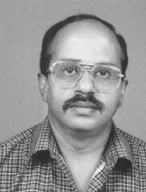
P.K.Sinha
Revision as of 05:53, 20 July 2012 by Arnulf (talk | contribs) (Created page with "== Praveen Kumar Sinha == thumb|right|100px|P.K.Sinha Serving the Geological Survey of India since 14th July, 1986 Location: India == Professional exp...")
Praveen Kumar Sinha
Serving the Geological Survey of India since 14th July, 1986
Location: India
Professional experience
Experienced in field work for more that 10 years field programs on
- Geological mapping,
- Mineral exploration, : Exploration for plateau type bauxites in a basaltic country
- Mineral exploration : Exploration for diamonds & laboratory based programs Trainings in digital technology
- Primary course on Computer Basics,
- Geographical Information System (ARC/INFO),
- Oracle 8 and Developer 2000,
- Advanced Training in Arc/Info on N.T.
- Attended advance / vender's training on Raster GIS, Internet GIS, ARCGIS, ARCSDE and Prospectivity Mapping.
- Besides the trainings carried out by the GSITI, I have attended trainings in the modules covering Principles of Cartography, Principles of GIS and Principles of Remote Sensing at ITC, the Netherlands (September to December 2000).
- Geoinformatics: 1996-97 to 2001 and 2004 to 2007 I was a member of the team engaged in creation of geoscientific databases (geological information system) in Oracle and GIS environment.
- Faculty in GSITI training programs in digital concepts and geographic information system: a guest faculty (since March 2001) and there after as core trainer (since September 2001) led a favourable environment to enthuse me to my dedicated association with the training programs of the Organisation As a core member of the faculty, I had utilized my innovative and modern methodology in the transfer of knowledge and development of the Scientific Human Resource of the Nation. I have been sharing my experience in the field of Geoinformatics and the knowledge acquired (with practical on ILWIS) at a short stint at ITC, the Netherlands. Courses covered wide fields from GIS: Raster, Vector, 3D, SRDBMS, capture, manipulation, analysis and modeling etc.
- In the year 2005 I was introduced to FOSS by Mr. Ravi Kumar (then Director, GSI; now an advocate member – OSGeo). Initiation of with working with GRASS, followed by OpenJump,
- Spatial data editing for higher degree of authentication, data standardisation, projection management for the data acquired from feeder state centers, gap & overlap removal, edge matching, establishing the seamless-ness finalisation, geometry validation (simplification). This exercise was done for a regional geological layers data (covering 929 toposheets), maintanance of regional repository (PostGIS), positioning the GCPs of layers to correct point etc.
This work was carried out using FOSS: OpenJump, PostGIS (Postgres), spatialite (Sqlite).
This data is loaded on Portal of the organisation.
