Difference between revisions of "Philippines/philgeos2012"
Wiki-Maning (talk | contribs) |
Wiki-Maning (talk | contribs) |
||
| (40 intermediate revisions by the same user not shown) | |||
| Line 7: | Line 7: | ||
== Program == | == Program == | ||
| − | {| class="wikitable" border=" | + | {| class="wikitable" cellpadding="5" border="1px solid #dfdfdf" cellspacing="0" width="95%" |
| − | |- style="background-color:#CCC" | + | |-style="background-color:#CCC" |
!width=80|Time | !width=80|Time | ||
| − | !width= | + | !width=120|Speaker |
!Title | !Title | ||
!Description | !Description | ||
!Slides and other resources | !Slides and other resources | ||
| − | |- | + | |-style="background-color:#CCC" |
! colspan="5" | Registration | ! colspan="5" | Registration | ||
|- | |- | ||
| Line 34: | Line 34: | ||
|Wayne Manuel | |Wayne Manuel | ||
|Google Maps API | |Google Maps API | ||
| − | |Google Maps (https://developers.google.com/maps/) has a wide array of APIs that let you embed the robust functionality and everyday usefulness of Google Maps into your own website and applications, and overlay your own data on top of them. | + | |Google Maps (https://developers.google.com/maps/) has a wide array of APIs that let you embed the robust functionality and everyday usefulness of Google Maps into your own website and applications, and overlay your own data on top of them. |
|[https://developers.google.com/maps/documentation/javascript/ Google Maps JavaScript API v3] | |[https://developers.google.com/maps/documentation/javascript/ Google Maps JavaScript API v3] | ||
|- | |- | ||
| Line 62: | Line 62: | ||
|- | |- | ||
|1:00 - 2:30 | |1:00 - 2:30 | ||
| + | |Rally de Leon | ||
|Editing OpenStreetMap Data | |Editing OpenStreetMap Data | ||
| − | |||
|OpenStreetMap (http://www.openstreetmap.org/) is a project that creates and provides free geographic data and mapping to anyone who wants it. We started it because most maps you think of as free actually have legal or technical restrictions on their use, holding back people from using them in creative, productive, or unexpected ways. This session will introduce how to to edit data in OpenStreetMap. | |OpenStreetMap (http://www.openstreetmap.org/) is a project that creates and provides free geographic data and mapping to anyone who wants it. We started it because most maps you think of as free actually have legal or technical restrictions on their use, holding back people from using them in creative, productive, or unexpected ways. This session will introduce how to to edit data in OpenStreetMap. | ||
| | | | ||
| Line 160: | Line 160: | ||
* Maning's [http://www.flickr.com/photos/esambale/sets/72157632099432413/with/8219887452/ flickr set] and personal [http://epsg4253.wordpress.com/2012/11/26/foss4g-comes-to-the-philippines/ notes] | * Maning's [http://www.flickr.com/photos/esambale/sets/72157632099432413/with/8219887452/ flickr set] and personal [http://epsg4253.wordpress.com/2012/11/26/foss4g-comes-to-the-philippines/ notes] | ||
* [http://philgeos2012.wordpress.com/ PhilGEOS 2012 website] | * [http://philgeos2012.wordpress.com/ PhilGEOS 2012 website] | ||
| + | * [http://news.essc.org.ph/?p=4530 ESSC joins 1st Phl geomatics symposium] | ||
[[Category: Events]] | [[Category: Events]] | ||
[[Category:Philippines Chapter]] | [[Category:Philippines Chapter]] | ||
Latest revision as of 18:54, 21 February 2013
Overview
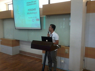
OSGEO Philippines (OSGeo-PH), the University of Philippines Department of Geodetic Engineering (UPD-GE), OpenStreetMap Philippines (OSM-PH) and the Environmental Science for Social Change (ESSC) organized a series of pre-symposium workshops showcasing free and open source technologies at the PhilGEOS 2012 last November 23-24, 2012 at Melchor Hall University of the Philippines, Diliman, Quezon City (map).
This is our first FOSS4G event in the Philippines. Over 60 participants joined 8 workshops and 3 lightning talks. The OSGeo Live project was also presented in one of the parallel technical sessions in the main conference. Likewise, an exhibit booth was installed during the PhilGEOS conference for OSGeo and OpenStreetMap. Over ~50 OSGeo Live DVDs were handed out to conference participants.
Program
| Time | Speaker | Title | Description | Slides and other resources |
|---|---|---|---|---|
| Registration | ||||
| 8:30 - 8:45 | Ariel Blanco - PhilGEOS 2012 Conference Chair | Opening Remarks | ||
| 8:45 - 9:00 | Maning Sambale - OSGeo-PH | Workshop schedules and room assignments | ||
| Track 1: GE Lab | ||||
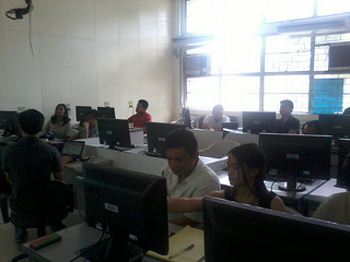
| 9:00 - 10:30 | Wayne Manuel | Google Maps API | Google Maps (https://developers.google.com/maps/) has a wide array of APIs that let you embed the robust functionality and everyday usefulness of Google Maps into your own website and applications, and overlay your own data on top of them. | Google Maps JavaScript API v3 |
| 10:30 - 12:00 | Eugene Alvin Villar | Using Leaflet | Leaflet (http://leaflet.cloudmade.com/) is a modern open-source JavaScript library for mobile-friendly interactive maps. t is built from the ground up to work efficiently on both desktop and mobile platforms like iOS and Android, taking advantage of HTML5 and CSS3 on modern browsers. | Workshop reference |
| Track 2: GE Theater | ||||
| 9:00 - 10:30 | Marx Tupas | GeoNode | Geonode (http://geonode.org) is an integrated platform for the management and publication of geospatial data. Its data management tools allow for integrated creation of data, metadata, and map visualizations. Each dataset in the system can be shared publicly or restricted to allow access to only specific users. Social features like user profiles and commenting and rating systems allow for the development of communities around each platform to facilitate the use, management, and quality control of the data the GeoNode instance contains. | |
| 10:30 - 12:00 | Jules Bañgate | GRASS GIS | GRASS GIS (http://grass.osgeo.org/) is a software for performing spatial analysis. It consists of more than 350 modules for processing vector (2D/3D), raster and voxel data. Many interfaces to other programs in related domains like geostatistics, databases, mapserver and even other GIS software exist. It can serve as a Desktop GIS and as the backbone of a complete GIS infrastructure. | |
| Lunch | ||||
| Track 1: GE Lab | ||||
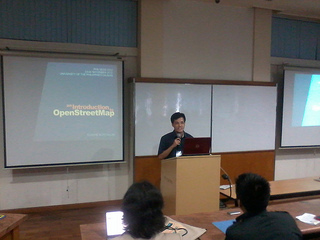
| 1:00 - 2:30 | Rally de Leon | Editing OpenStreetMap Data | OpenStreetMap (http://www.openstreetmap.org/) is a project that creates and provides free geographic data and mapping to anyone who wants it. We started it because most maps you think of as free actually have legal or technical restrictions on their use, holding back people from using them in creative, productive, or unexpected ways. This session will introduce how to to edit data in OpenStreetMap. | |
| 2:30 - 4:00 | Maning Sambale | Advance Cartography with Quantum GIS | Quantum GIS (http://www.qgis.org) is a user friendly GIS that runs on several operating systems (Linux, Unix, Mac OSX, Windows and Android). QGIS supports vector, raster, and database formats. QGIS is licensed under the GNU Public License. This workshop is a technical demonstration and hands-on tutorial in the use of QGIS using the advance cartographic styling features of the application. | Workshop materials |
| Track 2: GE Theater | ||||
| 1:00 - 2:30 | RK Aranas | Remote Sensing with Opticks | Opticks (http://opticks.org) is an expandable remote sensing and imagery analysis software platform that is free and open source. | |
| 2:30 - 4:00 | Ranel Padon | Mapping with Drupal CMS | Slides | |
| Lightning Talks | ||||
| Mario Basa | GeoFuse | Demo site, GitHub source repo | ||
| Wilfredo Rada | Geoprocessing with Python | Slides | ||
| Maning Sambale | About the OSGeo-Philippine Local Chapter | |||
| Closing | ||||
Venue and available facilities
- GE Computer Labs - maximum 20 participants, with projector, computers and internet connection.
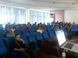
- GE Theater - maximum 80 participants, with projector, bring your own laptops for exercises, limited wifi connection.
- Post-event online evaluation form (http://bit.ly/UjcpuP)
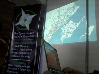
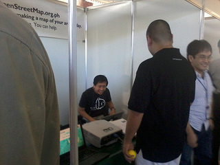
Exhibition booth
Exhibition Checklist
- Booth will be ~2 x 2 meters, with electric plugs and a table
- Retractable banner (non-woven print and banner stand)
- Portable Literature Stand
- Table skirt
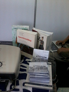
- Consumables (live-dvd, brochure)
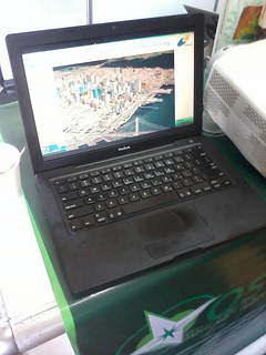
- A computer running Live DVD and a slide deck loop for the apps
- FOSS4G books - OSM, PostGIS in Action, GRASS GIS 3rd Edition
Booth staff
- Maning
- RK
- Eugene
- Mario
Photos and News
- Photos
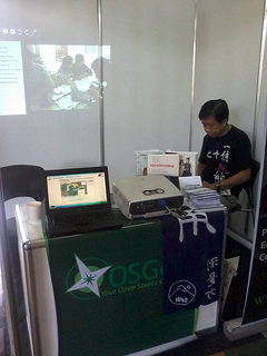
Exhibit Booth
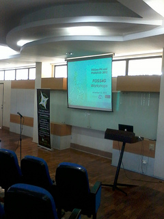
Main GE Theater
OSGeo Live DVDs
OSGEeo Live slideshow
OSM-PH Slideshow
OSM Talk in the technical session
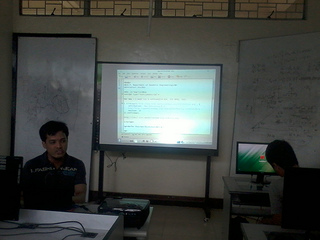
Leaflet workshop by Eugene Alvin Villar
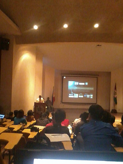
Opening remarks by Dr. Ariel Blanco (UP-DGE)
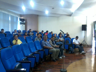
Participants at GE Theater
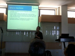
GeoNode workshop by Mark Tupas
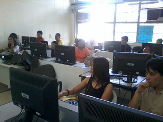
Participants at GE Lab
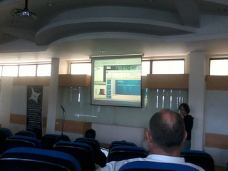
Google Maps workshop by Wayne Manuel

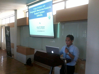
GRASS GIS workshop by Jules Bañgate
Opticks workshop by RK Aranas
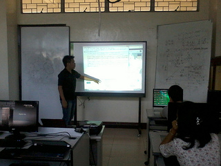
OSM editing workshop by Rally de Leon
PhilGEOS opening program


- Maning's flickr set and personal notes
- PhilGEOS 2012 website
- ESSC joins 1st Phl geomatics symposium