Semantic search

Jump to navigation Jump to search

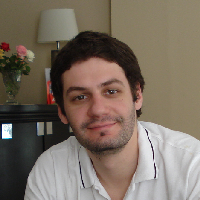
[[ Cristianzamar | Cristian R. Zamar ]]

Name: Cristian R. Zamar
Job Title: GIS Developer / Consultant
Company: Government of Formosa Province; Independent Consultant / Freelancer
Country: Argentina
State: Formosa
City: Formosa
Local Chapter: Argentinia
Website: http://www.linkedin.com/in/cristianzamar
Email: cristianzamar@gmail.com
Phone: +54-9-370-4271736
Coordinate: 26° 11' 6.79" S, 58° 10' 27.66" W
Languages: Spanish, English

Experience: OSGeo coder.png OSGeo user.png

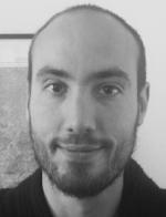
Cristian R. Zamar

Cristian has been contributing to different FOSS4G projects and events from the beginning of his Developer career. He is a member of Geoinquietos Argentina and a geomatics and OSS enthusiast. He participated in the organization of the FOSS4G-AR Conferences in 2016 and 2017 and leaded the IT team of the SDI of Argentina for six years. Currently, he is also an IT Director and works for the SDI of Formosa Province, Argentina.

Loading map...

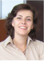
[[ Daniele Oxoli | Daniele Oxoli ]]

Name: Daniele Oxoli
Job Title: Research Fellow
Company: Politecnico di Milano
Address: P.zza Leonardo da Vinci 32
Country: Italiano
City: Milano
Website: http://geolab.como.polimi.it/
Email: daniele.oxoli@polimi.it
Coordinate: 45° 28' 48.00" N, 9° 13' 48.00" E
Languages: Italian, English

Experience: OSGeo charter.png OSGeo user.png

Environmental Eng. passionate of GIS and FOSS

Loading map...

[[ Darsvid | Daria Svidzinska ]]

Name: Daria Svidzinska
Job Title: Associate Professor
Company: Department of Physical Geography and Geoecology, Faculty of Geography, Taras Shevchenko National University of Kyiv (TSNUK), Ukraine
Country: Ukraine
City: Kyiv
Local Chapter: Ukraine
Coordinate: 50° 27' 0.00" N, 30° 30' 0.00" E


Experience: OSGeo user.png

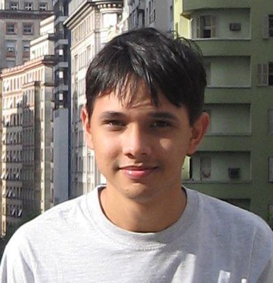
Daria Svidzinska
Loading map...

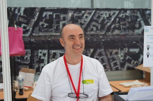
[[ Bitner | David Bitner ]]

Name: David Bitner
Job Title: Owner/Consultant
Company: dbSpatial LLC
Country: USA
State: MN
City: Minneapolis
Local Chapter: Twin Cities
Social Media: http://@bitnerd, http://@dbspatial
Website: http://dbspatial.com/
Email: bitner@dbspatial.com
Coordinate: 44° 58' 38.28" N, 93° 15' 55.69" W


Experience: OSGeo coder.png OSGeo charter.png OSGeo user.png

David Bitner

David Bitner is the founder of dbSpatial and a consultant specializing in open source geospatial application and database development. David is an OSGeo Charter Member and a member of the Sahana Software Foundation Board of Directors. David has served on several conference committees and was the chair of the 2013 FOSS4GNA event in Minneapolis.

Loading map...

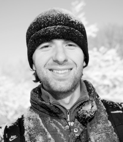
[[ David Mateos | David Mateos ]]

Name: David Mateos
Company: Terrativa S. Coop. Mad.
Country: Spain
State: Madrid
City: Cerceda
Local Chapter: Capítulo Local de la comunidad hispano-hablante
Website: http://dmts.es
Coordinate: 40° 41' 49.20" N, 3° 55' 57.00" W


Experience: OSGeo charter.png OSGeo user.png

Loading map...

[[ DMateos | David Mateos ]]

Name: David Mateos
Company: Terrativa S. Coop. Mad.
Country: Spain
State: Madrid
City: Cerceda
Local Chapter: Capítulo Local de la comunidad hispano-hablante
Website: http://dmts.es
Coordinate: 40° 41' 49.20" N, 3° 55' 57.00" W


Experience: OSGeo charter.png OSGeo user.png

Loading map...

[[ Didier Richard | Didier Richard ]]

Name: Didier Richard
Job Title: Surveyor Engineer
Company: IGN (French NMA)
Country: France
State: France
City: Saint-Mandé
Local Chapter: Francophone OSGeo Chapter
Website: https://www.geoportail.gouv.fr/
Coordinate: 48° 50' 29.00" N, 2° 35' 14.00" E
Languages: french, english

Experience: OSGeo coder.png OSGeo user.png OSGeo Committer.png

Didier Richard

I have been a supporter of OpenSource software for Geomatics for long. I am working at IGN (French National Mapping Agency) and promotes openness and free software internally (e.g., at IGN's school, namely ENSG -- École Nationale des Sciences Géographiques, Géomatique --) and externally (past contributor to Geoserver, french translations, committer to PROJ.4 and GDAL, user of many OSS). I managed the French Geoportal project, which is based on opensource software like Geoserver, OpenLayer, PROJ.4, GDAL, etc ... and has a big PostgrSQL/PostGIS backend.I am also involved in local chapter's FOSS4G and member of the FOSS4G Europe 2017 organizing committee (logistics, workshops, codesprint and communication).

Loading map...

[[ Misev | Dimitar Misev ]]

Name: Dimitar Misev
Job Title: Postdoc researcher
Company: Constructor University / rasdaman
Country: Germany
City: Bremen
Local Chapter: FOSSGIS e.V.
Social Media: https://www.linkedin.com/in/dimitarmisev
Website: https://dimitarmisev.com/
Coordinate: 53° 9' 58.69" N, 8° 38' 59.75" E
Languages: English, Macedonian

Experience: OSGeo coder.png OSGeo user.png

Dimitar Misev
Loading map...

[[ Kotzino | Dimitris Kotzinos ]]

Name: Dimitris Kotzinos
Job Title: Faculty member
Company: Department of Computer Science of University of Cergy Pontoise
Country: France
City: Cergy Pontoise
Local Chapter: Greek
Website: http://www.kotzinos.eu
Coordinate: 49° 2' 19.50" N, 2° 4' 30.32" E
Languages: Greek, English

Experience: OSGeo charter.png OSGeo user.png

Dimitris Kotzinos

Dimitris's interests are in the areas of Web Information Systems, Semantic Web, Open Linked Data, Social Networks, etc. Dimitris is a frequent speaker at GI Conferences both national and international and also an organizer of events or special sessions dedicated to Open Geospatial Software/Data/Protocols.

Loading map...

[[ Dnewcomb | Doug Newcomb ]]

Name: Doug Newcomb
Job Title: Cartographer
Country: USA
State: NC
City: Raleigh
Local Chapter: North America
Coordinate: 35° 26' 52.50" N, 82° 9' 50.45" W


Experience: OSGeo charter.png

Doug Newcomb

Doug Newcomb has a BS and MA in Geography and is an advocate of Free and Open Source Software (FOSS) in general and geospatial software specifically. Doug has used Linux (Red Hat, CentOS,Debian,Ubuntu) since 1996. Employed at various government environmental agencies since 1990. Specializes in use of GRASS with incomplete LiDAR data to derive landscape scale (statewide) forest canopy structure data.

Loading map...

[[ Dtutic | Dražen Tutić ]]

Name: Dražen Tutić
Job Title: Assistant Professor
Company: Faculty of Geodesy, University of Zagreb
Address: Kačićeva 26
Country: Croatia
City: Zagreb
Local Chapter: Croatia
Instant Messaging: Skype: dtutic
Social Media: https://twitter.com/DtuticTutic, https://www.facebook.com/OSGL-Geodetskog-fakulteta-Sveučilišta-u-Zagrebu-502794936557312/
Website: http://github.com/GEOF-OSGL/
Email: dtutic@geof.hr
Phone: +38514639193
Coordinate: 45° 48' 30.50" N, 15° 57' 48.56" E
Languages: English, Croatian

Experience: OSGeo coder.png OSGeo charter.png OSGeo user.png

Dražen is researcher and teacher in cartography and geoinformatics. His special interest and developing is in the field of map projections and cartographic generalization. He established Open Source Geospatial Lab at the Faculty of Geodesy, University of Zagreb.

Loading map...

[[ Drazen Tutic | Dražen Tutić ]]

Name: Dražen Tutić
Job Title: Assistant Professor
Company: Faculty of Geodesy, University of Zagreb
Address: Kačićeva 26
Country: Croatia
City: Zagreb
Local Chapter: Croatia
Instant Messaging: Skype: dtutic
Social Media: https://twitter.com/DtuticTutic, https://www.facebook.com/OSGL-Geodetskog-fakulteta-Sveučilišta-u-Zagrebu-502794936557312/
Website: http://github.com/GEOF-OSGL/
Email: dtutic@geof.hr
Phone: +38514639193
Coordinate: 45° 48' 30.50" N, 15° 57' 48.56" E
Languages: English, Croatian

Experience: OSGeo coder.png OSGeo user.png

Dražen is researcher and teacher in cartography and geoinformatics. His special interest and developing is in the field of map projections and cartographic generalization. He established Open Source Geospatial Lab at the Faculty of Geodesy, University of Zagreb.

Loading map...

[[ Elżbieta Wołoszyńska-Wiśniewska | Elżbieta Wołoszyńska-Wiśniewska ]]

Name: Elżbieta Wołoszyńska-Wiśniewska
Country: Poland
City: Warsaw
Local Chapter: Poland
Instant Messaging: Skype username: sterniczka
Social Media: http://www.twitter.com/ElaWolo, http://pl.linkedin.com/in/elzbietawoloszynskawisniewska
Email: ela@gridw.pl
Coordinate: 52° 15' 32.40" N, 21° 1' 12.00" E
Languages: Polish, English, Russian, German

Experience: OSGeo user.png

Elżbieta Wołoszyńska-Wiśniewska
Loading map...

[[ Maning | Emmanuel "Maning" Sambale ]]

Name: Emmanuel "Maning" Sambale
Country: Philippines
City: Manila
Local Chapter: Phillipines
Website: http://epsg4253.wordpress.com/
Coordinate: 14° 38' 20.40" N, 121° 5' 9.60" E
Languages: English, Filipino

Experience: OSGeo charter.png

As an OSGeo member, Maning would like to Strengthen the OSGeo-PH Local Chapter and promote OSGeo in the Philippines through training and material development. His area of focus is Mindanao Island.

Loading map...

[[ Enockseth | Enock Seth Nyamador ]]

Name: Enock Seth Nyamador
Job Title: GIS Consultant
Country: Ghana
State: Greater Accra
City: Accra
Local Chapter: Africa Local Chapter
Social Media: https://twitter.com/enock4seth
Website: https://open.enockseth.co
Email: open@enockseth.co
Phone: +233-27-5657589
Coordinate: 5° 33' 36.05" N, 0° 12' 20.68" W
Languages: English, French, basic German

Experience: OSGeo user.png

Passionate about FOSS and Communities of Practice.

Loading map...

[[ Erik Meerburg | Erik Meerburg ]]

Name: Erik Meerburg
Job Title: Initiator, educator and customer success manager
Company: Geo Academie and B3Partners
Address: Pieterstraat 23
Country: Nederlands
State: Always positive
City: Delft
Local Chapter: OSGeo.NL
Social Media: http://twitter.com/geogoeroe
Website: http://www.geo-academie.nl/
Email: erik@geo-academie.nl
Phone: +31628167631
Coordinate: 52° 0' 34.20" N, 4° 21' 41.76" E
Languages: Dutch, English

Experience: OSGeo charter.png OSGeo user.png

Erik Meerburg

Founded the Geo Academie, based a strong belief that education in geo-information is more than ‘knowing which buttons to push’. Sees developments like open source software, neographers and crowdsourcing as the most promising in years and recognizes the challenge that it provides to traditional geo-information science.

Currently working for B3Partners, makers of Tailormap.

Organizer of the (only?) Maptime Summercamp @GeoFort. Doing voluntary work for MissingMaps. Rotarian. Husband, father, cat owner. Guitar and (double) bass player. Quite forgetful.

Loading map...

[[ Etienne | Etienne DELAY ]]

Name: Etienne DELAY
Job Title: Postdoctoral fellow
Company: GEOLAB - OHMi Téssékéré
Country: Senegal
City: Dakar
Local Chapter: Francophone OSGeo Chapter
Website: http://geolab.univ-bpclermont.fr/spip.php?article184
Coordinate: 14° 41' 15.36" N, 17° 27' 49.68" W
Languages: French, English, Italian

Experience: OSGeo charter.png OSGeo user.png

Etienne DELAY

He realized his Phd in Geography about modelisation of landscape dynamics and prospective for steep slope vineyard. He've developed a research methodology based on field work and companion modeling, combined with the formalization of the observed processes and agents based models. This approach offer the possiblity to understand : spatials, social, cultural and / or economic conditions than take place on territorial scale to provide prospective scenarios.

Loading map...

[[ Eva | Eva Jelínková ]]

Name: Eva Jelínková
Address: Palackého 420/21
Country: Czech Republic
City: Valašské Meziříčí
Local Chapter: Czech
Social Media: http://@evajelinkova
Email: evka.jelinkova@gmail.com
Coordinate: 49° 28' 3.98" N, 17° 57' 50.06" E
Languages: Czech, English

Experience: OSGeo charter.png OSGeo user.png

In 2013 graduated Master's degree of Geoinformatics at Palacký University, Olomouc. Since school years using FOSS GIS software. Advanced user of MapServer, MapCache, QGIS Desktop + Server, PostGIS, pycsw, etc.

Loading map...

[[ Fsc7 | Felipe Costa ]]

Name: Felipe Costa
Job Title: Programming Analyst
Company: Massmedia OÜ
Address: Tartu
Country: Estonia
State: Tartumaa
City: Manaus
Local Chapter: Brasil
Website: http://lattes.cnpq.br/3609044175401060
Coordinate: 58° 23' 0.00" N, 26° 43' 0.00" E
Languages: Portuguese, English

Experience: OSGeo user.png

Felipe Costa
Loading map...

[[ Amyonthemap | Feng Amy Gao ]]

Name: Feng Amy Gao
Job Title: President
Company: Spatial Front Inc.
Country: USA
State: Maryland
City: Potomac
Local Chapter: North America
Coordinate: 39° 1' 4.57" N, 77° 12' 34.04" W
Languages: English, Chinese (Mandarin)

Experience: OSGeo user.png

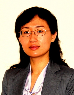
Feng Amy Gao

Amy is the President of Spatial Front Inc, a fast-growing IT consulting company. She has extensive experience with the design and development of enterprise geospatial information systems. She has worked for all levels of US governments (federal, state, and local), companies from IBM to start-ups, and as Adjunct Professor in college. One of her latest projects - National Broadband Map, a high-profile project funded by Recovery Act - was built on an open source stack. She is enthusiastic about open source geospatial technologies and interested in using more and helping people learn more about them.

Loading map...