File:OSGClipperChart 20160303.png
Jump to navigation
Jump to search
Size of this preview: 800 × 450 pixels. Other resolutions: 320 × 180 pixels | 1,280 × 720 pixels.
Original file (1,280 × 720 pixels, file size: 98 KB, MIME type: image/png)
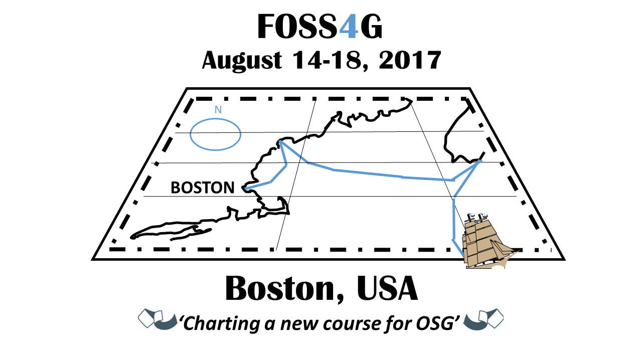
The next entry, a sort of variant of the clipper ship, emphasizes navigation and charting a new course for OSG (the slogan can certainly change). The chart created very roughly is based on the official navigation charts on the US govt. web site. Boston is the starting port, making stops along the way, then turning to the open sea. The ship is shown sailing off the map into 'uncharted territory.' There may be too much detail, even after tracing only the essential items.
File history
Click on a date/time to view the file as it appeared at that time.
| Date/Time | Thumbnail | Dimensions | User | Comment | |
|---|---|---|---|---|---|
| current | 23:16, 3 March 2016 | | 1,280 × 720 (98 KB) | Wiki-NorStar (talk | contribs) | A sort of variant of the clipper ship entry. It has a chart where the course is charted, and the clipper ship is about to leave the map into 'uncharted territory.' |
| 23:09, 3 March 2016 |  | 1,280 × 720 (79 KB) | Wiki-NorStar (talk | contribs) | The next entry, a sort of variant of the clipper ship, emphasizes navigation and charting a new course for OSG (the slogan can certainly change). The chart created very roughly is based on the official navigation charts on the US govt. web site. Bost... |
You cannot overwrite this file.
File usage
The following page uses this file: