Difference between revisions of "Mapbender"
(updated) |
(more updates) |
||
| Line 2: | Line 2: | ||
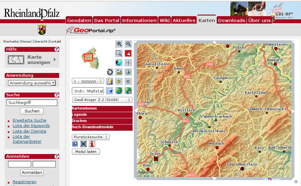
[[Image:Geoportal.png|thumb|right|Geoportal Rhineland Palatinate]] | [[Image:Geoportal.png|thumb|right|Geoportal Rhineland Palatinate]] | ||
| − | Mapbender is the geospatial portal (Geoportal) site management software for Spatial Data Infrastructures. Mapbender | + | Mapbender is the geospatial portal (Geoportal) site management software for Spatial Data Infrastructures. The Mapbender data back allows to manage web mapping resources and feature services (for example OGC WMS and WFS including transactional). The basic authentication module can be connected with existing systems and allows multi client capable user manangement, authorization, group and service administration.[http://www.mapbender.org/OWS_Security_Proxy OWS Security Proxy] acts as a facade for services registered in Mapbender and can be used to control access. Mapbender can log user operations on services and layers and has a monitoring functionality designed specifically for mapping and geographic resources. The viewing components are supported by and [[JQuery Spatial | jQuery]] and [[OpenLayers]]. Mapbender is [http://svn.osgeo.org/mapbender/trunk/mapbender/license/license.txt dual licensed] under the GNU GPL and simplified BSD licenses. |
| − | ==Summary== | + | == Summary == |
* Project page: http://www.mapbender.org/ | * Project page: http://www.mapbender.org/ | ||
* Mailing lists: http://www.mapbender.org/index.php/Mapbender_Mailing_Lists | * Mailing lists: http://www.mapbender.org/index.php/Mapbender_Mailing_Lists | ||
Revision as of 04:19, 3 June 2010
Mapbender is the geospatial portal (Geoportal) site management software for Spatial Data Infrastructures. The Mapbender data back allows to manage web mapping resources and feature services (for example OGC WMS and WFS including transactional). The basic authentication module can be connected with existing systems and allows multi client capable user manangement, authorization, group and service administration.OWS Security Proxy acts as a facade for services registered in Mapbender and can be used to control access. Mapbender can log user operations on services and layers and has a monitoring functionality designed specifically for mapping and geographic resources. The viewing components are supported by and jQuery and OpenLayers. Mapbender is dual licensed under the GNU GPL and simplified BSD licenses.
Summary
- Project page: http://www.mapbender.org/
- Mailing lists: http://www.mapbender.org/index.php/Mapbender_Mailing_Lists
- Bug tracker and ticket system: http://trac.osgeo.org/mapbender/
- Code repository: http://svn.osgeo.org/mapbender/
- IRC: irc://freenode.net#mapbender
Gallery
The gallery contains some Mapbender use cases:
Please feel free to submit your Mapbender based application or simply send the base URL of your application to the user mailing list.
Functionality
Mapbender is an SDI back end to create and maintain web based spatial applications.
End-user interfaces can be compiled from a broad selection of preconfigured modules based on jQuery and OpenLayers. Mapbender can be used to create highly focused light clients with a minimum set of modules as well as full-fledged applications with OWS security proxy, log module, digitizing with auto snapping, catalog and metadata editor components, monitoring and lots of more functionality.
Management interfaces help to maintain and monitor mapping and feature resources in a metadata catalog and grant access to individuals and groups. Adherence to standards, such as OGC WMS and transactional OGC WFS, make Mapbender agnostic to different brands of server software and allows to take advantage of interoperable services from various platforms.
Community
Mapbender code is implemented and maintained by developers from a diverse background and different companies. The core team meets every Monday as 17:00 UTC on IRC, feel free to join and participate at any time.
Join the community:
- Add yourself as a Mapbender user to the Mapbender user Map
- Subscribe to the mailing list
- Get a wiki account and help to grow and maintain the Mapbender documentation.
- Become a developer
- Present your Mapbender solution to the community or on fairs


