Difference between revisions of "User:Toze"
Jump to navigation
Jump to search
| (10 intermediate revisions by the same user not shown) | |||
| Line 1: | Line 1: | ||
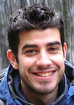
| − | + | [[Image:Toze.jpg|thumb|right|200px]] | |
| + | == António José Silva == | ||
| + | * PhD student in Statistics and Information Management | ||
| + | * MSc in Science and Geographic Information Systems | ||
| + | * Lic in Information Technologies, branch in Geographic Information Technologies | ||
| + | * Bsc in Geographic Engineering (Geomatics Engineering) | ||
* Águeda, Portugal | * Águeda, Portugal | ||
| + | * [http://www.openstreetmap.org/?lat=40.57345&lon=-8.44371&zoom=15&layers=M Show on OpenStreetMap] | ||
| + | |||
| + | == Contacts == | ||
* ajfsilva AT gmail DOT com | * ajfsilva AT gmail DOT com | ||
| + | * Twitter user: geotoz | ||
| + | * [http://wiki.openstreetmap.org/w/index.php?title=User:Toze OSM] | ||
| − | == | + | == [http://osgeopt.pt/ OSGeo PT - OSGeo Portuguese Local Chapter] == |
| − | * | + | * Charter Member |
| − | |||
| − | == | + | ===[http://wiki.osgeopt.pt/index.php/Vamos_mapear_Portugal Vamos Mapear Portugal]=== |
| − | * | + | |
| + | === [http://wiki.osgeo.org/wiki/Grupos_de_Trabalho Grupo de Trabalho OSGeo] === | ||
| + | * [http://wiki.osgeo.org/wiki/Autarquias Autarquias] | ||
| + | * [http://wiki.osgeo.org/wiki/Ensino_/_Educação Ensino/Educação] | ||
| − | == | + | == Interests == |
| − | * | + | * Geographic Information Systems (GIS) |
| − | * Free and Open Source Software | + | * Geospatial Free and Open Source Software (GFOSS) |
* Free and Open Source Software (FOSS) | * Free and Open Source Software (FOSS) | ||
| + | * GFOSS in local government | ||
| + | * GFOSS in education | ||
| + | * OpenStreetMap (OSM) | ||
| + | * Geospatial Crowdsourcing | ||
| + | * Volunteered Geographic Information (VGI) | ||
| + | * WebGIS | ||
| − | |||
[[Category:Portugal]] | [[Category:Portugal]] | ||
Latest revision as of 07:08, 10 May 2013
António José Silva
- PhD student in Statistics and Information Management
- MSc in Science and Geographic Information Systems
- Lic in Information Technologies, branch in Geographic Information Technologies
- Bsc in Geographic Engineering (Geomatics Engineering)
- Águeda, Portugal
- Show on OpenStreetMap
Contacts
- ajfsilva AT gmail DOT com
- Twitter user: geotoz
- OSM
OSGeo PT - OSGeo Portuguese Local Chapter
- Charter Member
Vamos Mapear Portugal
Grupo de Trabalho OSGeo
Interests
- Geographic Information Systems (GIS)
- Geospatial Free and Open Source Software (GFOSS)
- Free and Open Source Software (FOSS)
- GFOSS in local government
- GFOSS in education
- OpenStreetMap (OSM)
- Geospatial Crowdsourcing
- Volunteered Geographic Information (VGI)
- WebGIS
