Difference between revisions of "MOU AGU Announcement"
(Created page with "= OSGeo and AGU sign a Memorandum of Understanding = Vienna, April ### 2018 The Open Source Geospatial Foundation (OSGeo) and the American Geophysical Union (AGU) have signe...") |
|||
| (18 intermediate revisions by 2 users not shown) | |||
| Line 1: | Line 1: | ||
| − | = | + | == Subject == |
| − | + | OSGeo and AGU sign a Memorandum of Understanding | |
| − | + | == News Date == | |
| − | + | Vienna, April 11 2018 | |
| − | + | == Details == | |
| − | |||
| − | + | The Open Source Geospatial Foundation (OSGeo) and the American Geophysical Union (AGU) have signed a Memorandum of Understanding (MoU) during the European Geoscience Union (EGU) General Assembly in Vienna on April 9 2018. | |
| − | + | [[File:AGU100_logo_V-CMYK.jpg|thumbnail|AGU Logo]] | |
| − | + | The aim of the agreement is to develop coordinated activities and share expertise by promoting sustainable open science through reliable open source geospatial software, open datasets and related resources, especially for early career scientists. Specifically both organizations through the MOU will work together to: | |
| + | * improve scientific recognition for open software and open resource-related efforts by suitable citation standards and best-practices. | ||
| + | * hold joint international workshops and conference sessions on open geo-datasets and open source geospatial software for the geophysical sciences. | ||
| − | + | Both organizations will establish a liaison to ensure good information flow and cooperation. | |
| − | + | Peter Löwe, Vice President of the Open GeoScience Committee at Open Geospatial Foundation said: “''this is an important step forward for the recognition of open source software as a pilar of reproducible open science, which will set standards for the next generation of scientists''”. | |
| + | |||
| + | Brooks Hanson, Director at American Geophysical Union said: | ||
| + | “''The AGU values scientific research integrity, transparency, and reproducibility. The software used in scientific research is an important research output that needs to be managed and as open as possible. OSGeo’s role in supporting open source software is an important service to our researchers and to further science''”. | ||
| + | |||
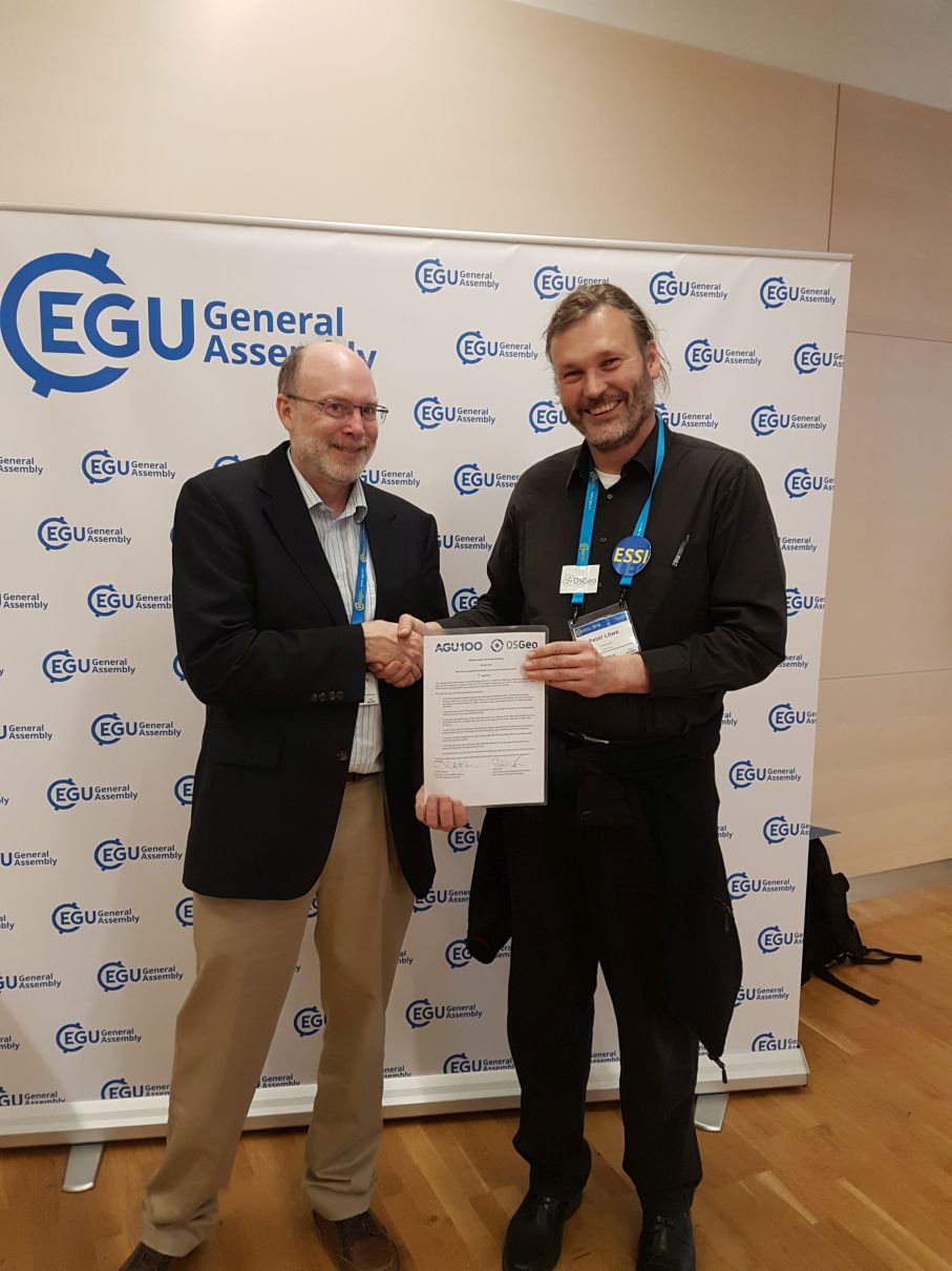
| + | [[File:EGU2018 AGU MoU brooks hanson peter loewe.jpg|thumbnail|MoU and signatories at EGU GA 2018 (B.Hanson, P.Löwe)]] | ||
| + | |||
| + | == About AGU == | ||
| + | |||
| + | The American Geophysical Union (https://sites.agu.org/) is dedicated to advancing the Earth and space sciences for the benefit of humanity through its scholarly publications, conferences, and outreach programs. AGU is a not-for-profit, professional, scientific organization representing 60,000 members in 137 countries. Join the conversation on Facebook, Twitter, YouTube, and our other social media channels. | ||
| + | |||
| + | |||
| + | == About OSGeo == | ||
| + | |||
| + | OSGeo (https://www.osgeo.org/) is a not-for-profit organization founded in 2006 whose mission is to support and promote the collaborative development of open source geospatial technologies and data. The Foundation provides financial, organizational and legal support to the broader open source geospatial community. It also serves as an independent legal entity to which community members can contribute code, funding and other resources, secure in the knowledge that their contributions will be maintained for public benefit. In 2018 OSGeo is the home for over 30 geospatial open source projects, and the OSGeo foundation has over 30,000 members. Since 2006 OSGeo has also hosted the widely popular international FOSS4G (Free and Open Source Software for Geospatial) conference, rotating it all over the globe each year. | ||
| + | |||
| + | Read more about partnerships with OSGeo: https://wiki.osgeo.org/wiki/MOU_OSGeo_All | ||
Latest revision as of 06:23, 11 April 2018
Subject
OSGeo and AGU sign a Memorandum of Understanding
News Date
Vienna, April 11 2018
Details
The Open Source Geospatial Foundation (OSGeo) and the American Geophysical Union (AGU) have signed a Memorandum of Understanding (MoU) during the European Geoscience Union (EGU) General Assembly in Vienna on April 9 2018.
The aim of the agreement is to develop coordinated activities and share expertise by promoting sustainable open science through reliable open source geospatial software, open datasets and related resources, especially for early career scientists. Specifically both organizations through the MOU will work together to:
- improve scientific recognition for open software and open resource-related efforts by suitable citation standards and best-practices.
- hold joint international workshops and conference sessions on open geo-datasets and open source geospatial software for the geophysical sciences.
Both organizations will establish a liaison to ensure good information flow and cooperation.
Peter Löwe, Vice President of the Open GeoScience Committee at Open Geospatial Foundation said: “this is an important step forward for the recognition of open source software as a pilar of reproducible open science, which will set standards for the next generation of scientists”.
Brooks Hanson, Director at American Geophysical Union said: “The AGU values scientific research integrity, transparency, and reproducibility. The software used in scientific research is an important research output that needs to be managed and as open as possible. OSGeo’s role in supporting open source software is an important service to our researchers and to further science”.
About AGU
The American Geophysical Union (https://sites.agu.org/) is dedicated to advancing the Earth and space sciences for the benefit of humanity through its scholarly publications, conferences, and outreach programs. AGU is a not-for-profit, professional, scientific organization representing 60,000 members in 137 countries. Join the conversation on Facebook, Twitter, YouTube, and our other social media channels.
About OSGeo
OSGeo (https://www.osgeo.org/) is a not-for-profit organization founded in 2006 whose mission is to support and promote the collaborative development of open source geospatial technologies and data. The Foundation provides financial, organizational and legal support to the broader open source geospatial community. It also serves as an independent legal entity to which community members can contribute code, funding and other resources, secure in the knowledge that their contributions will be maintained for public benefit. In 2018 OSGeo is the home for over 30 geospatial open source projects, and the OSGeo foundation has over 30,000 members. Since 2006 OSGeo has also hosted the widely popular international FOSS4G (Free and Open Source Software for Geospatial) conference, rotating it all over the globe each year.
Read more about partnerships with OSGeo: https://wiki.osgeo.org/wiki/MOU_OSGeo_All

