Difference between revisions of "GLTN"
(Basic information on GLTN) |
|||
| (5 intermediate revisions by the same user not shown) | |||
| Line 1: | Line 1: | ||
| − | ''OSGeo | + | [[File:Gltn-logo.png|thumb|right|258px|GLTN Logo]] |
| + | |||
| + | ''The Social Tenure Domain Model ([[STDM]]) is a GLTN project supported by UN-Habitat using OSGeo software. Explore the web site at: http://www.stdm.gltn.net/'' | ||
| + | |||
| + | == Partnership == | ||
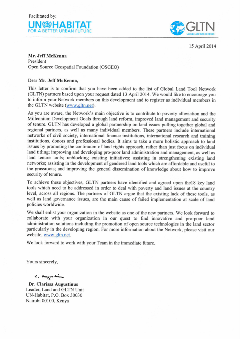
| + | ''OSGeo is [http://gltn.net/index.php/the-network/gltn-partners GLTN Partner]. This parternship was approved through a motion by the OSGeo Board of Directors during the [[Board Meeting 2014-02-06]]. '' | ||
| + | |||
| + | [[File:GLTN_OSGEO_partnership.png|thumb|300px|right|Partnership letter]] | ||
| + | |||
| + | The purpose of this partnership is to establish a collaborative relationship between the Open Source Geospatial Foundation (OSGeo) and the [http://gltn.net/ Global Land Tool Network] (GLTN). One of the geospatial tools developed by GLTN under the lead of the United Nations Habitat office is the [[STDM | Social Tenure Domain Model (STDM)]]. It is based on a data model implemented using Postgres and [[PostGIS]] and a front end plugin based on [[QGIS]]. '' | ||
| + | |||
| + | === Role of OSGeo === | ||
| + | This partnership will allow GLTN partners to fund individuals through OSGeo to | ||
| + | join forces on projects, collaborate on the software, take part in | ||
| + | meetings, conferences, workshops, etc. | ||
| + | |||
| + | === OSGeo Representative === | ||
| + | [[Arnulf Christl]] will act as a liaison between the two organizations. | ||
== About GLTN == | == About GLTN == | ||
| Line 31: | Line 48: | ||
* For more information please visit the GLTN web site at: http://www.gltn.net/ | * For more information please visit the GLTN web site at: http://www.gltn.net/ | ||
* OSGeo supports the Social Tenure Domain Model project [[STDM]] | * OSGeo supports the Social Tenure Domain Model project [[STDM]] | ||
| + | |||
| + | [[Category:MoU]] | ||
Latest revision as of 06:37, 24 March 2015
The Social Tenure Domain Model (STDM) is a GLTN project supported by UN-Habitat using OSGeo software. Explore the web site at: http://www.stdm.gltn.net/
Partnership
OSGeo is GLTN Partner. This parternship was approved through a motion by the OSGeo Board of Directors during the Board Meeting 2014-02-06.
The purpose of this partnership is to establish a collaborative relationship between the Open Source Geospatial Foundation (OSGeo) and the Global Land Tool Network (GLTN). One of the geospatial tools developed by GLTN under the lead of the United Nations Habitat office is the Social Tenure Domain Model (STDM). It is based on a data model implemented using Postgres and PostGIS and a front end plugin based on QGIS.
Role of OSGeo
This partnership will allow GLTN partners to fund individuals through OSGeo to join forces on projects, collaborate on the software, take part in meetings, conferences, workshops, etc.
OSGeo Representative
Arnulf Christl will act as a liaison between the two organizations.
About GLTN
The Global Land Tool Network (GLTN) is an alliance of global regional and national partners contributing to poverty alleviation through land reform, improved land management and security of tenure particularly through the development and dissemination of pro-poor and gender-sensitive land tools.
Objectives
Secure land tenure and property rights are fundamental to shelter and livelihoods as well as the realization of human rights, poverty reduction, economic prosperity and sustainable development.
GLTN's main objective is to contribute to poverty alleviation and the Millennium Development Goals through land reform, improved land management and security of tenure.
UN-Habitat continues to work towards these objectives through GLTN with partners who include international civil society organizations, international finance institutions, international research and training institutions, donors and professional bodies.
Mission
Most developing countries use conventional land administration systems which cover less than 30 per cent of the country, leaving up to 70 per cent of citizens looking to informal and/ or customary approaches for their tenure security.
While there are many examples of good land policies, there are few policies that have been fully implemented due to lack of pro-poor, gender sensitive and large scale land tools. Further, conventional land titling approaches have largely failed to deliver their expected results since existing technical solutions are too expensive, inappropriate for the range of tenure found in developing countries, unsustainable financially or in terms of available capacity, and instead a range of land tenure options is more appropriate. OUR CORE VALUES
Core Values and Principles
GLTN's core values and principles are founded in the development of land tools that are;
- pro poor,
- good governance,
- equity,
- subsidiarity,
- sustainability,
- affordability,
- systematic large scale and
- gender sensitive
Links
- For more information please visit the GLTN web site at: http://www.gltn.net/
- OSGeo supports the Social Tenure Domain Model project STDM

