Difference between revisions of "User:Dirkf"
Jump to navigation
Jump to search
Wiki-Dirkf (talk | contribs) |
Wiki-Dirkf (talk | contribs) |
||
| Line 2: | Line 2: | ||
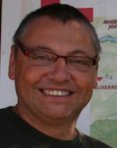
[[Image:dirk-frigne.jpg|thumb|right|100px|Dirk]] | [[Image:dirk-frigne.jpg|thumb|right|100px|Dirk]] | ||
| + | |||
| + | ;OSGeo Experience | ||
| + | |||
| + | [[File:OSGeo_psc.png|link=OSGeo_Advocate#Developers_and_Committee_Members]] | ||
| + | [[File:OSGeo_coder.png|link=OSGeo_Advocate#Developers_and_Committee_Members]] | ||
| + | [[File:OSGeo_user.png|link=OSGeo_Advocate#OSGeo_Community_Members]] | ||
<ul> | <ul> | ||
| − | <li>OSGeo Charter member 2013</li> | + | <li>OSGeo Charter member (since 2013)</li> |
| − | <li>Member of the INSPIRE comité since 2013</li> | + | <li>Member of the INSPIRE comité (since 2013)</li> |
| − | |||
<li>Founder and spiritual father of <b>[http://www.geomajas.org/ geomajas]</b> (2008 - today)</li> | <li>Founder and spiritual father of <b>[http://www.geomajas.org/ geomajas]</b> (2008 - today)</li> | ||
| − | |||
[http://www.geomajas.org/ geomajas] is an enterprise-ready open source GIS framework for the web. It has client-server integration for displaying and editing of geographic data. | [http://www.geomajas.org/ geomajas] is an enterprise-ready open source GIS framework for the web. It has client-server integration for displaying and editing of geographic data. | ||
Revision as of 07:47, 8 November 2014
Dirk Frigne
- OSGeo Experience
- OSGeo Charter member (since 2013)
- Member of the INSPIRE comité (since 2013)
- Founder and spiritual father of geomajas (2008 - today) geomajas is an enterprise-ready open source GIS framework for the web. It has client-server integration for displaying and editing of geographic data. Geomajas has integrated security and is endlessly scalable. It is compliant with OGC standards such as WMS, WFS, etc and also supports spatial databases. It integrates with your system and provides out-of-the-box functionality through plug-ins. By leveraging GWT on the client, development is all-Java making it easier and more efficient for your team. The project became an OSGEO project in december 2010. Reference applications and developer documentation on the geomajas website.
- Founder and spiritual father of geGIS (2006 - 2008) This project originated in 2006 and is for the moment only interesting from a historical perspective. geGIS stands for generic GIS ans is a thin client RIA environment for generating and exploiting GIS electronic services. Started as an governmental Dutch project (Flanders - Belgium). The project was the prototype project to start the Geomajas project.
- Founder of DFC Software Engineering ([1] 1994- today) DFC software engineering is a project oriented company, working on eGov an GIS project for governmental agencies, communities, regions. The combination of ICT experts and a good understanding of the GIS needs results in a curriculum of interesting project references. The OSGeo project geomajas originated from DFC Software Engineering who took the lead in establishing and shaping the project. In 2008 a new spinnout Geosparc was created to focus on a product development strategy, using the open source community geomajas as one of the basic assets.
- Founder of Geosparc ([2] 2008 - today) The aim of Geosparc is to professionally support Geomajas, the open source GIS application development software, coupling the innovation of open source with the reliability of a true enterprise-class platform. Geomajas was built with today's Internet and cloud architectures in mind. This truly differentiates Geomajas from other GIS software. When integration, security and scalability are important keywords as part of your environment, you should certainly consider geomajas as the base of your application or solution. Geosparc guarantees different product offerings based on the Geomajas platform. Geosparc delivers service level agreements and eventually can provide our clients with an alternative licensing model than the open source AGPL licence, which gives our clients huge opportunities to use the positive and strong points of an open source platform, together with the interesting points of commercial licensing offerings.
- Member en co-founder of the industry list (june 2014) Doing business with open source and what is the role that OSGeo should play is a question that pops up more and more often. As the result of a BOF on the OSGeo conference in Hamburg (july 2014) Recently I started the industry list together with Peter Bauman and Jorge Sanz. The aim of this list is to discuss the ethics and the position of OSGeo in the space of geolocation business using open source libraries and tools.
- Doing business with open source for almost 10 years now (since 2006) Open source software can be an enabler for interoperable and sustainable innovative software solutions. Recently I started a blog to share my experiences with peer OSGeo business people (www.Frigne.be september 2014).
{{#umSetParam: 3.678838|51.0875|Gent, Belgium|dirkf|Dirk Frigne}} {{#umUserMap: dirkf|400px|250px|6|2|y}}
