Difference between revisions of "User:Maxi"
| Line 9: | Line 9: | ||
Massimiliano received his PhD in Gedoesy and Geomatics after his master degree in environmental engineering at the Politecnico di Milano. He's currently the head of the geomatic division within the Institute of Earth Sciences (www.ist.supsi.ch) in Switzerland. He's member of the project steering committee (PSC) of the projects GIS GRASS (http://grass.osgeo.org) and ZOO (www.zoo-project.org). He's group developed the istSOS (http://istgeo.ist.supsi.ch/software/istsos/) and Geoshield (https://sites.google.com/site/geoshieldproject/) project. His interest is mainly in (i) natural hazards, (ii) GIS embedded environmental modeling, (iii) geospatial Web services developement. | Massimiliano received his PhD in Gedoesy and Geomatics after his master degree in environmental engineering at the Politecnico di Milano. He's currently the head of the geomatic division within the Institute of Earth Sciences (www.ist.supsi.ch) in Switzerland. He's member of the project steering committee (PSC) of the projects GIS GRASS (http://grass.osgeo.org) and ZOO (www.zoo-project.org). He's group developed the istSOS (http://istgeo.ist.supsi.ch/software/istsos/) and Geoshield (https://sites.google.com/site/geoshieldproject/) project. His interest is mainly in (i) natural hazards, (ii) GIS embedded environmental modeling, (iii) geospatial Web services developement. | ||
| − | ;OSGeo Experience [[File:OSGeo_charter.png|link=OSGeo_Advocate#OSGeo_Charter_Members]] [[File:OSGeo_committee.png|link=OSGeo_Advocate#Developers_and_Committee_Members]] [[File:OSGeo_psc.png|link=OSGeo_Advocate#Voted_position_in_an_OSGeo_community]] [[File:OSGeo_user.png|link=OSGeo_Advocate#OSGeo_Community_Members]] | + | ;OSGeo Experience [[File:OSGeo_board.png|link=OSGeo_Advocate#OSGeo_Board_Members]] [[File:OSGeo_charter.png|link=OSGeo_Advocate#OSGeo_Charter_Members]] [[File:OSGeo_committee.png|link=OSGeo_Advocate#Developers_and_Committee_Members]] [[File:OSGeo_psc.png|link=OSGeo_Advocate#Voted_position_in_an_OSGeo_community]] [[File:OSGeo_user.png|link=OSGeo_Advocate#OSGeo_Community_Members]] |
: | : | ||
Revision as of 04:06, 4 September 2014
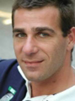
Massimiliano Cannata
Professor in geomatics, SUPSI (University of Applied Sciences of Southern Switzerland)
Location: Canobbio, Switzerland
Massimiliano received his PhD in Gedoesy and Geomatics after his master degree in environmental engineering at the Politecnico di Milano. He's currently the head of the geomatic division within the Institute of Earth Sciences (www.ist.supsi.ch) in Switzerland. He's member of the project steering committee (PSC) of the projects GIS GRASS (http://grass.osgeo.org) and ZOO (www.zoo-project.org). He's group developed the istSOS (http://istgeo.ist.supsi.ch/software/istsos/) and Geoshield (https://sites.google.com/site/geoshieldproject/) project. His interest is mainly in (i) natural hazards, (ii) GIS embedded environmental modeling, (iii) geospatial Web services developement.
-
- GRASS PSC member
- ZOO PSC member
- Italian OSGeo Chapter founder
- Italian OSGeo liason officer (up to 2008)
- Contact
- Email: massimiliano.cannata AT supsi DOT ch
- Phone (work): +41 (0)58 666 62 14
- Skype:
- Spoken Language(s)
- English, Italian
- Profile last updated
- 22 March 2013
