Difference between revisions of "Mapping The Past"
Wiki-Leifuss (talk | contribs) |
Wiki-Leifuss (talk | contribs) |
||
| Line 4: | Line 4: | ||
The general function of this theory group is to further explore just what we are intending to do when mapping the past and create a future agenda by which appropriate techniques and technologies can be created by the community in order to better undertake them. We will start with an approximate agenda (outlined below) but, being a wiki, all contributors are welcome to add content to any of the debates at any time. | The general function of this theory group is to further explore just what we are intending to do when mapping the past and create a future agenda by which appropriate techniques and technologies can be created by the community in order to better undertake them. We will start with an approximate agenda (outlined below) but, being a wiki, all contributors are welcome to add content to any of the debates at any time. | ||
| − | |||
| − | |||
The initial discussion is intended to try and create a 'periodic table' of past mapping techniques. This is not a catalogue of things that we map (eg geology, roads, extents of empire, etc) but an attempt to cluster those things into ontological categories. When and how do we map snapshots? Changes? Inferences? Facts? Predictions? and so on. | The initial discussion is intended to try and create a 'periodic table' of past mapping techniques. This is not a catalogue of things that we map (eg geology, roads, extents of empire, etc) but an attempt to cluster those things into ontological categories. When and how do we map snapshots? Changes? Inferences? Facts? Predictions? and so on. | ||
| Line 14: | Line 12: | ||
It is hoped that the discusion will also lead to a colloquium in which these matters can be debated with a wider public. | It is hoped that the discusion will also lead to a colloquium in which these matters can be debated with a wider public. | ||
| + | |||
* [[Past Mapping Periodic Table]] | * [[Past Mapping Periodic Table]] | ||
| Line 20: | Line 19: | ||
* [[Past Mapping Future]] | * [[Past Mapping Future]] | ||
| + | |||
| + | |||
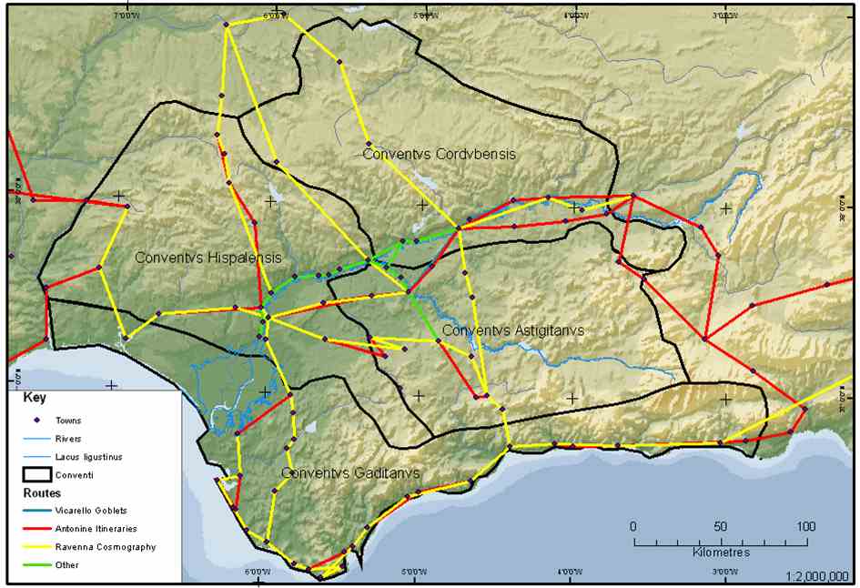
| + | [[Image:Routes.jpg |Autogenerated map of known Roman itineraries through Baetica (Andalucia, Spain)]] | ||
Revision as of 12:37, 28 September 2006
This page is the beginnings of a discussion forum on using geospatial technologies to map the past. It starts from the observation that mapping past landscapes is unlike mapping the future (which is predictive or prescriptive), or the present (which is descriptive and verifiable).
In fact, it is remarkably difficult to state plainly what past mapping is, other than 'reflecting the past' because it is hard to define criteria by which the 'correctness' of a map can be ascertained. This is not merely due to the truism that it is impossible to verify things for which one has no data, but also because the variety of different kinds of information which maps try to convey, combined, with the 'total' nature of spatial representation mean that few past maps will be 'correct' in anything but the most limited of senses.
The general function of this theory group is to further explore just what we are intending to do when mapping the past and create a future agenda by which appropriate techniques and technologies can be created by the community in order to better undertake them. We will start with an approximate agenda (outlined below) but, being a wiki, all contributors are welcome to add content to any of the debates at any time.
The initial discussion is intended to try and create a 'periodic table' of past mapping techniques. This is not a catalogue of things that we map (eg geology, roads, extents of empire, etc) but an attempt to cluster those things into ontological categories. When and how do we map snapshots? Changes? Inferences? Facts? Predictions? and so on.
The second discussion will be to ask how well current (especially Open) software and techniques are able to cope with these different aspects of spatial information.
The third discussion will attempt to establish a future agenda to work on new software and methodologies where required.
It is hoped that the discusion will also lead to a colloquium in which these matters can be debated with a wider public.
