Glossary-Project
OSGeo Glossary Project
The OSGeo glossary project is building processes and tools for setting up cross-domain, inter-operable glossaries. The focus is initially on OSGeo and spatial projects, but the patterns will be equally applicable and usable within other domains as well.
Goals
Glossaries are easy to set up for simple examples but extremely hard to scale - especially when trying to inherit terms from other organizations. The collaborative overhead becomes overwhelming. Communities struggle to agree upon:
- Term definitions,
- Field and sentence structure,
- Tooling,
- Governance, and more.
Challenges
Here we cover some of the key challenges we’ve been working through.
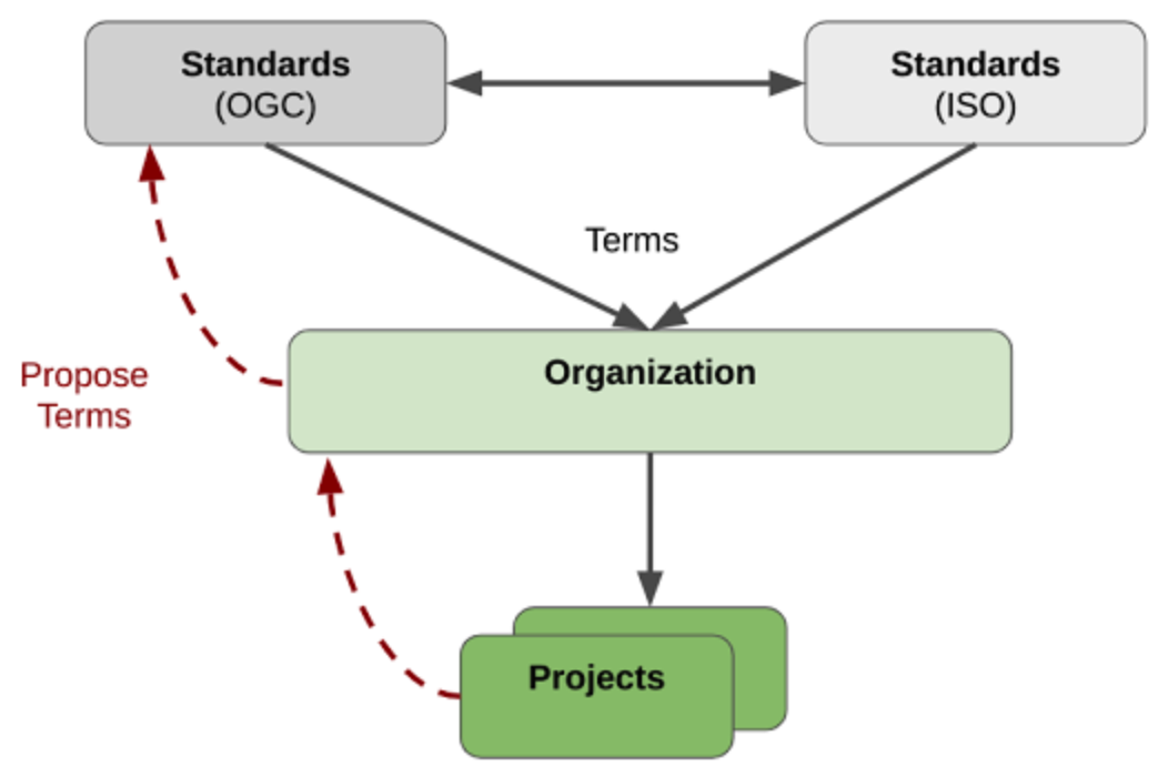
Sharing Terms
We’ve been working on how to share terms between glossaries.
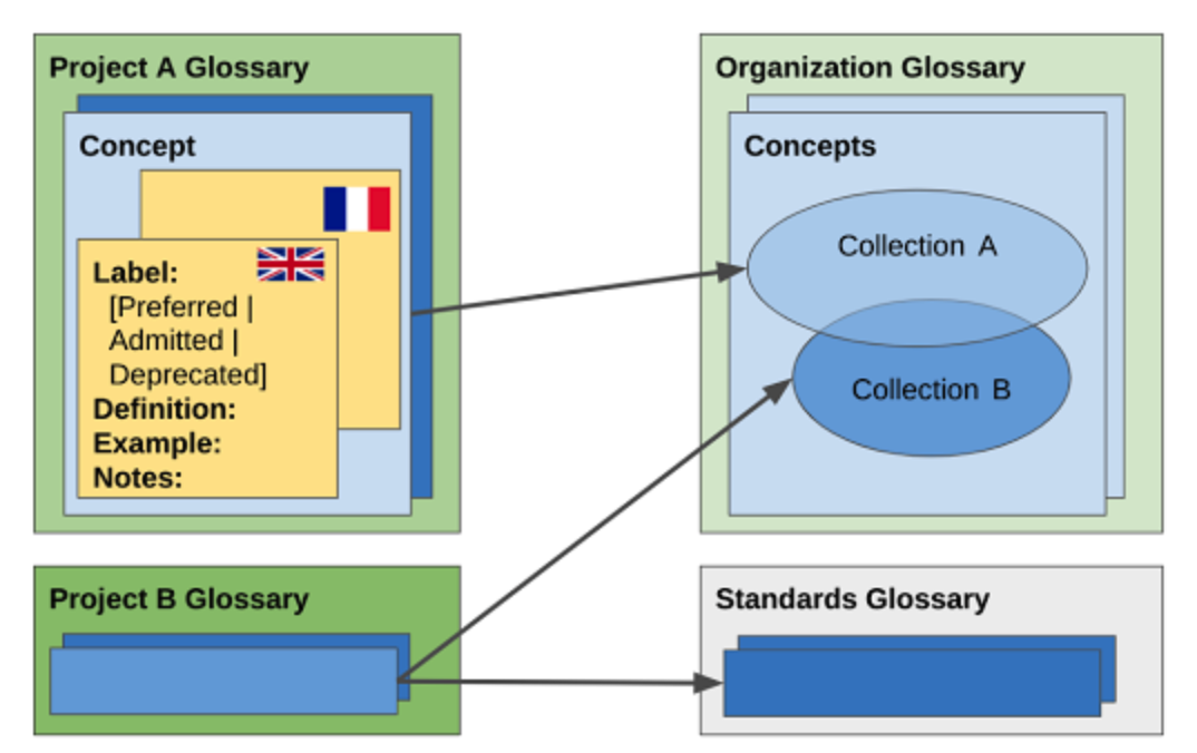
Information Schemas
We’ve been establishing standardized information structures.
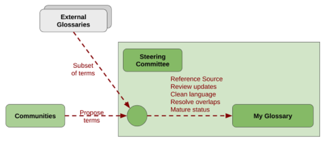
Governance
We’ve been working on governance models that projects can adopt.
Open-source software tooling
For building better cross-organizational glossaries, we are using Glossarist: an open-source tool to create, maintain, and update glossaries hassle-free. Glossarist is already in use by the ISO/TC 211 spatial standards body.
OSGeo Terminology
We’ve established an initial GeoLexica glossary covering English terminology used within OSGeo.
Next Steps
In 2021 and onwards, we aim to achieve the following:
- Create best practices in cross-domain glossary management, for adoption by the open-source and technical writing communities.
- Build a community that defines and manages geospatial terms across multiple geospatial projects and communities.
- Set up processes collated in explanations and how-tos which are easy-to-follow by everyday people wanting to stand up an interoperable glossary.
More Info
To know more about the project, refer to our project manifesto or read about our pilot project.
Point of Contact
We communicate on the OSGeo Lexicon email list. (Note: After subscribing, check your email spam for your subscription confirmation email. It is sent straight after subscribing. Or ask cameron . shorter AT gmail .com for help.)
Want to be a part of our community?
If you wish to be a part of this challenging glossary management project, then please reach out to us through our mailing list or our slack channel:
- Try setting up your own glossary using the tools and processes we are establishing. Help us improve in the process.
- Help research and then document best practices in glossary management.
- Help with whatever dirty work is required to keep the project moving forward.


