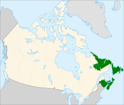
Atlantic Canada Chapter
Atlantic Canada Chapter of OSGeo
About the Chapter
Mission
- Promoting Open Source Geospatial tools and publicly available Geodata in Atlantic Canada
- Work with local private, public, and academic sectors to promote OSGeo software and use
Objectives
Regular Meetings
- bi-annual (once every 6 months), rotated around the region
Regional Events:
- Workshops and Training
- Special Lectures
- Demonstrations
Communication
- All chapter communication will be done through our email list: http://lists.osgeo.org/mailman/listinfo/atlanticcanada
- other relevant communication links:
- Open Street Map (Canada) mailing list: http://lists.openstreetmap.org/listinfo/talk-ca
- Open Street Map (Canada) project page: http://wiki.openstreetmap.org/wiki/WikiProject_Canada
- Open Street Map (Canada) IRC chat room: irc://irc.oftc.net/#osm-ca.
Legal status
- chapter is in formation as of June 2010
Atlantic Canada Chapter Officers
Chapter Representative to OSGeo
- Jeff McKenna (Gateway Geomatics, Lunenburg, NS)
Co-Chairs of the Local Chapter
Membership
- Bernie Connors, SNB (GeoNB, Fredericton, NB)
- Sheldon O'Reilly (CARIS, Fredericton, NB)
- Michael Henheffer (CARIS, Fredericton, NB)
- Eugenia Dietrich (CARIS, Fredericton, NB)
- Todd Jellett (CARIS, Fredericton, NB)
- Mark Masry (CARIS, Fredericton, NB)
- Aditya Aggarwal (CARIS, Fredericton, NB)
- Tim McCarthy (CARIS, Fredericton, NB)
- Luis Pontes (CARIS, Fredericton, NB)
- Alex Palmer (CARIS, Fredericton, NB)
- Adam Richard (CARIS, Fredericton, NB)
- Troy Coburn (CARIS, Fredericton, NB)
Meetings of the Atlantic Canada Chapter
Links
- mailing list: http://lists.osgeo.org/mailman/listinfo/atlanticcanada
