Difference between revisions of "Live GIS Disc Press Release 26"
(Created page with "=OSGeo-Live 5.5 released - the Open Source Geospatial DVD= ---- DRAFT ---- 1 March 2012 Version 5.5 of the [http://live.osgeo.org OSGeo-Live GIS software collection] is release...") |
|||
| (12 intermediate revisions by 2 users not shown) | |||
| Line 1: | Line 1: | ||
| − | = | + | [[File:Osgeolive wordle.png|link=http://live.osgeo.org|500px|right]] |
| − | + | <br><br> | |
| − | + | = OSGeo-Live 5.5 ready to distribute at international conferences = | |
| − | + | 28 February 2012 | |
| − | + | Version 5.5 of the [http://live.osgeo.org OSGeo-Live GIS software collection] and accompanying [http://trac.osgeo.org/osgeo/browser/livedvd/promo/trunk/en/presentation/ Lightening Presentation], has been released, ready for distribution at a large number of geospatial conferences and workshops from around the world. | |
| − | |||
| − | |||
| − | |||
==About OSGeo-Live== | ==About OSGeo-Live== | ||
| − | OSGeo-Live is a self-contained bootable DVD, USB flash drive and Virtual Machine based upon Ubuntu Linux that is pre-configured with a wide variety of robust open source geospatial software. The applications can be trialled without installing anything on your computer, simply by booting the computer from the DVD or USB drive. | + | OSGeo-Live is a self-contained bootable DVD, USB flash drive and Virtual Machine based upon Ubuntu Linux that is pre-configured with a wide variety of robust open source geospatial software. The applications can be trialled without installing anything on your computer, simply by booting the computer from the DVD or USB drive. The lightening overview introduces all these applications, and hence provides a comprehensive introduction to the breadth of Geospatial Open Source. |
| − | + | * http://live.osgeo.org | |
==Highlights== | ==Highlights== | ||
| − | * | + | * 50 Quality Geospatial Open Source applications installed and pre-configured |
| − | * Quality free world maps | + | * Quality free world maps and geodata |
| − | * One page overviews and quick | + | * One page overviews and quick start guides for all applications |
* Overviews of key OGC standards | * Overviews of key OGC standards | ||
* Translations for Greek, German, Polish, Spanish and Japanese | * Translations for Greek, German, Polish, Spanish and Japanese | ||
| Line 27: | Line 24: | ||
Browser Clients | Browser Clients | ||
| − | * OpenLayers | + | * OpenLayers - Browser GIS Client |
| − | * Geomajas - | + | * Geomajas - Browser GIS Client |
| − | * Mapbender | + | * Mapbender - Geoportal Framework |
| − | * MapFish | + | * MapFish - Web Mapping Framework |
| − | * GeoMoose | + | * GeoMoose - Web GIS Portal |
Crisis Management | Crisis Management | ||
| − | * Sahana Eden | + | * Sahana Eden - Disaster management |
| − | * Ushahidi | + | * Ushahidi - Mapping and Timeline for events |
Databases | Databases | ||
| − | * PostGIS | + | * PostGIS - Spatial Database |
| − | * SpatiaLite | + | * SpatiaLite - Lightweight Database |
| − | * Rasdaman | + | * Rasdaman - Multi-Dimensional Raster Database |
| − | * pgRouting | + | * pgRouting - Routing for PostGIS |
Desktop GIS | Desktop GIS | ||
| − | * Quantum GIS (QGIS) | + | * Quantum GIS (QGIS) |
| − | * GRASS GIS | + | * GRASS GIS |
| − | * gvSIG Desktop | + | * gvSIG Desktop |
| − | * User-friendly Desktop Internet GIS (uDig) | + | * User-friendly Desktop Internet GIS (uDig) |
| − | * Kosmo Desktop | + | * Kosmo Desktop |
| − | * OpenJUMP GIS | + | * OpenJUMP GIS |
| − | * SAGA | + | * SAGA |
| − | * OSSIM | + | * OSSIM - Image Processing |
| − | * Geopublisher | + | * Geopublisher - Catalogue |
| − | * AtlasStyler | + | * AtlasStyler - Style Editor |
| − | * osgEarth | + | * osgEarth - 3D Terrain Rendering |
| + | * MB-System - Sea Floor Mapping | ||
Navigation and Maps | Navigation and Maps | ||
| − | * GpsDrive | + | * GpsDrive - GPS Navigation |
| − | * Marble | + | * Marble - Spinning Globe |
| − | * OpenCPN | + | * OpenCPN - Marine GPS Chartplotter |
| − | * OpenStreetMap Tools | + | * OpenStreetMap - OpenStreetMap Tools |
| − | * Prune | + | * Prune - View, Edit and Convert GPS Tracks |
| − | * Viking | + | * Viking - GPS Data Analysis and Viewer |
| − | * zyGrib | + | * zyGrib - Weather Forecast Maps |
Spatial Tools | Spatial Tools | ||
| − | * GeoKettle | + | * GeoKettle - ETL (Extract, Transform and Load) Tool |
| − | * GDAL/OGR | + | * GDAL/OGR - Geospatial Data Translation Tools |
| − | * GMT | + | * GMT - Cartographic Rendering |
| − | * Mapnik | + | * Mapnik - Cartographic Rendering |
| − | * MapTiler | + | * MapTiler - Create Map Tiles |
| − | * OTB | + | * OTB - Image Processing |
| − | * R Spatial Task View | + | * R Spatial Task View - Statistical Programming |
Web Services | Web Services | ||
| − | * GeoServer | + | * GeoServer |
| − | * MapServer | + | * MapServer |
| − | * deegree | + | * deegree |
| − | * GeoNetwork | + | * GeoNetwork - Metadata Catalogue |
| − | * MapProxy | + | * pycsw - Metadata Catalogue |
| − | * QGIS Server | + | * MapProxy - Proxy WMS & tile services |
| − | * 52°North WSS | + | * QGIS Server - Web Map Service |
| − | * 52°North WPS | + | * 52°North WSS - Web Security Service |
| − | * 52°North SOS - | + | * 52°North WPS - Web Processing Service |
| − | * TinyOWS | + | * 52°North SOS - Sensor Observation Service |
| − | * ZOO Project | + | * TinyOWS - WFS-T Service |
| + | * ZOO Project - Web Processing Service | ||
Data | Data | ||
| − | * Natural Earth | + | * Natural Earth - Geographic Data Sets |
| − | * OSGeo | + | * OSGeo North Carolina, USA Educational dataset |
* OpenStreetMap - Sample extract from OpenStreetMap | * OpenStreetMap - Sample extract from OpenStreetMap | ||
| Line 104: | Line 103: | ||
* MetaCRS - Coordinate Reference System Transformations | * MetaCRS - Coordinate Reference System Transformations | ||
* libLAS - LiDAR Data Access | * libLAS - LiDAR Data Access | ||
| + | |||
| + | Other software of interest (not available Live) | ||
| + | |||
| + | * MapWindow GIS - Microsoft Windows based GIS | ||
| + | * MapGuide Open Source - Web Service | ||
| + | |||
| + | ==Where to find OSGeo-Live== | ||
| + | You can pick up an OSGeo-Live DVD or USB and/or see the presentation at: | ||
| + | |||
| + | # Our http://live.osgeo.org website | ||
| + | # [http://www.malaysiageospatialforum.org Malaysian Geospatial Forum], Malaka, Malaysia, March 2012 | ||
| + | # [http://www.sigte.udg.edu/jornadassiglibre/ Spanish FOSS4G 2012], Girona, Spain, March 2012 | ||
| + | # [http://www.fossgis.de/konferenz/2012/ FOSSGIS 2012], Dessau, Germany,March 2012 | ||
| + | # [http://awra.org/meetings/Spring2012/ AWRA GIS and Water Resources Conference], New Orleans, USA, March 2012 | ||
| + | # [http://www.lancs.ac.uk/gisruk2012/ GISRUK 2012], Lancaster University, UK, April 2012 | ||
| + | # [http://foss4g-na.org/ FOSS4G North America 2012], Washington DC, USA, April 2012 | ||
| + | # [http://foss4g-cee.org/ FOSS4G-CEE & Geoinformatics 2012], Prague, Czech Republic, May 2012, | ||
| + | # [http://www.mapwindow.org/conference/2012/ MapWindow/FOSS4G Regional Netherlands], Velp, The Netherlands, June 2012 | ||
| + | # [http://www.iemss.org/sites/iemss2012/sessions_D.html International Environmental Modeling and Software Society Conference (IEMSS)], Leipzig, Germany, July 2012 | ||
| + | # [http://www.34igc.org/ 34th International Geological Conference], Brisbane, Australia, August 2012 | ||
| + | # [http://2012.foss4g.org International FOSS4G2012], Beijing, China, September 2012 | ||
| + | # [http://intergeo.de INTERGEO], Hannover Germany, October 2012 | ||
== Credits == | == Credits == | ||
| Line 109: | Line 130: | ||
Over 80 people have directly helped with OSGeo-Live packaging, documenting and translating, and thousands have been involved in building the packaged software. | Over 80 people have directly helped with OSGeo-Live packaging, documenting and translating, and thousands have been involved in building the packaged software. | ||
| − | Packagers, documenters and translators include: | + | Packagers, documenters and translators include: |
| + | Agustín Díez, Aikaterini Kapsampeli, Alan Boudreault, Alexandre Dube, Alex Mandel, Andrea Antonello, Andrea Yanza, Angelos Tzotsos, Anne Ghisla, Anton Patrushev, Argyros Argyridis, Astrid Emde, Brian Hamlin, Bruno Binet, Cameron Shorter, Christos Iossifidis, Dane Springmeyer, Daniel Kastl, David Mateos, Diego González, Dimitar Misev, Dominik Helle, Edgar Soldin, Eike Hinderk Jürrens, Eric Lemoine, Etienne Dube, Fran Boon, François Prunayre, Frank Gasdorf, Gavin Treadgold, Gérald Fenoy, Hamish Bowman, Haruyuki Seki, Henry Addo, Hernan Olivera, Howard Butler, Ian Turton, Jackie Ng, Jan Drewnak, Javier Sanchez, Jesús Gómez, Jim Klassen, Jody Garnett, Johan Van de Wauw, Jorge Arévalo, Jorge Sanz, José Antonio Canalejo, Judit Mays, Klokan Petr Pridal, Kristof Lange, Lance McKee, Lars Lingner, Lucía Sanjaime, Mage Whopper, Manuel Grizonnet, Marco Puppin, Mark Leslie, Massimo Di Stefano, Mauricio Miranda, Mauricio Pazos, Michaël Michaud, Michael Owonibi, Micha Silver, Mike Adair, Milena Nowotarska, Nathaniel V. Kelso, Ned Horning, Nobusuke Iwasaki, Oliver Tonnhofer, Òscar Fonts, Otto Dassau, Paul Meems, Pedro-Juan Ferrer, Pirmin Kalberer, Ricardo Pinho, Roald de Wit, Roberto Antolín, Ruth Schoenbuchner, Samuel Mesa, Sergio Baños, Simon Cropper, Simon Pigot, Stefan A. Tzeggai, Stefan Hansen, Steve Lime, Thierry Badard, Thomas Baschetti, Tom Kralidis, Trevor Wekel, Valenty Gonzalez, Yoichi Kayama | ||
==Sponsoring organisations== | ==Sponsoring organisations== | ||
| + | |||
| + | * [http://www.osgeo.org The Open Source Geospatial Foundation] (OSGeo) provides the primary development & hosting infrastructure and personnel for the project, and for many of the software teams which contribute to it. | ||
* LISAsoft provides sustaining resources and staff toward the management and packaging of software onto the Live DVD. http://www.lisasoft.com | * LISAsoft provides sustaining resources and staff toward the management and packaging of software onto the Live DVD. http://www.lisasoft.com | ||
Latest revision as of 15:35, 13 August 2012
OSGeo-Live 5.5 ready to distribute at international conferences
28 February 2012
Version 5.5 of the OSGeo-Live GIS software collection and accompanying Lightening Presentation, has been released, ready for distribution at a large number of geospatial conferences and workshops from around the world.
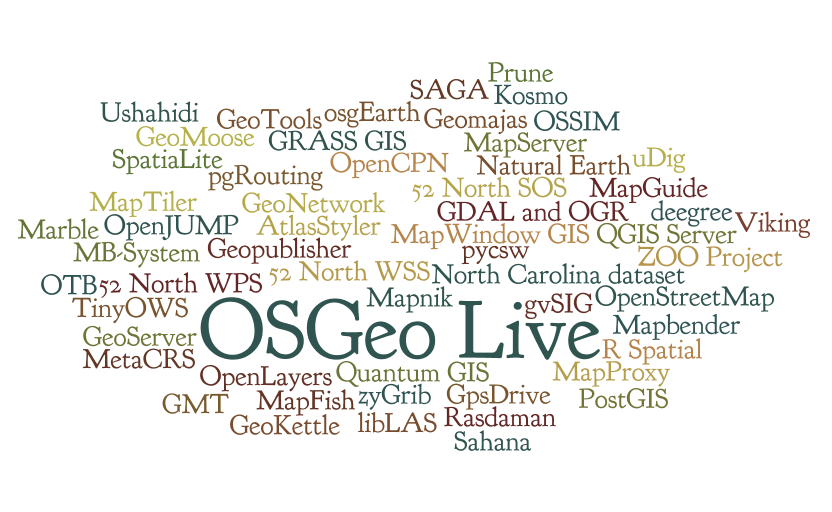
About OSGeo-Live
OSGeo-Live is a self-contained bootable DVD, USB flash drive and Virtual Machine based upon Ubuntu Linux that is pre-configured with a wide variety of robust open source geospatial software. The applications can be trialled without installing anything on your computer, simply by booting the computer from the DVD or USB drive. The lightening overview introduces all these applications, and hence provides a comprehensive introduction to the breadth of Geospatial Open Source.
Highlights
- 50 Quality Geospatial Open Source applications installed and pre-configured
- Quality free world maps and geodata
- One page overviews and quick start guides for all applications
- Overviews of key OGC standards
- Translations for Greek, German, Polish, Spanish and Japanese
Contents
Browser Clients
- OpenLayers - Browser GIS Client
- Geomajas - Browser GIS Client
- Mapbender - Geoportal Framework
- MapFish - Web Mapping Framework
- GeoMoose - Web GIS Portal
Crisis Management
- Sahana Eden - Disaster management
- Ushahidi - Mapping and Timeline for events
Databases
- PostGIS - Spatial Database
- SpatiaLite - Lightweight Database
- Rasdaman - Multi-Dimensional Raster Database
- pgRouting - Routing for PostGIS
Desktop GIS
- Quantum GIS (QGIS)
- GRASS GIS
- gvSIG Desktop
- User-friendly Desktop Internet GIS (uDig)
- Kosmo Desktop
- OpenJUMP GIS
- SAGA
- OSSIM - Image Processing
- Geopublisher - Catalogue
- AtlasStyler - Style Editor
- osgEarth - 3D Terrain Rendering
- MB-System - Sea Floor Mapping
Navigation and Maps
- GpsDrive - GPS Navigation
- Marble - Spinning Globe
- OpenCPN - Marine GPS Chartplotter
- OpenStreetMap - OpenStreetMap Tools
- Prune - View, Edit and Convert GPS Tracks
- Viking - GPS Data Analysis and Viewer
- zyGrib - Weather Forecast Maps
Spatial Tools
- GeoKettle - ETL (Extract, Transform and Load) Tool
- GDAL/OGR - Geospatial Data Translation Tools
- GMT - Cartographic Rendering
- Mapnik - Cartographic Rendering
- MapTiler - Create Map Tiles
- OTB - Image Processing
- R Spatial Task View - Statistical Programming
Web Services
- GeoServer
- MapServer
- deegree
- GeoNetwork - Metadata Catalogue
- pycsw - Metadata Catalogue
- MapProxy - Proxy WMS & tile services
- QGIS Server - Web Map Service
- 52°North WSS - Web Security Service
- 52°North WPS - Web Processing Service
- 52°North SOS - Sensor Observation Service
- TinyOWS - WFS-T Service
- ZOO Project - Web Processing Service
Data
- Natural Earth - Geographic Data Sets
- OSGeo North Carolina, USA Educational dataset
- OpenStreetMap - Sample extract from OpenStreetMap
Geospatial Libraries
- GeoTools - Java GIS Toolkit
- MetaCRS - Coordinate Reference System Transformations
- libLAS - LiDAR Data Access
Other software of interest (not available Live)
- MapWindow GIS - Microsoft Windows based GIS
- MapGuide Open Source - Web Service
Where to find OSGeo-Live
You can pick up an OSGeo-Live DVD or USB and/or see the presentation at:
- Our http://live.osgeo.org website
- Malaysian Geospatial Forum, Malaka, Malaysia, March 2012
- Spanish FOSS4G 2012, Girona, Spain, March 2012
- FOSSGIS 2012, Dessau, Germany,March 2012
- AWRA GIS and Water Resources Conference, New Orleans, USA, March 2012
- GISRUK 2012, Lancaster University, UK, April 2012
- FOSS4G North America 2012, Washington DC, USA, April 2012
- FOSS4G-CEE & Geoinformatics 2012, Prague, Czech Republic, May 2012,
- MapWindow/FOSS4G Regional Netherlands, Velp, The Netherlands, June 2012
- International Environmental Modeling and Software Society Conference (IEMSS), Leipzig, Germany, July 2012
- 34th International Geological Conference, Brisbane, Australia, August 2012
- International FOSS4G2012, Beijing, China, September 2012
- INTERGEO, Hannover Germany, October 2012
Credits
Over 80 people have directly helped with OSGeo-Live packaging, documenting and translating, and thousands have been involved in building the packaged software.
Packagers, documenters and translators include: Agustín Díez, Aikaterini Kapsampeli, Alan Boudreault, Alexandre Dube, Alex Mandel, Andrea Antonello, Andrea Yanza, Angelos Tzotsos, Anne Ghisla, Anton Patrushev, Argyros Argyridis, Astrid Emde, Brian Hamlin, Bruno Binet, Cameron Shorter, Christos Iossifidis, Dane Springmeyer, Daniel Kastl, David Mateos, Diego González, Dimitar Misev, Dominik Helle, Edgar Soldin, Eike Hinderk Jürrens, Eric Lemoine, Etienne Dube, Fran Boon, François Prunayre, Frank Gasdorf, Gavin Treadgold, Gérald Fenoy, Hamish Bowman, Haruyuki Seki, Henry Addo, Hernan Olivera, Howard Butler, Ian Turton, Jackie Ng, Jan Drewnak, Javier Sanchez, Jesús Gómez, Jim Klassen, Jody Garnett, Johan Van de Wauw, Jorge Arévalo, Jorge Sanz, José Antonio Canalejo, Judit Mays, Klokan Petr Pridal, Kristof Lange, Lance McKee, Lars Lingner, Lucía Sanjaime, Mage Whopper, Manuel Grizonnet, Marco Puppin, Mark Leslie, Massimo Di Stefano, Mauricio Miranda, Mauricio Pazos, Michaël Michaud, Michael Owonibi, Micha Silver, Mike Adair, Milena Nowotarska, Nathaniel V. Kelso, Ned Horning, Nobusuke Iwasaki, Oliver Tonnhofer, Òscar Fonts, Otto Dassau, Paul Meems, Pedro-Juan Ferrer, Pirmin Kalberer, Ricardo Pinho, Roald de Wit, Roberto Antolín, Ruth Schoenbuchner, Samuel Mesa, Sergio Baños, Simon Cropper, Simon Pigot, Stefan A. Tzeggai, Stefan Hansen, Steve Lime, Thierry Badard, Thomas Baschetti, Tom Kralidis, Trevor Wekel, Valenty Gonzalez, Yoichi Kayama
Sponsoring organisations
- The Open Source Geospatial Foundation (OSGeo) provides the primary development & hosting infrastructure and personnel for the project, and for many of the software teams which contribute to it.
- LISAsoft provides sustaining resources and staff toward the management and packaging of software onto the Live DVD. http://www.lisasoft.com
- Information Center for the Environment at the University of California, Davis provides hardware resources and development support to the OSGeo Live project. http://ice.ucdavis.edu
- The DebianGIS and UbuntuGIS teams provide and quality-assure many of the core packages. http://wiki.debian.org/DebianGis and https://wiki.ubuntu.com/UbuntuGIS