Difference between revisions of "MOU ICA"
m (add draft note) |
|||
| (26 intermediate revisions by 4 users not shown) | |||
| Line 1: | Line 1: | ||
| − | + | ==Memorandum of Understanding 2016== | |
| − | |||
'''Memorandum of Understanding between''' | '''Memorandum of Understanding between''' | ||
| − | |||
| − | |||
| − | |||
| − | + | The Open Source Geospatial Foundation (OSGeo) | |
| + | and | ||
| + | International Cartographic Association ([http://icaci.org/ ICA]) | ||
| − | The purpose of this Memorandum of Understanding (MOU) is to establish a collaborative relationship between the Open Source Geospatial Foundation (OSGeo) and the International Cartographic Association (ICA). Both parties to this MOU share the goal of | + | ''Revised MoU approved by the OCGeo Board of Directors and ICA Executive Committee in October 2016'' |
| + | |||
| + | The purpose of this Memorandum of Understanding (MOU) is to establish a collaborative relationship between the Open Source Geospatial Foundation (OSGeo) and the International Cartographic Association (ICA). Both parties to this MOU share the goal of helping share global geo-information with all communities. | ||
| + | |||
| + | The MOU will cover the following proposals and topics: | ||
| + | * To formally bridge the cartography and *GIScience* communities with the Open Source Geospatial *communities*. | ||
| + | * To promote the development related cartography and GIScience Open Source Geospatial software. | ||
| + | * To work closely with the "Geo for All" initiative, to help promote openness in education and research. | ||
| + | * To promote the distribution and use of open geo-data sets in all communities. | ||
| + | * To hold joint international workshops and conference sessions on open geo-data sets and Open Source geospatial software for cartography. | ||
| + | |||
| + | This MOU will be reviewed biennially by both parties at which time revisions may be made and the agreement renewed. | ||
| + | |||
| + | Signed by | ||
| + | |||
| + | Menno-Jan Kraak, President, ICA | ||
| + | |||
| + | Helena Mitasova, Vice-President, OSGeo | ||
| + | |||
| + | == Memorandum of Understanding 2011, 2015== | ||
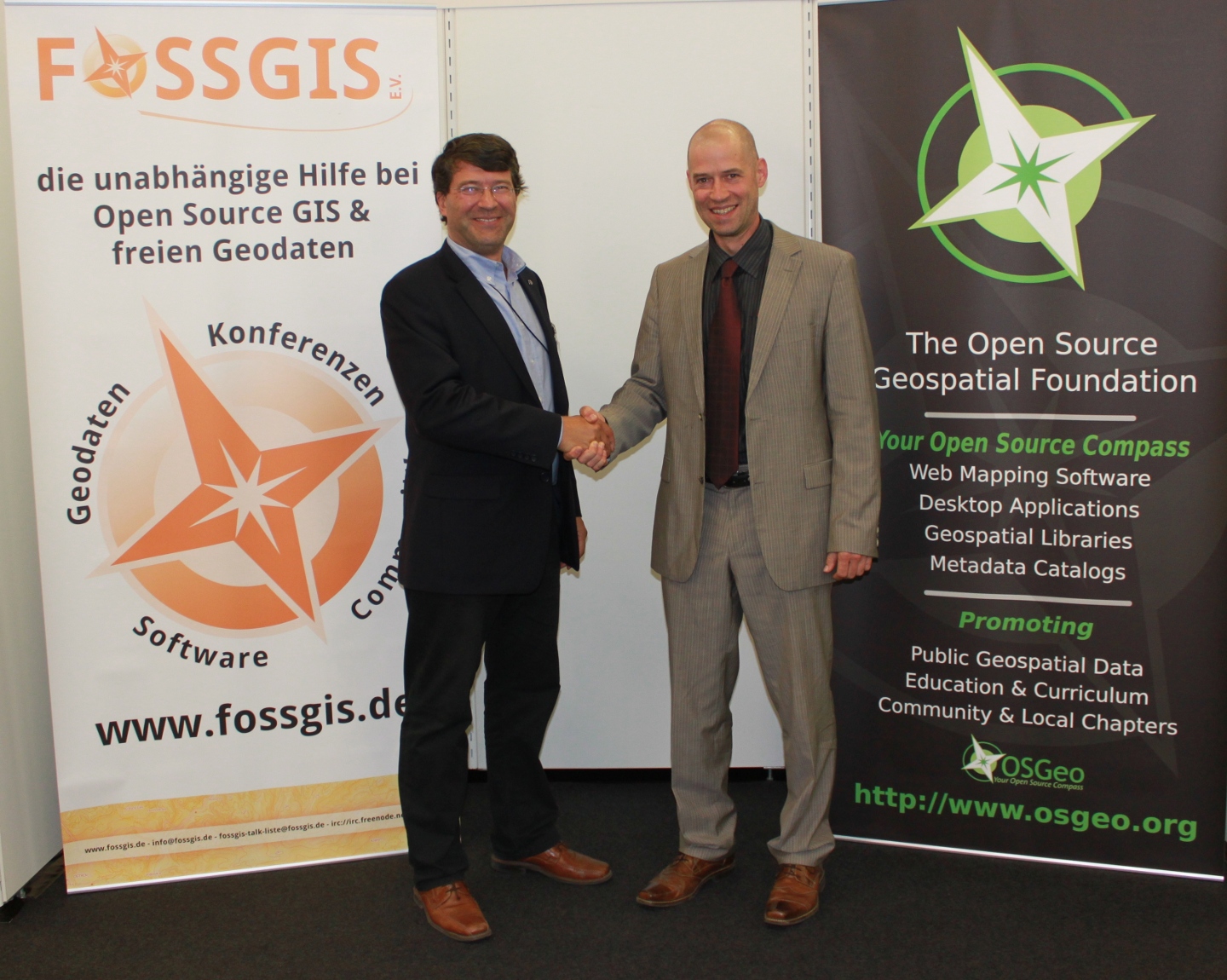
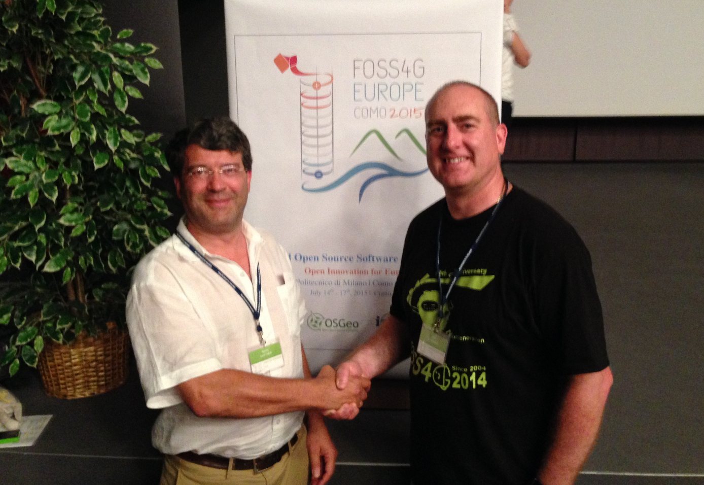
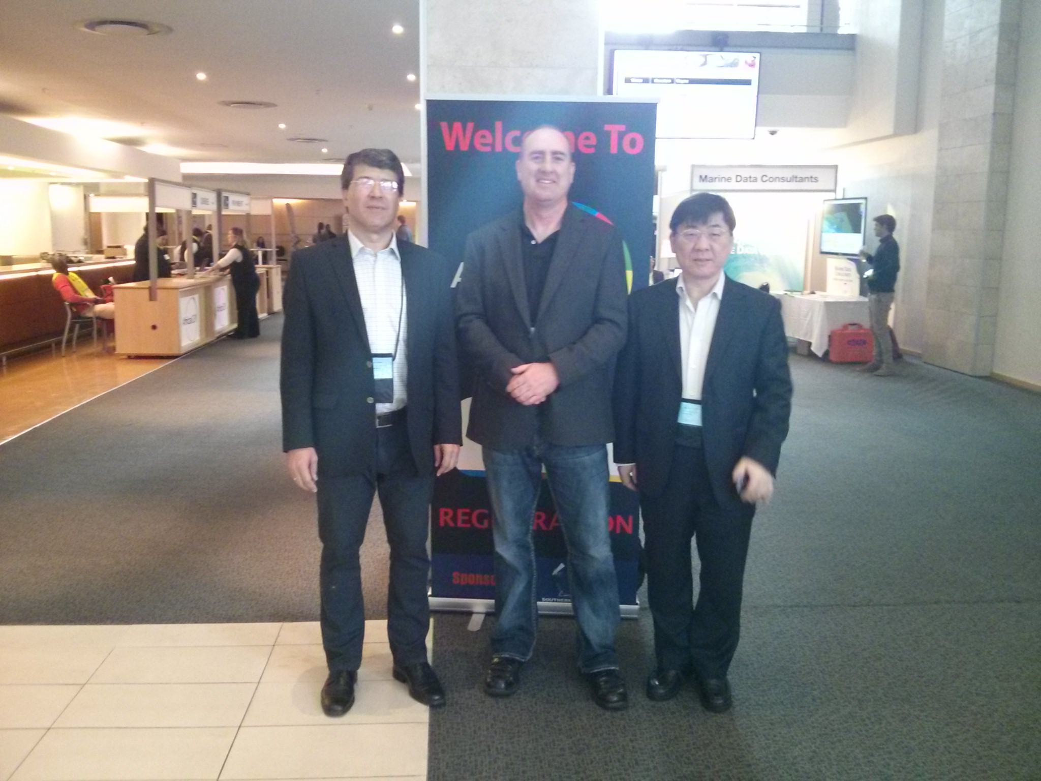
| + | This Memorandum of Understanding was approved on 18th Sept. 2011 by the OSGeo Board of Directors at the [[Face to Face Meeting Denver 2011#Minutes | Denver Board Meeting]]. This MoU was renewed by Georg Gartner, former President ICA, and Jeff McKenna, President OSGeo, on 16 July 2015 at FOSS4G Europe, in Como Italy. | ||
| + | |||
| + | ------ | ||
| + | |||
| + | [[File:OSGeo-ICA MoU.png|thumb|300px|right|Memorandum of Understanding]] | ||
| + | |||
| + | [[File:Jeff georg renew mou 2015.jpg|thumb|400px|right|Prof. Georg Gartner and Jeff McKenna shake hands after renewing the MoU at FOSS4G-Europe 2015 in Como, Italy]] | ||
| + | [[File:ICA-OSGeo-ISPRS-presidents.jpg|thumb|300px|right|Presidents Georg Gartner (ICA), Jeff McKenna (OSGeo), and Chen Jun (ISPRS) meet at AfricaGEO in South Africa, 2014, to renew the partnership.]] | ||
| + | [[File:Mou ica-osgeo.jpg|thumb|400px|right|Prof. Georg Gartner and Arnulf Christl shake hands after signing the MoU at the OSGeo booth at [[Intergeo | Intergeo 2011]] in Germany]] | ||
| + | |||
| + | ; Memorandum of Understanding between | ||
| + | : The Open Source Geospatial Foundation | ||
| + | : and | ||
| + | : International Cartographic Association ([http://icaci.org/ ICA]) | ||
| + | |||
| + | ''September 2011. Renewed July 2015'' | ||
| + | |||
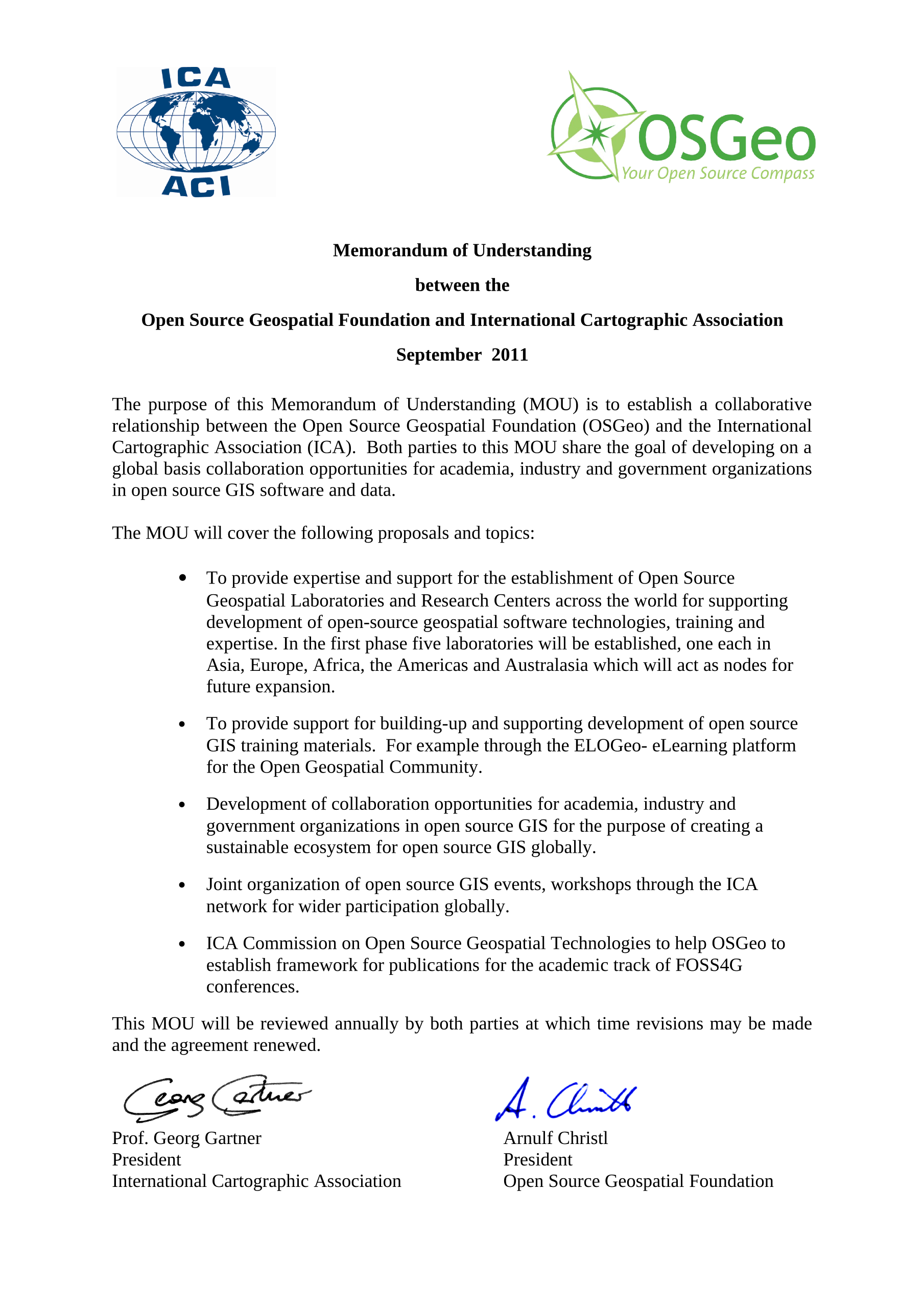
| + | The purpose of this Memorandum of Understanding (MOU) is to establish a collaborative relationship between the Open Source Geospatial Foundation (OSGeo) and the International Cartographic Association (ICA). Both parties to this MOU share the goal of developing global collaboration opportunities for academia, industry and government organizations in open source geospatial software and data especially through the ''GeoForAll initiative''. | ||
The MOU will cover the following proposals and topics: | The MOU will cover the following proposals and topics: | ||
| − | * To provide expertise and support for the establishment of Open Source Geospatial Laboratories and Research Centers across the world for supporting development of open-source geospatial software technologies, training and expertise | + | * To further develop the GeoForAll initiative, through expanding partnerships. |
| − | * To provide support for building-up and supporting development of open source | + | * To provide expertise and support for the establishment of Open Source Geospatial Laboratories and Research Centers across the world for supporting development of open-source geospatial software technologies, training and expertise. |
| − | * Development of collaboration opportunities for academia, industry and government organizations in open source | + | * To provide support for building-up and supporting development of open source geopatial education and training materials. |
| − | * Joint organization of open source | + | * Development of collaboration opportunities for academia, industry and government organizations in open source geospatial software and data for the purpose of creating a sustainable ecosystem for open source geospatial software and data globally. |
| − | * ICA Commission on Open Source Geospatial Technologies to | + | * Joint organization of open source geospatial events, workshops through the ICA and OSGeo network for wider participation globally. |
| + | * ICA Commission on Open Source Geospatial Technologies to further collaborate with OSGeo on academic publications. | ||
This MOU will be reviewed annually by both parties at which time revisions may be made and the agreement renewed. | This MOU will be reviewed annually by both parties at which time revisions may be made and the agreement renewed. | ||
| − | Signed | + | Signed by |
| − | + | : Prof Georg Gartner, President, ICA | |
| + | : Jeff McKenna, President, OSGeo | ||
| + | |||
| + | == Geo for All == | ||
| + | One of the more visible results of this Memorandum of Understanding the [[Geo for All]] initiative. | ||
| + | |||
| + | == Download Document == | ||
| + | * [[:File:OSGeo-ICA MoU.pdf | Document in PDF format (145kB)]] | ||
| + | * [[:File:OSGeo-ICA MoU.png | Document as PNG image (631kB)]] | ||
| + | |||
| + | == Related Articles == | ||
| + | * [http://www.geoconnexion.com/geo_news_article/OSGeo-and-ICA-sign-MOU/11852 Geoconnexion] | ||
| + | * [http://www.directionsmag.com/pressreleases/the-open-source-geospatial-foundation-and-the-international-cartographic-as/209371 Directionsmag] | ||
| + | * [http://www.vector1media.com/news/top-stories/54-projects/23583-open-source-geospatial-foundation-and-the-international-cartographic-association-ica-memorandum-of-understanding.html vector1media] | ||
| + | |||
[[Category:MoU]] | [[Category:MoU]] | ||
Latest revision as of 00:55, 14 June 2017
Memorandum of Understanding 2016
Memorandum of Understanding between
The Open Source Geospatial Foundation (OSGeo) and International Cartographic Association (ICA)
Revised MoU approved by the OCGeo Board of Directors and ICA Executive Committee in October 2016
The purpose of this Memorandum of Understanding (MOU) is to establish a collaborative relationship between the Open Source Geospatial Foundation (OSGeo) and the International Cartographic Association (ICA). Both parties to this MOU share the goal of helping share global geo-information with all communities.
The MOU will cover the following proposals and topics:
- To formally bridge the cartography and *GIScience* communities with the Open Source Geospatial *communities*.
- To promote the development related cartography and GIScience Open Source Geospatial software.
- To work closely with the "Geo for All" initiative, to help promote openness in education and research.
- To promote the distribution and use of open geo-data sets in all communities.
- To hold joint international workshops and conference sessions on open geo-data sets and Open Source geospatial software for cartography.
This MOU will be reviewed biennially by both parties at which time revisions may be made and the agreement renewed.
Signed by
Menno-Jan Kraak, President, ICA
Helena Mitasova, Vice-President, OSGeo
Memorandum of Understanding 2011, 2015
This Memorandum of Understanding was approved on 18th Sept. 2011 by the OSGeo Board of Directors at the Denver Board Meeting. This MoU was renewed by Georg Gartner, former President ICA, and Jeff McKenna, President OSGeo, on 16 July 2015 at FOSS4G Europe, in Como Italy.

- Memorandum of Understanding between
- The Open Source Geospatial Foundation
- and
- International Cartographic Association (ICA)
September 2011. Renewed July 2015
The purpose of this Memorandum of Understanding (MOU) is to establish a collaborative relationship between the Open Source Geospatial Foundation (OSGeo) and the International Cartographic Association (ICA). Both parties to this MOU share the goal of developing global collaboration opportunities for academia, industry and government organizations in open source geospatial software and data especially through the GeoForAll initiative.
The MOU will cover the following proposals and topics:
- To further develop the GeoForAll initiative, through expanding partnerships.
- To provide expertise and support for the establishment of Open Source Geospatial Laboratories and Research Centers across the world for supporting development of open-source geospatial software technologies, training and expertise.
- To provide support for building-up and supporting development of open source geopatial education and training materials.
- Development of collaboration opportunities for academia, industry and government organizations in open source geospatial software and data for the purpose of creating a sustainable ecosystem for open source geospatial software and data globally.
- Joint organization of open source geospatial events, workshops through the ICA and OSGeo network for wider participation globally.
- ICA Commission on Open Source Geospatial Technologies to further collaborate with OSGeo on academic publications.
This MOU will be reviewed annually by both parties at which time revisions may be made and the agreement renewed.
Signed by
- Prof Georg Gartner, President, ICA
- Jeff McKenna, President, OSGeo
Geo for All
One of the more visible results of this Memorandum of Understanding the Geo for All initiative.


