Difference between revisions of "Angelos Tzotsos"
Jump to navigation
Jump to search
| Line 6: | Line 6: | ||
|State=Attica | |State=Attica | ||
|City=Athens | |City=Athens | ||
| − | |Coordinate=37. | + | |Coordinate=37.979, 23.7676 |
|LocalChapter=Greek | |LocalChapter=Greek | ||
|Email=tzotsos@osgeo.org | |Email=tzotsos@osgeo.org | ||
| − | |Phone=+ | + | |Phone=+30 693 2149344 |
|SocialMedia=https://twitter.com/tzotsos; | |SocialMedia=https://twitter.com/tzotsos; | ||
|Website=http://users.ntua.gr/tzotsos | |Website=http://users.ntua.gr/tzotsos | ||
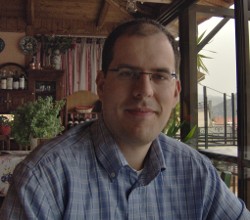
| − | |Photo= | + | |Photo=tzotsos.jpg |
|Languages=Greek, English; | |Languages=Greek, English; | ||
|Info=Angelos is a remote sensing expert with background in surveying engineering and software development. He is involved in numerous activities around free and open source software and has great experience in geospatial applications, geospatial data catalogues and metadata. His research involves remote sensing, machine learning, computer vision and object-based image analysis. He is currently the President of OSGeo and also serves at the OSGeo Board of Directors. He is an active advocate of OSGeo in Greece at related conferences. He is also an individual OGC member. His recent activity involved implementation of data.gov catalog service and implementation of the Greek national open data portal geodata.gov.gr. | |Info=Angelos is a remote sensing expert with background in surveying engineering and software development. He is involved in numerous activities around free and open source software and has great experience in geospatial applications, geospatial data catalogues and metadata. His research involves remote sensing, machine learning, computer vision and object-based image analysis. He is currently the President of OSGeo and also serves at the OSGeo Board of Directors. He is an active advocate of OSGeo in Greece at related conferences. He is also an individual OGC member. His recent activity involved implementation of data.gov catalog service and implementation of the Greek national open data portal geodata.gov.gr. | ||
| − | + | }} | |
| − | OSGeo | + | {{OSGeo Experience |
| − | + | |User=Yes | |
| + | |Committee=Yes | ||
| + | |Board=Yes | ||
| + | |Coder=Yes | ||
| + | |Translate=No | ||
| + | |PSC=Yes | ||
| + | |ExBoard=No | ||
| + | |Charter=Yes | ||
| + | |Chair=Yes | ||
| + | |SolKatz=No | ||
| + | |Committer=Yes | ||
| + | }} | ||
| + | ;OSGeo Experience | ||
| + | : | ||
:* [http://live.osgeo.org OSGeo-Live]. PSC Chair, OSGeo Project Officer, Build manager and Core Developer. | :* [http://live.osgeo.org OSGeo-Live]. PSC Chair, OSGeo Project Officer, Build manager and Core Developer. | ||
:* [http://pycsw.org pycsw]. OSGeo Project Officer, PSC Member and Core Developer. | :* [http://pycsw.org pycsw]. OSGeo Project Officer, PSC Member and Core Developer. | ||
| Line 36: | Line 49: | ||
:* [https://github.com/kalxas/mseg MSEG]. Personal project. | :* [https://github.com/kalxas/mseg MSEG]. Personal project. | ||
:* [https://github.com/kalxas/GIMED GIMED]. Personal project. | :* [https://github.com/kalxas/GIMED GIMED]. Personal project. | ||
| − | + | ||
| − | |||
| − | |||
| − | |||
| − | |||
| − | |||
| − | |||
| − | |||
| − | |||
| − | |||
| − | |||
| − | |||
| − | |||
| − | |||
;Profile last updated: 17 April 2020 | ;Profile last updated: 17 April 2020 | ||
[[Category:Greek]] | [[Category:Greek]] | ||
[[Category:OSGeo Member]] | [[Category:OSGeo Member]] | ||
| + | [[Category:OSGeo Advocate]] | ||
| + | [[Category:Board of Directors]] | ||
Revision as of 02:54, 17 April 2020
| OSGeo Member | ||
|---|---|---|
| Name: | Angelos Tzotsos |  |
| Job Title: | Geospatial Software Developer, Remote Sensing Consultant, Senior Researcher | |
| Company: | Open Source Geospatial Foundation | |
| Address: | ||
| City: | Athens | |
| State: | Attica | |
| Country: | Greece | |
| Local Chapter: | Greek | |
| Email: | tzotsos@osgeo.org | |
| Phone: | +30 693 2149344 | |
| Instant Messaging: | ||
| Website: | http://users.ntua.gr/tzotsos | |
| Language(s): | Greek, English | |
| Personal Description : | Angelos is a remote sensing expert with background in surveying engineering and software development. He is involved in numerous activities around free and open source software and has great experience in geospatial applications, geospatial data catalogues and metadata. His research involves remote sensing, machine learning, computer vision and object-based image analysis. He is currently the President of OSGeo and also serves at the OSGeo Board of Directors. He is an active advocate of OSGeo in Greece at related conferences. He is also an individual OGC member. His recent activity involved implementation of data.gov catalog service and implementation of the Greek national open data portal geodata.gov.gr. | |
|
|
||
OSGeo Experience and Roles:
- OSGeo Experience
-
- OSGeo-Live. PSC Chair, OSGeo Project Officer, Build manager and Core Developer.
- pycsw. OSGeo Project Officer, PSC Member and Core Developer.
- pygeoapi. PSC Member and Contributor.
- GeoNode. Core Developer.
- Orfeo Toolbox. Developer.
- ZOO-Project. PSC Member and Developer.
- QGIS. Plugin Developer (DigitizingTools, MetaSearch, CadTools)
- Data.gov USA open data catalog (based on CKAN and pycsw). Developer.
- Geodata.gov.gr Greek open data catalog (based on PublicaMundi) . Scientific and Technical Coordinator, Core Developer.
- OWSlib. Developer.
- MapServer. Packager.
- GRASS GIS. Packager.
- openSUSE Official Member, Geospatial Package Maintainer.
- UbuntuGIS. Member and Package Maintainer.
- DebianGIS. Package Contributor.
- Gnorasi (Orfeo Toolbox external project). Core developer.
- MSEG. Personal project.
- GIMED. Personal project.
- Profile last updated
- 17 April 2020