Difference between revisions of "Didier Richard"
Jump to navigation
Jump to search
| Line 9: | Line 9: | ||
|LocalChapter=Francophone OSGeo Chapter | |LocalChapter=Francophone OSGeo Chapter | ||
|Website=https://www.geoportail.gouv.fr/ | |Website=https://www.geoportail.gouv.fr/ | ||
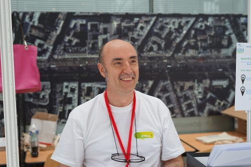
| + | |Photo=DidierRichardatFOSS4GEurope2017.jpg | ||
|Languages=french; english; | |Languages=french; english; | ||
|Info=I have been a supporter of OpenSource software for Geomatics for long. I am working at IGN (French National Mapping Agency) and promotes openness and free software internally (e.g., at IGN's school, namely ENSG -- École Nationale des Sciences Géographiques, Géomatique --) and externally (past contributor to Geoserver, french translations, committer to PROJ.4 and GDAL, user of many OSS). I managed the French Geoportal project, which is based | |Info=I have been a supporter of OpenSource software for Geomatics for long. I am working at IGN (French National Mapping Agency) and promotes openness and free software internally (e.g., at IGN's school, namely ENSG -- École Nationale des Sciences Géographiques, Géomatique --) and externally (past contributor to Geoserver, french translations, committer to PROJ.4 and GDAL, user of many OSS). I managed the French Geoportal project, which is based | ||
Latest revision as of 03:04, 1 November 2017
| OSGeo Member | ||
|---|---|---|
| Name: | Didier Richard |  |
| Job Title: | Surveyor Engineer | |
| Company: | IGN (French NMA) | |
| Address: | ||
| City: | Saint-Mandé | |
| State: | France | |
| Country: | France | |
| Local Chapter: | Francophone OSGeo Chapter | |
| Email: | ||
| Phone: | ||
| Instant Messaging: | ||
| Website: | https://www.geoportail.gouv.fr/ | |
| Language(s): | french; english | |
| Personal Description : | I have been a supporter of OpenSource software for Geomatics for long. I am working at IGN (French National Mapping Agency) and promotes openness and free software internally (e.g., at IGN's school, namely ENSG -- École Nationale des Sciences Géographiques, Géomatique --) and externally (past contributor to Geoserver, french translations, committer to PROJ.4 and GDAL, user of many OSS). I managed the French Geoportal project, which is based on opensource software like Geoserver, OpenLayer, PROJ.4, GDAL, etc ... and has a big PostgrSQL/PostGIS backend.I am also involved in local chapter's FOSS4G and member of the FOSS4G Europe 2017 organizing committee (logistics, workshops, codesprint and communication). | |
|
|
||
OSGeo Experience and Roles: