Difference between revisions of "MOU LH Corporation"
| (13 intermediate revisions by 4 users not shown) | |||
| Line 1: | Line 1: | ||
| − | == Memorandum of Understanding == | + | == Memorandum of Understanding (2015) == |
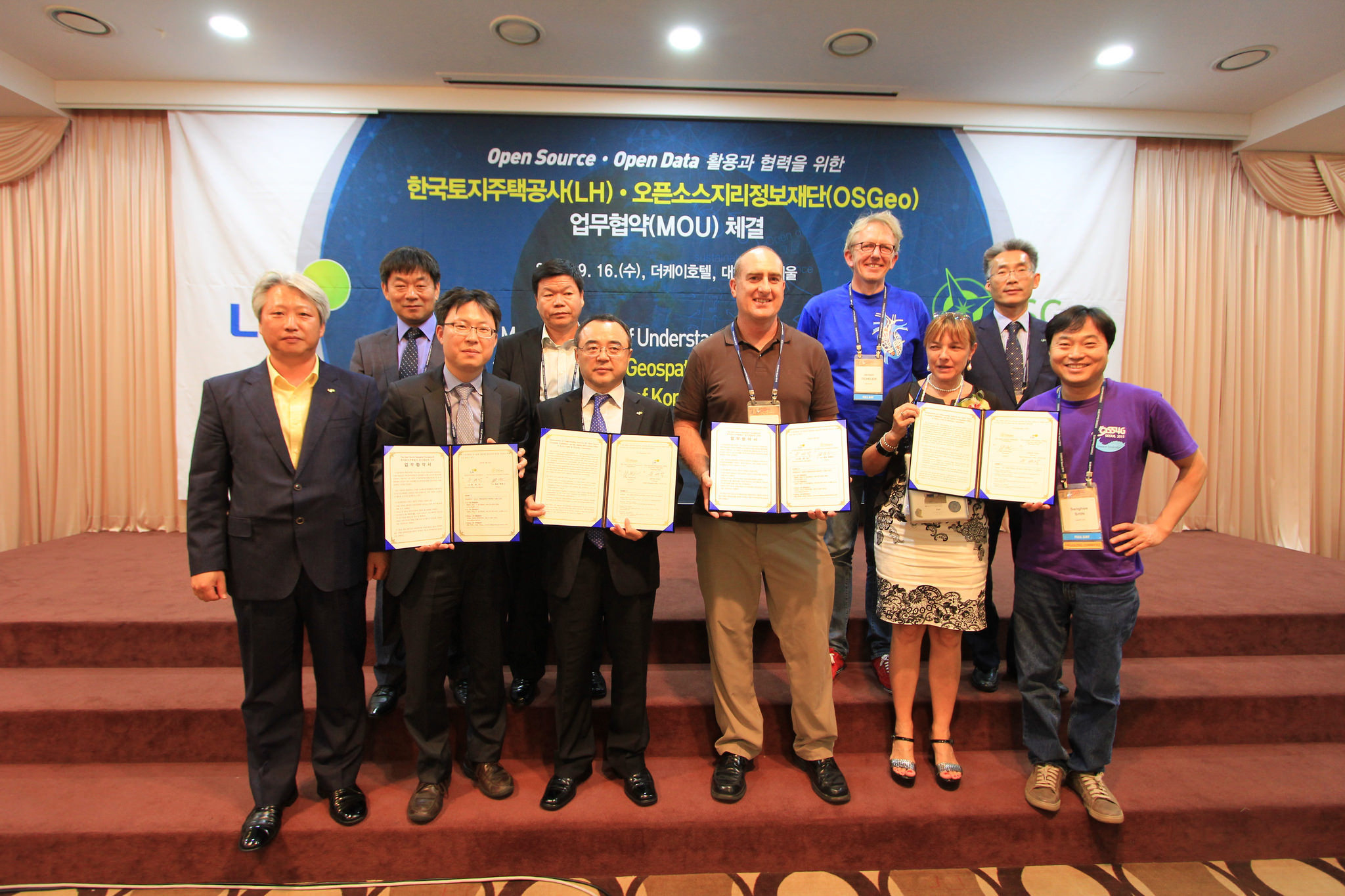
| − | ''This | + | ''This MOU was officially singed on 16th September 2015 at [http://2015.foss4g.org FOSS4G Seoul] |
| − | + | '' | |
| + | : | ||
| + | ''This MOU was [https://wiki.osgeo.org/wiki/MOU_LH_Corporation_(2017) renewed] on 30th August 2017 at [http://www.osgeo.kr/240 FOSS4G Korea] | ||
| + | '' | ||
| + | [[File:MOU LH.jpg|thumbnail]] | ||
------ | ------ | ||
| Line 39: | Line 43: | ||
Secondary OSGeo Liaison | Secondary OSGeo Liaison | ||
| − | : Jeff McKenna, OSGeo President | + | : Jeff McKenna, OSGeo President, president AT osgeo.org |
Primary LH Liaison | Primary LH Liaison | ||
| − | : Dr. Junyoung Choi, Spatial | + | : Dr. Junyoung Choi, Spatial Information Office of LH, +82-70-4295-7850, junyoung AT lh.or.kr |
Secondary LH Liaison | Secondary LH Liaison | ||
| − | : Hanmi Jo, General manager, Spatial information office of LH | + | : Hanmi Jo, General manager, Spatial information office of LH, +82-55-922-3412, jhm AT lh.or.kr |
== About LH Corp == | == About LH Corp == | ||
Latest revision as of 22:39, 28 September 2017
Memorandum of Understanding (2015)
This MOU was officially singed on 16th September 2015 at FOSS4G Seoul
This MOU was renewed on 30th August 2017 at FOSS4G Korea
- Memorandum of Understanding between
- The Open Source Geospatial Foundation
- and
- Spatial Information Office of Korea Land & Housing Corporation (LH Corp)
September 2015
The purpose of this Memorandum of Understanding (MOU) is to establish a collaborative relationship between the Open Source Geospatial Foundation (OSGeo) and the Spatial Information Office of Korea Land and Housing Corporation (LH Corp). Both parties to this MOU share the goal of developing collaboration opportunities for academia, industry and government organizations in Open Source GIS software and data in Korea.
LH Corp has been supporting and advancing Korean national spatial data infrastructure and developing and operating related geospatial systems since the early years, through various technical projects and academic activities at a range of scales: local, regional, national and international.
The MOU will cover the following proposals and topics:
- Positive effort to activate utilization of Open Source GIS in public domain organizations of ROK (Republic of Korea), including LH Corp.
- Establish a close cooperation with OSGeo and specifically with the OSGeo Korean chapter.
- Work and research together to introduce Open Source software and communities to LH Corp team members, for possible use in the development of geospatial applications.
- Continue to help LH Corp establish open geospatial datasets, through the help of the OSGeo local chapter, to allow the Korean public access.
Each Party will appoint and maintain a representative to act as liaison with the other Party, and each Party may deal exclusively with the liaison appointed by the other Party if it so chooses, except as otherwise provided in Exhibit A. The initial liaisons are listed on Exhibit A.
This MOU will be reviewed annually by both parties at which time revisions may be made and the agreement renewed.
Signed by
- Jaekak Yoon, Director, Spatial Information Office at LH Corp
- Jeff McKenna, President, OSGeo
EXHIBIT A
I. Liaisons
The initial liaisons and their contact data is as follows:
Primary OSGeo Liaison
- Sanghee Shin, OSGeo Korean Chapter, +82-2-3397-3475, shshin AT gaia3d.com
Secondary OSGeo Liaison
- Jeff McKenna, OSGeo President, president AT osgeo.org
Primary LH Liaison
- Dr. Junyoung Choi, Spatial Information Office of LH, +82-70-4295-7850, junyoung AT lh.or.kr
Secondary LH Liaison
- Hanmi Jo, General manager, Spatial information office of LH, +82-55-922-3412, jhm AT lh.or.kr
About LH Corp
LH Corp is one of the largest public companies in Korea providing land and housing for public purpose. They are owned and controlled by the Korean government. They’ve played a large role in the development of many geospatial systems in Korea as well.
