Difference between revisions of "User:Pvanbosgeo"
Pvanbosgeo (talk | contribs) |
Pvanbosgeo (talk | contribs) |
||
| Line 8: | Line 8: | ||
|SocialMedia=https://pvanb.wordpress.com/; | |SocialMedia=https://pvanb.wordpress.com/; | ||
|Website=http://ecodiv.org | |Website=http://ecodiv.org | ||
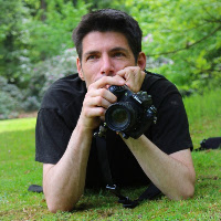
| + | |Photo=Pvb small.jpg | ||
|Languages=Dutch; English; Portugues; | |Languages=Dutch; English; Portugues; | ||
|Info=My main research interests are forest and landscape ecology, biogeography, and conservation and sustainable use of biodiversity and natural resources. I have worked for international research (Bioversity, ICRAF, ILRI) institutes in Syria, Brazil and Kenya. | |Info=My main research interests are forest and landscape ecology, biogeography, and conservation and sustainable use of biodiversity and natural resources. I have worked for international research (Bioversity, ICRAF, ILRI) institutes in Syria, Brazil and Kenya. | ||
Revision as of 12:32, 29 February 2016
| OSGeo Member | ||
|---|---|---|
| Name: | Paulo van Breugel |  |
| Job Title: | ||
| Company: | Spatial Dynamics | |
| Address: | ||
| City: | Apeldoorn | |
| State: | ||
| Country: | the Netherlands | |
| Local Chapter: | Dutch | |
| Email: | ||
| Phone: | ||
| Instant Messaging: | ||
| Website: | http://ecodiv.org | |
| Language(s): | Dutch; English; Portugues | |
| Personal Description : | My main research interests are forest and landscape ecology, biogeography, and conservation and sustainable use of biodiversity and natural resources. I have worked for international research (Bioversity, ICRAF, ILRI) institutes in Syria, Brazil and Kenya. I am currently working as freelance researcher and GIS/spatial analyst while also pursuing my Ph.D. at the Copenhagen University, studying the impact of climate change on the vegetation in eastern Africa, and how this influences options for conservation and sustainable use of the region's natural resources. | |
|
|
||
OSGeo Experience and Roles:
![]()
![]() I am a strong proponent of open source software and open data as essential components of a more transparent, rapid and inclusive science, especially in ecology, biogeography and conservation sciences. For my spatial analysis I typically use GRASS GIS, R, OGR/GDAL, and QGIS, amongst others. I furthermore use QGIS, Tilemill and Leaflet when I have to create maps (print and online, see e.g., the maps on [[1]]).
I am a strong proponent of open source software and open data as essential components of a more transparent, rapid and inclusive science, especially in ecology, biogeography and conservation sciences. For my spatial analysis I typically use GRASS GIS, R, OGR/GDAL, and QGIS, amongst others. I furthermore use QGIS, Tilemill and Leaflet when I have to create maps (print and online, see e.g., the maps on [[1]]).
I am not really a software developer, but like many GRASS GIS and R users, I know enough of scripting (R, Python, command line) to make my own life easier, and even to write a few simple GRASS GIS addons ;-). I furthermore try to find the time to write down my notes on the use of Open Source software on my blog Ecostudies.