Semantic search

Jump to navigation Jump to search

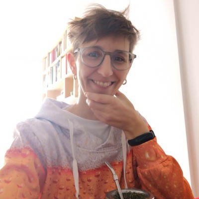
[[ Veroandreo | Veronica Andreo ]]

Name: Veronica Andreo
Job Title: Researcher and lecturer
Country: Argentina
City: Cordoba
Local Chapter: Geolibres
Website: https://veroandreo.gitlab.io/
Email: veroandreo@gmail.com
Coordinate: 31° 25' 7.02" S, 64° 11' 10.56" W
Languages: Spanish, English, Italian

Experience: OSGeo coder.png OSGeo psc.png OSGeo charter.png OSGeo user.png OSGeo Committer.png

Veronica Andreo

Vero holds a PhD in Biology and a MSc degree in GIS and Remote Sensing. She is mostly interested in GIS and remote sensing uses and applications for public health, environmental monitoring and disaster management. She is a GRASS GIS and FOSS4G enthusiast and a very active promoter of Osgeo/FOSS4G philosophy everywhere: in conferences, courses, workshops and so on. She is mainly involved in GRASS GIS community contributing tutorials, examples, general documentation, user support, translations, etc.

Loading map...

[[ Victoria Rautenbach | Victoria Rautenbach ]]

Name: Victoria Rautenbach
Job Title: Senior Lecturer
Company: University of Pretoria
Country: South Africa
City: Pretoria
Local Chapter: Africa Local Chapter
Website: https://www.up.ac.za/en/geography-geoinformatics-and-meteorology/article/2735602/victoria-rautenbach
Email: victoria.rautenbach@gmail.com
Coordinate: 25° 45' 16.20" S, 28° 13' 53.04" E


Experience: OSGeo charter.png OSGeo exboard.png OSGeo user.png

Victoria Rautenbach is a senior lecturer in the Department of Geography, Geoinformatics and Meteorology at the University of Pretoria, South Africa. Victoria’s research focuses on spatial data visualization to support decision making. Her research spans two disciplines: Geographic Information Science (GISc) and Computer Science; multi-dimensional geovisualization, spatial data infrastructure, open source for geospatial software and geoinformation standards.

Victoria is interested in web mapping development and the use of mapping to improve less fortunate communities, and has also been involved in various open data events in South Africa.

Loading map...

[[ Vidhan13j07 | Vidhan Jain ]]

Name: Vidhan Jain
Country: India
State: Rajasthan
City: Jaipur
Email: vidhanj1307@gmail.com
Coordinate: 26° 54' 44.64" N, 75° 47' 14.28" E


Experience: OSGeo coder.png OSGeo user.png

Loading map...

[[ Volaya | Victor Olaya ]]

Name: Victor Olaya
Job Title: Developer
Company: Universidad de Extremadura, UNEX
Country: France
City: Auch
Local Chapter: Francophone OSGeo Chapter
Instant Messaging: Skype: volaya1978
Website: http://volaya.es/
Coordinate: 43° 38' 46.28" N, 0° 35' 13.69" E
Languages: Spanish, English, French, Russian

Experience: OSGeo coder.png

Victor Olaya

Victor is the creator and main developer of the SEXTANTE library, a spatial data analysis library currently used by several open source GIS such as gvSIG or QGIS. He is also the main author of the Spanish Free GIS Book, a free (CC BY) book on the fundamentals of Geographic Information Systems.

Loading map...

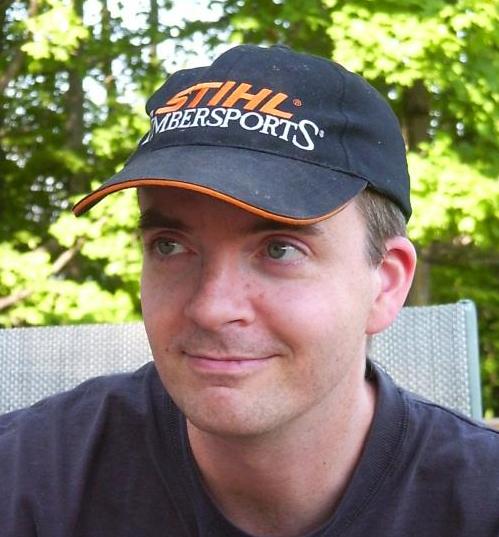
[[ Warmerda | Frank Warmerdam ]]

Name: Frank Warmerdam
Company: Planet
Country: Canada
State: Ontario
City: Eganville
Local Chapter: California Chapter
Email: warmerdam@pobox.com
Coordinate: 45° 27' 47.06" N, 77° 16' 18.16" W


Experience: OSGeo psc.png OSGeo charter.png OSGeo exboard.png OSGeo user.png OSGeo SolKatz.png

Frank Warmerdam
Loading map...

[[ Wenzeslaus | Vaclav Petras ]]

Name: Vaclav Petras
Job Title: Geospatial Research Software Engineer
Company: North Carolina State University
Country: USA
State: NC
City: Raleigh
Local Chapter: North America
Social Media: http://@vaclavpetras
Website: http://wenzeslaus.github.io/
Coordinate: 35° 47' 5.32" N, 78° 40' 54.11" W
Languages: Czech, English

Experience: OSGeo coder.png OSGeo psc.png OSGeo charter.png OSGeo user.png OSGeo Committer.png

Loading map...

[[ Wonderchook | Kate Chapman ]]

Name: Kate Chapman
Job Title: Executive Director
Company: Humanitarian OpenStreetMap Team
Country: United States of America
State: Oregon
City: Portland
Local Chapter: PDX-OSGEO
Instant Messaging: Skype: kateachapman
Phone: +1-703-673-8834
Coordinate: 45° 31' 12.00" N, 122° 40' 26.40" W
Languages: English, Indonesian

Experience: OSGeo user.png

Kate Chapman

Kate is Executive Director of the Humanitarian OpenStreetMap Team. Her most recent projects have included working in Indonesia leading a team to train disaster managers in using open-source software to better plan for disasters and relaunching of the OpenAerialMap project. Kate has spoken about the benefits of open-source and open data for disaster response and risk reduction all over the world, including giving keynotes at Linux Conf Australia and FOSS4G in 2013.

Loading map...

[[ Woodbri | Stephen Woodbridge ]]

Name: Stephen Woodbridge
Job Title: Owner
Company: iMaptools.com
Country: USA
State: MA
City: North Chelmsford
Local Chapter: North America
Coordinate: 42° 38' 20.33" N, 71° 22' 58.23" W


Experience: OSGeo coder.png OSGeo psc.png OSGeo charter.png OSGeo user.png

Stephen Woodbridge
Loading map...

[[ Ybh0616 | Byeong-Hyeok Yu ]]

Name: Byeong-Hyeok Yu
Job Title: GIS/RS analyst (GISP)
Company: Korea National Park Service
Country: South Korea
City: Seoul
Local Chapter: Korea
Social Media: http://www.facebook.com/ybh0616
Website: http://blog.daum.net/geoscience
Email: bhyu@knps.or.kr
Phone: +82-2-721-9655
Coordinate: 37° 31' 32.19" N, 126° 58' 46.53" E
Languages: Korean, English

Experience: OSGeo charter.png OSGeo user.png

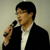
Byeong-Hyeok Yu
Loading map...

[[ Yoichi | Yoichi Kayama ]]

Name: Yoichi Kayama
Job Title: Researcher and Programmer
Company: Aero Asahi Corporation
Country: Japan
City: Tokyo
Local Chapter: Japan
Social Media: http://www.facebook.com/yoichi.kayama, https://twitter.com/#!/pokopen
Website: http://d.hatena.ne.jp/yoichi 46/
Phone: +81-49-244-4874
Coordinate: 35° 42' 32.40" N, 139° 43' 51.60" E
Languages: Japanese, English

Experience: OSGeo charter.png OSGeo user.png

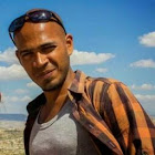
Yoichi Kayama

Yoichi Kayama is a software engineer and researcher who has conducted research and program development related to geographic information for more than 20 years. Since OSGeo.JP was formed, he has been supporting the Japanese FOSS4G event held annually in Tokyo and Osaka. He co-authored a FOSS4G handbook, he was engaged in the Japanese localization of QGIS, and he has taught how to use QGIS in a number of workshops.

Loading map...

[[ Zia | Mohammed Zia ]]

Name: Mohammed Zia
Job Title: Geospatial Develope
Company: CGG Satellite Mapping
Address: Crompton Way
Country: United Kingdom
State: West Sussex
City: Crawley
Local Chapter: OSGeo UK
Website: https://www.linkedin.com/in/zia33
Email: mohammed.zia33@gmail.com
Coordinate: 51° 7' 35.70" N, 0° 10' 55.11" W
Languages: Python, JavaScript, SQL, NoSQL

Experience: OSGeo coder.png OSGeo charter.png OSGeo user.png

Mohammed Zia

Zia is a full-time employee at the Satellite Mapping Team at CGG UK Ltd., working as a Geospatial Developer.

Loading map...