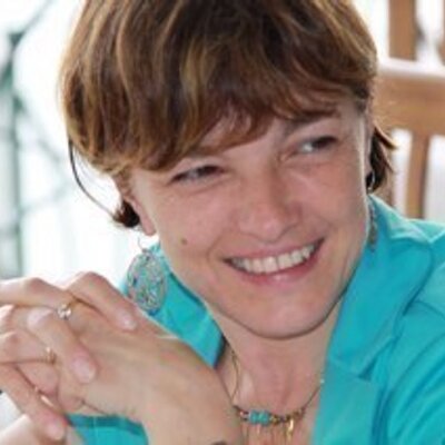
User:Maria
Maria Antonia Brovelli
High school Diploma with classical studies orientation (final grade: 60/60), Degree in Physics (with honours) in 1986, PhD in Geodesy and Cartography in 1991.
From 1992 to 1994 she worked as researcher at the National Institute of Geophysics and Volcanology; in this position, she helped in establishing the International Geoid Service (IGeS) of the International Association of Geodesy (IAG) and became a member of the Editorial board of the IGES Bulletin and then its Editor in Chief. She has been working at the Politecnico di Milano since 1994, first as researcher, then as Associate Professor and finally as Full Professor. She is currently teaching Digital Mapping, Geographic Information Systems (GIS), Remote Sensing and Geospatial Web, Geo Big Data and Citizen-Generated Geographic Information. Since 2000, she has been also organizing and teaching courses in Continuing Education. From 2006 to 2011, she taught GIS III for the Master of Geomatics Engineering of Technical University of Zurich (ETH).
In 1997 she started the Laboratory of Geomatics, placed at the Como Campus of the Politecnico di Milano and up to 2011 she has coordinated its activities as Head of the Lab. She has been involved in Politecnico governance by covering several service activities. From 2011 to 2016 she was Vice Rector of Politecnico di Milano for the Como Campus. She is member of the Board of the Italian Society of Photogrammetry and Surveying ( SIFET) and member of the Bulletin Editorial Board.
She is one of the Directors of OSGeo, member of GeoForall Advisory Board Geo For All, chair of the European GeoForAll Lab Network and Chair of the OSGeo UN Committee.
She is Editor of the international journal Applied Geomatics published by Springer and chair of WG IV/4 “Collaborative crowdsourced cloud mapping (C3M)” of the International Society for Photogrammetry and Remote Sensing (ISPRS).
She is one of the mentors of PoliMappers, the Politecnico di Milano chapter of YouthMappers.
She is chair of the Capacity Building WG of UN Open GIS Initiative and member of the Advisory Board of UN-GGIM Academic Network.
In 2010 she hosted the WebMGS event in Como, an international workshop on 'Pervasive Web Mapping, Geoprocessing and Services'.
In July 2015, she hosted over 400 attendees to her home campus in Como, for FOSS4G-Europe 2015. As the chair of the event, she kept registration costs very low, and in fact the event would "sell out", due to such a demand, no more registrations were possible several weeks before the event. She also organized a pre-event, FOSS4VGI, where she helped fund 30 researchers and trainers from all over Europe to learn about Open Data and Open Source software.
She has been developing her scientific activity within geodesy and geomatics since 1988, by participating in national and international research projects. Initially devoted to research in physical geodesy, radar-altimetry and statistical analysis, after becoming an associate professor, she focused her interests on digital mapping and geographic information systems, free and open source GIS theory and applications representing one of her main research issues. She was and is responsible for research contracts and consultancy related to the design and implementation of Geographic Information Systems; web Mapping and Web Geoservices, systems for integrating and controlling the quality of digital terrain models, VGI and Geo-crowdsourcing and Big Geodata. She is co-author of three textbooks on the statistical data treatment, of a volume on orthophotos and digital terrain models, as well as more than 150 scientific publications.
In September 2015 she was honored with the 2015 Sol Katz Award for Geospatial Free and Open Source Software [1] during the FOSS4G 2015 conference in Seoul, South Korea.
She is proudly mother of two wonderful daughters: Giulia Leila and Federica Luna.
- Contact
- maria.brovelli@polimi.it
- Spoken Languages
- Italian, English, French (basic)
- Profile last updated
- 5 May 2017
