File:Fig10 excludedRoads.png
Jump to navigation
Jump to search
The printable version is no longer supported and may have rendering errors. Please update your browser bookmarks and please use the default browser print function instead.
Size of this preview: 493 × 599 pixels. Other resolutions: 197 × 240 pixels | 2,092 × 2,542 pixels.
Original file (2,092 × 2,542 pixels, file size: 1.1 MB, MIME type: image/png)
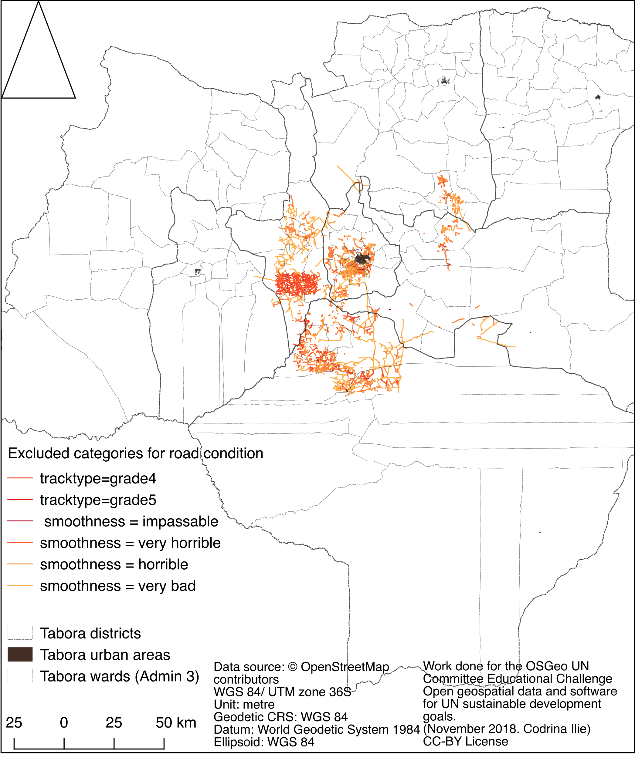
Spatial distribution of OSM roads that have been tagged as in bad condition.
File history
Click on a date/time to view the file as it appeared at that time.
| Date/Time | Thumbnail | Dimensions | User | Comment | |
|---|---|---|---|---|---|
| current | 02:51, 21 January 2019 | | 2,092 × 2,542 (1.1 MB) | Codrina (talk | contribs) | Spatial distribution of OSM roads that have been tagged as in bad condition. |
You cannot overwrite this file.
File usage
The following page uses this file: