Difference between revisions of "GvSIG Report 2008"
m (→Downloads: added more download data stuff) |
m (→Other statistics: smaller user map) |
||
| (20 intermediate revisions by the same user not shown) | |||
| Line 1: | Line 1: | ||
| − | |||
== gvSIG == | == gvSIG == | ||
| Line 5: | Line 4: | ||
=== Key Accomplishments === | === Key Accomplishments === | ||
| − | * The community portal (http://www.gvsig.org) | + | * The community portal (http://www.gvsig.org) allowed to publish: |
| − | * gvSIG mailing lists have grown in subscribers (more than | + | ** User documentation (in several languages) |
| − | * The project source repository has been published at http://subversion.gvsig.org | + | ** Tehcnical documentation (at this moment only in Spanish) |
| + | ** A catalog of contributions (new extensions, non-official gvSIG releases, more documentation, etc.) | ||
| + | * gvSIG mailing lists have grown in subscribers (more than 2300, see numbers below) and a new mailing list has been created for the the Italian community | ||
| + | * The project source repository has been published at http://subversion.gvsig.org for gvSIG and gvSIG Mobile | ||
| + | * A new public FTP repository has been published at ftp://gvsig.org | ||
| + | * Releases of gvSIG extensions and releases during 2008: | ||
| + | ** First 3D pilot extension ( [http://tinyurl.com/bkr27v 7 of January]) | ||
| + | ** ArcSDE extension ([http://tinyurl.com/bdj5lt 6 of February]) | ||
| + | ** gvSIG 1.1.2 ([http://tinyurl.com/cwomzm 4 of March]) | ||
| + | ** First official release of gvSIG Mobile and the gvSIG synchronization extension([http://tinyurl.com/d4k5db 13 of March]) | ||
| + | ** Raster pilot extension ([http://tinyurl.com/b4vmjb 27 of March]) | ||
| + | ** Publishing extension ([http://tinyurl.com/bpde5u 30 of July]) | ||
| + | ** Metadata management extension ([http://tinyurl.com/bsl3nc 23 of September]) | ||
| + | ** gvSIG 1.9alpha ([http://tinyurl.com/cclq4n 27 of November]) | ||
| + | ** Second version of 3D support and Dielmo OpenLIDAR extension ([http://tinyurl.com/crpu4x 21 of January]) | ||
* International events where gvSIG project has been officially represented: | * International events where gvSIG project has been officially represented: | ||
| + | ** ''TopCart'', Valencia, Spain | ||
** ''Primer simposio GIS Educación en América Latina'', Quito, Ecuador | ** ''Primer simposio GIS Educación en América Latina'', Quito, Ecuador | ||
| − | ** '' | + | ** ''II Jornadas SIG Libre'', Girona, Spain |
** ''FOSSGIS2008'', Freiburg, Germany | ** ''FOSSGIS2008'', Freiburg, Germany | ||
| + | ** ''Primo incontro degli utenti italiani di gvSIG'', Trieste, Italy | ||
| + | ** ''XXII International Geodesy Students Meeting'', Valencia, Spain | ||
| + | ** ''AGIT'', Salzburg, Germany | ||
| + | ** ''1er encuentro Geomática Libre'', Mérida, Venezuela | ||
** ''FOSS4G2008'', Cape Town, South Africa | ** ''FOSS4G2008'', Cape Town, South Africa | ||
| + | ** ''Open Source World Conference'', Málaga, Spain | ||
| + | ** ''Intergeo'', Bremen, Germany | ||
** ''Latinoware'08'', Foz de Iguazú, Brasil | ** ''Latinoware'08'', Foz de Iguazú, Brasil | ||
| − | ** '' | + | ** ''Jornadas para las Infraestructuras de Datos Espaciales de España'', Tenerife, Spain |
| − | ** '' | + | ** ''III Congreso de Software Libre de la Comunitat Valenciana'', Alicante, Spain |
| − | + | ||
| − | + | ||
| − | + | ||
| − | + | ====gvSIG Commons==== | |
| + | |||
| + | Aiming to produce reusable components not only for gvSIG software but also for other Java FOSS projects, gvSIG project is releasing some products as independent sub-projects at the [https://gvsig.org/web/projects/gvsig-commons gvSIG Commons] initiative. At this moment the ''[https://gvsig.org/web/projects/gvsig-commons/osgvp Open Scene Graph Virtual Planets]'' project is releasing versions and is published also at the SVN (http://subversion.gvsig.org/osgvp) | ||
| + | |||
| + | ====4th gvSIG Conference==== | ||
| + | |||
| + | The [[4th gvSIG Conference]] was a succesful event with more than 600 delegates where gvSIG developers and users presented their last year experiences. In the same context (the Valencia Conference Centre) a OGC TC/PC meeting and the first Spanish Eclipse Day took place. | ||
| + | |||
| + | There were 9 workshops to show last gvSIG features as well as more than 30 presentations and plenary sessions. | ||
| + | {| | ||
| + | |- style="border-width:0px;vertical-align:top;" | ||
| + | | | ||
| + | [[Image:4th gvSIG conf people.jpg|300px|Hall of the Valencia Conference Centre]] | ||
| + | | | ||
| + | [[Image:DSC07898 2.jpg|325px|Hall of the Valencia Conference Centre]] | ||
| + | | | ||
| + | [[Image:4th gvSIG conf session2.jpg|338px|Plenary session]] | ||
| − | + | |- | |
| − | + | |Conference Hall (Photo by [[Jorge Sanz]]) | |
| − | + | |Session (Photo by [http://picasaweb.google.es/caminoroderomerino/JornadasGvSIG_4diciembre2008# Camino Rodero]) | |
| − | + | |Session (Photo by Verónica Navarro) | |
| − | + | |} | |
| − | |||
| − | |||
| − | |||
| − | |||
====Downloads==== | ====Downloads==== | ||
| Line 57: | Line 89: | ||
| Mobile 0.1 || 3.387 || 3978 | | Mobile 0.1 || 3.387 || 3978 | ||
|} | |} | ||
| − | |||
| | | | ||
| − | |||
{|class=wikitable | {|class=wikitable | ||
|+ Pilots and extensions | |+ Pilots and extensions | ||
| Line 77: | Line 107: | ||
|- | |- | ||
|} | |} | ||
| − | |||
| | | | ||
| − | |||
{|class=wikitable | {|class=wikitable | ||
|+ Documentation | |+ Documentation | ||
| Line 107: | Line 135: | ||
|- | |- | ||
|} | |} | ||
| + | |||
| + | ====Other statistics==== | ||
| + | [[Image:GvSIG spread 2008.png|thumb|300px|right|Known countries where gvSIG is beeing used]] | ||
| + | * gvSIG GUI translated in more than 20 languages | ||
| + | * Mailing lists subscribers: | ||
| + | ** Users: 1255 | ||
| + | ** Developers: 618 | ||
| + | ** International: 521 | ||
| + | ** Italian: 160 | ||
| + | * Known countries with registered users: 42 | ||
| + | * Known countries where gvSIG has been downloaded: 59 | ||
=== Areas for Improvement === | === Areas for Improvement === | ||
| − | * | + | |
| − | + | gvSIG project needs to: | |
| + | |||
| + | * Open the bug tracking system | ||
| + | * Open the gvSIG project organization to the community | ||
| + | * Stablish a fixed release schedule (like Ubuntu Linux) | ||
| + | * Create more technical documentation in English | ||
| + | |||
=== Opportunities to Help === | === Opportunities to Help === | ||
| − | * | + | * Test gvSIG and report bugs and annoyances at mailing lists |
| + | * Write use cases and report them | ||
| + | * Offer services (development, training) with gvSIG | ||
| + | * Propose new features and discuss them on the mailing lists | ||
| + | * Help us joining the testing team for a more formal work | ||
| + | * Help us and join the translation group | ||
=== Outlook for 2009 === | === Outlook for 2009 === | ||
| − | * | + | * Start a new organization to strength the project and allow new companies, universities and public administrations to participate actively on the project management |
| + | * Start a community-driven formal testing | ||
| + | * Release a stable version of gvSIG with new features: | ||
| + | ** Refactored data access (hopefully without users taking account of it) | ||
| + | ** New symbology support | ||
| + | ** Raster analysis (classification, principal components analysis, mosaic, etc.) | ||
| + | ** Network geoprocessing | ||
| + | ** Topology creation, editing and validating | ||
| + | ** 3D support | ||
| + | ** And others: LIDAR, geocoding, reports and charts, WPS,... | ||
| + | * Release a stable version of gvSIG Mobile with new features: | ||
| + | ** Refactored core with gvSIG desktop compatibility | ||
| + | ** Full editing | ||
| + | ** Custom forms | ||
| + | ** Phone ME support (finally a trully free JVM for PDA!) | ||
| + | ** GPS library | ||
| + | ** OpenMoko and Android versions | ||
Latest revision as of 09:45, 3 March 2009
gvSIG
- Contact name: Jorge Sanz
Key Accomplishments
- The community portal (http://www.gvsig.org) allowed to publish:
- User documentation (in several languages)
- Tehcnical documentation (at this moment only in Spanish)
- A catalog of contributions (new extensions, non-official gvSIG releases, more documentation, etc.)
- gvSIG mailing lists have grown in subscribers (more than 2300, see numbers below) and a new mailing list has been created for the the Italian community
- The project source repository has been published at http://subversion.gvsig.org for gvSIG and gvSIG Mobile
- A new public FTP repository has been published at ftp://gvsig.org
- Releases of gvSIG extensions and releases during 2008:
- First 3D pilot extension ( 7 of January)
- ArcSDE extension (6 of February)
- gvSIG 1.1.2 (4 of March)
- First official release of gvSIG Mobile and the gvSIG synchronization extension(13 of March)
- Raster pilot extension (27 of March)
- Publishing extension (30 of July)
- Metadata management extension (23 of September)
- gvSIG 1.9alpha (27 of November)
- Second version of 3D support and Dielmo OpenLIDAR extension (21 of January)
- International events where gvSIG project has been officially represented:
- TopCart, Valencia, Spain
- Primer simposio GIS Educación en América Latina, Quito, Ecuador
- II Jornadas SIG Libre, Girona, Spain
- FOSSGIS2008, Freiburg, Germany
- Primo incontro degli utenti italiani di gvSIG, Trieste, Italy
- XXII International Geodesy Students Meeting, Valencia, Spain
- AGIT, Salzburg, Germany
- 1er encuentro Geomática Libre, Mérida, Venezuela
- FOSS4G2008, Cape Town, South Africa
- Open Source World Conference, Málaga, Spain
- Intergeo, Bremen, Germany
- Latinoware'08, Foz de Iguazú, Brasil
- Jornadas para las Infraestructuras de Datos Espaciales de España, Tenerife, Spain
- III Congreso de Software Libre de la Comunitat Valenciana, Alicante, Spain
gvSIG Commons
Aiming to produce reusable components not only for gvSIG software but also for other Java FOSS projects, gvSIG project is releasing some products as independent sub-projects at the gvSIG Commons initiative. At this moment the Open Scene Graph Virtual Planets project is releasing versions and is published also at the SVN (http://subversion.gvsig.org/osgvp)
4th gvSIG Conference
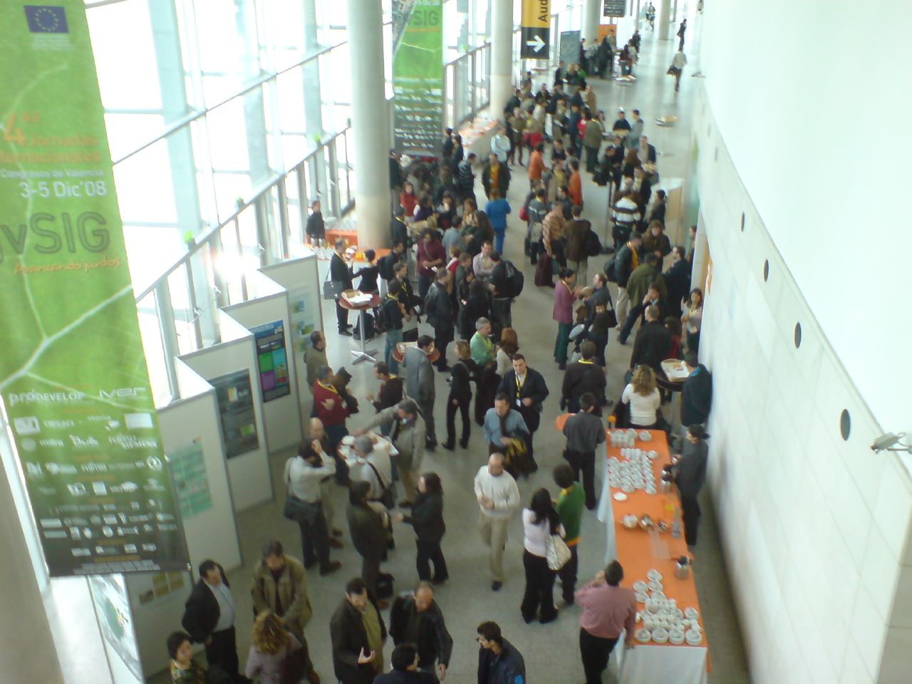
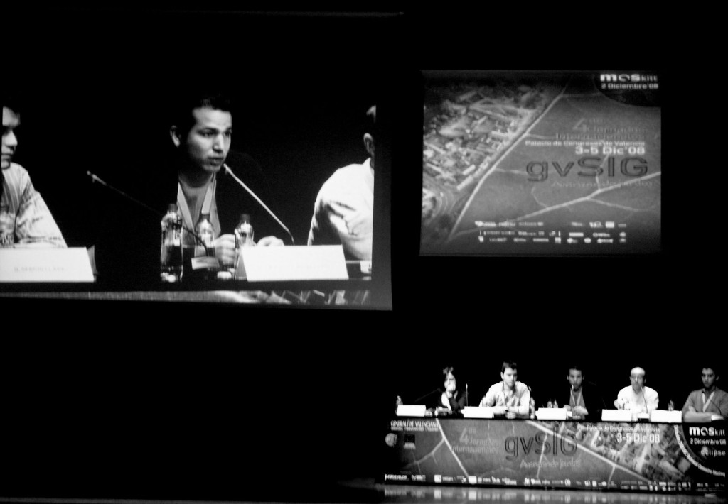
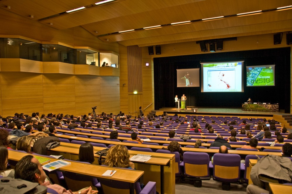
The 4th gvSIG Conference was a succesful event with more than 600 delegates where gvSIG developers and users presented their last year experiences. In the same context (the Valencia Conference Centre) a OGC TC/PC meeting and the first Spanish Eclipse Day took place.
There were 9 workshops to show last gvSIG features as well as more than 30 presentations and plenary sessions.
| Conference Hall (Photo by Jorge Sanz) | Session (Photo by Camino Rodero) | Session (Photo by Verónica Navarro) |
Downloads
These are approximate numbers about gvSIG releases downloads during 2008 (as of 17 of December of 2008):
|
|
| |||||||||||||||||||||||||||||||||||||||||||||||||||||||||||||||
Other statistics
- gvSIG GUI translated in more than 20 languages
- Mailing lists subscribers:
- Users: 1255
- Developers: 618
- International: 521
- Italian: 160
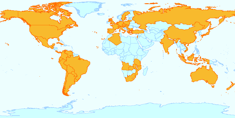
- Known countries with registered users: 42
- Known countries where gvSIG has been downloaded: 59
Areas for Improvement
gvSIG project needs to:
- Open the bug tracking system
- Open the gvSIG project organization to the community
- Stablish a fixed release schedule (like Ubuntu Linux)
- Create more technical documentation in English
Opportunities to Help
- Test gvSIG and report bugs and annoyances at mailing lists
- Write use cases and report them
- Offer services (development, training) with gvSIG
- Propose new features and discuss them on the mailing lists
- Help us joining the testing team for a more formal work
- Help us and join the translation group
Outlook for 2009
- Start a new organization to strength the project and allow new companies, universities and public administrations to participate actively on the project management
- Start a community-driven formal testing
- Release a stable version of gvSIG with new features:
- Refactored data access (hopefully without users taking account of it)
- New symbology support
- Raster analysis (classification, principal components analysis, mosaic, etc.)
- Network geoprocessing
- Topology creation, editing and validating
- 3D support
- And others: LIDAR, geocoding, reports and charts, WPS,...
- Release a stable version of gvSIG Mobile with new features:
- Refactored core with gvSIG desktop compatibility
- Full editing
- Custom forms
- Phone ME support (finally a trully free JVM for PDA!)
- GPS library
- OpenMoko and Android versions


