Difference between revisions of "Massimiliano Cannata"
| Line 3: | Line 3: | ||
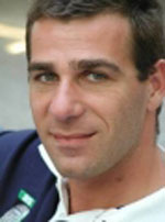
[[File:Massimiliano_cannata.jpg|thumb|right|100px|Massimiliano Cannata]] | [[File:Massimiliano_cannata.jpg|thumb|right|100px|Massimiliano Cannata]] | ||
| − | Professor in geomatics | + | Professor in enginering geomatics at University of Applied Sciences and Arts of Southern Switzerland (SUPSI) |
Location: Canobbio, Switzerland | Location: Canobbio, Switzerland | ||
| − | Massimiliano received his PhD in Gedoesy and Geomatics after his master degree in environmental engineering at the Politecnico di Milano. | + | ;Short Bio |
| + | -------------- | ||
| + | Massimiliano received his PhD in Gedoesy and Geomatics after his master degree in environmental engineering at the Politecnico di Milano. Since 2007 he's the head of the geomatic division within the Institute of Earth Sciences (www.ist.supsi.ch) in Switzerland. | ||
| − | ;OSGeo Experience [[File:OSGeo_board.png|link=OSGeo_Advocate#OSGeo_Board_Members]] [[File:OSGeo_charter.png|link=OSGeo_Advocate#OSGeo_Charter_Members]] [[File:OSGeo_committee.png|link=OSGeo_Advocate#Developers_and_Committee_Members]] [[File:OSGeo_psc.png|link=OSGeo_Advocate#Voted_position_in_an_OSGeo_community]] [[File:OSGeo_user.png|link=OSGeo_Advocate#OSGeo_Community_Members]] | + | He's a director of the Open Source Geospatial foundation (OSGeo) and member of the project steering committee of the projects GIS GRASS (http://grass.osgeo.org) and ZOO (www.zoo-project.org). He's group lead the developement of the istSOS project (http://istgeo.ist.supsi.ch/software/istsos/)implementing open standards for sensor observation services. |
| + | |||
| + | |||
| + | ;Research | ||
| + | --------------- | ||
| + | Massimiliano start his research activities working on methodologies for LiDAR data filtering and analyses, but from 2002, he start focusing his activities on the GIS embedded environmental modeling, geospatial Web technologies and interoperability and the sensor Web. | ||
| + | |||
| + | He conducted a large number of research project and consultancies for the local government administration in the field of spatial data infrastructure, natural hazard mitigation, environmental monitoring network, decision support systems. He also leads the scientific execution of projects funded by the World Bank, the European Union and gained extensive experince in working with developing countries. | ||
| + | |||
| + | |||
| + | ;Education | ||
| + | --------------- | ||
| + | Currently Massimiliano is teaching Gematic I, Geomatic II and GIS in the Bachelor of Science SUPSI in Civil engineering and Geoinformation and 3D data in the Bachelor of Science SUPSI in Architeture. From 2006 to 2010 Lecturer ex cathedra at the Academy of Architecture in Mendrisio. | ||
| + | |||
| + | |||
| + | ;OSGeo Experience | ||
| + | ------------------ | ||
| + | [[File:OSGeo_board.png|link=OSGeo_Advocate#OSGeo_Board_Members]] - [[File:OSGeo_charter.png|link=OSGeo_Advocate#OSGeo_Charter_Members]] - [[File:OSGeo_committee.png|link=OSGeo_Advocate#Developers_and_Committee_Members]] - [[File:OSGeo_psc.png|link=OSGeo_Advocate#Voted_position_in_an_OSGeo_community]] - [[File:OSGeo_user.png|link=OSGeo_Advocate#OSGeo_Community_Members]] | ||
| − | |||
:* GRASS PSC member | :* GRASS PSC member | ||
:* ZOO PSC member | :* ZOO PSC member | ||
| Line 18: | Line 36: | ||
;Contact: | ;Contact: | ||
| + | --------- | ||
: Email: massimiliano.cannata AT supsi DOT ch | : Email: massimiliano.cannata AT supsi DOT ch | ||
: Phone (work): +41 (0)58 666 62 14 | : Phone (work): +41 (0)58 666 62 14 | ||
| − | |||
;Spoken Language(s): English, Italian | ;Spoken Language(s): English, Italian | ||
| − | ;Profile last updated: | + | ;Profile last updated: 21 September 2015 |
Revision as of 05:34, 21 September 2015
Massimiliano Cannata
Professor in enginering geomatics at University of Applied Sciences and Arts of Southern Switzerland (SUPSI)
Location: Canobbio, Switzerland
- Short Bio
Massimiliano received his PhD in Gedoesy and Geomatics after his master degree in environmental engineering at the Politecnico di Milano. Since 2007 he's the head of the geomatic division within the Institute of Earth Sciences (www.ist.supsi.ch) in Switzerland.
He's a director of the Open Source Geospatial foundation (OSGeo) and member of the project steering committee of the projects GIS GRASS (http://grass.osgeo.org) and ZOO (www.zoo-project.org). He's group lead the developement of the istSOS project (http://istgeo.ist.supsi.ch/software/istsos/)implementing open standards for sensor observation services.
- Research
Massimiliano start his research activities working on methodologies for LiDAR data filtering and analyses, but from 2002, he start focusing his activities on the GIS embedded environmental modeling, geospatial Web technologies and interoperability and the sensor Web.
He conducted a large number of research project and consultancies for the local government administration in the field of spatial data infrastructure, natural hazard mitigation, environmental monitoring network, decision support systems. He also leads the scientific execution of projects funded by the World Bank, the European Union and gained extensive experince in working with developing countries.
- Education
Currently Massimiliano is teaching Gematic I, Geomatic II and GIS in the Bachelor of Science SUPSI in Civil engineering and Geoinformation and 3D data in the Bachelor of Science SUPSI in Architeture. From 2006 to 2010 Lecturer ex cathedra at the Academy of Architecture in Mendrisio.
- OSGeo Experience
- GRASS PSC member
- ZOO PSC member
- Italian OSGeo Chapter founder
- Italian OSGeo liason officer (up to 2008)
- Contact
- Email: massimiliano.cannata AT supsi DOT ch
- Phone (work): +41 (0)58 666 62 14
- Spoken Language(s)
- English, Italian
- Profile last updated
- 21 September 2015
{{#umSetParam: 8.961382|46.027897|Lugano, Switzerland|Maxi71|Massimiliano Cannata}}
{{#umUserMap: Maxi71|400px|250px|6|2|y}}
