LandcoverDB CS Detail

From OSGeo
Jump to navigation Jump to search
The printable version is no longer supported and may have rendering errors. Please update your browser bookmarks and please use the default browser print function instead.

Catalogue of landcover classes:

Name Description Texture WMS RGB-values1 VMap0 equivalent, LandcoverDB VMap0 FAO LCCS GlobCover CORINE landclass NLCD class USGS value/code NOAA code ATKIS code
  • BASIC FEATURE


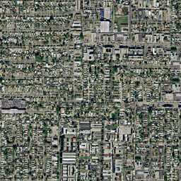
cs_urban
  • VMap0: Built-Up Area
  • GlobCover: Artificial surfaces and associated areas (Urban areas >50%)
  • CORINE: Continuous urban fabric
  • NLCD: Developed, High Intensity
  • USGS: Urban and Built-Up Land
  • CORINE German: durchgängig städtische Prägung
FG city.png
Clc111.png

211
000
000

v0_urban
190 111 24 1/100 11 2111
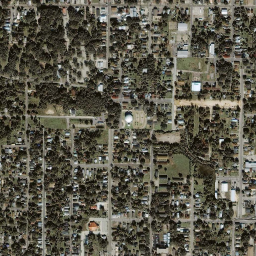
cs_suburban
  • NLCD: Developed, Medium Intensity
  • NOAA: Mixed Urban or Built-up Land


23
16
cs_town
  • VMap0: Built-Up Area (point feature)
  • CORINE: Discontinuous urban fabric
  • NLCD: Developed, Low Intensity
  • NOAA: Other Urban or Built-up Land
  • CORINE German: nicht durchgängig städtische Prägung
FG town.png

Clc112.png

239
042
071

v0_town

112 22
17
cs_industrial
  • CORINE: Industrial or commercial units
  • NOAA: Industrial
  • CORINE German: Industrie/Gewerbeflächen

Clc121.png

211
000
155


121
13
cs_fishing
  • VMap0: Fish Hatchery/Fish Farm/Marine Farm

085
155
239


cs_transport
  • CORINE: Road and railnetworks and associated land
  • NOAA: Transportation, Communications and Utilities
  • CORINE German: Straßen und Eisenbahn

Clc2004-122new.png

126
126
126


122
14
cs_port
  • CORINE: Port areas
  • CORINE German: Hafengebiete

Clc123.png

155
155
211


123


cs_asphalt
  • Asphalt


cs_airport
  • Typical mixed/dry grass coverage around airfields
  • CORINE: Airports
  • CORINE German: Flughäfen
FG airport.png

Clc124.png

099
099
099


124


cs_openmining
  • VMap0: Mine/Quarry
  • CORINE: Mineral extraction sites
  • NOAA: Strip Mines, Quarries, and Gravel Pits
  • CORINE German: Abbauflächen

Clc131.png

155
071
042


131
75
cs_dump
  • CORINE: Dump sites
  • CORINE German: Deponien und Abraumhalden

Clc132.png

155
013
042


132


cs_construction
  • CORINE: Construction sites
  • CORINE German: Baustellen

Clc133.png

183
099
126


133


cs_dirt
  • GlobCover: Bare areas
  • NLCD: Barren Land (Rock/Sand/Clay)
  • NOAA: Bare Ground


200
31
83

cs_rock
  • CORINE: Bare rock
  • NOAA: Bare Exposed Rock
  • CORINE German: Felsflächen ohne Vegetation
FG rock.png

Clc332.png

211
211
155


332
74
cs_lake
  • VMap0: Inland Water, Perennial/Permanent
  • GlobCover: Water bodies
  • CORINE: Water bodies
  • NLCD: Open Water
  • USGS: Water Bodies
  • NOAA: Lakes
  • CORINE German: Wasserflächen
FG water-lake.png

Clc512.png

000
155
239

v0_lake
210 512 11 16/500 52
cs_intermittentlake
  • VMap0: Inland Water, Non-Perennial/Intermittent/Fluctuating


v0_intermittentlake


cs_watercourse
  • CORINE: Water courses
  • CORINE German: Gewässerläufe

Clc511.png

000
099
239

511
  • SURFACE FEATURE


cs_sand
  • VMap0: Ground Surface Element, Sand, Soil Wetness Condition: Unknown
  • CORINE: Beaches, dunes, and sand plains
  • NOAA: Sandy Areas Other than Beaches
  • CORINE German: Strände, Dünen, Sandflächen
FG sand.png

Clc331.png

239
239
183

v0_sand

331
73
N/A
  • NOAA: Beaches


72
cs_floodland
  • VMap0: Land Subject to Inundation
  • GlobCover: Closed to open (>15%) grassland or shrubland or woody vgt on regularly flooded or waterlogged soil, fresh, brakish or saline water
  • NLCD: Wmergent Herbaceous Wetlands
  • USGS: Herbaceous Wetland
  • NOAA: Nonforested Wetland


v0_floodland


95 17/620 62
cs_lagoon
  • CORINE: Coastal lagoons
  • CORINE German: Lagunen

Clc521.png

000
211
239


521


cs_estuary
  • CORINE: Estuaries
  • NOAA: Bays and Estuaries
  • CORINE German: Mündungsgebiet

Clc522.png

099
211
239


522
54
N/A
  • CORINE: Sea and ocean
  • CORINE German: Meere und Ozeane

Clc523.png

159
215
248


523


cs_saltmarsh
  • CORINE: Salt marshes
  • CORINE German: Salzwiesen

Clc421.png

183
126
211


421


cs_saline
  • CORINE: Salines
  • NOAA: Dry Salt Flats
  • CORINE German: Salinen

Clc422.png

000
000
000


422
71
cs_littoral
  • VMap0: Ground Surface Element, Sand, Wet
  • CORINE: Intertidal flats
  • CORINE German: In der Gezeitenzone liegende Flächen

Clc423.png

239
183
239

v0_littoral

423


cs_lava
  • VMap0: Ground Surface Element, Lava


v0_lava


cs_burnt
  • CORINE: Burnt areas
  • CORINE German: Brandflächen

Clc334.png

000
000
000


334


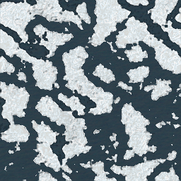
cs_glacier
  • VMap0: Snow Field/Ice Field
  • GlobCover: Permanent Snow and Ice
  • CORINE: Glaciers and perpetual snow
  • NLCD: Perennial Ice/Snow
  • USGS: Snow or Ice
  • NOAA: Glaciers
  • CORINE German: Gletscher/Dauerschneegebiet
FG glacier.png

Clc2004-335new.png

000
000
000

v0_glacier
220 335 12 24/900 92
cs_packice
  • VMap0: Pack Ice
FG packice.png

v0_packice


cs_polarice
  • VMap0: Polar Ice


v0_polarice


  • LOW VEGETATION


cs_barrencover
  • VMap0: Ground Surface Element, Distorted Surface
  • GlobCover: Sparse (<15%) vegetation
  • CORINE: Sparsely vegetated areas
  • USGS: Barren or Sparsely Vegetated
  • NOAA: Mixed Barren Land
  • CORINE German: Flächen mit spärlicher Vegetation

Clc333.png

126
211
155

v0_barrencover
150 333 19/770 77
cs_bog
  • VMap0: Bog
  • CORINE: Peatbogs
  • CORINE German: Torfmoore

Clc412.png

126
071
211

v0_bog

412


cs_marsh
  • VMap0: Marsh/Swamp
  • GlobCover: Closed (>40%) broadleaved forest regularly flooded, fresh water
  • CORINE: Inland marshes
  • NLCD: Woody Wetlands
  • USGS: Wooded Wetland
  • NOAA: Forested Wetland
  • CORINE German: Sümpfe
FG marsh.png

Clc2004-411.png

183
071
239

v0_marsh
160
411 90 18/610 61
cs_grassland
  • Grass coverage, may be of agricultural use but not cultivated (see: 'cropgrass') - alternatively called 'grasscover'
  • VMap0: Grassland
  • GlobCover: Closed to open (>15%) grassland
  • CORINE: Natural grasslands
  • NLCD: Grassland/Herbaceous
  • USGS: Grassland
  • GORINE German: Natürliches Grasland
FG grass.png

Clc321.png

155
183
099

v0_grasscover
140 321 71 7/311

cs_greenspace
  • Grass coverage in municipal parks et. al.
  • CORINE: Green urban areas
  • NLCD: Developed, Open Space
  • CORINE German: Städtische Grünflächen

Clc141.png

099
239
000


141 21


cs_golfcourse
  • CORINE: Sport and leisure facilities
  • CORINE German: Sport/Freizeitanlagen

Clc142.png

239
071
000


142


cs_cemetery
  • Cemetery


  • MEDIUM VEGETATION


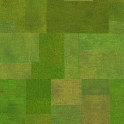
cs_cropgrass
  • Agricultural grass coverage, explicitly cultivated
  • GlobCover: Mosaic vegetation (grassland/shrubland/forest) (50-70%) / cropland (20-50%)
  • CORINE: Pastures
  • USGS: Cropland/Grassland Mosaic
  • NOAA: Cropland and Pasture
  • CORINE German: Wiesen und Weiden
FG cropgrass.png

Clc2004-231.png

155
211
013


30 231 5/280 21
cs_drycrop
  • VMap0: Crop land, Dry Crops
  • GlobCover: Rainfed croplands
  • CORINE: Non-irrigated arable land
  • NLCD: Pasture/Hay
  • USGS: Dryland Cropland and Pasture
  • CORINE German: Nicht bewässertes Ackerland
FG drycrop.png

Clc211.png

239
239
126

v0_drycroppasturecover
10 211 81 2/211

cs_irrcrop
  • VMap0: Crop land, Vegetation Characteristics: Other
  • GlobCover: Post-flooding or irrigated croplands
  • CORINE: Permanently irrigated land
  • USGS: Irrigated Cropland and Pasture
  • CORINE German: Regelmäßig bewässertes Ackerland
FG irrcrop.png

Clc212.png

000
000
000

v0_irrcroppasturecover
11 212 3/212

cs_vineyard
  • CORINE: Vineyards
  • CORINE German: Weinbauflächen

Clc221.png

239
155
013


11 221 3/212

cs_orchard
  • CORINE: Fruit trees and berry plantations
  • CORINE German: Obst- und Beerenobstbestände

Clc2004-222.png

239
211
155


11 222 3/212

cs_olives
  • CORINE: Olive groves
  • CORINE German: Olivenhaine

Clc223.png

000
000
000


11 223 3/212

cs_rice
  • CORINE: Rice fields

Clc2004-213.png

000
000
000


213


cs_mixedcrop
  • VMap0: Crop land, Vegetation Characteristics: Unknown
  • CORINE: Annual crops associated with permanent crops
  • USGS: Mixed Dryland/Irrigated Cropland and Pasture
  • NOAA: Other Agricultural Land
  • CORINE German: Einjähr. Kulturen in Verbindung mit Dauerkulturen
FG mixedcrop.png

Clc2004-241.png

000
000
000

v0_mixedcroppasturecover

241 4/213 24
cs_complexcrop
  • CORINE: Complex cultivation patterns
  • NOAA: Confined Feeding Operations
  • CORINE German: Komplexe Parzellenstrukturen

Clc242.png

239
211
099


242
23
cs_naturalcrop
  • GlobCover: Mosaic cropland (50-70%) / vegetation (grassland/shrubland/forest) (20-50%)
  • CORINE: Land principally occupied by agriculture, with significant areas of natural vegetation
  • NLCD: Cultivated Crops
  • CORINE German: Landwirtschaft mit natürlicher Bodenbedeckung

Clc243.png

183
183
071


20
243 82


cs_agroforest
  • CORINE: Agro-forestry areas
  • CORINE German: Agroforstlich genutzte Flächen

Clc244.png

000
000
000


244 6/290

cs_herbtundra
  • VMap0: Tundra
  • NLCD: Dwarf Scrub
  • USGS: Herbaceous Tundra
  • NOAA: Herbaceous Tundra
FG herbtundra.png

v0_herbtundracover


51 20/820 82
cs_heath
  • CORINE: Moors and heathland
  • CORINE German: Heiden und Moorheiden

Clc2004-322.png

211
211
000


322


cs_sclerophyllous
  • CORINE: Sclerophyllous vegetation
  • CORINE German: Hartlaubgewächse

Clc323.png

000
000
000


323


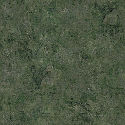
cs_scrub
  • VMap0: Scrub/Brush
  • GlobCover: Closed to open (>15%) shrubland (<5m)
  • CORINE: Transitional woodland shrub
  • NLCD: Shrub/Scrub
  • USGS: Shrubland
  • NOAA: Shrub and Brush Rangeland
  • CORINE German: Wald/Strauch
FG shrub.png

Clc324.png

183
239
000

v0_scrubcover
130 324 52 8/321 32
  • TALL VEGETATION


cs_deciduousforest
  • VMap0: Trees, Deciduous
  • GlobCover: Closed (>40%) broadleaved deciduous forest (>5m)
  • CORINE: Broad-leaved forest
  • NLCD: Deciduous Forest
  • USGS: Deciduous Broadleaf Forest
  • NOAA: Deciduous Forest Land
  • CORINE German: Laubwälder
FG deciduous.png

Clc311.png

000
183
000

v0_deciduousbroadcover
50 311 41 11/411 41
N/A
  • GLobCover: Open (15-40%) needle-leaved deciduous or evergreen forest (>5m)
  • USGS: Deciduous Needleleaf Forest


90
12/412

N/A
  • GlobCover: Closed to open (>15%) broadleaved evergreen and/or semi-deciduous forest (>5m)
  • USGS: Evergreen Broadleaf Forest


40
13/421

cs_evergreenforest
  • VMap0: Trees, Evergreen
  • GlobCover: Closed (>40%) needle-leaved evergreen forest (>5m)
  • CORINE: Coniferous forest
  • NLCD: Evergreen Forest
  • USGS: Evergreen Needleleaf Forest
  • NOAA: Evergreen Forest Land
  • CORINE German: Nadelwälder
FG evergreen.png

Clc312.png

000
126
099

v0_evergreenbroadcover
70 312 42 14/422 42
cs_mixedforest
  • VMap0: Trees, Mixed Trees
  • GlobCover: Closed to open (>15%) mixed broadleaved and needleaved forest
  • CORINE: Mixed forest
  • NLCD: Mixed Forest
  • USGS: Mixed Forest
  • NOAA: Mixed Forest Land
  • CORINE German: Mischwälder
FG mixedforest.png

Clc313.png

000
126
000

v0_mixedforestcover
100 313 43 15/430 43
cs_rainforest
  • Rain forest


  • LINE


cs_road
  • Road


v0_road


cs_freeway
  • Motorway/Freeway


v0_freeway


cs_railroad1
  • Medium railroad


v0_railroad1


cs_railroad2
  • Large railroad


v0_railroad2


cs_stream
  • VMap0: River/Stream, Perennial/Permanent
  • NOAA: Streams and Canals
v0_stream 51
cs_intermittentstream
  • VMap0: River/Stream, Non-Perennial/Intermittent/Fluctuating


v0_intermittentstream


cs_canal
  • VMap0: Canal


v0_canal


Sources:

1) Colours do not precisely correspond with EEA's Corine Landclass Colour values, Latest CLC2000 RGB-Values
, instead, the values are taken from the DLR's "Classification key and lookup-table" at Data description CLC2000.