Difference between revisions of "LandcoverDB CS Detail"

From OSGeo
Jump to navigation Jump to search
(NLCD home page)
m (Test for changing WIki table formatting)
 
Line 1: Line 1:
 
== Catalogue of landcover classes:  ==
 
== Catalogue of landcover classes:  ==
  
{| cellspacing="0" cellpadding="4" border="1"
+
{| class="wikitable" cellspacing="0" cellpadding="4" border="1"
 
|-
 
|-
! Name  
+
! Name !! Description !! Texture !! WMS RGB-values<sup>1</sup> !! VMap0 equivalent, [[LandcoverDB VMap0 Detail|LandcoverDB VMap0]] !! FAO LCCS !! GlobCover !! CORINE landclass !! NLCD class!! USGS value/code !! NOAA code !! ATKIS code
! Description  
 
! Texture  
 
! WMS RGB-values<sup>1</sup>  
 
! VMap0 equivalent, [[LandcoverDB VMap0 Detail|LandcoverDB VMap0]]  
 
! FAO LCCS  
 
! GlobCover  
 
! CORINE landclass  
 
! NLCD class
 
! USGS value/code  
 
! NOAA code  
 
! ATKIS code
 
 
|-
 
|-
 
|  
 
|  
 
*BASIC FEATURE
 
*BASIC FEATURE
  
| <br>  
+
| <br> || <br> || <br> || <br> || <br> || <br> || <br> || <br> || <br> || <br> || <br>
| <br>  
 
| <br>  
 
| <br>  
 
| <br>  
 
| <br>  
 
| <br>  
 
|
 
| <br>  
 
| <br>  
 
| <br>
 
 
|-
 
|-
| cs_urban  
+
| cs_urban ||  
|  
 
 
*VMap0: Built-Up Area  
 
*VMap0: Built-Up Area  
 
*GlobCover: Artificial surfaces and associated areas (Urban areas &gt;50%)  
 
*GlobCover: Artificial surfaces and associated areas (Urban areas &gt;50%)  
Line 39: Line 17:
 
*USGS: Urban and Built-Up Land  
 
*USGS: Urban and Built-Up Land  
 
*CORINE German: durchgängig städtische Prägung
 
*CORINE German: durchgängig städtische Prägung
 +
|| [[Image:FG city.png|thumb|right|50px]]
 +
| align="center" | [[Image:Clc111.png|20x20px]]
  
| [[Image:FG city.png|thumb|right|50px]]
+
<sub>211<br>000<br>000</sub><br>
| align="center" |
+
|| v0_urban || <br> || 190 || 111 || 24|| 1/100 || 11 || 2111
[[Image:Clc111.png|20x20px]]


<sub>211<br>000<br>000</sub><br>  


| v0_urban  
 
| <br>  
 
| 190  
 
| 111  
 
| 24
 
| 1/100  
 
| 11  
 
| 2111
 
 
|-
 
|-
 
| cs_suburban  
 
| cs_suburban  

Latest revision as of 14:36, 15 November 2015

Catalogue of landcover classes:

Name Description Texture WMS RGB-values1 VMap0 equivalent, LandcoverDB VMap0 FAO LCCS GlobCover CORINE landclass NLCD class USGS value/code NOAA code ATKIS code
  • BASIC FEATURE


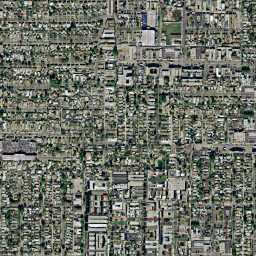
cs_urban
  • VMap0: Built-Up Area
  • GlobCover: Artificial surfaces and associated areas (Urban areas >50%)
  • CORINE: Continuous urban fabric
  • NLCD: Developed, High Intensity
  • USGS: Urban and Built-Up Land
  • CORINE German: durchgängig städtische Prägung
FG city.png
Clc111.png

211
000
000

v0_urban
190 111 24 1/100 11 2111
cs_suburban
  • NLCD: Developed, Medium Intensity
  • NOAA: Mixed Urban or Built-up Land


23
16
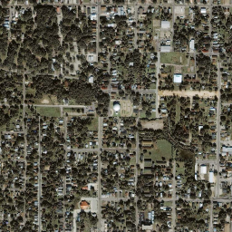
cs_town
  • VMap0: Built-Up Area (point feature)
  • CORINE: Discontinuous urban fabric
  • NLCD: Developed, Low Intensity
  • NOAA: Other Urban or Built-up Land
  • CORINE German: nicht durchgängig städtische Prägung
FG town.png

Clc112.png

239
042
071

v0_town

112 22
17
cs_industrial
  • CORINE: Industrial or commercial units
  • NOAA: Industrial
  • CORINE German: Industrie/Gewerbeflächen

Clc121.png

211
000
155


121
13
cs_fishing
  • VMap0: Fish Hatchery/Fish Farm/Marine Farm

085
155
239


cs_transport
  • CORINE: Road and railnetworks and associated land
  • NOAA: Transportation, Communications and Utilities
  • CORINE German: Straßen und Eisenbahn

Clc2004-122new.png

126
126
126


122
14
cs_port
  • CORINE: Port areas
  • CORINE German: Hafengebiete

Clc123.png

155
155
211


123


cs_asphalt
  • Asphalt


cs_airport
  • Typical mixed/dry grass coverage around airfields
  • CORINE: Airports
  • CORINE German: Flughäfen
FG airport.png

Clc124.png

099
099
099


124


cs_openmining
  • VMap0: Mine/Quarry
  • CORINE: Mineral extraction sites
  • NOAA: Strip Mines, Quarries, and Gravel Pits
  • CORINE German: Abbauflächen

Clc131.png

155
071
042


131
75
cs_dump
  • CORINE: Dump sites
  • CORINE German: Deponien und Abraumhalden

Clc132.png

155
013
042


132


cs_construction
  • CORINE: Construction sites
  • CORINE German: Baustellen

Clc133.png

183
099
126


133


cs_dirt
  • GlobCover: Bare areas
  • NLCD: Barren Land (Rock/Sand/Clay)
  • NOAA: Bare Ground


200
31
83

cs_rock
  • CORINE: Bare rock
  • NOAA: Bare Exposed Rock
  • CORINE German: Felsflächen ohne Vegetation
FG rock.png

Clc332.png

211
211
155


332
74
cs_lake
  • VMap0: Inland Water, Perennial/Permanent
  • GlobCover: Water bodies
  • CORINE: Water bodies
  • NLCD: Open Water
  • USGS: Water Bodies
  • NOAA: Lakes
  • CORINE German: Wasserflächen
FG water-lake.png

Clc512.png

000
155
239

v0_lake
210 512 11 16/500 52
cs_intermittentlake
  • VMap0: Inland Water, Non-Perennial/Intermittent/Fluctuating


v0_intermittentlake


cs_watercourse
  • CORINE: Water courses
  • CORINE German: Gewässerläufe

Clc511.png

000
099
239

511
  • SURFACE FEATURE


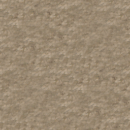
cs_sand
  • VMap0: Ground Surface Element, Sand, Soil Wetness Condition: Unknown
  • CORINE: Beaches, dunes, and sand plains
  • NOAA: Sandy Areas Other than Beaches
  • CORINE German: Strände, Dünen, Sandflächen
FG sand.png

Clc331.png

239
239
183

v0_sand

331
73
N/A
  • NOAA: Beaches


72
cs_floodland
  • VMap0: Land Subject to Inundation
  • GlobCover: Closed to open (>15%) grassland or shrubland or woody vgt on regularly flooded or waterlogged soil, fresh, brakish or saline water
  • NLCD: Wmergent Herbaceous Wetlands
  • USGS: Herbaceous Wetland
  • NOAA: Nonforested Wetland


v0_floodland


95 17/620 62
cs_lagoon
  • CORINE: Coastal lagoons
  • CORINE German: Lagunen

Clc521.png

000
211
239


521


cs_estuary
  • CORINE: Estuaries
  • NOAA: Bays and Estuaries
  • CORINE German: Mündungsgebiet

Clc522.png

099
211
239


522
54
N/A
  • CORINE: Sea and ocean
  • CORINE German: Meere und Ozeane

Clc523.png

159
215
248


523


cs_saltmarsh
  • CORINE: Salt marshes
  • CORINE German: Salzwiesen

Clc421.png

183
126
211


421


cs_saline
  • CORINE: Salines
  • NOAA: Dry Salt Flats
  • CORINE German: Salinen

Clc422.png

000
000
000


422
71
cs_littoral
  • VMap0: Ground Surface Element, Sand, Wet
  • CORINE: Intertidal flats
  • CORINE German: In der Gezeitenzone liegende Flächen

Clc423.png

239
183
239

v0_littoral

423


cs_lava
  • VMap0: Ground Surface Element, Lava


v0_lava


cs_burnt
  • CORINE: Burnt areas
  • CORINE German: Brandflächen

Clc334.png

000
000
000


334


cs_glacier
  • VMap0: Snow Field/Ice Field
  • GlobCover: Permanent Snow and Ice
  • CORINE: Glaciers and perpetual snow
  • NLCD: Perennial Ice/Snow
  • USGS: Snow or Ice
  • NOAA: Glaciers
  • CORINE German: Gletscher/Dauerschneegebiet
FG glacier.png

Clc2004-335new.png

000
000
000

v0_glacier
220 335 12 24/900 92
cs_packice
  • VMap0: Pack Ice
FG packice.png

v0_packice


cs_polarice
  • VMap0: Polar Ice


v0_polarice


  • LOW VEGETATION


cs_barrencover
  • VMap0: Ground Surface Element, Distorted Surface
  • GlobCover: Sparse (<15%) vegetation
  • CORINE: Sparsely vegetated areas
  • USGS: Barren or Sparsely Vegetated
  • NOAA: Mixed Barren Land
  • CORINE German: Flächen mit spärlicher Vegetation

Clc333.png

126
211
155

v0_barrencover
150 333 19/770 77
cs_bog
  • VMap0: Bog
  • CORINE: Peatbogs
  • CORINE German: Torfmoore

Clc412.png

126
071
211

v0_bog

412


cs_marsh
  • VMap0: Marsh/Swamp
  • GlobCover: Closed (>40%) broadleaved forest regularly flooded, fresh water
  • CORINE: Inland marshes
  • NLCD: Woody Wetlands
  • USGS: Wooded Wetland
  • NOAA: Forested Wetland
  • CORINE German: Sümpfe
FG marsh.png

Clc2004-411.png

183
071
239

v0_marsh
160
411 90 18/610 61
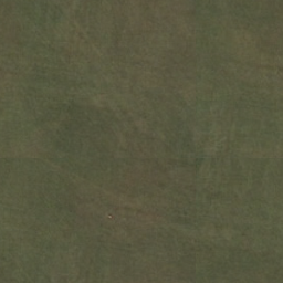
cs_grassland
  • Grass coverage, may be of agricultural use but not cultivated (see: 'cropgrass') - alternatively called 'grasscover'
  • VMap0: Grassland
  • GlobCover: Closed to open (>15%) grassland
  • CORINE: Natural grasslands
  • NLCD: Grassland/Herbaceous
  • USGS: Grassland
  • GORINE German: Natürliches Grasland
FG grass.png

Clc321.png

155
183
099

v0_grasscover
140 321 71 7/311

cs_greenspace
  • Grass coverage in municipal parks et. al.
  • CORINE: Green urban areas
  • NLCD: Developed, Open Space
  • CORINE German: Städtische Grünflächen

Clc141.png

099
239
000


141 21


cs_golfcourse
  • CORINE: Sport and leisure facilities
  • CORINE German: Sport/Freizeitanlagen

Clc142.png

239
071
000


142


cs_cemetery
  • Cemetery


  • MEDIUM VEGETATION


cs_cropgrass
  • Agricultural grass coverage, explicitly cultivated
  • GlobCover: Mosaic vegetation (grassland/shrubland/forest) (50-70%) / cropland (20-50%)
  • CORINE: Pastures
  • USGS: Cropland/Grassland Mosaic
  • NOAA: Cropland and Pasture
  • CORINE German: Wiesen und Weiden
FG cropgrass.png

Clc2004-231.png

155
211
013


30 231 5/280 21
cs_drycrop
  • VMap0: Crop land, Dry Crops
  • GlobCover: Rainfed croplands
  • CORINE: Non-irrigated arable land
  • NLCD: Pasture/Hay
  • USGS: Dryland Cropland and Pasture
  • CORINE German: Nicht bewässertes Ackerland
FG drycrop.png

Clc211.png

239
239
126

v0_drycroppasturecover
10 211 81 2/211

cs_irrcrop
  • VMap0: Crop land, Vegetation Characteristics: Other
  • GlobCover: Post-flooding or irrigated croplands
  • CORINE: Permanently irrigated land
  • USGS: Irrigated Cropland and Pasture
  • CORINE German: Regelmäßig bewässertes Ackerland
FG irrcrop.png

Clc212.png

000
000
000

v0_irrcroppasturecover
11 212 3/212

cs_vineyard
  • CORINE: Vineyards
  • CORINE German: Weinbauflächen

Clc221.png

239
155
013


11 221 3/212

cs_orchard
  • CORINE: Fruit trees and berry plantations
  • CORINE German: Obst- und Beerenobstbestände

Clc2004-222.png

239
211
155


11 222 3/212

cs_olives
  • CORINE: Olive groves
  • CORINE German: Olivenhaine

Clc223.png

000
000
000


11 223 3/212

cs_rice
  • CORINE: Rice fields

Clc2004-213.png

000
000
000


213


cs_mixedcrop
  • VMap0: Crop land, Vegetation Characteristics: Unknown
  • CORINE: Annual crops associated with permanent crops
  • USGS: Mixed Dryland/Irrigated Cropland and Pasture
  • NOAA: Other Agricultural Land
  • CORINE German: Einjähr. Kulturen in Verbindung mit Dauerkulturen
FG mixedcrop.png

Clc2004-241.png

000
000
000

v0_mixedcroppasturecover

241 4/213 24
cs_complexcrop
  • CORINE: Complex cultivation patterns
  • NOAA: Confined Feeding Operations
  • CORINE German: Komplexe Parzellenstrukturen

Clc242.png

239
211
099


242
23
cs_naturalcrop
  • GlobCover: Mosaic cropland (50-70%) / vegetation (grassland/shrubland/forest) (20-50%)
  • CORINE: Land principally occupied by agriculture, with significant areas of natural vegetation
  • NLCD: Cultivated Crops
  • CORINE German: Landwirtschaft mit natürlicher Bodenbedeckung

Clc243.png

183
183
071


20
243 82


cs_agroforest
  • CORINE: Agro-forestry areas
  • CORINE German: Agroforstlich genutzte Flächen

Clc244.png

000
000
000


244 6/290

cs_herbtundra
  • VMap0: Tundra
  • NLCD: Dwarf Scrub
  • USGS: Herbaceous Tundra
  • NOAA: Herbaceous Tundra
FG herbtundra.png

v0_herbtundracover


51 20/820 82
cs_heath
  • CORINE: Moors and heathland
  • CORINE German: Heiden und Moorheiden

Clc2004-322.png

211
211
000


322


cs_sclerophyllous
  • CORINE: Sclerophyllous vegetation
  • CORINE German: Hartlaubgewächse

Clc323.png

000
000
000


323


cs_scrub
  • VMap0: Scrub/Brush
  • GlobCover: Closed to open (>15%) shrubland (<5m)
  • CORINE: Transitional woodland shrub
  • NLCD: Shrub/Scrub
  • USGS: Shrubland
  • NOAA: Shrub and Brush Rangeland
  • CORINE German: Wald/Strauch
FG shrub.png

Clc324.png

183
239
000

v0_scrubcover
130 324 52 8/321 32
  • TALL VEGETATION


cs_deciduousforest
  • VMap0: Trees, Deciduous
  • GlobCover: Closed (>40%) broadleaved deciduous forest (>5m)
  • CORINE: Broad-leaved forest
  • NLCD: Deciduous Forest
  • USGS: Deciduous Broadleaf Forest
  • NOAA: Deciduous Forest Land
  • CORINE German: Laubwälder
FG deciduous.png

Clc311.png

000
183
000

v0_deciduousbroadcover
50 311 41 11/411 41
N/A
  • GLobCover: Open (15-40%) needle-leaved deciduous or evergreen forest (>5m)
  • USGS: Deciduous Needleleaf Forest


90
12/412

N/A
  • GlobCover: Closed to open (>15%) broadleaved evergreen and/or semi-deciduous forest (>5m)
  • USGS: Evergreen Broadleaf Forest


40
13/421

cs_evergreenforest
  • VMap0: Trees, Evergreen
  • GlobCover: Closed (>40%) needle-leaved evergreen forest (>5m)
  • CORINE: Coniferous forest
  • NLCD: Evergreen Forest
  • USGS: Evergreen Needleleaf Forest
  • NOAA: Evergreen Forest Land
  • CORINE German: Nadelwälder
FG evergreen.png

Clc312.png

000
126
099

v0_evergreenbroadcover
70 312 42 14/422 42
cs_mixedforest
  • VMap0: Trees, Mixed Trees
  • GlobCover: Closed to open (>15%) mixed broadleaved and needleaved forest
  • CORINE: Mixed forest
  • NLCD: Mixed Forest
  • USGS: Mixed Forest
  • NOAA: Mixed Forest Land
  • CORINE German: Mischwälder
FG mixedforest.png

Clc313.png

000
126
000

v0_mixedforestcover
100 313 43 15/430 43
cs_rainforest
  • Rain forest


  • LINE


cs_road
  • Road


v0_road


cs_freeway
  • Motorway/Freeway


v0_freeway


cs_railroad1
  • Medium railroad


v0_railroad1


cs_railroad2
  • Large railroad


v0_railroad2


cs_stream
  • VMap0: River/Stream, Perennial/Permanent
  • NOAA: Streams and Canals
v0_stream 51
cs_intermittentstream
  • VMap0: River/Stream, Non-Perennial/Intermittent/Fluctuating


v0_intermittentstream


cs_canal
  • VMap0: Canal


v0_canal


Sources:

1) Colours do not precisely correspond with EEA's Corine Landclass Colour values, Latest CLC2000 RGB-Values
, instead, the values are taken from the DLR's "Classification key and lookup-table" at Data description CLC2000.