Uploads by Wiki-S%C3%A9bastien
Jump to navigation
Jump to search
This special page shows all uploaded files.
User account "Wiki-S%C3%A9bastien" is not registered.
| Date | Name | Thumbnail | Size | User | Description | Versions |
|---|---|---|---|---|---|---|
| 06:20, 29 November 2019 | (Seoul)FOSS4G Asia Proposal 2020.pdf (file) | 509 KB | Venkat | 1 | ||
| 06:26, 29 November 2019 | (Seoul)Letter of support.pdf (file) | 102 KB | Venkat | 1 | ||
| 03:32, 29 April 2016 | -.jpeg (file) |  |
31 KB | Wiki-Sittichai choosumrong | 1 | |
| 10:48, 14 July 2006 | -foss4g2006-07122006.pdf (file) | 39 KB | Oertz | 1 | ||
| 07:59, 26 November 2018 | 00 question mark.png (file) |  |
482 bytes | Silli | 1 | |
| 17:51, 5 June 2008 | 01 Action Notes 30May 2008.pdf (file) | 25 KB | Wiki-AndrewD | Action Notes from first meeting of the 2009 OC and PCO | 1 | |
| 17:33, 21 October 2009 | 01 arevalo ican poster.pdf (file) | 608 KB | Wiki-Antti | ICAN aims to be a global reference for the development of coastal web atlases (CWAs). Via the expertise of more than 35 member organisations. ICAN intendes to inform, guide and influence matters related to research, development and use of CWAs. Kathrin | 1 | |
| 13:37, 16 November 2018 | 01 new map view.png (file) |  |
111 KB | Silli | 1 | |
| 03:39, 9 February 2020 | 01 overview.jpg (file) |  |
48 KB | Wiki-Banbar | 1 | |
| 13:47, 16 November 2018 | 02 map view all.png (file) |  |
1,001 KB | Silli | 1 | |
| 18:43, 21 October 2009 | 03 knudsen.pdf (file) | 235 KB | Wiki-Antti | The KMStrlib geo-transformation library, which has been in active use and development since the 1960s at KMS (National Survey and Cadastre, Denmark), is now finally being released under an open source licence. KMStrlib provides a unified interface to a l | 1 | |
| 18:45, 21 October 2009 | 04 knudsen.pdf (file) | 1.64 MB | Wiki-Antti | In this poster presentation, we describe how the PINGPONG program (FOSS distributed under the GPL) has been used to implement a quality control procedure for laser scanned DEMs. The approach used is independent of navigational (GPS/INS) data and ground co | 1 | |
| 08:01, 26 November 2018 | 05 raster reproject.png (file) |  |
18 KB | Silli | 1 | |
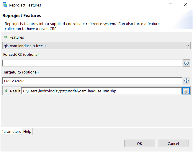
| 08:02, 26 November 2018 | 06 vector reproject.png (file) |  |
16 KB | Silli | 1 | |
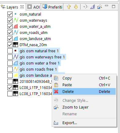
| 08:02, 26 November 2018 | 07 delete layers.png (file) |  |
19 KB | Silli | 1 | |
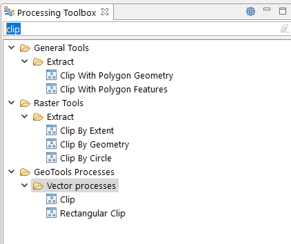
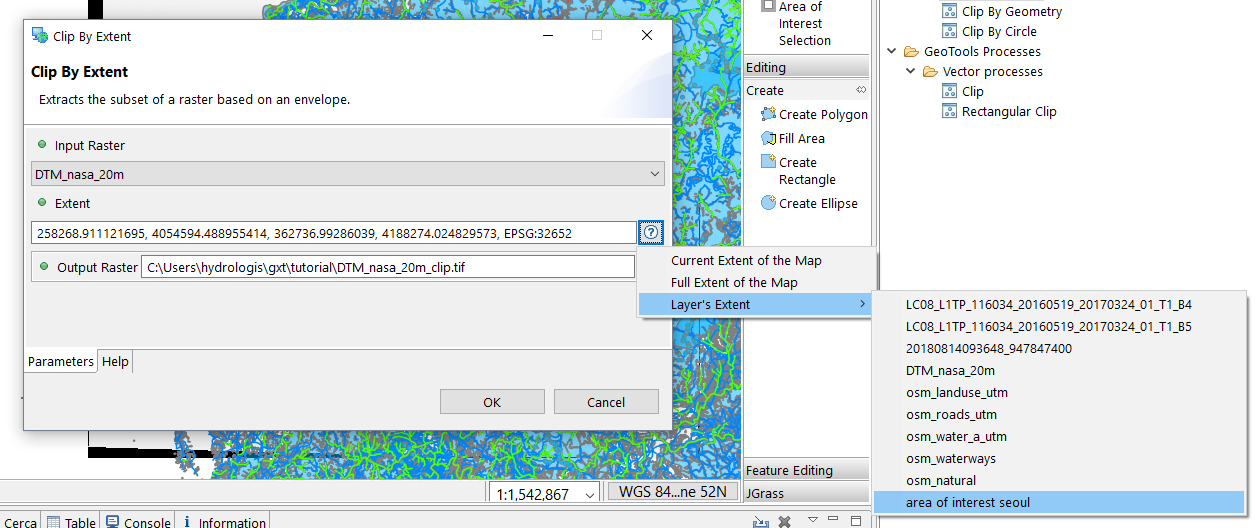
| 08:04, 26 November 2018 | 08 search clip.png (file) |  |
15 KB | Silli | 1 | |
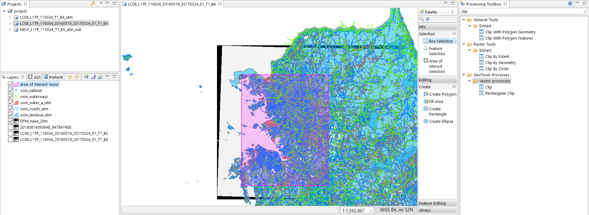
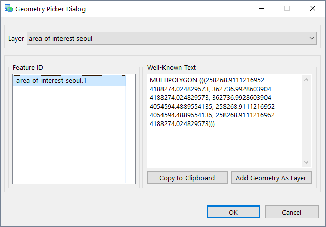
| 08:03, 26 November 2018 | 09 area of interest.png (file) |  |
765 KB | Silli | 1 | |
| 23:20, 24 March 2011 | 0 0 Using SPRING.odt (file) | 27 KB | Elil | 1 | ||
| 23:20, 24 March 2011 | 0 1 Main Steps to operate the SPRING.odt (file) | 25 KB | Elil | 1 | ||
| 08:04, 26 November 2018 | 10 raster clip.png (file) |  |
192 KB | Silli | 1 | |
| 00:05, 27 May 2023 | 11.jpg (file) |  |
146 KB | Aryang257 | 1 | |
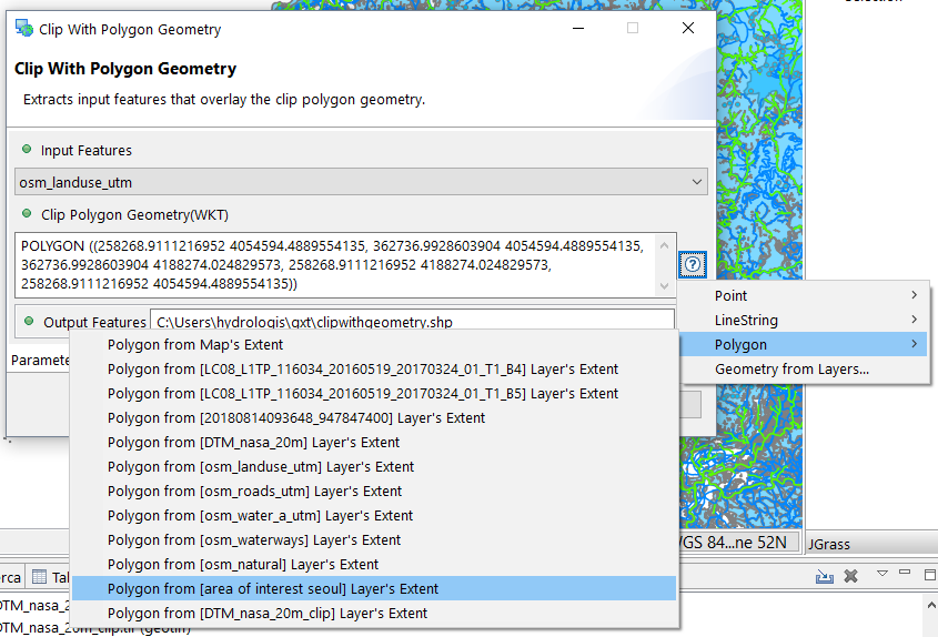
| 08:05, 26 November 2018 | 11 clip vector.png (file) |  |
133 KB | Silli | 1 | |
| 00:10, 27 May 2023 | 12.jpg (file) |  |
66 KB | Aryang257 | 1 | |
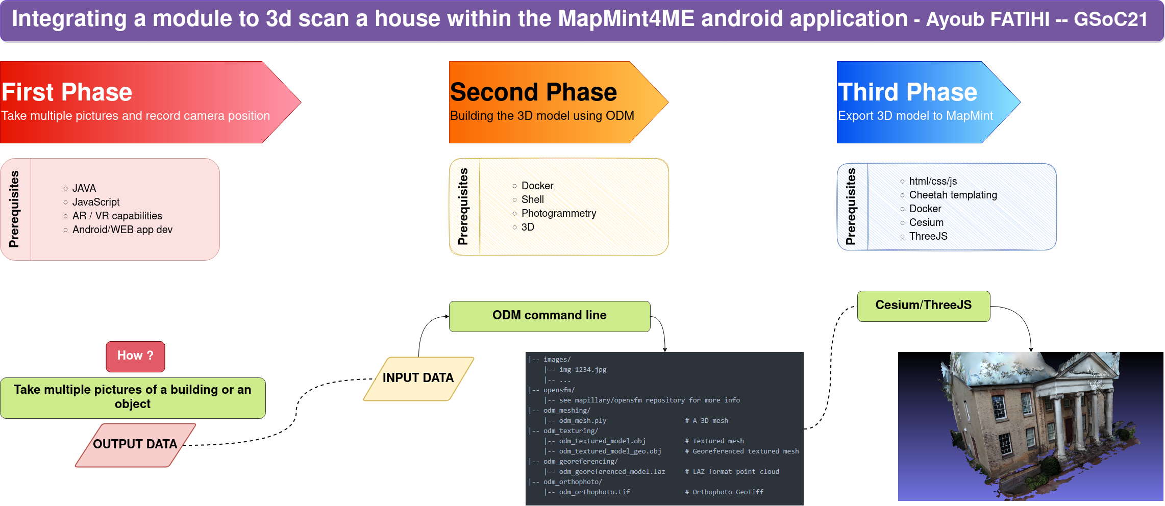
| 04:32, 22 August 2021 | 129237773-f636dcfb-c737-49f8-a23e-78fa3392d6d0.png (file) |  |
598 KB | Ayoubft | 1 | |
| 08:05, 26 November 2018 | 12 clip vector.png (file) |  |
15 KB | Silli | 1 | |
| 09:53, 4 August 2014 | 1361375259918.jpg (file) |  |
37 KB | Wiki-Santos | 1 | |
| 08:10, 26 November 2018 | 13 preliminary operations.png (file) |  |
510 KB | Silli | 1 | |
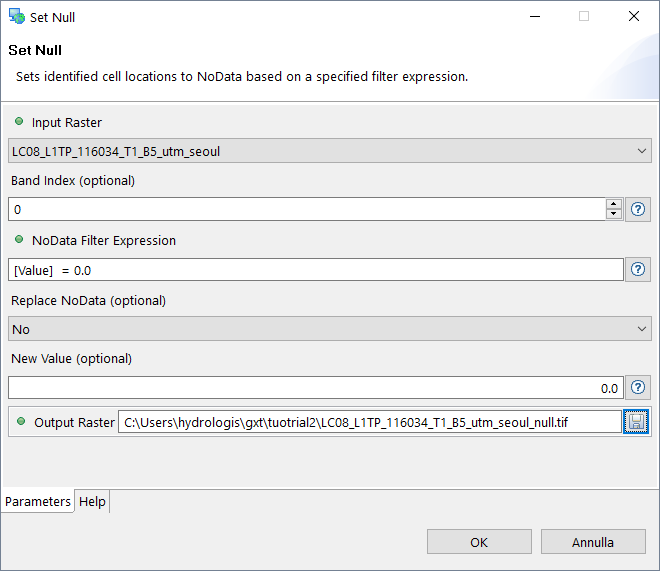
| 08:06, 26 November 2018 | 14 setnull.png (file) |  |
19 KB | Silli | 1 | |
| 01:55, 13 May 2016 | 151030 FOSS4G2016 WCCB-Aufsicht Ebene 0.pdf (file) | 970 KB | Tadams | Floor plan of F4G Bonn venue 2016 | 1 | |
| 08:06, 26 November 2018 | 15 setnull.png (file) |  |
19 KB | Silli | 1 | |
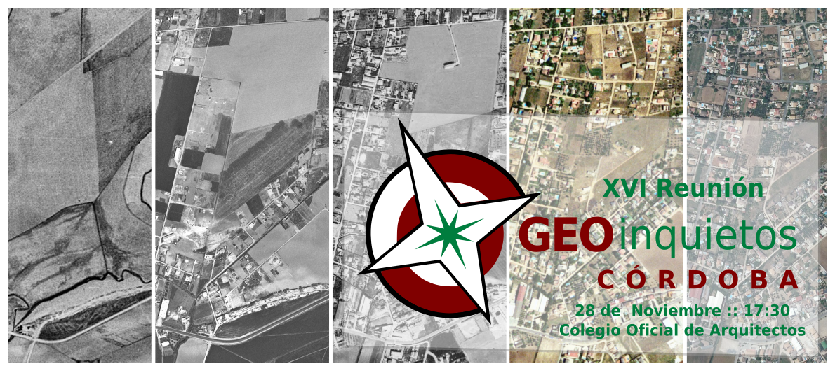
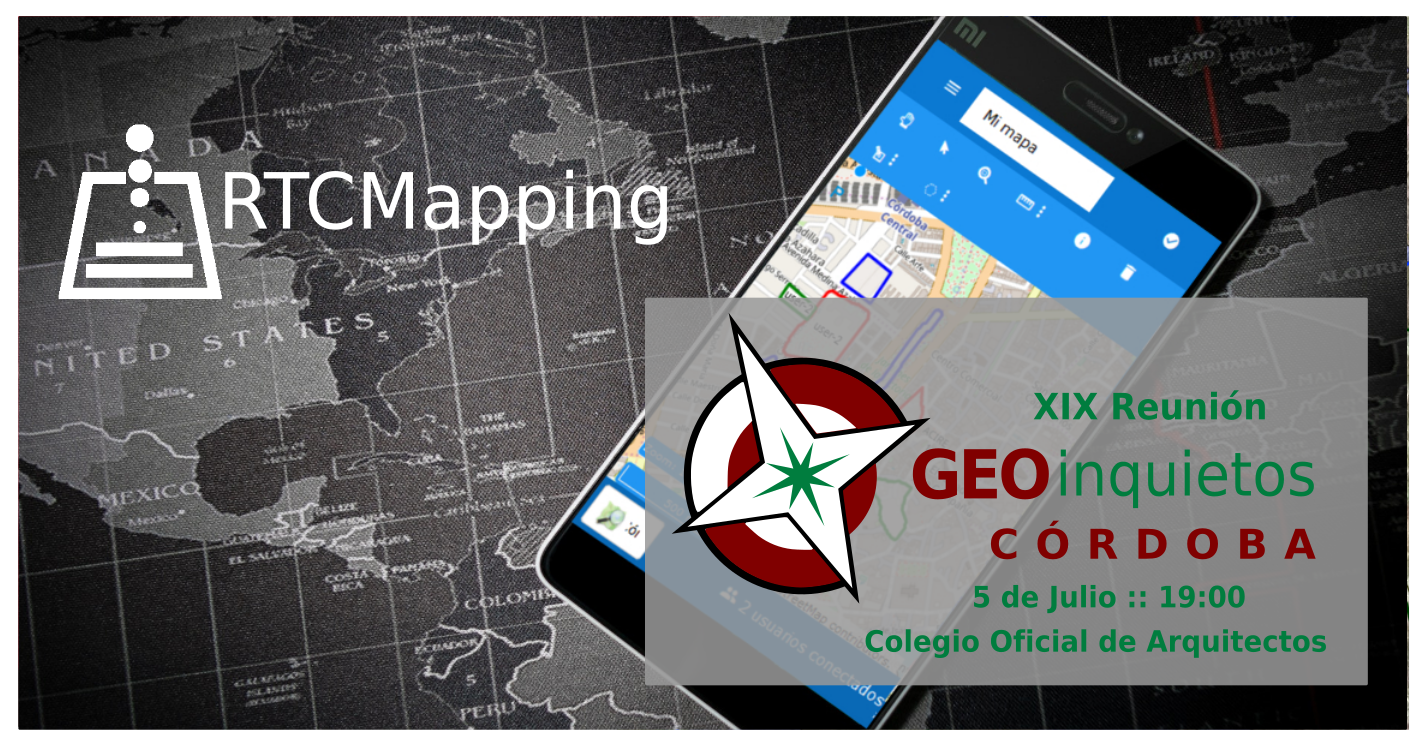
| 02:26, 28 November 2017 | 16 geoinquietos fb.png (file) |  |
1.03 MB | Wiki-Pasoriano | Category:Iniciativas_Locales Category:Geoinquietos Córdoba | 1 |
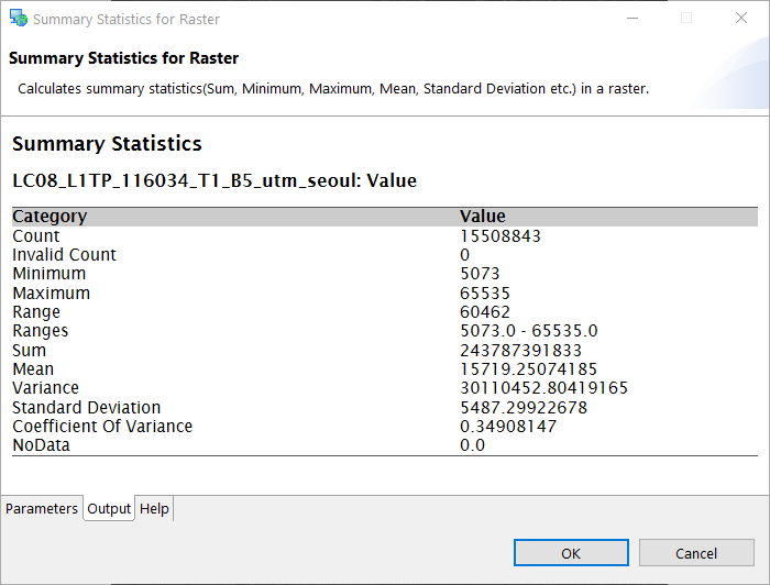
| 08:33, 26 November 2018 | 16 summary stats.png (file) |  |
14 KB | Silli | 1 | |
| 01:35, 29 November 2017 | 16geoinquietos 1.jpg (file) |  |
105 KB | Wiki-Pasoriano | Category:Iniciativas_Locales Category:Geoinquietos Córdoba | 1 |
| 01:37, 29 November 2017 | 16geoinquietos 10.jpg (file) |  |
97 KB | Wiki-Pasoriano | Category:Iniciativas_Locales Category:Geoinquietos Córdoba | 1 |
| 01:35, 29 November 2017 | 16geoinquietos 2.jpg (file) |  |
109 KB | Wiki-Pasoriano | Category:Iniciativas_Locales Category:Geoinquietos Córdoba | 1 |
| 01:36, 29 November 2017 | 16geoinquietos 3.jpg (file) |  |
80 KB | Wiki-Pasoriano | Category:Iniciativas_Locales Category:Geoinquietos Córdoba | 1 |
| 01:36, 29 November 2017 | 16geoinquietos 9.jpg (file) |  |
98 KB | Wiki-Pasoriano | Category:Iniciativas_Locales Category:Geoinquietos Córdoba | 1 |
| 01:37, 29 November 2017 | 16geoinquietos byJoseAntonio.jpg (file) |  |
68 KB | Wiki-Pasoriano | Category:Iniciativas_Locales Category:Geoinquietos Córdoba | 1 |
| 01:29, 29 November 2017 | 16geoinquietos patricio sala colegioarquitectos.jpg (file) |  |
116 KB | Wiki-Pasoriano | Category:Iniciativas_Locales Category:Geoinquietos Córdoba | 1 |
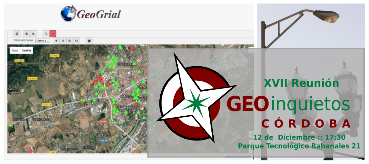
| 03:30, 28 November 2017 | 17 geoinquietos.png (file) |  |
663 KB | Wiki-Pasoriano | Category:Iniciativas_Locales Category:Geoinquietos Córdoba | 1 |
| 03:28, 28 November 2017 | 17 geoinquietos fb.png (file) |  |
663 KB | Wiki-Pasoriano | Category:Iniciativas_Locales Category:Geoinquietos Córdoba | 1 |
| 08:34, 26 November 2018 | 17 summary stats.png (file) |  |
25 KB | Silli | 1 | |
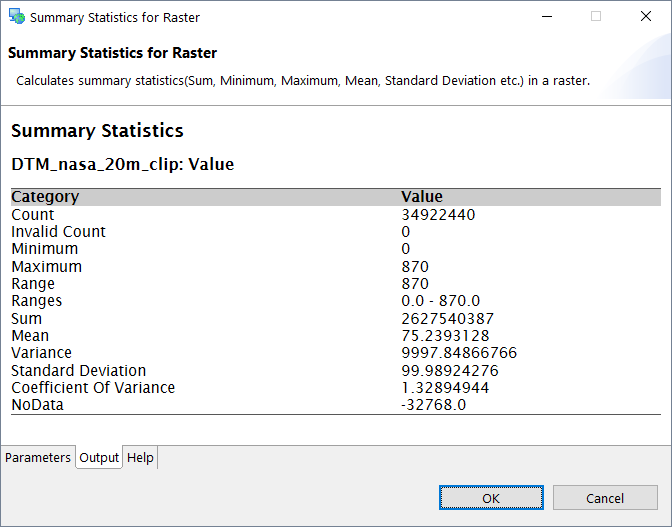
| 08:34, 26 November 2018 | 18 summary stats.png (file) |  |
22 KB | Silli | 1 | |
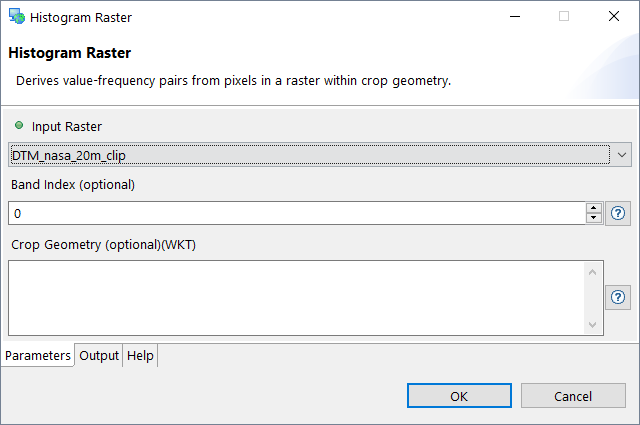
| 08:34, 26 November 2018 | 19 histogram.png (file) |  |
13 KB | Silli | 1 | |
| 10:55, 27 June 2018 | 19geoinquietos.png (file) |  |
1.54 MB | Wiki-Pasoriano | Category:Iniciativas_Locales Category:Geoinquietos Córdoba | 1 |
| 16:21, 14 August 2019 | 1EncontroGeoinquietosFor.jpeg (file) |  |
337 KB | Narceliodesa | 1 | |
| 23:21, 24 March 2011 | 1 1 10 How to Begin Step 6 Visualizing other Categories.odt (file) | 63 KB | Elil | 1 | ||
| 23:22, 24 March 2011 | 1 1 13 How to Begin Step 7 Visualize Cadastral Data.odt (file) | 33 KB | Elil | 1 | ||
| 23:22, 24 March 2011 | 1 1 14 How to Begin Step 8 Closing SPRING.odt (file) | 26 KB | Elil | 1 | ||
| 23:21, 24 March 2011 | 1 1 1 How to Begin Step 1 Activating a databank.odt (file) | 30 KB | Elil | 1 |