Semantic search

Jump to navigation Jump to search

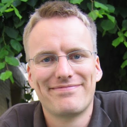
[[ Alexanno | Alexander Salveson Nossum ]]

Name: Alexander Salveson Nossum
Job Title: software developer
Company: Norkart
Country: Norway
City: Trondheim
Local Chapter: Norway
Social Media: http://twitter.com/alexanno, http://github.com/alexanno
Website: http://alexanno.net/
Coordinate: 63° 25' 49.80" N, 10° 23' 42.36" E


Experience: OSGeo coder.png OSGeo user.png

Alexander Salveson Nossum
Loading map...

[[ Moovida | Andrea Antonello ]]

Name: Andrea Antonello
Job Title: Tech lead
Company: HydroloGIS
Address: Bolzano, Alto Adige, Italia
Country: Italia
City: Bolzano
Local Chapter: Italiano
Social Media: http://twitter.com/themoovida
Website: http://www.andreaantonello.com/
Email: andrea.antonello@gmail.com
Coordinate: 46° 29' 50.51" N, 11° 20' 56.34" E
Languages: Italian, German, English

Experience: OSGeo coder.png OSGeo charter.png OSGeo user.png

Andrea Antonello
Loading map...

[[ Aross | Andrea Ross ]]

Name: Andrea Ross
Job Title: Director
Company: LocationTech
Country: Canada
State: Ontario
City: Ottawa
Local Chapter: Ottawa Chapter
Website: http://42aross.wordpress.com/
Coordinate: 45° 25' 15.72" N, 75° 41' 24.08" W


Experience: OSGeo charter.png OSGeo user.png

Andrea Ross

Andrea Ross has worked with open technologies and open communities for most of the last 20 years. Her roles during that time involved developing healthcare, telecom, database, and geospatial systems. Currently, as Director of Ecosystem Development for the Eclipse Foundation, nurturing open communities is what she does for a living. Andrea is a founder and inaugural Director of LocationTech.

Loading map...

[[ Andy Anderson | Andy Anderson ]]

Name: Andy Anderson
Job Title: Academic Technology Specialist
Company: Amherst College
Address: Amherst College, Academic Technology Services
Country: USA
State: Massachusetts
City: Amherst
Local Chapter: North America
Social Media: https://twitter.com/GeoObservatory
Website: https://www.amherst.edu/people/facstaff/aanderson
Email: aanderson@amherst.edu
Coordinate: 42° 22' 15.60" N, 72° 31' 1.20" W
Languages: English, Spanish

Experience: OSGeo charter.png OSGeo user.png

I have been using open-source software since the early 1980s, and specifically FOSS4G since 2007. I have been programming since the mid-1970s, primarily for scientific applications but also including open-source software, beginning with Fortran and C and continuing most recently with JavaScript, Python, R, and SQL. I currently teach occasional classes with FOSS4G and write documentation for using FOSS4G in my position as Academic Technology Specialist for Mathematical and Spatial Data Analysis at Amherst College, in my role as Adjunct Assistant Professor in Environmental Conservation at the University of Massachusetts, and as a member of GeoForAll. I also served on the Boston Local Organizing Committee for FOSS4G 2017, in particular as chair of the Program Committee.

Loading map...

[[ Angelos Tzotsos | Angelos Tzotsos ]]

Name: Angelos Tzotsos
Job Title: Geospatial Software Developer, Remote Sensing Consultant, Senior Researcher
Company: Open Source Geospatial Foundation
Country: Greece
State: Attica
City: Athens
Local Chapter: Greek
Social Media: https://twitter.com/tzotsos
Website: http://users.ntua.gr/tzotsos
Email: tzotsos@osgeo.org
Phone: +30-693-2149344
Coordinate: 37° 58' 44.40" N, 23° 46' 3.36" E
Languages: Greek, English

Experience: OSGeo board.png OSGeo coder.png OSGeo psc.png OSGeo charter.png OSGeo user.png OSGeo Committer.png

Angelos Tzotsos

Angelos is a remote sensing expert with background in surveying engineering and software development. He is involved in numerous activities around free and open source software and has great experience in geospatial applications, geospatial data catalogues and metadata. His research involves remote sensing, machine learning, computer vision and object-based image analysis. He is currently the President of OSGeo and also serves at the OSGeo Board of Directors. He is an active advocate of OSGeo in Greece at related conferences. He is also an individual OGC member. His recent activity involved implementation of data.gov catalog service and implementation of the Greek national open data portal geodata.gov.gr.

Loading map...

[[ Kalxas | Angelos Tzotsos ]]

Name: Angelos Tzotsos
Job Title: Geospatial Software Developer, Remote Sensing Consultant, Senior Researcher
Company: Open Source Geospatial Foundation
Country: Greece
State: Attica
City: Athens
Local Chapter: Greek
Social Media: https://twitter.com/tzotsos
Website: http://users.ntua.gr/tzotsos
Email: tzotsos@osgeo.org
Phone: +30-693-2149344
Coordinate: 37° 58' 44.40" N, 23° 46' 3.36" E
Languages: Greek, English

Experience: OSGeo board.png OSGeo coder.png OSGeo psc.png OSGeo charter.png OSGeo user.png OSGeo Committer.png

Angelos Tzotsos

Angelos is a remote sensing expert with background in surveying engineering and software development. He is involved in numerous activities around free and open source software and has great experience in geospatial applications, geospatial data catalogues and metadata. His research involves remote sensing, machine learning, computer vision and object-based image analysis. He is currently the President of OSGeo and also serves at the OSGeo Board of Directors. He is an active advocate of OSGeo in Greece at related conferences. He is also an individual OGC member. His recent activity involved implementation of data.gov catalog service and implementation of the Greek national open data portal geodata.gov.gr.

Loading map...

[[ Anitagraser | Anita Graser ]]

Name: Anita Graser
Job Title: Senior Scientist
Company: AIT Austrian Institute of Technology
Country: Austria
City: Vienna
Local Chapter: FOSSGIS e.V.
Instant Messaging: https://fosstodon.org/@underdarkgis
Social Media: https://www.linkedin.com/in/anita-graser-95102530
Website: https://anitagraser.com/
Email: anitagraser@gmx.at
Coordinate: 48° 16' 2.77" N, 16° 25' 30.47" E
Languages: German, English

Experience: OSGeo psc.png OSGeo charter.png OSGeo exboard.png OSGeo user.png

QGIS PSC member, author of 'Learning QGIS' and co-author of 'QGIS Map Design' and 'QGIS 2 Cookbook'.

Loading map...

[[ Anna Petrasova | Anna Petrasova ]]

Name: Anna Petrasova
Job Title: Geospatial Research Software Engineer
Company: North Carolina State University
Country: USA
State: NC
City: Raleigh
Local Chapter: North America
Coordinate: 35° 46' 49.45" N, 78° 38' 20.68" W
Languages: Czech, English

Experience: OSGeo coder.png OSGeo psc.png OSGeo charter.png OSGeo user.png

Anna Petrasova

Anna is an active GRASS GIS developer since 2011. She promotes free and open source geospatial software for research and education among students and colleagues and supports its users both in person and on mailing lists.

Loading map...

[[ Aghisla | Anne Ghisla ]]

Name: Anne Ghisla
Country: Germany
State: Berlin
City: Berlin
Local Chapter: FOSSGIS e.V.
Coordinate: 52° 31' 1.33" N, 13° 23' 19.90" E
Languages: Italian, French, English, German

Experience: OSGeo coder.png OSGeo charter.png OSGeo exboard.png OSGeo user.png

Anne Ghisla

Anne is a natural scientist who got interested in GIS and open source programming during university. She started with GRASS GIS and QGIS, first met the OSGeo community by helping on documentation. Then she started programming in 2008 thanks to Google Summer of Code, and became mentor and administrator for OSGeo in following years. She doesn't code much anymore, as she is now focused on connecting people and communities of different software projects. She helped Jorge Rocha with CRO duties for OSGeo elections in 2019 and 2020.

Loading map...

[[ Ant Scott | Ant Scott ]]

Name: Ant Scott
Job Title: Geospatial Consultant
Company: Astun Technology
Address: 17 West St, Epsom KT18 7RL
Country: United Kingdom
City: Epsom
Local Chapter: OSGeo UK
Social Media: http://@antscott
Email: antony.scott@gmail.com
Coordinate: 51° 19' 59.56" N, 0° 16' 22.37" W
Languages: English, French

Experience: OSGeo user.png

Loading map...

[[ ArArgyridis | Argyros Argyridis ]]

Name: Argyros Argyridis
Job Title: PhD Student
Company: Remote Sensing Laboratory, NTUA
Country: Greece
City: Athens
Local Chapter: Greek
Website: http://users.ntua.gr/arargyr
Coordinate: 37° 58' 42.37" N, 23° 46' 50.10" E
Languages: Greek, English, French

Experience: OSGeo user.png

Argyros Argyridis

Argyros finished his master thesis on Rural and Surveying Engineering at NTUA. His research is regarding the development and investigation of computer vision techniques and artificial inteligence methods for remote sensing applications.

Loading map...

[[ Ajolma | Ari Jolma ]]

Name: Ari Jolma
Company: Finnish Environment Institute
Address: Skinnarintie 12 H 20
Country: Finland
City: Vantaa
Local Chapter: Finland (Board Member)
Website: http://arijolma.org
Coordinate: 60° 16' 1.20" N, 24° 47' 6.00" E


Experience: OSGeo coder.png OSGeo charter.png OSGeo exboard.png OSGeo user.png OSGeo Committer.png

Loading map...

[[ Aanthieni | Ariel Anthieni ]]

Name: Ariel Anthieni
Job Title: CEO
Company: Kan Territory & IT
Country: Argentina
State: CABA
City: CABA
Local Chapter: Argentinia
Social Media: https://www.linkedin.com/in/aanthieni/
Website: https://wiki.osgeo.org/wiki/User:Aanthieni
Email: aanthieni@kan.com.ar
Coordinate: 34° 37' 19.46" S, 58° 22' 37.70" W
Languages: Spanish, English

Experience: OSGeo board.png OSGeo charter.png OSGeo user.png

Ariel Anthieni

President Geolibres Asociación Civil

Loading map...

[[ Ingenieroariel | Ariel Nuñez ]]

Name: Ariel Nuñez
Job Title: Consultant
Company: Global Facility for Disaster Reduction and Recovery, World Bank
Country: Colombia
City: Barranquilla
Local Chapter: Sudamerica
Coordinate: 11° 0' 0.00" N, 74° 0' 0.00" W
Languages: Spanish, English

Experience: OSGeo coder.png OSGeo user.png

Ariel is an electronic engineer with experience in sensor networks and software development. He has contributed to many open source software projects centered around web development and GIS. His work in disaster risk reduction centers around the use of open source geospatial tools to improve resilience to natural hazards. He is doing a masters degree on Electronic Engineering and his research involves finding abnormal patterns using computer vision and machine learning.

Loading map...

[[ Atd | Arne Schubert ]]

Name: Arne Schubert
Job Title: Chief-Developer
Company: WhereGroup
Country: Germany
State: NRW
City: Bonn
Local Chapter: FOSSGIS e.V.
Social Media: https://twitter.com/#!/yagajs
Website: https://atd.yagajs.org
Phone: +049-2224-8979262
Coordinate: 50° 44' 22.19" N, 7° 7' 11.94" E
Languages: German, English, French, Spanish, Italian

Experience: OSGeo coder.png OSGeo charter.png OSGeo user.png OSGeo Committer.png

Loading map...

[[ Asgerpetersen | Asger Sigurd Skovbo Petersen ]]

Name: Asger Sigurd Skovbo Petersen
Job Title: Partner
Company: Septima
Country: Danmark
City: Copenhagen
Local Chapter: Danmark
Instant Messaging: Skype: asgerskovbopetersen
Social Media: https://dk.linkedin.com/in/asgerskovbopetersen, https://twitter.com/asgerpetersen, https://github.com/AsgerPetersen
Website: http://www.septima.dk/
Phone: +45-91-32-69-44
Coordinate: 55° 41' 33.87" N, 12° 35' 57.68" E
Languages: English, German, Scandinavian

Experience: OSGeo coder.png OSGeo charter.png OSGeo user.png

Asger Sigurd Skovbo Petersen

Asger is an open source and open data advocate. Open source geospatial software has played a central role in his professional life since 2000, where he does development, consulting and training on open source geospatial software. Asger co-founded the company Septima in 2013 with the aim to help Danish clients to utilize newly released open governmental geodata using open source software.

Loading map...

[[ Astrid Emde | Astrid Emde ]]

Name: Astrid Emde
Job Title: GIS-Consultant
Company: WhereGroup
Country: Germany
State: Nordrhein-Westfalen
City: Cologne
Local Chapter: FOSSGIS e.V.
Social Media: https://twitter.com/#!/astroidex
Coordinate: 50° 56' 25.56" N, 6° 58' 6.97" E
Languages: German, English, French, Spanish

Experience: OSGeo psc.png OSGeo charter.png OSGeo exboard.png OSGeo user.png OSGeo Committer.png OSGeo SolKatz.png

Astrid Emde
Loading map...

[[ Aureliopires | Aurélio Pires ]]

Name: Aurélio Pires
Job Title: Software Engineer and senior GIS consultant
Country: Portugal
City: Braga
Local Chapter: Portugal
Coordinate: 41° 33' 6.26" N, 8° 25' 2.26" W


Experience: OSGeo charter.png OSGeo user.png

Aurélio Pires

Aurélio Pires is a Software Engineer and works as a senior GIS consultant in Portugal.

Loading map...

[[ Niroshan Bandara | Bandara ]]

Name: Bandara
Job Title: Student
Company: Osaka City University
Country: Sri Lanka
City: Osaka
Coordinate: 34° 35' 30.84" N, 135° 30' 19.44" E
Languages: English, Sinhalese, Japanese

Experience: OSGeo coder.png OSGeo charter.png OSGeo user.png

Loading map...

[[ Baovola | Baovola ]]

Name: Baovola
Job Title: Information System Officer
Company: National Geographic and Hydrographic Institute of Madagascar
Address: VC 11 TER Ambanidia
Country: Madagascar
State: Madagascar
City: Antananarivo
Local Chapter: Madagascar
Social Media: http://@BaovolaMada
Email: marieannabvl@gmail.com
Phone: +261340541419
Coordinate: 18° 52' 45.12" S, 47° 30' 28.44" E
Languages: Malagasy, English, French

Experience: OSGeo user.png

Baovola is a Computer Scientist by training. She works at the National Geographic and Hydrographic Institute of Madagascar as an Information System Officer. In 2017, she studied GIS in Brussels. She is a promoter of Open Source and Open Data. She has established the new OSGeo Madagascar Chapter during the FOSS4G 2018.

Loading map...