Difference between revisions of "Template:AdvocateList-ask"
(mobo edit) |
(mobo edit) |
||
| Line 35: | Line 35: | ||
| template=AdvocateListTemplate | | template=AdvocateListTemplate | ||
| sort=Name | | sort=Name | ||
| − | | order= | + | | order=asc |
}} | }} | ||
</pre> | </pre> | ||
| Line 72: | Line 72: | ||
| template=AdvocateListTemplate | | template=AdvocateListTemplate | ||
| sort=Name | | sort=Name | ||
| − | | order= | + | | order=asc |
}} | }} | ||
| Line 112: | Line 112: | ||
| template=AdvocateListTemplate | | template=AdvocateListTemplate | ||
| sort=Name | | sort=Name | ||
| − | | order= | + | | order=asc |
}} | }} | ||
</includeonly> | </includeonly> | ||
Revision as of 07:15, 30 November 2015
Usage
{{AdvocateList-ask}}
Query Text
{{
#ask:
[[Category:OSGeo Member]] [[Category:OSGeo Advocate]]
| ?Name
| ?Address
| ?City
| ?State
| ?Country
| ?LocalChapter
| ?Website
| ?Email
| ?Phone
| ?Photo
| ?Languages
| ?Coordinate
| ?Info
| ?Board
| ?Chair
| ?Coder
| ?PSC
| ?Committe
| ?Charter
| ?ExBoard
| ?User
| ?Committer
| ?SolKatz
| ?InstantMessaging
| ?SocialMedia
| ?JobTitle
| ?Company
| format=template
| template=AdvocateListTemplate
| sort=Name
| order=asc
}}
Query Result
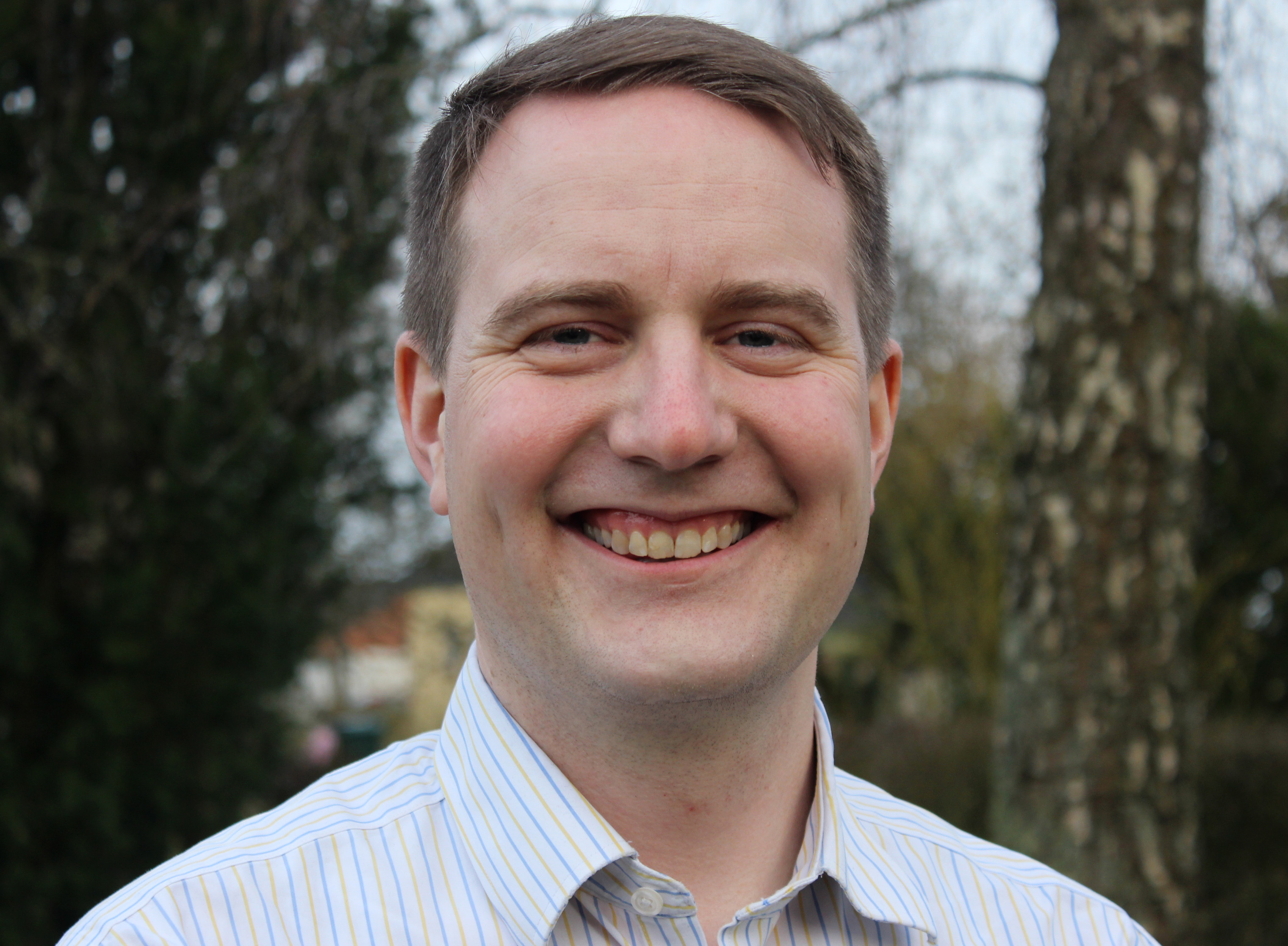
[[ GregersP | (Hans) Gregers Hedegaard Petersen ]]
|
Name: (Hans) Gregers Hedegaard Petersen |
|
|
Greg is an open source and open data advocate. Though he started as a statistical consultant and developer (using FOSS like Debian, R, etc), he ended up in the geo business. Now he consults clients on several areas regarding geodata - mostly within the use of geodata and GIS at public admin clients. He has a strong belief in Open Data, and co-founded the company Septima in January 2013 to utilize the newly released national data. Greg is an avid speaker on the subject of Open Data. |
|
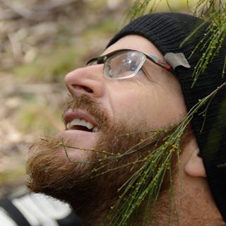
[[ Adamsteer | Adam Steer ]]
|
Name: Adam Steer |
|
|
I currently work as a postodoctoral researcher at the Norwegian Polar Institute, understanding sea ice structure and morphology in the northern Barents Sea. I have a doctorate in surveying technology from the University of Tasmania, based on estimating sea ice thickness at high resolution by combining airborne lidar, digital photogrammetry, field observations (yes! I love to drill holes in ice!), and upward looking sonar from an Autonomous Underwater Vehicle. I'm very strongly motivated to promote the use of open geospatial tools for developing geospatial strategies, research and development - removing barriers to serious data analysis. I also like to ski, climb rocks and ride mountain bikes as fast as possible. And sit under trees and watch the sky. I’m an OSGeo charter member, and helped to found OSGeo Oceania. I was part of the local organising committee for FOSS4G SotM Oceania 2018 and 2019, and director of OSGeo Oceania in 2019 and 2020. |
|
[[ Adiez | Agustín Diez Castillo ]]
|
Name: Agustín Diez Castillo |
|
|
Agustín is a GIS specialits at the University of Valencia, Spain. Agustín teaches Geographic Information Systems in the Master program of the Departament de Prehistòria i Aruqeologia. |
|
[[ Alastair Graham | Alastair Graham ]]
|
Name: Alastair Graham |
|
|
I am a freelance geographer with a specialism in Earth observation. I am a user of Linux and open-source geospatial software and am currently a co-host on the Geomob podcast. As an OSGeo:UK Committee member since 2019, I have co-organised FOSS4G:UK meetings in 2020, 2022 and 2024. I am an advocate of open-source and open-data and want to help healthy communities grow around tooling, data and ideals linked to these concepts. |
|
[[ Albertovavassori | Alberto Vavassori ]]
|
Name: Alberto Vavassori |
|
|
|
[[ Aleda Freeman | Aleda Freeman ]]
|
Name: Aleda Freeman |
|
|
|
[[ Afabiani | Alessio Fabiani ]]
|
Name: Alessio Fabiani |
|
|
|
[[ Afabiani | Alessio Fabiani ]]
|
Name: Alessio Fabiani |
|
|
|
[[ Alex Mandel | Alex Mandel, Phd ]]
|
Name: Alex Mandel, Phd |
|
|
Alex is a geographer with a background in natural resource sciences. He studies geospatial software development and applications working with many government agencies and other small organizations to implement geospatial solutions. He is an active advocate of OSGeo in the Western US at related academic conferences and local un-conferences. |
|
[[ Alexbruy | Alexander Bruy ]]
|
Name: Alexander Bruy |
|
|
Alexander is a microelectronics engineer who got interested in GIS and open source programming during university. He started with OSGeo4W and QGIS, first met the OSGeo community by helping on translation. Then he became QGIS contributor, later — core developer and translation team lead. Is a GFOSS enthusiast and a active member of both the international and Ukrainian OSGeo communities, in particular the QGIS one. |
|
[[ Akotsev | Alexander Kotsev ]]
|
Name: Alexander Kotsev |
|
|
I graduated in GIScience at the University of Sofia and started an academic career at the same university in 2004. In 2011 I was awarded a senior Fulbright scholarship at the Ohio State University where I worked with geocomputation and geovisualisation of spate-time data. Since 2012 I work at the Joint Research Centre of the European Commission. I have accomplished many consultancies in data management in EU, Africa and Asia. My research interests include data analysis, sensor web, open source technology and architectures for knowledge management. I have extensively been using OSGEO products for teaching and research since 15 years. |
|
[[ Alexanno | Alexander Salveson Nossum ]]
|
Name: Alexander Salveson Nossum |
|
|
|
[[ Moovida | Andrea Antonello ]]
|
Name: Andrea Antonello |
|
|
|
[[ Aross | Andrea Ross ]]
|
Name: Andrea Ross |
|
|
Andrea Ross has worked with open technologies and open communities for most of the last 20 years. Her roles during that time involved developing healthcare, telecom, database, and geospatial systems. Currently, as Director of Ecosystem Development for the Eclipse Foundation, nurturing open communities is what she does for a living. Andrea is a founder and inaugural Director of LocationTech. |
|
[[ Andy Anderson | Andy Anderson ]]
|
Name: Andy Anderson |
|
|
I have been using open-source software since the early 1980s, and specifically FOSS4G since 2007. I have been programming since the mid-1970s, primarily for scientific applications but also including open-source software, beginning with Fortran and C and continuing most recently with JavaScript, Python, R, and SQL. I currently teach occasional classes with FOSS4G and write documentation for using FOSS4G in my position as Academic Technology Specialist for Mathematical and Spatial Data Analysis at Amherst College, in my role as Adjunct Assistant Professor in Environmental Conservation at the University of Massachusetts, and as a member of GeoForAll. I also served on the Boston Local Organizing Committee for FOSS4G 2017, in particular as chair of the Program Committee. |
|
[[ Kalxas | Angelos Tzotsos ]]
|
Name: Angelos Tzotsos |
|
|
Angelos is a remote sensing expert with background in surveying engineering and software development. He is involved in numerous activities around free and open source software and has great experience in geospatial applications, geospatial data catalogues and metadata. His research involves remote sensing, machine learning, computer vision and object-based image analysis. He is currently the President of OSGeo and also serves at the OSGeo Board of Directors. He is an active advocate of OSGeo in Greece at related conferences. He is also an individual OGC member. His recent activity involved implementation of data.gov catalog service and implementation of the Greek national open data portal geodata.gov.gr. |
|
[[ Angelos Tzotsos | Angelos Tzotsos ]]
|
Name: Angelos Tzotsos |
|
|
Angelos is a remote sensing expert with background in surveying engineering and software development. He is involved in numerous activities around free and open source software and has great experience in geospatial applications, geospatial data catalogues and metadata. His research involves remote sensing, machine learning, computer vision and object-based image analysis. He is currently the President of OSGeo and also serves at the OSGeo Board of Directors. He is an active advocate of OSGeo in Greece at related conferences. He is also an individual OGC member. His recent activity involved implementation of data.gov catalog service and implementation of the Greek national open data portal geodata.gov.gr. |
|
[[ Anitagraser | Anita Graser ]]
|
Name: Anita Graser |
|
|
|
[[ Anna Petrasova | Anna Petrasova ]]
|
Name: Anna Petrasova |
|
|
Anna is an active GRASS GIS developer since 2011. She promotes free and open source geospatial software for research and education among students and colleagues and supports its users both in person and on mailing lists. |
|
[[ Aghisla | Anne Ghisla ]]
|
Name: Anne Ghisla |
|
|
Anne is a natural scientist who got interested in GIS and open source programming during university. She started with GRASS GIS and QGIS, first met the OSGeo community by helping on documentation. Then she started programming in 2008 thanks to Google Summer of Code, and became mentor and administrator for OSGeo in following years. She doesn't code much anymore, as she is now focused on connecting people and communities of different software projects. She helped Jorge Rocha with CRO duties for OSGeo elections in 2019 and 2020. |
|
[[ Ant Scott | Ant Scott ]]
|
Name: Ant Scott |
|
|
|
[[ Arazshah | Araz ShahKarami ]]
|
Name: Araz ShahKarami |
|
|
Araz is a software engineer and GIS developer passionate about bridging the gap between modern backend architecture and geospatial technologies. Specializing in NestJS,GeoDjango, PostGIS, he focuses on building scalable, open-source geospatial solutions. He is an active advocate for FOSS4G adoption in the region and regularly contributes to educational resources and open-source tools. |
|
[[ ArArgyridis | Argyros Argyridis ]]
|
Name: Argyros Argyridis |
|
|
Argyros finished his master thesis on Rural and Surveying Engineering at NTUA. His research is regarding the development and investigation of computer vision techniques and artificial inteligence methods for remote sensing applications. |
|
[[ Ajolma | Ari Jolma ]]
|
Name: Ari Jolma |
|
|
|
[[ Aanthieni | Ariel Anthieni ]]
|
Name: Ariel Anthieni |
|
|
President Geolibres Asociación Civil |
|
[[ Ingenieroariel | Ariel Nuñez ]]
|
Name: Ariel Nuñez |
|
|
Ariel is an electronic engineer with experience in sensor networks and software development. He has contributed to many open source software projects centered around web development and GIS. His work in disaster risk reduction centers around the use of open source geospatial tools to improve resilience to natural hazards. He is doing a masters degree on Electronic Engineering and his research involves finding abnormal patterns using computer vision and machine learning. |
|
[[ Atd | Arne Schubert ]]
|
Name: Arne Schubert |
|
|
|
[[ Asgerpetersen | Asger Sigurd Skovbo Petersen ]]
|
Name: Asger Sigurd Skovbo Petersen |
|
|
Asger is an open source and open data advocate. Open source geospatial software has played a central role in his professional life since 2000, where he does development, consulting and training on open source geospatial software. Asger co-founded the company Septima in 2013 with the aim to help Danish clients to utilize newly released open governmental geodata using open source software. |
|
[[ Astrid Emde | Astrid Emde ]]
|
Name: Astrid Emde |
|
|
|
[[ Aureliopires | Aurélio Pires ]]
|
Name: Aurélio Pires |
|
|
Aurélio Pires is a Software Engineer and works as a senior GIS consultant in Portugal. |
|
[[ Niroshan Bandara | Bandara ]]
|
Name: Bandara |
|
|
|
[[ Baovola | Baovola ]]
|
Name: Baovola |
|
|
Baovola is a Computer Scientist by training. She works at the National Geographic and Hydrographic Institute of Madagascar as an Information System Officer. In 2017, she studied GIS in Brussels. She is a promoter of Open Source and Open Data. She has established the new OSGeo Madagascar Chapter during the FOSS4G 2018. |
|
[[ BarendKobben | Barend Köbben ]]
|
Name: Barend Köbben |
|
|
|
[[ Barryrowlingson | Barry Rowlingson ]]
|
Name: Barry Rowlingson |
|
|
Barry is a research fellow in CHICAS, a group of statisticians, epidemiologists, and geneticists at Lancaster University. He has used GIS for over 25 years, and open source exclusively since Y2K. He has served on FOSS4G and OSGeoUK conference committees and contributes to spatial software in R and QGIS. |
|
[[ Bastian | Bastian Drees ]]
|
Name: Bastian Drees |
|
|
|
[[ Rorschach | Ben Hur Pintor ]]
|
Name: Ben Hur Pintor |
|
|
Ben is an experienced senior consultant and long-time open geospatial advocate who has a wealth of experience as an educator, trainer, and leader in open data, data literacy, and open geospatial. He is the proprietor of BNHR—an open data and open geospatial consultancy in the Philippines—as well as the co-founder of the Civic Literacy Initiative and SmartCT. He supports and takes an active role in the open data and open geospatial communities in the Philippines both as an individual and through his organizations—co-organizing the Pista ng Mapa conference since 2019 and joining several local, regional, and international open geospatial conferences. Through BNHR, he supports the QGIS project as a QGIS certifying organization and as a QGIS Sustaining Member. He works to help build better, fairer, and safer societies through the advancement and use of free and open geospatial data and technologies. |
|
[[ Benwebb | Benjamin Webb ]]
|
Name: Benjamin Webb |
|
|
Ben Webb is a software developer with the Internet of Water (IoW) project at the Lincoln Institute’s Center for Geospatial Solutions. Ben is working to develop core CGS and IoW software for water data management exchange to support state and federal agencies, as well as nonprofit organizations, addressing key climate resilience, conservation, and water management outcomes. Most recently, Ben has been helping develop the second version of the World Meteorological Organization (WMO) Information System, wis2box, with a focus on reducing the technology barriers for UN member states to share data about weather, climate, and water. A graduate of Colby College with a B.A. in computational biology, he is used to seeking answers to complicated questions by developing software and common data standards. |
|
[[ Biancafederici | Bianca Federici ]]
|
Name: Bianca Federici |
|
|
Bianca Federici is Professor of Geomatics at the University of Genoa (Italy). She teaches in several courses related to surveying techniques and GIS, with special focus on FOSS solutions. Her research mainly concerns the analysis of geospatial data in GIS and remote sensing for environmental analysis, as well as surveying and monitoring of natural and built environments. She is currently a member of the executive committee of GFOSS.it. She was co-chair of the FOSS4G 2022 international conference, she organized or participated in the organization of the Italian GRASS GIS Users Meeting in 2007 and 2013, the Italian OSMit2010 Conference and several Italian FOSS4G conferences since 2017. She has been a member of their scientific committees. |
|
[[ Bdollins | Bill Dollins ]]
|
Name: Bill Dollins |
|
|
|
[[ Bjornharrtell | Björn Harrtell ]]
|
Name: Björn Harrtell |
|
|
|
[[ Bogdan Grama | Bogdan Grama ]]
|
Name: Bogdan Grama |
|
|
|
[[ Pcreso | Brent Wood ]]
|
Name: Brent Wood |
|
|
Brent Wood has worked in fisheries/marine/environmental research for 40 years, and for almost half of this time he used Open Source tools for spatial data management, analysis and visualisation. He has been a NZ Open Source Society Council member for several years, as well as an active Wellington Linux User Group member and Installfest organiser. He has been a regular presenter at FOSS4G since 2009, and was a finalist in the 2010 NZOSA awards for a web mapping portal using Silverstripe, Postgis. mapserver and Geonetwork which provided public access to research data and reports. Brent manages the NIWA QGIS Users Group, which is currently acting as the NZ QGIS User Group, and is an active participant in the Wellington Postgres Users Group (with a focus on Postgis). He is also interested in the use of R as a GIS/spatial analysis & mapping tool. His platform of choice is Linix, and has several years experience is setting up and using Linux based GIS workstations. |
|
[[ Brian Hamlin | Brian M Hamlin ]]
|
Name: Brian M Hamlin |
|
|
|
[[ Ybh0616 | Byeong-Hyeok Yu ]]
|
Name: Byeong-Hyeok Yu |
|
|
|
[[ Chaedri | Caitlin Haedrich ]]
|
Name: Caitlin Haedrich |
|
|
|
[[ Cameron Green | Cameron Green ]]
|
Name: Cameron Green |
|
|
Cameron Green is a MSc Geoinformatics student in the Department of Geography, Geoinformatics and Meteorology at the University of Pretoria and has actively been involved in OSGeo initiatives and open source technologies since 2017. In 2017, he was selected for the Faculty of Natural and Agricultural Science Undergraduate Mentorship Bursary Program under Prof Serena Coetzee and Dr Victoria Rautenbach. The mentorship bursary was awarded based on academic merit and commitment. Through the program, he assisted with various administrative and technical tasks in the departments. At University, he joined the environmental society, called The Greenline Society. He served on the Executive Council for three years as the Marketing and Publications Manager (2015), Vice-Chairperson (2016) and Chairperson and Residence Director (2017). As part of the Executive Council, he had various responsibilities, such as organised and participated events and coordinating marketing. He is currently the president of the University of Pretoria YouthMappers chapter, and has been instrumental in the arrangements of various mapathons that were held at the University of Pretoria and with school learners in Pretoria. He was a DST/NRF intern in the Centre for Geoinformation Science under the supervision of Prof Serena Coetzee in 2018. As part of his duties, he was a teaching assistant for GIS310 (Advance GIS), GMT320 (Geoinformatics project) and GIS 311 (Geoinformatics). His main task was to manage and coordinate the practical sessions for the GIS 310 group of 120 students. For GMT 320, he assisted with administration and logistical arrangements with the community of Alaska informal settlement and presents practicals to the students. Through the internship and his honour’s project, he was involved in the Frontiers of Engineering Seed Funding project with King's College London. The aim of the project was to improve the process for collecting volunteered geographic information by interacting with hackathons. For the project, he assisted with the arrangement of mapathons and the development of a wiki for reporting on the process. Additionally, he coordinated with postgraduate students at King's College London to analyse the quality of the data. During this time, he was a facilitator in a UN OpenGIS online course on QGIS and a mentor in the annual Google Code-in. Currently, he is working as a research assistant in the Department of Geography, Geoinformatics and Meteorology at the University of Pretoria. In the 2019 edition of Google Code-in Cameron was a mentor and administrator for OSGeo during this time where he coordinated directly with the participants, mentors and Google to ensure the smooth running of the competition. During his time at the University, he has assisted with and lead workshops where various open source geospatial topics were covered. He has also participated in a number of community outreach and engagement programs. At his university, Cameron is always assisting students with learning open source software and develops material for open source GIS applications that students use and works not only with Geoinformatics students but also students from other degrees. Later this year (2020), Cameron will again be a facilitator in a UN OpenGIS online course on PostGIS. His current research is an international collaboration between the South African National Research Foundation (NRF) and the Swedish STINT. The focus of this study was to build a collaborative data library for the sharing of fine-grained spatial and non-spatial data. This was achieved by building and configuring a customized GeoNode instance. |
|
[[ Camerons | Cameron Shorter ]]
|
Name: Cameron Shorter |
|
|
Cameron has a breadth of practical experience with the numerous facets of Geospatial Open Source and OGC Standards. He has chaired a FOSS4G conference; served on the OSGeo Board, co-founded and co-coordinates the OSGeoLive project; co-authored OSGeo Software Incubation criteria; and consults to governments and industry on Open Source, Open Standards and Spatial Data Systems. |
|
[[ Candan Eylul Kilsedar | Candan Eylül Kilsedar ]]
|
Name: Candan Eylül Kilsedar |
|
|
Candan Eylül Kilsedar obtained her BSc degree in Computer Science and Engineering at Sabancı University in 2012 and her MSc degree in Informatics Engineering at Politecnico di Milano in 2014. She worked as a research fellow in the GEOlab of the Department of Civil and Environmental Engineering (DICA) at Politecnico di Milano from January 2015 to June 2020, during which time she contributed to various projects, mainly on the urban environment. Some of her projects are available at https://github.com/kilsedar. She obtained her PhD degree with honours on using free and open-source software for multidimensional visualisation and processing of open urban geospatial data at Politecnico di Milano in 2020. She served as the president of PoliMappers from November 2016 to December 2018 and later served as one of its faculty advisors until June 2020. From June 2020 to March 2025, she worked in Directorate D (Sustainable Resources), Unit D.1 (Forests and Bioeconomy) and Unit D.6 (Nature Conservation and Observations), Knowledge Centre on Earth Observation (KCEO) Team of the Joint Research Centre (JRC). Currently, she is working as a researcher in the SDG11Lab of DIST at Politecnico di Torino. |
|
[[ Clds1 | Carmen Díez ]]
|
Name: Carmen Díez |
|
|
I belong to several groups that support the development of FOSS4G (Geoinquietos Madrid, AESIG as vocal y QGIS España Association as treasurer) and I attempt to contribute to the use of free GIS and creation of Open Databases, as well as participation in humanitarian mapping events or local development. In the last years, I have attended several national events (SIGLibre and Geocamp) and also international ones (FOSS4G and FOSS4G EU) all ones related to Open Sources and Free GIS. I have contributed to the preparation of the FOSS4G EU Sevilla candidacy in 2017 and I've organized Geocamp 2018 in Madrid. In 2019 I was part of the organization committee of International QGIS User Conference & Hackmeeting held in A Coruña (Spain). |
|
