Semantic search

Jump to navigation Jump to search

[[ Lars | Lars Lingner ]]

Name: Lars Lingner
Job Title: GIS-Consultant
Company: mapwebbing
Country: Germany
State: Berlin
City: Berlin
Local Chapter: FOSSGIS e.V.
Social Media: https://twitter.com/#!/mapwebbing
Coordinate: 52° 31' 32.16" N, 13° 24' 6.48" E
Languages: German, English

Experience: OSGeo user.png OSGeo Committer.png

Lars Lingner is an active member in the local chapter FOSSGIS e.V. since 2007 He is using open source software as well as open data and is promoting several projects on local, national and international events. Such as FOSSGIS Konferenz, AGIT, State of the Map, FOSS4G. He is organizing local regularly events in Berlin, Germany called Stammtisch and Hackweekend for the OpenStreetMap and FOSSGIS community. His focus is the server side software to build an open source map stack, like MapServer, PostgreSQL/Postgis, GDAL/OGR.

Loading map...

[[ Surveyor | Landon Blake ]]

Name: Landon Blake
Job Title: Owner
Company: Redefined Horizons
Country: USA
State: California
City: Stockton
Local Chapter: California Chapter
Social Media: https://twitter.com/mapit4u, http://www.linkedin.com/in/landonblake
Website: http://www.redefinedhorizons.com/
Coordinate: 37° 57' 27.73" N, 121° 17' 26.81" W


Experience: OSGeo user.png

Landon Blake

Landon Blake is a land surveyor and GIS programmer with a focus on OpenJUMP and CAD customization. He serves as the Vice President of the California Land Surveyors Association Central Valley Chapter, is a member of the California Land Surveyors Association GIS Committee, and also serves as a member of the California Geodetic Control Working Group.

Loading map...

[[ Kurt Menke | Kurt Menke ]]

Name: Kurt Menke
Job Title: GIS Specialist, Owner
Company: Bird's Eye View GIS
Country: USA
State: New Mexico
City: Albuquerque
Local Chapter: New Mexico
Instant Messaging: Skype: birdseyeviewgis
Website: http://www.birdseyeviewgis.com
Email: Kurt@birdseyeviewgis.com
Coordinate: 35° 5' 2.77" N, 106° 39' 3.55" W


Experience: OSGeo charter.png OSGeo user.png

Kurt Menke

Kurt Menke is a Certified GIS Professional (GISP) who has been working in the field for 19 years. He works largely on spatial analysis in the conservation field. He received a Masters degree (MA) in Geography from the University of New Mexico in 2000. He is a long time advocate of FOSS4G. Recently he has authored Discover QGIS through Locate Press and co-authored Mastering QGIS through Packt Publishing. In 2015 he was part of the GeoAcademy team awarded the GeoForAll Educator of the Year award.

Loading map...

[[ Kevin Smith | Kevin Smith ]]

Name: Kevin Smith
Job Title: Software Engineer
Company: Boundless
Country: Canada
State: British Columbia
City: Victoria
Local Chapter: British Columbia Chapter
Coordinate: 48° 27' 0.00" N, 123° 24' 0.00" W
Languages: English

Experience: OSGeo coder.png OSGeo psc.png OSGeo charter.png OSGeo user.png OSGeo Committer.png

Loading map...

[[ Wonderchook | Kate Chapman ]]

Name: Kate Chapman
Job Title: Executive Director
Company: Humanitarian OpenStreetMap Team
Country: United States of America
State: Oregon
City: Portland
Local Chapter: PDX-OSGEO
Instant Messaging: Skype: kateachapman
Phone: +1-703-673-8834
Coordinate: 45° 31' 12.00" N, 122° 40' 26.40" W
Languages: English, Indonesian

Experience: OSGeo user.png

Kate Chapman

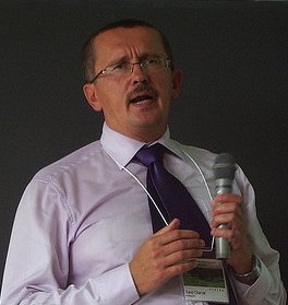
Kate is Executive Director of the Humanitarian OpenStreetMap Team. Her most recent projects have included working in Indonesia leading a team to train disaster managers in using open-source software to better plan for disasters and relaunching of the OpenAerialMap project. Kate has spoken about the benefits of open-source and open data for disaster response and risk reduction all over the world, including giving keynotes at Linux Conf Australia and FOSS4G in 2013.

Loading map...

[[ KarelCharvat | Karel Charvat ]]

Name: Karel Charvat
Job Title: Chair of Czech Center for Science and Sociaty
Company: Czech Center for Science and Sociaty
Country: Czech Republic
City: Prague
Local Chapter: Chech
Social Media: http://www.linkedin.com/profile/view?id=73516853
Coordinate: 50° 4' 30.22" N, 14° 26' 9.53" E
Languages: Czech, Russian, English

Experience: OSGeo user.png

Karel Charvat
Loading map...

[[ Jerome Jacovella-St-Louis | Jérôme Jacovella-St-Louis ]]

Name: Jérôme Jacovella-St-Louis
Job Title: Chief Technology Officer
Company: Ecere Corporation
Address: 347 rue Docteur-J.-Cousineau
Country: Canada
State: Québec
City: Gatineau
Local Chapter: Ottawa Chapter
Social Media: https://www.linkedin.com/in/jeromestlouis, https://twitter.com/EcereCorp
Website: http://ecere.ca/
Email: jerome@ecere.com
Coordinate: 45° 28' 35.40" N, 75° 42' 4.68" W
Languages: French, English

Experience: OSGeo charter.png OSGeo user.png

Jérôme Jacovella-St-Louis
Loading map...

[[ Just | Just van den Broecke ]]

Name: Just van den Broecke
Job Title: Open Source Geospatial Professional
Company: Just Objects B.V.
Address: Amstelveen, The Netherlands
Country: The Netherlands
City: Amstelveen
Local Chapter: Dutch
Instant Messaging: Skype: justb4
Social Media: https://twitter.com/justb4
Website: https://justobjects.nl/
Email: just@justobjects.nl
Coordinate: 52° 18' 43.86" N, 4° 51' 10.26" E
Languages: Dutch, English, German, French

Experience: OSGeo coder.png OSGeo charter.png OSGeo user.png OSGeo Committer.png

Just van den Broecke
Loading map...

[[ Just van den Broecke | Just van den Broecke ]]

Name: Just van den Broecke
Job Title: Open Source Geospatial Professional
Company: Just Objects B.V.
Address: Amstelveen, The Netherlands
Country: The Netherlands
City: Amstelveen
Local Chapter: Dutch
Instant Messaging: Skype: justb4
Social Media: https://twitter.com/justb4
Website: https://justobjects.nl/
Email: just@justobjects.nl
Coordinate: 52° 18' 43.86" N, 4° 51' 10.26" E
Languages: Dutch, English, German, French

Experience: OSGeo coder.png OSGeo charter.png OSGeo user.png OSGeo Committer.png

Just van den Broecke
Loading map...

[[ NOVACITE | Junyoung Choi ]]

Name: Junyoung Choi
Job Title: Research Fellow
Company: Seoul Institute of Technology(SIT)
Address: Maebongsan-ro 37
Country: Korea
State: Seoul
City: Mapo-gu
Local Chapter: Korea
Instant Messaging: Skype:Choi-jun-young
Social Media: https://www.facebook.com/junyoung.choi.50159
Coordinate: 37° 34' 33.90" N, 126° 53' 26.00" E
Languages: Korean, English, Basic French(DELF A2), Basic Japanese(Reading)

Experience: OSGeo charter.png OSGeo user.png

Junyoung Choi
Loading map...

[[ Julienmichel | Julien Michel ]]

Name: Julien Michel
Job Title: R&D engineer
Company: CNES
Country: France
City: Toulouse
Local Chapter: Francophone OSGeo Chapter
Coordinate: 43° 33' 42.43" N, 1° 28' 53.82" E
Languages: French, English

Experience: OSGeo coder.png OSGeo psc.png OSGeo charter.png OSGeo user.png

Julien Michel

Julien Michel is a many year (9+) contributor to the Orfeo ToolBox (www.orfeo-toolbox.org), an open-source C++ library for remote sensing images processing, which is an incubating OSGeo project. Julien Michel is also a member of the OTB Project Steering Committee.

He occasionnaly contributes to the OSSIM and ITK projects.

Loading map...

[[ Jsanz | Jorge Sanz ]]

Name: Jorge Sanz
Job Title: Data Engineer
Company: Elastic
Country: Spain
State: Valencia
City: València
Local Chapter: Capítulo Local de la comunidad hispano-hablante
Social Media: http://@xurxosanz
Website: http://jorgesanz.net
Email: jorge@jorgesanz.net
Coordinate: 39° 28' 12.00" N, 0° 22' 33.60" W
Languages: Catalan, Spanish, English

Experience: OSGeo charter.png OSGeo exboard.png OSGeo user.png

Jorge Sanz
Loading map...

[[ Jorge Sanz | Jorge Sanz ]]

Name: Jorge Sanz
Job Title: Data Engineer
Company: Elastic
Country: Spain
State: Valencia
City: València
Local Chapter: Capítulo Local de la comunidad hispano-hablante
Social Media: http://@xurxosanz
Website: http://jorgesanz.net
Email: jorge@jorgesanz.net
Coordinate: 39° 28' 12.00" N, 0° 22' 33.60" W
Languages: Catalan, Spanish, English

Experience: OSGeo charter.png OSGeo exboard.png OSGeo user.png

Jorge Sanz
Loading map...

[[ Jjesus | Jorge Samuel Mendes de Jesus ]]

Name: Jorge Samuel Mendes de Jesus
Job Title: Spatial Data Infrastructure Manager
Country: The Netherlands
State: Gelderland
City: Wageningen
Instant Messaging: @JMendesDeJesus
Email: jorge.mendesdejesus@isric.org
Coordinate: 51° 58' 22.51" N, 5° 40' 15.53" E
Languages: Portuguese, Spanish, English, Dutch, Italian

Experience: OSGeo coder.png OSGeo charter.png OSGeo user.png OSGeo Committer.png

Loading map...

[[ Jonaseberle | Jonas Eberle ]]

Name: Jonas Eberle
Job Title: Research assistant, Developer
Company: German Aerospace Center - Earth Observation Center; Eberle Software & Web Development
Country: Germany
State: Bavaria
City: Munich
Local Chapter: FOSSGIS e.V.
Email: jonas.eberle@gmx.de
Coordinate: 50° 55' 35.04" N, 11° 35' 16.44" E
Languages: German, English

Experience: OSGeo psc.png OSGeo charter.png OSGeo user.png

Jonas Eberle

EO Platform Architect and Research assistant at German Aerospace Center, German Remote Sensing Data Center, Department for Information Technology.Interested in Earth Observation, OGC-compliant EO services, and user-friendly services and applications.

Loading map...

[[ Jonahsullivan | Jonah Sullivan ]]

Name: Jonah Sullivan
Job Title: Geospatial Advisor
Company: Australian Public Service
Country: Australia
Local Chapter: Oceania
Languages: English

Experience: OSGeo board.png OSGeo coder.png OSGeo charter.png OSGeo user.png

Federal sector geospatial analyst in Australia. FOSS4G SotM Oceania Committee member 2018, OSGeo Oceania Board member 2019, 2020, 2021, 2022, 2023, 202, FOSS4G SotM Oceania 2020 Co-Chair, FOSS4G SotM Oceania 2021 Conference Committee member.

Loading map...

[[ John Bryant | John Bryant ]]

Name: John Bryant
Company: Mammoth Geospatial
Country: Australia
State: WA
City: Fremantle
Local Chapter: Oceania
Website: https://mammothgeospatial.com
Email: johnwbryant@gmail.com
Coordinate: 32° 3' 45.50" S, 115° 45' 33.14" E
Languages: English, Spanish

Experience: OSGeo charter.png OSGeo user.png

John Bryant

Originally from Canada, I'm currently based in Fremantle, Australia where I operate an open geospatial consulting company called Mammoth Geospatial. Organiser of FOSS4G Perth and geogeeks.org, founding chair of FOSS4G SotM Oceania & OSGeo Oceania. Frequent attendee and sometimes volunteer at global FOSS4G events. Always keen to meet other spatial enthusiasts. Building a strong open geospatial community in Oceania!

Loading map...

[[ Johanvdw | Johan Van de Wauw ]]

Name: Johan Van de Wauw
Job Title: Data Scientist
Company: Gisky
Country: Belgium
City: Ghent
Local Chapter: Belgium
Social Media: http://be.linkedin.com/in/johanvdw/
Website: http://blog.gisky.be/
Phone: +32486025381
Coordinate: 51° 2' 59.14" N, 3° 43' 55.71" E
Languages: Dutch, English, French, Spanish, German

Experience: OSGeo coder.png OSGeo charter.png OSGeo user.png

Johan Van de Wauw
Loading map...

[[ Jive | Jody Garnett ]]

Name: Jody Garnett
Country: Canada
City: Victoria
Local Chapter: British Columbia Chapter
Website: https://how2map.com/
Email: jody.garnett@how2map.com
Coordinate: 48° 25' 42.00" N, 123° 21' 53.74" W


Experience: OSGeo coder.png OSGeo psc.png OSGeo charter.png OSGeo exboard.png OSGeo user.png OSGeo Committer.png

Jody Garnett

A mapish developer working at GeoCat. Active with OSGeo and LocationTech communities working on a wide range of free and open source geospatial goodness!

Loading map...

[[ Doublebyte | Joana Simoes ]]

Name: Joana Simoes
Job Title: Software Engineer, DevRel
Company: ByteRoad/OGC
Country: Portugal
City: Lisbon
Local Chapter: Portugal
Social Media: https://noc.social/@doublebyte
Website: https://doublebyte.net/
Coordinate: 38° 44' 13.01" N, 9° 8' 33.67" W
Languages: Portuguese, English, Spanish, Italian

Experience: OSGeo coder.png OSGeo charter.png OSGeo user.png OSGeo Committer.png

Joana Simoes

Joana is a software engineer with more than fifteen years of experience, with a sound expertise in the field of geospatial tech and analytics. After acquiring a PhD in Geographic Information Systems, at the University College of London (2007), her drive to solve real-world problems has led her to SMEs, an international organization, a research foundation and a start-up. Joana has been very much involved in the Free and Open Source Software community, in particular in what concerns geospatial technologies, standards and data. This has led her to become a charter member of the Open Geospatial Foundation (OSGeo) in 2017, and the vice-president of the Portuguese chapter of OSGeo. During 2017 she also took a leading role at the board of the Global Spatial Data Infrastructure Association (GSDI), as a board director of the Industry Advisory Council. Joana is the founder of ByteRoad, an R&D company in the field of spatial data infrastructures and leads Developer Relations at OGC. She is also a reviewer for the European Commission, and has been deeply involved in education, teaching the next generation of full-stack developers and data analysts.

Loading map...

[[ Doublebyte | Joana Simoes ]]

Name: Joana Simoes
Job Title: DevRel, Founder
Company: OGC, ByteRoad
Country: Portugal
City: Lisboa
Local Chapter: Portugal
Social Media: https://twitter.com/doublebyte
Website: https://doublebyte.net/
Coordinate: 38° 44' 13.01" N, 9° 8' 33.67" W
Languages: Portuguese, English, Spanish, Italian

Experience: OSGeo coder.png OSGeo charter.png OSGeo user.png OSGeo Committer.png

Joana Simoes

Joana is a software developer, data scientist and strategist in the field of geospatial information and technologies. She has worked in different environments, ranging from academia to industry, and has always advocated for FOSS in general, and FOSS4G in particular. When working at the United Nations, she led the migration of a code base, from proprietary technologies to FOSS, and refactored the FAO GIS course, to take advantage of FOSS4G. Joana uses a myriad of FOSS4G technologies on her daily work and during her free time, and has occasionally contributed to projects such as QGIS, or GeoNetwork. She joined the local chapters of the countries where she lived (e.g.: UK, Spain) and currently she is serving as a board member at the Portuguese Local chapter.

Loading map...

[[ JoCook | Jo Cook ]]

Name: Jo Cook
Job Title: Geospatial Consultant and Metadata Lead
Country: UK
Local Chapter: OSGeo UK https://uk.osgeo.org
Coordinate: 51° 19' 57.49" N, 0° 16' 19.10" W


Experience: OSGeo charter.png OSGeo exboard.png OSGeo user.png OSGeo Committer.png

Jo Cook
Loading map...

[[ Ticheler | Jeroen Ticheler ]]

Name: Jeroen Ticheler
Job Title: Director
Company: GeoCat
Address: Veenderweg 13
Country: The Netherlands
State: Gelderland
City: 6721WD Bennekom
Local Chapter: Nederlands
Email: jeroen.ticheler@geocat.net
Coordinate: 51° 59' 57.48" N, 5° 40' 25.32" E
Languages: Dutch, English

Experience: OSGeo psc.png OSGeo charter.png OSGeo exboard.png OSGeo user.png OSGeo Committer.png

Jeroen has been promoting the use of international standards and Free and Open Source Software for geographic data and information for over twenty years now. Jeroen is Project Officer for the GeoNetwork opensource project. He served on the OSGeo Board in 2007 & 2008 and is a Charter member since the early days of OSGeo.

Loading map...

[[ Jeroen Ticheler | Jeroen Ticheler ]]

Name: Jeroen Ticheler
Job Title: Director
Company: GeoCat
Address: Veenderweg 13
Country: The Netherlands
State: Gelderland
City: 6721WD Bennekom
Local Chapter: Nederlands
Email: jeroen.ticheler@geocat.net
Coordinate: 51° 59' 57.48" N, 5° 40' 25.32" E
Languages: Dutch, English

Experience: OSGeo psc.png OSGeo charter.png OSGeo exboard.png OSGeo user.png OSGeo Committer.png

Jeroen has been promoting the use of international standards and Free and Open Source Software for geographic data and information for over twenty years now. Jeroen is Project Officer for the GeoNetwork opensource project. He served on the OSGeo Board in 2007 & 2008 and is a Charter member since the early days of OSGeo.

Loading map...

[[ Jeff Hamm | Jeff Hamm ]]

Name: Jeff Hamm
Job Title: President
Company: GeoPlan Consulting
Country: Canada
State: Yukon
City: Tagish
Local Chapter: Yukon Chapter
Website: http://geoprism.ca
Email: jeff@geoprism.ca
Coordinate: 60° 18' 46.44" N, 134° 16' 27.48" W
Languages: English

Experience: OSGeo user.png

I graduated as a geographer several datum changes ago, and remember clearly discovering the magic of gdal in my search to become digital and shpless. Now, 40 years later, I don’t know anyone that can’t find their way through the world using mobile mapping tools.

At a MapServer user meeting in Ottawa in 2004, I found and embraced a vibrant, innovative and sociable community of such diversity, everyone had a place, and a role in growing a movement.

As a participant and presenter at several FOSS4G conferences, I know how passionate OSGeo is about our community. In whatever small way I may have contributed, I have gained far more in return.

I am particularly interested in engaging community in land use decision making, and in mapping the negotiated and overlapping jurisdiction of colonial and indigenous world views.

I am fortunate to call the Yukon home, but I still stay connected with my OSGeo family everywhere. I value and respect diversity; and honour those who give of themselves to further the dreams of others.

Loading map...

[[ JRM | Jean-Roc Morreale ]]

Name: Jean-Roc Morreale
Job Title: Informations System Administrator
Company: Departmental Center of Archeology, Conseil Général du Pas de Calais
Country: France
City: Arras
Local Chapter: Francophone OSGeo Chapter
Coordinate: 50° 17' 33.09" N, 2° 46' 21.90" E
Languages: French, English

Experience: OSGeo user.png

Jean-Roc Morreale

Jean-Roc is an archaeologist specialized in the long-term conservation and exploitation of field data, this task is made much easier when using open data formats and free software. For this reason, he started to localize Quantum GIS and participate as board member of the french OSGeo chapter to the promotion and the diffusion of free and open GIS tools into the labs but also into the public administration.

Loading map...

[[ Jack Reed | Jack Reed ]]

Name: Jack Reed
Job Title: Geospatial Web Engineer
Company: Stanford University
Country: United States
State: Georgia
City: Atlanta
Local Chapter: Southeast US
Social Media: http://@mejackreed
Website: https://www.jack-reed.com
Email: phillipjreed@gmail.com
Coordinate: 33° 44' 57.30" N, 84° 23' 14.33" W
Languages: English

Experience:

I work at the Stanford Libraries increasing access to geospatial data. I'm a co-founder of the GeoBlacklight and OpenGeoMetadata projects and work on a variety of other open source software projects.

Loading map...

[[ Jsenag | J Sena ]]

Name: J Sena
Job Title: Software Engineer
Company: ICGC
Country: Spain
City: Barcelona
Social Media: https://twitter.com/jsenag
Website: https://github.com/jessisena
Email: jessisena@gmail.com
Coordinate: 41° 22' 56.68" N, 2° 10' 38.06" E
Languages: spanish, catalan, english

Experience: OSGeo user.png

Software Engineer and postgraduate in UX.

She has been working actively in the geo field for 6 years, with a wide experience in the design and development of geo-themed mobile and web applications, betting on the use of open technologies and open data.

https://twitter.com/jsenag https://github.com/jessisena

Loading map...

[[ Ianturton | Ian Turton ]]

Name: Ian Turton
Job Title: Software Engineer and Open Source GIS Trainer
Country: United Kingdom
State: W. Sussex
City: Worthing
Email: ian@ianturton.com
Coordinate: 51° 0' 0.00" N, 0° 25' 0.00" W


Experience: OSGeo coder.png OSGeo charter.png OSGeo Committer.png

Ian Turton
Loading map...

[[ Ian | Ian Edwards ]]

Name: Ian Edwards
Job Title: Technical Director
Company: MyAcorn Limited
Country: United Kingdom
City: Exeter
Local Chapter: OSGeo UK
Coordinate: 50° 43' 32.33" N, 3° 31' 35.98" W


Experience: OSGeo charter.png OSGeo user.png

Ian Edwards

Ian's GIS career has spanned academia, business and government, including research positions at the universities of Cambridge and Exeter, director of a GIS company and also working for the UK government as a lead software engineer at the Met Office. Ian is an honorary fellow of the University of Exeter, and continues to be a regular speaker at the University of Cambridge. He is also a Fellow of the Royal Geographical Society.

Loading map...

[[ Mhugo | Hugo Mercier ]]

Name: Hugo Mercier
Job Title: Senior software engineer
Company: Oslandia
Country: France
City: Nantes
Local Chapter: Francophone OSGeo Chapter
Website: http://oslandia.com
Email: hugo.mercier@oslandia.com
Coordinate: 47° 12' 0.11" N, 1° 32' 47.76" W
Languages: french, english

Experience: OSGeo user.png

Loading map...

[[ Hcastellaro | Horacio Castellaro ]]

Name: Horacio Castellaro
Job Title: Subgerente de Desarrollo GIS
Company: Gobierno de la Ciudad de Buenos Aires
Address: Rivadavia 5865
Country: Argentina
State: Ciudad Autónoma de Buenos Aires
City: Buenos Aires
Local Chapter: Argentinia
Social Media: http://@hcastellaro
Email: castellaro@gmail.com
Coordinate: 34° 35' 58.92" S, 58° 22' 54.84" W
Languages: spanish

Experience: OSGeo user.png

Loading map...

[[ Eyedol | Henry Addo ]]

Name: Henry Addo
Job Title: Software Developer
Company: Ushahidi
Country: Ghana
City: Accra
Local Chapter: Africa Local Chapter
Social Media: https://twitter.com/eyedol
Website: http://careers.stackoverflow.com/eyedol
Email: henry@ushahidi.com
Phone: +233-26-2109717
Coordinate: 5° 36' 13.38" N, 0° 11' 13.07" W
Languages: English

Experience: OSGeo coder.png

Henry Addo

Henry Addo is an open source software developer. He is an active contributor to the open source community and develops core features for the Ushahidi platform, a free and open source software for crowdsourcing information through multiple channels including SMS, the web, email and twitter and visualizing the information on a map.

Loading map...

[[ Helmut Kudrnovsky | Helmut Kudrnovsky ]]

Name: Helmut Kudrnovsky
Job Title: researcher
Country: Austria
Website: http://www.alectoria.at; alectoria.blogspot.com
Coordinate: 47° 15' 52.46" N, 11° 15' 50.59" E
Languages: German, English

Experience: OSGeo coder.png OSGeo charter.png OSGeo user.png OSGeo Committer.png

Helmut Kudrnovsky

Focuses on vegetation science, alpine rivers, GIS, nature conservation and sustainable development in the Alps by using and promoting open data and open GIS software.

Contributes to GRASS GIS on ML, by improvements for WinGRASS and coding some addons

Loading map...

[[ Helena | Helena Mitasova ]]

Name: Helena Mitasova
Job Title: Professor at the Department of Marine, Earth and Atmospheric Sciences and the Center for Geospatial Analytics
Company: North Carolina State University
Country: USA
State: NC
City: Raleigh
Local Chapter: North America
Website: https://geospatial.ncsu.edu/osgeorel/
Email: hmitaso@ncsu.edu
Coordinate: 35° 47' 7.08" N, 78° 40' 30.00" W
Languages: English, Slovak

Experience: OSGeo psc.png OSGeo charter.png OSGeo exboard.png OSGeo user.png OSGeo SolKatz.png

Helena Mitasova

Helena has participated in the GRASS GIS development since 1991 and co-authored the first book on GRASS. She is an associate director for earth and environmental sciences applications at the Center for Geospatial Analytics at North Carolina State University (NCSU) in Raleigh, NC and she leads NCSU GeoForAll lab, one of the founding labs of the OSGeo research and education initiative. She published as the lead author or co-author over 100 publications on tools and applications of GRASS GIS. She co-developed methods for spatial interpolation, terrain analysis, hydrologic and erosion modeling and visualization. She received her PhD from the Slovak Technical University, Bratislava, Slovakia.

Loading map...

[[ Heegu Park | Heegu Park ]]

Name: Heegu Park
Job Title: Marketing Director and Business Development
Company: Gaia3D Inc.
Country: South Korea
City: Suwon
Local Chapter: Korea
Social Media: https://twitter.com/slhead, https://www.facebook.com/heegu.park
Website: http://www.gaia3d.com/
Email: hgpark@gaia3d.com
Coordinate: 37° 16' 37.20" N, 127° 0' 39.60" E
Languages: Korean, English, some Spanish

Experience: OSGeo user.png

Heegu Park

Heegu Park is a member of OSGeo Korean Chapter and loves the spirit of Opensource. He is one of the LOC members of FOSS4G 2015 event.

Loading map...

[[ Harryom | Harish Kumar Solanki ]]

Name: Harish Kumar Solanki
Job Title: Senior Assistant Professor
Company: National Institute of Rural Development & Panchayati Raj
Address: Rajendra Nagar
Country: India
State: Telangana
City: Hyderabad
Local Chapter: India
Social Media: http://linkedin.com/in/hksolanki
Website: http://nird.org.in
Email: hksolanki.nird@gov.in
Coordinate: 17° 18' 44.78" N, 78° 24' 9.94" E
Languages: Hindi, English

Experience: OSGeo charter.png OSGeo user.png

File:File:IMAG4148.jpg
Harish Kumar Solanki
Loading map...

[[ Gisxperts | Hannes Reuter ]]

Name: Hannes Reuter
Country: Luxembourg
City: Luxembourg
Coordinate: 49° 37' 59.52" N, 6° 10' 8.00" E


Experience: OSGeo user.png

Loading map...

[[ Gpasero | Guillaume Pasero ]]

Name: Guillaume Pasero
Job Title: Technical Manager
Company: CS SI
Address: 5 rue Brindejonc des Moulinais
Country: FRANCE
City: TOULOUSE
Local Chapter: Francophone OSGeo Chapter
Coordinate: 43° 34' 39.63" N, 1° 29' 40.42" E
Languages: English, French

Experience: OSGeo coder.png OSGeo user.png OSGeo Committer.png

Loading map...

[[ Gsteinmon | Guido Stein ]]

Name: Guido Stein
Job Title: Geospatial Data Alchemist
Company: Applied Geographics, Inc.
Address: 24 School St, Suite 500
Country: USA
State: MA
City: Boston
Social Media: http://@guidos
Website: http://guidostein.com
Email: guido@guidostein.com
Coordinate: 42° 21' 27.58" N, 71° 3' 33.08" W
Languages: english, spanish

Experience: OSGeo charter.png OSGeo user.png

Guido Stein
Loading map...

[[ Lutra | Giovanni Manghi ]]

Name: Giovanni Manghi
Job Title: GIS/WebGIS Teacher, tester and developer
Company: NATURALGIS
Country: Portugal
City: Évora
Local Chapter: Portugal
Instant Messaging: Skype: toirao
Social Media: https://www.facebook.com/naturalgis, https://twitter.com/naturalgis, https://www.linkedin.com/company/naturalgis
Website: http://www.naturalgis.pt/
Phone: +351967058216
Coordinate: 38° 34' 14.79" N, 7° 54' 33.41" W
Languages: English, Italian, Portuguese, Spanish

Experience: OSGeo coder.png OSGeo charter.png OSGeo user.png

Giovanni Manghi

Giovanni is conservation biologist with 10+ years of GIS experience, Italian but lives and work in Portugal. Is a GFOSS enthusiast and a active member of both the international and Portuguese OSGeo communities, in particular the QGIS (Quantum GIS) one.

Loading map...

[[ Gert-Jan van der Weijden | Gert-Jan van der Weijden ]]

Name: Gert-Jan van der Weijden
Country: The Netherlands
City: Amsterdam
Local Chapter: OSGeo.NL
Social Media: https://twitter.com/gisnederland
Website: http://www.gisnederland.nl/
Email: gert-jan@gisnederland.nl
Coordinate: 52° 22' 27.97" N, 4° 53' 52.78" E
Languages: Dutch, English, German

Experience: OSGeo charter.png OSGeo user.png

Gert-Jan van der Weijden
Loading map...

[[ Gzeiss | Geoff Zeiss ]]

Name: Geoff Zeiss
Job Title: Director Utility Industry Program,
Company: Autodesk
Country: Canada
State: Ontario
City: Ottawa
Local Chapter: Ottawa Chapter
Email: geoff.zeiss@autodesk.com
Coordinate: 45° 25' 15.60" N, 75° 41' 24.00" W


Experience: OSGeo charter.png OSGeo exboard.png

Geoff Zeiss

Geoff has more than 20 years experience in the geospatial software industry and 15 years experience developing enterprise geospatial solutions for the utilities, communications, and public works industries. His particular interests include streamlining the infrastructure management workflow, open source geospatial, and converged BIM/CAD/GIS/3D solutions.

Loading map...

[[ Gabriele Prestifilippo | Gabriele Prestifilippo ]]

Name: Gabriele Prestifilippo
Job Title: Research Fellow
Company: Politecnico di Milano
Address: P.zza Leonarda da Vinci, 32
Country: Italiano
State: Italy
City: Milano
Social Media: https://www.linkedin.com/in/gabrieleprestifilippo/
Coordinate: 45° 28' 40.26" N, 9° 13' 33.29" E
Languages: English, Italian

Experience: OSGeo coder.png OSGeo charter.png OSGeo user.png

Gabriele Prestifilippo

Gabriele Prestifilippo obtained a B.Sc. degree in Computer Engineering at Università degli Studi di Catania in 2014. In 2016 he obtained a M.Sc. in Computer Science and Engineering at Politecnico di Milano with a thesis on Geographic Information Systems (GIS), creating a web application to visualize and analyze multidimensional datasets in more than three dimensions. He is a contributor to FOSS community. He is interested in full-stack web development and he is researching about web technologies involved in the GIS field.

Loading map...

[[ Fjbehr | Franz-Josef Behr ]]

Name: Franz-Josef Behr
Job Title: Professor
Company: Stuttgart University of Applied Sciences
Country: Germany
City: Stuttgart
Local Chapter: FOSSGIS e.V.
Instant Messaging: Skype: fjbehr
Website: http://www.gis-management.de/
Coordinate: 48° 46' 48.64" N, 9° 10' 21.64" E
Languages: German, English

Experience: OSGeo user.png

Franz-Josef Behr
Loading map...

[[ Warmerda | Frank Warmerdam ]]

Name: Frank Warmerdam
Company: Planet
Country: Canada
State: Ontario
City: Eganville
Local Chapter: California Chapter
Email: warmerdam@pobox.com
Coordinate: 45° 27' 47.06" N, 77° 16' 18.16" W


Experience: OSGeo psc.png OSGeo charter.png OSGeo exboard.png OSGeo user.png OSGeo SolKatz.png

Frank Warmerdam
Loading map...

[[ Frafra | Francesco Frassinelli <libravatar email="fraph24@gmail.com"/> ]]

Name: Francesco Frassinelli <libravatar email="fraph24@gmail.com"/>
Job Title: Senior Engineer IT
Company: Norwegian Institute for Nature Research
Address: Høgskoleringen 9
Country: Norway
City: Trondheim
Website: https://frafra.eu/
Email: francesco.frassinelli@nina.no
Phone: +47-41290887
Coordinate: 63° 24' 50.54" N, 10° 24' 23.26" E
Languages: Italian, English, Norwegian

Experience: OSGeo coder.png OSGeo user.png OSGeo Committer.png

Francesco Frassinelli has been active in free software communities since 2004, and in OpenStreetMap since 2008; he has been one of the founders and officers of the student association PoliMappers in Politecnico di Milano, where he obtained an MSc degree in Geoinformatics Engineering with a thesis on OpenStreetMap temporal accuracy and up-to-dateness. He works as coordinator for environmental data at the Norwegian Institute for Nature Research. He has 10+ year of experience as a software developer, and more recently he became a member of both GeoNode and CKAN development teams, as well as a contributor to the Geopaparazzi project. He is active on GitHub, where it contributes to the OSM Italy and HOT tasking manager repositories as well, among others. He is mostly focused on Python projects, containerization, and continuous integration.

Loading map...

[[ Amyonthemap | Feng Amy Gao ]]

Name: Feng Amy Gao
Job Title: President
Company: Spatial Front Inc.
Country: USA
State: Maryland
City: Potomac
Local Chapter: North America
Coordinate: 39° 1' 4.57" N, 77° 12' 34.04" W
Languages: English, Chinese (Mandarin)

Experience: OSGeo user.png

Feng Amy Gao

Amy is the President of Spatial Front Inc, a fast-growing IT consulting company. She has extensive experience with the design and development of enterprise geospatial information systems. She has worked for all levels of US governments (federal, state, and local), companies from IBM to start-ups, and as Adjunct Professor in college. One of her latest projects - National Broadband Map, a high-profile project funded by Recovery Act - was built on an open source stack. She is enthusiastic about open source geospatial technologies and interested in using more and helping people learn more about them.

Loading map...

[[ Fsc7 | Felipe Costa ]]

Name: Felipe Costa
Job Title: Programming Analyst
Company: Massmedia OÜ
Address: Tartu
Country: Estonia
State: Tartumaa
City: Manaus
Local Chapter: Brasil
Website: http://lattes.cnpq.br/3609044175401060
Coordinate: 58° 23' 0.00" N, 26° 43' 0.00" E
Languages: Portuguese, English

Experience: OSGeo user.png

Felipe Costa
Loading map...

[[ Eva | Eva Jelínková ]]

Name: Eva Jelínková
Address: Palackého 420/21
Country: Czech Republic
City: Valašské Meziříčí
Local Chapter: Czech
Social Media: http://@evajelinkova
Email: evka.jelinkova@gmail.com
Coordinate: 49° 28' 3.98" N, 17° 57' 50.06" E
Languages: Czech, English

Experience: OSGeo charter.png OSGeo user.png

In 2013 graduated Master's degree of Geoinformatics at Palacký University, Olomouc. Since school years using FOSS GIS software. Advanced user of MapServer, MapCache, QGIS Desktop + Server, PostGIS, pycsw, etc.

Loading map...