OSGeo Code Sprint 2018
Annual Code Sprint comes to Bonn (Germany) in 2018!
Sponsoring Find out about Sponsoring the Event.
- Gold Sponsors
- Silver Sponsors
- Bronze Sponsors
In 2018 we once again want to invite you to Bonn to meet for codesprint at Basecamp! ....
Purpose
Bring together project members to make decisions and tackle larger geospatial problems as in previous years:
- Daytona_Beach (2017)
- Paris (2016)
- Philadelphia (2015)
- Vienna (2014)
- Boston (2013)
- Island Wood (Seattle) (2012)
- Montreal (2011)
- New York City (2010)
- Toronto (2009)
Dates and Times
Dates:
- Sprint: Sunday-Sunday, March 18 to 25, 2018 (8 days - Arrival/Departure Sundays)
Other Events from January to March 2018
- OSGeo's 12th birthday Feb 4
- FOSDEM 3-4 Feb https://fosdem.org/2018/
- FOSS4G IT 19-22 Feb http://foss4g-it2018.gfoss.it/
- QGis Hackfest 21-25 Feb, 2018
- FOSSGIS 21-24 March https://www.fossgis-konferenz.de/2018/
- please add your event
Location
Coding Venue
- Venue & Accommodation BaseCamp.
- For more informations: http://www.basecamp-bonn.com/
- OpenStreetMap
Accommodations
- Make sure that you book your accommodation on your own. And also you have to pay for it.
- you can book at BaseCamp directly: http://www.basecamp-bonn.com/
- BONNOX http://www.bonnox.de/en
- You can use this official hotel booking system: http://www.bonn-region.de/events/fossgis-konferenz-english.html
How to get there
- http://alienus.de/basecamp1/en/arrival-bonn-hostel/
- http://www.openstreetmap.org/search?query=raste%201%20bonn#map=18/50.70762/7.12383
By train
- From Bonn Main station take the U-Trains (Underground platform) 16, 63 or 68. Get off after 6 min at stop Dt. Telekom / Ollenhauerstr.
- http://alienus.de/basecamp1/en/arrival-bonn-hostel/
- http://www.openstreetmap.org/search?query=raste%201%20bonn#map=18/50.70762/7.12383
- online public transport planner
By Car
- Coming from the highway A59 Basecamp is located at the end of the highway A562. For navigation systems it is best to type Basecamp's address: "In der Raste 3, 53129 Bonn")
Schedule
- lunch every day at 12:30
- only sunday march 19th at 19:00
OSGeo Member Meeting
- OSGeo Member_Meeting_Bonn_2018 is scheduled for Monday 19 March 2018 18:00 in Bonn
- you are all welcome to join
- We would like to have a discussion on OSGeo topics for about 2 hours. And OSGeo will provide food and drinks.
Social Events
BaseCamp ist great. But you should also see the outside of BaseCamp and we want to bring you in contact with Bonn and the FOSSGIS e.V. Community (german language Local Chapter of OSGeo)
Tuesday 20th March: FOSSGIS
- 19:00 Uhr Inofficial Start of FOSSGIS Konferenz
- Gesindehaus in Poppelsdorf (Clemens-August Straße 59)
- everyone pays for themself
- you are welcome to join
- https://www.gesindehaus-bonn.de/
- https://www.openstreetmap.org/way/30070888
Wednesday 21th March: FOSSGIS Conference Social Event
- Wednesday 21th March 19:00-01:00
- we want to invite you to the event
- with buffet, loo-session and dj team
- Dad's Phonkey in action with his Loop-Station https://de-de.facebook.com/dadsphonkey
- Rafa from DJ Kollektiv Lucha Amada http://luchaamada.blogsport.de/
- see also https://fossgis-konferenz.de/2018/socialevents/
- we need the information, whether you need a ticket for the social event - please add to you information in the wiki table above!!!'
- all evenings Pub race - find out about pubs in Bonn
- meet at
OSGeo Exhibition Pack
- take your OSGeo Exhibition Pack home - get information and make an order Talk:Exhibition_Pack#Ordering
Project Plans
(i.e what do you wish/want/plan to work on during the sprint ?)
- GRASS GIS project: See dedicated Wiki page
- OSGeo Website:
- document website roles
- double check with attendees that they are setup correctly
- OSGeoLive
- build documentation - mo 12:00-17:00
- start Release cycle: more info: OSGeoLive 12 Schedule
- start of the build cycle for the next OSGeoLive release, 12.0 19 - 23 March
- OSGeoLive12 - how to configure for specific purpose like an INSPIRE flavor 22 - 23 March
- OSGeo Europe - preparing the website pages, further organizing, coordinate common activities
- pycsw: see dedicated Wiki page
- MapServer: see dedicated Wiki page
- ZOO-Project: see dedicated Wiki page
- Geopaparazzi/gvSIG Mobile:
- bugfixing
- testing of rspatialite 4.5
- API for synchronization with cloud for server+serverless modes
- pgRouting:
- Release of version 2.5.3
- Release of version 2.6.0
- PyWPS:
- Check Pull-Requests.
- New Release.
- Planning WPS 2.0.0 implementation.
- Having a look at OWSContext: http://www.owscontext.org/
- Discuss WPS2.0-REST: https://52north.github.io/tamis-rest-api/
- Look at Docker extension pull-request
- OSGeo incubation: one last review before submitting for graduation (User:Tomkralidis)
- OWSLib:
- fix test-suite.
- pep8.
- owslib.wps:
- Planning WPS 2.0.0 implementation.
- Handling SSL certificates.
- TEAM Engine: See TEAM Engine code sprint at OSGeo Code Sprint in Bonn, Germany (2018-03-20)
- Raster Processing Engine: architecture / api spike
- JTS Topoligy Suite:
- Java jigsaw module manifests
- GeoTools:
- re code-format all active branches
- branch to repackage library modules for java jigsaw
- replace JSR-275 Unit library to avoid Java 18.3 conflict
- uDig:
- Look at minimal viable code-contribution for LocationTech, avoiding JAI dependency
- GeoHealthCheck:
- re high prio issues and PRs
- re-architecture/REST API
- deegree project: See dedicated Wiki page
Participants
Please add your name and the projects you are planning to sprint and note the likeliness of your attendance.
| No | Name | Country | Organisation | Projects | sun | mon | tue | wed | thu | fri | sat | sun | Accommodation | vegetarian food | social event | ||
|---|---|---|---|---|---|---|---|---|---|---|---|---|---|---|---|---|---|
| 1 | Jeff McKenna <libravatar email="jmckenna@gatewaygeomatics.com"/> | CA | jmckenna(at)osgeo.org | OSGeo | MapServer, MS4W, ZOO-Project | x | x | x | x | x | x | AirBNB | x | ||||
| 2 | Howard Butler | US | howard@hobu.co | Hobu, Inc. | Proj.4, PDAL, GDAL, Point clouds | x | x | x | x | x | No thank you. | ||||||
| 3 | Even Rouault | FR | even.rouault(at)spatialys.com | Spatialys | Proj.4, GDAL, MapServer | x | x | x | x | x | BaseCamp | x | |||||
| 4 | Markus Neteler | DE | neteler(at)osgeo.org | mundialis | GRASS GIS (Proj.4, GDAL, OTB, QGIS) | x | x | x | x | x | x | x | x | preferably | |||
| 5 | Gérald Fenoy | FR | gerald.fenoy(at)geolabs.fr | GeoLabs | MS4W, ZOO-Project | x | x | x | x | x | x | x | x | shared accommodation | |||
| 6 | Stephan Meißl | AT | stephan(at)meissl.name | EOX | MapServer, EOxServer | x | x | x | x | x | BaseCamp | x | |||||
| 7 | Martin Landa | CZ | landa.martin(at)gmail.com | CTU in Prague | GRASS GIS (Proj.4, GDAL, PostGIS, QGIS) | x | x | x | x | x | x | x | x | BaseCamp | |||
| 8 | Connor Manning | US | connor@hobu.co | Hobu, Inc. | Entwine, Greyhound, PDAL, Point clouds | x | x | x | x | x | x | x | x | ||||
| 9 | Markus Schütz | AT | mschuetz@potree.org | TU Wien | Potree, point clouds | x | x | x | x | x | |||||||
| 10 | Tom Kralidis | CA | tomkralidis(at)gmail.com | self | pycsw, OWSLib, pygeometa, MapServer, geocatalogo | x | x | x | x | x | tbd | sure | x | ||||
| 11 | Angelos Tzotsos | GR | tzotsos(at)osgeo.org | OSGeo | pycsw, OSGeoLive, GeoNode, UbuntuGIS, OTB, ZOO-Project | x | x | x | x | x | x | x | x | booked | No | x | |
| 12 | Jorge Samuel Mendes de Jesus | NL | jorge.dejesus(at)geocat.net | Geocat | pywps | x | x | x | x | AirBNB | NO! | ||||||
| 13 | Ariel Núñez | CO | ariel(at)terranodo.io | Terranodo | GeoNode | x | x | x | x | x | x | x | x | tbd | |||
| 14 | Luís de Sousa | PT & NL | luis.de.sousa(at)protonmail.ch | ISRIC | PyWPS, GRASS | x | x | x | x | x | BaseCamp | ||||||
| 15 | Volker Mische | DE | volker.mische(at)gmail,com | Myself | Noise, CouchDB | x | x | x | x | x | x | x | x | BaseCamp | 50% | ||
| 16 | Just van den Broecke | NL | justb4(at)gmail,com | Myself | GeoHealthCheck, Stetl | x | x | x | x | x | x | x | x | Booked | - | x | |
| 17 | Jorge Gustavo Rocha | PT | jgr@geomaster.pt | Geomaster | QGIS, GeoExt 3, Nominatim | x | x | x | x | x | 2 x | 2 x | BaseCamp | x | |||
| 18 | Torsten Friebe | DE | friebe AT lat-lon DOT de | lat/lon | deegree | x | x | x | x | not needed | yes, please | ||||||
| 19 | Dirk Stenger | DE | stenger AT lat-lon DOT de | lat/lon | deegree, TEAM Engine | x | x | not needed | |||||||||
| 20 | Lyn Goltz | DE | goltz AT lat-lon DOT de | lat/lon | deegree, TEAM Engine | x | x | not needed | yes | ||||||||
| 21 | Rob Emanuele | US | remanuele@azavea.com | Azavea | PDAL, GDAL, Point clouds, GeoTrellis, LocationTech | x | x | x | x | x | |||||||
| 22 | Grigory Pomadchin | RU | gr.pomadchin AT gmail DOT com | Azavea | PDAL, GDAL, Point clouds, GeoTrellis | x | x | x | x | x | |||||||
| 23 | Tom van Tilburg | NL | tom.van.tilburg@geodan.nl | geodan | Pointcloud | x | x | x | x | x | x | tbd | - | ||||
| 24 | Brad Chambers | US | bradley.chambers@digitalglobe.com | Radiant Solutions | PDAL, Point Clouds | x | x | x | x | x | TBD | No thanks! | |||||
| 25 | Eugene Cheipesh | USA | echeipesh AT azavea DOT com | Azavea | LocationTech, JTS, JAI Replacement | x | x | x | x | x | x | x | |||||
| 26 | Luca Delucchi | IT | lucadeluge AT gmail DOT com | Fondazione Edmund Mach | GRASS GIS, OSGeoLive, pyModis | x | x | x | x | x | x | ? | ? | Basecamp | x | ||
| 27 | Veronica Andreo | AR/NL | veroandreo AT gmail.com | on-my-own-time | GRASS GIS | x | x | x | x | x | x | x | ? | Basecamp | x | ||
| 28 | Dirk Frigne | BE | Dirk AT Geosparc.com | OSGeo Europe | GeoMajas OSGeo Live | x | x | x | - | x | x | motor home | |||||
| 29 | Michael Smith | US | michael.smith.erdc at gmail.com | US Army Corps | MapServer, PDAL | x | x | x | x | x | x | x | x | hotel | |||
| 30 | Vicky Vergara | MX | vicky at georepublic DOT de | Georepublic | pgRouting, OSgeoLive, PDAL, Point clouds | x | x | x | x | x | x | x | x | Basecamp | |||
| 31 | Marco Hugentobler | CH | marco at sourcepole dot com | Sourcepole | QGIS | x | x | x | x | x | BaseCamp | ||||||
| 32 | Pirmin Kalberer | CH | pka at sourcepole dot com | Sourcepole | QGIS, GDAL, t-rex | x | x | x | x | x | BaseCamp | ||||||
| 33 | Moritz Lennert | BE | mlennert at club dot worldonline dot be | ULB | GRASS GIS | x | x | x | x | BaseCamp | preferably | ||||||
| 34 | Andrew Bell | US | andrew@hobu.co | Hobu, Inc. | Proj.4, PDAL, Point clouds, meshes | x | x | x | x | x | |||||||
| 35 | Dan "Ducky" Little | US | dlittle@boundlessgeo.com | Boundless | React + OpenLayers, MapServer | x | x | x | x | x | FeWo | x | |||||
| 36 | Nicklas Avén | SE/NO | nicklas.aven@jordogskog.no | Just me | TilelessMap, PostGIS | x | x | x | x | x | x | x | BaseCamp | x | |||
| 37 | Chris Lucas | NL | chris.lucas@geodan.nl | Geodan | PDAL, point clouds | x | x | x | x | x | tbd | ||||||
| 38 | Marc Jansen | DE | jansen@terrestris.de | terrestris | OpenLayers, react-geo, GeoExt | (x) | x | x | (x) | (x) | (x) | not needed | |||||
| 39 | Marco Lechner | DE | marco.lechner@fossgis.de | FOSSGIS e.V./BfS | OpenLayers, Geonetwork, Geoserver, everything | (x) | x | x | (x) | (x) | (x) | BaseCamp | veg. | ||||
| 40 | Martin Heidegger | JP/AT | martin.heidegger@gmail.com | Freelancer (Georepublic) | Point clouds, dotloom, pix4d/potree | (x) | x | x | x | (x) | BaseCamp | x | |||||
| 41 | Andrea Antonello | IT | andrea.antonello@gmail.com | HydroloGIS / Free University of Bolzano | Geopaparazzi, gvSIG, gvSIG Mobile, everything | (x) | x | x | x | x | x | TBD | no | ||||
| 42 | Astrid Emde | DE | astrid_emde@osgeo.org | WhereGroup/OSGeo | Mapbender, OSGeoLive, OSGeo | x | x | x | x | x | BaseCamp | vegetarian | |||||
| 43 | Christian Mayer | DE | chris@meggsimum.de | meggsimum | OpenLayers, GeoExt | (x) | x | x | (x) | (x) | (x) | not needed | |||||
| 44 | Andreas Schmitz | DE | schmitz@terrestris.de | terrestris | OpenLayers, react-geo, GeoExt | (x) | x | x | (x) | (x) | (x) | not needed | |||||
| 45 | Christian Kuntzsch | DE | Christian.Kuntzsch@wheregroup.com | WhereGroup | Mapbender | x | x | x | x | BaseCamp | |||||||
| 46 | Nina Moelkner | DE | nina.moelkner@wheregroup.com | WhereGroup | Mapbender | x | x | not needed | |||||||||
| 47 | Robin Schwammborn | DE | robin.schwammborn@wheregroup.com | WhereGroup | Mapbender | x | x | not needed | |||||||||
| 48 | Cesar Martinez | ES | cesar.izq@gmail.com | gvSIG/Scolab | gvSIG, gvSIG Mobile, Geopaparazzi | x | x | x | x | x | BaseCamp if possible | not needed | |||||
| 49 | Thekla Wirkus | DE | thekla.wirkus@wheregroup.com | WhereGroup | Mapbender | x | not needed | ||||||||||
| 50 | Axel Schaefer | DE | axel.schaefer@wheregroup.com | WhereGroup | Mapbender | x | (x) | not needed | |||||||||
| 51 | Markus Metz | DE | metz@mundialis.de | mundialis | GRASS GIS (Proj.4, GDAL, OTB, QGIS) | x | x | x | x | Base Camp | not needed | x | |||||
| 52 | Taehoon Kim | JP/KR | kim.taehoon@aist.go.jp | AIST | Point clouds | (x) | x | x | x | x | x | x | |||||
| 53 | Marco Pochert | DE | mpochert@bfs.de | BfS | OpenLayers, Geonetwork, GeoExt, everything | (x) | x | x | (x) | (x) | (x) | BaseCamp | |||||
| 54 | Bart van den Eijnden | Netherlands | bartvde@boundlessgeo.com | Boundless | React + OpenLayers | x | x | x | x | x | x | ||||||
| 55 | Felix Kunde | DE | felix-kunde@gmx.de | Beuth University | 3DCityDB and testing GMLAS tools | x | x | HBF | |||||||||
| 56 | Stefan Blumentrath | NO | stefan.blumentrath@nina.no | Norwegian Institute for Nature Research (NINA) | GRASS GIS | x | x | x | x | x | x | ? | |||||
| 57 | Alessandro Pasotti | IT | elpaso@itopen.it | ItOpen | QGIS | x | x | x | x | x | x | Base Camp | |||||
| 58 | Milena Nowotarska | PL | milena.osgeo(at)gmail.com | OSGeo / GISTRA | GRASS GIS, QGIS, OSGeoLive | x | x | x | gluten free | ||||||||
| 59 | Vasile Craciunescu | RO | vasile(at)geo-spatial.org | OSGeo / geo-spatial.org | FOSS4G2019 | x | x | x | BaseCamp | ||||||||
| 60 | Oliver Rudzick | DE | osm(at)rudzick.de | FOSSGIS | OSM | x | x | (x) | (x) | (x) | x | x | not needed | ||||
| 61 | Uli Rothstein | DE | uli.rothstein(at)fossgis.de | terrestris / FOSSGIS | Orga | x | x | (x) | (x) | (x) | x | x | not needed | ||||
| 62 | Nils Bühner | DE | buehner(at)terrestris.de | terrestris | SHOGun, react-geo | x | x | not needed | |||||||||
| 63 | Daniel Koch | DE | koch(at)terrestris.de | terrestris | SHOGun, react-geo | x | x | (x) | (x) | (x) | not needed | ||||||
| 64 | Kai Volland | DE | volland(at)terrestris.de | terrestris | react-geo | x | x | not needed | |||||||||
| 65 | Johannes Weskamm | DE | weskamm(at)terrestris.de | terrestris | OSM-Vector-Tiles / react-geo | x | x | x | not needed | ||||||||
| 66 | Carmen Tawalika | DE | tawalika(at)mundialis.de | mundialis | actinia | x | x | x | x | x | x | not needed | |||||
| 67 | Frank Gasdorf | DE | fgdrf(at)users.sourceforge.net | uDig, Geotools, LocationTech, JTS, JAI Replacement | x | x | x | TBD | |||||||||
| 68 | Roman Zoller | CH | roman.zoller ät camptocamp.com | Camptocamp | OpenLayers / react-geo / TBD? | (x) | (x) | (x) | x | x | Hotel | ||||||
| 69 | Jody garnett | CA | jody.garnett@gmail.com | OSGeo | GeoTools | x | x | x | x | x | x | x | base camp | whiskey | |||
| 70 | Seth Girvin | IE | sgirvin@compass.ie | Compass Informatics | MapServer, GeoExt | x | x | x | x | x | Basecamp | ||||||
| 71 | María Arias de Reyna | ES | maria.arias@geocat.net | GeoCat bv,OSGeo | GeoNetwork | x | x | x | - | no | |||||||
| 72 | Mario Härtwig | DE | mario.haertwig(at)geops.de | geOps | OpenLayers Editor | x | x | x | BaseCamp | ||||||||
| 73 | Friedjoff Trautwein | DE | friedjoff.trautwein(at)geops.de | geOps | OpenLayers Editor | x | x | x | BaseCamp | ||||||||
| 74 | Kyoung-Sook Kim | JP | ks.kim(at)aist.go.jp | AIST | Point clouds | (x) | x | x | x | ||||||||
| 75 | Carsten Ehbrecht | DE | ehbrecht(at)dkrz.de | DKRZ | pywps, owslib | x | x | x | (x) | Hotel | no | ||||||
| 76 | Johan Van de Wauw | BE | johan AT gisky.be | gisky | saga, osgeo live, owslib, debian/ubuntu | x | x | x | x | Basecamp | none | x | |||||
| 77 | Peter Limkilde Svendsen | DK | pelis åt sdfe dot dk | SDFE | Point clouds | (x) | x | x | x | x | (x) | - | |||||
| 78 | Alexander Kotsev | IT | alexander.kotsev åt ec dot europa dot eu | EC/JRC | x | x | |||||||||||
| 79 | Ondřej Pešek | CZ | pesej.ondrek(at)gmail.com | CTU in Prague | GRASS GIS | x | x | x | x | x | x | x | x | BaseCamp | |||
| 80 | Charlotte Toma | DE | charlotte.toma(at)wheregroup.com | WhereGroup | Mapbender | x | x | no | no | x | |||||||
| 81 | Paul S | DE | paul.schell(at)wheregroup.com | WhereGroup | Mapbender | x | x | no | no | x | |||||||
| 82 | Julius Krey | DE | julius.krey(at)wheregroup.com | WhereGroup | Mapbender | x | x | no | no | ||||||||
| 83 | Daniel Santillan | AT | daniel.santillan@eox.at | EOX | plotty, 3D JavaScript in general | x | x | x | BaseCamp | ||||||||
| 84 | Anton Wagensonner | AT | awagensonner(at)riegl.com | RIEGL | point clouds, PDAL | x | x | hotel | no | ||||||||
| 85 | Norbert Wenzel | AT | nwenzel(at)riegl.com | RIEGL | point clouds, PDAL | x | x | hotel | no | ||||||||
| 86 | Kris Depril | BE | Kris.depril@geosparc.com | Geosparc | OSGeoLive | x | x | x | not needed | ||||||||
| 87 | Sophie Herrmann | AT | sophie.herrmann@eodc.eu | eodc | pycsw | x | x | x | hotel | ||||||||
| 88 | André Henn | DE | henn@terrestris.de | terrestris | react-geo / SHOGun | x | x | not needed | |||||||||
| 89 | Anika Bettge | DE | bettge@mundialis.de | mundialis | GRASS GIS | x | |||||||||||
| 90 | Hajar Benelcadi | DE | benelcadi@mundialis.de | mundialis | OTB, GRASS GIS, snappy | x | yes please | ||||||||||
| 91 | Johannes Kröger | DE | hannes ät enjoys dot it | me | GDAL, QGIS | x | x | ||||||||||
| 92 | Stephan Reichhelm | DE | reichhelm AT grit.de | grit GmbH | deegree | x | not needed | No | |||||||||
| 93 | Radek Novotný | CZ | radeknovotny94(at)gmail.com | CTU in Prague | GRASS GIS | x | x | x | x | x | x | ||||||
| 94 | Nikos Alexandris | DE | nik@nikosalexandris.net | Freelancer | GRASS GIS | x | x | x | x | x | ? | - | |||||
| 95 | Hartmut Holzgraefe | DE | hartmut@php.net | MariaDB Corp. | maposmatic, mapnik | (x) | x | x | (x) | (x) | (x) | - | (?) | hotel | |||
| # | Your name | DE | organization | project | x | x | x | x | x | x | x | x | ?Accommodation | ?vegetarian | do you need a ticket for the social event? yes=x |
Communication
- Please join the mailing list: https://lists.osgeo.org/mailman/listinfo/tosprint
- IRC chat during the event: #tosprint Server: irc.freenode.net
- Twitter: #TOSprint ( https://twitter.com/search?q=tosprint )
Costs
Participants should plan for the following costs:
- Travel to Bonn
- Accommodation for x nights
All other costs - food, outings and entertainment - should/will be covered by the sponsors
Individual preparation
- Bring your own laptop
- Bring your power connector adapter if needed (photo: Germany). See also http://www.power-plugs-sockets.com/
- Install Git and compiler tools, and come with a working development environment
Sponsoring
The Open Source Geospatial Foundation (OSGeo) has a long tradition of organizing code sprints for developers of Open Source GIS software. (https://wiki.osgeo.org/wiki/Category:Code_Sprints).
Simultaneously with the FOSSGIS Conference 2018 in Bonn an international code sprint of the OSGeo will take place from 19 to 25 March 2018. We expect about 80 developers from all over the world to come from various [1] projects. Whether desktop application, geospatial library, metadata catalog or web mapping: be sure to find products in the list that you use. Thus, the Code Sprint is also an opportunity for your developers to meet with the core developers of the projects, get a deeper insight into the software and participate in the development.
The code sprint will take place at BaseCamp in Bonn. During the FOSS4G 2016 in Bonn we have already organized a code sprint at this location, in which about 100 developers worked on the open source projects every day. (https://wiki.osgeo.org/wiki/FOSS4G_2016_Code_Sprint)
In addition to the costs of providing the technical infrastructure, the cost of food and drinks for the developers is the main cost. A buffet at lunchtime and drinks during the whole day are intended.
So far, the code sprint is already sponsored by OSGeo and FOSSGIS e. V..
In order to cover the costs, we would be very pleased about further sponsors!
What we offer:
- Your logo on top of the websites of the Code Sprint 1 as well as on all official documents around the Code Sprint
- Mention in all code sprint related mails
- Our undying gratitude, which comes in handy when you least expect it (Remember that feature you wanted...)
Our sponsorship levels:
- Gold: >= 2500 USD
- Silver: 1500 USD
- Bronze: 750 USD
So...
- get your company talking to the top developers of the scene!
- enable your GIS developers to take advantage of this opportunity, there is no better opportunity to learn!
- support the software you use - you benefit immediately.
Thank you very much!
Contact: To sponsor, please contact codesprint@osgeo.org directly.
Event Owner
- Astrid Emde
- Uli Rothstein
- Carmen Tawalika
- Oliver Rudzick
- Mirko Blinn
- Supported by
Press Release
- Impressions from OSGeo Code Sprint 2018 in Bonn
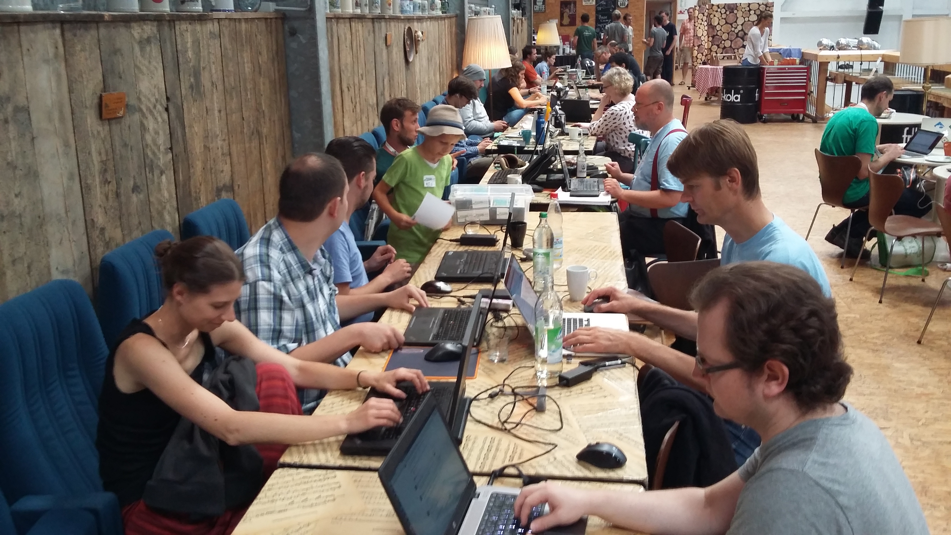
The annual OSGeo Code sprint was held in Bonn March 18 to 25, bringing together nearly hundred members of the OSGeo community together. A code sprint is a chance for the community to meet in person for direct collaboration, projects use this as an opportunity to work together or tackle larger issues as a team.
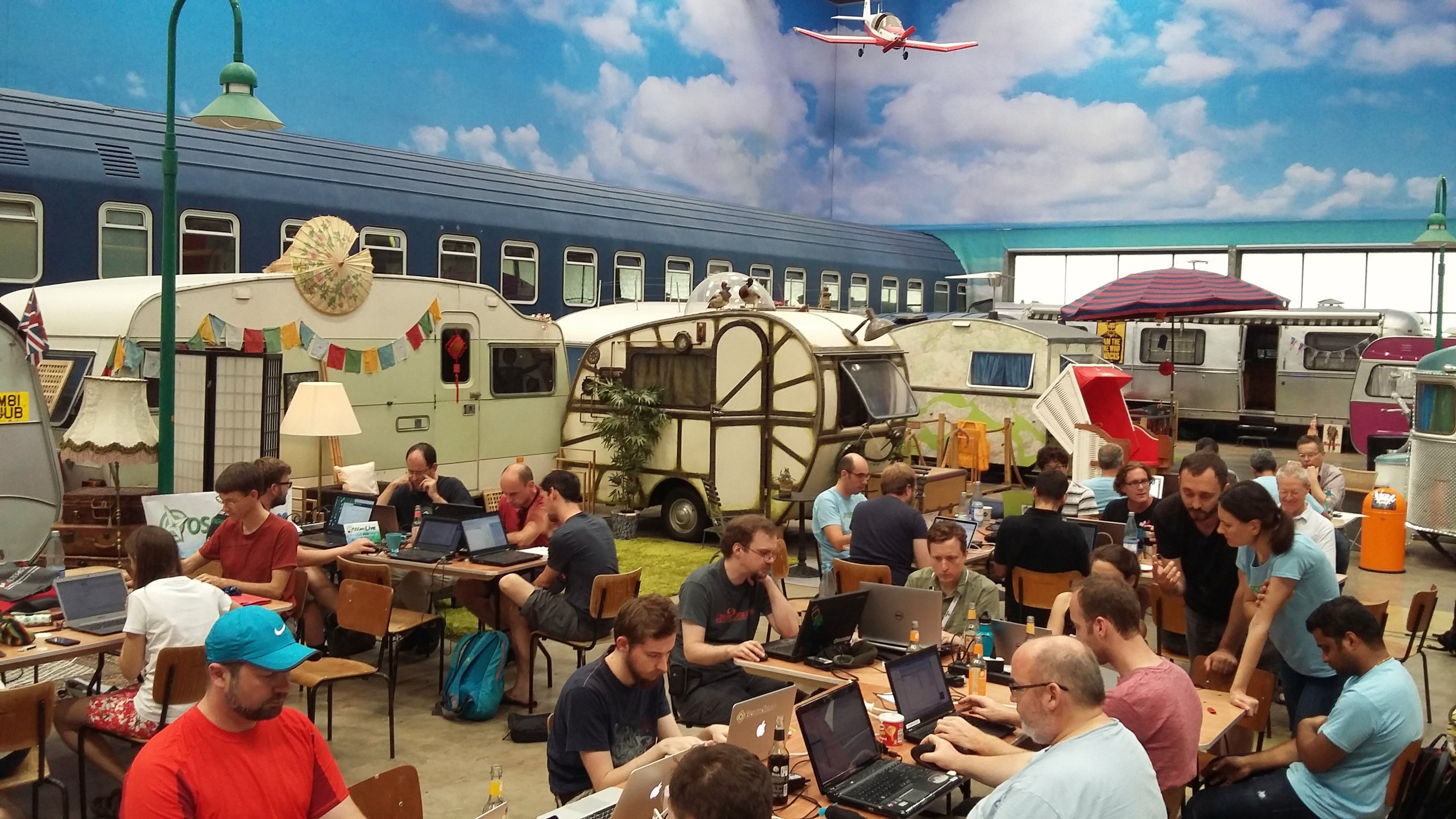
We made use of BaseCamp to host the code sprint, providing a friendly indoor "campground' with picnic tables for working, surrounded by caravans of all shapes and sizes making up the accommodation. It can be quite a shock to roll out of bed, and find python developers in a cluster before your morning coffee.
The sprint itself was generously supported by sponsors, making the sprint free to attend with food and drinks provided.
Participation was open to all, not only OSGeo projects, and we were pleased to welcome over eighty developers from all over the world! This was a chance for developers to meet (often for the fist time) and collaborate with core developers, gaining a insight into the software, and participate in open source development,
Photo Impressions There are some photos from the event at flickr: https://www.flickr.com/photos/143943250@N05/albums/72157691529787542 Find also some Photos from FOSSGIS Conference https://www.flickr.com/groups/4529299@N22/
An impressive list of projects was represented: uDig, Geotools, LocationTech, JTS Topology Suite, JAI Replacement, TilelessMap, PostGIS, SHOGun, react-geo, Saga, OSGeoLive, owslib, debian/ubuntu, UbuntuGIS, OpenLayers, MapServer, QGIS, GeoExt 3, Nominatim, GDAL, t-rex, PyWPS, GRASS GIS, OWSLib, pygeometa, MapServer, geocatalogo, GeoNode, OTB, ZOO-Project, Proj.4, Point clouds, meshes, Potree, PDAL, GeoTrellis, snappy, OSM-Vector-Tiles, Geonetwork, Geoserver, OpenLayers Editor, Noise, CouchDB, MS4W, EOxServer, maposmatic, mapnik, Mapbender, gvSIG, gvSIG Mobile, Geopaparazzi, pyModis, GeoMajas, GeoHealthCheck, Stetl, Entwine, Greyhound, deegree, TEAM Engine, actinia, 3DCityDB and testing GMLAS tools!
The event also played host to some community building activities: FOSS4G 2019 organization, OSGeo board meeting, OSGeo marketing committee, MoU between TIB and OSGeo, OSGeo member meeting.
OSGeo Member meeting
The OSGeo Member Meeting took place in Bonn at BaseCamp at March 19th 2018 during the OSGeo Code Sprint. About 50 people came to the Member Meeting and from the board María Arias de Reyna, Jody Garnett, Vasile Craciunescu, Michael Smith, Angelos Tzotsos and Astrid Emde were present. María Arias de Reyna was moderating the meeting, a whiteboard (shown in the photo below) was used to collect topics and questions for the OSGeo board and members to discuss. (Read more https://wiki.osgeo.org/wiki/Member_Meeting_Bonn_2018)
Entwine
GeoHealthCheck (GHC)
- Per-Resource Scheduling (link)
- Re-architecture to run in all-in-one daemon mode
- Docker deployment improvements
- Presented GHC at FOSSGIS
- OSGeo Community Project start
Geopaparazzi
- Added Cloud Profiles, allowing users to easily download complex data sets from the web #441.
- Added view-only of geographic feature attributes
- Enhanced the viewing of files (images, PDFs, etc) linked to geographic features #454.
- Various bug fixes #456, #460, #461, #466.
GRASS GIS
- A lot of work, please look at the dedicated GRASS GIS wiki page
- Press release with photo collage: https://grass.osgeo.org/news/75/15/Recap-from-the-OSGeo-Code-Sprint-in-Bonn-2018/
MoU TIB During the Code Sprint the Mou between OSGeo and Technische Informationsbibliothek (TIB) – German National Library of Science and Technology was signed. Maria Arias de Reyna, President, Open Source Geospatial Foundation and Dr. Bastian Drees on behalf of Prof. Dr. Sören Auer, Director, Technische Informationsbibliothek (TIB) signed the MoU. Read more at MOU_TIB.
PyWPS
- Code sprint summary at the GitHub Wiki
- PyWPS was proposed for OSGeo graduation
OSGeoLive
- Tasks for incubation were done
- Provenance review
- Final touches of the new Documentation framework
OpenLayers Mapbox styles generation library from OpenLayers (ol-mapbox-style) and upgrading the Boundless SDK (not an OSGeo project, but open source: https://github.com/boundlessgeo/sdk/) to OpenLayers 5.
OWSLib
- Merged Pull-Requests
- Fixed test-suite
PDAL
- Refactored documentation and website
- Conda builds
- Numpy reader support
- 1.7.0 release preparation
- OSGeo4W builds
- Windows building and testing
PgRouting
- Released 2.5.3
- Released 2.6.0
- on the news
SAC
- Website roles assignment to project members
- Open issues when needed
TEAM Engine
- Discussed test strategies for test suites and enhanced the existing tests for ETS WFS 2.0 #318.
- Enhanced the transformation from the CTL log to the EARL report by mapping hierarchies. In addition some bugs was fixes in the transformation #319.
Mapbender
- Working on the documentation and the translations as on the restructuring and small designs of the new theme (https://github.com/mapbender/mapbender/projects/5)
- Working on the OpenLayers4/5 implementation (https://github.com/mapbender/mapbender/projects/3)
- Working on some bugs that occured.
Thanks again to all 10 sponsors of the event.
TODO later: all Logos of our sponsors
We are looking forward to the next OSGeo Code Sprint!
When not working, attendees did enjoy exploring the town, making for some great "geobeer" discussion. The sprint was held in conjunction with the FOSSGIS Conference, the regional "foss4g" event for Germany. The crew enjoyed a little bit of socializing, with code sprinters joining the "gala event" and contributing to the festive atmosphere and dancing. The city itself provided many distractions, with computational device museum being a highlight.
Draft Press Release
For a whole week from March 18 to 25, 2018 nearly 100 active members of the OSGeo Community came to Bonn for the OSGeo Code Sprint 2018 to discuss and work on their projects. About 80 developers from all over the world and from various projects came to Bonn.
The sprint was in the same week as the FOSSGIS Conference 2018 (https://fossgis-konferenz.de/2018/). Like that FOSSGIS participants could meet the delegates of the Code Sprint.
The code sprint took take place at the great BaseCamp in Bonn (http://www.basecamp-bonn.de/). BaseCamp is an indoor campground with different caravans, night sleepers and a lot of space for working zones with a lot of atmosphere.
The participation in code sprint was free of charge. Food and drinks were provided. Thanks to our sponsors who made that possible.
OSGeo Code Sprints are always open to all who wish to participate. The Code Sprint was also an opportunity for developers to meet with the core developers of several projects and also an opportunity to get a deeper insight into the software and participate in the development.
Nearly all OSGeo projects came to Bonn to join the sprint and above all many other projects. Here comes a list of the projects that took part or was worked on - an impressive list:
uDig, Geotools, LocationTech, JTS, JAI Replacement, TilelessMap, PostGIS, SHOGun, react-geo, Saga, OSGeoLive, owslib, debian/ubuntu, UbuntuGIS, OpenLayers, MapServer, QGIS, GeoExt 3, Nominatim, GDAL, t-rex, PyWPS, GRASS GIS, OWSLib, pygeometa, MapServer, geocatalogo, GeoNode, OTB, ZOO-Project, Proj.4, Point clouds, meshes, Potree, PDAL, GeoTrellis, snappy, OSM-Vector-Tiles, Geonetwork, Geoserver, OpenLayers Editor, Noise, CouchDB, MS4W, EOxServer, maposmatic, mapnik, Mapbender, gvSIG, gvSIG Mobile, Geopaparazzi, pyModis, GeoMajas, GeoHealthCheck, Stetl, Entwine, Greyhound, deegree, TEAM Engine, actinia, 3DCityDB and testing GMLAS tools, FOSS4G 2019, OSGeo board and marketing, OSGeo member meeting, MoU between TIB and OSGeo
Photo Impressions
There are some photos from the event at flickr:
https://www.flickr.com/photos/143943250@N05/albums/72157691529787542
Find also some Photos from FOSSGIS Conference https://www.flickr.com/groups/4529299@N22/
Read about the goals of the projects and what happened during the week:
OSGeo Member meeting The OSGeo Member Meeting took place in Bonn at BaseCamp at March 19th 2018 during the OSGeo Code Sprint. About 50 people came to the Member Meeting and from the board María Arias de Reyna, Jody Garnett, Vasile Craciunescu, Michael Smith, Angelos Tzotsos and Astrid Emde were present. María Arias de Reyna was moderating the meeting, a whiteboard (shown in the photo below) was used to collect topics and questions for the OSGeo board and members to discuss. (Read more https://wiki.osgeo.org/wiki/Member_Meeting_Bonn_2018) 0 Entwine
GeoHealthCheck (GHC)
- Per-Resource Scheduling (link)
- Re-architecture to run in all-in-one daemon mode
- Docker deployment improvements
- Presented GHC at FOSSGIS
- OSGeo Community Project start
Geopaparazzi
- Added Cloud Profiles, allowing users to easily download complex data sets from the web #441.
- Added view-only of geographic feature attributes
- Enhanced the viewing of files (images, PDFs, etc) linked to geographic features #454.
- Various bug fixes #456, #460, #461, #466.
GRASS GIS
- A lot of work, please look at the dedicated GRASS GIS wiki page
- Press release with photo collage: https://grass.osgeo.org/news/75/15/Recap-from-the-OSGeo-Code-Sprint-in-Bonn-2018/
MoU TIB During the Code Sprint the Mou between OSGeo and Technische Informationsbibliothek (TIB) – German National Library of Science and Technology was signed. Maria Arias de Reyna, President, Open Source Geospatial Foundation and Dr. Bastian Drees on behalf of Prof. Dr. Sören Auer, Director, Technische Informationsbibliothek (TIB) signed the MoU. Read more at MOU_TIB.
PyWPS
- Code sprint summary at the GitHub Wiki
- PyWPS was proposed for OSGeo graduation
OSGeoLive
- Tasks for incubation were done
- Provenance review
- Final touches of the new Documentation framework
OpenLayers Mapbox styles generation library from OpenLayers (ol-mapbox-style) and upgrading the Boundless SDK (not an OSGeo project, but open source: https://github.com/boundlessgeo/sdk/) to OpenLayers 5.
OWSLib
- Merged Pull-Requests
- Fixed test-suite
PDAL
- Refactored documentation and website
- Conda builds
- Numpy reader support
- 1.7.0 release preparation
- OSGeo4W builds
- Windows building and testing
PgRouting
- Released 2.5.3
- Released 2.6.0
- on the news
SAC
- Website roles assignment to project members
- Open issues when needed
TEAM Engine
- Discussed test strategies for test suites and enhanced the existing tests for ETS WFS 2.0 #318.
- Enhanced the transformation from the CTL log to the EARL report by mapping hierarchies. In addition some bugs was fixes in the transformation #319.
Mapbender
- Working on the documentation and the translations as on the restructuring and small designs of the new theme (https://github.com/mapbender/mapbender/projects/5)
- Working on the OpenLayers4/5 implementation (https://github.com/mapbender/mapbender/projects/3)
- Working on some bugs that occured.
Thanks again to all 10 sponsors of the event.
TODO later: all Logos of our sponsors
We are looking forward to the next OSGeo Code Sprint!
